
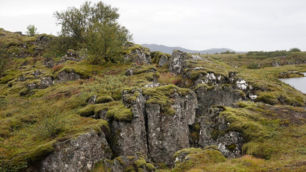
Stand on any overlook in – a canyon rim, a rocky coastline, a quiet prairie – and you are basically staring at the aftermath of a series of planetary-scale disasters. Mountain ranges rose, oceans vanished, continents collided, and gigantic sheets of ice scraped the land like a cosmic bulldozer. None of this felt dramatic to the rocks at the time; it unfolded over millions of years. But stacked together, these events turned a chunk of Earth into the we recognize today.
What makes it even more mind-bending is that the story is still ongoing. The ground under your feet is slowly moving, rivers are rewriting the map grain by grain, and stress is building in faults that will one day snap. In this article, we will walk through ten of the biggest geological plot twists that reshaped the continent, from mountain-building and inland seas to super-eruptions and ice ages. By the end, everyday landscapes might look a lot less ordinary – and a lot more like pages in an unfinished epic.
The Birth of the n Craton: Building the Ancient Core
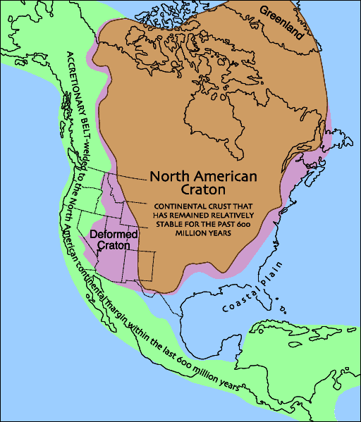
It is hard to imagine, but the heart of is older than complex life, older than trees, older than fish. Deep beneath the modern US and Canada lies a stubborn block of ancient rock called the n craton, a continental core that began forming more than two and a half billion years ago. This core is like the structural frame of a skyscraper: everything else – the mountains, basins, and coastal margins – was later bolted on around it.
Early on, small island-like fragments of crust collided, welded, and thickened, much like tiny Lego plates being snapped together into a larger base. Over time, this process created a stable, buoyant mass of continental lithosphere that resisted being destroyed by plate tectonics. Without this tough inner chassis, later collisions and rifting events might have shredded the continent instead of reshaping it. In a very real sense, the craton’s survival set the stage for all the dramatic events that followed.
The Grenville Orogeny: A Supercontinent Collision That Built a Hidden Mountain Range
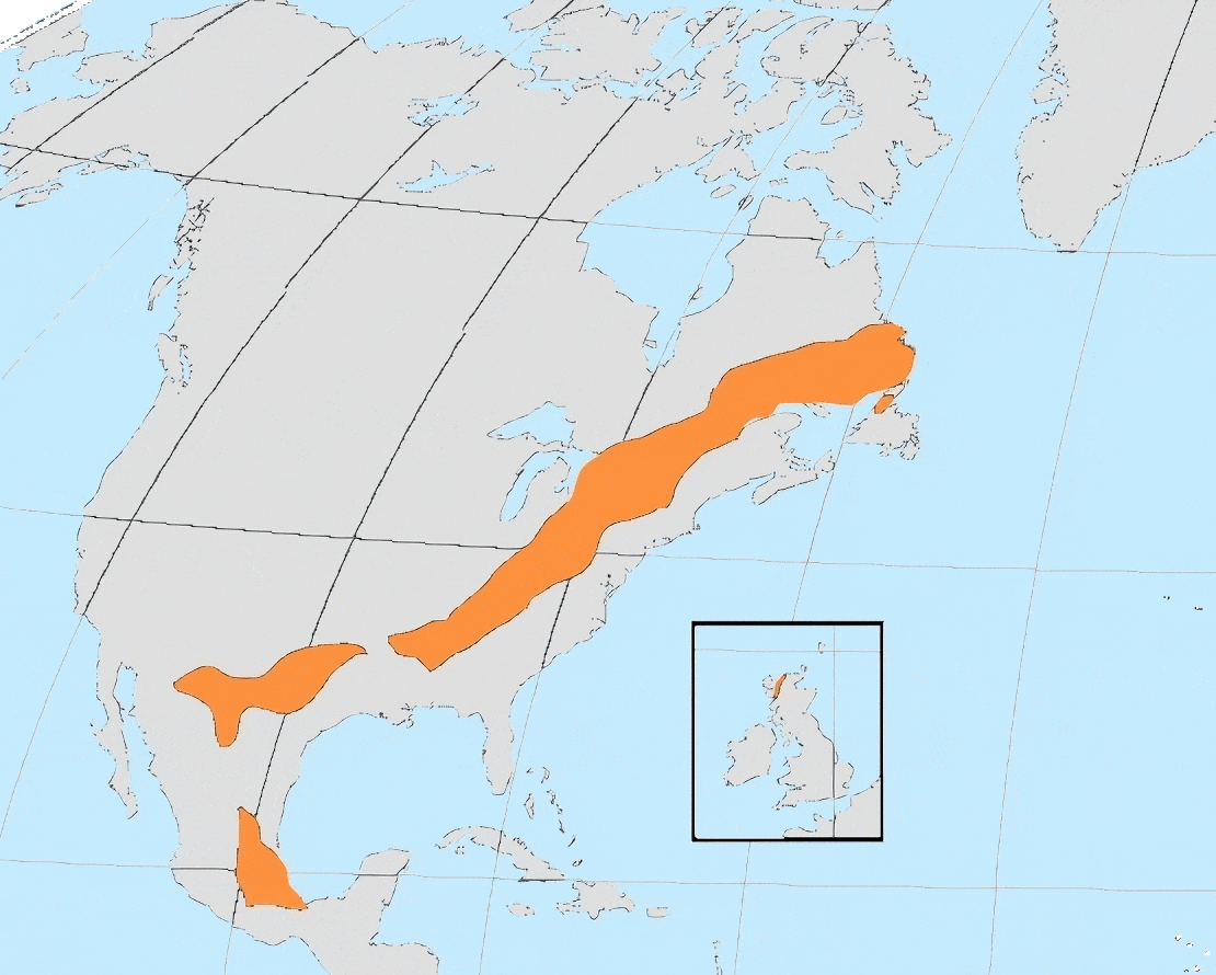
Long before the Appalachians became the gentle green ridges we hike today, a far older mountain chain towered across eastern . During the Grenville orogeny around a billion years ago, proto– slammed into other continents during the assembly of the supercontinent Rodinia. The collision crumpled and thickened the crust along what is now the eastern and southeastern edge of the continent, raising a vast mountain belt that would have rivaled or exceeded the modern Himalaya in scale.
Most of those peaks are long gone, worn down and partly buried, but their roots remain, exposed in places like the Adirondacks, the Llano uplift in Texas, and the Canadian Shield. These ancient rocks influence everything from regional gravity anomalies to the paths of later rifts and basins. You do not see “Grenville Mountains” on a modern map, yet this deep, invisible architecture still guides how younger structures form, a bit like an old scar dictating how new injuries will heal.
The Opening of the Iapetus Ocean and the Birth of the Appalachians
If the Grenville collision was a grand continental pileup, the next chapters were more like a breakup and rebound romance. After Rodinia split apart, a new ocean – the Iapetus – opened along the eastern margin of . That rifting thinned the crust, allowed basaltic magmas to pour out, and set up a passive continental margin somewhat similar to today’s Atlantic Coast. For tens of millions of years, sediments quietly accumulated along this calm edge.
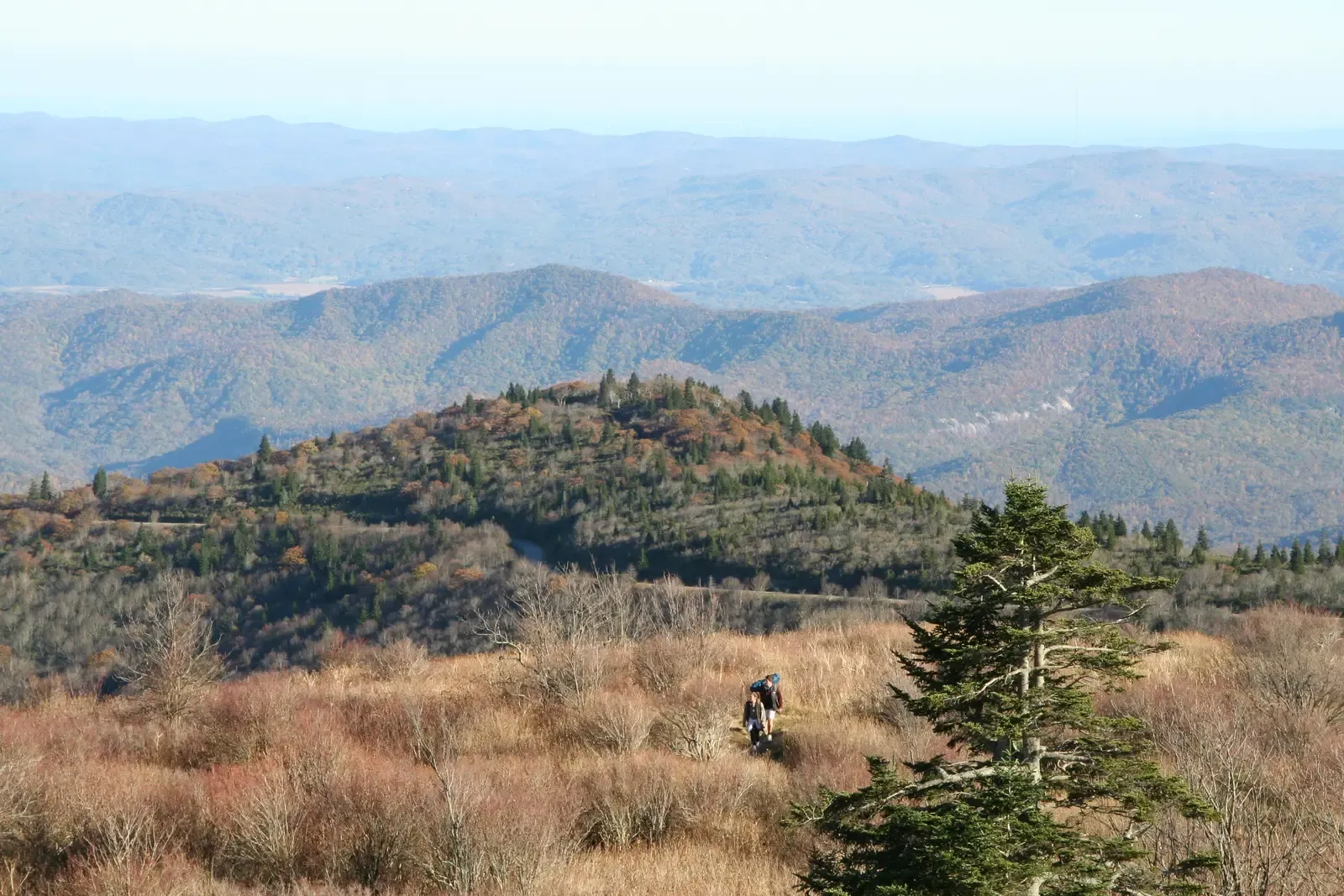
The serenity did not last. Eventually, smaller oceanic plates and island arcs began converging back toward the continent, closing the Iapetus and triggering a series of mountain-building events known as orogenies. Over several stages, including the Taconic, Acadian, and Alleghanian orogenies, the Appalachians were raised as blocks of crust were thrust westward, folded, and stacked like a geological deck of cards. What we see now – rounded ridges and fertile valleys – is the faded afterimage of those once colossal mountains, reshaped by hundreds of millions of years of erosion.
The Breakup of Pangaea and the Birth of the Atlantic Margin
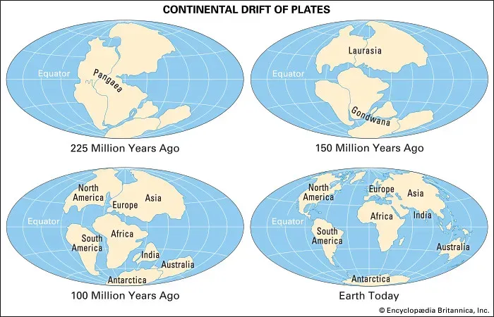
Fast-forward to the age of dinosaurs, and found itself locked into another supercontinent: Pangaea. Around two hundred million years ago, enormous tectonic forces began prying this giant landmass apart. As Pangaea split, rift valleys opened along what is now the East Coast, forming basins that filled with sediments and volcanic rocks. Some of these rift zones failed and never became full oceans, but they left behind structural basins that still shape where cities, rivers, and highways sit today.
Meanwhile, one rift did succeed spectacularly: the one that grew into the Atlantic Ocean. As pulled away from Africa and Europe, magma rose to create new oceanic crust, and the eastern margin of the continent transitioned to a passive, subsiding edge. Thick piles of sediments washed off the retreating Appalachians onto this new Atlantic margin, building the foundation for broad coastal plains and offshore continental shelves. The familiar outline of eastern – its sandy beaches, estuaries, and barrier islands – is a direct product of that breakup drama.
The Western Interior Seaway: When an Ocean Split the Continent in Two
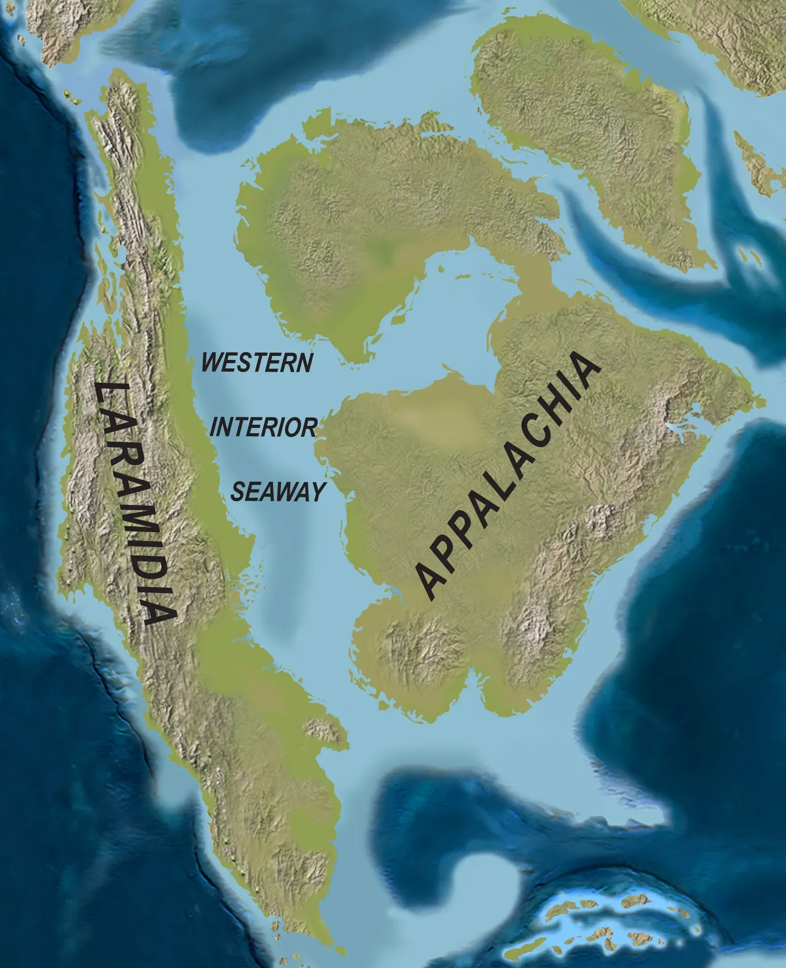
One of the strangest episodes in n history came in the middle of the dinosaur era, when rising global sea levels and a sagging continental interior combined to let ocean water flood the heart of the continent. The result was the Western Interior Seaway, a shallow inland sea that, at its peak, ran from the Arctic Ocean to the Gulf of Mexico. Imagine standing in what is now Kansas and looking at open water reaching the horizon in both directions.
This seaway turned vast areas of the Great Plains and central Canada into marine environments, home to giant swimming reptiles, ammonites, and chalk-forming plankton. Layer upon layer of muds, sands, and limestones were deposited on its floor, later hardening into the rocks we see in places like the Badlands and the cliffs of the US interior West. When the seaway finally retreated as the land rose again, it left behind thick sedimentary blankets that control where we find groundwater, hydrocarbons, and some of the continent’s most iconic fossil beds.
The Laramide Orogeny and the Uplift of the Rocky Mountains
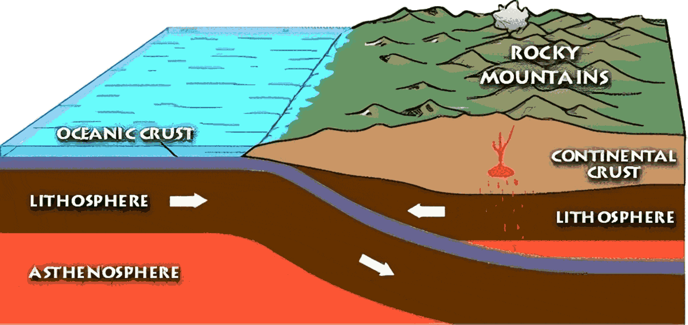
The Rocky Mountains are so visually dominant that it is tempting to assume they have been there forever, but they are comparatively young in geologic terms. During the Late Cretaceous into the early Paleogene, tectonic forces along the western margin of the continent shifted in a peculiar way. Instead of diving steeply under , the Farallon Plate began to subduct at a shallow angle, transmitting compressive stress far inland. The result was the Laramide orogeny, a mountain-building episode that uplifted basement blocks in what is now Colorado, Wyoming, Montana, and beyond.
Unlike some earlier orogenies that mostly crumpled the edge of the continent, the Laramide lifted deep, brittle blocks of ancient crust right through younger sedimentary layers. That is why you see Precambrian rocks exposed in high Rocky Mountain cores while softer sediments are folded and faulted around them. The uplift shut down the Western Interior Seaway, changed drainage patterns, and altered climate on both sides of the new range. Entire ecosystems were forced to adapt as sea-level coastal plains gave way to upland basins and rising peaks.
The Basin and Range Extension: Stretching the Crust Into a Landscape of Valleys
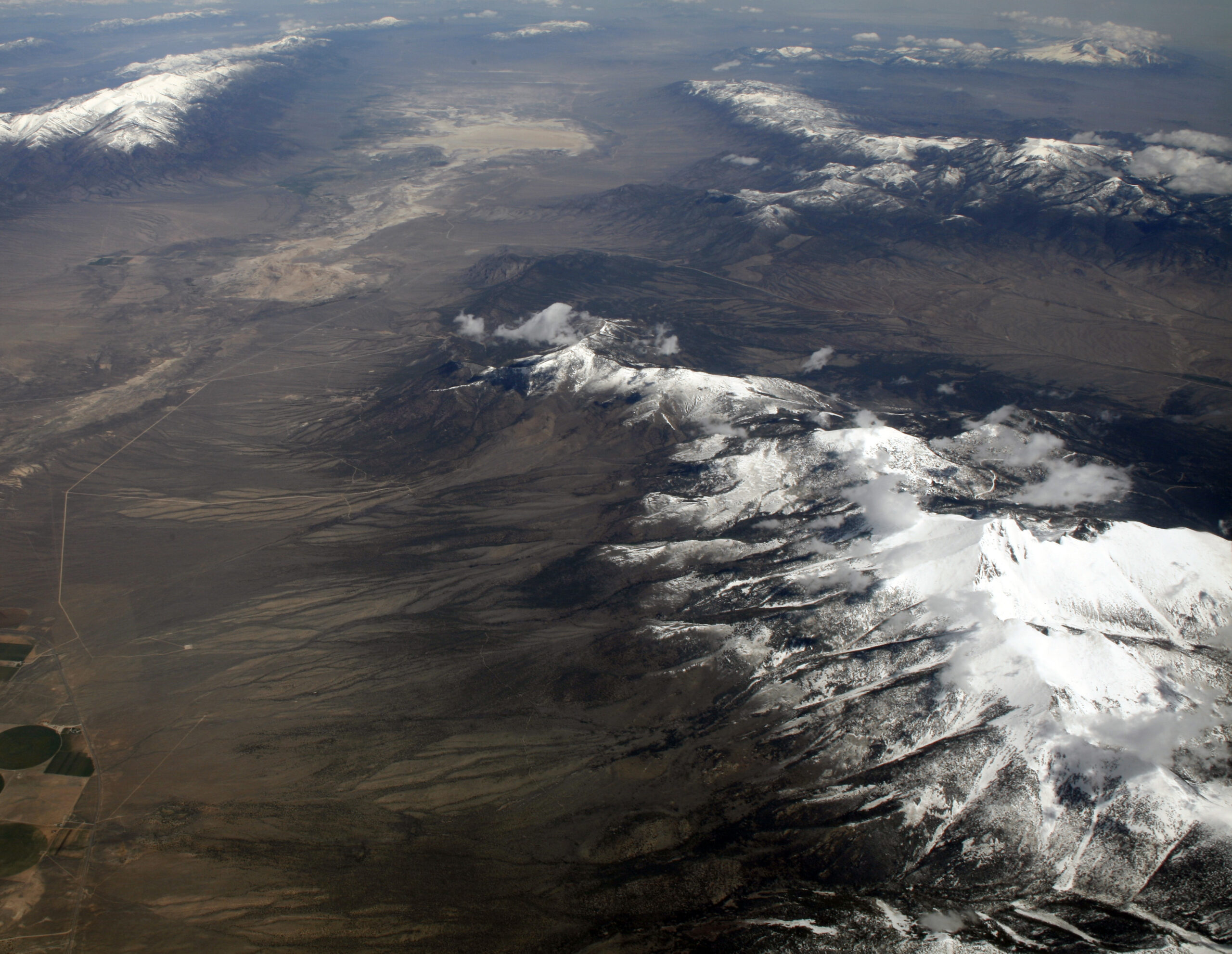
After all that squeezing and compressing in the Rockies, the western interior of did something that seems almost contradictory: it started to stretch. Beginning roughly in the Miocene, the region now known as the Basin and Range Province – from eastern California across Nevada into Utah and beyond – began to pull apart. As the crust stretched and thinned, blocks of rock tilted along normal faults, dropping down to form basins and leaving up-tilted ranges standing high above them.
From space, the result looks like a washboard of alternating long valleys and narrow mountain chains. On the ground, it created stark deserts, enclosed basins that trap water in salty lakes, and mountain “islands” that host unique ecosystems. This extension is still ongoing, and it has major implications for seismic hazards and geothermal resources in the West. It is a reminder that the continent is not a rigid slab; it is more like a slowly deforming piece of taffy, pulled in different directions over geologic time.
The Yellowstone Hotspot and Catastrophic Super-Eruptions
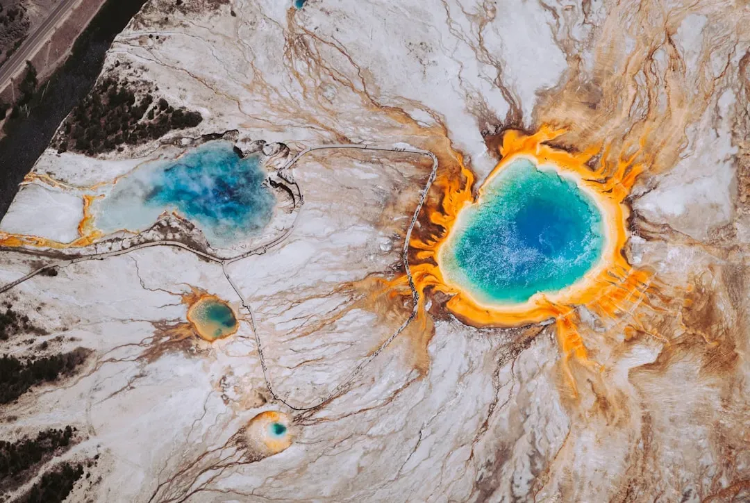
Few places in capture the public imagination like Yellowstone, and not just because of the geysers. Beneath the park lies a powerful hotspot – a rising plume of hot mantle material – that has punched through the moving n Plate over the last several million years. As the plate drifted southwest over this nearly stationary heat source, a trail of enormous calderas and volcanic fields formed, stretching from the modern Snake River Plain in Idaho to the current Yellowstone Plateau.
Some of the eruptions associated with this hotspot have been among the largest known on Earth in the last few million years, ejecting colossal volumes of ash and lava across the continent. These events reshaped broad areas, burying landscapes, altering river systems, and affecting climate on continental scales. While the popular imagination sometimes jumps straight to apocalyptic scenarios, the scientific picture is more nuanced: Yellowstone is a real hazard, but also a natural laboratory that shows how deep Earth processes can dramatically remodel a continent’s surface.
The Cascadia Subduction Zone and the Rise of the Pacific Northwest
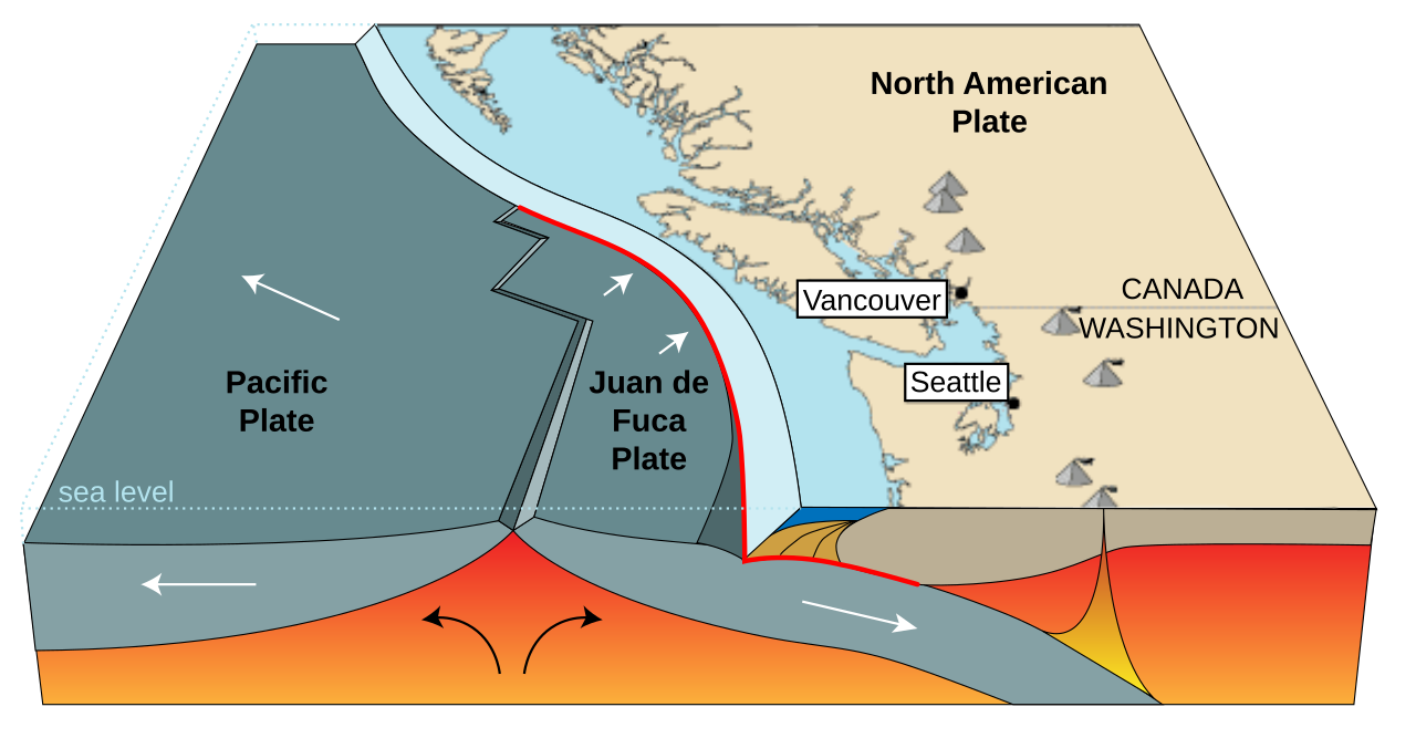
Along the Pacific Northwest coast, the quiet, forested landscape hides one of the most consequential plate boundaries on the planet. Offshore, the small Juan de Fuca Plate is slowly subducting beneath along the Cascadia subduction zone. This process has built the Cascade volcanic arc – from Mount St. Helens to Mount Rainier and beyond – and uplifted portions of the Coast Ranges and Olympic Mountains over millions of years.
Subduction here has also loaded the margin with tremendous seismic potential. Large megathrust earthquakes and tsunami-generating events have struck in the past and will happen again, with the most recent big one occurring several centuries ago. Geologically, Cascadia is actively reshaping the northwest edge of the continent: sediments are being scraped off and piled into accretionary wedges, coastal areas are rising or falling between big quakes, and volcanic eruptions continue to build peaks that dominate regional climate and hydrology. It is a dynamic frontier that shows continental growth in action.
The Pleistocene Ice Ages and the Carving of the Modern Landscape
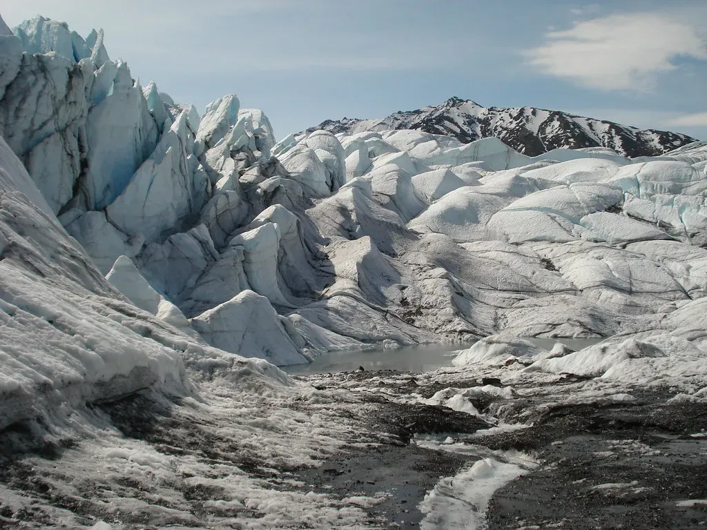
For all the drama of deep-time mountain building and super-eruptions, some of the most visually obvious reshaping of happened shockingly recently. During the Pleistocene ice ages, massive ice sheets spread across much of Canada and the northern United States, in some places more than a kilometer thick. These glaciers acted like slow, unstoppable bulldozers, scraping bedrock, scooping out basins, and grinding rock into fine flour that rivers then carried away.
As the ice advanced and retreated multiple times, it carved the Great Lakes, reshaped river routes like the upper Mississippi, and left moraines, drumlins, and outwash plains dotting the northern landscape. When the ice finally melted back over the last tens of thousands of years, huge meltwater floods roared across the interior, sometimes forming temporary giant lakes larger than modern states. The fertile soils of the Midwest, the gentle topography of New England’s uplands, and even the isostatic rebound still lifting parts of Canada today all bear the fingerprints of those relatively recent glacial episodes.
The Ongoing Story: Earthquakes, Subsidence, and Human-Driven Changes
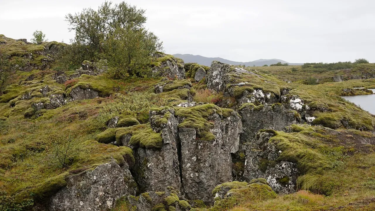
It is tempting to think of these ten events as finished chapters, but geology does not stop just because we started paving roads and launching satellites. The n Plate continues to move, stress continues to accumulate on faults from California to the New Madrid seismic zone, and coastal areas are subsiding or rising due to sediment loading and glacial rebound. Even slow processes like river erosion are constantly rewriting local topography, shifting channels, and building new deltas.
On top of that, human activity has become a noticeable geological force in its own right. We dam rivers, pump groundwater, trigger small to moderate earthquakes with fluid injection in some regions, and influence sediment supply to coasts and floodplains. None of this rivals mountain-building in scale, but it does tweak the trajectory of the next few chapters in the continent’s story. In my view, the most humbling realization is that we are living inside an ongoing experiment: the landscape feels permanent, yet every cliff, valley, and shoreline is provisional, waiting for the next big turn of the tectonic screw.
Conclusion: A Restless Continent Hiding in Plain Sight
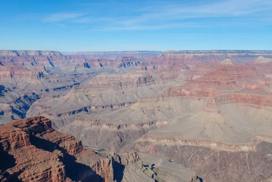
When you zoom out far enough in time, stops looking like a stable backdrop and starts looking like a shape-shifter. Ancient cratons welded together, supercontinents assembled and broke apart, oceans opened and closed, mountains rose and crumbled, ice sheets scraped and flooded. These ten episodes are only the highlights of a much longer saga, but they explain why we have Rockies instead of a flat western plain, why there are fossil seashells in the middle of the continent, and why some coasts are quiet beaches while others sit on top of dangerous plate boundaries.
Personally, I think the most radical idea is not that the continent was once different – it is that it will be different again. Plates will keep drifting, hotspots will keep burning upward, ice will advance and retreat, and someday future geologists may look back at our familiar map the way we look at Pangaea: as just one temporary arrangement. So the next time you see a mountain skyline or a winding river, it might be worth asking yourself a simple question: which chapter of this restless continent’s story are we really in right now?