
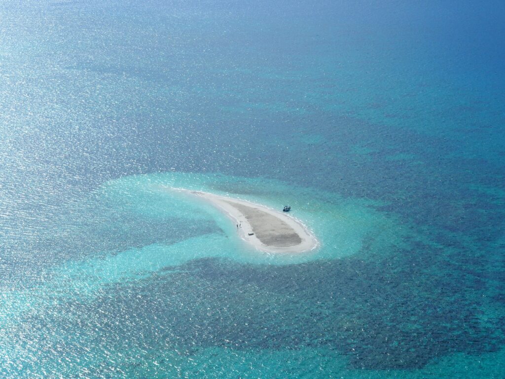
Imagine waking up in a coastal town and realizing that a nearby island, a place your grandparents swore they visited, simply does not exist on any modern map. No ruins, no beaches, not even a rock sticking out of the waves. It sounds like a plot twist in a mystery novel, but history is full of islands that were once charted, fought over, mythologized, and then seemingly erased from the face of the Earth.
Some of these islands were swallowed by rising seas or volcanic fury. Others were mirages born from bad navigation and wishful thinking. A few sit in a strange grey zone between legend and geology, where science is still catching up to old sailors’ tales. Let’s walk through eight of the most compelling examples of vanished, and what they reveal about human error, climate, and the brutal power of the oceans.
Thule: The Edge of the Ancient World That Slipped Away
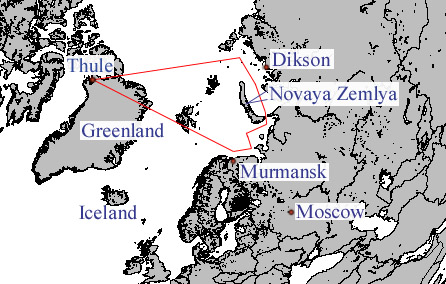
For ancient Greek and Roman writers, Thule was the last outpost of the known world, a mysterious island somewhere beyond Britain, where the sun barely set and the seas turned sluggish and strange. It was described with enough confidence that medieval mapmakers happily drew it onto their charts, even though almost nobody could agree on where it actually was. Over time, Thule became less a place you could sail to and more a symbol of the limit of human knowledge, the spot where certainty dissolved into fog.
Modern scholars have tried to pin Thule onto real locations like Iceland, the Faroe Islands, or northern Norway, arguing over distances and travel times recorded by ancient geographers. Yet the more closely you read the descriptions, the more they blur, mixing rough observation with rumor and secondhand stories. If a real, specific island was once behind the legend, it has long since melted into the larger sweep of northern coasts and archipelagos, swallowed not by the ocean, but by ambiguity and time.
Helike: The Greek City That Sank Like a Real-Life Atlantis
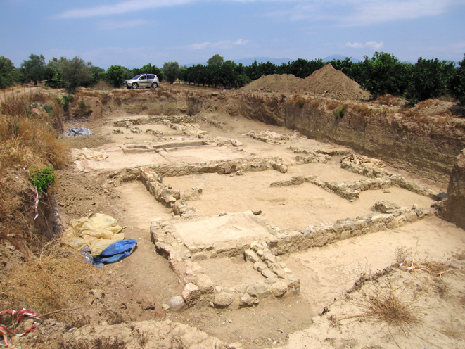
Helike was not only an island; it was a powerful coastal city in ancient Greece that effectively became one when disaster struck. One winter night in the fourth century BCE, a massive earthquake and tsunami reportedly drowned Helike so thoroughly that its ruins lay beneath the sea, visible to sailors for generations as a warning of divine anger and natural catastrophe. Ancient writers treated it as a chilling moral tale: a prosperous city wiped out overnight, its land transformed into a shallow lagoon.
For a long time, Helike was dismissed as half-legend, overshadowed by the more famous story of Atlantis. But in the late twentieth and early twenty-first centuries, archaeologists began uncovering evidence of the city’s remains buried in coastal sediments on the Gulf of Corinth, matching ancient descriptions of seismic destruction and sudden subsidence. The shoreline had shifted, and what was once solid ground had temporarily become seafloor, only to be partly reclaimed by silt and change. Helike’s “disappearing island” status shows how earthquakes can redraw coastlines in hours, not centuries.
Surtsey’s Lost Neighbors: Vanished Volcanic Islets off Iceland
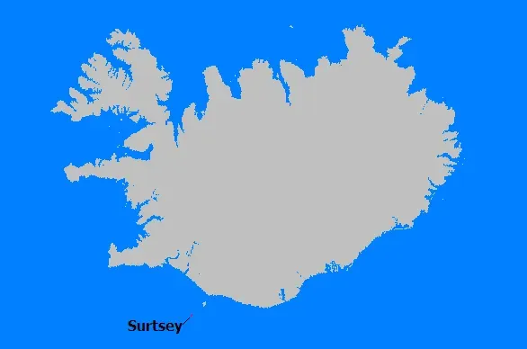
When the volcanic island of Surtsey erupted from the North Atlantic in the 1960s, the world watched in fascination as a brand-new landmass rose, smoldering, straight from the sea. Less well known is that the same region off Iceland has produced smaller, short-lived islands in the past that barely had time to earn names before waves and wind tore them back down. Volcanic islands made of loose ash and cinder can erode shockingly fast, shrinking within years and sometimes disappearing completely from the surface.
Some early modern maps show tiny islets near Iceland that no longer exist, likely the ghosts of such eruptions. These islands underscore how dynamic volcanic archipelagos can be: land can appear dramatically and then vanish just as suddenly, leaving puzzled sailors and conflicting charts behind. I find it oddly humbling that entire islands can have lifespans shorter than a human lifetime, like sparks from a campfire that flare up in the dark ocean and then burn out.
Bermeja: The Mexican Island That Might Never Have Been
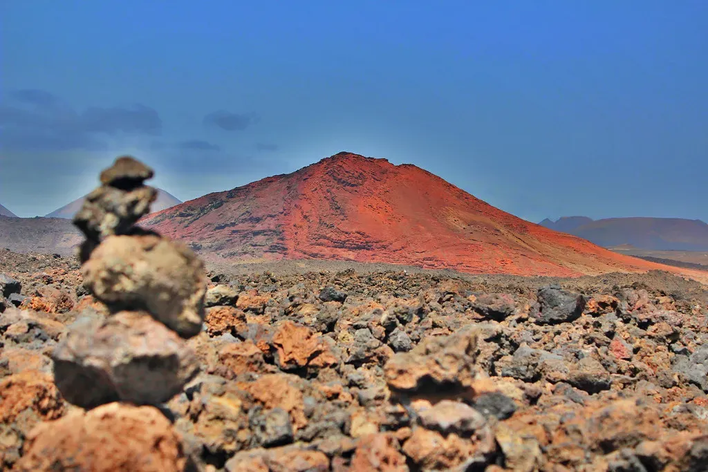
Bermeja is one of those islands that invite conspiracy theories because its disappearance is tied to politics and money. For centuries, this tiny island was drawn on maps off the Yucatán Peninsula, marked by Spanish cartographers and later reproduced by others. Then, in the late twentieth century, when maritime boundaries and oil rights became big business, Mexican and international surveys could not find Bermeja at all. Where the maps showed land, there was only empty water.
Some claimed the island had sunk due to erosion or rising seas, while others whispered about deliberate destruction to shift offshore resource claims. But careful bathymetric surveys suggest there is no shallow submerged feature where Bermeja was supposed to be. The most likely explanation is a chain of earlier mapping errors, copied and re-copied until a phantom island became official. In that sense, Bermeja “disappeared” not because the ocean took it, but because better data exposed that it probably never existed in the first place.
Sandy Island: The Google Maps Phantom Erased by Reality
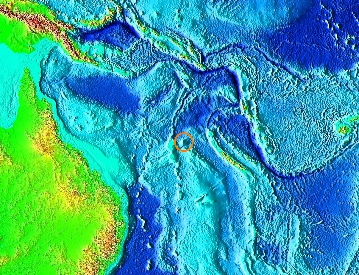
In the early 2010s, a small island known as Sandy Island appeared on modern digital maps between Australia and New Caledonia, big enough to be noticed, small enough to be obscure. Then a research vessel sailed right over the spot and found nothing but deep blue water, far too deep for any island to be lurking just below the surface. Within days, cartographers and tech platforms quietly removed Sandy Island from their datasets, as if erasing a typo in a document. The disappearance was sudden and strangely intimate for anyone who trusts their navigation apps without question.
The story of Sandy Island goes back to old nautical charts that likely mistook floating pumice, storm debris, or a misread position for a fixed island, and that error kept getting copied into newer maps and databases. For me, what makes Sandy Island fascinating is how it proves that even in the satellite age, our picture of the planet is still a rough draft full of inherited mistakes. This island lived and died entirely on paper and on screens, yet its “vanishing” felt like watching reality override a widely shared illusion.
Doggerland’s Drowned Islands in the North Sea
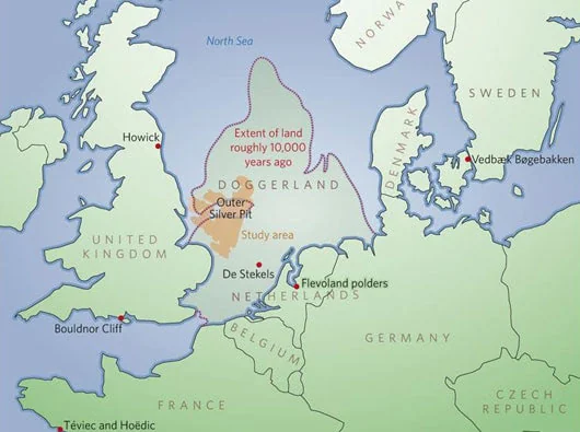
Between Britain and mainland Europe lies the shallow North Sea, which once was not a sea at all but a broad landscape of low hills, rivers, and islands known today as Doggerland. During the last Ice Age and its slow retreat, sea levels were lower, and people actually lived on these now-submerged lands, hunting, gathering, and moving between scattered island-like high points. As the climate warmed and the oceans rose over thousands of years, those high points turned into true islands, and then even those vanished beneath the waves.
Fishing trawlers have pulled up ancient bones, tools, and even traces of peaty soils from the seafloor, hinting at forests and communities that stood where waves now roll. Doggerland’s disappearing islands were not a single dramatic event, but a slow drowning over generations, punctuated by sudden floods and storms. It is hard not to see a warning in this story: rising seas do not just nibble at coastlines, they can erase entire worlds that once seemed as solid and permanent as any modern country.
New Moore / South Talpatti: The Island Claimed, Then Claimed by the Sea
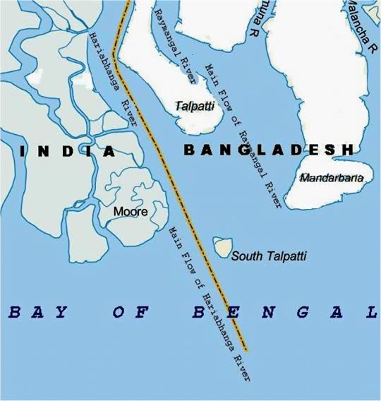
In the Bay of Bengal, an uninhabited sandbar known as New Moore Island to India and South Talpatti to Bangladesh emerged in the late twentieth century and quickly became a diplomatic headache. Both countries laid claim to this tiny, shifting patch of land, not because anyone lived there, but because sovereignty over the island implied control over surrounding waters and resources. Then, while arguments dragged on, satellite images showed that the island itself was gradually being eroded away.
By the early twenty-first century, New Moore–South Talpatti had effectively disappeared beneath the sea, rendered irrelevant by the very forces that created it. Rising sea levels, strong currents, and frequent cyclones in the region combined to wipe out a place that had barely had time to acquire a history. To me, this island is a brutally clear example of how human borders and legal claims are flimsy compared to the shifting physics of deltas and coasts; the ocean simply refused to recognize anyone’s paperwork.
Antillia: The Enigmatic Island That Vanished into Legend
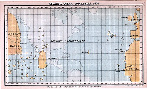
On medieval European maps of the Atlantic, you sometimes find a large, elongated island west of Portugal and Spain labeled Antillia, drawn long before the Caribbean islands we now call the Antilles were fully known. Sailors and scholars speculated about it endlessly: was it a refuge of exiled Iberian Christians, a distant outpost of some forgotten kingdom, or merely wishful thinking projected into the great ocean? Antillia moved around from map to map, sometimes closer to Europe, sometimes nearer to where the actual West Indies would later be charted.
Most historians now view Antillia as a composite myth, woven from rumors of western lands, distorted reports from earlier voyages, and the natural human urge to imagine land beyond the horizon. As real Atlantic islands like the Azores and Caribbean archipelagos were explored and mapped accurately, Antillia quietly faded away, no longer needed to fill blank spaces. In a way, it disappeared twice: first as a physical place that probably never existed, and then as an idea replaced by real coastlines that surpassed the old fantasies.
Conclusion: When Islands Vanish, Our Certainties Go With Them
Looking across these eight cases, what strikes me most is how fragile our sense of solid ground really is. Some islands, like Helike’s drowned landscape or the fleeting volcanic islets near Iceland, were taken by brute geological force. Others, like Bermeja and Sandy Island, crumbled not under waves but under scrutiny, exposed as cartographic mirages that survived only because nobody looked closely enough. In every case, though, an island’s disappearance forced people to confront the gap between what they thought they knew and what the evidence actually showed.
I think we are often too confident that our maps, models, and borders capture reality in full, when history shows they are constantly being edited by nature and by new information. Disappearing islands are more than curiosities; they are reminders that coastlines move, seas rise, data can be wrong, and certainty is temporary. As the climate warms and sea levels inch higher, we may watch modern islands follow Doggerland and New Moore into memory, turning living communities into future legends. The uncomfortable question is not whether this will happen, but which of today’s “permanent” places will be tomorrow’s vanished worlds – what would you bet on staying above water in a few hundred years?