
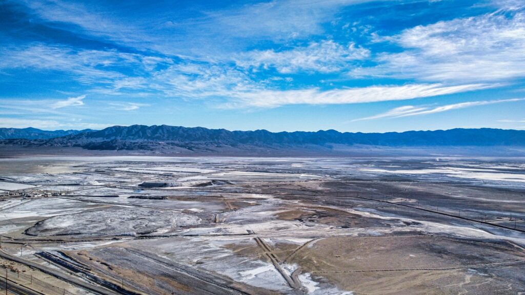
Every few decades, a long‑quiet lake pulls back like a curtain and reveals what it has been hiding. Shorelines creep outward, the waterline drops, and suddenly the smooth blue surface that always felt calm and eternal turns into a cracked, dusty landscape. It is both eerie and mesmerizing, like walking onto a stage after the audience has left and the lights have come up.
What a dried lake bed exposes is not just mud and rock. It shows us forgotten histories, human mistakes, rare fossils, and even clues about the future climate we are heading toward. Some of what appears is beautiful, some is heartbreaking, and some is simply bizarre. But all of it tells a story that water had quietly kept to itself for years, or even centuries.
Think about this: lakes feel permanent during a human lifetime, yet many of them breathe in and out over long cycles of drought and flood. When a lake retreats, it is like opening a time capsule. Old towns step back into the sun. Trees that last saw daylight before your grandparents were born suddenly stand again in dry air. Even the scars our modern lifestyle leaves behind can show up in shocking detail.
Let’s walk across this imaginary dried lake bed together and explore 11 things it might reveal every few decades – things that are as scientific as they are emotional, as unsettling as they are fascinating.
#1 Ancient Trees and Long-Drowned Forests
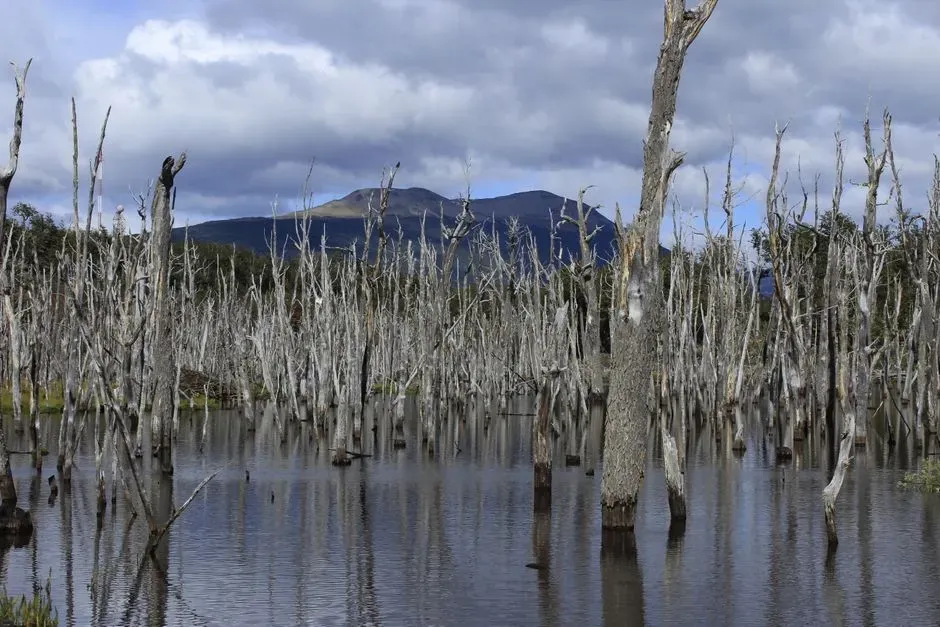
Few sights are more haunting than the blackened stumps of an ancient forest rising out of a cracked, empty lake. These are not just random bits of wood; they are often the remains of trees that were alive long before the lake existed in its current form. When reservoirs flood river valleys or lowland forests, the trunks may be preserved underwater for decades, sometimes even for centuries, shielded from oxygen and decay.
When the waterline drops far enough, those same trees emerge like ghosts returning to the surface. Dendrochronologists – scientists who study tree rings – love these moments, because those rings offer precise records of rainfall, droughts, volcanic eruptions, and even large wildfires going back hundreds of years. The wood is like nature’s own hard drive, quietly backing up the climate’s memory until the lake finally lets it surface.
What makes these drowned forests so eerie is the emotional clash: you’re looking at something both very old and strangely fresh. The bark might be gone, but the core is often still solid, the rings still crisp. Walk among the stumps and it feels like stepping into a forest that died mid-breath when the dam gates closed, only to reappear whenever drought pulls the plug. It is beautiful, but it is also a reminder that every artificial lake is built on a sacrifice of whatever lived there before.
A few key takeaways when those old trees resurface:
- They often preserve centuries of climate data in their rings.
- Their condition can tell us how long a valley has been flooded.
- They visually expose the tradeoff between water storage and lost ecosystems.
#2 Lost Towns, Roads, and Old Infrastructure
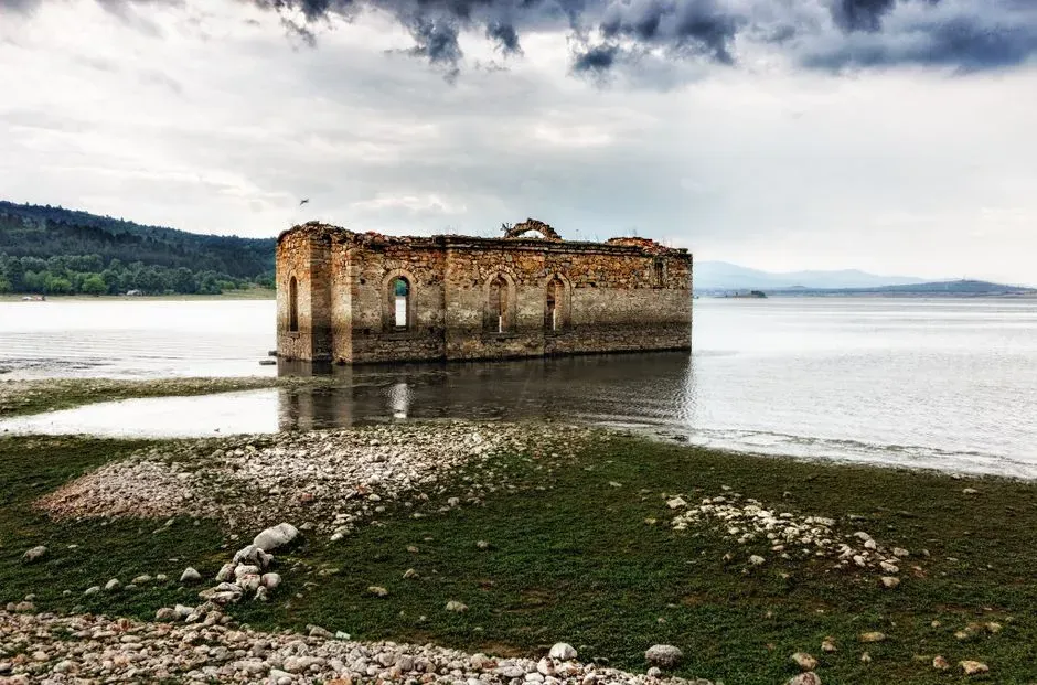
If you have ever seen a stone bridge, a church steeple, or a half-collapsed house sticking out of a dry lake bed, you know how unsettling it can be. Many reservoirs were built by flooding existing communities – villages, farms, mining camps, rail lines. As long as the water is high, those places might as well be myths. But when lake levels drop, the past literally walks back into the present.
Old roads emerge as pale scars curving across the mud. Foundations of homes reappear, sometimes still lined with stonework, broken chimneys, or rusted bedsprings. Abandoned railway lines, utility poles, bridge abutments, culverts, and decades-old fences suddenly sit under open sky again. In some cases, former residents or their descendants visit these newly exposed ruins to stand where a living town once was and where their childhood kitchen or school used to be.
From a scientific standpoint, these reappearing structures are time stamps. They mark exactly when a valley was flooded, how much infrastructure was left behind, and how decisions were made about relocation and compensation. From a human standpoint, they are emotional landmines. What looks like “ruins” to an outsider can feel like grieving all over again to someone whose grandparents were forced to leave before the water rose.
When dried lake beds expose old towns, you can usually expect to see:
- Street grids and foundations tracing the outlines of entire communities.
- Traces of daily life – bottle dumps, wells, steps, and collapsed barns.
- Evidence of how quickly and roughly the relocation was handled.
#3 Shipwrecks, Boats, and Hidden Maritime Accidents
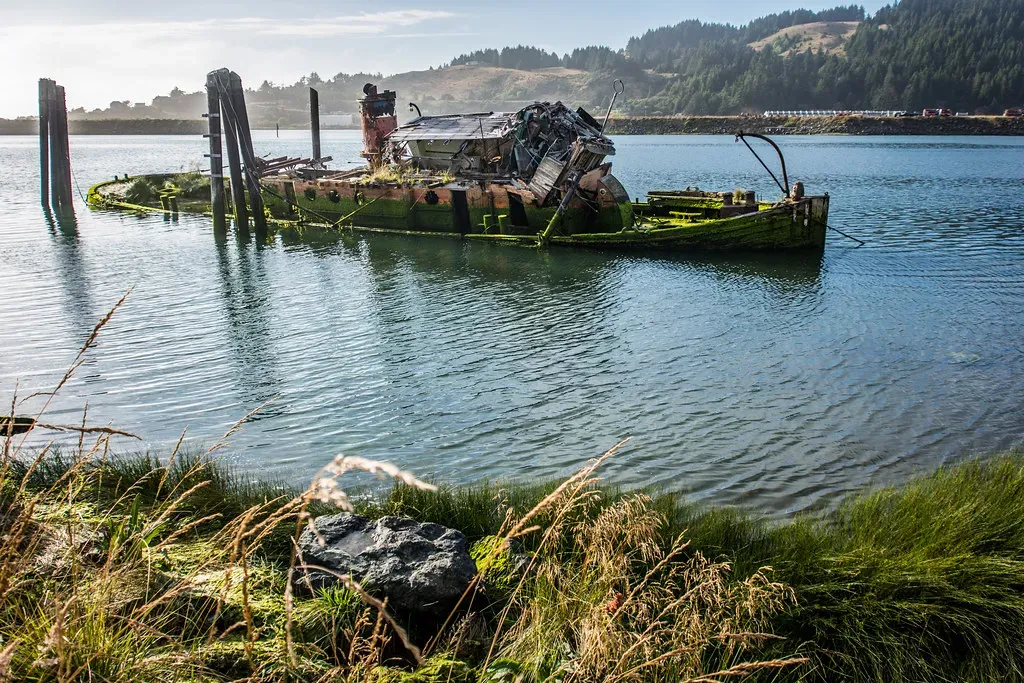
Every sizable lake has its share of secrets, and boats are often part of them. When water levels drop dramatically, the lake floor can start to look like an open-air ship museum. Fiberglass fishing boats, wooden rowboats, old ferries, and sometimes entire shipwrecks can appear, tilted awkwardly on the mud with hulls cracked and hardware rusted to a dull brown.
Some of these vessels are simply abandoned or sunk by storms, neglect, or winter ice. Others are tied to accidents, drownings, or even unsolved disappearances. Law enforcement agencies occasionally get answers to old missing-persons cases when a drought lets divers and investigators reach previously inaccessible depths. Sonar scans that once showed a mysterious shape can finally be confirmed as an overturned car or boat when water levels fall and mud dries out.
From a scientific and engineering perspective, these wrecks are a snapshot of materials aging underwater. Metal corrosion, biofouling from algae and mollusks, structural decay in wood and fiberglass – every surface carries evidence of how fresh water slowly eats away at human objects. Researchers interested in corrosion, coatings, or biofilms sometimes study these hulls to understand long‑term degradation in real-world conditions, not just in labs.
On a more human level, walking past a half-buried hull in a dried lake bed is sobering. It is not just a pile of parts; it was someone’s pride and joy, or in tragic cases, someone’s last place on Earth. That uneasy blend of archaeology, engineering, and grief is one of the reasons exposed wrecks capture so much public attention whenever lakes drop and camera crews rush in.
#4 Prehistoric Bones and Fossils
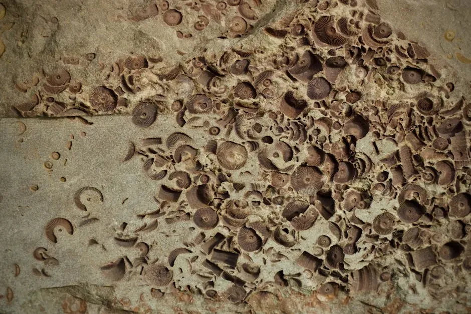
Every now and then, a receding lake pulls something up from far deeper time: the bones of Ice Age mammals, ancient fish, or even dinosaur-era fossils from long before the lake itself existed. Not every dried lake bed is a paleontologist’s dream, of course. But lakes often occupy low points where sediment from surrounding land has been washing in for millennia, and sometimes that sediment quietly hides remarkable remains.
When water evaporates or is drawn down, erosion can cut into old layers of clay and silt, revealing fossilized shells, plant impressions, and vertebrate bones. In arid regions where seasonal lakes fill and dry repeatedly, the deposits can stack like pages in a book, each one preserving a slightly different climate or ecosystem. If those layers become exposed, researchers can literally walk along the outcrop and step through thousands of years of environmental change.
There is also a forensic side to this. Animal remains in more recent layers – say, the last few hundred or thousand years – can tell us which species once lived in or around the lake, what they ate, and how often drought struck. Stable isotope analysis of fossil bones and teeth can reveal what the water and vegetation were like when the animal was alive. That helps reconstruct how regional climate has changed naturally over long timescales, which in turn gives context for the rapid changes driven by modern human activity.
When fossils appear on dried lake beds, you often see a mix of:
- Small, fragile pieces like fish vertebrae or rodent bones.
- Heavier remains such as tusks, antlers, or limb bones from large mammals.
- Trace fossils like burrows, footprints, or plant impressions in ancient mud.
#5 Layers of Toxic Sediment and Industrial Waste
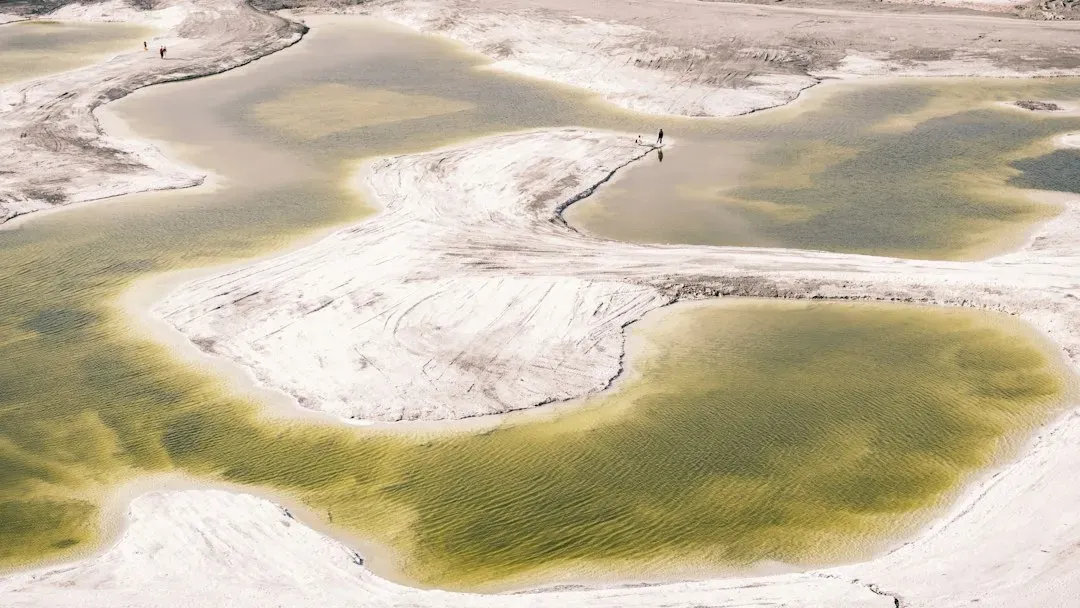
Here is the less romantic side of a vanishing lake: sometimes it exposes just how much pollution we have been quietly parking under the waterline. Lakes act as sinks for whatever washes in from upstream and from surrounding cities and farms – heavy metals from industrial runoff, excess nutrients from fertilizers, microplastics, and legacy chemicals like old pesticides that were banned decades ago but still linger in the environment.
As sediment builds up at the bottom year after year, these contaminants often concentrate in specific layers, forming a kind of dirty timeline. When water levels drop low enough, those layers can crack open into the air. That is when the problem stops being invisible. Dust storms can blow contaminated particles into nearby communities. Pets and wildlife can walk across the exposed mud and track pollutants onto dry land. In extreme cases, dried lake beds can become active health hazards rather than just environmental curiosities.
From a scientific angle, sediment cores from lake bottoms are invaluable. By studying them in the lab, researchers can see when industrialization ramped up, when specific chemicals started appearing, and whether pollution controls actually reduced certain contaminants over time. But when those same sediments are left uncovered at the surface, they move from the safe context of a research sample to a live issue of public safety and environmental justice.
Some typical warning signs when toxic layers are exposed include:
- Strong chemical or sulfur-like odors rising from the mud.
- Visible slicks, odd colors, or salt crusts on the surface.
- Reports of respiratory irritation or dust problems downwind.
#6 Archaeological Artifacts and Indigenous Sites
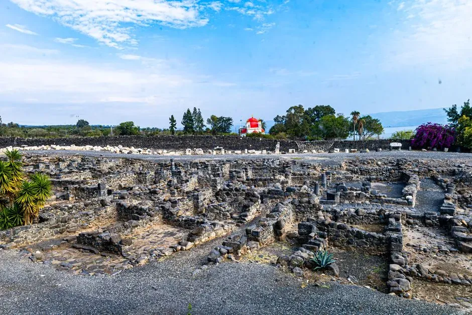
Many lakes occupy valleys and basins that people have used for thousands of years. Long before dams, campfires dotted the shores, stone tools were sharpened near streams, and burial grounds were placed on high, safe ground above flood levels. When modern reservoirs flood these areas, entire layers of human history can end up underwater, sometimes incompletely documented or not surveyed at all.
When water recedes, those stories can resurface in a fragile and vulnerable way. Pottery fragments, stone tools, hearth remains, shell middens, rock carvings, and even burial sites may become visible on the newly exposed ground. Indigenous nations, archaeologists, and cultural heritage workers often race to document and protect these materials before looters, tourists, or erosion destroy them. There is a tension here: the public finds such discoveries fascinating, but sensitive sites are not open-air museums and deserve respect and protection.
Scientifically, these exposed sites can radically improve our understanding of how people adapted to changing water levels and climates in the past. Storage pits, fishing structures, and seasonal camps can reveal migration patterns and food strategies. But there is an ethical imperative: you cannot treat sacred sites or ancestral burial grounds as just another “cool thing” revealed by a drought. Many Indigenous communities see the repeated flooding and re-exposure of their cultural landscapes as ongoing harm, not curiosity fodder.
On a dried lake bed with cultural history, you might see:
- Projectile points, grinding stones, and other everyday tools.
- Traces of ancient fire pits or house outlines in the soil.
- Rock art or engravings newly exposed along receding shorelines.
#7 Cracked Mud, Salt Flats, and Climate Clues
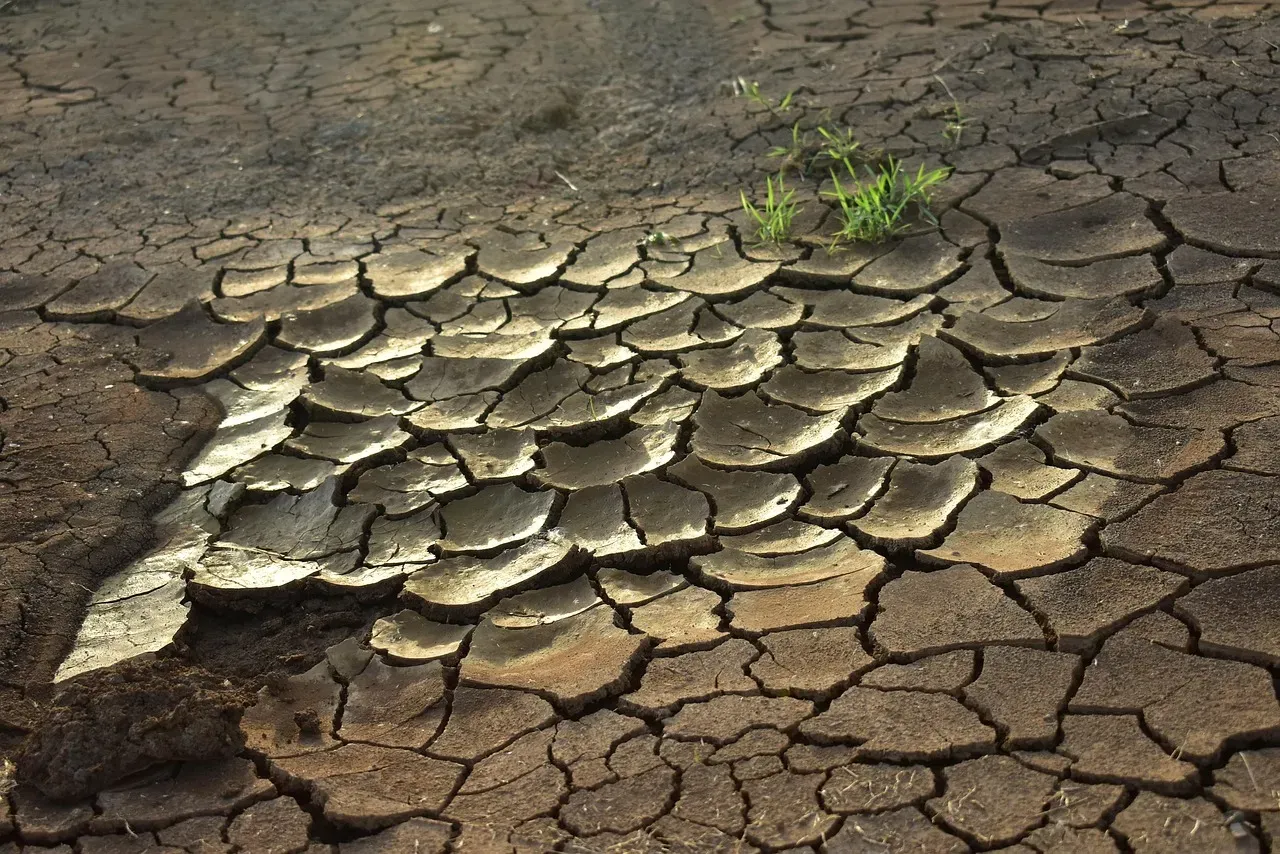
One of the most visually striking things a dried lake bed reveals is also one of the most basic: the texture of the earth itself. Wide sheets of cracked mud, crispy as broken pottery, can stretch to the horizon. In some basins, the surface turns white with salt crystals, creating dazzling salt flats that shimmer under the sun. These patterns are beautiful in photographs, but they also carry dense scientific information.
Those polygonal cracks in the mud tell geologists how quickly the surface dried, how thick the sediment is, and how many cycles of wetting and drying it has been through. Salt crusts and evaporite minerals reveal what dissolved ions were present in the water – things like sodium, calcium, sulfate, and carbonate – and hint at the water balance between inflow and evaporation. By sampling deeper layers below the surface, scientists can reconstruct previous periods when the lake dropped or even disappeared entirely.
In the context of a warming climate, these exposed surfaces are like warning labels. Lakes in many regions are shrinking not only because of drought but also because of increased evaporation and greater water withdrawals for agriculture and cities. When people see cracked lake beds where they remember boating just a decade earlier, it turns the abstract phrase “climate change” into something that hits right in the gut. The ground itself becomes a chart of how water security, energy demands, and a shifting atmosphere intersect.
Key climate signals written into dried lake surfaces include:
- Repeated stacks of mud-crack layers marking past drought cycles.
- Changes in salt composition indicating shifts in inflow sources.
- Dustiness of the surface, which affects air quality and regional weather.
#8 Fish Skeletons, Stranded Shells, and Food-Web Remnants
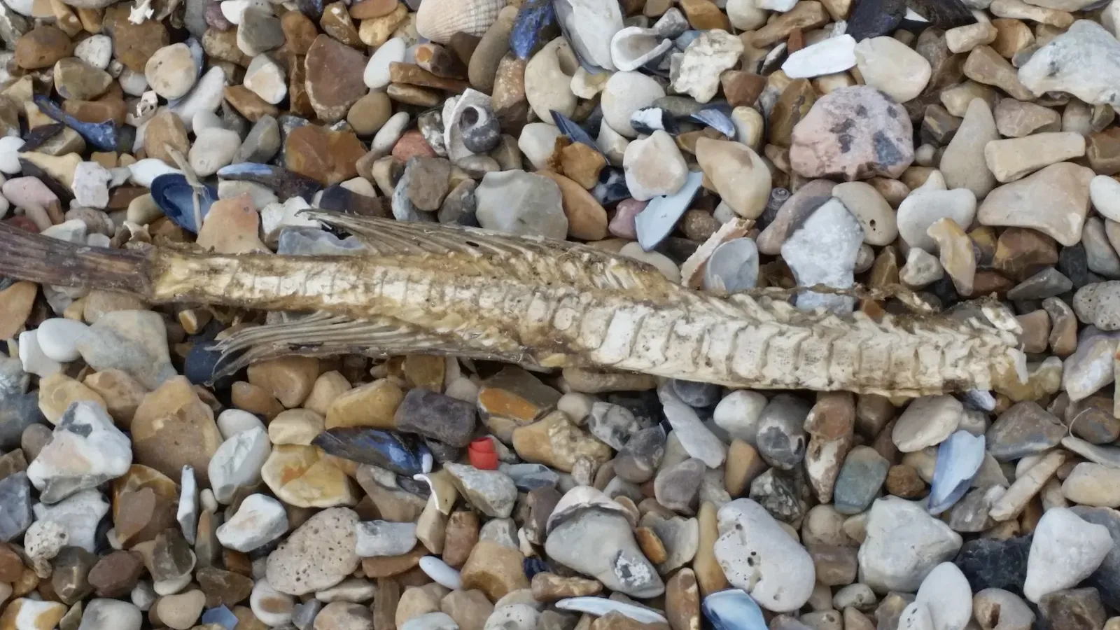
When water retreats fast, many aquatic creatures simply cannot move with it. Fish, mussels, snails, and other lake life may end up stranded and die where they lie. Over weeks and months, soft tissues decay or are eaten, leaving behind skeletons, shells, and scattered bones on the dry surface. It can look macabre, but to an ecologist, it is also a map of the lake’s internal food web.
Fish skeletons tell stories. Their size, species, and distribution help researchers see how populations were structured before the water dropped. Shell beds from freshwater mussels can reveal which species thrived in the past and whether invasive species had taken over. The position of carcasses can hint at how quickly the shoreline moved – mass die‑offs in one band may indicate a sharp drop, while scattered remains suggest a slower retreat that let some animals escape.
There is also a nutrient story to consider. When a lakebed dries and then refills, those dead organisms become a pulse of nutrients that can fuel future algal blooms. In lakes already struggling with excess nutrients from agriculture, this boom-and-bust cycle can make water quality even more unstable. From a food-web perspective, a drying event is not just a tragedy for the creatures that die; it is also a reset button that can reorganize which species dominate when the water returns.
On the ground, people wandering across a dried lake bed will often notice:
- Concentrations of fish bones in depressions where water last lingered.
- Belts of shells marking former shorelines.
- Scavenger tracks and droppings – birds, coyotes, raccoons – recording who feasted on the stranded animals.
#9 Car Bodies, Dump Sites, and Everyday Human Debris
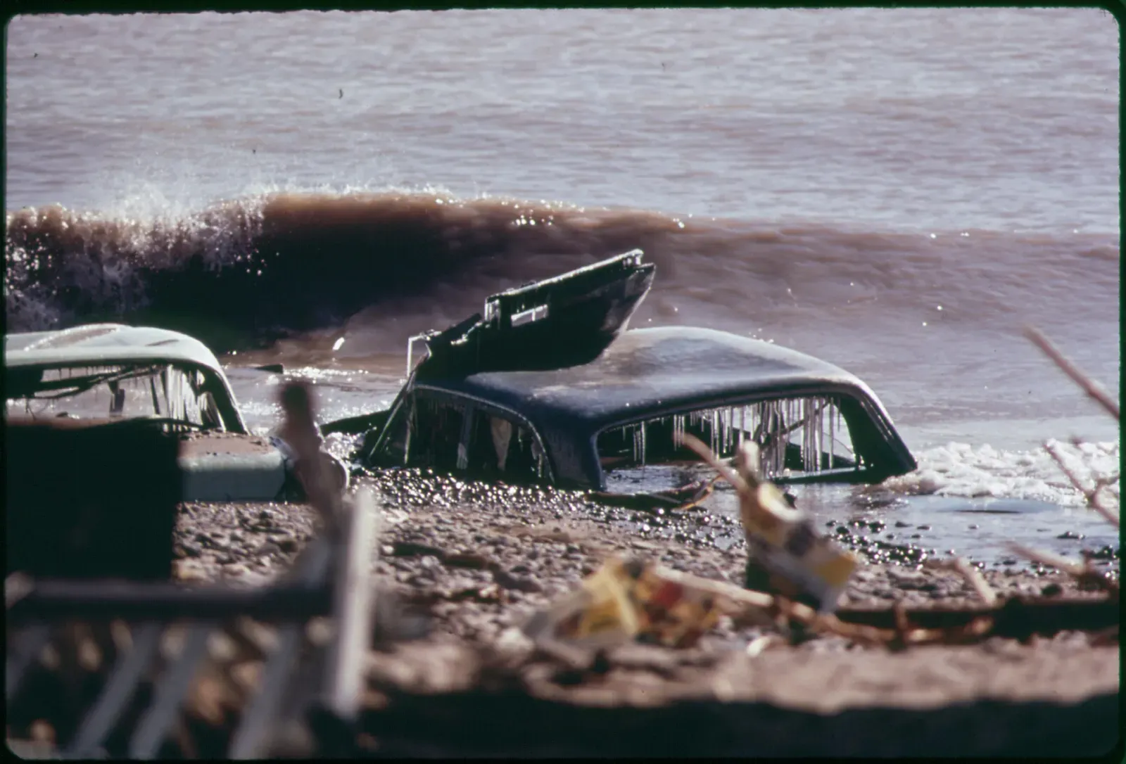
Here is the part nobody likes to admit: lakes are often treated as convenient black holes for our trash. When they dry up, the evidence is impossible to ignore. Entire car bodies, rusted appliances, shopping carts, tires, construction debris, and endless tangles of fishing line and plastic show up along the receding edge or sitting squarely in the middle of what used to be deep water.
Some of this junk is the result of deliberate dumping – an old refrigerator pushed into the reservoir under cover of night, a car rolled down an embankment to get rid of it cheaply. Other items are the byproduct of recreation gone careless: disposable cups, lost tackle, broken coolers, cheap lawn chairs, and beer cans that never made it back to a trash bag. When the water is high, this all vanishes from view, so it is easy for people to pretend it is not there. Once the lake dries, the illusion collapses.
From an environmental standpoint, these items can leach chemicals and microplastics into the sediment and water. As metals corrode and plastics slowly break apart, they become long-lived contaminants that future generations inherit. For researchers studying pollution, a dried lake bed can double as a brutal but honest inventory of local behavior: what people buy, what they throw away, and how seriously they actually take the idea of “out of sight, out of mind.”
Common scenes on a newly exposed lake floor include:
- Vehicles with missing parts, stripped long ago when they were still partly submerged.
- Piles of mixed scrap metal and construction waste near old boat ramps.
- Layers of plastic debris, from bottles to fragments barely larger than grains of sand.
#10 Geological Structures and the Shape of the Old Landscape
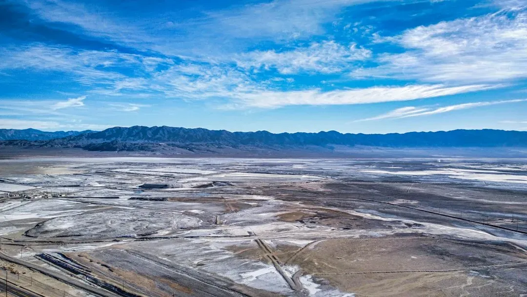
When a lake is full, it flattens everything into a simple water surface. You cannot see the ridges, channels, and slopes beneath; it all looks like one continuous blue sheet. But when the water drops and the bed dries out, the original shape of the valley returns, almost like the lake took its hands off a map and let the terrain breathe again. Gullies, old river channels, terraces, and bedrock outcrops become visible in remarkable detail.
Geologists pay attention to these features because they hold the key to how the lake formed in the first place. Was it carved by glaciers, like a long U‑shaped bowl? Was it dammed by a landslide or lava flow, leaving a steep barrier at one end? Were there multiple levels of older shorelines etched into the sides of the basin, hinting at ancient climates where the water stood higher or lower than today? A dried lake bed can show all of this at once, like a stripped-down architectural drawing.
For engineers and planners, exposed lake structure is not just academically interesting; it can reveal risks. Steep, unstable slopes that never mattered underwater can become landslide hazards when they dry out. Old channels can guide where water will rush if the lake refills fast after heavy rains, shaping flood patterns. Even the texture of the sediment – whether it is soft silt, sticky clay, or coarse gravel – affects how safe it is to walk or build on and how easily dust will be kicked into the air by wind.
In practical terms, walking across a dried lake bed can show you:
- Meandering streambeds that once snaked through the valley before the dam.
- Stepped terraces marking former lake levels over thousands of years.
- Bedrock high points that formed underwater islands or peninsulas when the lake was full.
#11 Climate Stories Written in Rings, Layers, and Lines
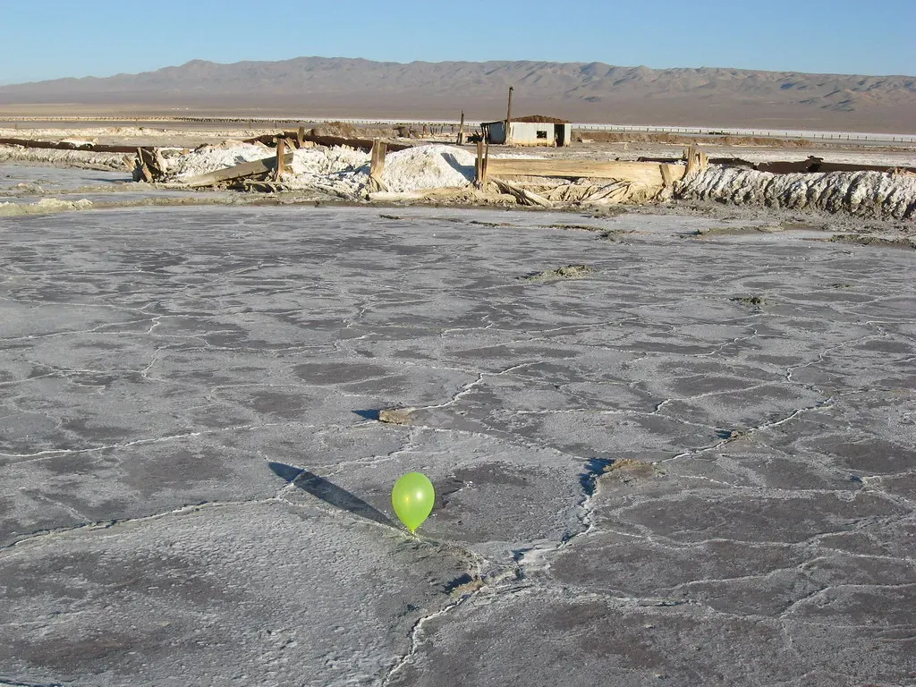
Every few decades, when a lake retreats, it does not just expose objects. It exposes patterns. Tree rings in drowned forests, sediment layers in exposed banks, old shoreline lines on rocks, salt bands, and even the sequence of abandoned docks and boat ramps all tell a connected climate story. Taken together, they can sketch out centuries of wet and dry cycles, big flood events, and the more recent acceleration of human-driven change.
Scientists often treat a dried lake bed like a layered archive. They sample core after core, slice them, and study particle sizes, pollen grains, charcoal fragments from ancient fires, and the chemistry locked into each layer. That allows them to reconstruct past rainfall, temperature swings, vegetation shifts, and even how often major dust storms roared across the region. It is a quieter kind of drama than a newly discovered ghost town or shipwreck, but it might be even more consequential for our future.
At the same time, ordinary people read the story in a more emotional language. They see that docks now sit on bare dirt where they once floated. They remember summers when the water was lapping at a particular boulder that is now high and dry. They watch local fish populations struggle. Maybe they hear that the lake hit a “record low” again, and they realize records are falling faster than they used to. Those personal observations, tied to the physical evidence on the lake bed, can shape public pressure for better water management and climate action.
In a sense, every dried lake bed is both a science lab and a mirror. It shows us how the planet has always changed and how, lately, we have been pushing it faster. The rings, layers, and lines are not just abstractions; they are a ledger of choices – natural and human – that have led to this moment.
Conclusion: The Lake Was Never Really Silent
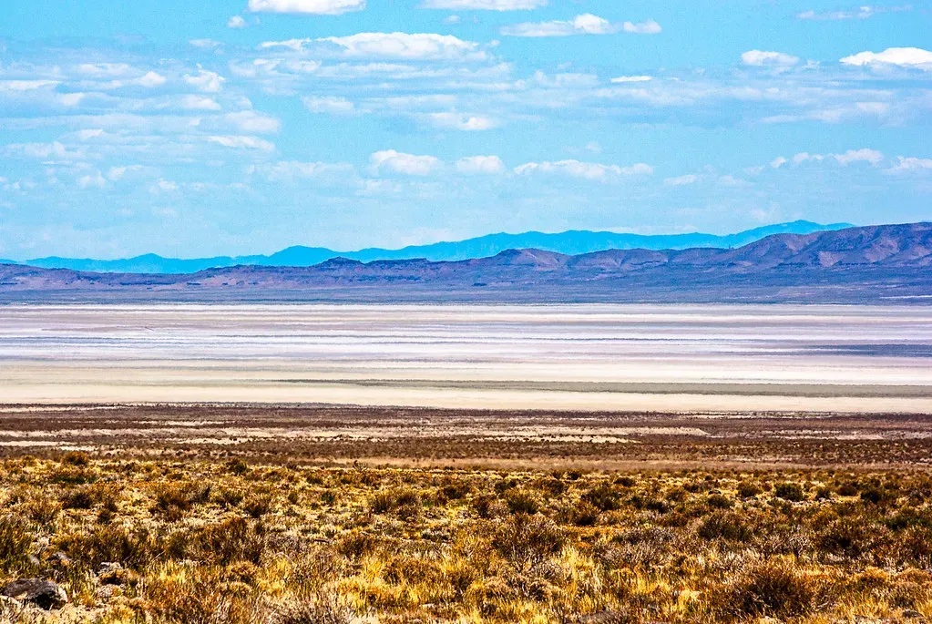
When you look across a dried lake bed, it is tempting to see emptiness: no boats, no waves, no reflections of the sky. But after walking through everything it reveals – ancient forests, drowned towns, forgotten boats, fossil bones, toxic layers, sacred sites, broken fish skeletons, car husks, carved valleys, and climate records – it is hard to keep calling it empty. The lake was never really silent; it was just speaking in a language we could not hear underwater.
I think that is what unsettles people the most when lakes vanish every few decades. It is not just the lost recreation or the ugly ring of mud. It is the sudden honesty. The water, which used to hide both our past and our mistakes, retreats and shows us exactly what we have built over and under it, what we have sacrificed for it, and what we have been willing to throw away. You cannot stand in the middle of a cracked lake bed, staring at a half-buried car next to the stumps of a hundred-year-old forest, and still pretend that human activity is some small, harmless thing.
My opinion is that dried lake beds should be treated like urgent classrooms. When they appear, we ought to listen carefully and move quickly: document the science, protect the cultural sites, clean up the trash, and rethink the policies that made this particular lake retreat in the first place. Then, if and when the water comes back, we will not be able to claim ignorance the next time the shoreline peels away and the stories underneath return to the light.
So the next time you see images of a shrunken lake on the news and a cracked, pale bed where waves once rolled, ask yourself: what is it trying to show us this time – and are we actually willing to look?