North America is, in many ways, a continent written in stone. Scratch below the surface of any great landscape here and you’ll find a timeline measured not in centuries but in hundreds of millions of years. Every canyon wall, volcanic crater, and weathered rock spire is a sentence in an ongoing story about how this landmass came to be.
You don’t need a geology degree to feel the weight of that history. You just need to stand at the right edge and look. From the ancient basement rocks of the southwest to the smoldering caldera of the northwest, eleven formations stand out as especially powerful chapters in North America’s geological biography.
1. The Grand Canyon, Arizona: A Two-Billion-Year Open Book
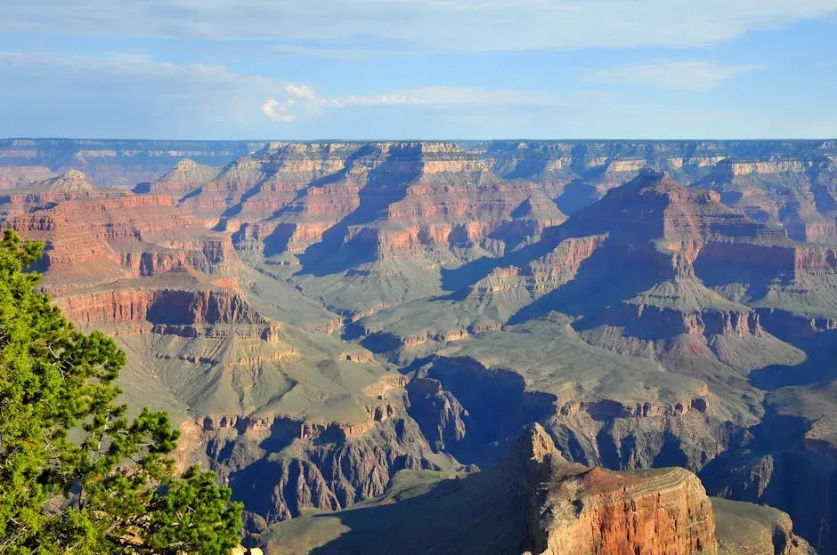
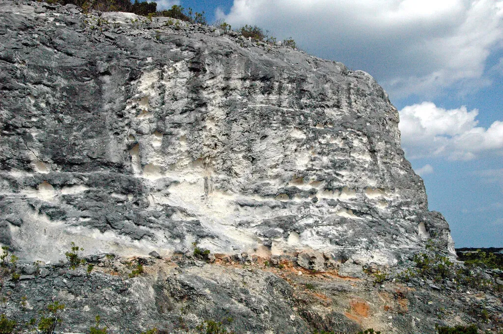
The Grand Canyon stretches roughly 1.6 kilometers deep, carved into the uplifting Colorado Plateau by the erosional power of the Colorado River and its tributaries, exposing an exceptionally complete rock record covering roughly forty percent of Earth’s entire history. That kind of scale is almost impossible to absorb at first glance. It takes a moment for the mind to catch up with the eyes.
The major geologic exposures in the Grand Canyon range in age from the two-billion-year-old Vishnu Schist at the bottom of the Inner Gorge to the 270-million-year-old Kaibab Limestone on the Rim. In the Grand Canyon, clear horizontal layers of different rocks provide information about where, when, and how they were deposited, long before the canyon was even carved. You’re not just looking at scenery when you stand on that rim. You’re reading the most detailed geological record on the continent.
2. Yellowstone Caldera, Wyoming: The Fire Still Burns Below
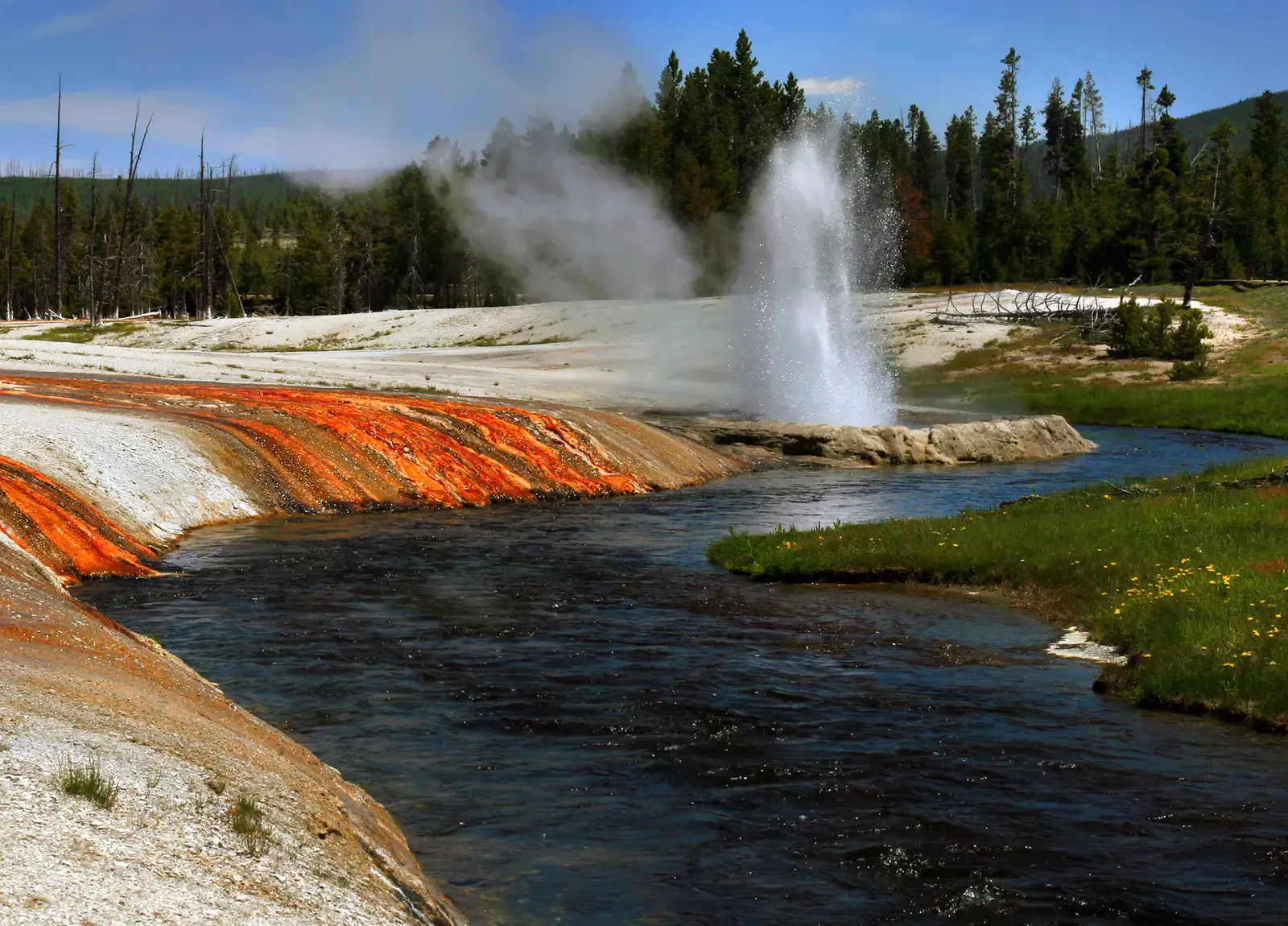
Yellowstone National Park is considered not only an active volcano but a supervolcano, meaning it is capable of massive eruptions of more than 240 cubic miles of magma. The region’s most recent caldera-forming eruption, roughly 640,000 years ago, created the 35-mile-wide, 50-mile-long Yellowstone Caldera. The landscape you see today, its geysers, hot springs, and steaming mud pots, is the direct result of that enormous geological wound.
The first major eruption of the Yellowstone volcano, which occurred 2.1 million years ago, is among the largest volcanic eruptions known, covering over 5,790 square miles with ash. Since its most recent major eruption approximately 640,000 years ago, Yellowstone has remained geologically active, primarily due to the vast magma chamber beneath the caldera, which is estimated to contain around 4,000 cubic kilometers of partially molten material, making it one of the largest of its kind globally. Few places on Earth remind you quite so directly that the ground beneath your feet is very much alive.
3. Devils Tower, Wyoming: A Volcanic Sentinel on the Plains
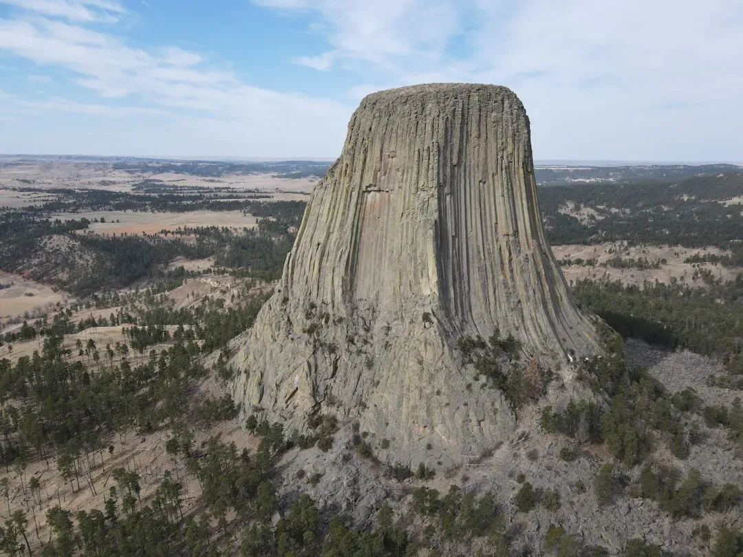
Rising 867 feet above the plains of Wyoming, Devils Tower is an imposing monolithic formation created by volcanic activity over 50 million years ago. Its grooved surface is the result of magma cooling and contracting into hexagonal columns. The geometry is so precise and so unusual that it stops people cold. There’s nothing ordinary about looking at it.
Sacred to Indigenous tribes and a popular destination for climbers, Devils Tower stands as a testament to the power of volcanic forces and erosion working over millions of years. It was the first national monument in the country, and it was also the backdrop for the film Close Encounters of the Third Kind. The surrounding plains have long since eroded away, leaving this stubborn pillar of igneous rock standing alone as one of the most striking landforms in North America.
4. Bryce Canyon, Utah: Cathedrals Built by Ice
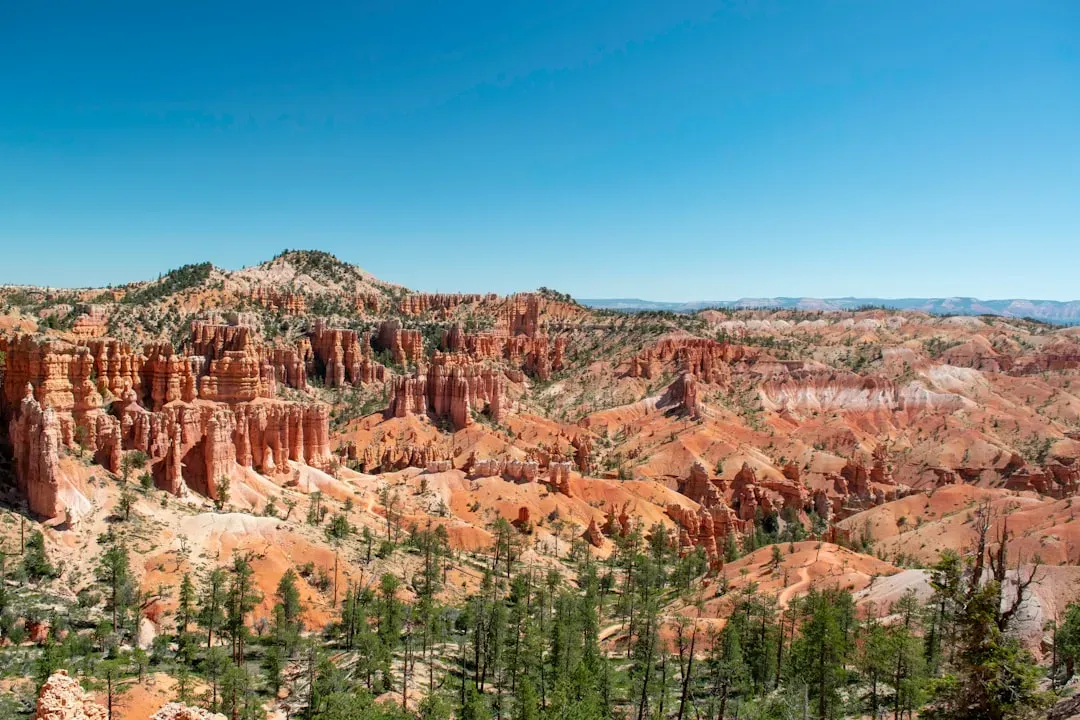
Bryce Canyon is known for distinctive hoodoos, spires and towers that appear as forests of rock, and this national park is part of the Colorado Plateau, a region that was once periodically flooded by freshwater and marine landscapes in which massive amounts of fine-grained sediment was deposited over millions of years, lithified into sedimentary rock, and later uplifted by tectonic activity. The result is one of the most surreal landscapes on the continent.
Nowhere in the world are hoodoos so abundant as in the northern section of Bryce Canyon National Park in Utah. Over 200 freeze-thaw cycles occur each year in Bryce Canyon, and that relentless rhythm of freezing and thawing is the true sculptor here. In the case of Bryce Canyon, the hoodoos’ rate of erosion is roughly two to four feet every 100 years, meaning the landscape you see today is already different from what existed a century ago and will change considerably in the centuries ahead.
5. Arches National Park, Utah: Stone Arches in an Ancient Desert
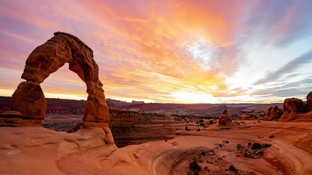
Arches National Park is home to over 2,000 natural sandstone arches, making it the largest concentration of arches in the world, and these arches are the result of millions of years of geologic processes, including the deposition of sand dunes followed by erosion by wind, water, and ice. The sheer variety of shapes and sizes within the park makes it almost impossible to believe they were formed by natural forces alone.
Located in Utah, Arches National Park boasts over 2,000 natural stone arches, the highest concentration in the world, and these formations, including the iconic Delicate Arch, were sculpted over millions of years through erosion and weathering. One captivating fact is that new arches continue to form as old ones collapse, showcasing nature’s ongoing transformation. The park is, in essence, a geological process still in motion, not a finished monument.
6. The Appalachian Mountains: North America’s Ancient Backbone
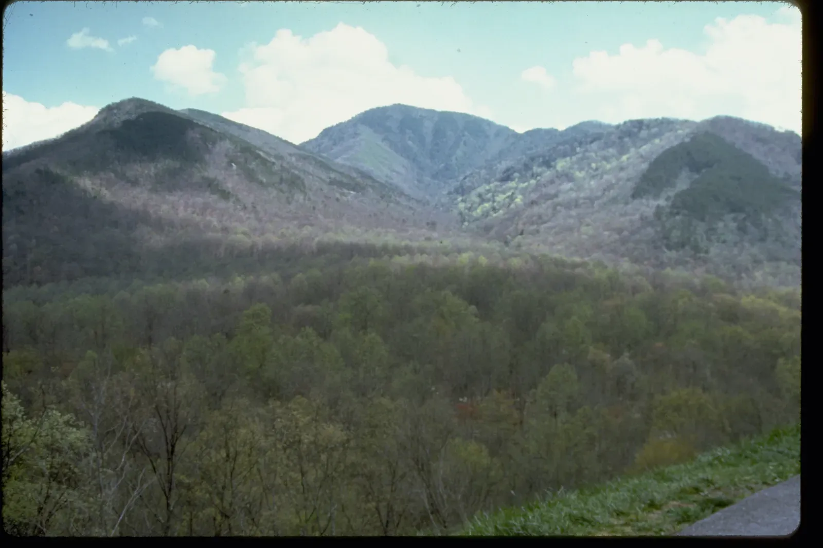
The once quiet Appalachian passive margin changed to a very active plate boundary when a neighboring oceanic plate, the Iapetus, collided with and began sinking beneath the North American craton, and with the birth of this new subduction zone, the early Appalachians were born. That collision happened roughly 480 million years ago, placing the Appalachians among the oldest mountain ranges on Earth.
This was just the first of a series of mountain-building plate collisions that contributed to the formation of the Appalachians. The range you see today is a worn-down remnant of what was once a towering mountain system comparable in height to the modern Himalayas. Time and persistent erosion have smoothed them into the rolling, forested ridges that define the eastern edge of the continent, but their roots reach deep into the story of North America’s formation.
7. Mammoth Cave, Kentucky: A Hidden World Below the Surface
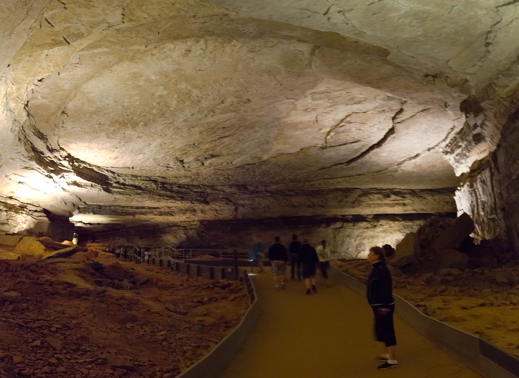
Mammoth Cave’s labyrinthine passages and vast chambers were formed by water dissolving limestone over millions of years, and Native Americans first explored the cave around 5,000 years ago, leaving behind artifacts and mummified remains. It is the world’s longest known cave system, and geologists estimate that only a fraction of its passages have been fully mapped.
European settlers discovered it in the late 18th century, and it gained fame as a source of saltpeter during the War of 1812. One haunting story is that of tuberculosis patients housed in the cave in the 1800s, as it was believed the air might cure them. The cave’s geological record is just as layered as its human history. Its passages represent millions of years of slow dissolution, where slightly acidic groundwater quietly hollowed out an underground labyrinth beneath the Kentucky landscape.
8. Yosemite Valley, California: Granite Carved by Glaciers
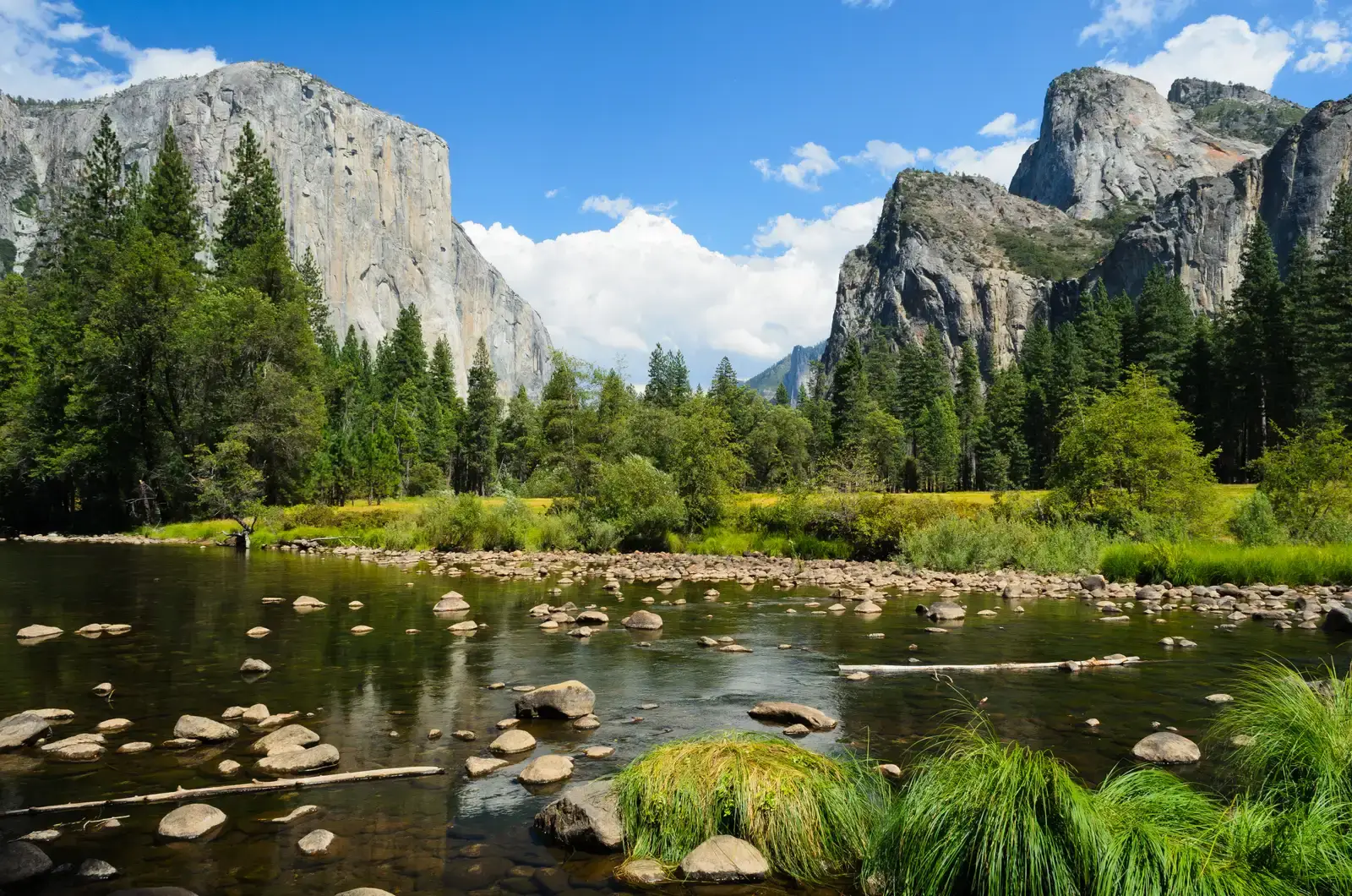
The granite cliffs of Yosemite Valley, including El Capitan and Half Dome, are wonders of glacial sculpting. During the Ice Age, glaciers carved deep into the Sierra Nevada mountains, shaping Yosemite’s stunning rock faces and plunging waterfalls. The valley itself was widened and deepened by repeated advances and retreats of glacial ice over tens of thousands of years.
Today, Yosemite is a climber’s paradise and a geological marvel, with its towering cliffs revealing the resilience and beauty of ancient granite molded by ice and time. What makes Yosemite’s geology particularly striking is the contrast between the sheer vertical walls, some rising nearly 3,000 feet from the valley floor, and the flat, polished meadows below. That contrast is the direct legacy of glacial erosion at a monumental scale.
9. Monument Valley, Arizona and Utah: The Southwest’s Most Recognizable Skyline
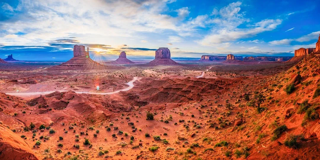
Monument Valley’s distinctive sandstone buttes, known as mittens and merricks, rise dramatically from a flat desert floor in the Navajo Nation. The sediments that formed these structures are now exposed across Arizona, New Mexico, Oklahoma, Utah, Colorado, Wyoming, South Dakota, and Montana, and at the time of their deposition, this region was home to forests of conifers, ginkgos, and tree ferns. What you see towering above the desert floor today is essentially all that remains after millions of years of erosion stripped away the surrounding rock.
One of the most geologically intriguing features of the Colorado Plateau, where Monument Valley sits, is its remarkable stability. Relatively little rock deformation has affected this high, thick crustal block within the last 600 million years or so. That stability is precisely what preserved these buttes. While surrounding regions were pulled apart and pushed around by tectonic forces, the plateau held firm, allowing the slow work of erosion to sculpt these extraordinary pillars of Permian-age sandstone.
10. The Channeled Scablands, Washington: Shaped by a Prehistoric Flood
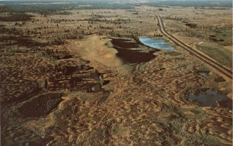
Several times between 12,000 and 15,000 years ago, an ice sheet crept into the Idaho Panhandle, blocking the Clark Fork River and creating a lake 200 miles long and 2,000 feet deep. Time and again the ice dam broke, unleashing an inland tsunami that swept east into Montana and west all the way to the Pacific. The scale of these floods was almost incomprehensible by any modern standard.
Among other feats of geologic engineering, these walls of water diverted the Palouse River and carved the 200-foot cliffs that form the backdrop for Palouse Falls, a beautiful cascade surrounded by desert in southeastern Washington. The scablands themselves, with their rippled terrain and massive dry waterfalls, were initially dismissed as impossible until geologist J Harlen Bretz proved their catastrophic origin in the 20th century. It remains one of geology’s great detective stories, and the landscape carries every mark of its violent past.
11. The Canadian Shield: The Oldest Rock in North America
The part of the North American Craton where basement rock is exposed is called the Canadian Shield. Surrounding this is a stable platform where the basement is covered by sediment, and surrounding that are a series of orogenic zones. The Canadian Shield is a large area of Archean through Proterozoic igneous and metamorphic rocks in eastern Canada and north-central and northeastern United States. It is the geological foundation on which much of North America rests.
North America is somewhat unusual among the continents in having stable interior lowlands of great antiquity that are almost completely enclosed by younger orogenic belts. These lowlands include the Canadian (Laurentian) Shield and an interior platform of crystalline rock that is covered by a veneer of virtually flat-lying sedimentary rock. The Shield preserves rocks nearly four billion years old in some locations, making it one of the most ancient exposed surfaces on the planet. You can stand on it and, if you’re inclined to think in deep time, understand that the ground beneath you has existed in some recognizable form since before complex life developed on Earth.
Conclusion: Reading the Landscape Differently
Every one of these formations asks you to shift your sense of time. A human lifetime barely registers against the ages that shaped these landscapes. The canyon carved over millions of years, the caldera that last exploded hundreds of thousands of years ago, the mountain range built by continental collisions nearly half a billion years back – these are not distant abstractions. They are physical places you can visit, touch, and stand inside.
North America’s geological story is ongoing. Erosion continues to reshape Bryce Canyon’s hoodoos. Yellowstone’s caldera floor still rises and falls with magmatic pressure. New arches will form in Utah as older ones collapse. The continent’s past is not locked away – it’s written across the surface, available to anyone willing to look at the ground beneath their feet with a little curiosity and patience.