Have you ever stood at the edge of a vast canyon or traced your hand across ancient rock and wondered about the stories locked within? The continent beneath your feet has been shaped by billions of years of volcanic fury, continental collisions, and slow, patient erosion. North America’s landscape isn’t just a collection of pretty views. It’s a geological archive that reveals how our planet has transformed itself over unimaginable spans of time.
Think about this for a moment. Some rocks you can touch today formed when Earth itself was still young, when the atmosphere looked nothing like what we breathe now. These formations aren’t just old; they’re witnesses to events that built the very foundation of the continent we live on. So let’s dive in and explore seven of the most ancient and influential geological formations that sculpted North America into what it is today.
The Canadian Shield: North America’s Ancient Heart
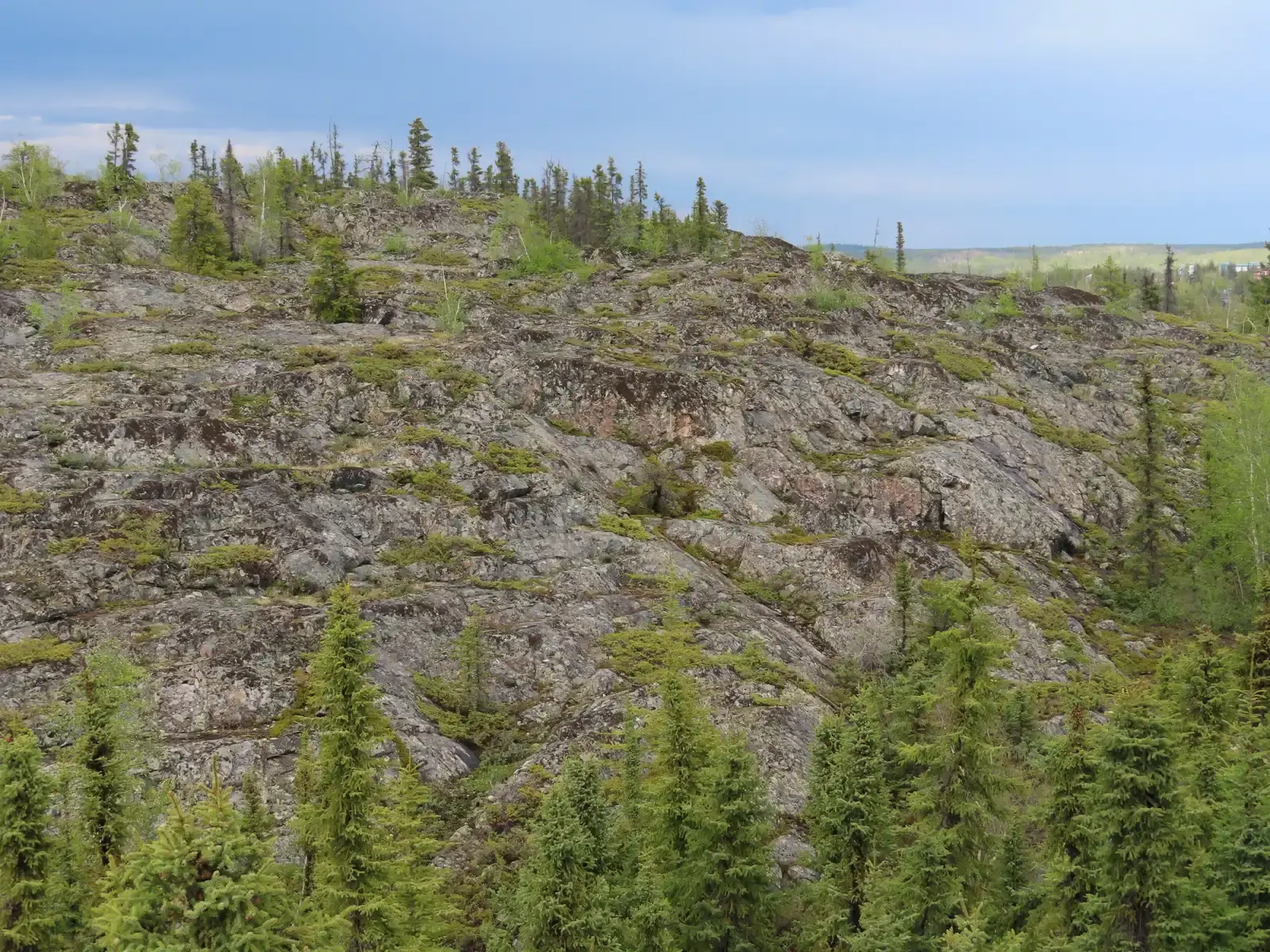
The Canadian Shield forms the North American Craton, the ancient geologic core of the continent, and was the first part of North America to be permanently elevated above sea level. It is Earth’s greatest area of exposed Archean rock, with metamorphic base rocks mostly from the Precambrian period between 4.5 billion and 540 million years ago. Stretching across more than half of Canada and extending into the northern United States, this massive horseshoe-shaped region represents some of the oldest exposed rock on the planet’s surface.
What makes the Canadian Shield truly remarkable is its sheer age and stability. The Acasta Gneiss in the Canadian Shield in northwestern Canada was dated to 4.031 billion years ago, while the Nuvvuagittuq Greenstone Belt in northern Quebec harbors the oldest known surviving fragments of Earth’s crust, dating back to 4.16 billion years ago. These rocks formed during the Hadean Eon when our world was turbulent and hellish. Severe glaciation during the ice ages covered the shield and scraped the rock clean, leaving behind a thin soil layer that exposes this geological treasure. The shield’s ancient volcanic belts and mineral-rich formations continue to provide valuable resources while offering scientists an unparalleled window into Earth’s earliest chapters.
The Appalachian Mountains: A Testament to Continental Collision
When you look at the gentle, rolling peaks of the Appalachian Mountains today, it’s hard to imagine they were once as tall as the Himalayas. The geology of the Appalachians dates back more than 1.2 billion years to the Mesoproterozoic era when two continental cratons collided to form the supercontinent Rodinia. The Appalachian Mountains formed during a collision of continents 500 to 300 million years ago, and in their prime they probably had peaks as high as the modern Himalayas.
These mountains tell the story of multiple collisions as ancient continents crashed together. Around 300 million years ago, the landmass that is now North America collided with Gondwana, a supercontinent comprised of present-day Africa and South America, lifting tons of rock high above the surrounding terrain. The region experienced three major mountain-building events: the Taconic, Acadian, and Alleghanian orogenies. By the end of the Mesozoic, the Appalachian Mountains had been eroded to an almost-flat plain, and it was not until the region was uplifted during the Cenozoic era that the distinctive topography of the present formed. Time and erosion have worn these once-mighty peaks down to their cores, but they remain one of the most biodiverse regions in North America.
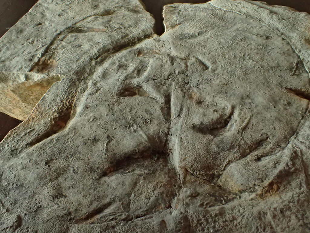
The Wyoming Craton: The Nucleus of a Continent
The North American continent grew around the Wyoming craton by accretion of rocks onto the margins of the continent, making the Wyoming craton the true nucleus of North America. Hidden beneath parts of Wyoming, Montana, and the northern Rockies, this ancient piece of continental crust represents one of the oldest coherent blocks of North American geology. The Wyoming Craton, along with the Slave Craton in northern Canada, contain the oldest rocks in North America, with the oldest rocks in Wyoming Craton dating from around 3.5 billion years old but containing exotic zircon grains that date from around 3.8 billion years old.
Here’s where it gets fascinating. Granitic magmatism ranging from 2.8 to 2.6 billion years ago occurred across the Wyoming province, and along with high-pressure rocks in the northern Teton range, record the earliest evidence of plate tectonics in North America and some of the earliest plate tectonics anywhere on earth. This craton served as a building block, a stable foundation upon which younger rocks and mountain ranges would later form. Between 1.7 and 1.8 billion years ago the Wyoming Craton, the Slave Craton, and other Archean cratons with a younger history were stitched together by deformation zones to produce Laurentia, the Precambrian core of North America. Think of it as the continent’s original seed from which everything else grew outward.
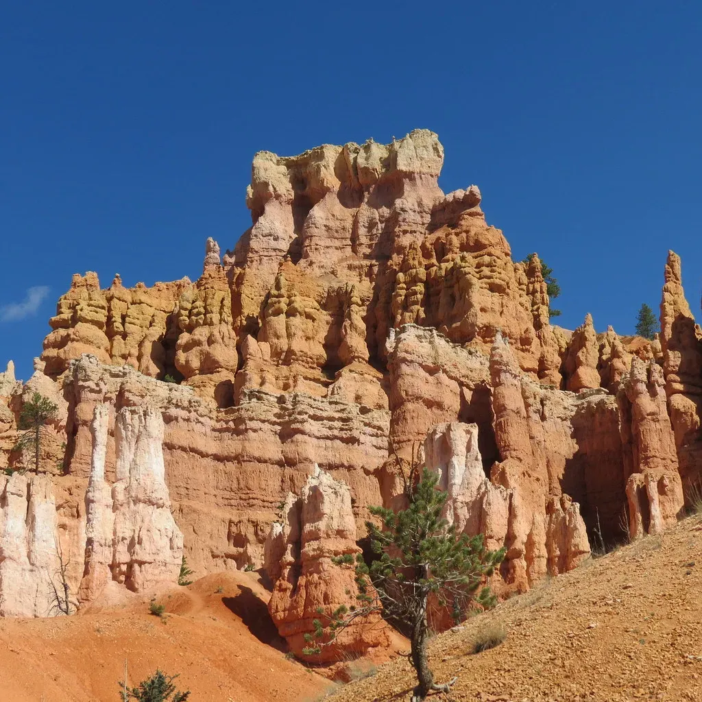
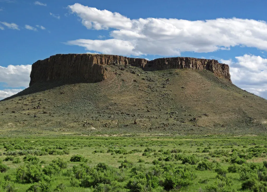
The Colorado Plateau: A Stable Island in Geological Chaos
The Colorado Plateau is geology’s great mystery, a region that defied the chaos happening all around it. One of the most geologically intriguing features of the Colorado Plateau is its remarkable stability, with relatively little rock deformation such as faulting and folding affecting this high, thick crustal block within the last 600 million years or so. While mountain ranges rose and tectonic plates ground against each other on all sides, this massive block of ancient rock remained largely intact.
The sculptured beauty and brilliant colors of the Colorado Plateau’s sedimentary rock layers expose rocks ranging in age from billions to just a few hundred years old. Ancient Precambrian rocks, exposed only in the deepest canyons, make up the basement of the Colorado Plateau, and most are metamorphic rocks formed deep within the Earth while continental collision on a grand scale produced the nucleus of the North American continent well over a billion years ago. By 600 million years ago North America had been eroded to a remarkably smooth surface, and it is on this crystalline rock surface that the younger, more familiar layered rocks of the Colorado Plateaus were deposited. Today, this plateau gives us the Grand Canyon and countless other geological wonders, each layer a page in Earth’s autobiography.
The Grand Canyon: Earth’s Greatest Geological Textbook
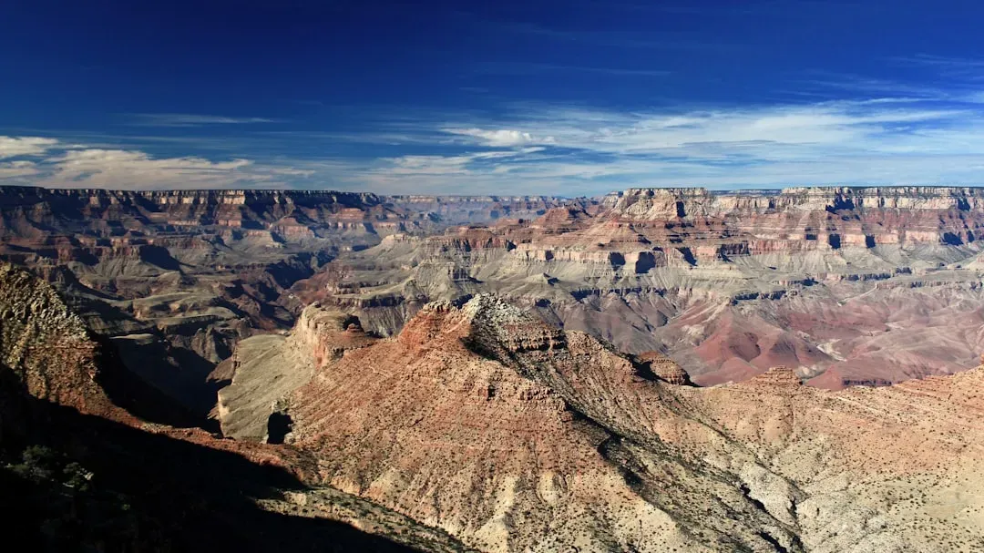
There’s a reason the Grand Canyon takes your breath away. Hailed as one of the Seven Wonders of the World, the Grand Canyon exhibits the largest section of geologic time on earth, and hiking to the bottom, one passes through a third of the planet’s age. Nearly two billion years of Earth’s geological history have been exposed as the Colorado River and its tributaries cut their channels through layer after layer of rock while the Colorado Plateau was uplifted.
Let’s be real: the Grand Canyon is essentially a geological time machine carved by water. The Park contains excellent exposure of the world renowned Great Unconformity, an impressive angular unconformity occupying 1.2 billion years in the rock record, and the gap in the rock record straddles the Precambrian-Cambrian boundary. Several recent studies support the hypothesis that the Colorado River established its course through the area about 5 to 6 million years ago, and since that time, the Colorado River has driven the down-cutting of the tributaries and retreat of the cliffs, simultaneously deepening and widening the canyon. Every stripe of color you see represents a different environment, a different era, a different world entirely. The canyon isn’t just beautiful; it’s arguably the most complete geological record exposed anywhere on the planet.
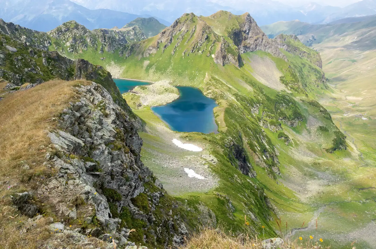
The Rocky Mountains: Built by Compression and Uplift
The Rocky Mountains are younger than most formations on this list, but their story is equally dramatic. The Rocky Mountains took shape during a period of intense plate tectonic activity that formed much of the rugged landscape of the western United States, with three major mountain-building episodes reshaping the west from about 170 to 40 million years ago. The Laramide orogeny, about 70 to 40 million years ago, the last of the three episodes, is responsible for raising the Rocky Mountains.
What happened next is almost as interesting as their formation. As of 60 million years ago, the Rockies were like Tibet: a high plateau, probably 6,000 metres above sea level. Since then, erosion stripped away the high rocks, revealing the ancestral rocks beneath and forming the current landscape of the Rockies, with periods of glaciation occurring from the Pleistocene Epoch to the Holocene Epoch. The ice ages left their mark on the Rockies, forming extensive glacial landforms, such as U-shaped valleys and cirques. These mountains are still young in geological terms, still being shaped by the ongoing dance between uplift and erosion.
The Basin and Range Province: A Landscape Stretched Apart
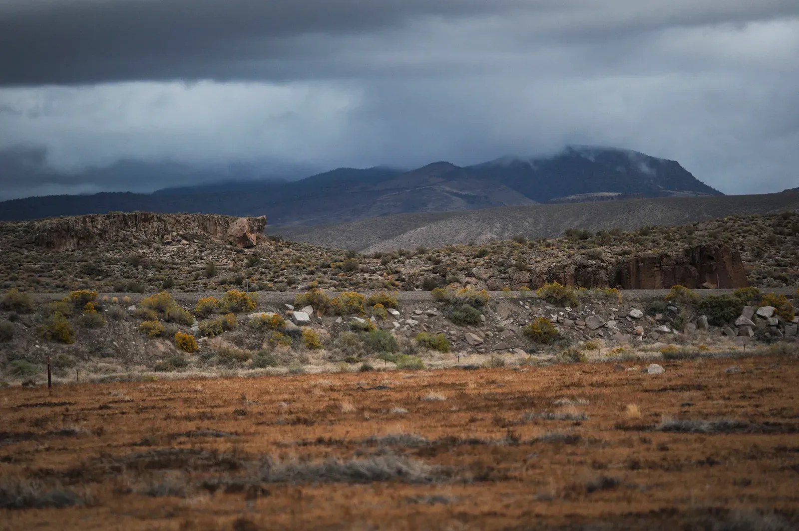
While the formations we’ve discussed so far were built by compression and collision, the Basin and Range Province tells a different story: one of extension and stretching. This region, spanning much of Nevada and parts of surrounding states, features alternating mountain ranges and flat valleys created by the Earth’s crust literally being pulled apart. The topography is striking, almost rhythmic in its pattern of basin, range, basin, range, repeating across hundreds of miles.
This extension began roughly 20 to 30 million years ago and continues today, though at a slower pace. Normal faults drop blocks of crust down to form valleys while adjacent blocks remain high as mountain ranges. The results are dramatic: steep mountain fronts rising abruptly from flat desert floors. Death Valley, the lowest point in North America at 282 feet below sea level, sits within this province. Death Valley is world-famous for the incredible size, shape, and exposure of alluvial fans, and the Black Mountain front is defined by a prominent fault scarp with an abrupt topographic transition from the mountains to the flat valley bottom creating ideal conditions for alluvial fan formation. This landscape of extremes demonstrates how tectonic forces can stretch and thin continental crust, creating environments unlike anywhere else on Earth.
Conclusion: Reading the Rocks

These seven ancient geological formations are more than scenic backdrops for your vacation photos. They’re the building blocks of North America, each layer and fold recording moments when continents collided, oceans opened and closed, and mountains rose and fell. From the 4-billion-year-old rocks of the Canadian Shield to the relatively young Rockies, these formations tell a continuous story of transformation.
The next time you’re hiking through mountains or gazing into a canyon, remember you’re standing on a stage where Earth has been performing for billions of years. The rocks beneath your feet witnessed the birth of the atmosphere, the first stirrings of life, and countless cycles of creation and destruction. What other chapters will these ancient formations witness in the eons to come? Did you expect that the ground beneath us held so many secrets?