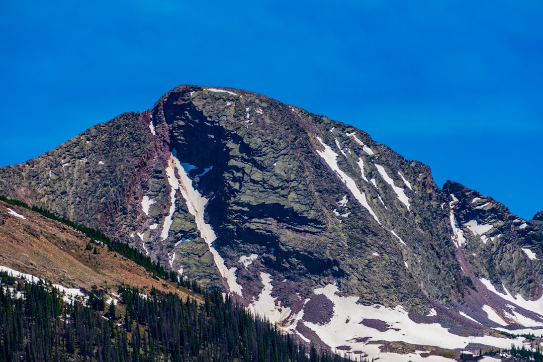
You might have unknowingly stood on the remnants of an ancient lost continent during your European vacation. While millions of tourists explore the magnificent Alps, the dramatic Balkan Mountains, and the stunning Apennines each year, few realize they’re treading on the remains of a massive landmass that disappeared beneath Europe over 100 million years ago. This buried continent, now known as Greater Adria, was roughly the size of Greenland and once thrived as a tropical paradise in ancient seas.
The discovery of Greater Adria represents one of geology’s most remarkable detective stories, pieced together through decades of meticulous research and cutting-edge technology. Unlike the mythical Atlantis, this lost continent is scientifically verified and has left unmistakable traces across southern Europe’s most iconic landscapes.
The Discovery That Rewrote Geological History
Geologists have reconstructed, time slice by time slice, a nearly quarter-of-a-billion-year-long history of a vanished landmass that now lies submerged beneath southern Europe, with scientists from Utrecht University uncovering the remnants of Greater Adria buried beneath Southern Europe for around 140 million years. The breakthrough came after van Hinsbergen and his colleagues spent more than 10 years collecting information about the ages of rock samples thought to be from Greater Adria, as well as the direction of any magnetic fields trapped in them. The researchers’ analysis represents “a huge amount of work,” says Laurent Jolivet, a geologist at Sorbonne University in Paris who was not involved in the new study, with the amount of detail in the team’s systematic time-lapse reconstruction being unprecedented.
The research team faced extraordinary challenges in piecing together this geological puzzle. “The Mediterranean region is quite simply a geological mess,” van Hinsbergen explains, noting that “everything is curved, broken, and stacked”. The region has a complex geopolitical makeup, obliging the researchers to piece together evidence from 30 different countries, from Spain to Iran, “each with its own geological survey, own maps, own ideas about evolutionary history”.
When Greater Adria Was Born From Gondwana
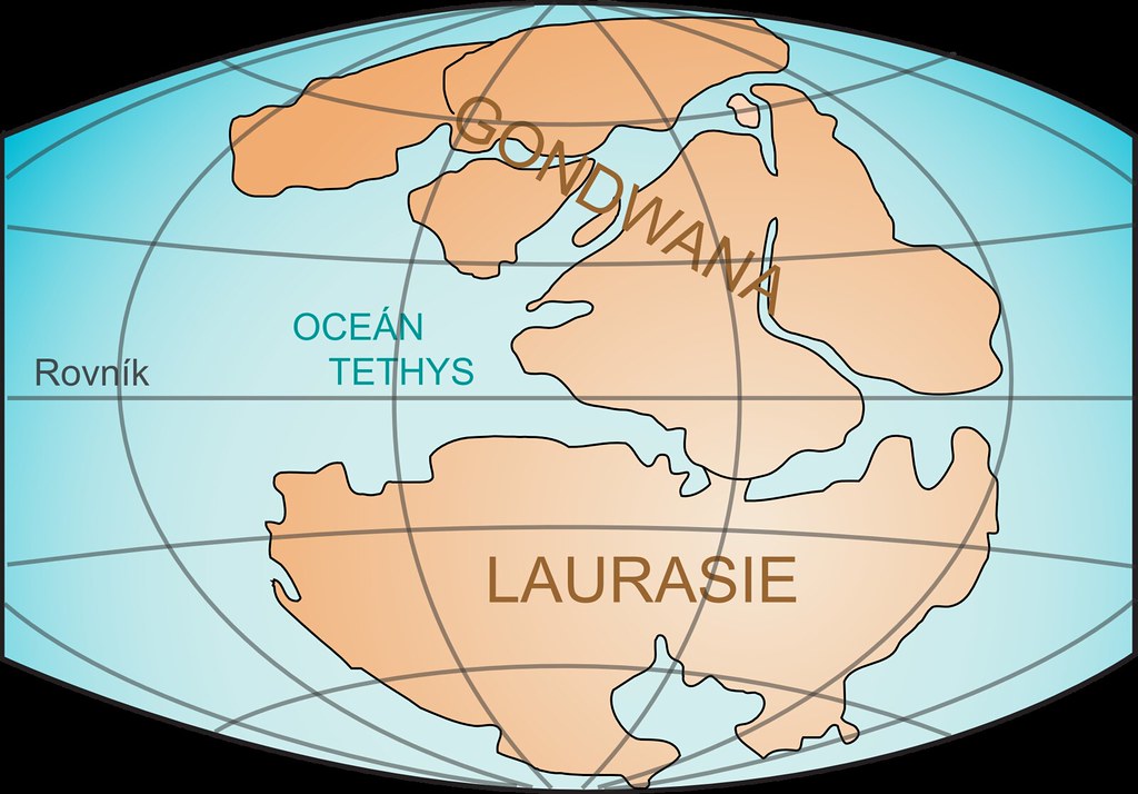
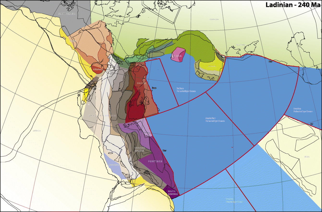
Greater Adria became a separate entity when it broke away from the southern supercontinent of Gondwana (which comprised what is today Africa, South America, Australia, Antarctica, the Indian subcontinent, and the Arabian Peninsula) about 240 million years ago and started to move northward. The world was a very different place back then, just recovering from the Permian-Triassic extinction, which came pretty close to wiping out all life on Earth, and the planet was repopulated by the first mammals and dinosaurs.
At that time, the planet’s land masses had coagulated into a single supercontinent, Pangaea, and around 240 million years ago, a Greenland-sized piece of continental plate broke off from what would become North Africa and started drifting north. It broke free into the Neo-Tethys Ocean and headed towards Laurasia, with the microcontinent of Iberia separating from the bulk of Greater Adria about 200 million years ago.
The continent’s journey northward was far from a simple drift. Rather than simply moving north with no change in its orientation, Greater Adria spun counterclockwise as it jostled and scraped past other tectonic plates. This complex dance of geological forces would eventually lead to its dramatic destruction and transformation into the mountain ranges we know today.
Life in the Tropical Paradise of Greater Adria
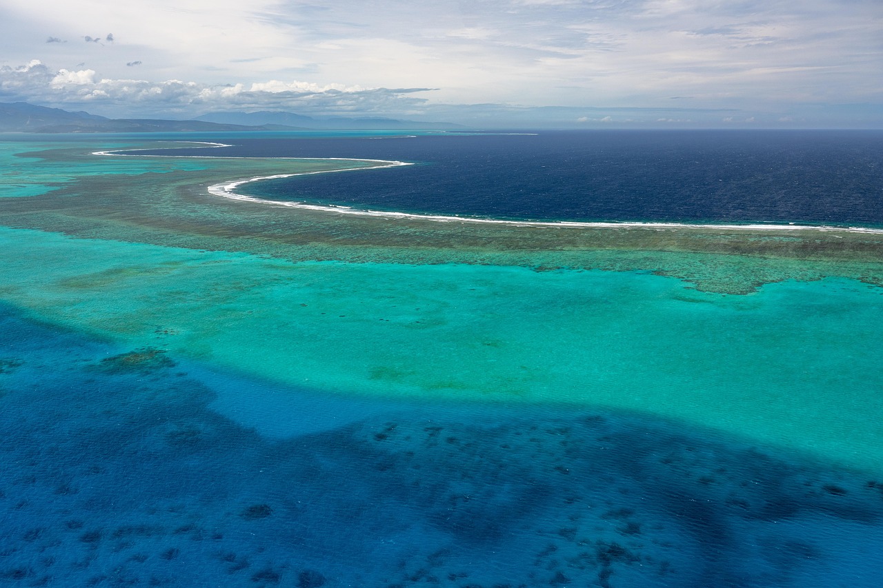
About 140 million years ago, it was a Greenland-size landmass, largely submerged in a tropical sea, where sediments collected and slowly turned into rock. Greater Adria was large, extending from what is now the Alps all the way to Iran, but not all of it was above water, meaning it was likely a string of islands or archipelagos, and it would have been a “good scuba diving region”.
Most of this continent was situated underwater and formed shallow, tropical seas in which sediment deposited, for example in large coral reefs, with the sedimentary rocks being scraped off when the rest of the continent subducted into the mantle. The underwater portions of Greater Adria created perfect conditions for marine life to flourish in warm, shallow seas.
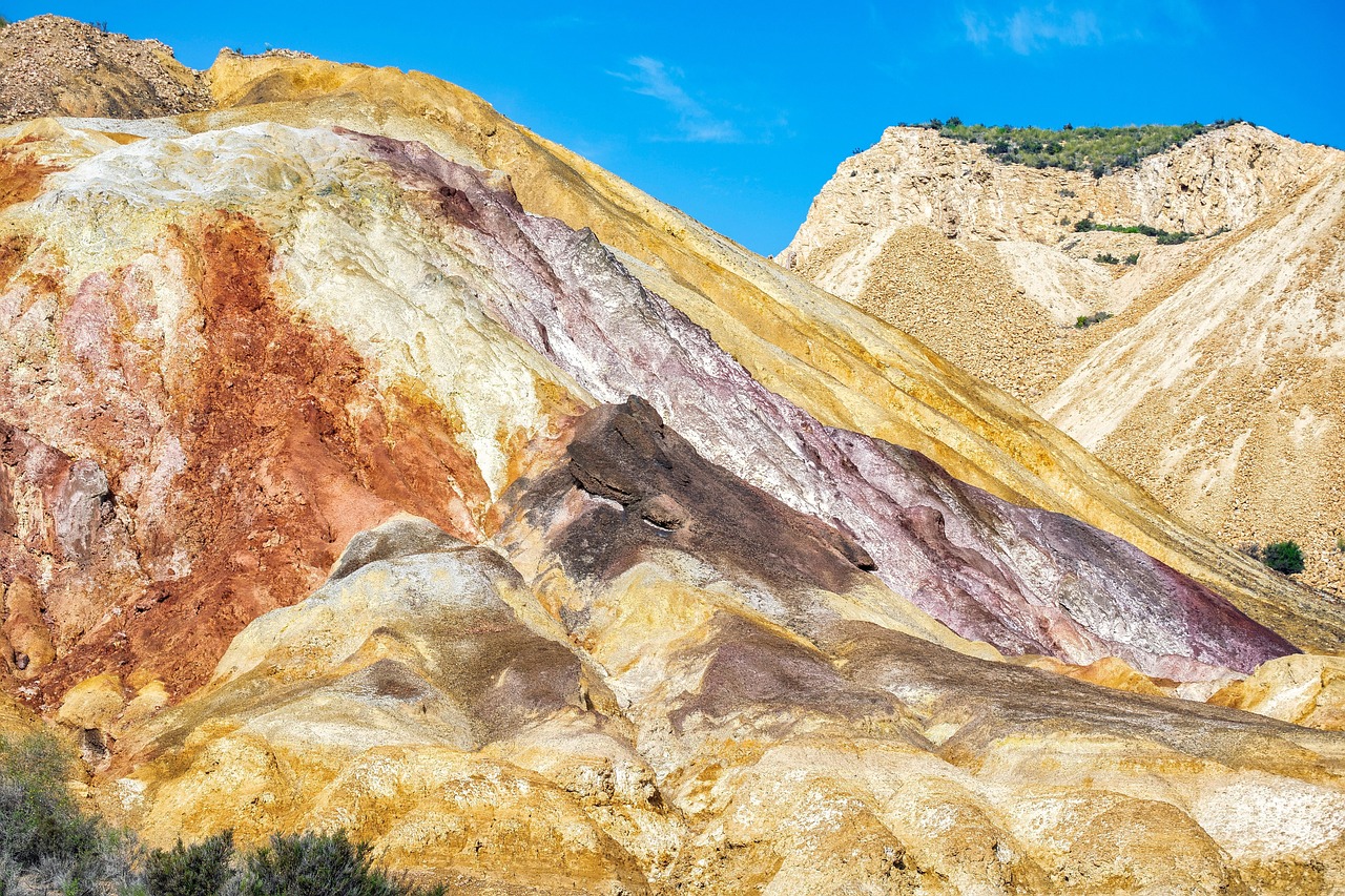
Imagine vast coral reefs stretching across azure waters, teeming with prehistoric marine creatures that are now preserved as fossils in European mountain ranges. The tropical climate meant that limestone deposits accumulated steadily over millions of years, creating the raw materials that would later form some of Europe’s most spectacular peaks.
The Collision That Changed Europe Forever
Then, as it collided with what is now Europe between 100 million and 120 million years ago, it shattered into pieces and was shoved beneath that continent. Although the tectonic collision happened at speeds of no more than 3 to 4 centimeters per year, the inexorable smash-up shattered the 100-kilometer-thick bit of crust and sent most of it deep within Earth’s mantle.
Around 100 million to 120 million years ago, Greater Adria smashed into Europe and began diving beneath it, but some of the rocks were too light and so did not sink into Earth’s mantle, instead being “scraped off” in a way similar to what happens when a person puts their arm under a table and then slowly moves it underneath: The sleeve gets crumpled up, and this crumpling formed mountain chains such as the Alps.
The collision wasn’t a single catastrophic event but rather a slow-motion destruction that played out over millions of years. Think of it like an enormous geological car crash happening in extreme slow motion, where the “debris” from the impact became the towering peaks that define southern Europe’s skyline today.
The Geological Detective Work Behind the Discovery
The team took specific note of the orientation of minuscule magnetic minerals, which were formed by primeval bacteria, with Hinsberg explaining that bacteria make the magnetic particles in order to orient themselves to Earth’s magnetic field, and when mineral-filled sediment turns into rocks, that orientation is frozen in time. This team’s examination revealed that the rocks had undergone extremely large rotations – evidenced by fault lines that look “like pieces of a broken plate”.
The continent was uncovered through simulations of plate tectonics with the GPlates software, with the team spending 10 years collecting a deluge of geological and geophysical data from all over the region and plugging it into their model, using software that van Hinsbergen describes as “relatively idiot-proof” and has allowed for more detailed visualisation. The reconstruction started with manual work: the entering of thousands of pieces of information from the literature that say something about movement in the earth, such as fault lines and magnetism stored in the rocks, making their method simple to reproduce.
The breakthrough required analyzing microscopic clues left by ancient bacteria millions of years ago. These tiny organisms unknowingly became geological compasses, preserving the exact orientation of rocks as Greater Adria twisted and turned during its final journey toward destruction.
Where Greater Adria’s Remains Hide Today
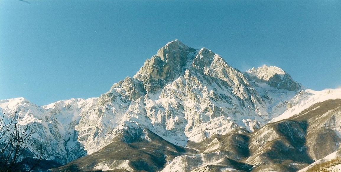
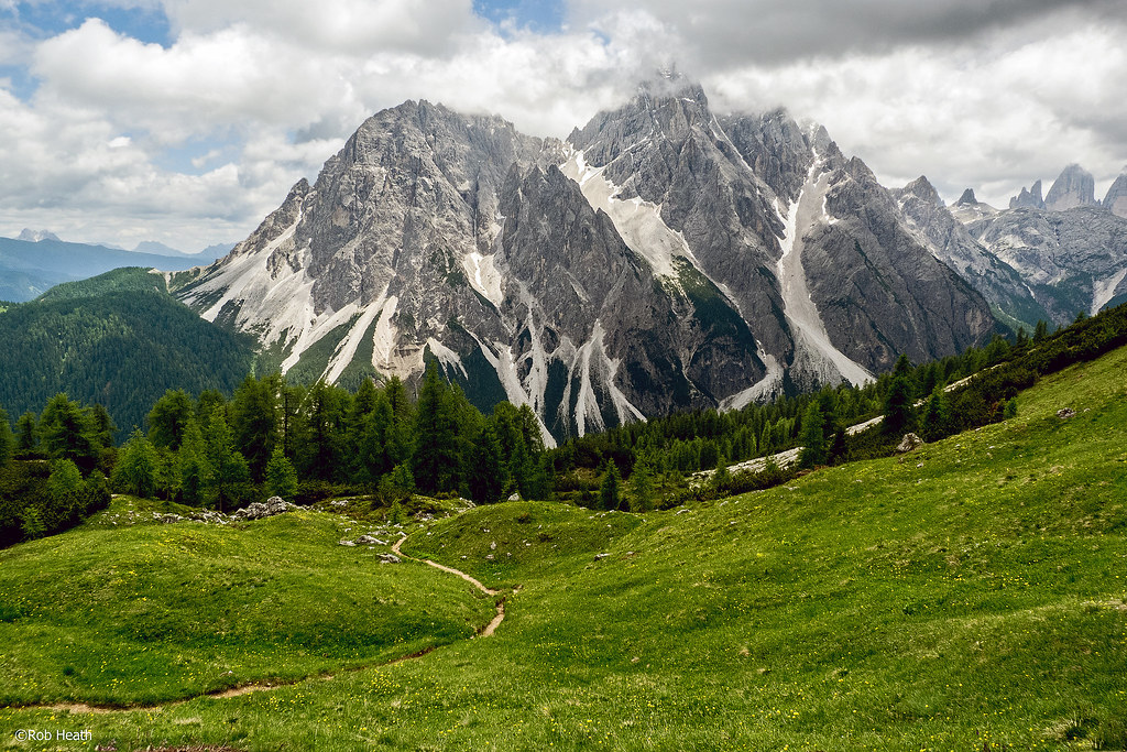
These scrapings are now the mountain belts of the Apennines, parts of the Alps, the Balkans, Greece, and Turkey, with the sedimentary rocks being scraped off and crumpled up into various mountain chains across the Mediterranean region. Excluding Iberia, the only part remaining relatively intact is a strip running from Turin and Istria to the Heel of Italy, under the Adriatic, which is an area geologists call ‘Adria’.
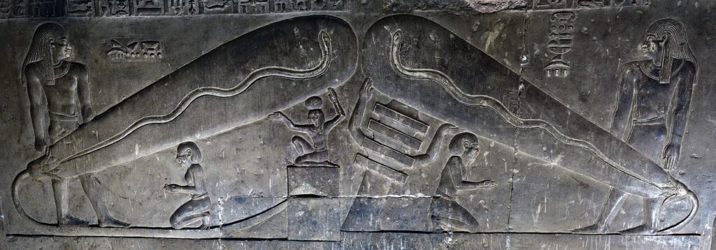
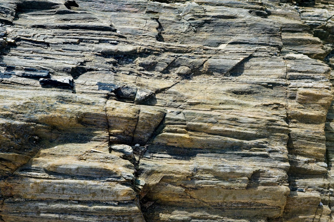
Under tremendous heat and pressure and over tens of millions of years, limestone rocks from Greater Adria turned into marble, with friction between Greater Adria and Europe pulling the sunken rocks back to the surface, where people found them and mined them – “That’s where the marble came from that the Romans and the Greeks used for their temples”.
“Forget Atlantis,” said van Hinsbergen, “Without realizing it, vast numbers of tourists spend their holiday each year on the lost continent of Greater Adria”. When you admire the pristine white marble of the Parthenon or walk through Roman ruins, you’re literally touching pieces of this ancient lost world that spent millions of years buried beneath Europe.
The Seismic Evidence Deep Beneath Our Feet
Research shows that portions of Greater Adria now lie as much as 1500 kilometers below our planet’s surface, with seismic waves allowing scientists to trace the deformed remnants up to this depth, where seismic waves continue to reveal its hidden presence. Other researchers who use seismic waves to generate computerized tomography–like images of structures deep within Earth have created an “atlas of the underworld” – a graveyard of slabs of crust that have sunk into the mantle.
Seismic waves have even allowed scientists to trace the deformed remnants of Greater Adria up to 1,500 kilometers below the Earth’s surface, with this seismic evidence offering a unique and compelling picture of a lost world beneath the Mediterranean. The team followed the traces of Greater Adria up to 1,500 kilometers beneath the Earth’s surface with the help of seismic waves – tools capable of revealing otherwise inaccessible depths.
Modern seismic imaging technology has essentially given scientists X-ray vision into Earth’s interior. The twisted remnants of Greater Adria continue to influence geological processes deep within the planet, creating a hidden landscape more dramatic than any surface mountain range.
The Tourism Connection You Never Knew Existed
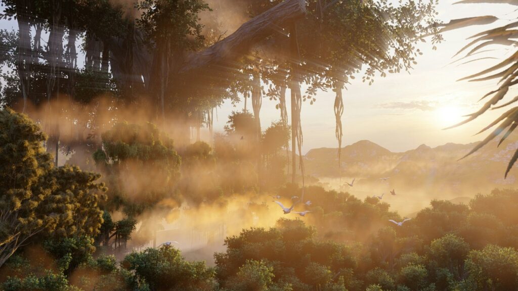
Millions of tourists visit the Alps every year making the impact of tourism on Alpine nature considerable. Yet most of these millions of visitors have no idea they’re exploring the remnants of an ancient continent. Without realizing it, vast numbers of tourists spend their holiday each year on the lost continent of Greater Adria, with tourists walking through the majestic mountains of Southern Europe unknowingly treading on the ancient remains of a once-great landmass that disappeared millions of years ago.
According to van Hinsbergen, the irony is that people tread on its remains every day without realizing it, saying “Forget Atlantis” as “Without realizing it, vast numbers of tourists spend their holiday each year on the lost continent of Greater Adria,” with regions built on its remnants including iconic destinations. The next time you’re skiing in the Austrian Alps or hiking through Croatian national parks, remember that you’re experiencing the final chapter of a continent that began its journey 240 million years ago.
From the towering Dolomites to the stunning Plitvice Lakes, these tourist destinations owe their very existence to the slow-motion destruction of Greater Adria. The irony is almost poetic: while millions search for lost worlds in fiction, they’re walking on the remains of a real one.
How Greater Adria Shaped European Mountain Formation
Subduction, the plunging of one plate under the other, is the basic way in which mountain chains are formed, with the research providing insights about volcanism and earthquakes that scientists are already applying elsewhere, and they can even predict what a given area will look like in the far future. With the reconstruction of the lost Greater Adria, geologists have made a substantial contribution to the fundamental body of knowledge concerning mountain range formation, with subduction being the basic way in which mountain chains are formed.
Subducting plates may have their top layers scraped off by the upper plate, and these scrapings can accumulate and crunch up to form mountains, with geologists able to match the amount of mountain-building leftovers seen today to the length of the section of the original plate that has been swallowed into the underlying mantle. The discovery of Greater Adria has profound implications for modern geology, particularly in the study of plate tectonics and the formation of mountain ranges, with the remnants providing invaluable data on how large landmasses can gradually sink into the Earth’s mantle.
The story of Greater Adria has revolutionized our understanding of how mountains form. Instead of requiring two continents to collide head-on like the Himalayas, mountains can also form when pieces of a sinking continent get scraped off and crumpled up during subduction.
Economic Treasures Hidden in the Geological Mess
In the short term, there are also economic aspects related to the research, with ore deposits and building materials that are vital to our society found in mountain belts such as those in the area investigated, and the geological systems in which these resources formed being fragmented together with the mountain belts. These insights will help scientists and surveyors to identify and locate ore deposits and other useful materials in mountain belts.
By modeling how this continent was destroyed and where its crust currently lies, geologists can better anticipate the behavior of active fault systems while helping locate deep-seated mineral and hydrocarbon resources, as the uplift and folding of rock layers often exposes rich deposits, making the study of Greater Adria not just a story about Earth’s ancient past, but also a key to mitigating future risks and planning sustainable resource extraction.
The geological chaos created by Greater Adria’s destruction has actually been a gift to human civilization. The twisted and folded rock layers have concentrated valuable minerals and created the building materials that have shaped European architecture for millennia. Modern mining operations can now use this ancient map to locate everything from precious metals to construction stone more efficiently.
Future Implications for Understanding Earth’s Dynamics
This discovery highlights the ongoing geological processes that continue to shape Earth’s surface, with the Mediterranean region remaining a highly active zone for tectonic activity, and the hidden presence of Greater Adria offering new insights into the ways continents interact with one another over millions of years. The same regions where tourists walk today may also be zones of seismic vulnerability – knowing their geological story is a matter of safety and survival.
It now seems that Zealandia and Greater Adria are just two recent examples of what was once a regular Atlantis-like process, with continents not always being stable fixtures of our planet, and early in our planet’s history, more than 2 billion years ago, they were fragile and transient things, easily crumbling, fracturing, or simply eroding away. As scientists continue to study the remnants of this lost continent, they gain a better understanding of the long-term processes that govern the Earth’s tectonic activity, with Greater Adria’s story being one of disappearance, transformation, and geological evolution.
The discovery of Greater Adria suggests that lost continents might be more common than previously thought. Our planet’s surface has been in constant flux for billions of years, with landmasses appearing, drifting, colliding, and disappearing in an endless dance of geological transformation.
Conclusion
The story of Greater Adria transforms our understanding of Europe’s geological heritage and reminds us that the solid ground beneath our feet has an extraordinary hidden history. Though Greater Adria no longer exists as a standalone landmass, its presence is still etched into the Earth’s surface, reshaping the way scientists understand Europe’s formation rather than disappearing without a trace, as it merged with surrounding plates, deforming into the topography we see today.
This remarkable discovery proves that reality can be far more fascinating than fiction. While Atlantis remains a myth, Greater Adria stands as scientific fact – a genuine lost continent hiding in plain sight beneath Europe’s most beloved destinations. The next time you marvel at Alpine peaks or explore Mediterranean coastlines, remember that you’re witnessing the final act of a geological drama that began nearly a quarter of a billion years ago.
What do you think about walking on the remains of this ancient lost world during your next European adventure? Tell us in the comments.