Southern California – Instruments built to detect earthquakes registered powerful vibrations from a Chinese space module’s fiery descent in April 2024, exposing flaws in traditional reentry forecasts.
Uncontrolled Reentries Pose Mounting Hazards
Uncontrolled Reentries Pose Mounting Hazards (Image Credits: Cdn.mos.cms.futurecdn.net)
Researchers have long grappled with the challenge of tracking space debris as it hurtles back to Earth. At least three large fragments, such as defunct satellites and rocket stages, plummet through the atmosphere each day on average. Thousands of human-made objects clutter orbits, and their uncontrolled returns carry risks of toxic contamination or ground impacts.
Predictions rely on radars and telescopes, but these tools falter once objects dip below 200 kilometers altitude. Chaotic atmospheric interactions scramble trajectories, leaving experts uncertain about landing zones. Past incidents underscored the dangers: A 1978 Soviet satellite scattered radioactive debris over Canada, with most fragments never recovered.
Seismic Signals Unlock Real-Time Insights
Hypersonic debris generates sonic booms upon atmospheric entry, shock waves that ripple through the air and vibrate the ground. Seismometers, densely deployed worldwide for quake monitoring, pick up these tremors alongside earthquakes, explosions, and even whale calls.
Openly available data from these networks enables rapid analysis. Lead researcher Benjamin Fernando of Johns Hopkins University and colleague Constantinos Charalambous of Imperial College London developed a method to invert seismic signals. Their approach maps boom propagation, yielding speed, altitude, descent angle, and fragmentation details within minutes.
Shenzhou-15: A Telling Test Case
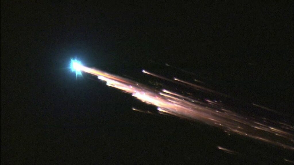
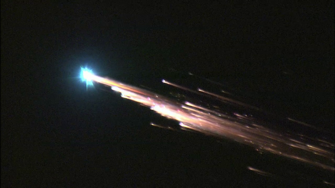
The team applied their technique to the April 2, 2024, reentry of China’s Shenzhou-15 orbital module, a 1.5-ton cylinder about 3.5 feet wide. U.S. Space Command forecasted a splashdown in the North Atlantic or South Pacific. Instead, data from 127 sensors across California and Nevada traced its path over the Los Angeles region, 25 miles north of predictions.
“Both of these predictions were completely wrong,” Fernando noted. The module screamed in at Mach 25 to 30 – roughly 7.8 kilometers per second – with a shallow 1.2-degree descent angle between 80 and 150 kilometers altitude. Waveform analysis revealed cascading breakups, shrinking the main boom from 0.4-0.5 seconds to 0.15 seconds, suggesting fragments no larger than 0.42 meters survived initially.
| Tracking Aspect | Pre-Reentry Prediction | Seismic Results |
|---|---|---|
| Path Location | North Atlantic/South Pacific | Over Southern California/Nevada |
| Deviation | – | 25-28 miles offset |
| Speed | – | Mach 25-30 |
Boosting Safety and Verification Efforts
This seismic method complements sparse radars by focusing on post-entry phases. It pinpoints fallout zones swiftly, aiding recovery of hazardous remnants – from batteries to potential radioactive payloads – before environmental harm spreads.
Future expansions could incorporate acoustic sensors, extending detection over oceans where data gaps persist. Such coverage might verify claims, like SpaceX’s assertion that Starlink satellites fully disintegrate over remote seas.
- Rapid trajectory reconstruction reduces search times from weeks to hours.
- Fragmentation patterns inform burn-up models and risk assessments.
- Global networks enable monitoring of frequent reentries amid rising satellite launches.
- Enhances aviation alerts, as seen in 2022 European airspace closures costing millions.
- Supports debris mitigation as orbits grow crowded.
Seismic tracking transforms existing quake monitors into vital space sentinels, closing critical gaps in orbital cleanup. As reentries accelerate, this innovation promises safer skies and ground.
- Seismometers detect sonic booms for precise, near-real-time reentry paths.
- Shenzhou-15 analysis corrected forecasts by dozens of miles over populated areas.
- Method reveals breakup dynamics, aiding hazard prediction and recovery.
What do you think about repurposing earthquake tech for space defense? Tell us in the comments.