If you could rewind time to observe the ground beneath your feet, you’d witness something absolutely mind-blowing. The familiar landscapes of the United States weren’t always where they are now. Long before humans walked the earth, before dinosaurs roamed, even before the first fish swam in ancient seas, the very rocks under your home were part of entirely different continents in completely different locations on the globe.
You’re standing on a geological jigsaw puzzle, assembled piece by piece over billions of years. Each layer tells stories of vanished oceans, colliding landmasses, and volcanic eruptions that reshaped the planet. From shallow tropical seas that once covered the heartland to massive mountain ranges that have risen and fallen multiple times, the United States has experienced one of the most dramatic geological transformations on Earth. Let’s dive in.
Ancient Rocks Reveal the Oldest Chapters of North America
You’re looking at rocks that date back roughly one point eight billion years when several continental fragments merged to form the stable foundation underlying the Canadian Shield and northern interior platform. These ancient pieces of crust represent the very heart of what would eventually become North America. Think about that for a moment. The rocks beneath parts of Minnesota and Canada are older than most mountains on Earth.
The mean age of continents is almost two billion years, more than thirty times the average age of oceanic crust. This staggering difference exists because continental crust resists being pulled back down into the mantle. The central core of present-day North America is its craton, the oldest, thickest part of the continent, with rocks more than two billion years old in places that were assembled through time as smaller microcontinents and terranes crashed together. These collisions weren’t gentle encounters but violent tectonic events that welded disparate chunks of earth into a growing landmass.
Rodinia Forms and Later Fractures in a Supercontinent Cycle
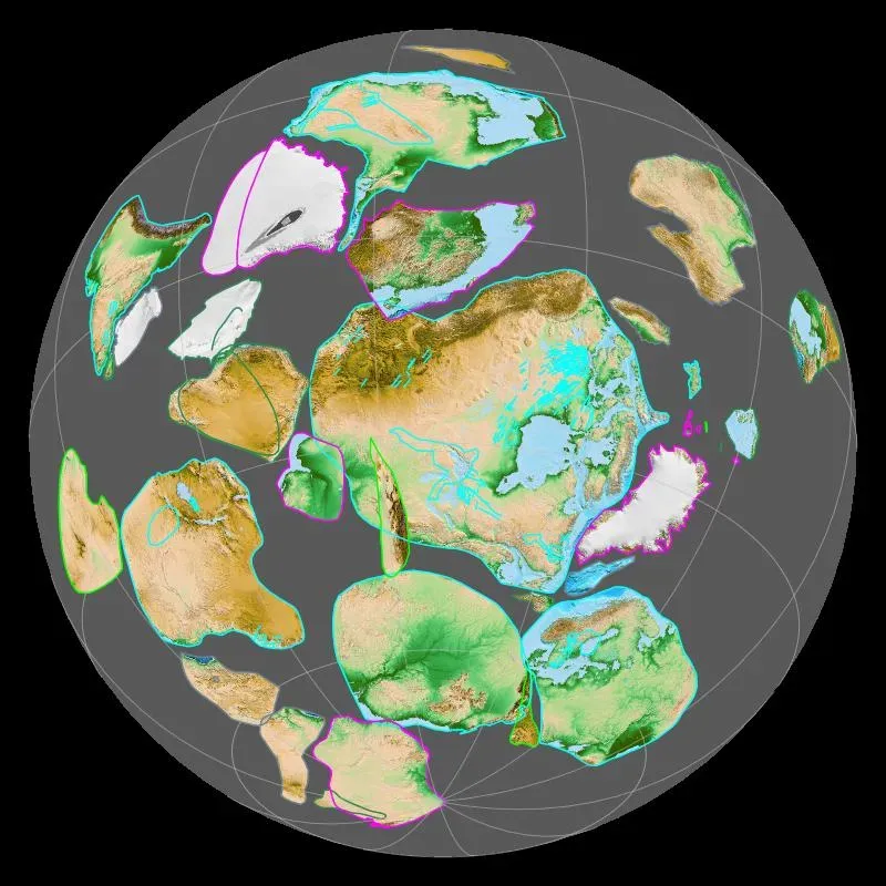
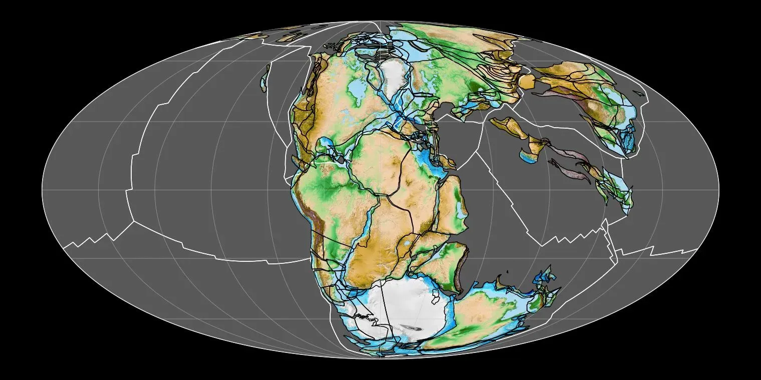
Rodinia was a supercontinent that assembled roughly between one point two six and zero point nine billion years ago and broke up between seven hundred fifty and six hundred thirty-three million years ago. North America was likely the core of this landmass, though you wouldn’t recognize the world map if you could see it then. The continents we know today were unrecognizable during Rodinia’s existence.
The geology of the Appalachians dates back more than one point two billion years to the Mesoproterozoic era when two continental cratons collided to form the supercontinent Rodinia, as all the other cratons of Earth also collided at about this time. This collision created the Grenville orogeny, a mountain-building event that produced towering peaks where the modern Appalachian region now sits. The extreme cooling of the global climate around seven hundred seventeen to six hundred thirty-five million years ago and the rapid evolution of primitive life during the subsequent Ediacaran and Cambrian periods are thought to have been triggered by the breaking up of Rodinia.
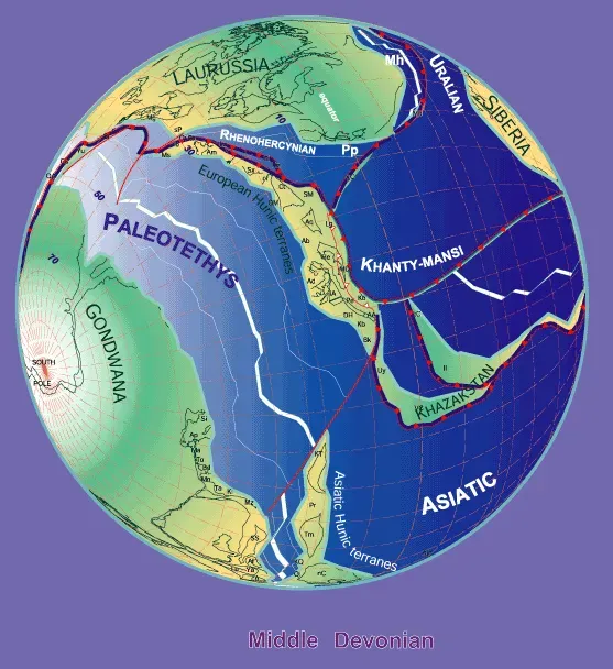
Shallow Seas Invade the Continental Interior During the Paleozoic

During the Cambrian Period, one large supercontinent called Gondwana and eight smaller continents existed, most of them located in the Southern Hemisphere, with the area that is North America today stretched along the equator where a shallow sea covered part of the land. Imagine standing in what’s now Kansas or Nebraska, completely underwater in a warm, tropical ocean teeming with strange creatures you’d never recognize.
During much of geologic time, large parts of the continental United States were covered by shallow seas in which lime, mud, and sand accumulated. These ancient marine deposits would later become the limestone, shale, and sandstone formations that define much of the American Midwest. At the start of the Paleozoic Era, what is now North America was actually in the Southern Hemisphere, and marine life flourished in the country’s many seas, although terrestrial life had not yet evolved. You wouldn’t have seen a single tree or blade of grass on the barren landscapes that occasionally rose above the waves.
Mountain Building Episodes Create the Appalachian Ranges
Mountain building occurred periodically throughout the next two hundred fifty million years through the Caledonian, Acadian, Ouachita, Hercynian, and Alleghenian orogenies. Each collision crumpled the crust, thrusting ancient seafloor sediments high into the sky. As more and more continental collisions crumpled eastern North America and thrust its agglomerated slivers into the sky, the Appalachian Mountains were born.
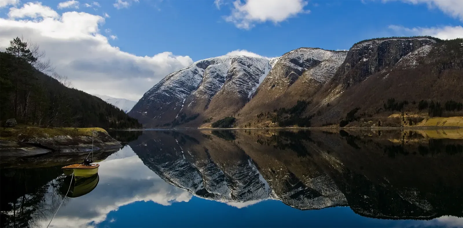
The Appalachian Mountains formed during a collision of continents five hundred to three hundred million years ago, and in their prime they probably had peaks as high as those in the modern zone of continental collision stretching from the Himalayas in Asia to the Alps in Europe, but over the past three hundred million years, the Appalachians have eroded to more modest heights. Let’s be real, these mountains have been worn down by hundreds of millions of years of rain, ice, and wind. What you see today are merely the eroded stumps of what were once truly colossal peaks.
Pangaea Assembles as Africa Collides with North America
By about three hundred million years ago during the Pennsylvanian Period, Africa was approaching the North American craton. This wasn’t a quick event but a slow-motion crash that took millions of years to complete. By around two hundred seventy million years ago, all the world’s landmasses had merged into a second single supercontinent called Pangaea, which then began splitting apart around two hundred million years ago in a geological breakup that formed the Atlantic Ocean.
The Atlantic Ocean opened two hundred million years ago, pushing North America westward, and as the continent rifted away from the supercontinent Pangaea, it finally earned the name North America. Picture this massive landmass tearing itself apart along a zipper of volcanic activity and earthquakes. During the Triassic Period, tension slowly began to pull North America away from the other merged continents, and as the crust was pulled apart, it stretched, thinned, and uplifted to the point of breaking. This rifting created basins that filled with sediment and lava flows, evidence of which you can still see today in the rocks of the eastern United States.
The Western Interior Seaway Splits the Continent in Two
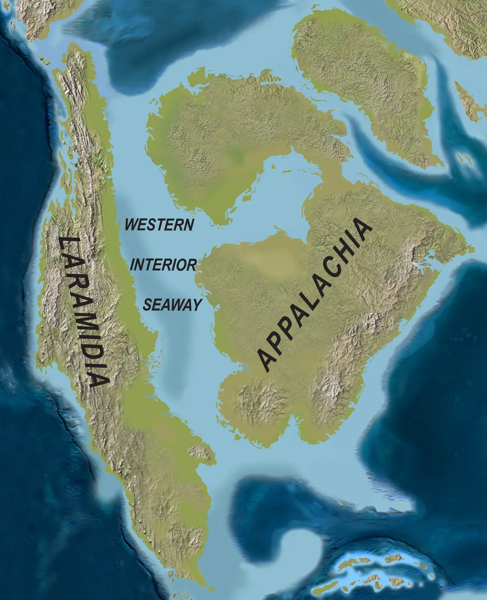
Here’s something wild to consider: The Western Interior Seaway was a large inland sea that split the continent into two landmasses called Laramidia to the west and Appalachia to the east, existing for thirty-four million years from the early Late Cretaceous to the earliest Paleocene, connecting the Gulf of Mexico to the Arctic Ocean at its largest extent, reaching depths of roughly two thousand five hundred feet, six hundred miles wide, and over two thousand miles long.
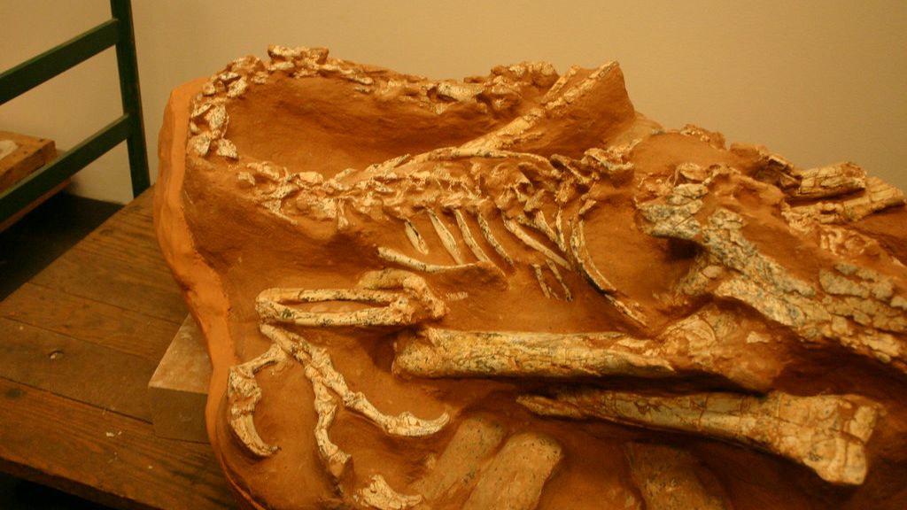
During the Late Cretaceous, the Gulf of Mexico had expanded through North America until reaching Alaska, and up to half of the continent’s modern surface area may have been submerged by this sea. Dinosaurs on the western half of the continent were completely isolated from those in the east. During much of the Mesozoic Era, the North American continental interior was mostly well above sea level with two notable exceptions, including during part of the Jurassic when rising seas flooded the low-lying areas of the continent and much of the Interior Plains eventually lay submerged beneath the shallow Sundance Sea. These ancient seaways left behind layer upon layer of marine fossils that paleontologists continue to discover today.
Plate Subduction Builds the Rocky Mountains and Western Ranges
About two hundred million years ago, a large tectonic plate called the Farallon Plate started to subduct beneath the western edge of North America, and this subduction formed a line of volcanoes stretching all the way from Alaska to Central America. The collision transformed what had been a relatively quiet western margin into one of the most geologically active regions on the planet.
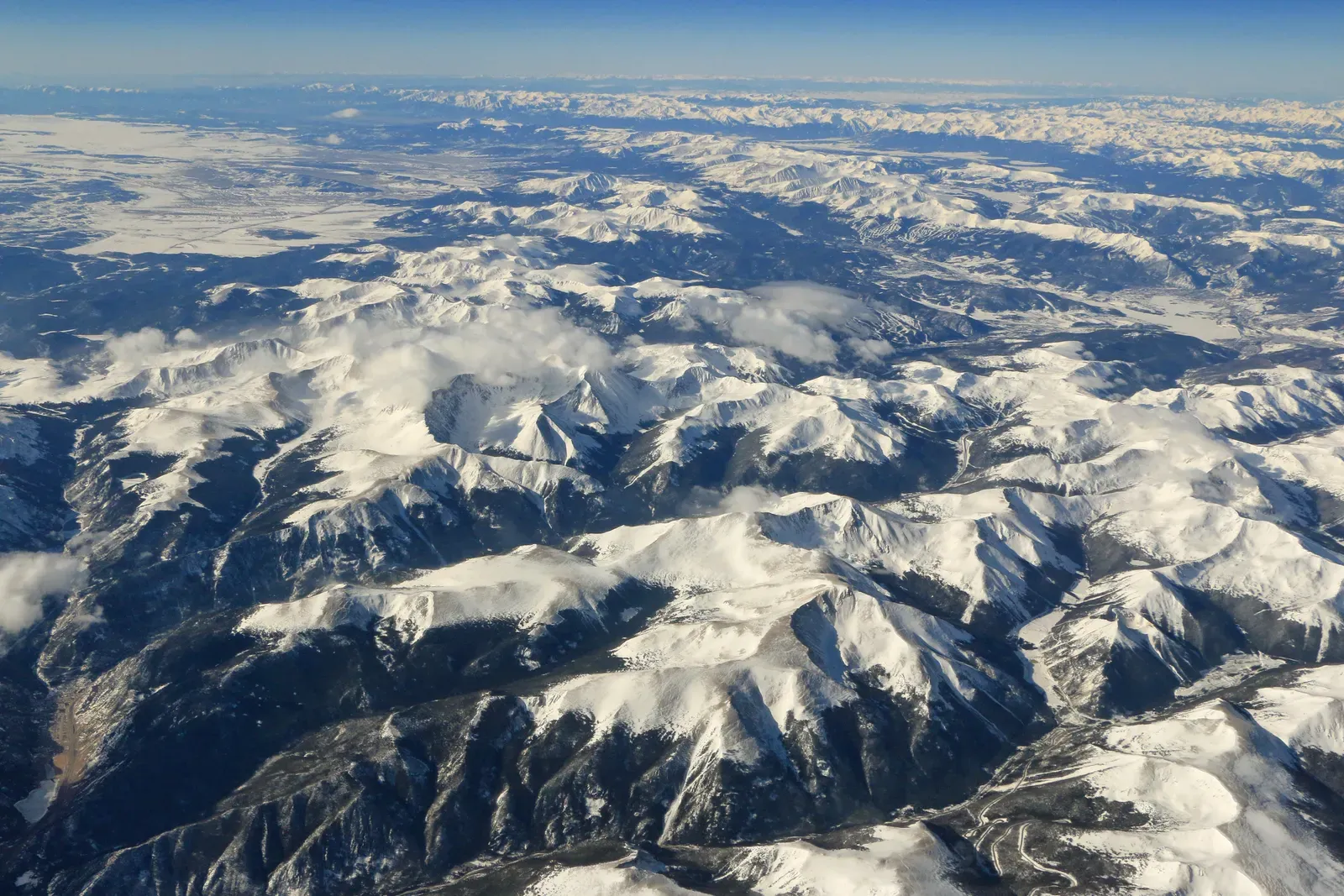
The Rocky Mountains took shape during a period of intense plate tectonic activity that formed much of the rugged landscape of the western United States through three major mountain-building episodes that reshaped the west from about one hundred seventy to forty million years ago. A broad region of crustal shortening developed as far east as the Rocky Mountains between about eighty and fifty million years ago during the Laramide orogeny. The compression was so intense that rocks originally at sea level were thrust thousands of feet into the air. I know it sounds crazy, but fossil seashells can be found near the peaks of these mountains, evidence of their marine origins.
Modern Tectonic Forces Continue to Shape the Landscape
For the most part, the North American plate moves in roughly a southwest direction away from the Mid-Atlantic Ridge at a rate of about two point three centimeters per year. That’s roughly how fast your fingernails grow. It doesn’t sound like much, yet over millions of years this slow crawl has opened an entire ocean.
When North America gobbled up the boundary between the Farallon and Pacific oceanic plates, its western margin shifted from a subduction zone to a transform boundary, marking the beginning of the San Andreas Fault, which moves side by side, and with the sudden shutdown of the giant conveyor belt grinding against its margin, the continent relaxed and the Basin and Range province opened in the Southwest. The richly textured landscape of the United States is a product of the dueling forces of plate tectonics, weathering and erosion, and over the four point five billion-year history of Earth, tectonic upheavals and colliding plates have raised great mountain ranges while the forces of erosion and weathering worked to tear them down. This eternal battle between construction and destruction continues today beneath your feet.
Conclusion
You’ve just traveled through billions of years of incredible geological drama. From ancient cratonic cores forged in the Precambrian to shallow tropical seas that drowned the continental interior, from multiple supercontinent cycles to the ongoing dance of tectonic plates, the United States has been constantly reshaped by forces beyond imagination. The mountains you hike, the plains you drive across, even the soil in your backyard all carry whispers of this deep history.
The geological story isn’t finished. Plates continue their slow migration, mountains rise and fall, and the landscape transforms in ways we’ll never personally witness but can read in the rocks. What do you think the United States will look like in another hundred million years? Share your thoughts below.