You’ve walked beside the mighty Mississippi, gazed into the depths of the Great Lakes, and hiked through valleys carved into the land by modern waterways. Yet beneath your feet lies something even more extraordinary – ghost rivers that once drained an entire continent. These ancient waterways, buried under hundreds of feet of rock and sediment, tell stories of a planet vastly different from the one we know today.
Imagine a continent where rivers flowed backward, lakes larger than entire countries drowned the plains, and ice sheets a mile thick rewrote the very blueprint of drainage systems. North America’s prehistoric rivers were titans of water and time, some predating even the mountains they carved through. Let’s dive into the fascinating world of these lost waterways and uncover the secrets hiding beneath our modern landscapes.
The Teays River: North America’s Forgotten Giant
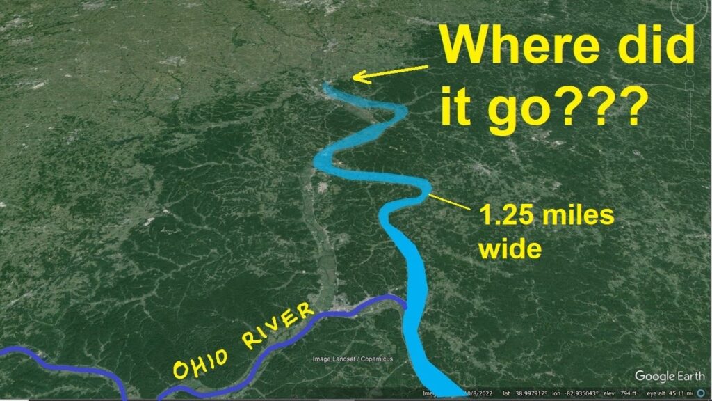
The Teays River was a major preglacial river that drained much of the present Ohio River watershed, but took a more northerly downstream course. Think of it as the Ohio River’s much older, bigger cousin – one that disappeared roughly two million years ago. The river’s headwaters were near Blowing Rock, North Carolina, and it flowed through Virginia, West Virginia, Ohio, Indiana, and Illinois.
Geologists have concluded that the Teays River may be the second oldest river on the face of planet Earth, with its origin believed to have preceded the formation of the Appalachian Mountains. Here’s where it gets wild – the river was already carving its path before those ancient peaks even existed. The Teays River was dissected and largely wiped away by advancing glaciers and their meltwater, as the massive continental ice sheets began to cover large parts of Ohio and other states downstream. The Mississippi was but a major tributary of the Teays, which then continued east and south until reaching the Mississippi Embayment, marking the end of what was one of North America’s truly great waterways.
When Ice Dams Created Monster Lakes
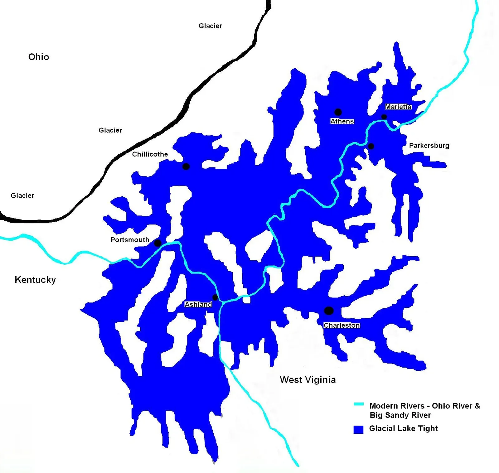
The first of perhaps three glaciations blocked the Teays River and created Tight Lake, a massive body of water covering large sections of southern Ohio and parts of Kentucky and West Virginia – about seventy percent the size of Lake Erie. Can you picture waking up one morning to find your entire region suddenly underwater?
Lake Tight covered an estimated 10,000 square miles and would have held 268 cubic miles of water, more than twice the volume of Lake Erie, with an average depth estimated at 140 feet and pockets as deep as 300 feet. Eventually, overflow from the lake carved new channels. The lake gradually filled in and the glacier melted leaving present day Teays Valley high and dry, with 180 feet of lake sediments in the Scott Depot area. The old river valley became a graveyard of sediment, buried but not forgotten.
Lake Agassiz: Bigger Than All the Great Lakes Combined
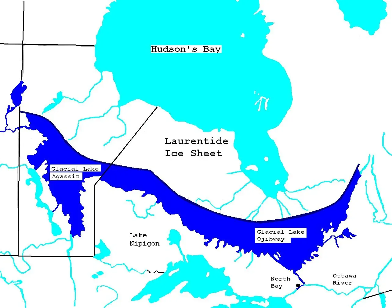
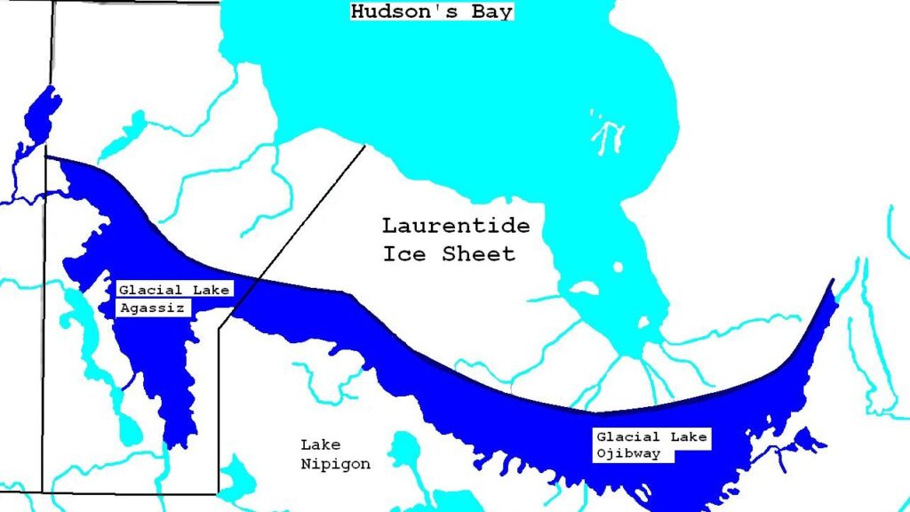
Lake Agassiz was a large proglacial lake that existed in central North America during the late Pleistocene, fed by meltwater from the retreating Laurentide Ice Sheet; around 13,000 years ago, this lake came to cover much of what are now southeastern Manitoba, northwestern Ontario, northern Minnesota, eastern North Dakota, and Saskatchewan, and at its greatest extent, it may have covered as much as 440,000 square kilometers, larger than any currently existing lake in the world.
Let’s be real – nothing today even comes close to this aquatic monster. So much water was in Lake Agassiz that when it drained, it rose global sea levels by between 0.8 and 2.8 meters, and the drainage was a major event that significantly impacted the climate and maybe early human civilization. Lake Agassiz developed due to river flows blocked by the glaciers; when the lake found outlets to Hudson Bay and Lake Superior, as well as the Mississippi River, it mostly drained away, although remnants called Lake Winnipeg and Lake Manitoba remain. To witness such a catastrophic drainage would have been truly apocalyptic.
The Paleo-Bell River: North America’s Amazon

North America did have an extensive river system from about fifty million to three million years ago that drained an area larger than today’s Amazon before it was supplanted by the continent’s modern river systems during the Pleistocene. This was the Paleo-Bell River, and honestly, most people have never even heard of it.
The age range of the younger palynomorphs constrained the duration over which the preglacial river existed to forty million to fifty million years. The Lena River is most like the Paleo-Bell River – the 4,300-kilometer long Lena River has a 2.5 million square kilometer drainage basin, and the river rises on the north shoulder of the Lake Baikal rift, flowing through the crustal terranes of southern Siberia. The Paleo-Bell was an absolute titan, draining water from the Rockies all the way to the Arctic Ocean before glaciation ripped it apart and redistributed its pieces.
The Ancient Susquehanna and Its Appalachian Relatives
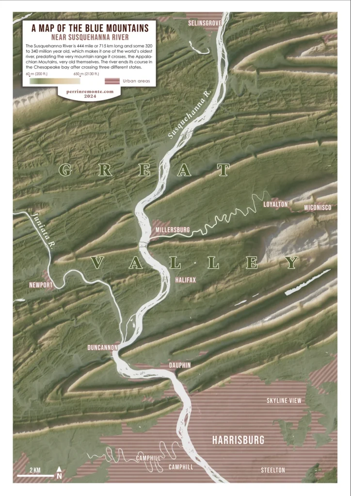
The Susquehanna River is one of the oldest rivers in the world – even older than the Appalachian mountains that surround it, with evidence that the flow of the ancient Susquehanna was established early enough that it predated the formation of the Appalachian Mountains over 300 million years ago. When mountains rose up across its path, the river simply kept cutting through them.
The New River is an example of antecedence as its ancestor was in place before the Appalachian Mountains were crumpled into existence, making the section of the New River that flows northwestward across the Appalachians one of the oldest rivers in North America. The French Broad River is closely associated with the New River, because both rivers flow through the Appalachian Mountains, and the French Broad River is believed to be one of the oldest rivers in the world, often said to be the third oldest river after the Nile and the New River. These waterways literally rose with the mountains – cutting downward as fast as the peaks lifted upward.
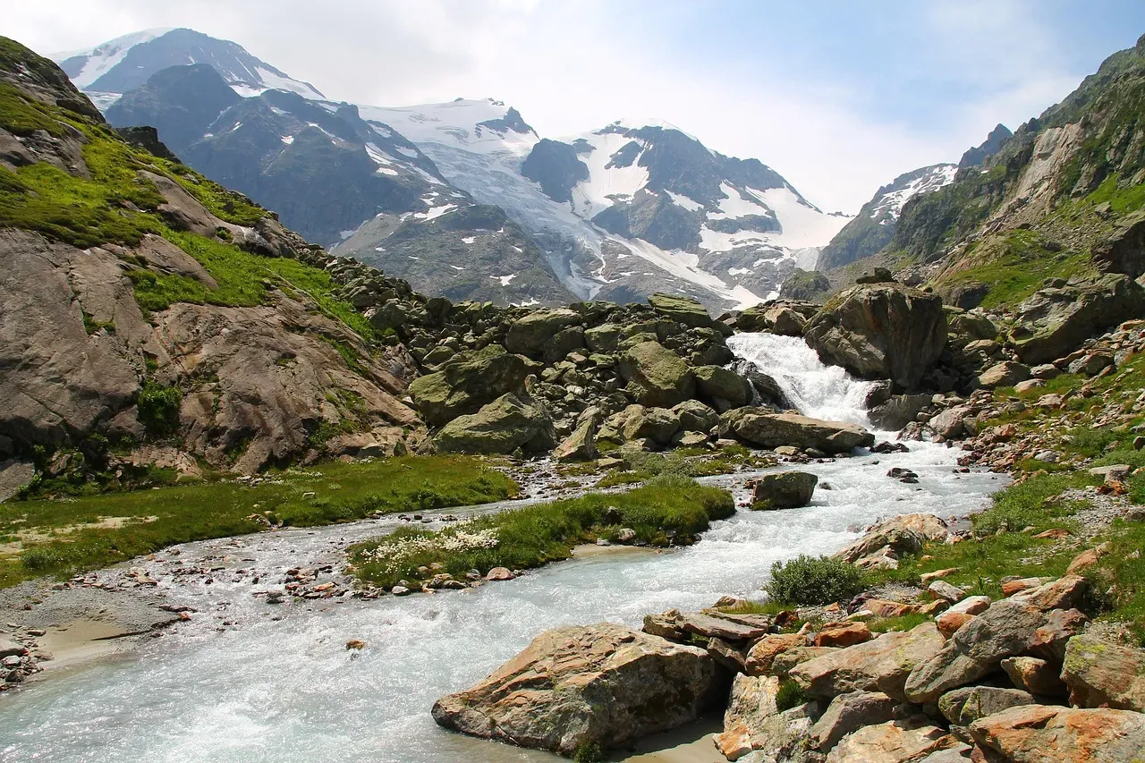
Ice Age Floods: When Water Became a Weapon
Approximately fifteen thousand years ago, roaring walls of water hundreds of feet high ripped through the Priest Rapids Valley at 80 miles per hour, and floods on this massive scale happened not once, but hundreds of times over the course of the last Ice Age. Picture an ice dam the size of a city blocking a massive lake, then suddenly giving way.
When part of the Cordilleran Ice Sheet pushed into the Lake Pend Oreille area, it created an ice dam over forty miles wide and 3,000 feet thick that blocked the Clark Fork River drainage and impounded Glacial Lake Missoula; at its largest, the lake was more than 2,000 feet deep at the ice dam and held over 500 cubic miles of water, and eventually the impounded lake water broke through the ice dam, sending a towering mass of water and ice up to 1,000 feet deep sweeping across parts of Idaho, Washington, and Oregon. These weren’t just floods – they were geological erasers that completely rewrote the landscape. Floodwater scraped away topsoil to form the Channeled Scablands and dramatically reshaped the topography of central and eastern Washington.
The Lost River Legacy: What Remains Today
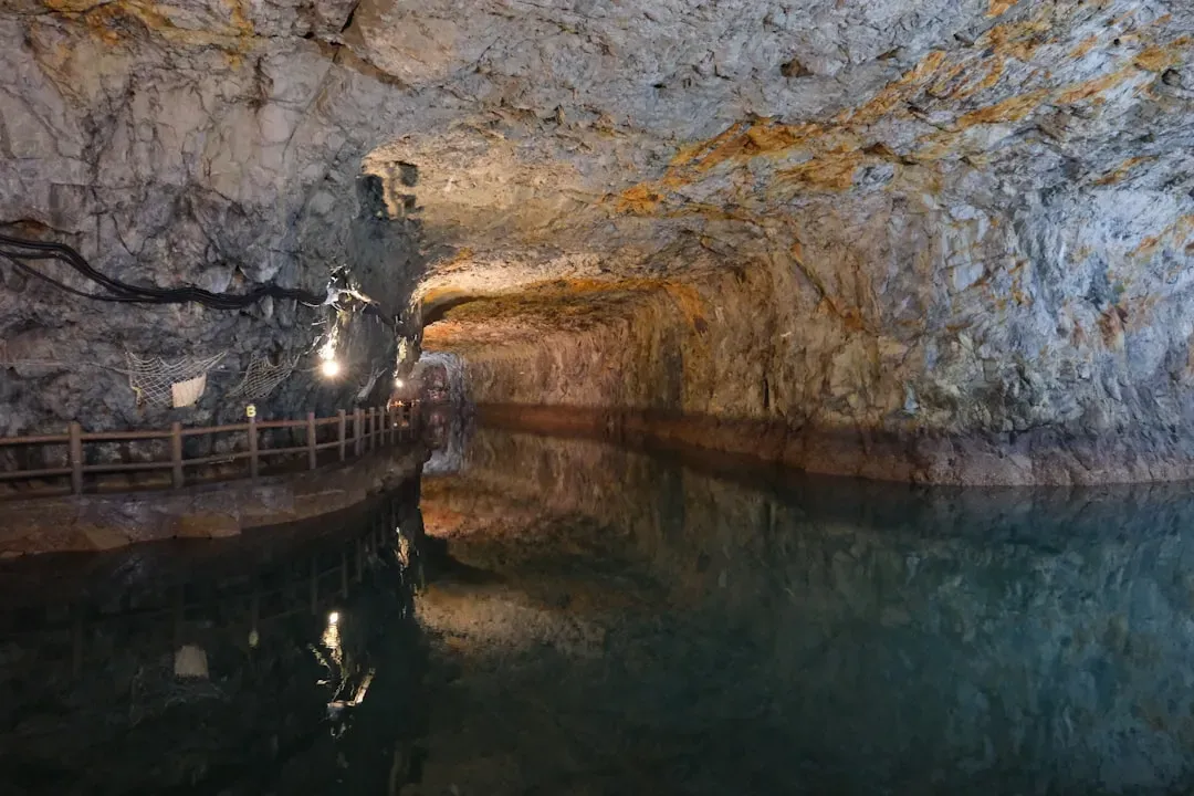
You might wonder what’s left of these ancient giants. Turns out, quite a lot if you know where to look. Today, the Teays is much more than a geological curiosity – the river’s buried bedrock valley is one of the largest and most important sources of ground water in the state of Illinois, and the Mahomet Aquifer provides more than 200 million gallons of water every day to communities across fifteen counties.
The ancient Teays River disappeared on the surface due to moraines left by retreating glaciers, but underground there is still flow along the ancient river bed; a coal company in Indiana once sunk a shaft looking for coal deposits over the ancient Teays River bed and instead of coal found water – lots of water. These deposits which lie buried under younger drift are excellent ground water reservoirs, and those found at the base of the drift in the “deep stage” Teays valley and its tributaries are of crucial importance to Wabash County and northern Indiana. So in a sense, these rivers never truly died – they simply went underground and continue serving us today.
Conclusion: Rivers Written in Stone and Memory
When glaciers began their final retreat 10,000 years ago, they left behind many landscape features, such as lakes, valleys, and mountains, with many hollowed-out areas carved by glaciers becoming lakes. The story of North America’s lost rivers is ultimately a story of transformation – of water finding ways to flow, mountains rising to block paths, and ice sheets powerful enough to rewrite the entire hydrological map of a continent.
These ancient waterways might be buried and forgotten by most, yet they shaped the very ground we walk on today. From the aquifers that supply our drinking water to the fertile valleys where we grow our crops, these prehistoric rivers still influence our lives in ways both seen and unseen. What would early peoples have witnessed as these massive rivers vanished and reformed? We can only imagine the awe and terror such transformations would have inspired. Next time you stand beside a modern river, take a moment to wonder what ancient giant might be sleeping beneath your feet.