Have you ever wondered what forces sculpted the mountains, valleys, and plains you drive through today? The landscapes of North America weren’t always the rolling farmlands, towering peaks, or desert basins we recognize now. Millions of years ago, this continent looked completely alien: entire mountain ranges higher than the Himalayas stood where gentle hills now sit, shallow seas drowned the heartland, and massive ice sheets stretched from coast to coast.
These dramatic transformations weren’t random. Five major geological phenomena reshaped North America over deep time, carving canyons, crushing continents together, and splitting them apart again. Each left behind clues written in rock layers, fossil beds, and topographic features that geologists continue to decode. So let’s dive in and explore the incredible natural forces that created the landscapes we call home today.
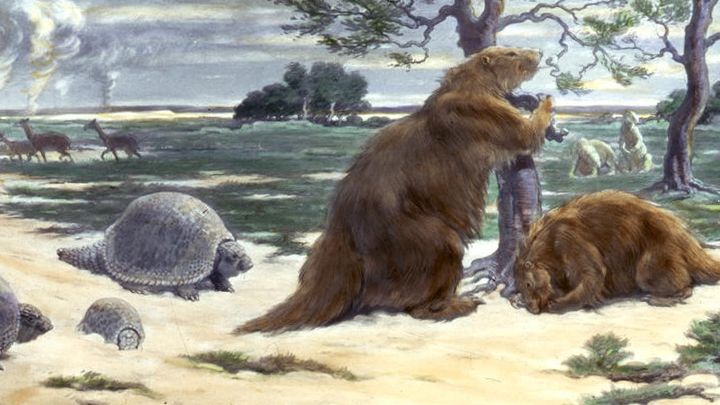
The Laurentide Ice Sheet: A Frozen Giant That Carved the Continent
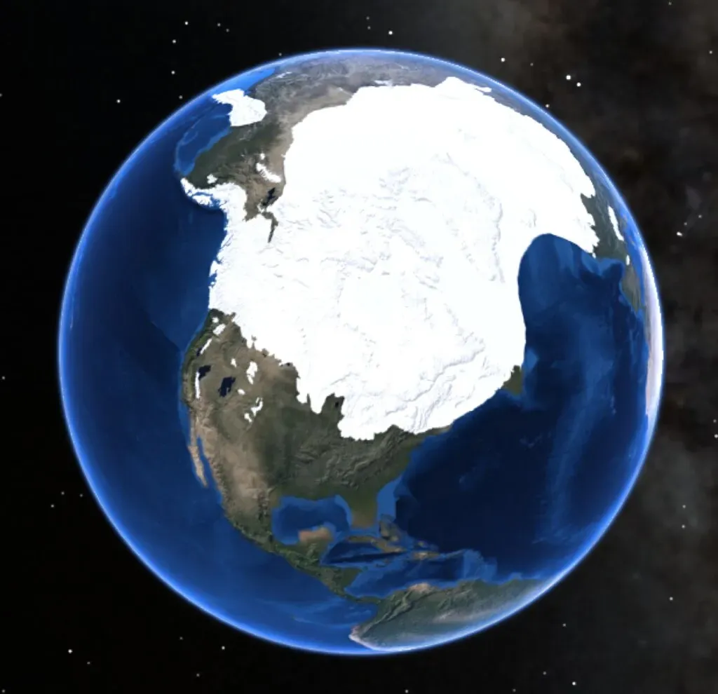
Imagine nearly half of North America buried beneath ice so thick it reached heights taller than most modern skyscrapers. The Laurentide Ice Sheet was a massive ice formation that covered millions of square miles, including most of Canada and a large portion of the Northern United States, during the Pleistocene Epoch. This wasn’t just any glacier; it was one of the most dominant forces in shaping the continent’s modern geography.
The last advance covered most of northern North America between roughly 95,000 and 20,000 years before the present day and gouged out the five Great Lakes and the hosts of smaller lakes of the Canadian Shield. Think about that for a moment: the Great Lakes, which hold about one fifth of the world’s fresh surface water, are essentially giant scars left by retreating ice. It created much of the surface geology of southern Canada and the northern United States, leaving behind glacially scoured valleys, moraines, eskers and glacial till. The immense weight of the ice literally pressed down on the Earth’s crust, and when it melted, the land slowly rebounded upward, a process still continuing in some areas today.
The Appalachian Mountains: Ancient Titans Worn Down by Time
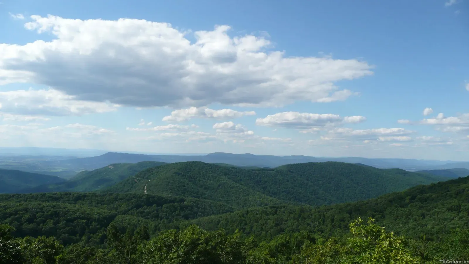
The Appalachians are deceptive. They look gentle and rolling compared to the jagged Rockies or the Sierra Nevada. Yet here’s the thing: the Appalachian Mountains formed during a collision of continents 500 to 300 million years ago, and in their prime they probably had peaks as high as those in the modern zone of continental collision stretching from the Himalayas in Asia to the Alps in Europe. Let that sink in for a moment. These weathered hills were once among the tallest mountains on Earth.
The geology of the Appalachians dates back more than 1.2 billion years to the Mesoproterozoic era when two continental cratons collided to form the supercontinent Rodinia. Over hundreds of millions of years, multiple mountain-building events stacked upon each other. During the middle Ordovician, a change in plate motions set the stage for the first Paleozoic mountain building event in North America when a neighboring oceanic crust collided with and began sinking beneath the North American craton, and with the creation of this new subduction zone, the early Appalachians were born. The mountains we see today are essentially the eroded roots of those ancient giants, sculpted by weathering, rivers, and ice over unimaginable spans of time.
The Western Interior Seaway: When an Ocean Split America in Two
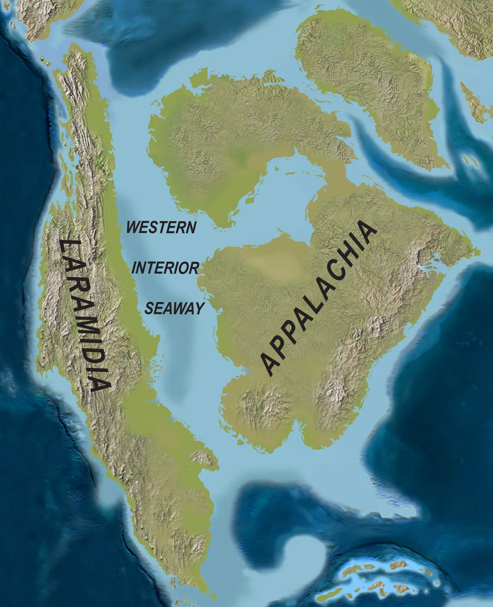
Picture this: you’re standing in Kansas roughly 85 million years ago, but instead of wheat fields stretching to the horizon, you’re on the shore of a vast inland ocean. Mosasaurs and giant sea turtles swim in the warm, shallow waters. The Western Interior Seaway was a large inland sea that split the continent into two landmasses, Laramidia to the west and Appalachia to the east, and the ancient sea existed for 34 million years from the early Late Cretaceous to the earliest Paleocene, connecting the Gulf of Mexico to the Arctic Ocean.
At its largest extent, the seaway was 2,500 feet deep, 600 miles wide and over 2,000 miles long. The seaway wasn’t just a body of water; it was a biological barrier that isolated land animals on either side, allowing distinct populations to evolve independently. The ancient Farallon and Kula tectonic plates were in the process of subducting beneath the North American Plate, causing the overlying land to warp and form a large back-arc basin, and ocean waters began to fill in the basin during a series of sea level increases during the Cretaceous, producing the Western Interior Seaway. Eventually, continued uplift and mountain building closed the seaway off, and the waters drained away, leaving behind massive chalk deposits and fossil beds that paleontologists treasure today.
The Formation of the Rocky Mountains: A Geological Puzzle
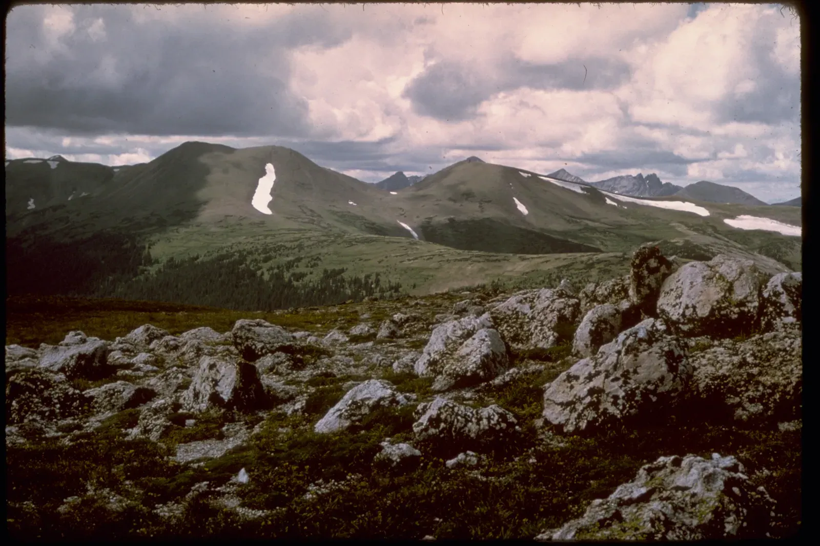
Mountains usually form where tectonic plates collide at their edges. The Rockies, though, broke that rule in a perplexing way. The Rocky Mountains took shape during a period of intense plate tectonic activity that formed much of the rugged landscape of the western United States, with three major mountain-building episodes reshaping the west from about 170 to 40 million years ago, and the last mountain building event, the Laramide orogeny, was responsible for raising the Rocky Mountains. What’s truly strange is their location.
The growth of the Rocky Mountains has been one of the most perplexing of geologic puzzles because mountain building is normally focused between 200 and 400 miles inland from a subduction zone boundary, yet the Rockies are hundreds of miles farther inland, and the answer most likely lies with an unusual subducting slab. This unusual flat subduction angle meant tectonic forces reached much deeper into the continent than normal. As of 60 million years ago, the Rockies were like Tibet: a high plateau, probably 6,000 meters above sea level, and since then, erosion stripped away the high rocks, revealing the ancestral rocks beneath, and forming the current landscape of the Rockies. Ice ages during the Pleistocene further carved the peaks into the dramatic forms we recognize today.
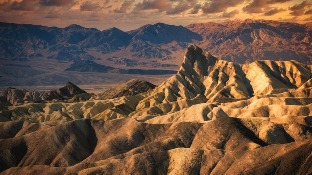
Basin and Range Extension: The Continent Pulls Itself Apart
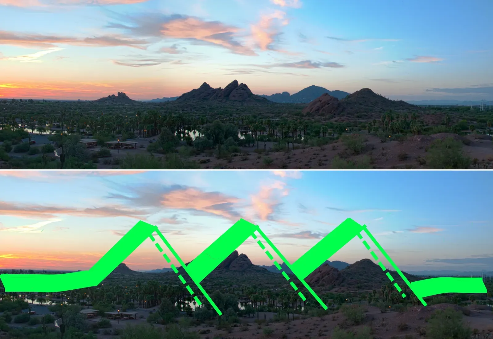
Drive through Nevada, western Utah, or eastern California, and you’ll notice something peculiar: parallel mountain ranges separated by flat valleys, repeating like waves across hundreds of miles. This isn’t coincidence. The Basin and Range Province is a vast physiographic region covering much of the inland Western United States and northwestern Mexico, defined by unique basin and range topography, characterized by abrupt changes in elevation, alternating between narrow faulted mountain chains and flat arid valleys or basins, and the physiography of the province is the result of tectonic extension that began around 17 million years ago in the early Miocene epoch.
Here’s what’s happening: the crust is literally being pulled apart. Basin and range topography is characterized by alternating parallel mountain ranges and valleys and is a result of crustal extension due to mantle upwelling, gravitational collapse, crustal thickening, or relaxation of confining stresses, and the extension results in the thinning and deformation of the upper crust, causing it to fracture and create a series of long parallel normal faults. As blocks of crust tilt and drop along these faults, valleys sink while adjacent blocks rise to form mountain ranges. This process, called extension, has been occurring in the Basin and Range for 36 million years. The region continues to stretch today, though at a much slower rate than in the past, with ongoing earthquakes reminding us that the Earth beneath our feet is never truly still.
Conclusion
From ice sheets miles thick to seas that drowned the heartland, from mountains that rivaled the Himalayas to a continent literally pulling itself apart, North America’s geological story is one of constant transformation. These five phenomena didn’t just shape rocks and landforms; they influenced where rivers flow, where ecosystems thrive, and ultimately where humans chose to settle. The next time you stand on a mountaintop, walk along a lakeshore, or drive across a wide valley, remember: you’re standing on a landscape millions of years in the making, sculpted by forces almost too vast to comprehend.
What strikes you most about these ancient forces? Did any of these geological phenomena surprise you? The Earth’s restless nature continues even now, writing new chapters in the story beneath your feet.