You’ve probably stood on a mountain peak, marveled at towering ranges, or wondered how continents ended up where they are today. These landscapes didn’t just appear overnight. They’re the result of violent geological collisions that transformed our planet over hundreds of millions of years. When massive chunks of Earth’s crust slammed together, they created features so dramatic they changed weather patterns, ocean currents, and even the course of life itself.
Let’s be real, the ground beneath your feet has a far more violent history than you might imagine. The story of continental collisions is one of unimaginable force, relentless pressure, and transformations that took place over timescales our minds struggle to grasp. So let’s dive in and explore the .
The Formation of Pangaea: When All Land Became One
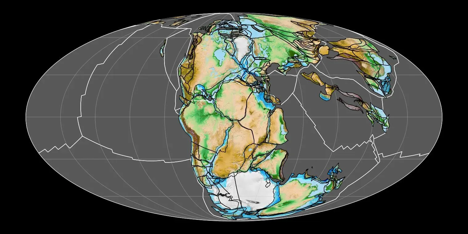
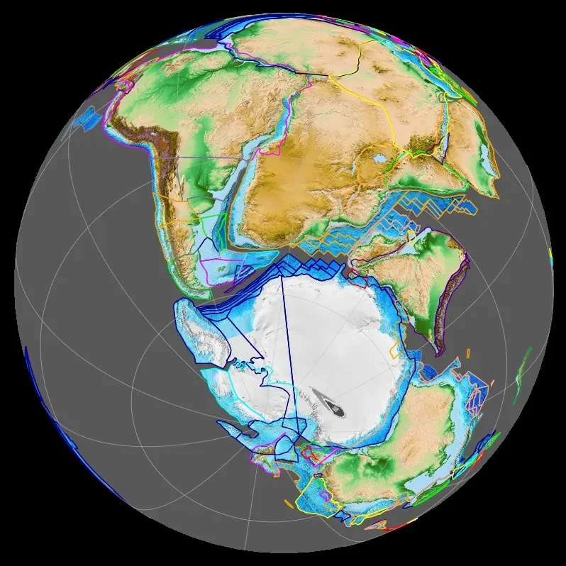
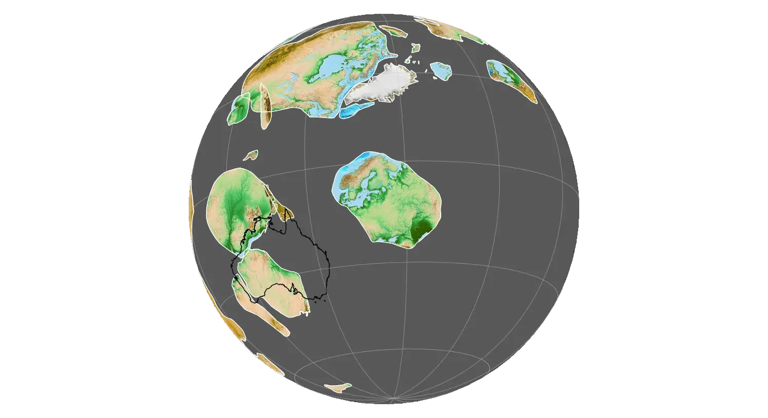
Around 335 million years ago, Earth’s landmasses assembled to form Pangaea, a supercontinent that began breaking apart about 200 million years ago. This wasn’t a quick event. The collision between Gondwana and Laurasia to form Pangaea occurred in a relatively brief interval, about 50 million years long. Think about that for a moment. Fifty million years seems like an eternity to us, yet in geological terms, it’s actually considered brief.
Extensive mountain-building events occurred where the continents collided with one another, and the newly created high mountain ranges strongly influenced local and regional terrestrial climates. The collision didn’t just create mountains; it fundamentally altered how air and water moved around the planet. Rugged mountain ranges similar to the Himalayas formed along the boundaries, with the combination of huge internal mountain ranges and vast unbroken expanses of land and sea leading to much different climates compared to today.
The Himalayas: An Ongoing Collision Between Giants
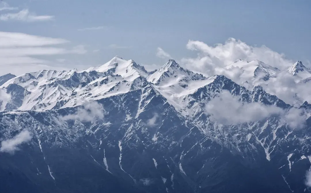
Here’s the thing about the Himalayas. They’re not just big, they’re actively growing. Between 40 and 50 million years ago, India and Eurasia, driven by plate movement, collided, and because both these continental landmasses have about the same rock density, one plate could not be subducted under the other. Instead, the crust simply crumpled upward.
The Himalayas and the Tibetan Plateau have risen very rapidly, with peaks such as Mt. Everest rising to heights of more than 9 km in just 50 million years. The Himalayas continue to rise more than 1 cm a year, a growth rate of 10 km in a million years. You could measure their growth over your lifetime. Some of the world’s most destructive earthquakes in history are related to continuing tectonic processes that began some 50 million years ago when the Indian and Eurasian continents first met.
The Appalachian Mountains: Ancient Titans Worn Down by Time

The Appalachian Mountains formed during a collision of continents 500 to 300 million years ago, and in their prime they probably had peaks as high as those in the modern zone of continental collision stretching from the Himalayas in Asia to the Alps in Europe. Imagine that. The gentle, rolling Appalachians you see today were once as imposing as the Himalayas.
Over the past 300 million years, the Appalachians have eroded to more modest heights. Around 300 million years ago, the landmass that is now North America collided with Gondwana, a supercontinent comprised of present-day Africa and South America, lifting tons of rock high above the surrounding terrain to form the southern end of the Appalachian Mountains now seen in Alabama, Tennessee and Georgia. Time and weather have relentlessly ground down these once-mighty peaks into the landscape we recognize today.
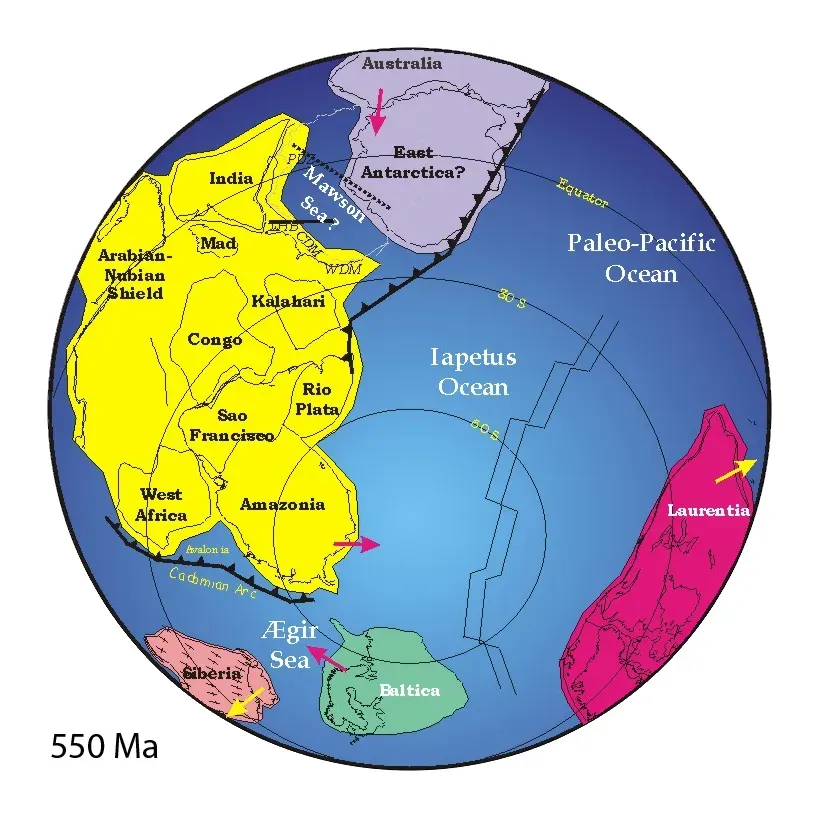
The Assembly of Gondwana: Multiple Collisions Creating a Southern Giant
Gondwana was formed by the accretion of several cratons, beginning around 800 to 650 million years ago with the East African Orogeny, and culminating in around 600 to 530 million years ago with the overlapping Brasiliano and Kuunga orogenies. This wasn’t a single crash but a series of collisions that gradually assembled the supercontinent.
Three orogenies were recognized: the East African Orogeny (650 to 800 million years ago), Kuunga orogeny (550 million years ago), and the Brasiliano orogeny (660 to 530 million years ago). Each collision added another piece to the puzzle. Eventually, Gondwana became the largest piece of continental crust of the Paleozoic Era, covering an area of some 100,000,000 square kilometers, about one-fifth of the Earth’s surface. That’s absolutely massive, roughly the size of all today’s continents combined.
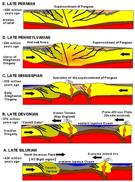
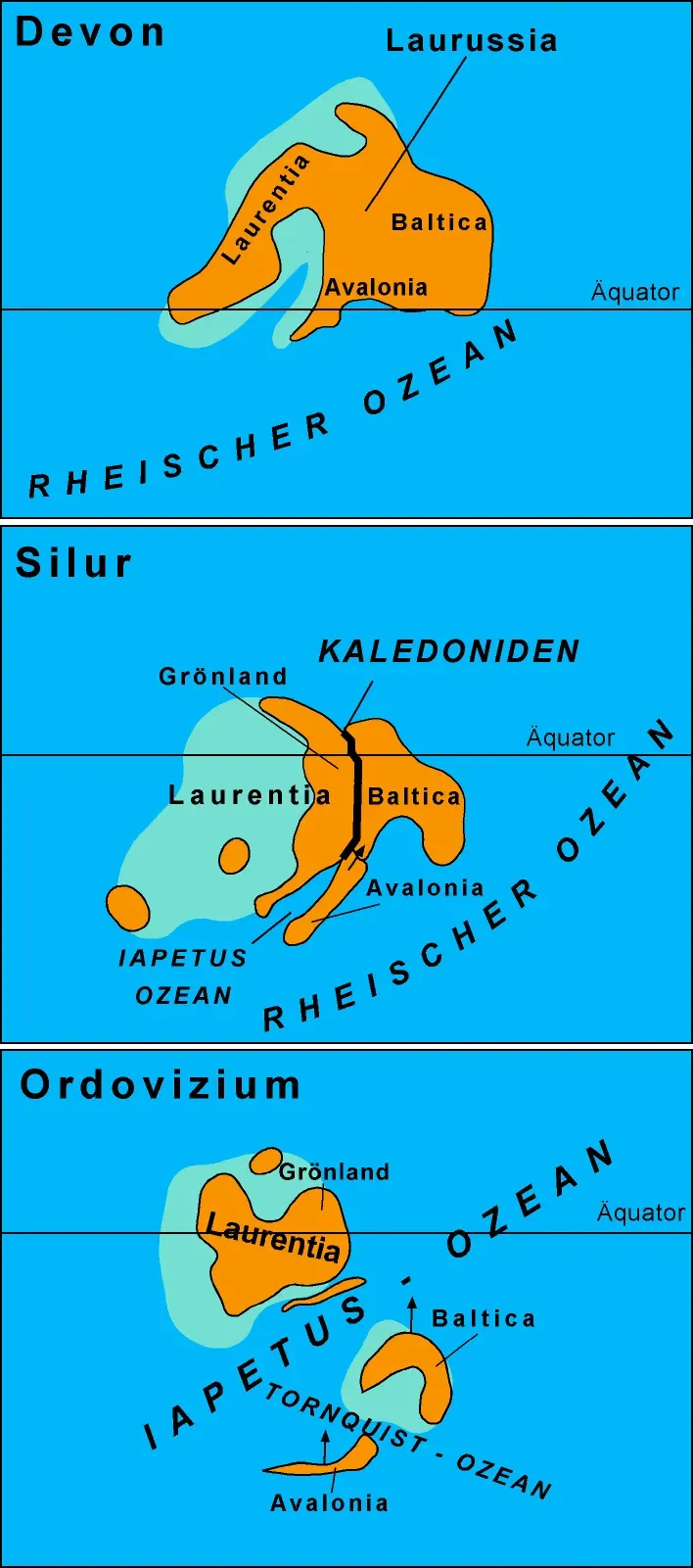
The Closure of the Iapetus Ocean: Building the Northern Appalachians
Baltica, Laurentia, and Avalonia all came together by the end of the Ordovician to form a landmass called Euramerica or Laurussia, closing the Iapetus Ocean and resulting in the formation of the northern Appalachians. This ancient ocean, which once separated continents, was completely consumed by the relentless movement of tectonic plates.
Eventually, the entire Iapetus Ocean closed and the continents collided to form the supercontinent of Pangaea, with the Appalachian Mountains forming from terrane accretion and the collision of Gondwanaland with ancient North America as the Iapetus Ocean closed. Where once waves rolled, mountains now stand. It’s hard to believe that an entire ocean basin could simply disappear, swallowed by continental convergence.
The East African Orogeny: Fusing East Gondwana Together
The collision between East and West Gondwana to form the East African Orogen took about 100 million years from beginning (610 million years ago) to end (510 million years ago). A hundred million years of continuous geological violence. Try to wrap your head around that timescale.
The Mozambique Belt formed 800 to 650 million years ago and was originally interpreted as the suture between East Gondwana (India, Madagascar, Antarctica, Australia) and West Gondwana (Africa and South America). This collision zone created mountains and deformed rocks in ways that geologists can still read today, like studying the scars of an ancient battle frozen in stone.
The Alleghanian Orogeny: The Final Assembly of Pangaea
The Alleghanian orogeny was a mountain-building event occurring almost entirely within the Permian Period (299 million to 251 million years ago) that created the Appalachian Mountains. This represents the final, dramatic chapter in Pangaea’s formation.
As the two continents collided, large belts of rock bounded by thrust faults piled one on top of another, shortening the crust along the eastern edge of North America in the North Carolina and Tennessee region by as much as 300 kilometers. At the peak of the mountain-building process, the Appalachians likely once reached elevations similar to those of the Alps and the Rocky Mountains before they were eroded. What remains today is just a shadow of their former glory.
The India-Asia Collision: Raising the Roof of the World
Researchers have constrained precisely the India-Asia collision onset as middle Palaeocene (59 million years ago), with no major diachroneity of collision onset from the central to the western Himalaya. This collision happened simultaneously along the entire boundary, not in stages.
In the Late Cretaceous (84 million years ago), the Indian plate began its very rapid northward drift covering a distance of about 6000 km, with the change of relative speed between the Indian and Asian plates from very fast (18-19.5 cm/yr) to fast (4.5 cm/yr) at about 55 million years ago as circumstantial support for collision then. India was racing northward at speeds that are exceptionally fast by geological standards. India rapidly marched northward towards Asia with a velocity of around 20 cm/yr, a plate velocity that exceeds any modern example, and continued to protrude into Asia for more than 2000 km following the collision.
The Closure of the Rheic Ocean: Assembling Western Pangaea
The Rheic Ocean came into being about 500 million years ago when two ancient ribbon continents, Avalonia and Carolinia, broke off the northern margin of Gondwana, and the continental collision that marked the end of the Rheic Ocean, some 350 million to 300 million years ago, was a seminal event in the assembly of Pangaea. This ocean had a dramatic birth and an equally dramatic death.
In the Devonian, Gondwana moved towards Euramerica, causing the Rheic Ocean to shrink, and in the Early Carboniferous, northwest Africa had touched the southeastern coast of Euramerica, creating the southern portion of the Appalachian Mountains, the Meseta Mountains, and the Mauritanide Mountains. The collision rippled across thousands of kilometers, building mountain ranges across multiple continents.
The Rodinia Supercontinent: Earth’s Ancient Assembly
The reconstructed supercontinent Rodinia, with Laurentia near its center, is inferred to have incorporated most of the major cratons on Earth in a single land mass around 1 billion years ago and remained essentially intact for over 200 million years, with the number of cratonic plates increasing from around 5 when Rodinia was assembled to around 20 when breakup was essentially complete. This ancient supercontinent predated Pangaea by hundreds of millions of years.
The first mountain-building tectonic plate collision that initiated the construction of what are today the Appalachian Mountains occurred during the Mesoproterozoic era at least one billion years ago when the pre-North-American craton called Laurentia collided with other continental segments, notably Amazonia, with all the other cratons of the Earth also colliding at about this time to form the supercontinent Rodinia. The rocks formed during this ancient collision still exist in today’s Blue Ridge Mountains and Adirondacks, silent witnesses to events that happened when Earth was less than half its current age.
Conclusion
The collisions that shaped our planet happened on timescales so vast they challenge comprehension. Mountains that seem eternal are actually temporary wrinkles in Earth’s crust, destined to be worn down by wind and water. The continents beneath our feet have crashed together and torn apart repeatedly over billions of years, and this dance continues today.
Standing on any mountain, you’re standing on the frozen memory of a collision. The Himalayas are still growing. Africa is slowly tearing apart along the Great Rift Valley. Australia continues its northward journey toward Asia. Our planet’s surface remains as dynamic today as it was hundreds of millions of years ago, just moving too slowly for us to notice in our brief lifetimes. What do you think Earth will look like 200 million years from now when the next supercontinent forms?