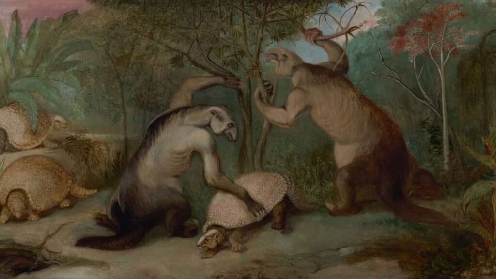
You usually think of dinosaurs as giant, roaming monsters, but you rarely picture the world they actually walked on. Yet if you could peel back the oceans and cities and farmlands you know today, you’d find a planet with a totally different layout, and that layout quietly decided who survived, who thrived, and who disappeared. The shape of the continents, the width of the oceans, and the position of the poles all acted like the rules of a game dinosaurs had to play for more than 160 million years.
Once you see dinosaurs through that lens, they stop looking like random creatures and start to feel more like the result of a long, slow experiment run by the planet itself. You notice how a supercontinent could boost some species and doom others, how a new seaway could invite in entirely different predators. By the time you reach the end of their story, you realize you can’t really talk about dinosaur dominance without talking about ancient geography first.
Pangaea: One Supercontinent, One Giant Dinosaur Arena
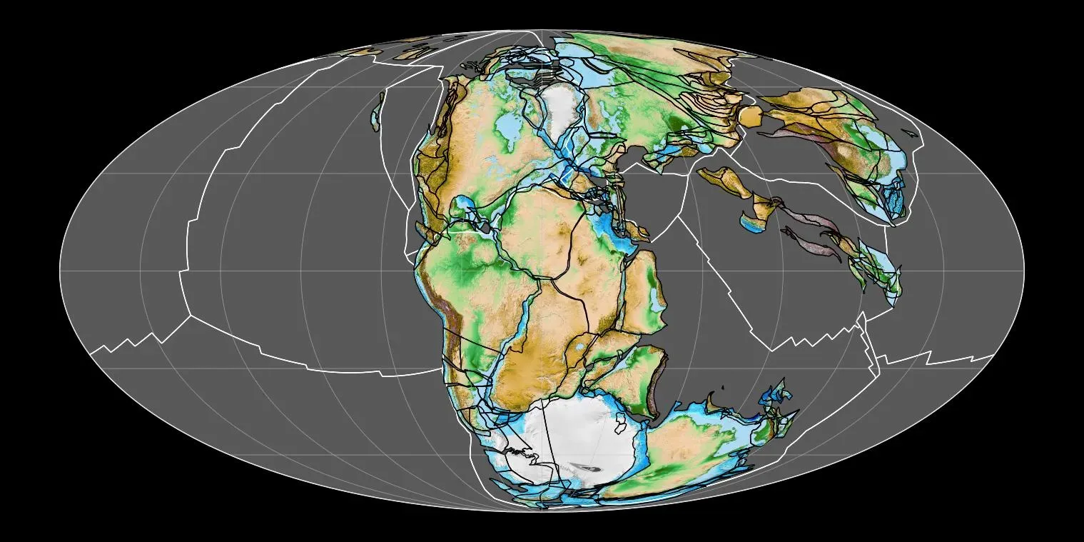
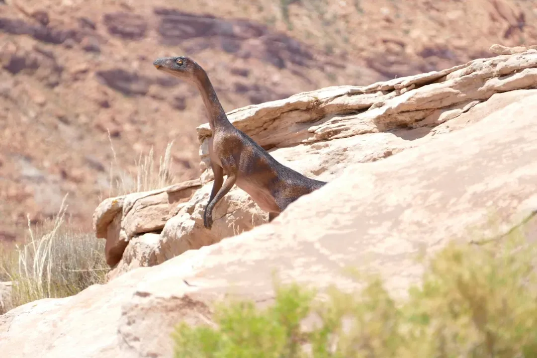
Imagine standing on a cliff in the Late Triassic and knowing you could, in theory, walk from what will one day be New York all the way to North Africa without ever crossing an ocean. That is the world of Pangaea, a single supercontinent stretching almost from pole to pole, and you are living in a time when land animals – especially early dinosaurs – can spread like wildfire. With so few marine barriers, if a species evolves a useful trait in one region, it can march across the continent and test that adaptation against all kinds of climates and competitors.
For you, that connected world means dinosaur evolution feels surprisingly “global” at first. Many early dinosaurs and their close relatives show up across what will later fragment into separate continents, because Pangaea gives them one huge testing ground. But there’s a catch: much of the interior is dry, seasonal, and sometimes brutally hot. When you picture lush Jurassic forests, this earlier phase looks harsher and more unstable, pushing you to see early dinosaurs not as unstoppable giants, but as tough, adaptable survivors in a supercontinent that could be both generous and unforgiving.
Rifting and Breaking Apart: When Continents Set the Stage for Specialization
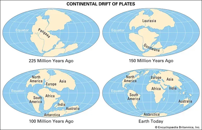
As time moves into the Jurassic, you watch cracks slice through Pangaea like fault lines in a broken plate, and those cracks slowly widen into young oceans. To you, this is not just plate tectonics trivia; it is the moment when dinosaur lineages start to get their own regional “stages.” Once landmasses drift apart, populations that used to mix freely get cut off, and isolation is exactly what drives them to branch into new forms, uniquely tuned to their home turf. The world shifts from one giant arena to a set of semi-private theaters.
If you trace fossils through this time, you notice that certain dinosaur groups begin to dominate particular regions as the continents move away from each other. You see how separation between what will become North America, Europe, Africa, and Gondwana encourages different styles of giant plant eaters and very different apex predators. To you, dinosaur dominance stops being a single global story and becomes a patchwork of regional empires, each sculpted by the new coastlines, mountain chains, and shifting climate belts created by that slow-motion breakup.
Laurasia vs. Gondwana: Two Hemispheres, Two Dinosaur Worlds
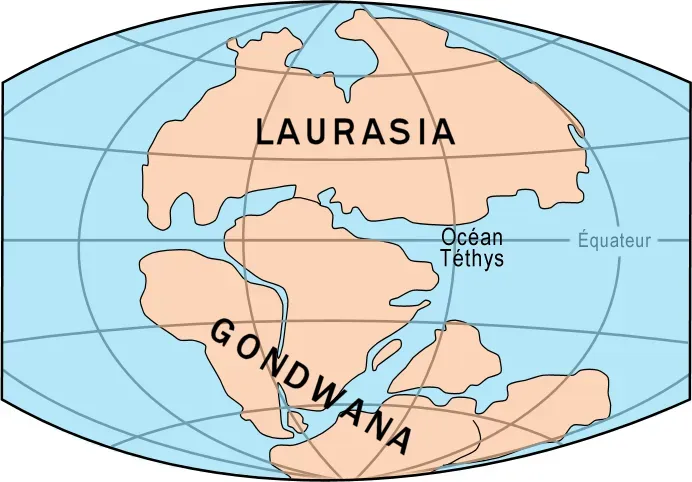
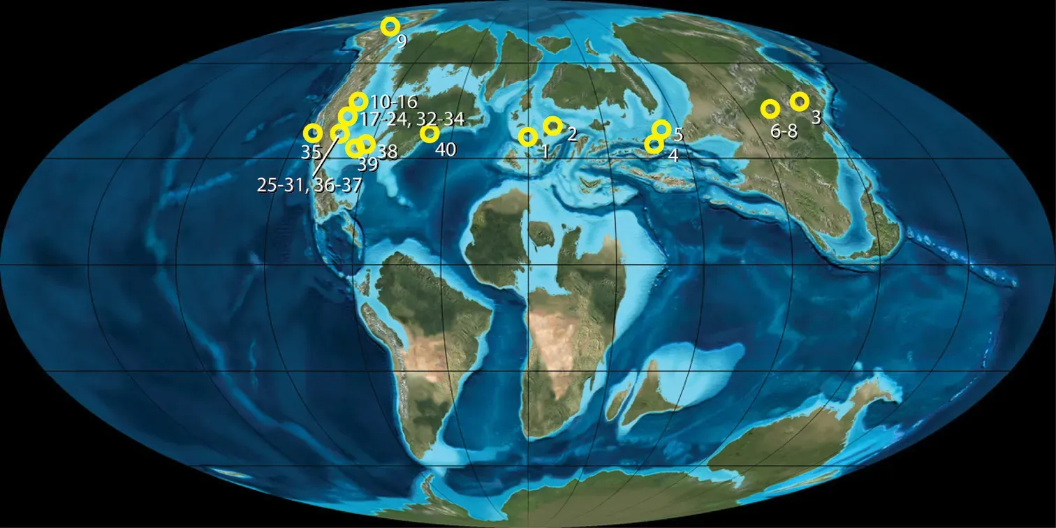
By the mid to Late Jurassic, you are effectively dealing with two great continental realms: Laurasia in the north and Gondwana in the south. On the map, they might just look like big pieces of crust, but to you they are like two different laboratories running parallel experiments with similar raw materials: dinosaurs, plants, and climate. The separation between northern and southern landmasses, along with changing ocean currents, leads to distinct climate patterns, different vegetation, and in turn, very different dinosaur communities.
When you look at Laurasia, you see certain theropods, sauropods, and ornithischians ruling the northern ecosystems, while Gondwana grows its own sets of massive long-necked herbivores and formidable predators. You start to notice that some dinosaur families are mostly northern, others mostly southern, which tells you that geography quietly guided their success. To really understand why some lineages flourish only in one hemisphere, you have to picture ocean barriers widening and climatic zones drifting over time, turning Laurasia and Gondwana into two semi-isolated evolutionary worlds.
Climate Highways and Barriers: Latitude, Oceans, and Dinosaur Habitats
If you zoom out from the continents themselves and look at where they sit relative to the equator and the poles, you begin to see why some dinosaur groups favor certain regions. Continents parked in tropical or subtropical bands tend to host dense vegetation, monsoon-like weather, and long growing seasons – perfect conditions for herds of giant herbivores. In contrast, landmasses drifting toward higher latitudes face cooler temperatures, more pronounced seasons, and long winter darkness, demanding different survival strategies from any dinosaur bold enough to live there.
Oceans then step in as your climate engineers, redirecting heat with currents and shaping rainfall patterns on nearby coasts. If a continent has a long coastline exposed to warm currents, you often find milder conditions and richer ecosystems, while interiors shielded by mountains or far from moisture may dry out. For you, this means dinosaur dominance is never just about size or teeth; it depends on where the land sits under the sun and how surrounding seas move energy around the globe. Ancient geography effectively writes the rules of where dinosaurs can feed, migrate, and nest.
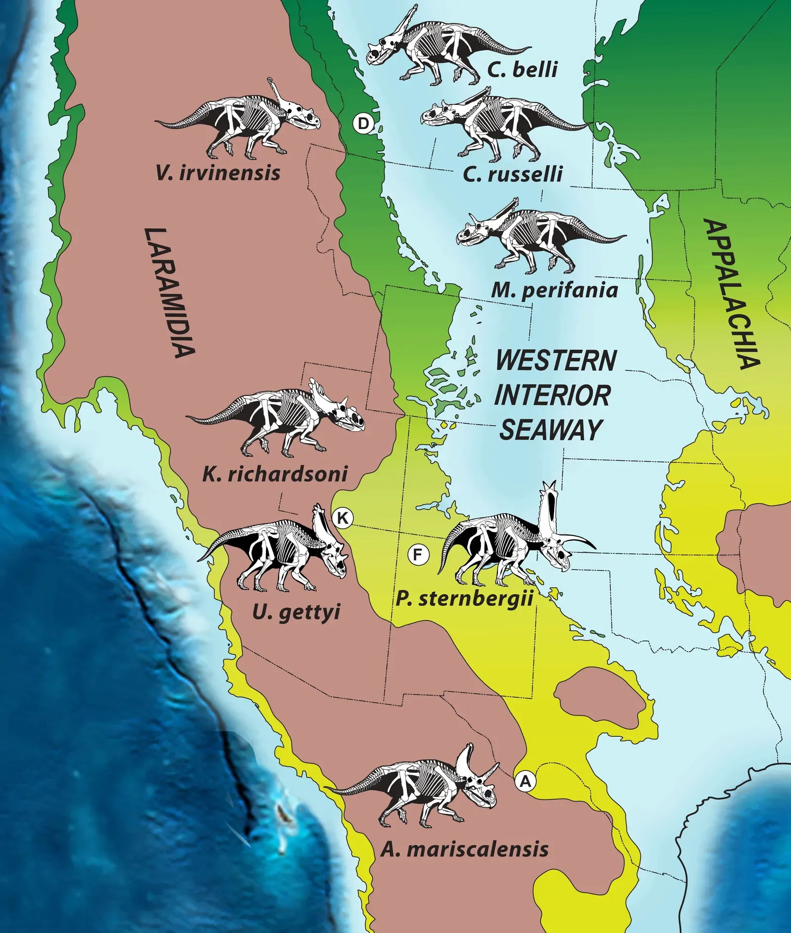
Island Worlds and Isolated Ecosystems: When Geography Shrinks the Rules
Not all dinosaurs lived on sprawling supercontinents; some evolved in what you might think of as natural laboratories: islands and isolated basins. When pieces of land break off or shallow seas flood low-lying regions, they create pockets of isolation where species are cut off from their mainland relatives. In those settings, you often see surprising body-size shifts, strange anatomical experiments, and unique predators or herbivores that you cannot find anywhere else. Geography, in this case, acts like a filter that lets only certain traits persist.
To you, these island worlds show how dramatically geography can rewrite the usual “rules” of dinosaur dominance. An enormous predator that would dominate a big continent might have no way to reach a remote island, giving smaller or more specialized dinosaurs a chance to fill the top spot. Over time, these secluded communities can become so distinct that when sea levels drop or land bridges form again, you see sudden biotic clashes – new competitors, new diseases, new pressures. Each of those outcomes traces back to the simple fact that the land was cut off, and then later reconnected.
Mountain Building, Volcanism, and the Rise and Fall of Habitats
When you think of dinosaurs, you might not immediately picture mountain ranges rising or vast volcanic plateaus spewing lava, but those forces quietly reset the ecological stage again and again. As plates collide and mountains push upward, they change wind patterns, block moist air, and cast dry rain shadows on one side. For dinosaurs, that can turn a once-lush lowland into an arid expanse and force populations to move, adapt, or disappear. What looks like a geological footnote on a map translates into real evolutionary pressure on the ground.
Volcanism adds a more dramatic twist to your story. Large-scale eruptions can flood regions with basalt, poison ecosystems with gases, and even alter the climate on a global scale for long stretches of time. When you track dinosaur fossils across these events, you see waves of turnover in species – old lineages fading, new ones rising to exploit changed environments. To your eyes, it becomes impossible to separate dinosaur success from the shifting and sometimes violent moods of the crust beneath them; geography is not just a backdrop, it is an active player reshaping habitats in bursts as well as in slow motion.
The Final Configuration: Continents, Currents, and the End of an Era
By the Late Cretaceous, the world map starts to look more familiar to you, with recognizable shapes for North America, South America, Africa, and Eurasia, though they are still not exactly where you see them today. Narrow seaways and growing oceans carve deeper boundaries between continents, while new coastlines and inland seas open up vast coastal plains and rich river systems. Dinosaurs face a planet that is no longer a single connected playground but a mosaic of separate theaters with increasingly distinct casts of characters.
At the same time, shifting ocean currents and sea levels influence climate in ways that shape which plants grow where, and thus which herbivores and predators can claim dominance. Some regions host flourishing faunas of horned dinosaurs and duck-billed giants, others lean more heavily on different herbivores and carnivores that have gone their own evolutionary way. When the end-Cretaceous asteroid finally strikes, it hits a biosphere already organized by millions of years of continental drift and climate rearrangement. The extinction is sudden, but the map it slams into has been quietly prepared by ancient geography all along.
When you step back from the details, you realize that dinosaurs did not just happen to live on Earth – they were shaped, steered, and sometimes cornered by the changing arrangement of land and sea beneath their feet. Supercontinents allowed them to spread, drifting plates split them into regional dynasties, and mountains, seas, and climate belts constantly redefined their opportunities. Even their final chapter unfolded on a planet whose continents and oceans were already locked into a pattern you would recognize on a classroom globe. In the end, when you picture any dinosaur, you are really looking at a living response to an ancient map.