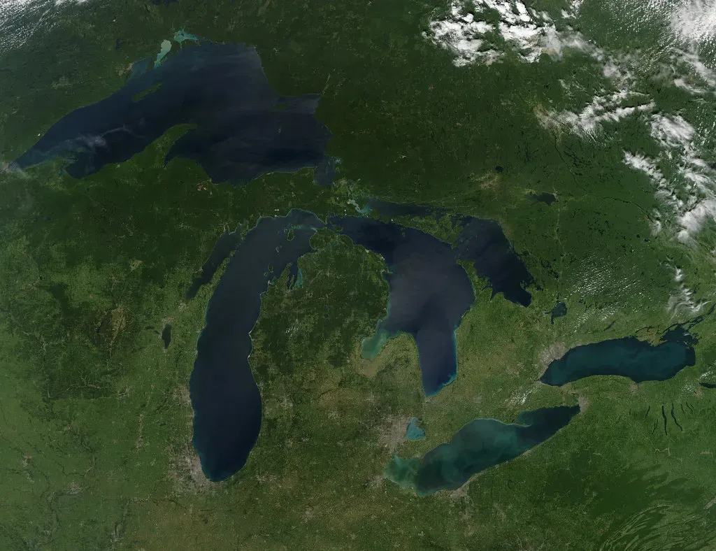
Picture a world where North America looks nothing like the continent you know today. No Great Lakes. No iconic shorelines. No Niagara Falls thundering over ancient rock. Just a vast, silent landscape buried under a crushing wall of ice stretching kilometres into the sky. That was reality for this continent not so long ago, geologically speaking.
The story of how the Great Lakes came to be is one of the most dramatic transformation stories on Earth. It involves ancient rock, continental ice, and a slow, grinding power that reshaped a continent over thousands of years. You might think you already know this story, but what actually happened is far stranger and more spectacular than most people realize. Let’s dive in.
The Ancient Rock That Set the Stage
Before you can understand the Great Lakes, you need to go back much further than the ice. We’re talking hundreds of millions of years further. The original North American continent was a mass of igneous rock lying to the north of the Great Lakes region, and forces beneath the surface caused a series of uplifts and downward foldings, with seas receding and returning again over immense spans of time.
Lake Superior itself began life a billion years ago as a massive rift, a crack in the continental crust. Think about that for a second. The landscape that would eventually cradle one of the world’s most iconic bodies of fresh water started as a wound in the planet’s skin. The lakes formed by glacial erosion, but geological features that formed between 300 million and 1.2 billion years ago predetermined the very shapes of America’s huge inland seas.
The Great Lakes area was a sort of submerged basin or bowl which gradually became lined with layers of materials, some hard and some soft, but finally, when the whole region was above sea level, a great river system existed. In other words, the geography was being set up long before any ice arrived. The glacier would eventually follow the path of least resistance, and geology had already drawn that map.
The Ice Sheet That Changed Everything
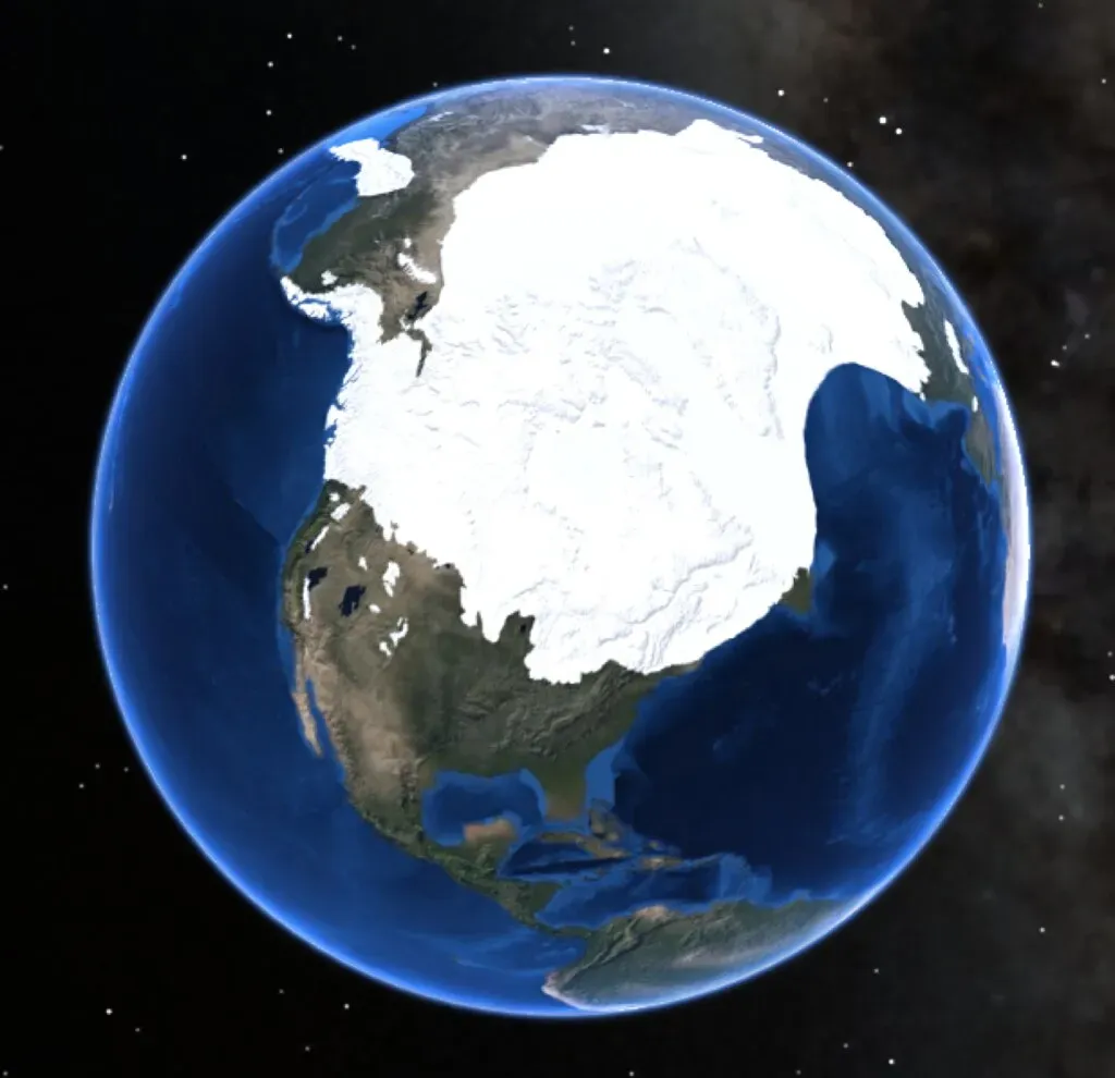
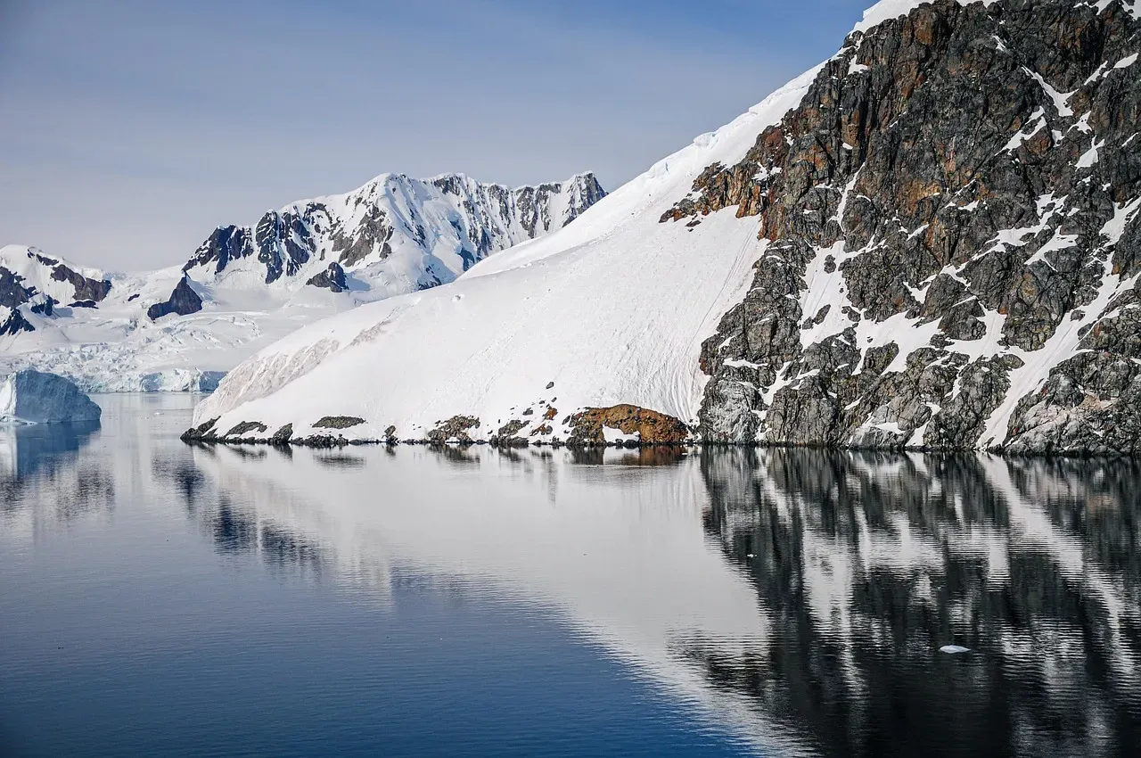
Here’s the thing about the Laurentide Ice Sheet: it was incomprehensibly enormous. It was a massive sheet of ice that covered millions of square miles, including most of Canada and a large portion of the northern United States, multiple times during the Quaternary glaciation epochs, from 2.58 million years ago to the present. That is not a typo. Millions of square miles.
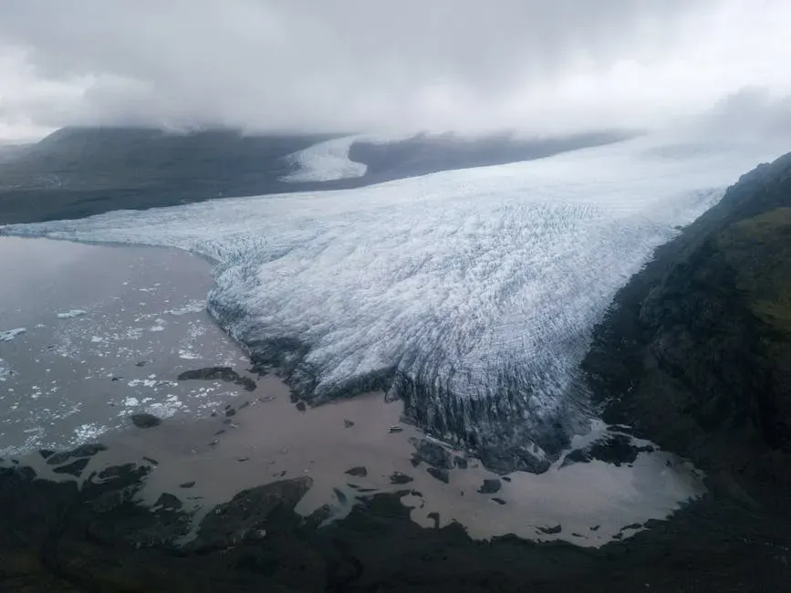
The lakes formed at the end of the last Ice Age, when Canada was under an ice sheet 3,000 to 9,000 feet thick. This massively heavy continental glacier had flowed southward, depressing and carving the Earth as it passed over, pushing ahead of it huge piles of eroded rock and gravel called glacial moraines. Honestly, trying to comprehend this is like trying to imagine the weight of an entire country compressed into moving ice. It’s staggering.
The last wave of Pleistocene glaciation pushed to its maximum extent between 25,000 and 21,000 years ago, plowing terminal moraines southward ahead of the glacial lobes. The Laurentide Ice Sheet is estimated to have been up to 3,000 feet thick in the area of the lakes and possibly more than 9,000 feet thick farther north. That kind of weight does not just sit lightly on a landscape. It carves it, grinds it, and fundamentally remakes it.
How Glaciers Carved the Lake Basins
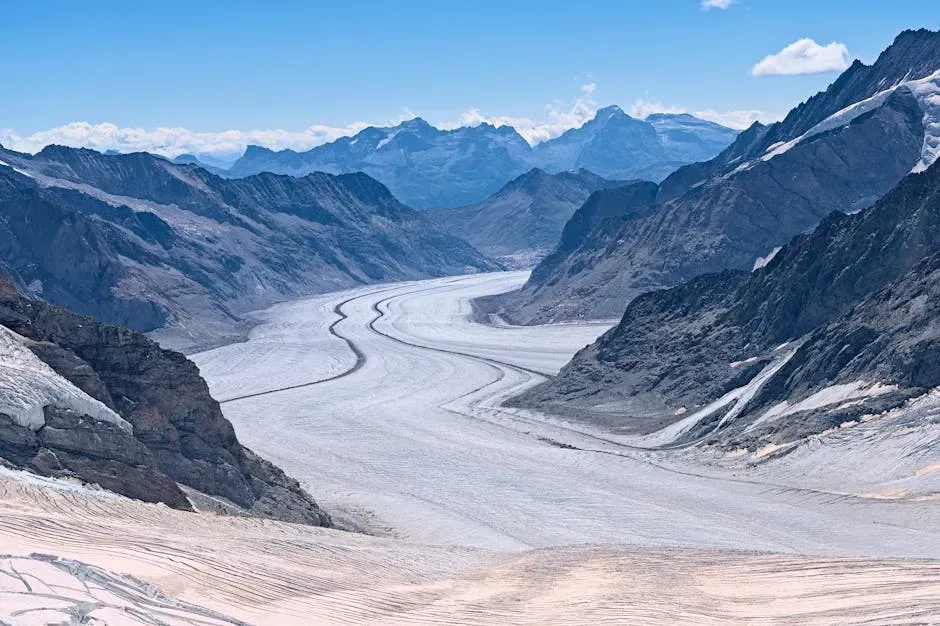
The Labradorian ice sheet worked itself into existing breaches and exposed bedrock, picking up and pushing rock material ahead of it as it went. As the ice sheet approached the Great Lakes area, it worked its way into old river valleys that were already present and divided itself into ice tongues, or major lobes of ice. As these ice tongues advanced, they deepened the valleys even further, turning them into river basins.
As ice crossed onto thicker sedimentary rock packages, it preferentially eroded through weaker lithologic units. Increased ice thickness and velocity in these eroded regions accelerated their erosion in a feedback loop, forming the overdeepened basins of the Great Lakes. You could think of it like water cutting through soft soil faster than through hard clay. The glacier found the weak spots in the rock and just kept digging deeper and deeper with every pass.
The Great Lakes are a product of glacial scour and were partially or totally covered by glacier ice at least six times since 0.78 million years ago. Six times. Not once or twice. Six separate glacial advances sculpted and re-sculpted the same landscape, each one deepening and reshaping what the previous one had already carved. Each lake basin originated as a northwardly flowing river, and over successive glaciations during the Quaternary period, was eroded into the present formations.
The Meltwater Miracle: Lakes Are Born
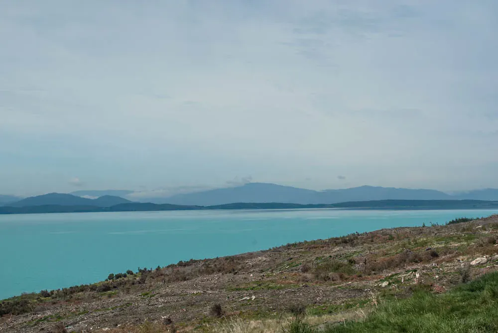
The Great Lakes began to form at the end of the Last Glacial Period around 14,000 years ago, as retreating ice sheets exposed the basins they had carved into the land, which then filled with meltwater. This was not some dramatic single event. There was no one spectacular day when you could have looked out and seen a new lake sparkling in the sunlight. It happened slowly, over centuries.
About 20,000 years ago, the ice sheet finally began to melt. As the glacier receded northward, floods of meltwater filled the deep depressions it had carved and were trapped in place by the banks of moraines it left behind. Over centuries, this formed the Great Lakes. Think of the moraines as natural dams. Without those ridges of deposited rock and gravel, the water would have simply drained away into river systems and the lakes would never have existed.
The retreat of the ice sheet left behind a large amount of meltwater from lakes like Lake Algonquin, Lake Chicago, Glacial Lake Iroquois, and the Champlain Sea that filled up the basins that the glaciers had carved, thus creating the Great Lakes as they are today. These ancient predecessor lakes were sometimes much larger than the modern lakes you know. As the ice sheet retreated into Canada, it temporarily made Lakes Superior, Michigan, and Huron into one huge body of water called Lake Nipissing, which had the unusual quality of having three outlets.
Crustal Rebound and the Reshaping of Shorelines
Here is where the story gets even more fascinating, and honestly a little mind-bending. The ice did not just carve the land. It bent it. Ice at 1.2 kilometres thick would exert a pressure of roughly 150 tons per square foot, and it is estimated that the weight of the glacier depressed the earth by about 61 metres. When the glacier retreated, the land began to rise in what is referred to as glacial rebound.
Isostatic rebound refers to the rise of land from which a heavy weight has been removed. In this case, the heavy weight was that of the glaciers, and Earth’s crust is still recovering from this load. This process is slow and operates barely within human time scales, and it has accounted for much of the long-term history of the Great Lakes, especially in northern regions where the ice was thickest and longest lived.
The result is that the Great Lakes are actually tilting to the south, with more land exposed on the north shore of Lake Superior each century. Ancient beaches and shorelines have been submerged on the south shore of Superior, since the lake is tilting southwards. So right now, as you read this, the lakes are still very slowly moving. The Earth is still healing from an ice age that ended thousands of years ago. I find that genuinely extraordinary.
The Great Lakes Today: A Freshwater Giant Facing New Pressures

The Great Lakes today hold an estimated 6 quadrillion gallons of water, a fifth of all the drinkable water on the surface of Earth. If all the water in the Great Lakes were spread evenly over the continental United States, the 48 states would be flooded under more than nine feet of water. That is an almost incomprehensible volume. A fifth of Earth’s surface freshwater, all sitting in five lakes that were carved by ice.
The Great Lakes contain roughly 20% of the world’s surface freshwater and provide drinking water to about 30 million people across the United States and Canada. Yet despite that staggering abundance, the health of these lakes is not guaranteed. A joint report from the United States and Canada found that the Great Lakes, one of the most important freshwater systems on Earth, are no longer in widespread decline, but are also not significantly improving, with overall conditions rated “fair” and unchanged in recent years, compiled by more than 200 scientists and experts.
Threats to the Great Lakes’ ecosystems include invasive species, climate change, pollution, and habitat destruction, with climate change affecting water temperatures, weather patterns, and lake levels. Meanwhile, the surfaces of the lakes total more than 94,000 square miles, covering an area about the size of the entire state of Oregon. Protecting something that vast requires cooperation, vigilance, and a genuine understanding of just how rare and irreplaceable this glacial gift truly is.
Conclusion
The Great Lakes did not simply appear on a map. They were forged through billions of years of geological setup, sculpted by miles-thick ice over thousands of years, and shaped into their final form by the slow, ongoing recovery of the Earth’s crust. Every time you stand at the edge of Lake Michigan or Superior and feel like you’re looking at an ocean, you’re right to be awe-struck. These lakes are one of the most dramatic geological legacies on the planet.
The story of their formation is also a reminder of how profoundly climate shapes the world we live in. Ancient ice built this freshwater system. Today, a warming climate is testing it. The lakes survived the end of an ice age. Whether they survive the pressures of the present era depends largely on what we choose to do next. Standing at those shores and knowing their full story makes that responsibility feel very real. So the next time you see Lake Superior glittering on the horizon, ask yourself: do the people around you truly know what they’re looking at? Tell us your thoughts in the comments below.