You look out a plane window over the United States and see checkerboard fields, hazy mountain ranges, maybe the glint of a river. It’s easy to think the landscape has always looked more or less like this. But beneath the familiar scenery is a deep, slow-motion story of titanic collisions, buried scars, and invisible currents of rock creeping thousands of miles below your feet.
For hundreds of millions of years, unseen geological forces have been quietly sculpting what you now drive, hike, and fly over. Mountain ranges have risen where shallow seas once shimmered. Entire chunks of crust have stretched like taffy, cracked, and sunk. Ice sheets thicker than the tallest skyscrapers have bulldozed the north and then vanished. When you learn how all this happened, the American landscape stops being just a backdrop and starts feeling like a living, restless machine that you happen to be standing on.
The Ancient Core Beneath Your Feet: North America’s Hidden Backbone
When you walk across much of the central and northern United States, you’re actually standing on an unimaginably old foundation called a craton. Think of it as the continent’s armored skeleton: a thick, stubborn block of rock that formed billions of years ago and has survived repeated cycles of continental breakup and collision. Parts of this ancient core, like the Wyoming craton and the Canadian Shield, were stitched together through early mountain-building events long before dinosaurs or forests existed.
You mostly see this only where erosion has peeled back younger layers, like in the Great Lakes region or parts of the northern Rockies, but it underpins far more than you realize. This old, cold root of the continent is strong and buoyant, so it resists being crumpled or ripped apart the way younger crust does near the coasts. That’s one reason the interior of the United States is dominated by broad plains and gentle hills: the deep structure beneath you is stable and hard to deform, quietly guiding where mountains can rise and where basins can sink.
Colliding Plates and Buried Mountain Chains
You probably think of the Rockies as the main mountain story in the West, but long before the modern range took shape, other mountain belts came and went. For hundreds of millions of years, oceanic plates were shoved beneath the western edge of North America, driving a series of mountain-building episodes that stacked vast sheets of rock eastward toward what is now Utah, Wyoming, and Montana. These events, collectively known as orogenies, repeatedly thickened the crust, crumpling it like a rug pushed against a wall.
During the late Cretaceous and early Cenozoic, a particularly unusual episode called the Laramide orogeny pushed the deformation far inland. Instead of just building a narrow coastal range, the flat-sliding Farallon plate shoved and warped the crust deep into the interior. You see the legacy of that today in places like the Bighorn Mountains, the Black Hills, and other isolated uplifts popping up out of the Great Plains. Many basins that now hold oil, gas, and thick sedimentary layers were created as flexed, downwarped areas next to those rising blocks – a reminder that underground resources you use every day are tied directly to long-vanished compressive forces.
Stretching the Crust: Why the Basin and Range Looks Torn Apart
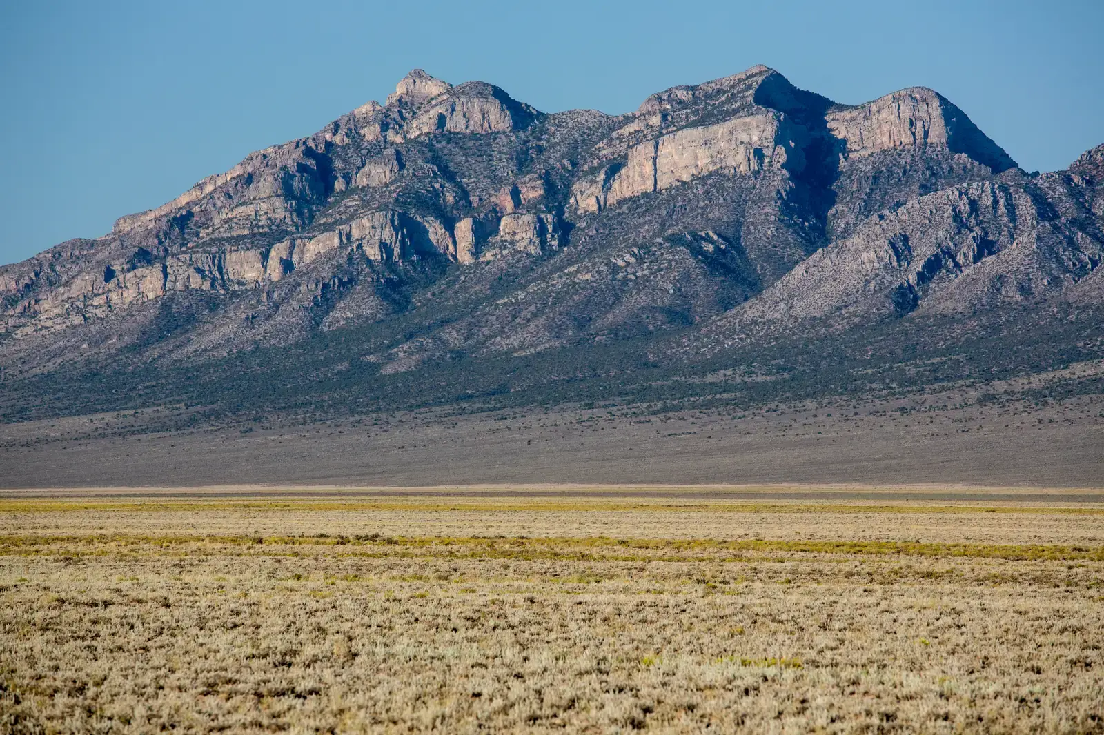
If you ever drive across Nevada, you feel it in your bones: up a long pass, down into a flat valley, repeat, again and again. That endless pattern of north–south mountain ranges separated by broad basins is not an accident; it’s the surface expression of the continent being stretched. For roughly the last few tens of millions of years, the western United States has been pulled apart, creating the Basin and Range Province that covers most of Nevada and spills into Utah, Arizona, California, and beyond.
As the crust thinned, it broke along large, steep normal faults, allowing blocks to tilt and drop. The lifted edges became mountain ranges; the dropped blocks formed the basins now filled with sediments, salt flats, and desert playas. You feel the dramatic relief at places like Death Valley, one of the lowest points in North America, sitting next to high peaks that rise abruptly from the desert floor. This extension is tied to changes in plate motions along the Pacific margin and the disappearance of the Farallon plate, but on your road trip it simply shows up as that hypnotic rhythm of ridges and valleys marching to the horizon.
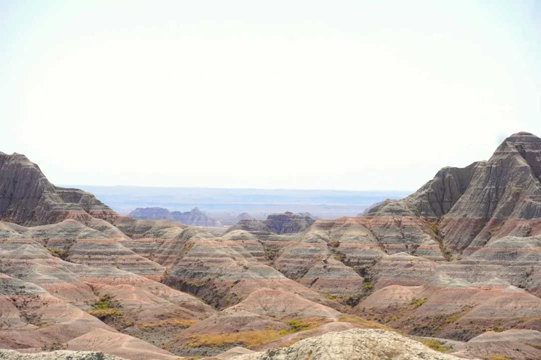
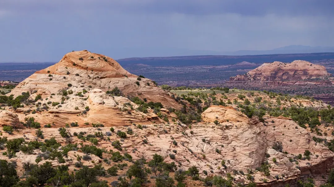
The Colorado Plateau: A Giant Block Quietly Lifted Skyward
Then you cross into the Four Corners region and everything changes. Instead of endless tilted ranges, you see broad, flat-topped mesas, deep canyons, and rock layers stacked like a layer cake barely disturbed. This is the Colorado Plateau, and it stands out precisely because it stayed relatively intact while the surrounding Basin and Range was torn apart. Yet it has been lifted several thousands of feet compared to its ancient position, raising old seafloor sediments and river deposits high into the dry air of Arizona, Utah, Colorado, and New Mexico.
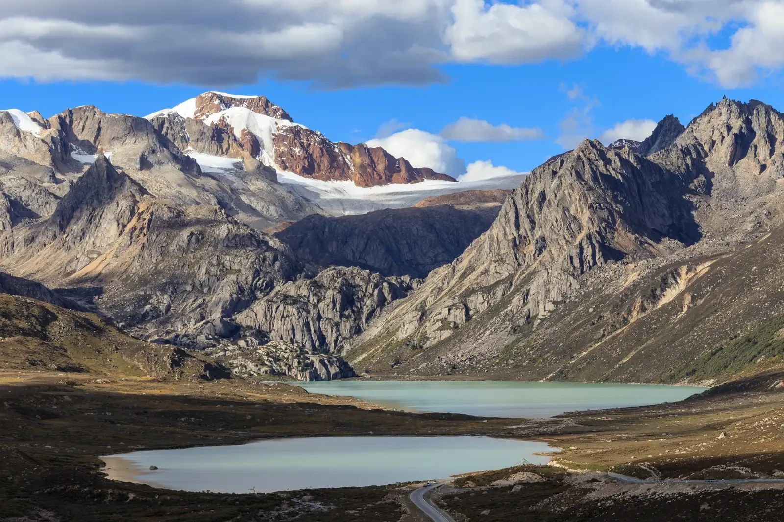
That uplift wasn’t just a surface quirk; it was driven from deep below, by hot, buoyant mantle rock rising beneath the plateau after the old subducted slab beneath it sank away. As the plateau rose, rivers like the Colorado gained more energy, carving down into the thick stack of rocks and exposing nearly two billion years of Earth history in canyons like the Grand Canyon. When you stand on a rim overlook and feel that dizzying drop at your toes, you’re seeing the result of a partnership between deep mantle forces pushing up and surface rivers cutting down, operating relentlessly over millions of years.
Hotspots on the Move: The Yellowstone Track Across the Northwest
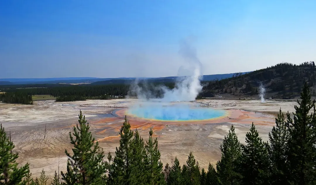
Not all volcanic activity in the United States lines up neatly with plate boundaries, and Yellowstone is the best example you can visit. The supervolcano beneath the park is thought to sit above a relatively stationary mantle hotspot, while the North American plate slowly grinds southwestward across it. Over about the last sixteen million years, that motion has left a trail: a scar of ancient volcanic centers and vast lava fields stretching across the Snake River Plain of Idaho toward the Pacific Northwest.
When you follow the Snake River west from Wyoming through Idaho, you’re roughly tracing that hotspot track in reverse time, from younger eruptions near Yellowstone to older caldera remnants farther west. The plain itself is a low, broad swath where repeated eruptions blanketed the landscape with thick volcanic rocks, later modified by faulting and gentle subsidence. Today, you see this history in features like the Craters of the Moon lava fields and the subtle, parabolic topography of the plain. Even if you never think about mantle plumes, you’re driving across their footprints whenever you cross southern Idaho.
Ice Giants: How Continental Glaciers Rewrote the North
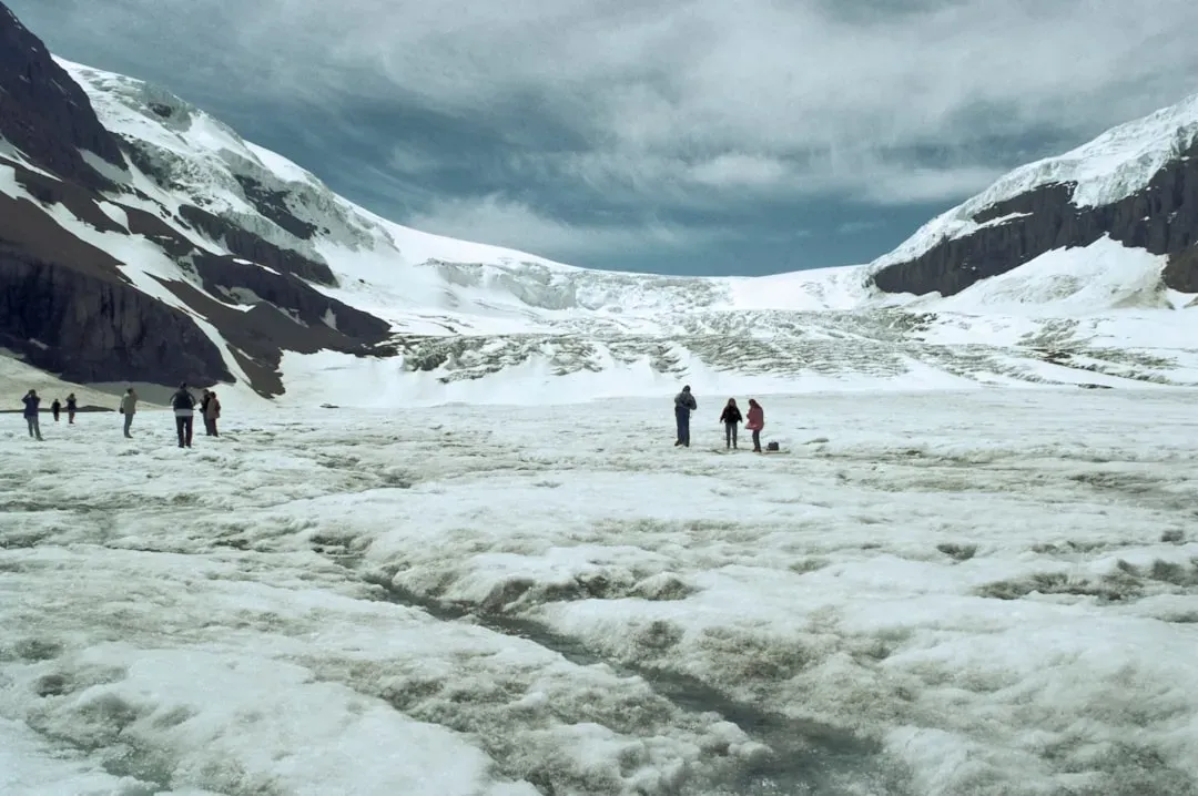
Head north in your mind to the upper Midwest and Northeast, and the invisible sculptor changes from fire to ice. During the last few million years, massive continental ice sheets repeatedly advanced and retreated over what’s now the northern United States. The largest of these, the Laurentide Ice Sheet, spread south from Canada multiple times, at its peak burying much of the upper Midwest and Northeast under ice that could be more than a mile thick. You can imagine it as a frozen bulldozer, gouging, grinding, and plucking rock as it moved.
As the ice advanced, it carved out basins that later filled with water to become the Great Lakes, and scraped and smoothed the underlying bedrock into rounded hills and lake-dotted lowlands. When the ice finally melted back for good around the early to middle Holocene, it left behind thick blankets of glacial till, long curving ridges called moraines, and countless kettle lakes. If you have ever paddled through the Boundary Waters, driven past Midwest farm fields on rich, flat soils, or traced the shorelines of the Great Lakes, you’ve been traveling through the ghostly imprint of those vanished ice giants.
Rivers as Sculptors: From Flat Uplands to Deep Canyons
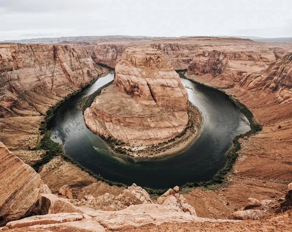
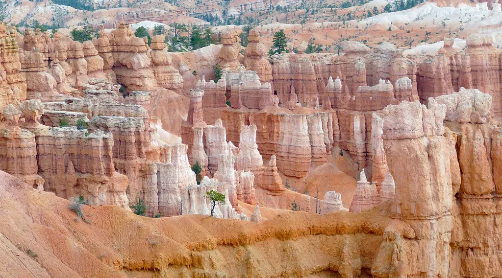
Once uplift or ice sets the stage, rivers take over as patient, relentless artists. Across the American landscape, streams and rivers respond to changes in elevation created by tectonics or isostatic rebound after glaciation. When land rises or base level drops, rivers gain more gravitational energy and start cutting down, carving valleys and canyons, and transporting sediment toward the coasts. The Colorado River is the classic example: as the Colorado Plateau rose, the river deepened its channel, slicing through layer after layer of rock to create the Grand Canyon’s staggering depth.
You see similar relationships elsewhere: in the Appalachian region, old mountains have been deeply dissected by rivers reacting to long-term uplift and the removal of glacial loads to the north. In formerly glaciated regions, rivers often occupy meltwater channels or flow along low spots left by the ice, sometimes forming oversized valleys compared to the streams you see today. Every meander, floodplain, and terrace you notice from a highway bridge tells you that the land has been moving, even if the motion is too slow for you to perceive in a lifetime.
Isostasy and Rebound: The Land Bounces Back
One of the strangest ideas you encounter in geology is that the solid Earth can behave a bit like a memory foam mattress. When a huge weight like a continental ice sheet or a massive mountain belt presses down on the crust, it pushes the underlying mantle aside and causes the surface to sag. Remove that weight – by melting ice or eroding mountains – and the crust begins to rise back up over thousands of years in a process called isostatic rebound. In the northern United States and Canada, the land is still slowly rising today as it recovers from the weight of the last ice sheets.
This vertical motion subtly changes coastlines, river gradients, and even lake levels over long timescales. Around former ice margins, you can trace old, now-tilted shorelines of ancient glacial lakes, showing how different parts of the landscape have risen at different rates. In mountainous regions, the balance is similar: as erosion wears down ranges built by earlier tectonic forces, the removal of rock can enable further uplift, keeping peaks high even as material is constantly removed. When you hike in a place like the Rockies or the Adirondacks, you’re standing on land that is still quietly adjusting to past loads you never saw.
Why This Hidden Story Changes How You See the Land
Once you know this backstory, the American landscape stops being just scenery and starts to feel like the visible skin of a much larger, ongoing system. Those flat Kansas fields sit on some of Earth’s oldest, toughest crust; the jagged Nevada ranges mark where the continent is being pulled apart; the calm mesas of the Southwest ride atop a block that has been hoisted kilometers into the air. Even the lakes you swim in and the soils that grow your food are hand-me-downs from vanished ice sheets, ancient seas, and rivers that shifted course as the ground rose or fell beneath them.
I still remember the first time I flew over the West after really learning this story; suddenly the view out the window looked completely different. Every broad valley hinted at crustal stretching, every abrupt escarpment whispered of fault movement, and every sinuous river seemed like a bright thread stitching together the work of deep Earth processes and surface erosion. When you step outside now – whether you’re in the city, on a farm, or on a national park overlook – you’re standing in the middle of that same story. Knowing that, does the ground under your feet feel a little more alive than it did before?