
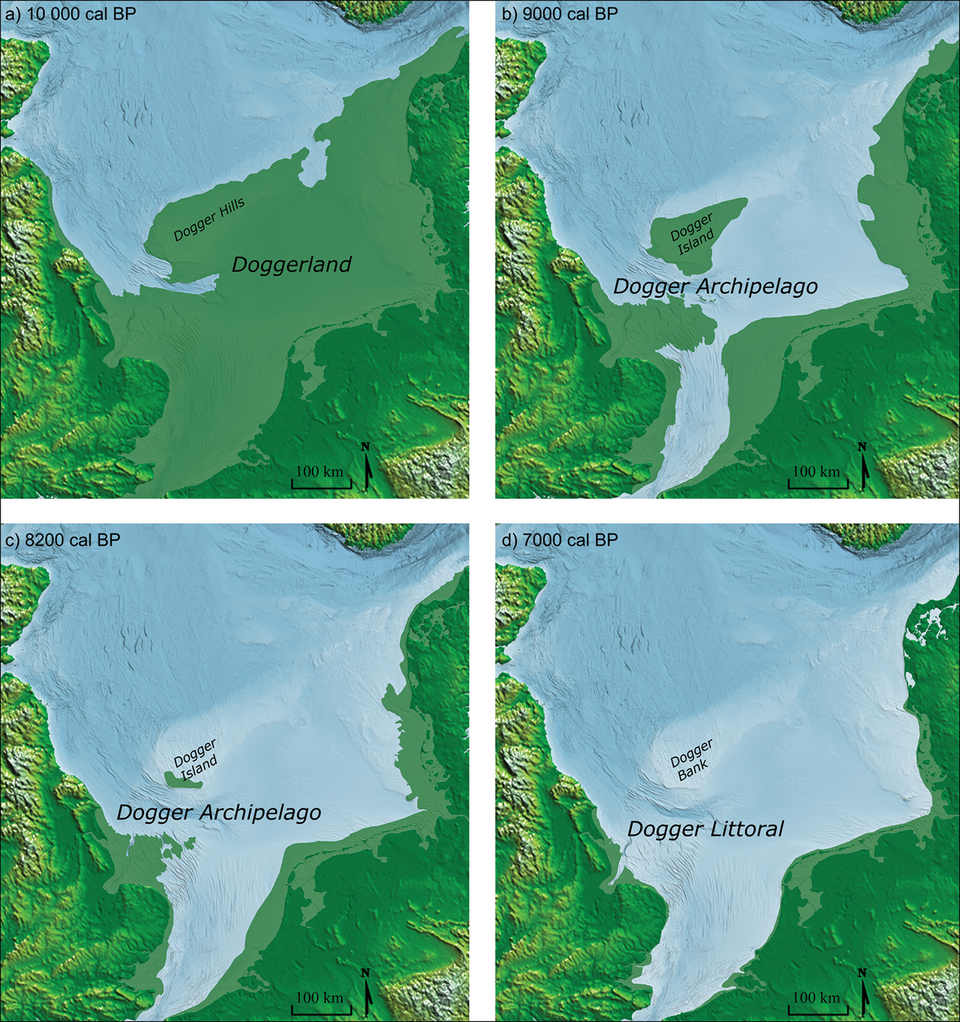
Ten thousand years ago, you could have walked from Yorkshire to Denmark without ever getting your feet wet. No boat, no ferry, no grey churning water in sight – just forest, riverbank, and open plain rolling on for hundreds of miles where the North Sea now sits. Most people assume Britain has always been an island, cut off and cozy behind its Channel. Geologists and archaeologists know better.
A vanished country called Doggerland once filled that entire gap, and it wasn’t some thin, forgettable land bridge. It was a real place – populated, hunted, fished, decorated with art, and eventually drowned in a story far stranger and more violent than most textbooks ever mention. Here’s what actually happened to it.
#1 – The Land Bridge That Made Britain Part of Europe
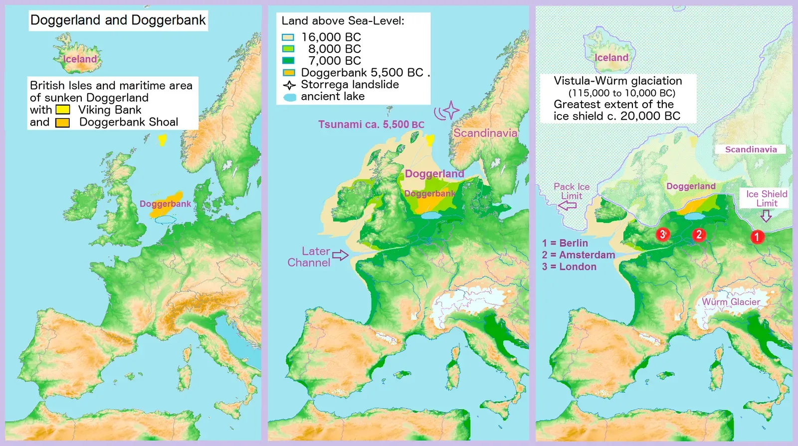
Long before “Brexit” meant anything, Britain wasn’t an island at all. It was simply the western edge of a much bigger landmass, physically fused to what is now France, Belgium, the Netherlands, and Germany.
Doggerland was a vast prehistoric expanse sitting in what is now the North Sea, connecting the British mainland to the European continent. It stretched from England’s eastern coast all the way to the western shores of the Netherlands and Germany, still intact as recently as twelve thousand years ago. This wasn’t a narrow neck of land either – it was a genuine extension of the continent, with people, animals, and rivers moving freely across it in every direction.
Here’s the part most people never learn: this landmass didn’t appear once and disappear for good. It surfaced and resubmerged repeatedly throughout the Pleistocene epoch, rising whenever glacial periods locked up enough seawater as ice and sinking again when the thaw returned. The name “Doggerland” technically refers to its final, best-documented version, but Britain has flickered on and off the European mainland for hundreds of thousands of years. Its current island status might just be the latest chapter, not the permanent one.
#2 – A Country Bigger Than the Netherlands and Denmark Combined
Forget the idea that Doggerland was some minor strip of coastal mud. At its peak, this place was enormous – genuinely continent-sized by European standards, and big enough to swallow several modern nations whole.
Archaeologist Vince Gaffney and his team at the University of Birmingham used seismic survey data, originally collected by oil companies drilling for gas beneath the North Sea, to digitally reconstruct nearly 18,000 square miles of the submerged landscape. That reconstructed core alone is larger than the entire modern Netherlands, and it’s still just a fraction of the full territory.
Fast Facts
- Peak size: more than 180,000 square kilometers of dry land
- Comparable footprint to modern Belgium, the Netherlands, and Denmark combined
- Digitally mapped core: nearly 18,000 square miles, larger than the Netherlands alone
- Reconstruction built from oil-industry seismic survey data, led by Vince Gaffney’s team at the University of Birmingham
At its greatest extent, this lost heartland of prehistoric Europe covered more than 180,000 square kilometers – roughly the combined footprint of modern Belgium, the Netherlands, and Denmark. One of the largest countries in prehistoric Europe simply isn’t in any history book taught in schools, for one blunt reason: it drowned before anyone could write its name down.
#3 – A Landscape of Rolling Hills, Hidden Valleys, and Quiet Lagoons
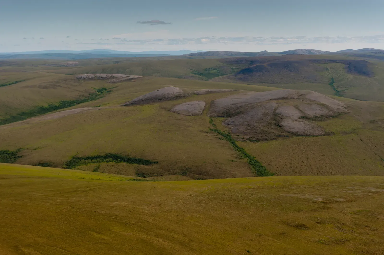
Doggerland wasn’t a flat, featureless wasteland people rushed across to get somewhere better. It was a genuinely varied landscape, closer to a national park than a corridor.
Picture gentle ridgelines rolling down into dense forest, opening onto reedy wetlands alive with birdlife. The land held sloping hills, wooded valleys, marshland, and lagoons, all stitched together into one continuous, livable world. This was somewhere people actually wanted to be, not just somewhere they had to cross.
Researchers studying the wider shelf describe a landscape of low hills and broad valleys, braided rivers and wide estuaries, marshy wetlands and long gravel beaches, home to bear, boar, red deer, and people, all before the rising seas erased it. That combination – hills for shelter, valleys for travel, lagoons for fishing – made it one of the most ecologically diverse regions in all of prehistoric Europe. Experts now argue this sheer variety is exactly why Doggerland became a magnet for early human settlement, long before anyone had planted a single crop.
#4 – The Forgotten Meeting Point of the Rhine and the Thames
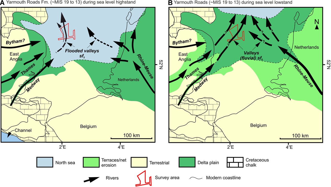
Here’s something that rarely makes it into mainstream retellings: two of Europe’s most famous rivers used to physically meet on dry land, inside Doggerland itself.
Fed by the prehistoric channels of the Rhine and the Thames, Doggerland was woven through with winding estuaries, massive freshwater lagoons, dense oak forests, and sweeping marshlands. Today these two rivers empty into the sea hundreds of kilometers apart, as strangers. Back then, their combined floodplain formed the beating heart of the entire landmass.
This river system mattered enormously for both wildlife and people. Freshwater lagoons drew fish, waterfowl, and land animals coming to drink, which in turn drew hunters following the food. Braided channels created natural travel corridors, letting animals and humans move with the seasons without ever crossing open water.
This ancient river confluence may be one of the most important – and least discussed – geographic features in all of European prehistory. It essentially decided where people settled, where they hunted, and eventually, where they stood when the water crept back in for good.
#5 – An Ice Age Wildlife Empire Beneath Today’s Fishing Boats
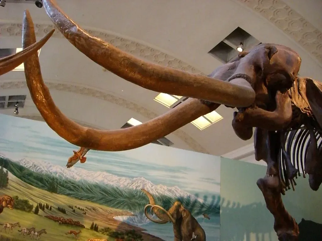
If you think mammoths only roamed Siberia or North America, think again. Doggerland was crawling with Ice Age giants, and the evidence is still surfacing today, quite literally.
The land supported an immense concentration of wildlife, including herds of woolly mammoths, reindeer, wild boar, and red deer, making it the premier hunting and fishing ground for nomadic Mesolithic hunter-gatherers. This wasn’t a handful of stray animals wandering through. It was a genuine wildlife concentration zone, comparable in density to the modern Serengeti.
Worth Knowing
- Woolly mammoths, reindeer, wild boar, and red deer once shared this landscape
- Trawlers have hauled up mammoth, woolly rhinoceros, and cave lion bones since the late 1800s
- Wildlife density here has been compared to the modern Serengeti
- Fishermen off the English coast still occasionally net a mammoth tusk by accident
Since the late 19th century, deep-sea trawlers dragging heavy nets along the shallow sandbanks of the Dogger Bank have hauled up an astonishing collection of prehistoric remains – thousands of fossilized bones belonging to mammoths, woolly rhinoceroses, and cave lions. Fishermen off the English coast still occasionally net a mammoth tusk without realizing what they’re holding.
Most people don’t realize the North Sea floor is essentially one giant, accidental fossil bed, quietly giving up Ice Age relics every time a trawler drags its net across the wrong patch of seabed.
#6 – Possibly the Richest Hunting and Fishing Ground in the Ancient World
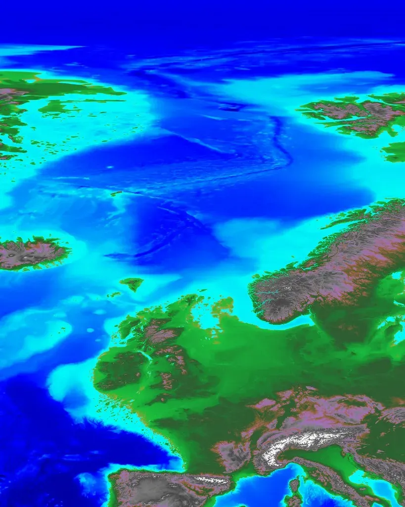
With rivers, lagoons, forests, and megafauna all packed into one place, Doggerland wasn’t just habitable. It was arguably one of the richest food environments anywhere in the prehistoric world.
The hunter-gatherers who lived there subsisted on an abundant supply of plant foods like berries and hazelnuts, alongside fish and other animal species drawn to the wetlands. This wasn’t scraping-by survival. It was genuine abundance, and abundance changes how people behave.
Archaeological deposits recovered from Doggerland contexts reveal a subsistence economy tuned to the sea, with fish bones, shell concentrations, and sea mammal remains dominating the assemblages, while scattered stone tools suggest repeated short-term camps. People weren’t just passing through this landscape. They kept returning to the same productive spots year after year, treating certain lagoons and estuaries almost like permanent larders – a pattern archaeologists usually associate with far more “settled” societies than typical wandering hunter-gatherer groups.
#7 – A Densely Populated Homeland, Not an Empty Wilderness
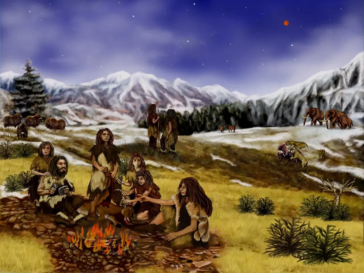
Doggerland wasn’t empty. By Stone Age standards, it was genuinely crowded – a heartland rather than a quiet, forgotten wilderness.
Given the sheer size of the region, historians believe thousands of people, split across different cultures and survival strategies, called Doggerland home. These weren’t isolated bands stumbling into each other by accident. Multiple distinct groups likely coexisted, each adapted to a different slice of the landscape.
Quick Compare
- Typical hunter-gatherers: high mobility, thin population density, brief seasonal camps
- Doggerland communities: repeated reuse of the same lagoons and estuaries year after year
- Oldest confirmed local genome: dated to roughly 9113 BCE
- Overall pattern: closer to proto-villages than wandering bands
What’s genuinely surprising is how settled some of these groups appear to have been for supposed hunter-gatherers. Researchers point to the concentration of resources in Doggerland as evidence that its people lived more settled lives than typical hunter-gatherer societies elsewhere. Ancient DNA is now backing this up: an early Mesolithic individual from Doggerland, dated to roughly 9113 BCE, marks the oldest genome recovered from this small Netherlands sample set, confirming a human presence stretching back millennia before the final flood.
While most textbooks frame Mesolithic people as constantly on the move, Doggerland’s communities look suspiciously close to proto-villages.
#8 – Home to Its Own Art, Weapons, and Symbols
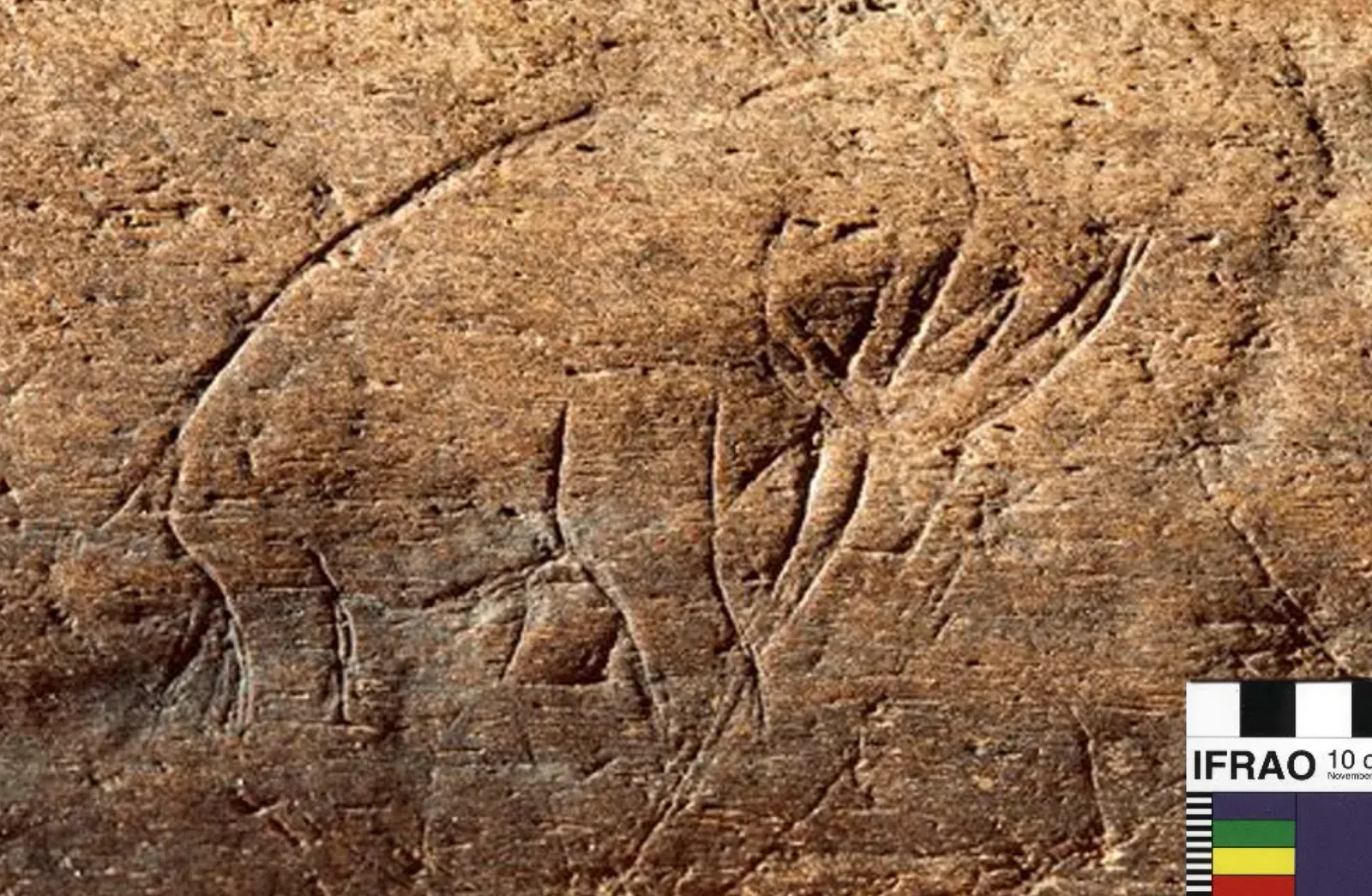
Doggerland wasn’t just a place people survived in. It was a place people expressed themselves in, with genuine craftsmanship and even early symbolic art.
One of the most striking finds is a 13,000-year-old aurochs or bison bone etched with a zigzag design, recovered near Brown Bank. That’s not a random scratch. Deliberate, repeated zigzag etching on bone strongly suggests decoration, counting, or ritual meaning – something archaeologists rarely find preserved this well from such an early period.
Weapon technology tells a similar story of skill and specialization. One famous discovery, an 8.5-inch barbed point carved from bone or antler, resembled a prehistoric harpoon and would soon reshape how researchers understood European prehistory. Combined with the sheer preservation quality of these finds, scientists working on the site have been blunt about what it means.
We have a completely intact landscape with a state of preservation that we can often only dream of on land.
Doggerland wasn’t a footnote to the Mesolithic. It may well have been its center.
#9 – A Shrinking Archipelago Watched by Its Own People
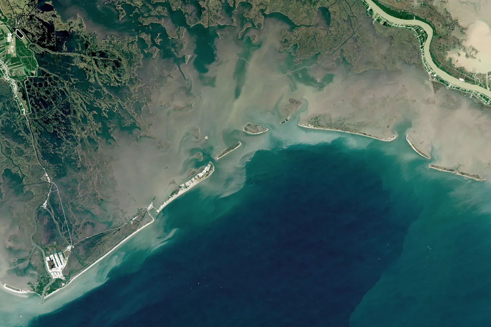
Doggerland didn’t vanish overnight in one dramatic gulp. For thousands of years, it slowly fractured into a shrinking chain of islands as the water crept steadily inward.
Its surface area decreased gradually as ice sheets melted and sea levels climbed, submerging the low-lying land beneath the sea one stretch at a time. This wasn’t quiet or unnoticed. It would have been visible within a single human lifetime, with familiar hunting grounds turning to marsh, then to open water, generation after generation.
At a Glance
- ~12,000 years ago: still a solid land connection between Britain and mainland Europe
- Gradual submersion: low-lying stretches turn to marsh, then to open water, over generations
- ~6150 BCE: the Storegga tsunami strikes what remains of the coastline
- ~5000 BCE: Dogger Bank, the last high ground, disappears beneath the sea
Eventually only the highest ground remained. The last surviving piece of the region, the elevated area known as Dogger Bank, was itself swallowed by rising waters around 5000 BCE.
Imagine being one of the final generations of Doggerlanders, watching your entire known world shrink from a continent to an island, then to a sandbank, then to nothing. It’s an unsettling parallel to modern coastal communities watching their own shorelines retreat – and it’s exactly why climate scientists keep bringing Doggerland up in conversations about sea-level rise today.
#10 – Ground Zero for a Tsunami That Struck Without Warning
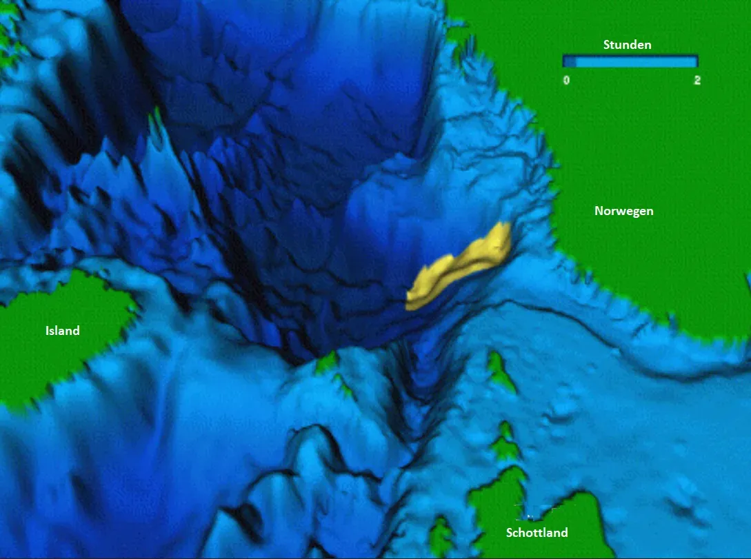
While rising seas slowly drowned most of Doggerland, its final chapters weren’t peaceful. They were catastrophic, triggered by one of the largest landslides in recorded geological history.
Researchers have confirmed that a tsunami, caused by an underwater landslide near Norway known as the Storegga slide, struck around 6150 BCE. This wasn’t an ordinary wave. A massive underwater collapse off the Norwegian coast sent a wall of water racing across the North Sea basin, slamming into whatever remained of Doggerland’s low-lying coastline with almost no warning at all.
Here’s the part experts still argue about: not everyone died out immediately. A 2020 study by British and Estonian scientists found that a small part of Doggerland’s population actually survived the aftermath, possibly becoming among the first in Britain to transition from hunter-gatherer life toward Neolithic farming.
That single detail complicates the popular “instant apocalypse” narrative. Some Doggerlanders didn’t just vanish. They adapted, migrated, and arguably helped kickstart Britain’s next cultural era.
#11 – The Final Plunge Beneath the North Sea
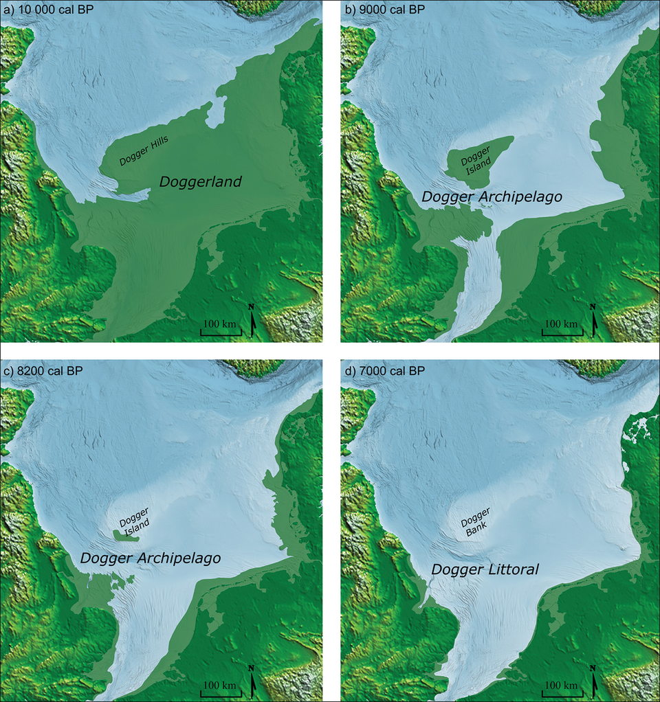
Eventually, even survival ran out of high ground. What began as a sprawling, continent-sized homeland ended as scattered wetland, and then as nothing at all.
The same forces that had made Doggerland a paradise for Mesolithic hunter-gatherers – climate change and melting glaciers – ultimately spelled its demise. It briefly held on as an island before slipping under the sea for good, taking the richest landscape in northwest Europe down with it. By roughly 6000 BCE, the transformation was essentially complete.
It’s no coincidence people have compared this to Atlantis. In the 20th century, French engineer Jean Deruelle even hypothesized that this event was what Plato was really describing in his works Critias and Timaeus, suggesting Doggerland was Atlantis itself.
Most historians reject a literal connection, and honestly, they’re right to. Doggerland’s real story doesn’t need embellishing. Researchers are quick to point out that it isn’t even that unusual, since similarly drowned coastal shelves exist worldwide. What makes it remarkable isn’t myth – it’s the plain fact that an entire, thriving, populated country genuinely disappeared beneath waves most of us now cross by ferry without a second thought.
The Bottom Line
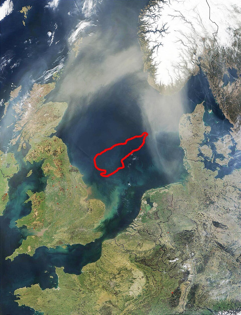
Doggerland’s real story is stranger than any Atlantis myth: a genuine, populated, river-fed continent slowly drowned over thousands of years, then got hit with a tsunami on its way out. It hosted megafauna, art, harpoons, and possibly proto-villages – not the empty land bridge most people imagine when they picture prehistoric Europe.
What’s most unsettling isn’t the mammoths or the myths. It’s how closely Doggerland’s slow-motion flooding mirrors what coastal cities are quietly facing again right now. The sea took an entire country once already, and most people have never even heard its name. Did we miss something that deserves a spot on this list? Drop your theory in the comments.