

Ever notice how some trees look like they’re permanently flinching away from an invisible shove? That’s not bad luck, poor soil, or a lightning strike you missed. It’s wind, and it’s been quietly signing its name across the landscape for decades, sometimes centuries. Most people drive right past these clues every single day without realizing they’re staring at a weather report written in bark, sand, and stone.
Here’s the part that surprised even us: some of these markers are more trustworthy than an actual weather station. Meteorologists and geomorphologists have used them for years to map prevailing winds in places where no instrument has ever been installed. Once you know what to look for, you’ll never look at a hillside, a dune, or a fence line the same way again.
#1 – Flagged Trees Point the Way
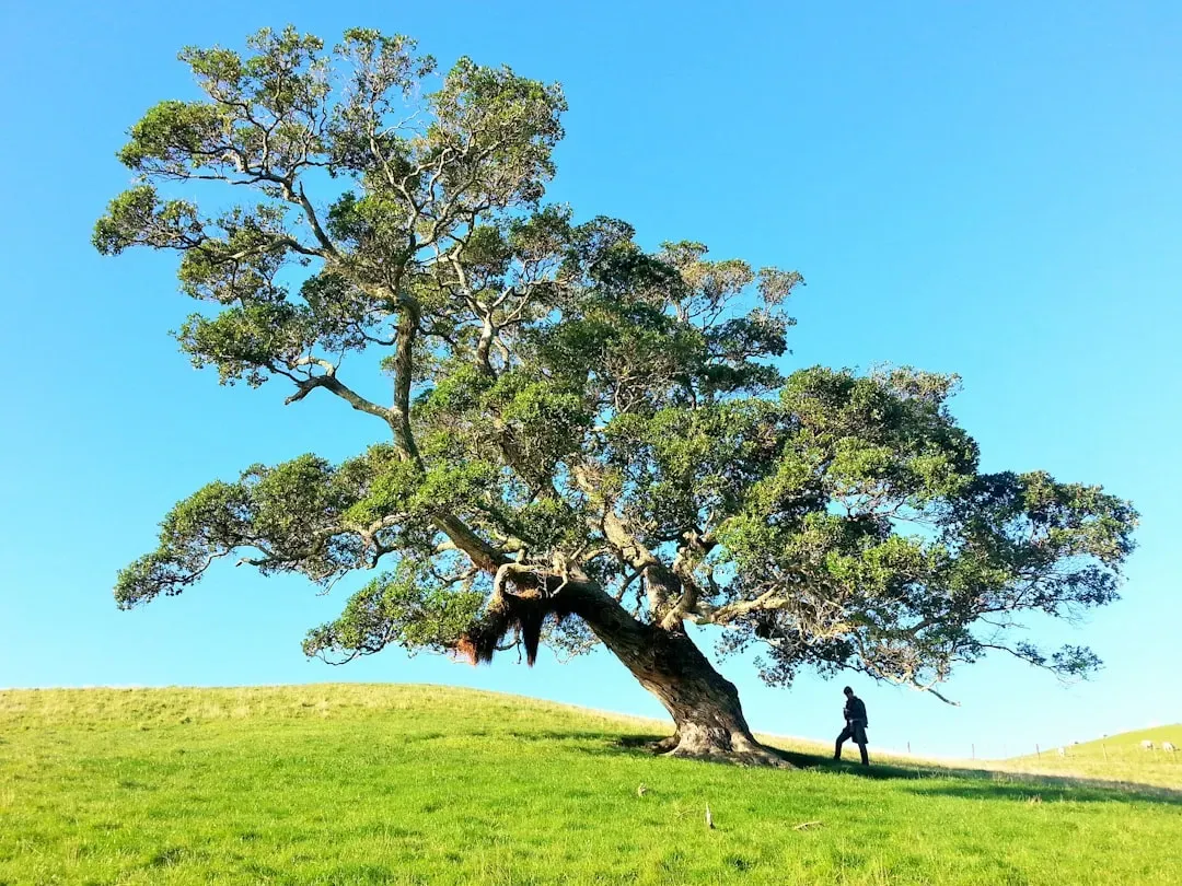
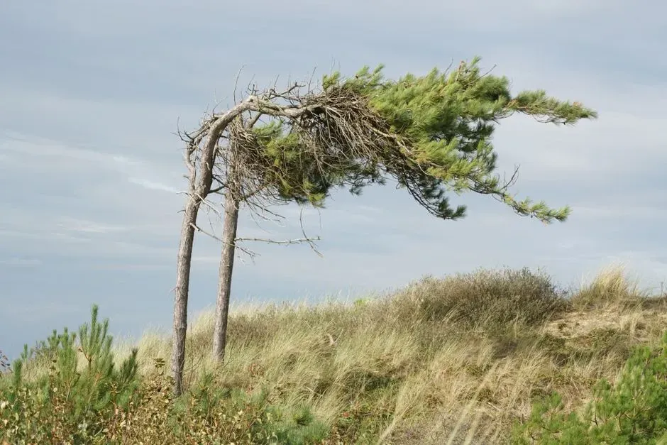
A tree that looks combed to one side isn’t damaged – it’s a living compass. Constant exposure to prevailing wind kills or stunts buds on the windward side while sparing growth downwind. Foresters call this a “flag” form, and once you learn to spot it, you’ll see it everywhere.
The effect shows up strongest on exposed ridgelines, coastal bluffs, and open plains where nothing breaks the airflow. A single flagged tree can reveal the dominant wind direction more reliably than a nearby weather station, simply because it represents years of averaged exposure instead of one gusty afternoon. Sitka spruce, juniper, and Monterey cypress are the classic textbook examples, chosen because their branch tissue reacts so visibly to chronic one-sided stress. But the flagged tree is just the warm-up. Wait until you see what wind does to an entire forest near a mountaintop.
Fast Facts
- Foresters call permanent one-sided wind damage a “flag” form
- Classic flagged species: Sitka spruce, juniper, and Monterey cypress
- Most visible on exposed ridgelines, coastal bluffs, and open plains
- Reflects years of averaged wind exposure, not a single storm
#2 – Krummholz Forests Tell an Even Older Story
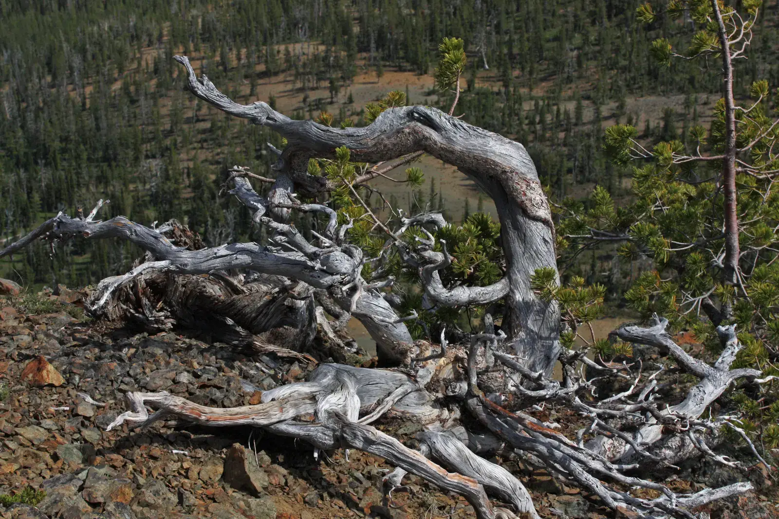
Near mountain treelines, trees don’t just lean – they crawl. This stunted, wind-sheared vegetation is called krummholz, German for “crooked wood,” and it grows low and dense, hugging the ground like a natural windbreak that built itself.
Krummholz forms because wind desiccates and physically abrades any shoot brave enough to poke above the protective snowpack. Over generations, the entire community trains itself sideways to survive. The living branches often extend only on the leeward side, creating a banner shape you can read from a distance like an arrow pointing downwind. Alpine ecologists use this orientation to map wind exposure zones on mountains long before an anemometer ever gets installed. Deserts play the same trick with sand instead of wood, and it’s even more dramatic.
#3 – Barchan Dunes Are Nature’s Wind Arrows
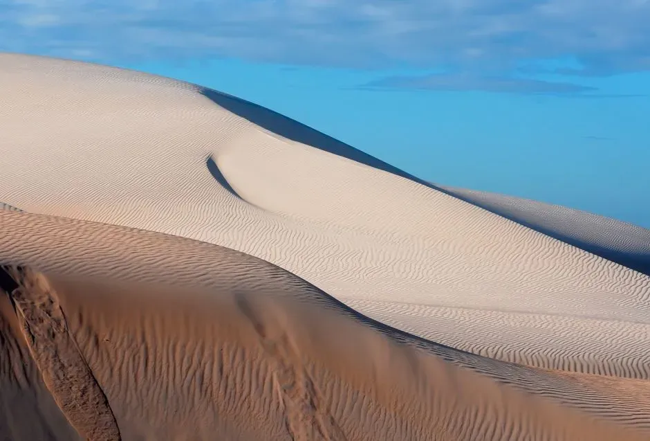
Crescent-shaped sand dunes, called barchans, are essentially wind vanes made of sand. Their “horns” always point downwind, while the gentler slope faces directly into the prevailing breeze – a shape that never lies about which way the air is moving.
These dunes form where wind blows strong and consistent, with little vegetation to anchor the sand in place. Wind pushes grains up the shallow windward slope, then drops them over the crest onto the steeper leeward face, migrating the entire dune downwind over time. Some barchan dunes travel dozens of feet per year, and their shape realigns almost immediately if the dominant wind shifts. Satellite images of the Sahara and parts of coastal Peru show entire fields of these dunes marching in unison, all pointing the same direction – an unmistakable signature visible from space. Sand doesn’t only move in dunes, though. It ripples too, and the ripples tell an even faster story.
#4 – Sand Ripples Hold a Miniature Version of the Same Clue
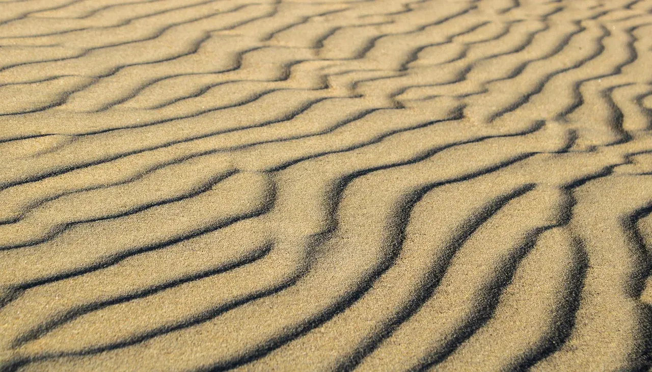
Zoom into any dune field and you’ll find the same asymmetry repeated in miniature. Sand ripples have a gentle windward slope and a steeper leeward face, mirroring the exact structure of the giant dunes towering above them.
These ripples form through saltation, the hopping motion of sand grains carried by wind, and their crest lines run perpendicular to the prevailing airflow. Because ripples reform within hours after a wind shift, they’re actually a better short-term wind indicator than dunes, which take far longer to reorient. Geologists studying both modern beaches and ancient sandstone use fossilized ripple patterns to reconstruct wind directions from millions of years ago. It’s a strange thought – something this small preserving something this old. The next clue isn’t in soft sand at all. It’s carved straight into solid rock.
Quick Compare
- Sand ripples: reform within hours of a wind shift
- Barchan dunes: take far longer to fully reorient
- Ripples: best for reading short-term wind direction
- Dunes: best for reading long-term prevailing wind
#5 – Ventifacts Are Rocks Sculpted by Relentless Wind
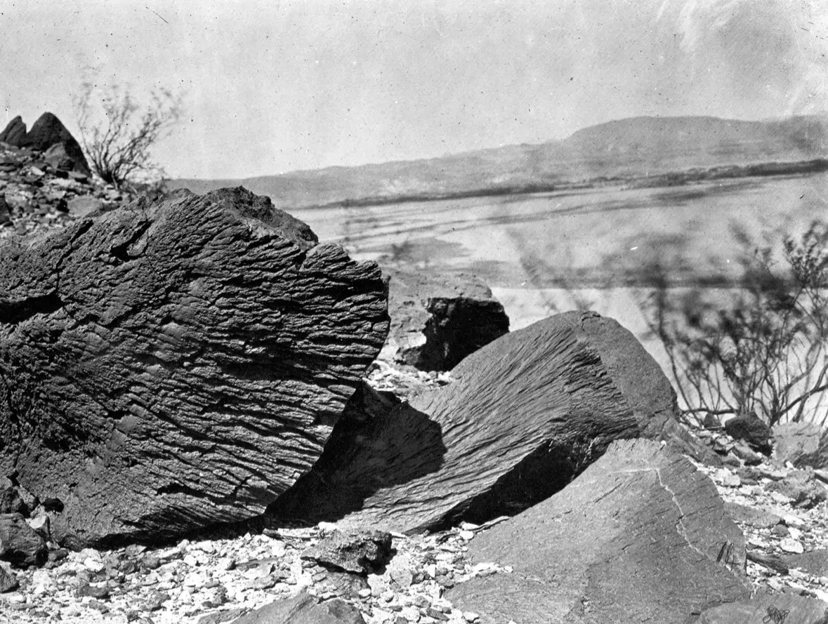
Some rocks aren’t shaped by rivers or glaciers at all – they’re shaped by wind-blown grit acting like slow-motion sandpaper. These wind-abraded stones, called ventifacts, develop flat, polished facets on whichever side faces the prevailing wind.
Over long stretches of time, airborne sand and dust continuously strike one exposed face of a rock while the sheltered side stays rougher and less worn. A single ventifact can display multiple distinct facets, each one marking a different dominant wind direction the rock endured as regional patterns shifted over geologic time. These formations turn up in cold deserts, polar regions, and arid basins where sparse vegetation lets abrasive particles travel unimpeded. Antarctic researchers frequently point to ventifacts as reliable, low-tech evidence of long-term wind regimes in places where instruments simply can’t survive the cold. Rock isn’t the only large-scale feature that gets this treatment – entire ridges do too.
#6 – Yardangs Are Streamlined by Decades of Steady Airflow
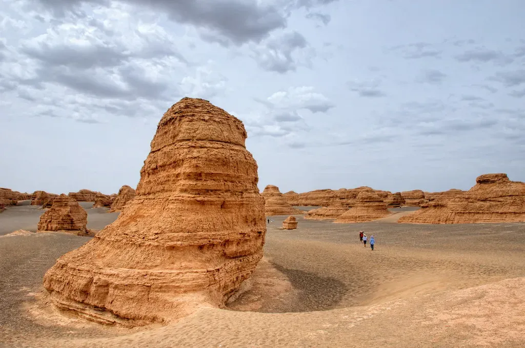
In wind-battered desert regions, entire ridges of rock or hardened sediment get streamlined into long, narrow shapes called yardangs. Their long axis always aligns with the prevailing wind direction, as if a rock formation had been stretched out by an invisible hand.
Yardangs form when wind erosion attacks softer rock layers faster than harder ones, leaving elongated ridges separated by wind-scoured grooves. Some yardang fields stretch for miles in perfectly parallel formation, offering one of the most visually striking proofs that a single wind direction dominated a region for an extremely long stretch of geologic time. They’ve even been spotted on Mars, where scientists use their orientation to reconstruct that planet’s ancient wind patterns. On Earth, yardangs in places like China’s Lop Nur desert remain a go-to case study for how patient, directional pressure reshapes solid ground. Snow does something remarkably similar back on our own planet, and it happens a lot faster.
#7 – Snow Drifts Reveal Wind Direction in Real Time
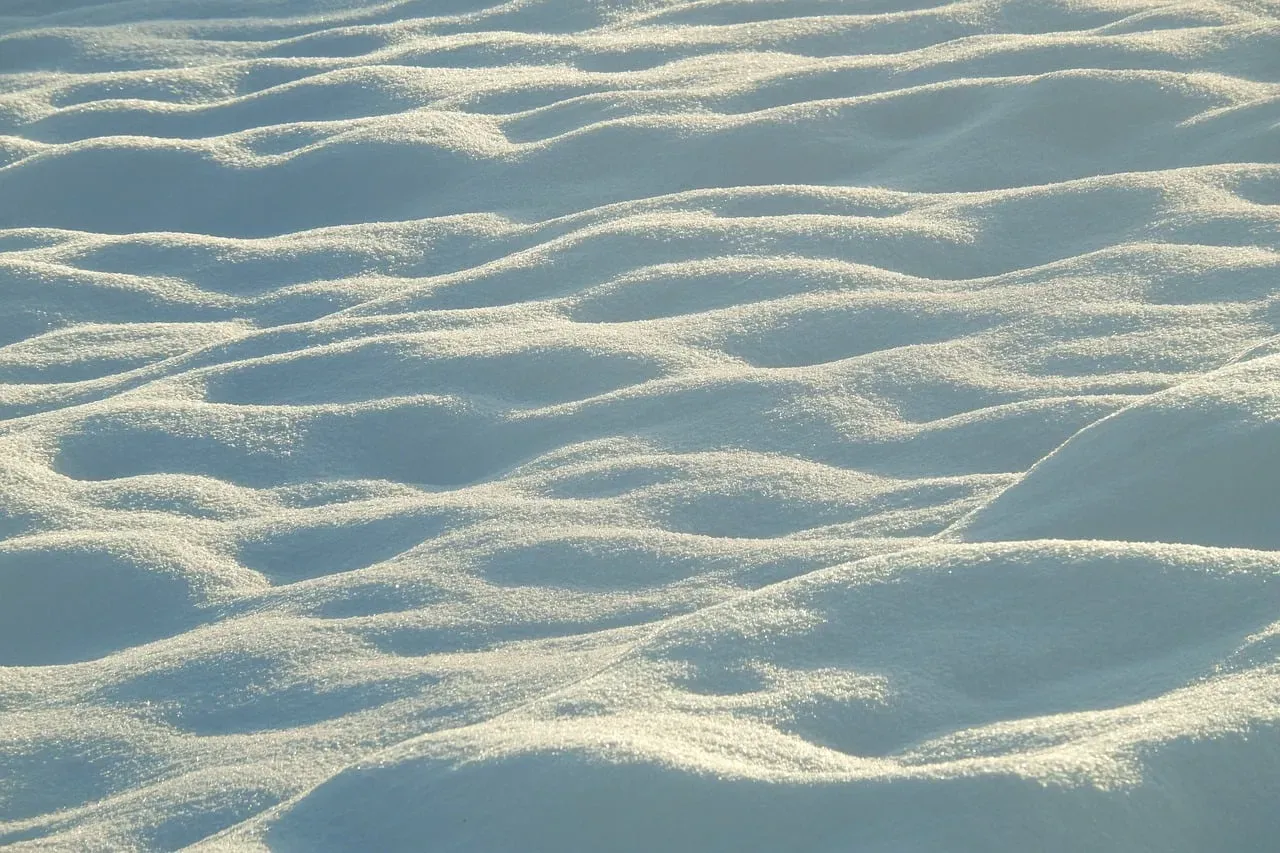
After a storm, snow doesn’t just fall – it gets rearranged. Drifts pile up on the leeward side of obstacles like fences, buildings, and rock outcrops, while the windward side stays comparatively bare or scoured clean.
This happens because wind loses speed and carrying capacity as it passes an obstruction, dropping its snow load just past the barrier. A sharp-edged, overhanging snow cornice often forms exactly opposite the prevailing wind direction, and avalanche forecasters treat these formations as a critical safety clue on mountain slopes. Unlike rock or dune formations that take years to develop, drift patterns update after every single storm, making them one of the fastest-changing wind indicators in nature. Highway crews and backcountry skiers both rely on drift shape to judge which way storms typically track through a valley. Living plants react to wind just as visibly, though on a very different timescale.
At a Glance
- Drifts pile up on the leeward, or downwind, side of obstacles
- Windward sides stay scoured clean or bare
- Cornices form directly opposite the prevailing wind
- Drift patterns can shift after every single storm
#8 – Flattened Crops and Grasses Trace Storm-Level Wind Patterns
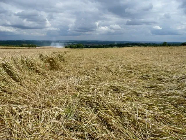
Anyone who’s driven past a wheat field after a windstorm has seen lodging – the flattening of stalks in one uniform directional pattern. A single storm can cause it, but chronic exposure creates a lasting lean even in undisturbed grasslands that never see a plow.
Grasses and cereal crops have weak stems compared to trees, so they respond to wind stress almost instantly, bending in whatever direction the air pushes them. Agricultural researchers have long used lodging patterns as an informal but surprisingly accurate way to map local wind corridors across open farmland, especially where dense weather station coverage doesn’t exist. Some experts argue this method deserves more attention in modern precision farming, since drone imagery could track lodging direction across huge fields and flag wind-prone zones before they cause real yield loss. Fine wind-blown particles create an entirely different, dustier kind of evidence.
#9 – Loess Deposits Show Where Wind-Blown Dust Settled

Some of the most fertile soil on Earth exists because of wind – specifically, thick deposits of fine silt called loess that pile up downwind of deserts, glaciers, or dry riverbeds. The thickness and spread of these deposits map directly onto ancient prevailing wind paths, like a fossilized weather map.
Loess forms when wind lifts extremely fine particles and carries them, sometimes for hundreds of miles, before dropping them as the wind slows and loses energy. Regions like China’s Loess Plateau contain deposits over a hundred meters thick in places, built up over hundreds of thousands of years of consistent wind transport from interior deserts. Soil scientists trace the thinning gradient of these layers to reconstruct exactly which direction ancient winds blew, and how strong they were compared to today. It’s a slow, quiet process, but it leaves one of the most durable wind records on the planet. Large bodies of water tell a faster, far more visible version of the same story.
#10 – Wave Patterns and Shoreline Erosion Reflect Dominant Wind Fetch

Lakes and coastlines are constantly reshaped by the direction wind travels across open water – a distance meteorologists call “fetch.” The longer the fetch in one consistent direction, the bigger the waves and the more brutal the shoreline erosion on that side.
This is why one shore of a lake often ends up rocky and stripped bare while the opposite shore stays calm, sandy, and sheltered from the worst of it. Coastal engineers routinely study long-term erosion patterns on one side of a shoreline to confirm which direction storms and prevailing winds most consistently approach from. Sand spits curve in the direction of longshore drift, which is itself driven by the angle of prevailing wind and wave attack. Beachgoers rarely think about it, but the entire shape of a familiar coastline is essentially a wind diagram drawn in sand and stone over centuries. The final clue on this list ties almost everything else together.
Why It Stands Out
- Erosion patterns build over centuries, not just single seasons
- One shore often ends up rocky and bare; the other stays calm and sandy
- Sand spits curve in the exact direction of longshore drift
- Engineers use erosion patterns to confirm dominant storm direction
#11 – Ridge Vegetation Zonation Shows the Full Wind Story at a Glance
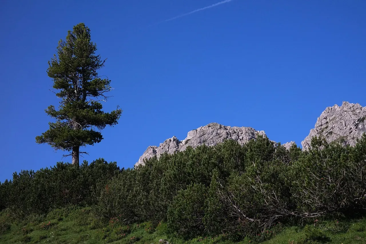
On exposed mountain ridges, you can often see a stark vegetation line where lush, tall trees on one side give way abruptly to stunted, sparse growth on the other. It’s rarely about soil or sunlight. Almost always, it’s about which side takes the brunt of the prevailing wind.
The windward slope faces constant desiccation, temperature swings, and mechanical stress, which suppresses plant height and diversity, while the sheltered leeward slope allows for taller, denser growth. This zonation can be so precise that ecologists have used ridge-line vegetation contrast alone to estimate prevailing wind direction with accuracy comparable to instrumented weather data. Some researchers argue this method deserves more respect than it gets, since it captures decades of average conditions rather than a single measurement point. Combined with flagged trees, krummholz, dune shape, and erosion patterns, ridge vegetation zonation completes the picture – proof that a landscape, once you know how to read it, never stops talking about the wind that built it.
The Bottom Line
Here’s my honest take after digging through all eleven of these: we’ve gotten a little too obsessed with instruments and a little too lazy about actually looking at the land. A weather station gives you a snapshot. A flagged tree, a krummholz forest, or a hundred-meter loess deposit gives you a verdict built over decades or millennia, and that’s arguably more honest data than anything a sensor spits out in real time.
Whether it’s a snowdrift behind a fence or a ridge where one side of the forest looks like an entirely different climate, prevailing wind leaves fingerprints everywhere if you’re willing to slow down and look. The land has been keeping this record long before we ever thought to. Which of these signs have you actually spotted in real life? Drop it in the comments and tell us where.