
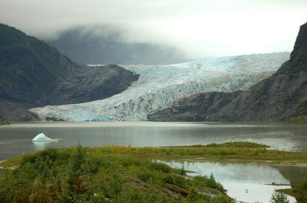
Imagine a force of ice so heavy it can bend solid rock, grind mountains to flour, and drag entire boulders like toys. Then imagine that same force melting away, inch by inch, leaving the landscape scattered with clues like a giant abandoned toolbox. That is what happens when a glacier retreats.
Glaciers do not just disappear; they rearrange the world on their way out. They carve, shove, scratch, dump, and flood, then slowly shrink back and expose everything they have built. The result is a landscape full of strange shapes and hidden stories, from long winding hills to lonely boulders that clearly do not belong.
Once you know what to look for, you can stand in a valley, on a hill, or beside a lake and suddenly realize: a glacier did this. Below are eleven of the most fascinating , and how you can recognize them out in the real world.
#1 Moraines: The Glacier’s Abandoned Construction Sites
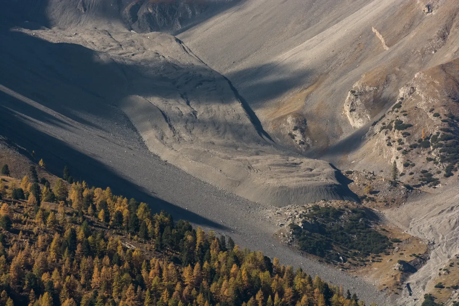
One of the clearest signatures of a former glacier is a moraine, which is basically a pile or ridge of rocky debris the ice dragged along and then dropped. Picture the front of a bulldozer pushing a chaotic pile of stones, gravel, sand, and mud – then the bulldozer backs away. The pile that remains is a terminal moraine, marking the furthest advance of the ice.
There are also lateral moraines along the sides of where the glacier once flowed, and ground moraines, which are wider, more subtle blankets of till smeared across the land. When the glacier melts, these piles and ridges look like oddly regular hills or berms made of unsorted, rough material with everything from fine silt to car‑sized rocks mixed together. That messy mixture – without neat layering – is a huge clue that ice, not water, did the work.
If you ever see a curved ridge crossing a valley like a low dam, you may well be looking at an old terminal moraine. Some key things moraines tend to show:
- Very mixed rock sizes all jumbled together
- Little to no layering or sorting like you’d see in river sediments
- Often forming arcs across valleys or long ridges along former glacier edges
In many parts of the world, people now live, farm, and build roads directly on moraines, not realizing they are literally sitting on the rubble line of an ancient ice front.
#2 U‑Shaped Valleys: Where Ice Rewrote the Mountain Outline
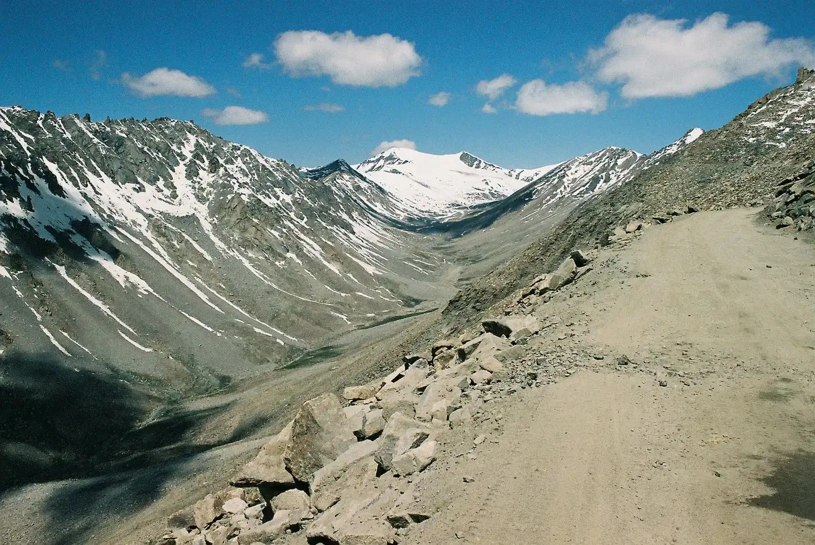
Before glaciers moved in, most mountain valleys were typically V‑shaped, carved by rivers that cut sharply into the rock. When ice takes over, it fills the valley like thick, slow concrete, grinding against the sides and bottom. Over thousands of years, this transforms a narrow V into a broad U, with steep walls and a relatively flat valley floor.
Once the glacier retreats, that U‑shape becomes a dead giveaway. Hikers often walk through these valleys without thinking about the geometry, but if the sides are towering and straight, and the floor is wide and level, you are almost certainly seeing the cross‑section of a past glacier. It is like nature took a knife to the valley’s sides, smoothing and widening everything dramatically.
U‑shaped valleys can be surprisingly dramatic. You might see hanging waterfalls spilling in from side valleys, sheer cliffs rising up nearly vertical, and broad grassy meadows occupying what used to be the glacier’s bed. It is almost like an empty bathtub: deep, smooth, and shaped perfectly for something massive that is no longer there.
#3 Cirques and Tarn Lakes: Glacial Amphitheaters in the Mountains
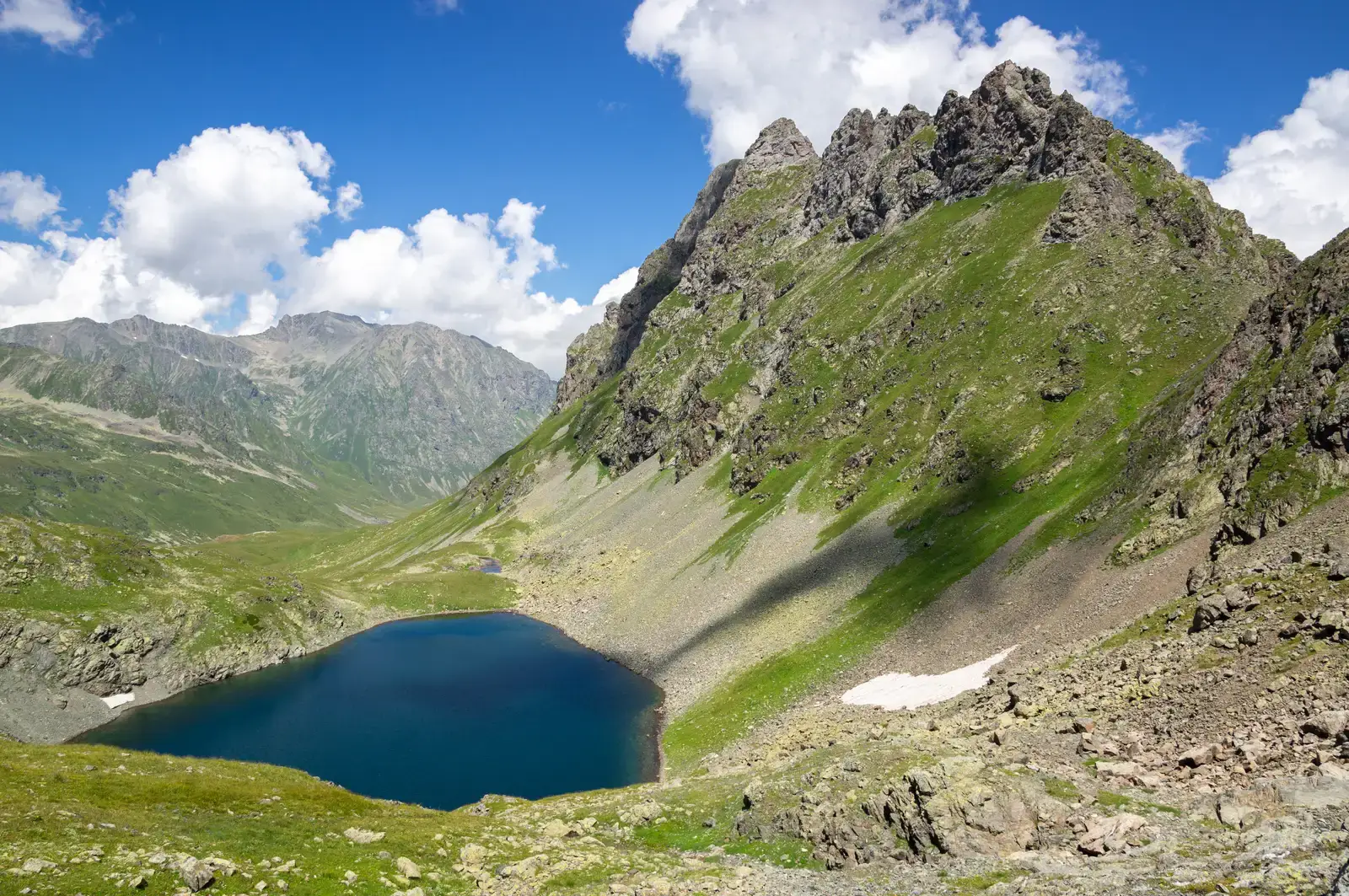
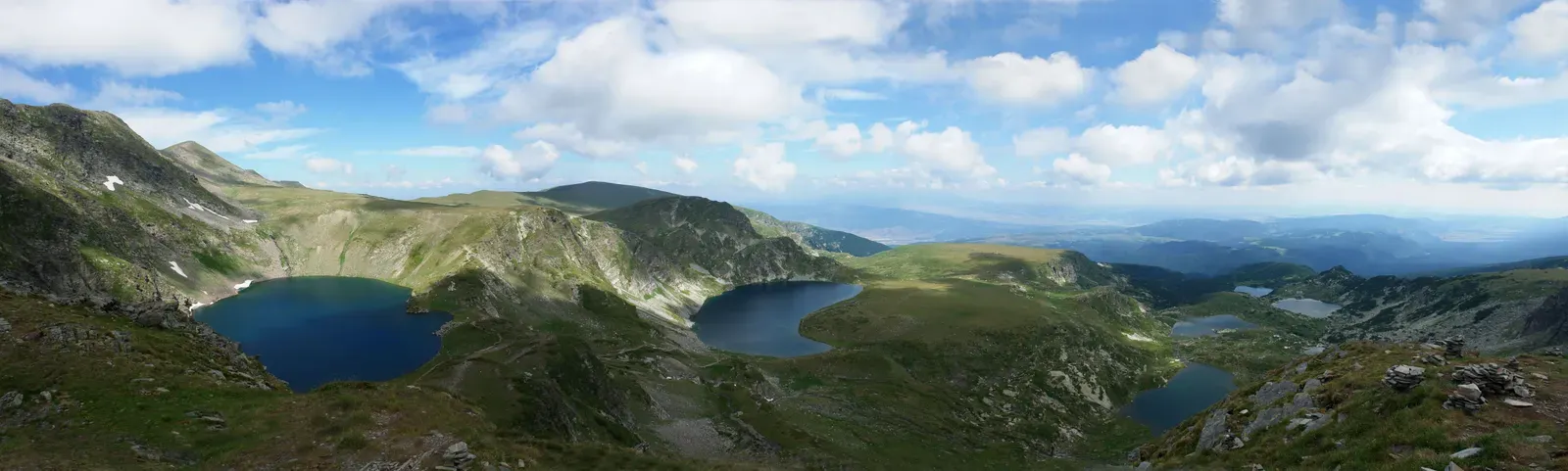
High up near mountain ridges, glaciers often begin as small snowfields that grow and compact into ice, carving out bowl‑shaped hollows called cirques. These cirques look like giant natural amphitheaters, surrounded by steep rock walls on three sides and open on one side where the glacier once flowed out and down. When the ice melts away, that hollow often fills with meltwater, forming a small, cold lake called a tarn.
Cirques are some of the most beautiful features glaciers leave behind. They feel like hidden rooms in the mountains, enclosed and quiet. If you have ever hiked to a small, glassy lake tucked in a steep rocky bowl with a notch at one end, there is a good chance you were sitting in an old cirque staring at a tarn. The lake’s dark, clear water and the surrounding cliffs are both part of that glacial legacy.
These features tell a pretty clear story if you know how to read them:
- A steep, curved back wall where ice once accumulated and scoured
- A lip or threshold at the front where the glacier overflowed
- Often a deep, surprisingly cold little lake occupying the hollow
When you stand beside a tarn in a cirque, you are basically standing in the glacier’s old cradle – the very spot where it was born, grew, and then finally vanished.
#4 Fjords: Sunken Valleys That Became Dramatic Seas
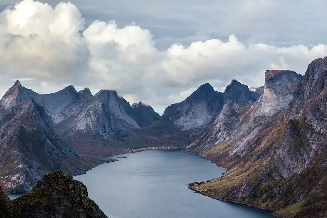
In coastal mountains, glaciers that reach the sea can carve valleys so deep that, when the ice melts and sea level rises, ocean water floods in. The result is a fjord: a narrow, steep‑walled inlet that can run far inland like a flooded U‑shaped valley. These are some of the most striking landscapes on Earth, combining vertical cliffs, deep water, and often hanging waterfalls that tumble straight into the sea.
Fjords form because glacial ice is heavy and powerful enough to cut far below the level that rivers usually erode to. Later, as ice sheets shrink and global sea level rises, those overdeepened valleys become perfect channels for seawater. When you see a long, winding, steep‑sided inlet with deep blue water and almost no gentle shoreline, that is the classic fingerprint of a former glacier.
What makes fjords especially fascinating is how alive they are today. They can host rich marine ecosystems, influenced by cold, nutrient‑rich waters rising from their depths and freshwater input from rivers and remaining glaciers. So while the ice may be gone, its legacy shapes everything from local weather patterns to where people build ports and towns along the coast.
#5 Eskers: The Frozen River Channels Turned to Stone
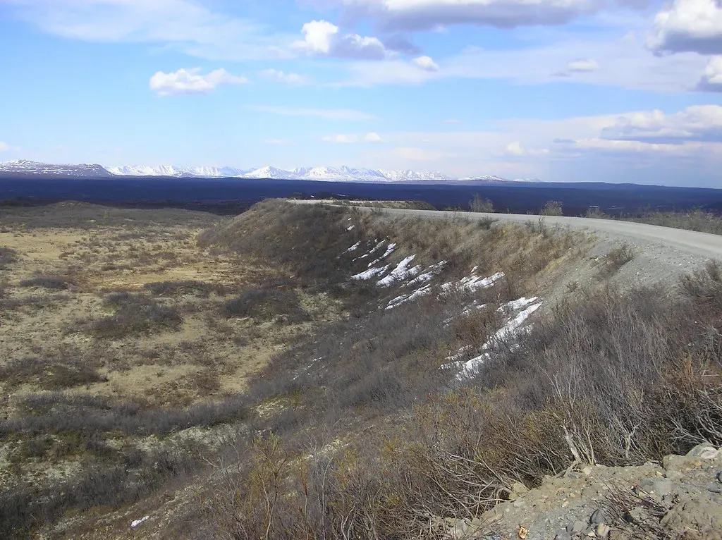
Eskers are one of those glacial features that sound simple in theory but look wonderfully odd on the ground. While a glacier is still in place, meltwater streams can flow in tunnels within or under the ice, carrying sand and gravel along their channels. When the glacier melts away, the sediment that filled those tunnels is left behind as long, sinuous ridges that snake across the landscape. Those ridges are eskers.
Imagine someone poured gravel into a hose laid over the ground, then pulled the hose away, leaving a winding gravel ridge sitting there by itself. That is basically an esker on a smaller scale. They can stretch for many kilometers, sometimes cutting right across swamps, fields, and hills in ways that make no sense if you are thinking only in terms of surface rivers.
Eskers are practical as well as geological curiosities. Because they are made of sand and gravel, people often mine them for construction materials, and roads sometimes follow their crests to stay above surrounding low, wet land. If you see a narrow, higher band of gravel running in a gentle S‑curve across otherwise flat terrain, there is a decent chance you are walking along the skeletal trace of a long‑vanished meltwater tunnel.
#6 Kettle Lakes and Kettle Holes: Where Dead Ice Finally Let Go
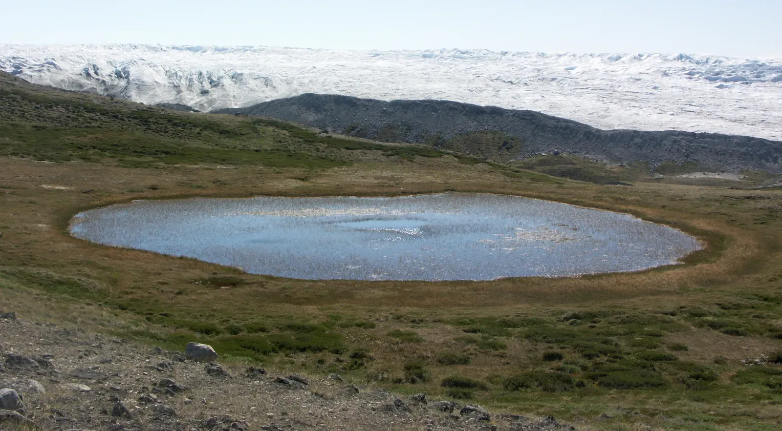
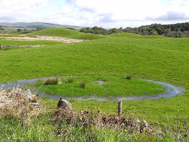
Not all glacier remnants move with the main ice mass. As a glacier retreats, chunks of ice can break off and become stranded in the debris left behind. These isolated ice blocks get buried by sediment and slowly melt over years or even decades. When they finally vanish, the overlying material collapses, leaving a depression called a kettle. If that depression fills with water, you get a kettle lake.
Kettle landscapes often look pockmarked, with dozens or even hundreds of irregular hollows scattered across an area that was once under ice. Some kettles are dry, others are wetland bogs, and some are small, rounded lakes with no obvious river flowing in or out. That lack of clear inlets and outlets is one of the clues that you are looking at a kettle rather than a standard river‑formed pond.
You can think of kettles as the footprints of dying ice. Key traits many kettle lakes share include:
- Round or irregular shapes with fairly steep sides
- Little connection to streams or rivers
- Often found tucked into broad outwash plains or near moraines
They are quiet features, easy to overlook, but each one marks a spot where the glacier was reluctant to let go, clinging on as a block of “dead ice” long after the main body had retreated upslope.
#7 Glacial Erratics: Giant Boulders That Clearly Do Not Belong
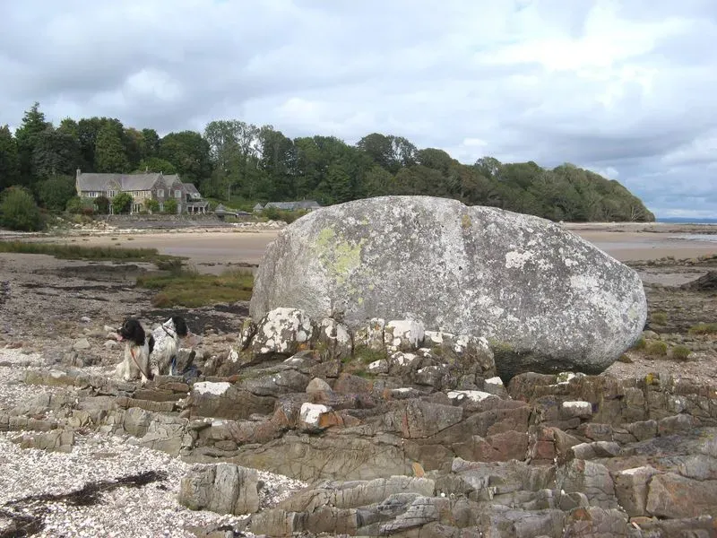
Few glacial leftovers are as charmingly weird as erratics. These are individual rocks or boulders, sometimes absolutely massive, that have been picked up by a glacier, carried for many kilometers, and then dropped in a place where the local bedrock is completely different. You might see a lone granite block sitting in a field of sandstone, or a house‑sized boulder perched on a gentle hillside with no mountains anywhere close by.
Because glaciers are like conveyor belts made of ice, they can transport rocks far from their sources. When the ice melts, the cargo is simply abandoned. Geologists can sometimes trace erratics back to their original locations by matching their rock type, showing just how far the glacier traveled. In some flat regions, erratics are the only obvious hint that thick ice once covered everything.
Erratics tend to capture people’s imagination. They often become local landmarks, spiritual sites, or just curiosity stops by the roadside. From a scientific perspective, they reveal things like:
- The direction the glacier flowed
- The kind of bedrock that lay upstream under the ice
- How powerful and extensive the ice sheet or glacier once was
I still remember standing next to a solitary boulder in a farm field, realizing it had been dragged there by ice from mountains over the horizon. It felt oddly humbling, like shaking hands with a traveler from a completely different age.
#8 Striations and Polished Bedrock: Scratches from an Ice‑Loaded Sandpaper
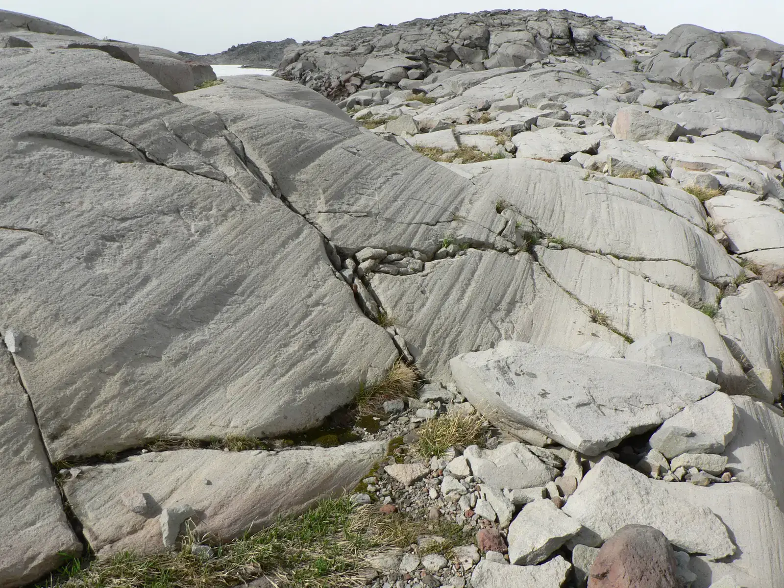
Glaciers do not just carry loose rocks; they also drag them against the bedrock beneath the ice like a gigantic sheet of sandpaper. Those rocks carve long, parallel scratches, called striations, and can polish the underlying rock to a surprising smoothness. When the ice retreats, it exposes bedrock surfaces that look scraped and shiny, with grooves all running roughly the same direction.
If you look closely, you might see not only fine scratches but larger grooves and chatter marks carved where bigger stones bounced and scraped along. These marks are incredibly useful to scientists because they show the direction in which the glacier moved. If you stand on a polished rock surface with striations and follow their line, you are literally lining yourself up with the ice’s path.
These surfaces can be easy to miss unless the light hits just right, but once you notice them, they are unforgettable. Some telltale signs:
- Rock that is unusually smooth compared to its surroundings
- Fine, straight, parallel lines etched into the surface
- All the scratches oriented in broadly the same direction
Walking across such rock can feel strange – almost like walking on a floor that a giant carefully scraped clean. It is a quiet but powerful reminder of how relentless moving ice can be.
#9 Outwash Plains: Braided Rivers and Sprawling Sediment Fans
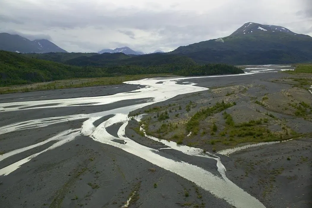
As glaciers melt, streams of water pour out from beneath and in front of the ice, carrying loads of sand, gravel, and silt. Unlike the messy, unsorted piles of a moraine, this meltwater starts to sort the material by size as it spreads out. Over time, this builds a broad, often flat expanse called an outwash plain, covered by layers of glacial sediments and crisscrossed by braided rivers.
Outwash plains can look deceptively simple – just wide, gravelly fields with multiple shallow channels weaving in and out. But they tell a story of intense seasonal melt, floods, and constant reworking by water flowing off the ice. Sediments are typically better sorted here, with coarse material closer to the glacier and finer sand and silt deposited farther away.
If you zoom out mentally, you can imagine the glacier as a giant faucet at the top of the system, turning up and down with seasons and climate. The outwash plain becomes its fan‑shaped apron of debris. Common hallmarks include:
- Broad, open surfaces gently sloping away from a former glacier front
- Multiple, shifting river channels with gravel bars and islands
- Layered sand and gravel deposits more organized than in moraines
Today, people often use these plains for farmland, roads, and even airports because they tend to be relatively flat and well drained – another way glacial legacies quietly shape modern life.
#10 Drumlin Fields: Streamlined Hills Shaped by Flowing Ice
Drumlins are one of the more mysterious features left behind by glaciers. They are smooth, oval or cigar‑shaped hills made of till or bedrock, often found in swarms called drumlin fields. The typical drumlin is blunt on one end and gently tapered on the other, aligned in the direction the glacier once flowed, like a field of frozen teardrops or upside‑down spoons.
Scientists are still debating the exact mechanisms that create drumlins, but the general idea is that they form beneath moving ice as it molds the sediment or rock beneath it. When the glacier retreats, those streamlined hills remain, giving the landscape a distinct, rippled texture that you can sometimes only fully appreciate from the air.
On the ground, drumlins may just feel like a series of oddly consistent hills, all pointing the same way. Yet they are incredibly useful clues, offering:
- Clear indicators of the direction and behavior of ice flow
- Evidence of how fast or thick a past ice sheet might have been
- Gentle, fertile slopes that people often farm or build on
Driving through a drumlin field can be strangely soothing: up, down, up, down, over and over, following the quiet rhythm of long‑gone ice.
#11 Proglacial Lakes and New Wetlands: Water Filling the Ice’s Empty Seat
As a glacier pulls back, it often leaves behind basins and blocked valleys that quickly fill with meltwater. These are proglacial lakes – water bodies that form directly in front of or beside a retreating glacier. Some are temporary, held back by weak moraines that can suddenly fail in outburst floods. Others become long‑lasting lakes, occupying deep over‑excavated basins carved by the ice.
Beyond the obvious lakes, retreating glaciers also create a patchwork of wetlands: marshes, bogs, and shallow ponds that fill low spots in the newly exposed land. Sediments begin to accumulate, plants move in, and over time these soggy areas can transform into rich ecosystems. What starts as freshly exposed, raw glacial debris can evolve into surprisingly biodiverse habitats filled with insects, birds, and aquatic life.
These water bodies and wetlands act as the final adjustment phase after the ice has gone, letting the landscape settle into a new equilibrium. Some common patterns include:
- Lakes dammed by moraines or bedrock thresholds
- Shallow, irregular wetlands in depressions on outwash or till
- Rapid ecological change as plants colonize bare ground and shorelines
Standing by a proglacial lake today, watching icebergs calve from the remaining glacier tongue, you are literally seeing the landscape rewrite itself in real time – water quietly taking the seat that ice once occupied.
Conclusion: Reading the Ghosts of Ice in Today’s Landscapes
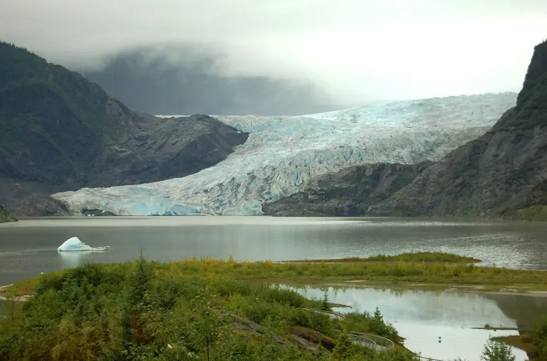
When a glacier retreats, it does not leave behind a clean slate. It leaves a crowded stage full of landforms, clues, and scars: moraines that mark its front lines, U‑shaped valleys and fjords that trace its path, erratics that reveal its reach, and subtle scratches on bedrock that whisper the direction it flowed. Once you learn to recognize these, it becomes almost impossible to see any mountainous or formerly glaciated landscape as “just scenery” again. Everywhere you look, you see evidence of enormous forces that used to fill the space where now there is only air.
Personally, I think that is the real magic of glacial geology. It is not just about memorizing names like drumlin or esker; it is about realizing that the ground under your feet is a story, and glaciers are some of the most dramatic authors nature has ever had. In a time when many of today’s glaciers are shrinking at a worrying pace, learning to read what past ice left behind feels both scientifically fascinating and emotionally unsettling. These landforms are not just relics – they are reminders that Earth’s climate, and its landscapes, can change on a scale that dwarfs human lifetimes.
As modern glaciers retreat, they are rapidly adding new chapters: fresh moraines, new kettle lakes, expanding proglacial lakes, and newly exposed bedrock already starting to polish under the next winter’s snow and melt. The big question is whether we will treat these features as quiet background scenery, or as warnings and lessons written into stone, water, and soil by ice that has seen more change than we can easily imagine. Next time you step into a wide valley or pass a lonely boulder in a field, will you wonder what the glacier that placed it there might have to say about our future?