Brazil – The government rolled out a detailed deforestation mapping tool to equip commodity producers with data needed for the European Union’s anti-deforestation regulation.
A Milestone in Deforestation Detection
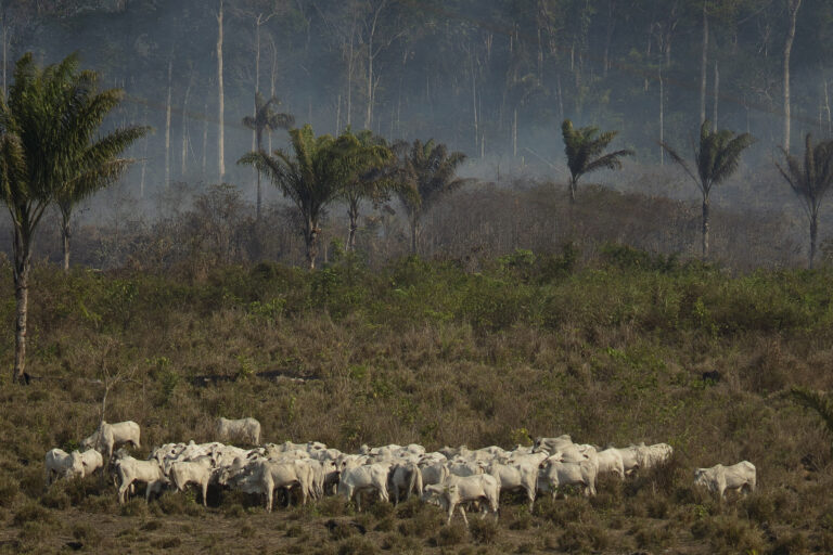
A Milestone in Deforestation Detection (Image Credits: Imgs.mongabay.com)
Researchers at the National Space Research Institute (INPE) produced the nation’s first deforestation maps using polygons as small as half a hectare, a precision level demanded by the EU Deforestation Regulation (EUDR).
This breakthrough marked the initial effort to surpass the one-hectare threshold of INPE’s longstanding PRODES system, which tracks annual Amazon deforestation from August to July.
Claudio Almeida, coordinator of INPE’s BiomasBR program, highlighted the achievement during an interview. “It was the first time we did [this in] less than 1 hectare,” he stated.
The maps specifically target December 2020, aligning with EUDR’s cutoff date for deforestation-free certification.
Navigating EUDR’s Strict Requirements
The EUDR, now set to take effect at the end of 2026 after successive delays, mandates geolocated proof that exports avoid land deforested after December 31, 2020.
Exporters must also demonstrate compliance with local laws and absence of social issues like enslaved labor.
The rule covers seven key commodities central to Brazil’s trade with Europe:
- Soy
- Cattle
- Rubber
- Palm oil
- Coffee
- Cocoa
- Timber
Soy meal alone represents one-third of Brazil’s exports, with half directed to the EU, underscoring the stakes for producers.
Innovative Tech Tackles Mapping Challenges
INPE addressed the Amazon’s rainy season obstacles – persistent clouds that hinder satellite imagery – through the Brazil Data Cube (BDC).
Almeida explained how BDC aggregates remote sensing images across periods, employing artificial intelligence, machine learning, and time-series analysis to create cloud-free composites by selecting optimal pixels from multiple sources.
Radar imagery filled gaps in remaining cloudy zones, ensuring complete coverage of Brazil’s territory for the critical December 2020 snapshot.
This high-resolution approach extends beyond the Amazon to all biomes nationwide.
Centralizing Data on the Agro Brasil Platform
The agriculture ministry commissioned the maps and integrated them into the Agro Brasil + Sustentável platform, launched in 2024 and opened to producers in late December 2025.
Lara Line Pereira de Souza, general coordinator for plant production at the ministry, described its purpose. “We needed to offer a public, universal, free tool to producers so that they could issue all the necessary documents for due diligence,” she said.
The system consolidates databases from public agencies like IBAMA and private traceability efforts, delivering compliance checklists or ratings.
André Nassar, executive president of the Brazilian Association of Vegetable Oil Industries, welcomed the initiative while stressing the need for EU recognition of Brazil’s legal proofs.
| Feature | PRODES | New INPE Maps |
|---|---|---|
| Minimum Detection | 1 hectare | 0.5 hectare |
| Coverage Period | Aug–Jul annual | Dec 2020 specific |
| Cloud Handling | Limited | BDC + Radar |
- INPE’s maps provide EUDR-ready data at unprecedented resolution for all Brazilian producers.
- The Agro Brasil platform unifies socioenvironmental compliance tools for free access.
- Success hinges on EU acceptance of Brazil’s official documentation amid ongoing trade tensions.
Brazil’s initiative positions its exporters to maintain vital EU market access while advancing national sustainability efforts. Producers now hold reliable tools to verify deforestation-free supply chains, potentially setting a model for global trade standards. What impact will this have on Brazil’s agricultural exports? Share your thoughts in the comments.