Picture this: millions of years ago, colossal creatures trudging along invisible highways carved by flowing water, their massive footprints disappearing beneath layers of silt and sand. You’ve probably seen movies where dinosaurs roam freely across vast landscapes, yet what if those journeys weren’t random at all? What if ancient rivers acted like prehistoric freeways, guiding these magnificent beasts from one feeding ground to another? The question isn’t just whimsical speculation. Recent discoveries are revealing something fascinating about how North America’s waterways might have orchestrated one of nature’s grandest migrations.
For decades, researchers have puzzled over the peculiar distribution of dinosaur fossils across the continent. Why do certain species appear in specific locations, sometimes thousands of miles apart, while others remain curiously localized? The answer might be flowing right beneath our feet, or rather, it was flowing about 100 million years ago.
Ancient Waterways as Natural Highways
River valleys served as natural highways, with their floodplains offering water, sheltering vegetation, and soft ground ideal for capturing prints. Think about how modern animals migrate along rivers today. Caribou, wildebeest, even elephants follow water sources like a roadmap. Dinosaurs weren’t so different.
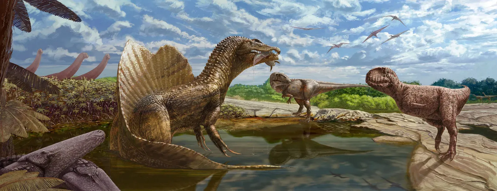
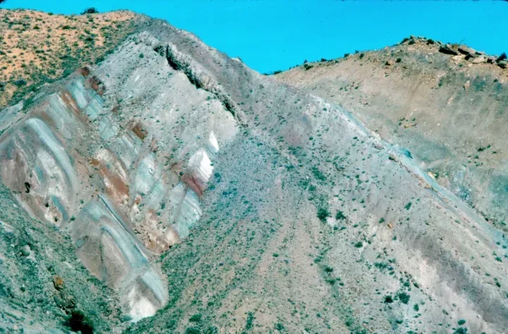
In the Late Jurassic-aged Morrison basin of western North America, sauropods occupied lowland river-floodplain settings characterized by a seasonally dry climate. These weren’t accidental choices. During the Jurassic period, the area that is now Colorado consisted of a low plain crossed by slow-moving rivers, and dinosaurs lived and died along the rivers, sometimes with their bones fossilized in the river mud and sand. The evidence is right there in the rock layers, telling stories about creatures that followed water like their survival depended on it, because honestly, it did.
The Morrison Formation Reveals Migration Secrets
You know what’s remarkable? Scientists can actually trace where these dinosaurs got their water from. Comparison of oxygen isotope ratios of sedimentary carbonates from the Morrison basin with those from carbonate from camarasaurid dinosaur teeth suggests that they drank water that fell in mountainous regions, so must have undertaken migrations between lowlands and mountainous areas about 300 kilometres apart.
That’s not just wandering around. That’s purposeful movement across nearly 200 miles. Imagine a creature the size of three school buses making that trek regularly. Massive herbivores with high nutritional and water needs could periodically experience nutritional and water stress under seasonally dry conditions, and the common occurrence of sauropods in this basin remained a paradox until evidence for migration emerged. The rivers weren’t just drinking fountains; they were lifelines connecting critical habitats.
The Western Interior Seaway Created Migration Corridors
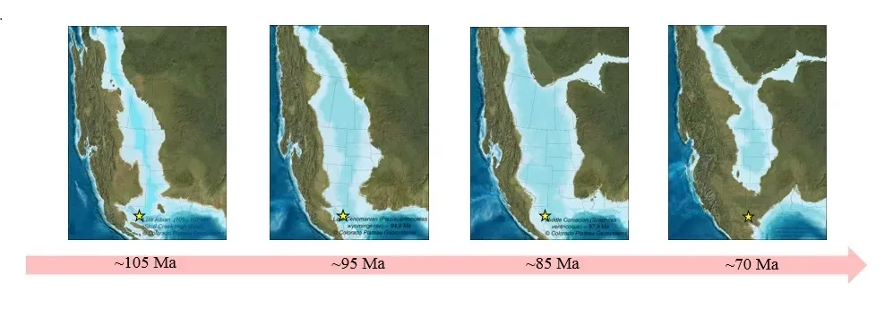
Here’s where things get really interesting. The Western Interior Seaway was a large inland sea that existed roughly over the present-day Great Plains of North America, splitting the continent into two landmasses, Laramidia to the west and Appalachia to the east, and existed for 34 million years from the early Late Cretaceous to the earliest Paleocene. Picture North America literally cut in half by water.
This massive seaway didn’t just divide the continent. It created something incredible. From Colorado to New Mexico, coastal strip sediment was trampled by dinosaurs, possibly because it offered a convenient north-south route that could be easily followed. Scientists have dubbed this the “Dinosaur Freeway.” Some scientists have suggested these were migrating herds, based on places where trackways appear to be parallel. Multiple sets of footprints, all heading the same direction, all at the same time. Coincidence? Unlikely.
Fossil Trackways Tell Migration Stories
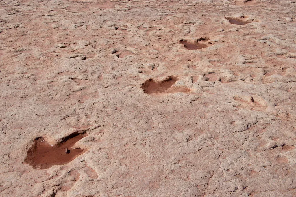
Footprints impressed into mud and silt along ancient rivers and lakes were found more than 3,700 miles away from each other. Let that sink in for a moment. Matching dinosaur tracks separated by an entire ocean’s width. River valleys served as natural highways, their floodplains offering water, sheltering vegetation, and soft ground, with muddy sediments left by the rivers and lakes containing dinosaur footprints that document these river valleys could provide specific avenues for life to travel across continents.
These aren’t isolated footprints either. We’re talking about hundreds of preserved tracks at sites across Colorado and New Mexico. The majority of trackways were made by large herbivorous dinosaurs that usually walked on two legs and had three toes per foot. The consistency in track patterns suggests repeated use over time, not random wandering. These were established routes, prehistoric pathways etched into the landscape by countless journeys.
Water Stress Drove Seasonal Movements
Let’s be real: survival isn’t romantic. Some species relied on permanent water bodies like rivers and lakes, while others adapted to survive in more unpredictable or seasonal water sources, with the availability of water dictating their behavior, migration patterns, and overall survival strategies. When your food source requires water to grow and you need gallons of water daily just to stay alive, you go where the water is.
Paleontologists believe that dinosaurs would migrate to a region with enough water as the seasons would get dry, however, as the basin would be flooded with water, they would head back to their previous location. This back-and-forth pattern makes perfect sense. Too dry? Head to the river. Too flooded? Move to higher ground. Analysis of fossil records revealed that adverse consequences, like the unavailability of food and water, were among the major factors for dinosaur migration, with them moving from continent to continent in search of the basic necessities of life.
River Deposits Preserve Migration Evidence
You might wonder how we can be so certain about these migration patterns. Here’s the thing: Most dinosaur fossils are found in rocks deposited by ancient rivers, with the best fossils coming from times and places where the animals were rapidly buried, such as in a river moving a lot of sediment, or in a floodplain behind a broken natural levee. Rivers don’t just guide migrations; they preserve evidence of them.
The holotype specimen was found in fluvial marine sedimentation, meaning that the corpse of the animal was transported by a river and washed out to sea. When dinosaurs died near rivers, those waterways became natural conveyor belts, transporting remains to locations where preservation was possible. Floodplain and residual channel deposits include isolated tracks of Theropoda and Ornithopoda, with sedimentological interpretation suggesting the existence of a river system. The evidence keeps piling up, quite literally, layer after layer.
Arctic Dinosaurs Challenge Migration Assumptions
Now here’s something that’ll make you rethink everything. The discovery of the first juvenile dromaeosaurid lower jaw bone on the North Slope of Alaska supports a growing theory that some Cretaceous Arctic dinosaurs did not migrate with the seasons but were year-round residents, with this being the first physical evidence that 70 million years ago, some dromaeosaurid nested in the area.
Let me tell you, finding baby dinosaur bones in Alaska changes the game completely. For years, arguments centered around whether these animals could have survived the harsh climate and must have migrated vast distances, however, new detailed analyses reveal that this animal probably slowed growth during the winter and did not migrate very far, if at all. If some dinosaurs didn’t need to migrate even in extreme environments, it suggests those that did migrate along rivers had other compelling reasons beyond just escaping cold weather. Resource availability, breeding grounds, predator avoidance – the motivations were complex.
Conclusion
The evidence paints a vivid picture. North America’s ancient river systems weren’t just geological features; they were the backbone of dinosaur migration across the continent. From the Morrison Formation’s massive sauropods traveling nearly 200 miles between highlands and lowlands, to the herds trampling the shores of the Western Interior Seaway, water shaped movement patterns in ways we’re only beginning to understand.
Most dinosaur fossils are found in rocks deposited by ancient rivers. That simple fact connects millions of years of prehistoric life to the water that flowed, carved, nourished, and ultimately preserved evidence of these incredible journeys. Rivers offered more than hydration; they provided food-rich floodplains, navigational corridors, and seasonal refuges during climate extremes.
What strikes me most is how similar these ancient migration patterns are to what we observe in modern wildlife. The strategies haven’t fundamentally changed, just the players. Next time you stand beside a river, consider that millions of years ago, creatures beyond imagination might have followed that same waterway on journeys that would humble any human expedition. The rivers remember, even if the dinosaurs are gone.
What do you think shaped migration patterns more – the availability of water or the search for food? The answer might not be as simple as you’d expect.