Satellite data promises precise tracking of the world’s forests, yet a recent analysis exposed profound inconsistencies across leading datasets that could alter environmental strategies worldwide.
Striking Lack of Consensus Emerges
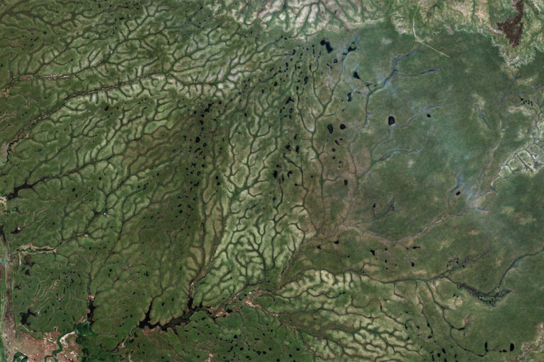
Striking Lack of Consensus Emerges (Image Credits: Imgs.mongabay.com)
Researchers compared ten prominent global forest datasets and discovered that only 26% of areas identified as forest by at least one source gained agreement from all.
This figure held even after researchers rescaled maps for uniformity. Moist tropical forests showed stronger alignment, but dry forests and fragmented zones lagged, with consensus dipping to 12% in some biomes.
Such disparities arise because no universal definition governs what qualifies as forest. Datasets vary in canopy cover thresholds – 10% might encompass savannas, while 70% limits coverage to dense stands.
Resolution differences further complicate matters. Finer imagery captures narrow strips overlooked by coarser scans, while algorithms and training data introduce additional variability.
Roots of the Mapping Variations
Differing methodologies underpin the confusion. Sensor types, machine-learning models, and validation approaches yield distinct outcomes, especially in challenging terrains.
Daniel C. Miller, a co-author from the University of Notre Dame, highlighted the challenge: “When land is viewed from the sky, it’s difficult to know at a global scale whether something is a forest or not.”
Key factors include:
- Canopy cover thresholds (e.g., 10% vs. 50% or higher).
- Spatial resolution, affecting detection of small patches.
- Satellite sensors and processing algorithms.
- Training data biases toward certain ecosystems.
- Temporal mismatches, like 2019 vs. 2020 baselines.
These elements ensure that even specialized deforestation trackers diverge significantly.
Policy Ramifications in Sharp Focus
Real-world applications amplify the stakes. The study examined three nations to quantify impacts.
| Country | Metric | Range Across Datasets |
|---|---|---|
| Kenya | Forest carbon as % of national biomass | 2%–37% |
| India | Forest-proximate people in poverty (millions) | 23–252 |
| Brazil | Deforestation overlap between trackers | <50% |
In Kenya, carbon estimates fluctuated wildly, hindering mitigation targeting. India’s figures shifted development aid potential dramatically, while Brazil’s spider monkey habitat assessments faltered.
Governments report climate progress using these maps; NGOs prioritize sites; investors gauge risks. Arbitrary choices thus steer billions in funding.
Charting a Clearer Path Ahead
The researchers, including Sarah Castle, Peter Newton, Johan Oldekop, Kathy Baylis, and Daniel Miller, urged caution. Treat estimates as ranges, cross-check datasets, and pursue standardization.
Sarah Castle emphasized: “If we cannot establish a reliable baseline for forest area, it undermines trust in nature-based markets.”
Hybrid approaches blending satellites with ground data offer promise, alongside transparent uncertainty reporting.
Key Takeaways
- Global forest datasets agree on just 26% of locations, worst in dry and fragmented areas.
- Disagreements yield order-of-magnitude shifts in carbon, poverty, and habitat metrics.
- Standardization and multi-dataset validation are essential for credible policy.
Forests anchor climate action and livelihoods, but resolving mapping disputes proves foundational. Policymakers must prioritize data harmony to safeguard these vital ecosystems effectively. What steps should follow to align global forest monitoring? Share your views in the comments.