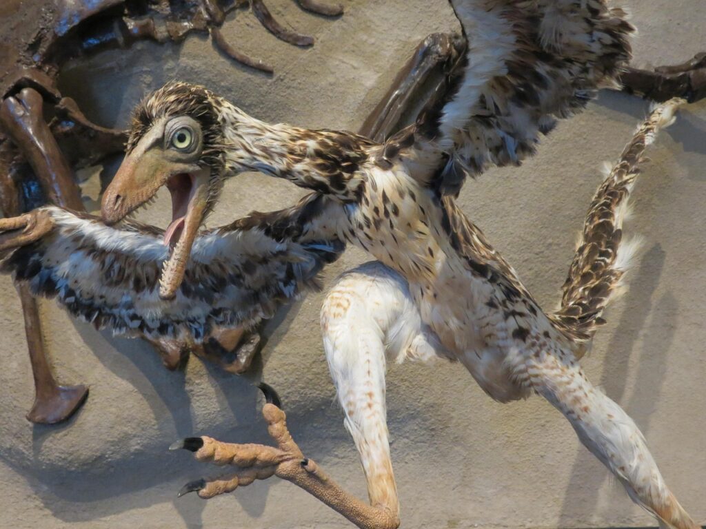
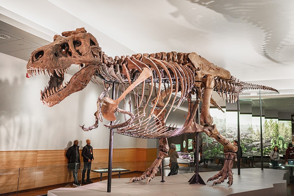
Finding dinosaur fossils isn’t simply a matter of luck or random digging. Modern paleontologists use sophisticated techniques, scientific knowledge, and sometimes a bit of intuition to determine promising dig sites. This methodical approach has revolutionized how we uncover the prehistoric past, making fossil hunting far more efficient than in the early days of paleontology.
Understanding Geological Periods

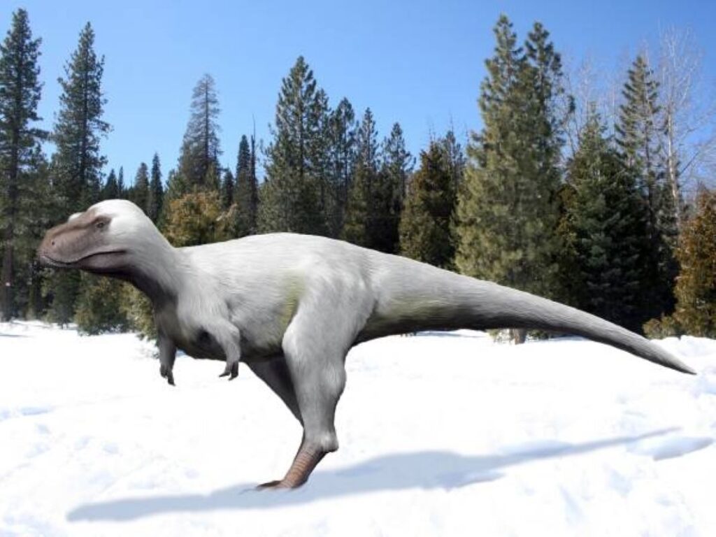
Before the first shovel hits the ground, paleontologists must identify rock formations from the right geological periods. Dinosaurs lived during the Mesozoic Era, which spans from approximately 252 to 66 million years ago and includes the Triassic, Jurassic, and Cretaceous periods. Scientists focus their search on sedimentary rock layers that date to these specific time frames. These rock formations are often exposed in areas where erosion has revealed layers that were once deeply buried. By understanding the geological timeline, paleontologists can eliminate vast areas where dinosaur fossils simply couldn’t exist, such as rocks that formed before dinosaurs evolved or after they went extinct. This targeted approach, based on geological age, significantly narrows down potential dig sites.
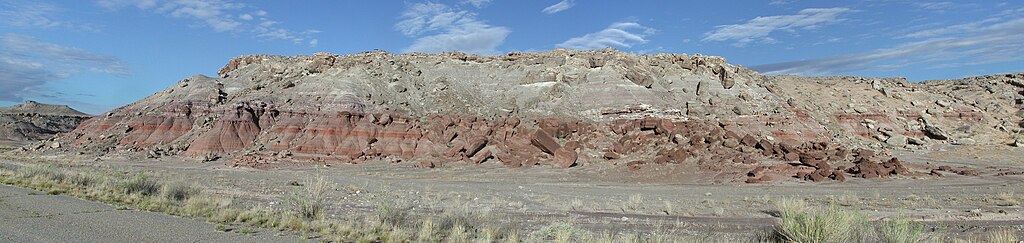
Identifying Fossil-Bearing Rock Types

Not all rock types preserve fossils equally well. Paleontologists primarily focus on sedimentary rocks like sandstone, mudstone, and shale, which form from accumulated layers of sediment that can trap and preserve organic remains. These rocks form in environments like ancient riverbeds, lakeshores, and floodplains—places where dinosaurs lived and died, and where conditions favored rapid burial that protected remains from scavengers and decomposition. Igneous and metamorphic rocks, formed through heat and pressure, typically destroy any organic material and rarely contain fossils. By targeting specific sedimentary formations known to preserve fossils well, scientists can focus their efforts on the most promising locations rather than wasting resources on rock types unlikely to yield discoveries.
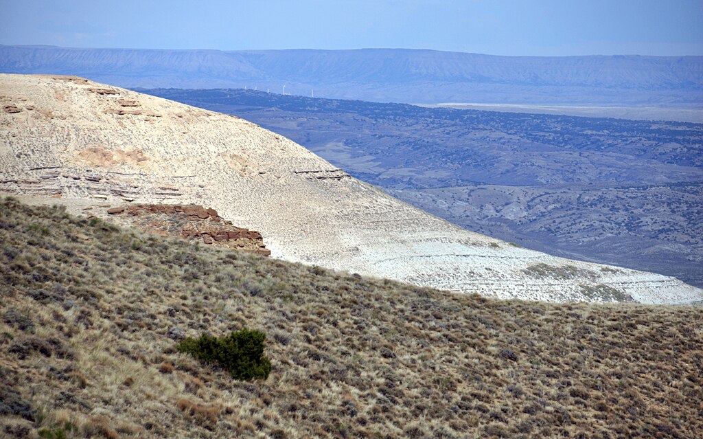
Prospecting in Exposed Outcrops
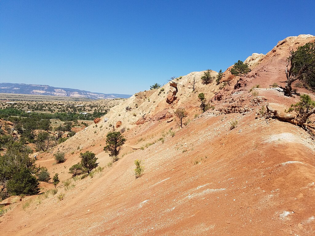
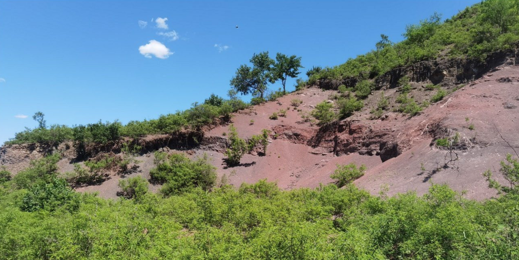
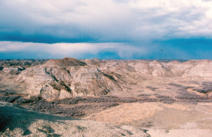
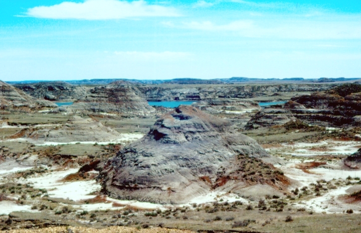
Field prospecting involves systematically surveying areas where appropriate rock layers are naturally exposed at the surface. These exposures, often called outcrops, provide paleontologists with valuable windows into the subsurface without requiring extensive excavation. Badlands, canyons, cliffs, and eroded hillsides are prime locations for fossil prospecting, as natural weathering processes continually expose new fossil material. Experienced paleontologists walk these areas slowly, scanning the ground meticulously for any fragments of bone that may have weathered out of the surrounding rock. Often, the discovery of small fragments on the surface—known as “float”—can lead researchers to larger, more complete specimens still embedded in the rock face. These preliminary surveys are crucial for identifying promising dig sites before committing to full-scale excavations.
Analyzing Ancient Environments
Understanding the ancient environments where dinosaurs lived provides crucial clues for locating their remains. Paleontologists study sedimentary structures, mineral compositions, and other geological features to reconstruct prehistoric landscapes. They look for evidence of ancient river channels, floodplains, lakebeds, and coastlines—environments where dinosaurs would have lived and where conditions favored fossil preservation. For instance, river channels often contain jumbled collections of bones that were washed together during floods, while lake sediments might preserve more complete, articulated skeletons. By identifying the specific environments that existed millions of years ago, scientists can predict which locations might contain the remains of particular dinosaur species, as different dinosaurs inhabited different ecological niches.
Following Historical Success
The history of successful fossil discoveries provides valuable guidance for current excavation efforts. Many famous fossil-bearing formations, such as the Morrison Formation in the western United States or the Dinosaur Provincial Park in Alberta, Canada, have yielded numerous significant finds over decades of research. Paleontologists often return to these proven productive areas, exploring new sections or digging deeper into known fossil beds. Historical records and publications from previous expeditions help modern scientists target specific areas within these larger formations. Sometimes, notes from expeditions conducted a century ago can lead ew discoveries in overlooked locations. This institutional knowledge, passed down through generations of paleontologists, creates a cumulative understanding of where fossils are likely to be found.
Utilizing Remote Sensing Technology

Modern paleontology increasingly relies on advanced remote sensing technologies to identify potential dig sites without setting foot on the ground. Satellite imagery, aerial photography, and LiDAR (Light Detection and Ranging) can reveal geological features and patterns invisible to the naked eye from ground level. These technologies allow paleontologists to map vast areas quickly, identifying promising geological formations, erosional patterns, and even subtle color changes in soil and rock that might indicate fossil-bearing layers. In regions with challenging terrain or limited accessibility, remote sensing provides crucial preliminary data that helps researchers prioritize which areas to visit in person. Some teams even use drones equipped with specialized cameras to survey potential sites in greater detail, creating high-resolution 3D models of outcrops before fieldwork begins.
Recognizing Surface Indicators

Experienced fossil hunters develop a keen eye for subtle surface indicators that might signal buried fossils. Small bone fragments, teeth, or even distinctive patterns of discoloration in the soil can point to larger specimens hidden beneath. These surface indicators are often the result of natural erosion processes that gradually expose deeply buried fossils. Paleontologists call the scattered fragments that appear on the surface “float” and use these pieces as clues to trace back to their source in the rock face. The discovery of even tiny fossil fragments can trigger a more thorough investigation of an area. In desert environments, the process of “desert pavement” can concentrate small fossils on the surface as winds blow away lighter sediments, creating natural collecting areas that serve as indicators of fossil-rich regions.
Employing Geophysical Methods
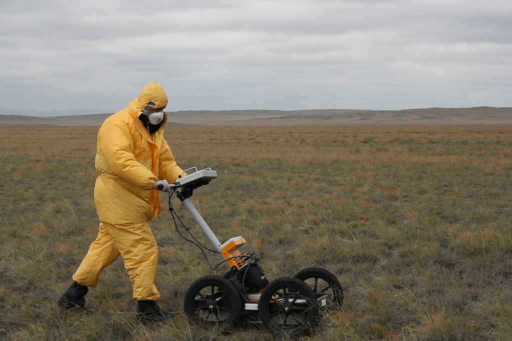
Before committing to full excavation, paleontologists sometimes employ geophysical methods to “see” beneath the surface without disturbing it. Ground-penetrating radar (GPR), electrical resistivity tomography, and magnetometry can detect density differences in subsurface materials, potentially revealing the presence of large fossils or fossil concentrations. These non-invasive techniques create images of what lies beneath the ground, helping researchers pinpoint exactly where to dig and reducing the amount of unnecessary excavation. While these technologies cannot identify fossils with absolute certainty, they can reveal anomalies that warrant closer investigation. In some cases, CT scanning equipment has been brought directly to field sites to create detailed 3D images of partially exposed specimens before they are fully excavated, guiding the digging process.
Consulting Local Knowledge
Local communities often possess valuable knowledge about fossil locations that might not be documented in scientific literature. Ranchers, farmers, construction workers, and amateur fossil enthusiasts frequently stumble upon significant discoveries while working on their land or pursuing their hobbies. Many major dinosaur finds throughout history began with a resident noticing unusual objects in rock formations on their property. Professional paleontologists increasingly recognize the importance of establishing relationships with local communities near potential fossil sites. By consulting with locals and creating channels for reporting potential finds, researchers can access a much wider network of observers than their scientific teams alone could provide. Some paleontological institutions have established formal programs to train interested community members in basic fossil identification and proper reporting procedures.
Conducting Surface Collection Surveys

Before starting major excavations, paleontology teams often conduct systematic surface collection surveys to assess the fossil potential of an area. These surveys involve walking in predetermined patterns across the target area, meticulously documenting and collecting visible fossil fragments. The distribution, density, and types of fossils found during these surveys help scientists determine which specific locations within a larger area deserve more intensive investigation. Surface collection data is carefully mapped, often using GPS coordinates, creating a spatial model of fossil distribution that reveals patterns not obvious to the naked eye. These preliminary surveys are especially important in areas where erosion continuously exposes new material, as they provide a snapshot of what might be buried more completely beneath the surface.
Analyzing Microfossil Evidence
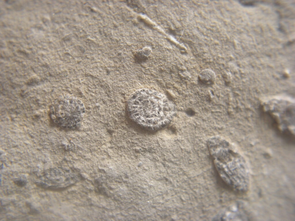
Sometimes the path to dinosaur fossils begins with much smaller discoveries. Microfossils—tiny remains like small teeth, scales, bone fragments, and even pollen—can indicate environments where larger fossils might be preserved. Paleontologists collect sediment samples from promising areas and process them through fine screens to isolate these minute specimens. The presence of certain microfossils can confirm that the environment was suitable for dinosaur preservation and that the sediments haven’t undergone processes that would destroy larger fossils. Additionally, microfossils can help date rock layers more precisely, ensuring that excavation efforts focus on periods when particular dinosaur species existed. This microscopic evidence provides crucial context before committing resources to large-scale excavations for dinosaur remains.
Leveraging Interdisciplinary Collaboration

Modern paleontological expeditions often involve experts from multiple scientific disciplines, each contributing specialized knowledge that helps identify promising dig sites. Geologists analyze rock formations and sedimentation patterns, paleobotanists study ancient plant remains to understand prehistoric ecosystems, and taphonomists examine how organisms become fossilized in different environments. This interdisciplinary approach creates a more complete picture of ancient landscapes and improves the targeting of excavation efforts. Computer scientists and data analysts help integrate information from various sources, creating predictive models that highlight areas with high fossil potential. By bringing together these diverse perspectives, paleontological teams can make more informed decisions about where to concentrate their limited research resources and increase their chances of significant discoveries.
Understanding the Role of Luck and Persistence
Despite all the scientific methods and technologies available, an element of serendipity remains in paleontological discoveries. Some of the most important dinosaur fossils have been found by accident or in locations that didn’t initially seem promising. What separates professional paleontologists from lucky amateurs is their persistent, systematic approach to investigating potential sites. Even when sophisticated methods point to a promising location, excavation requires painstaking work and patience, sometimes continuing for multiple field seasons before significant discoveries emerge. The paleontological record is inherently incomplete, with only a tiny fraction of prehistoric life becoming fossilized and an even smaller portion of those fossils being exposed and discovered. This reality means that even with the best scientific approaches, fossil hunting always involves embracing uncertainty and being prepared for both disappointment and extraordinary discoveries.
Conclusion
The science of locating dinosaur fossils has evolved dramatically from the early days when paleontologists relied primarily on luck and visible bone fragments. Today’s fossil hunters combine geological knowledge, technological tools, historical data, and community partnerships to identify the most promising excavation sites. This methodical approach has revolutionized our understanding of prehistoric life by making fossil discovery more efficient and comprehensive. Nevertheless, the field maintains a perfect balance of rigorous science and thrilling discovery—each new fossil uncovered represents another piece in the vast puzzle of Earth’s ancient past, waiting for paleontologists to find just the right place to dig.