Imagine standing at the edge of a canyon so deep you can see nearly two billion years of Earth’s history layered in stone beneath your feet. Or placing your hand on a column of rock that cooled from molten magma long before the dinosaurs ever roamed this planet. Across the United States, the land itself is a living library, and each rock formation, canyon wall, and volcanic butte is a chapter waiting to be read.
The story of American geology is honestly one of the most underappreciated subjects in science. You don’t need a PhD to feel the weight of deep time when you stand inside these landscapes. The US sits on one of the most geologically diverse stretches of crust on Earth, and its formations span nearly the entire known timeline of our planet. Let’s dive in.
Reading the Layers: How Rock Formations Reveal Earth’s Timeline
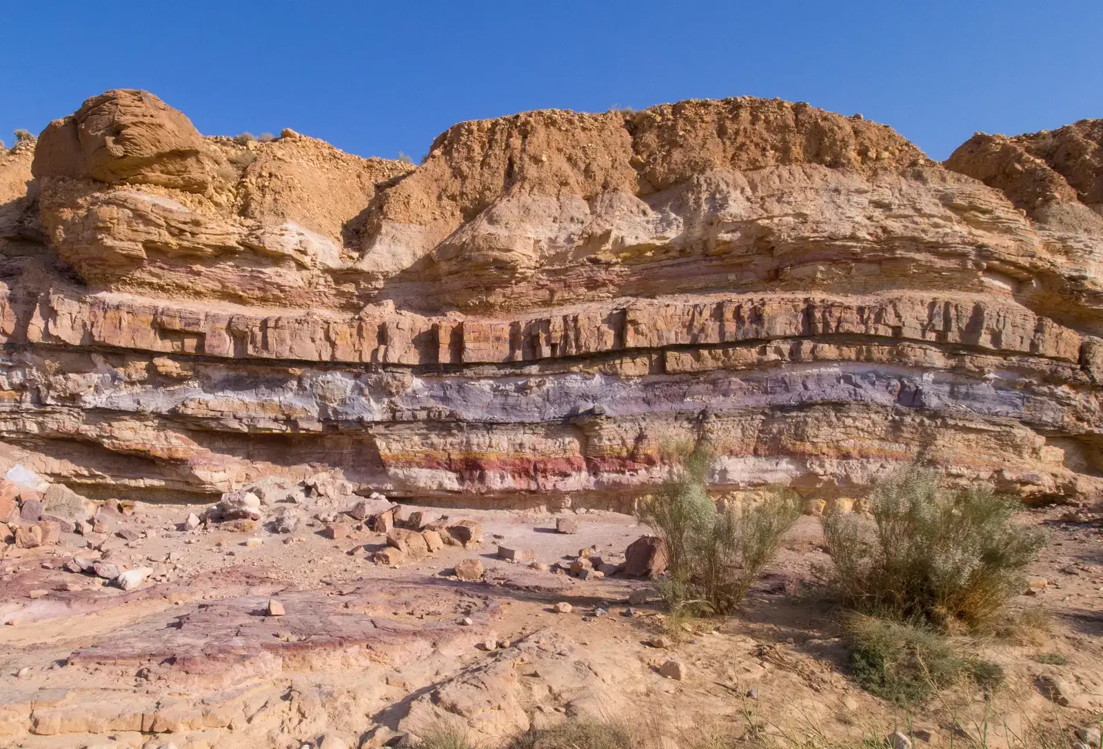
Before you can appreciate any individual formation, you need to understand how scientists actually decode them. Earth scientists use the structure, sequence, and properties of rocks, sediments, and fossils, as well as the locations of current and past ocean basins, lakes, and rivers, to reconstruct events in Earth’s planetary history. Rock layers show the sequence of geological events, and the presence and amount of radioactive elements in rocks makes it possible to determine their ages. Think of it like reading a book printed in stone, where each page took thousands or even millions of years to write.
In an undisturbed column of rock, the youngest rocks are at the top and the oldest are at the bottom. Rock layers have sometimes been rearranged by tectonic forces, and those rearrangements can be seen or inferred from inverted sequences of fossil types. It’s a bit like finding a novel where someone has shuffled all the chapters out of order. Geologists spend entire careers putting those chapters back together, and the formations scattered across the US give them extraordinary material to work with.
The Grand Canyon: Earth’s Greatest Open Book
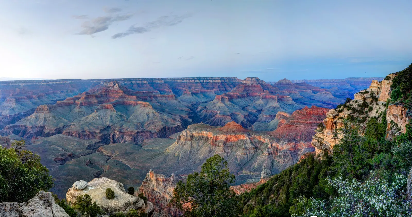
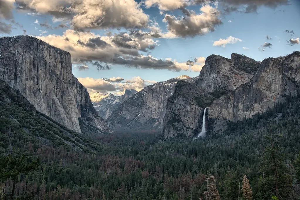
If you’ve ever stared into the Grand Canyon, you already know it stops you cold. The Grand Canyon in Arizona is one of the most iconic geological formations in the United States, carved by the mighty Colorado River over millions of years. It stretches approximately 277 miles in length, up to 18 miles in width, and reaches depths of over a mile. That sheer depth is what makes it so scientifically extraordinary. You aren’t just looking across a canyon. You are staring through time itself.
The steep walls of the Grand Canyon contain a number of layers of sedimentary rock laid down over millions of years. The lower formations belong to the early Precambrian age, while the upper layers are of the Paleozoic age. And between those two sets of rocks lies something even more staggering. The so-called Great Unconformity lies near the bottom of the Grand Canyon and indicates, in places, about a billion years of missing geologic time. A billion years, just gone. You can think of unconformities as missing “pages” in the book of the geologic record. Missing layers may seem like a problem, but the very fact that there is a gap in the record provides information to geologists, indicating changing ocean levels or changes in the Earth’s crust.
Yellowstone’s Supervolcano: Fire Beneath Your Feet
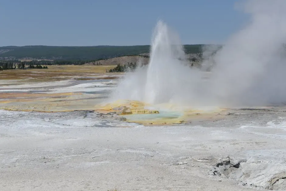
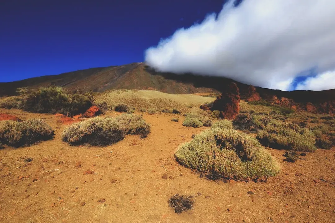
Here’s the thing about Yellowstone. Most people visit for the geysers and the bison. What they often don’t fully grasp is that they are literally standing on top of one of the most powerful volcanic systems on Earth. Three extraordinarily large explosive eruptions in the past 2.1 million years each created a giant caldera within or west of Yellowstone National Park. During these eruptions, enormous volumes of hot, fragmented volcanic rocks spread outward as pyroclastic density currents over vast areas. The hot ash, pumice, and other rock fragments accumulated and welded together to form extensive sheets of hard lava-like rock.
The three caldera-forming eruptions were about 6,000, 700, and 2,500 times larger than the May 18, 1980 eruption of Mt. St. Helens in Washington State. Together, the three catastrophic eruptions expelled enough ash and lava to fill the Grand Canyon. I find that comparison almost too large to process. A huge reservoir of magma remains beneath the surface, and it is this subterranean supervolcano that makes Yellowstone one of the planet’s most geologically dynamic areas. Magma, which is molten rock from below the Earth’s crust, is close to the surface in the greater Yellowstone area.
Devils Tower, Wyoming: A Frozen Giant From Deep Time
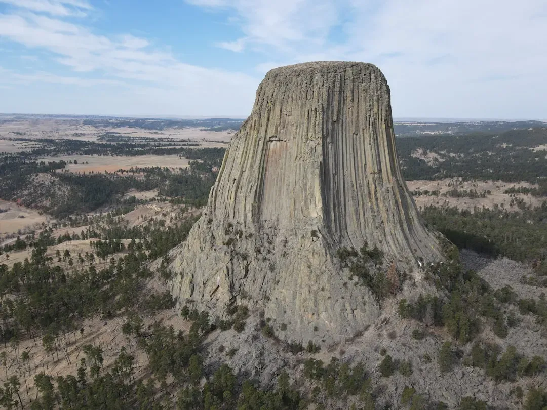
Rising like a stone skyscraper out of the Wyoming plains, Devils Tower is the kind of sight that makes your brain scramble for an explanation. Devils Tower is a laccolithic butte composed of igneous rock in the Bear Lodge Ranger District of the Black Hills, near Hulett and Sundance in Crook County, northeastern Wyoming, above the Belle Fourche River. It rises 1,267 feet above the Belle Fourche River, standing 867 feet from summit to base. The columns that run vertically along its flanks look almost architectural, like something deliberately engineered rather than naturally formed.
The igneous material that forms the tower is a phonolite porphyry intruded about 40.5 million years ago, a light- to dark-gray or greenish-gray igneous rock with conspicuous crystals of white feldspar. As the magma cooled, hexagonal columns formed, sometimes four-, five-, and seven-sided, up to 20 feet wide and 600 feet tall. Current research supports the conclusion that Devils Tower was not a volcano but was injected between sedimentary rock layers and cooled underground. The characteristic furrowed columns are the result of contraction which occurred during the cooling of the magma. It’s like watching nature accidentally build a cathedral out of cooling stone.
Bryce Canyon: Hoodoos and the Story of an Ancient Lakebed
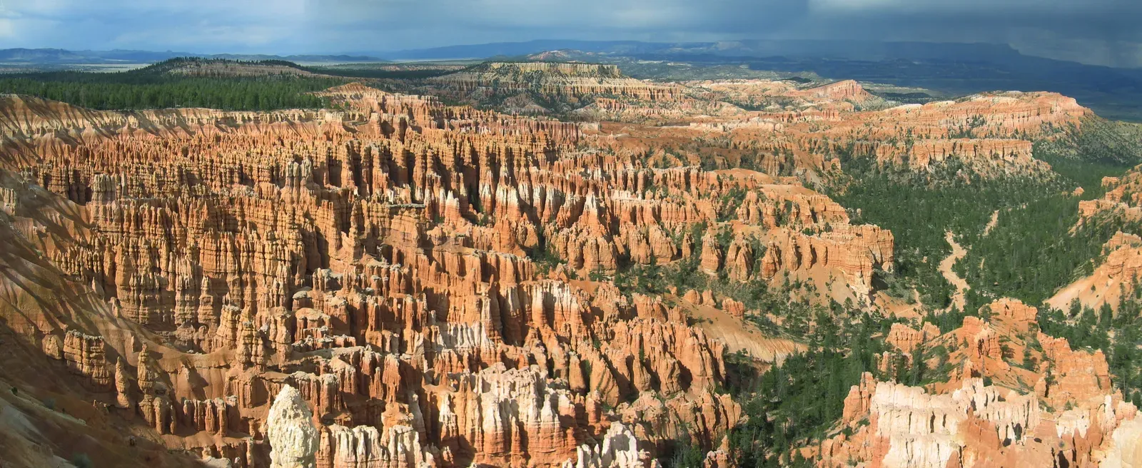
Bryce Canyon in Utah looks like something from another planet. Thousands of thin, towering rock spires, called hoodoos, fill the amphitheaters in colors ranging from deep red to pale white. Bryce Canyon National Park has the largest concentration of hoodoos, which are irregular columns of rock, found anywhere on Earth. Each of those strange formations tells a surprisingly straightforward story once you know how to listen.
The creation of these hoodoos is the result of millions of years of geological processes. The forces of erosion, including the freezing and thawing of water, have gradually shaped the soft limestone and sedimentary rock layers into these fascinating formations. Over time, rainwater and ice have sculpted the rocks, revealing a multitude of delicate arches, bridges, and windows. The iron-rich rock here was once sediment at the bottom of a giant mud puddle that stretched across much of present-day Utah 30 million to 55 million years ago. What is now a dramatic canyon landscape was once underwater. That transformation, honestly, is almost impossible to imagine.
Badlands National Park: From Ancient Sea to Prehistoric Savannah
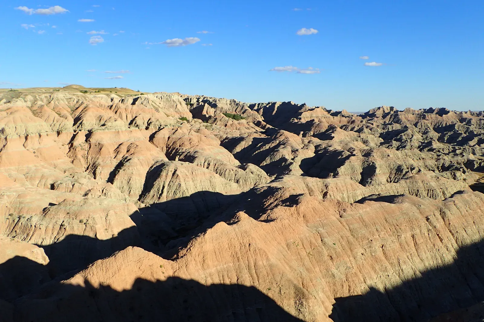
South Dakota’s Badlands look harsh and unwelcoming at first glance. Eroded buttes, jagged ridgelines, and crumbling sediment in layers of tan, gray, and rust. Yet underneath that raw exterior lies one of the richest fossil records in North America. Geological formations mixed with grass prairies inspired the Lakota Native American people to dub this region mako sica, meaning Badlands, not only due to its terrain but also the lack of water and extreme temperatures. Over millions of years, the Badlands drastically changed from a sea to a subtropical forest, to an open savannah.
The formations in the park are the result of two simple processes: deposition, the gradual building up of rocks, and erosion. The Badlands formations have a lifespan of approximately one million years. They erode at about one inch per year. Scientists estimate that in the next 500,000 years, the Badlands will have eroded completely. That means you are visiting a geological feature with a ticking clock. The Badlands buttes contain millions of years of history, much of which can be unpacked with the sciences of geology and paleontology. There are several types of rocks found in the Badlands, including sandstones, siltstones, mudstones, claystones, limestones, volcanic ash, and shale.
Craters of the Moon, Idaho: A Landscape Barely Cold
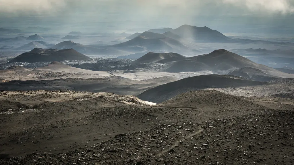
If the Grand Canyon makes you feel the weight of ancient deep time, Craters of the Moon in Idaho does the opposite. It makes you feel how geologically recent and active this planet still is. Boasting 618 square miles of nothing but lava, Craters of the Moon National Monument and Preserve contains nearly every volcanic rock formation possible: cinder cones, lava rivers, lava tubes, spatter cones, tree molds, and nearly endless lava beds. Standing inside it feels like walking on another world, which is not entirely a metaphor.
Between 2,000 and 15,000 years ago, molten lava repeatedly broke through a series of cracks in the Earth’s crust, known as the Great Rift of Idaho, flowing out in smooth, ropy streams for as much as 45 miles before hardening. Occasionally, chunks of rock blasted out with explosive force, creating a patchwork of jagged boulder fields. In geological terms, this landscape is practically brand new. Geologists predict that the area will erupt again, perhaps in another 200 years. Think about that. The next eruption at Craters of the Moon could happen within a few human generations. That’s not deep time at all. That’s almost tomorrow.
Plate Tectonics and the Ongoing Drama of America’s Western Geology
You can’t appreciate these individual formations without stepping back to see the bigger picture. The western United States, in particular, is a landscape shaped by the collision and movement of enormous tectonic plates. Here in the West, oceanic plates smashed into the continent with enough force to create the Rocky Mountains and the volcanic Cascade Range. That process was not quiet or gradual. It was violent, sustained, and continent-reshaping on a scale that makes even the largest human construction project look trivial.
The Earth’s outer layer, the crust, is dynamic, consisting of constantly moving plates made of a rigid continental and oceanic lithosphere overlying a churning, plastically flowing asthenosphere, which is the outer part of the Earth’s mantle. The rock record reveals that events on Earth can be catastrophic, occurring over hours to years, or gradual, occurring over thousands to millions of years. The formations you see today, from the sandstone towers of Colorado to the volcanic necks of New Mexico, are all snapshots of an ongoing story. From towering cliffs and majestic canyons to volcanic landscapes and surreal rock formations, the country is home to numerous iconic geological sites. These remarkable formations showcase the immense power and beauty of Earth’s geological processes, providing a glimpse into the planet’s ancient past.
Conclusion: The Earth Is Still Writing Its Story
What strikes me most about all of these formations is how they each hold a different slice of the same impossibly long story. The Grand Canyon whispers of shallow Cambrian seas. Yellowstone rumbles with magma that could reshape a continent. The hoodoos of Bryce Canyon are sculptures made from an ancient lakebed. The Badlands are dissolving before our eyes. Standing in any of these places, you realize that Earth’s history is not some distant, abstract thing. It’s under your feet right now.
The geological history of Earth follows the major geological events in Earth’s past based on the geologic time scale, a system of chronological measurement based on the study of the planet’s rock layers. That system, built by generations of geologists, is how we know what we know. Although preserved geologic clues are indeed fragmentary, geologists have become increasingly skilled at interpreting them and constructing an ever more detailed picture of the Earth’s past. The US, more than perhaps any other country, is a classroom where that picture can be read firsthand.
The next time you visit one of these landscapes, look down before you look up. The rock beneath your boots might be older than anything you’ve ever touched. What would you have guessed was buried under the ground you stand on every day?