The American West we know today—with its arid deserts, towering mountains, and dramatic canyons—bears little resemblance to the region’s prehistoric past. Millions of years ago, this landscape underwent extraordinary transformations as tectonic forces, dramatic climate shifts, and volcanic activity continually reshaped the terrain. From vast inland seas and tropical swamps to explosive volcanic landscapes and massive ice sheets, the geologic history of the western United States tells a remarkable story of environmental extremes. This ever-changing tapestry created the foundation for the West’s iconic landscapes while preserving an extraordinary fossil record that allows us to glimpse these lost worlds. By examining the prehistoric environments of the American West, we gain a deeper understanding of Earth’s dynamic systems and the dramatic ecological shifts that have occurred across deep time.
The Shallow Seas of the Western Interior

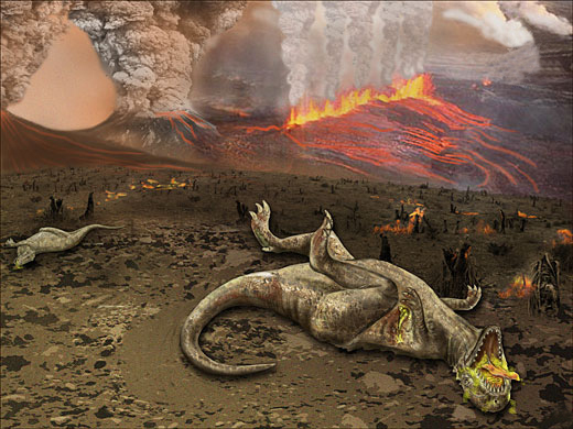
During much of the Cretaceous period (145-66 million years ago), a vast inland seaway split North America from the Arctic Ocean to the Gulf of Mexico. This Western Interior Seaway covered much of what is now the Great Plains and Rocky Mountain regions with warm, shallow waters. Marine deposits from this period reveal an ecosystem teeming with mosasaurs, plesiosaurs, giant sea turtles, and ammonites with spiral shells sometimes reaching six feet in diameter. The shorelines of this ancient sea featured sprawling deltas and coastal swamps where dinosaurs roamed. Evidence of this maritime past can be found throughout states like Kansas and South Dakota, where marine fossils emerge from what is now prairie and farmland. The cyclic advance and retreat of this seaway profoundly influenced sedimentation patterns across the region, creating the alternating layers of sandstone, shale, and limestone that characterize much of the western landscape.
Coal-Forming Swamps of the Paleocene
Following the extinction of the dinosaurs, the early Paleocene epoch (66-56 million years ago) saw much of the American West transform into vast subtropical swamps and wetlands. In what is now Wyoming, Montana, and the Dakotas, these lush environments featured broad-leafed evergreen forests, meandering rivers, and expansive peat bogs. The decomposing plant matter in these waterlogged environments eventually formed the extensive coal deposits that would later fuel western development. Fossils from these environments reveal a world dominated by primitive mammals, crocodilians, turtles, and an incredible diversity of plant life adapted to warm, wet conditions. The Powder River Basin of Wyoming and Montana, which today produces about 40% of America’s coal, stands as a testament to these ancient swamplands. Analysis of plant fossils from this time indicates average temperatures 10-20 degrees Fahrenheit warmer than today, with minimal seasonal variation despite the relatively high latitude.
The Rise of the Rocky Mountains

The formation of the Rocky Mountains fundamentally altered western North America’s landscape and climate patterns. Beginning around 80 million years ago during the Laramide Orogeny, intense tectonic forces compressed and uplifted vast sections of the Earth’s crust, creating the backbone of what would become the American West. This mountain-building episode lasted nearly 40 million years, producing dramatic ranges from New Mexico to Montana. As these mountains rose, they created rain shadows that began the long-term drying of the interior West. Paleobotanical evidence shows how plant communities shifted in response to these new elevation gradients, creating distinct ecological zones. The uplift also exposed ancient sedimentary layers, revealing the region’s older history in colorful bands visible today in locations like Colorado’s Garden of the Gods. Perhaps most importantly, this tectonic activity shaped the West’s watershed systems, establishing the major river networks that would carve iconic features like the Grand Canyon.
Eocene Subtropical Lakes and Forests

The Eocene epoch (56-34 million years ago) brought warm, humid conditions to much of the American West, creating environments that would seem utterly foreign to modern visitors. Vast lake systems spread across what is now Wyoming, Colorado, and Utah, surrounded by subtropical forests reminiscent of today’s Gulf Coast. The Green River Formation, famous for its exquisitely preserved fish fossils, formed during this time in a complex of three large lakes that covered approximately 25,000 square miles. Fossil evidence indicates these western landscapes supported palm trees, crocodiles, early primates, and even early horses no larger than small dogs. The remarkable fossil beds at Fossil Butte National Monument in Wyoming preserve entire ecosystems from this period in extraordinary detail, including insects with visible wing patterns and fish with scales and stomach contents intact. Climate reconstructions suggest winter temperatures rarely dropped below freezing, even at relatively high elevations and northern latitudes, illustrating how dramatically different regional climate patterns were during this “greenhouse Earth” period.
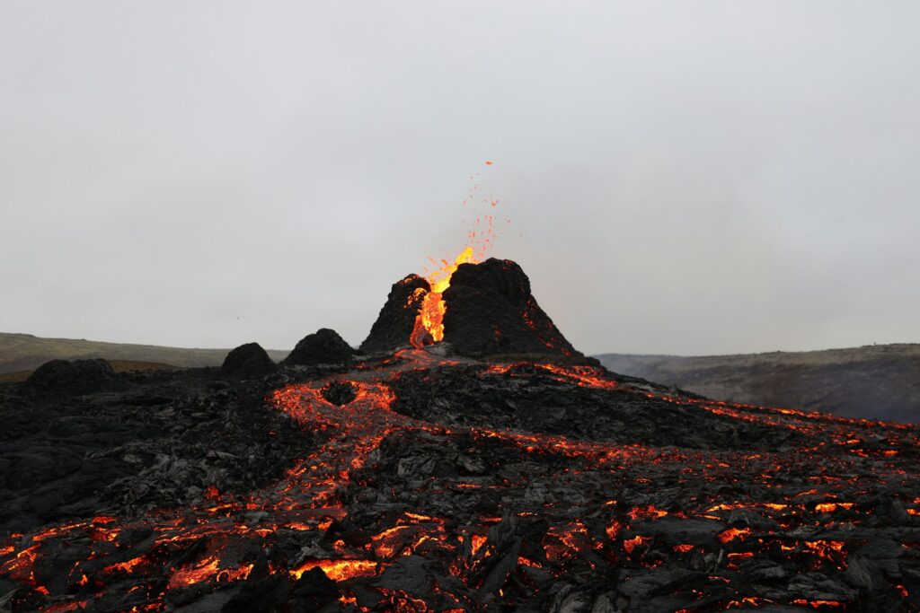
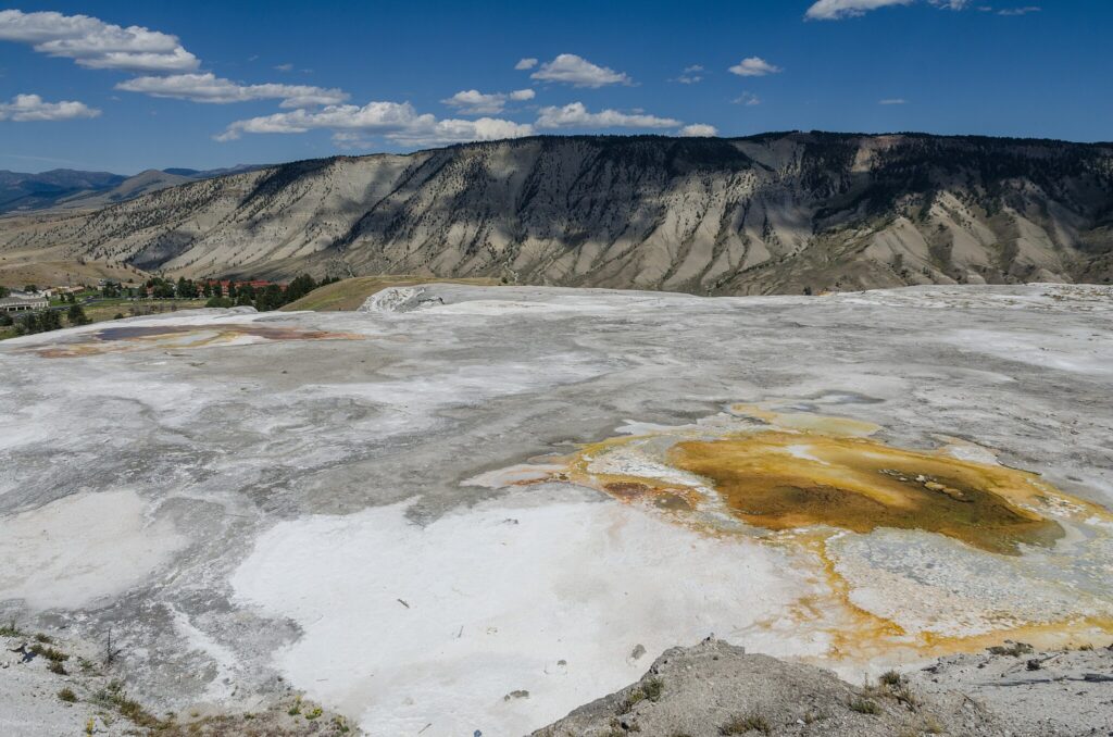
The Yellowstone Volcanic Province
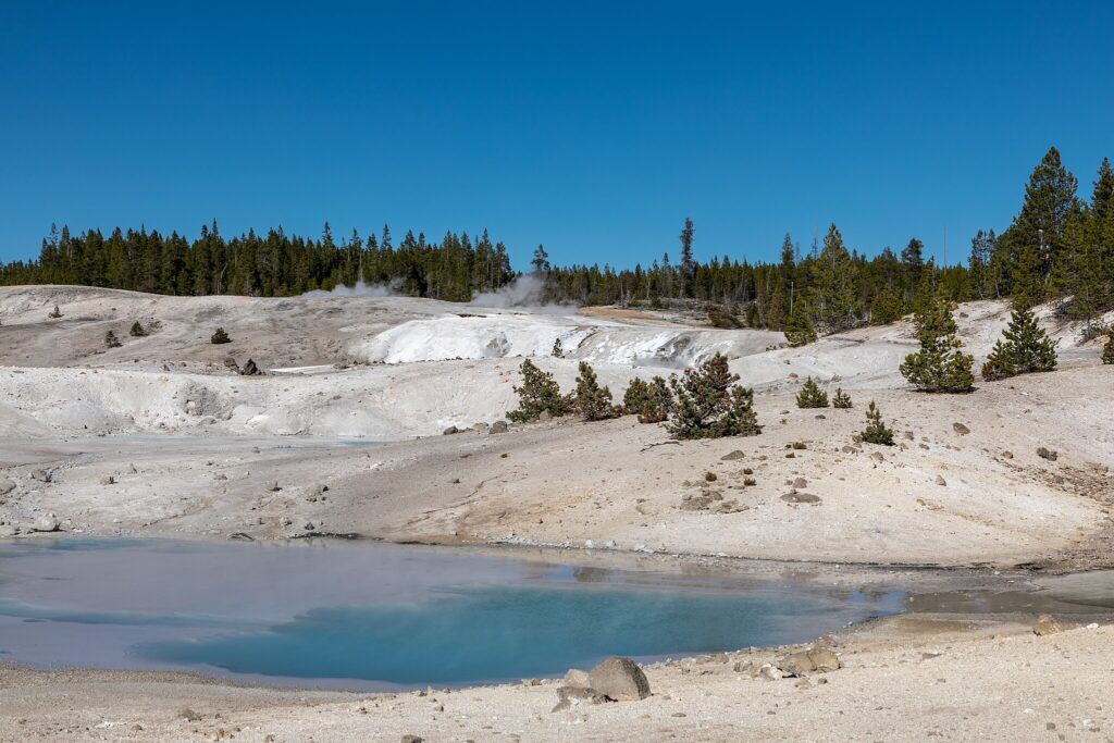
Few features showcase the West’s volcanic past as dramatically as the Yellowstone region, which sits atop one of Earth’s most powerful hotspots. Beginning around 16.5 million years ago, this hotspot generated a series of massive eruptions as the North American plate moved southwestward across the stationary mantle plume. This volcanic track created the Snake River Plain, a 400-mile-long arc of volcanic deposits stretching from Oregon to Wyoming. The most recent major caldera-forming eruption at Yellowstone occurred approximately 640,000 years ago, ejecting more than 240 cubic miles of material and creating an enormous depression that now forms much of Yellowstone National Park. These super-eruptions blanketed much of North America with ash, drastically affecting regional ecosystems. Today, Yellowstone’s geothermal features—including more than 10,000 hot springs and geysers—provide a window into the active volcanic system below. The unique hydrothermal environments support extremophile organisms that have proven valuable in biotechnology applications and offer insights into how life might exist in extreme environments on other planets.
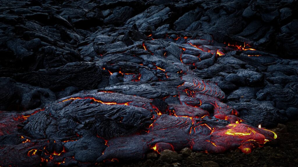
The Columbia River Basalt Flows
Between 17 and 14 million years ago, the Pacific Northwest experienced one of the most massive volcanic events in Earth’s history. The Columbia River Basalt Group eruptions flooded over 63,000 square miles of Oregon, Washington, and Idaho with layer upon layer of basaltic lava, creating flows up to 6,000 feet thick in some areas. Unlike explosive eruptions, these were primarily flood basalts—enormous fissure eruptions where lava welled up through cracks in the Earth’s crust and spread across the landscape like a slowly advancing tide. Individual flows could travel over 300 miles from their source, filling valleys and reshaping entire watersheds. The cooling and cracking patterns of these flows created the distinctive columnar basalt formations visible today at sites like Devils Postpile in California and Devils Tower in Wyoming. The enormous volume of volcanic gases released during these eruptions likely triggered significant climate disruptions, potentially contributing to the Mid-Miocene Climatic Optimum, a period of increased global temperatures. Today, the rich soils derived from weathered basalt support the renowned agricultural regions of the Columbia Basin.
The Great Basin’s Ancient Lakes
During the Pleistocene ice ages, what is now the arid Great Basin region of Nevada and Utah transformed into a landscape dominated by vast lakes. As glaciers expanded across northern latitudes, the climate of the American West became significantly wetter and cooler, filling basins with freshwater. The largest of these, Lake Bonneville, covered about 20,000 square miles—roughly the size of Lake Michigan—and reached depths of over 1,000 feet in some areas. When a natural dam composed of loose sediment catastrophically failed approximately 14,500 years ago, Lake Bonneville released an enormous flood that carved dramatic features along the Snake River. As the climate warmed and dried following the last ice age, these massive lakes gradually shrank, leaving behind distinctive shoreline terraces visible today on mountainsides throughout the region. Utah’s Great Salt Lake and Nevada’s Pyramid Lake represent the modest remnants of these once-massive water bodies. The sediments deposited in these ancient lake beds created the Great Basin’s salt flats, including the Bonneville Salt Flats where numerous land speed records have been set in modern times.
The Channeled Scablands: Catastrophic Flood Landscapes
Perhaps no prehistoric event altered the western landscape more dramatically or rapidly than the Missoula Floods, a series of cataclysmic outburst floods that occurred between 15,000 and 13,000 years ago. During the last ice age, a lobe of the Cordilleran Ice Sheet repeatedly dammed the Clark Fork River in Montana, creating enormous glacial Lake Missoula. When these ice dams failed, they released up to 500 cubic miles of water at once—more than the combined flow of all the world’s rivers—which raced across eastern Washington at speeds up to 80 miles per hour. These floodwaters scoured away soil and carved deep channels into solid basalt, creating the distinctive landscape known as the Channeled Scablands. Giant ripple marks, some over 30 feet high and visible only from the air, record the immense power of these floods. Enormous boulders transported by ice rafts were deposited hundreds of miles from their source. Geologist J Harlen Bretz first proposed the flood hypothesis in the 1920s, but his ideas faced decades of skepticism before becoming widely accepted, demonstrating how scientific understanding of landscape formation has evolved over time.
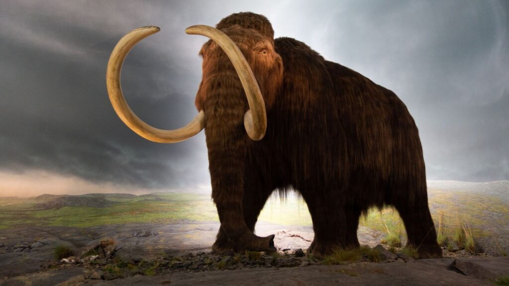
Ice Age Megafauna of the West
During the Pleistocene epoch, the American West supported an astounding diversity of large mammals that would seem almost fantastical by today’s standards. Columbian mammoths and mastodons browsed in forests and grasslands, while American camels—evolutionary products of North America before they migrated to Asia and Africa—roamed the western plains. Giant ground sloths standing up to 20 feet tall pulled down branches with powerful claws, and the American lion, significantly larger than modern African lions, hunted alongside dire wolves and saber-toothed cats. The La Brea Tar Pits in Los Angeles provide an extraordinary window into this lost ecosystem, preserving thousands of specimens that became trapped in natural asphalt seeps between 40,000 and 11,000 years ago. The mass extinction of these megafauna coincided roughly with the arrival of human hunters and the end of the last ice age, sparking ongoing scientific debate about the primary cause of their disappearance. Recent studies of ancient DNA, isotopes, and microfossils continue to reveal new insights about these animals’ diets, migrations, and adaptations to changing climates.
The Sierra Nevada’s Glacial Sculpture
The dramatic landscapes of California’s Sierra Nevada range bear the unmistakable imprint of Ice Age glaciers that repeatedly advanced and retreated over hundreds of thousands of years. Massive ice sheets up to 4,000 feet thick flowed down from high elevation snow fields, carving characteristic U-shaped valleys, knife-edge ridges, and cirque basins. Yosemite Valley represents perhaps the most famous glacial landscape in North America, where towering granite walls like El Capitan and Half Dome were exposed and shaped by the slow but relentless power of moving ice. As these glaciers retreated approximately 15,000-10,000 years ago, they left behind hanging valleys with spectacular waterfalls, polished granite surfaces, and scattered erratic boulders transported from distant sources. Terminal moraines—ridges of debris pushed forward by advancing ice—formed natural dams that created many of the region’s iconic alpine lakes. The most recent significant glacial advances in the Sierra Nevada occurred during the “Little Ice Age” between approximately 1300 and 1850 CE, when small glaciers expanded in high basins. Today, warming temperatures have reduced the Sierra’s remaining glaciers to mere remnants of their former extent, with many disappearing entirely within the past century.
Desert Formation in the Southwest
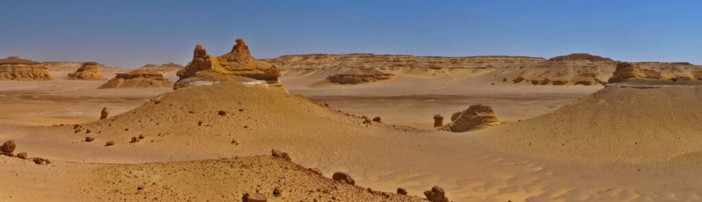
The iconic deserts of the American Southwest—the Mojave, Sonoran, and Chihuahuan—are relatively young landscapes that emerged primarily during the last 8 million years. Their formation resulted from the combined effects of mountain building, changing ocean circulation patterns, and global cooling trends. As the Sierra Nevada and other western mountain ranges rose, they created substantial rain shadows that blocked moisture from reaching interior regions. Simultaneously, the gradual closure of the seaway between North and South America altered ocean currents, affecting regional precipitation patterns. Paleobotanical evidence shows a dramatic transition from woodland and savanna environments to true desert ecosystems during this period. The distinctive plants that now characterize these deserts, including diverse cacti, agaves, and drought-adapted shrubs, evolved specialized adaptations in response to these increasingly arid conditions. Despite their relatively recent origin, these desert ecosystems have become remarkably diverse, supporting thousands of specially adapted plant and animal species. Paradoxically, some of the most distinctive desert landforms, like the hoodoos of Bryce Canyon, formed largely through water erosion during periodically wetter conditions, highlighting the complex interplay between different climate regimes in shaping southwestern landscapes.
The Colorado Plateau’s Ancient Environments
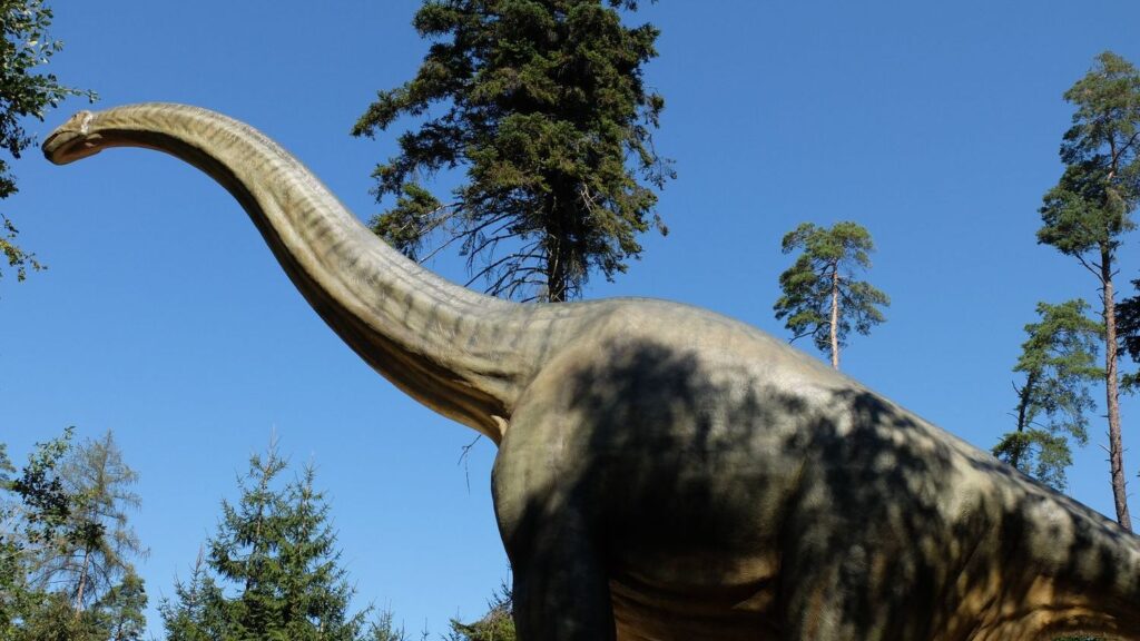
The Colorado Plateau, encompassing parts of Utah, Colorado, New Mexico, and Arizona, preserves an extraordinary record of changing environments spanning hundreds of millions of years. During the Permian period (299-252 million years ago), much of this region consisted of coastal dunes and tidal flats bordering a shallow sea, creating the distinctive red sandstone formations visible today in places like Zion National Park. The Triassic and Jurassic periods saw the region transform into a vast desert comparable to today’s Sahara, with enormous sand dunes that eventually lithified into the sweeping cross-bedded sandstones of Vermilion Cliffs and Canyonlands. By the Late Jurassic, the Morrison Formation—famous for its dinosaur fossils including Stegosaurus, Allosaurus, and Apatosaurus—was deposited in braided river systems and floodplains across the region. The relatively gentle tectonic history of the plateau allowed these ancient sedimentary layers to remain largely horizontal as the entire region was uplifted, creating the perfect conditions for the subsequent erosion that carved iconic features like the Grand Canyon. This exceptional stratigraphic record has made the Colorado Plateau a geological Rosetta Stone, allowing scientists to reconstruct environmental conditions spanning over 500 million years of Earth’s history.
Future Landscapes of the American West
The dramatic geological forces that shaped the prehistoric West continue to operate today, albeit often at imperceptibly slow rates that will nonetheless transform the landscape over deep time. The San Andreas Fault system continues to shift approximately 2 inches per year, gradually moving coastal California northward and potentially creating a future landscape where Los Angeles and San Francisco become neighboring cities in roughly 15 million years. The Yellowstone hotspot remains active beneath the national park, with geological evidence suggesting future large-scale eruptions are inevitable, though not imminent on human timescales. Climate models project significant regional changes in the coming centuries, potentially creating hotter, drier conditions across much of the West that could accelerate erosion and vegetation changes. Meanwhile, tectonic forces continue to build stress in subduction zones along the Pacific Northwest, where massive “megathrust” earthquakes and associated tsunamis have occurred every 300-500 years, dramatically altering coastal landscapes. While human activities now represent a dominant force shaping western environments through water diversion, mining, urbanization, and climate change, the region’s geological underpinnings ensure that swamps, volcanoes, and ice may yet play future roles in the ongoing environmental story of this dynamic region.
Conclusion

From primordial swamps to fiery volcanic landscapes to sculpting ice sheets, the prehistoric environments of the American West represent a testament to Earth’s dynamic nature. These dramatic transformations not only created the physical foundation for the landscapes we recognize today but also influenced the evolution and distribution of plant and animal species across the region. As we face an era of rapid environmental change, understanding the West’s prehistoric past offers valuable context for interpreting current conditions and anticipating future shifts. The geological and paleontological record reminds us that change—sometimes gradual, sometimes catastrophic—represents the only true constant in Earth’s systems. By studying these lost worlds preserved in rock, we gain perspective on our place in the ongoing story of this remarkable landscape.