There is a strange and humbling feeling that happens when you stand at the edge of the Grand Canyon, or press your hand against a mossy boulder in the Appalachians, and suddenly realize that the Earth beneath you is almost incomprehensibly old. Not old like a grandfather clock or a Roman ruin. Old like billions of years. Like time so vast it makes human civilization feel like a single breath.
America’s most beloved natural landscapes are not just beautiful to look at. They are open-air archives of Earth’s deepest history, layered with clues about ancient oceans, vanished supercontinents, and volcanic catastrophes that make anything in recorded human memory look tame. If you know what to look for, every canyon wall, mountain ridge, and geyser field becomes a story. Let’s dive in.
The Grand Canyon: Earth’s Greatest Open Book
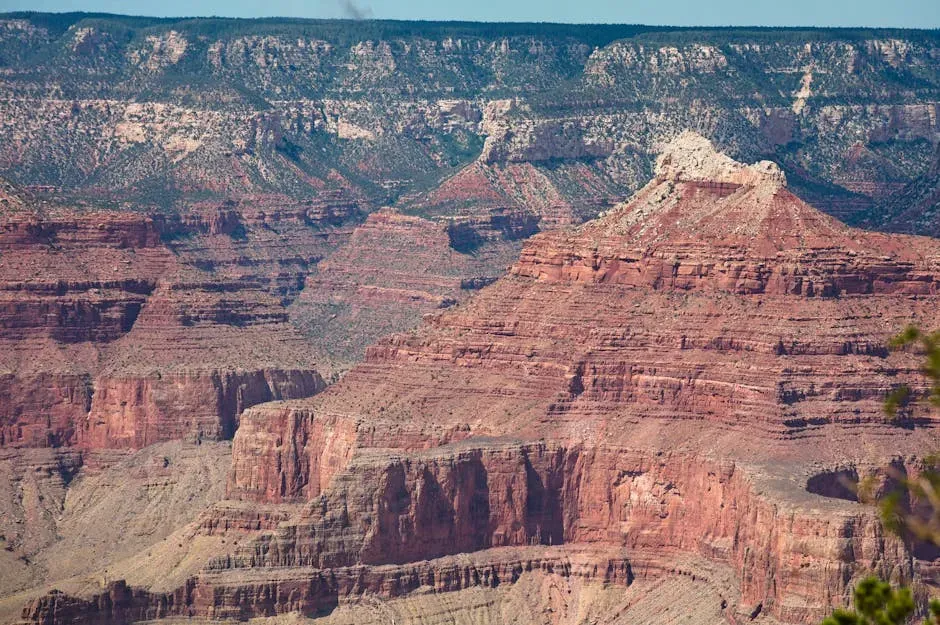
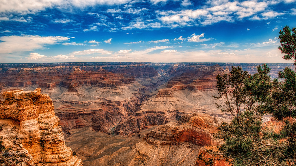
Of all the landscapes on this planet, few come close to matching the Grand Canyon as a raw window into deep time. Nearly two billion years of Earth’s geological history have been exposed as the Colorado River and its tributaries cut their channels through layer after layer of rock while the Colorado Plateau was uplifted. Think about that for a second. Two billion years of story, stacked in color-coded layers you can literally read with your eyes.
Hailed as one of the Seven Wonders of the World, the Grand Canyon exhibits the largest section of geologic time on Earth, and hiking to the bottom means passing through a third of the planet’s age. The deepest rocks you encounter at the canyon’s floor, known as the Vishnu Schist, are nearly 1.8 billion years old. That’s not just geology. That’s almost half the age of the universe captured in stone beneath your hiking boots.
The Great Unconformity: A Billion Years That Simply Vanished
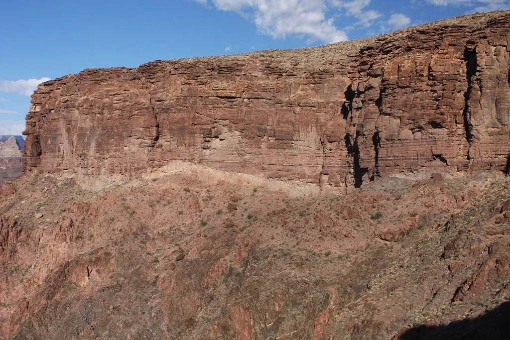
Here’s something that honestly makes my head spin. Inside the Grand Canyon’s walls, there is a visible gap in the rock record so enormous it borders on the surreal. The park contains excellent exposure of the world-renowned Great Unconformity, an impressive angular unconformity occupying 1.2 billion years in the rock record, with the gap straddling the Precambrian to Cambrian boundary. Roughly one billion years of Earth’s history is simply missing. Gone. Erased by erosion.
Unconformities are gaps in the geologic record that occur when rocks or sediments are eroded away and time elapses before new deposition occurs, with new sediment eventually forming new rock layers on top of the eroded surface. You can think of unconformities as missing “pages” in the book of the geologic record. Imagine picking up a novel only to discover that someone tore out an entire chapter covering a billion years. That is the Great Unconformity, and you can see it with your own eyes on a canyon hike.
Yellowstone: The Sleeping Giant Beneath Your Feet
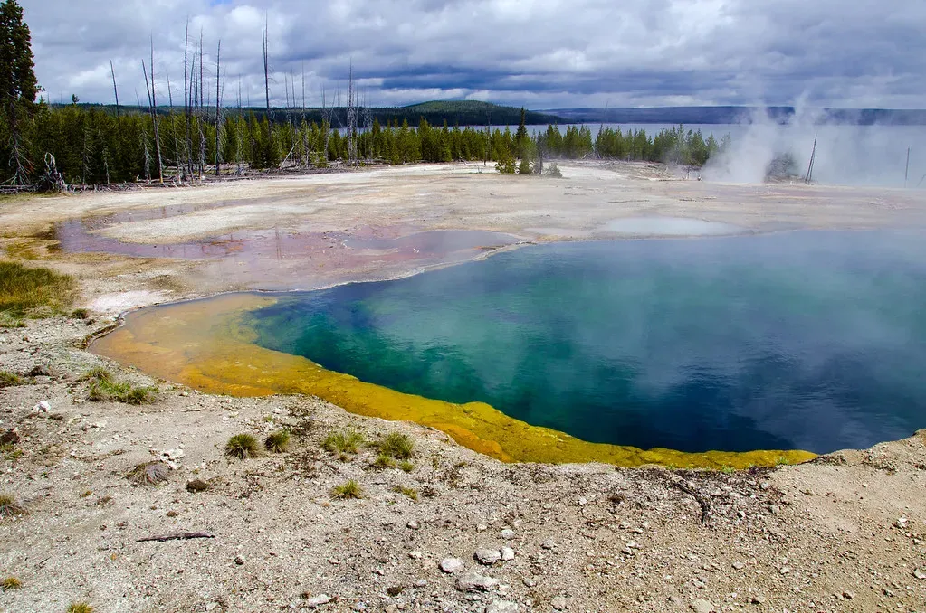
When you stroll the boardwalks of Yellowstone National Park, watching geysers erupt and mud pots bubble, you are walking on top of one of the most geologically violent systems on Earth. The Yellowstone Caldera is the largest in North America, and the Yellowstone hotspot has actually produced three calderas in the Yellowstone region, with the youngest measuring nearly 80 kilometers long and 50 kilometers wide. This is not a dormant wonder. It is an active, breathing supervolcano.
Volcanic activity began in the Yellowstone National Park region a little before about 2 million years ago, when molten rock rising from deep within the Earth produced three cataclysmic eruptions more powerful than any in the world’s recorded history. The Lava Creek eruption of the Yellowstone Caldera, which occurred 640,000 years ago, ejected approximately 1,000 cubic kilometres of rock, dust, and volcanic ash into the atmosphere. Scientists continue to monitor the caldera closely, and they see no evidence that another such cataclysmic eruption will occur at Yellowstone in the foreseeable future, noting that recurrence intervals of these events are neither regular nor predictable.
The Appalachian Mountains: Older Than Sharks, Older Than Trees
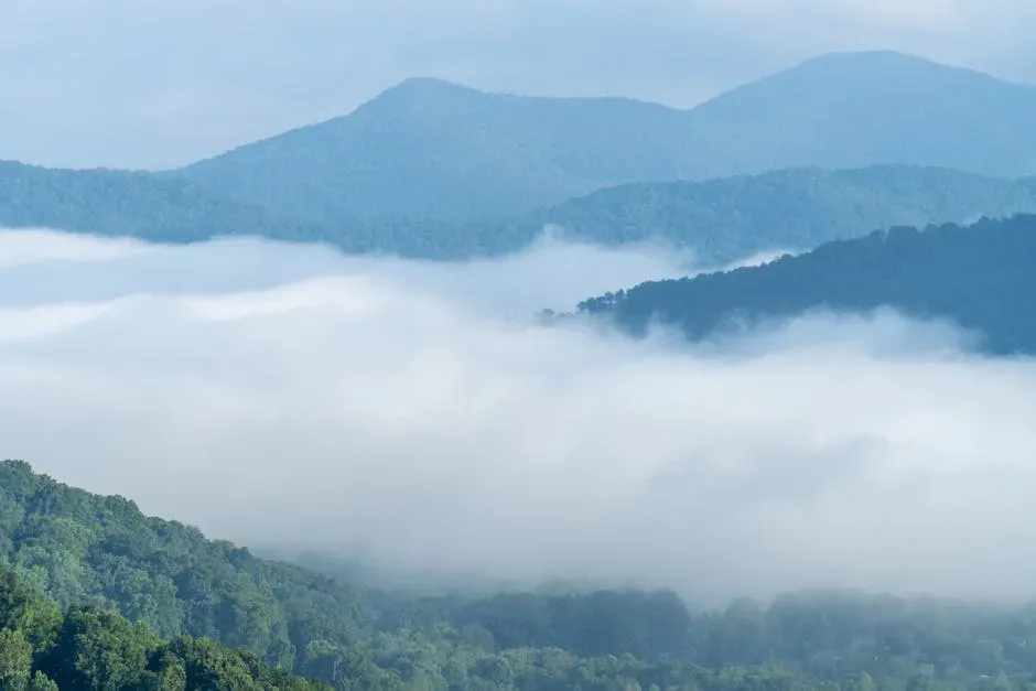
Most Americans drive through the Appalachians on their way somewhere else, admiring the rolling green ridges without a second thought. Yet these gentle mountains carry a staggering secret. The Appalachians are among the oldest mountains on Earth, born of powerful upheavals within the terrestrial crust and sculpted by the ceaseless action of water upon the surface. Their story began in a world completely alien to the one we know today.
The geology of the Appalachians dates back more than 1.2 billion years to the Mesoproterozoic era when two continental cratons collided to form the supercontinent Rodinia. The whole of the Appalachian Mountains is older than the very first tree to sprout, older than the very first animal to walk the earth, and even older than the very first shark to swim the sea. Let that sink in. These rounded, forested hills predate almost all complex life on this planet. These mountain ranges likely once reached elevations similar to those of the Alps and the Rocky Mountains before they were eroded into the modest heights you see today.
Bryce Canyon: Where Freeze and Thaw Sculpt the Impossible
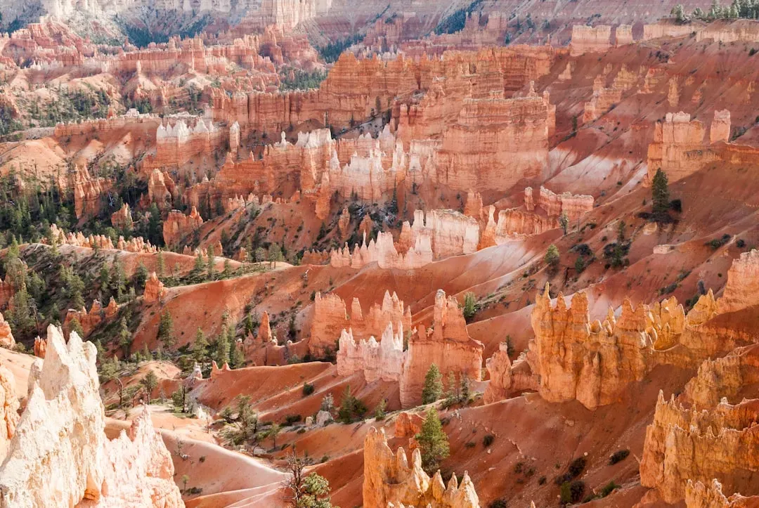
Bryce Canyon looks like something a fever dream invented. Those thousands of tall, thin, flame-colored spires, called hoodoos, seem like they defy physics. But the process that built them is both patient and relentless. Around 15 to 20 million years ago, massive tectonic forces began to uplift the entire Colorado Plateau, slowly elevating the region including the area where Bryce Canyon now stands, creating the Paunsaugunt Plateau, which raised the ancient lakebed rocks thousands of feet, exposing them to the elements.
The formation of Bryce Canyon’s hoodoos is a testament to the relentless power of two primary forces: uplift and erosion, a slow and painstaking process that continues even today, shaping and reshaping the landscape. The secret ingredient is actually ice. Water seeps into cracks in the rock, freezes, expands, and slowly pries the stone apart. Each hoodoo tells a story of ancient lakes, immense uplift, and the patient, relentless forces of erosion. It’s nature’s version of slow-motion demolition, carried out over millions of years.
The Channeled Scablands: Carved by a Biblical Flood That Actually Happened
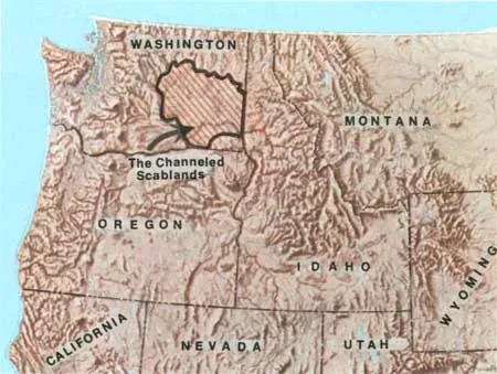
You might not have heard of the Channeled Scablands of the Pacific Northwest, but the geological event that created them is one of the most dramatic in North American history. Several times between 12,000 and 15,000 years ago, an ice sheet crept into the Idaho Panhandle, blocking the Clark Fork River and creating a lake 200 miles long and 2,000 feet deep, and time and again the ice dam broke, unleashing an inland tsunami that swept east into Montana and west all the way to the Pacific. I know it sounds crazy, but this actually happened repeatedly.
Among other feats of geologic engineering, these walls of water diverted the Palouse River and carved the 200-foot cliffs that form the backdrop for Palouse Falls, a beautiful cascade surrounded by desert in southeastern Washington. The sheer scale of these flood events reshaped an entire region in what geologists consider nearly an instant. It is a reminder that deep time is not always slow. Sometimes Earth rewrites its own landscape in a matter of days, leaving scars you can still visit today.
The Colorado Plateau: A Land That Traveled Thousands of Miles
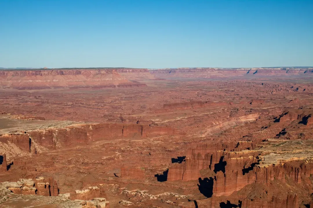
The stunningly vivid red rock country of the American Southwest, from Arches to Zion to Monument Valley, sits on top of the Colorado Plateau, a massive geological platform with a story of dramatic wandering. At this point in Earth’s history, the most spectacular wonders of geology in the United States are found in the West, where for the last 500 million years, dynamic forces have been staging geologic dramas from Sedona to Seattle. This region was once near the equator. Completely flat. Covered by vast, ancient seas.
If you allow yourself to be taken back into deep geologic time, you would find strange creatures roaming the Earth and Western North America looking completely unlike the modern landscape, with volcanic islands stretching from Mexico to Alaska and most of the Pacific Rim not yet existing as widespread dry land. Uplift of the region started about 75 million years ago during the Laramide orogeny, the mountain-building event largely responsible for creating the Rocky Mountains to the east, and in total the Colorado Plateau was uplifted an estimated 2 miles. Two miles straight up, without a single explosion. Just the slow, grinding push of tectonic forces over millions of years.
Mammoth Cave: The Longest Known Underground World on Earth
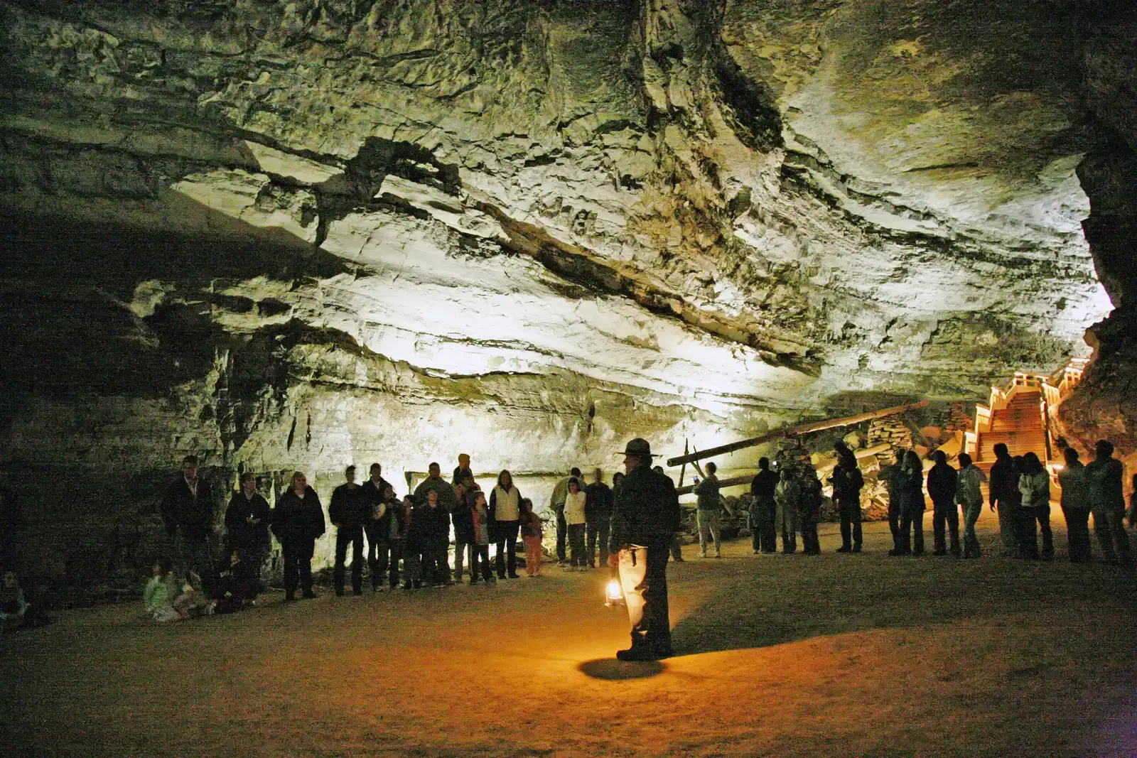
Beneath the rolling farmland of south-central Kentucky lies a geological achievement so vast it is genuinely difficult to comprehend. Mammoth Cave is the longest recorded cave system in the world with over 400 mapped miles, and it preserves part of an archetypal karst landscape with sinkholes, vertical shafts, windows, and springs. Honestly, those numbers alone should stop you in your tracks. Over 400 miles of mapped tunnels, and geologists believe there is still more to find.
The cave’s formation is a masterclass in patient geology. Slightly acidic rainwater slowly dissolved the limestone bedrock over millions of years, carving passages, chambers, and corridors in absolute darkness. During the Carboniferous Period, 358.9 to 298.9 million years ago, the long process of sedimentation included the formation of some of the richest limestone and coal deposits in the world. The very rock that Mammoth Cave carved itself into was laid down by ancient shallow seas that covered Kentucky hundreds of millions of years ago. Every passage you walk through underground was once the floor of an ocean.
Conclusion: You Are Always Standing on Deep Time

What strikes me most about all of this is how invisibly it hides in plain sight. You can stand at the rim of the Grand Canyon and see two billion years of history without fully absorbing what that means. You can drive through the Appalachians while listening to a podcast, entirely unaware that the mountains outside your window predate sharks. The landscapes of America are not just scenery. They are records of a planet constantly remaking itself, one slow catastrophe at a time.
Core geologic concepts such as volcanism, mountain building, deep time, tectonics, sedimentation, and glaciation all come alive when you use America’s beloved parks as touchstones. Deep time is not an abstract concept reserved for scientists. It is everywhere around you, carved into canyon walls, folded into mountain ridges, and bubbling up through the ground at Yellowstone. The question is not whether these landscapes hold secrets. The question is whether you will slow down long enough to read them.
Next time you visit one of these places, try this: put your hand on the rock. Feel its texture. Ask yourself what world it came from. The answer will be far stranger, and far more wonderful, than you expect. What would you have guessed was hiding beneath the landscape all along?