There is something quietly breathtaking about standing on a rocky outcrop in the Canadian wilderness or gazing into the layered walls of the Grand Canyon. You are not just looking at scenery. You are reading a story written in stone, a story so old it makes human history feel like a footnote. North America is one of the most geologically complex and ancient landmasses on Earth, shaped by forces that defy easy imagination.
From the collisions of ancient continents to the slow grind of glaciers, every ridge, valley, and canyon on this vast continent carries the fingerprints of an almost incomprehensible past. What you see on the surface today is, honestly, the final sentence of a multi-billion-year epic still being written. So let’s dive in.
The Ancient Heart: North America’s Primordial Core
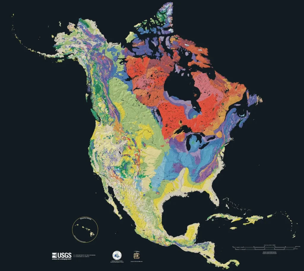
You might not think of the flat, quiet interior of Canada as one of the most remarkable places on Earth, but it absolutely is. North America is an ancient continent in several respects. It contains some of the oldest rocks on Earth, its interior has been stable for the longest period of time, and it was the first continent to achieve approximately its present size and shape. That stability is not boring – it’s extraordinary.
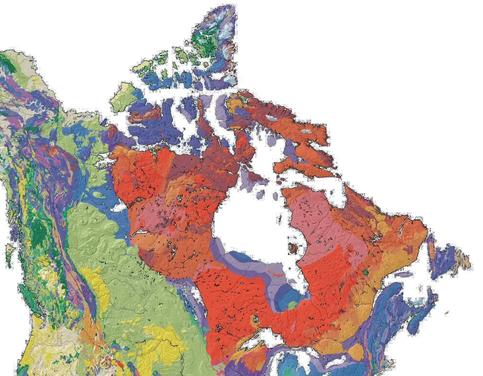
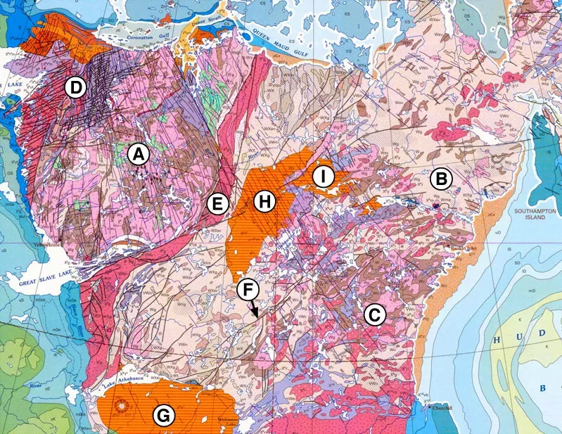
The ancient core at the heart of the continent is known as the Canadian Shield, and it holds records that geologists consider priceless. The ratio of neodymium and samarium was used to estimate the age of the faux amphibolite volcanic deposits of the Nuvvuagittuq greenstone belt in Quebec, Canada, and these rocks are estimated to be 4.28 billion years old. Think about that for a moment. These rocks formed when the Earth itself was barely getting started.
Laurentia: The Proto-Continent That Became North America
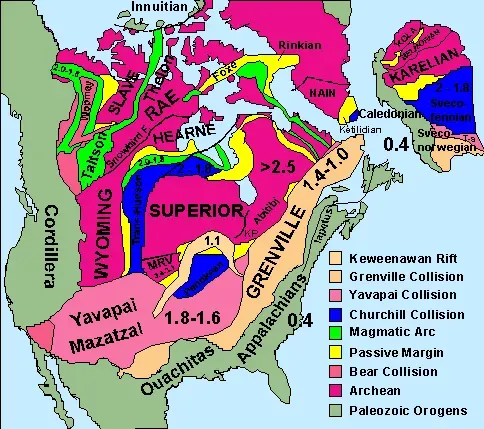
Long before you could have called it “North America,” this landmass went by another name entirely. Laurentia, or the North American craton, is a large continental craton that forms the ancient geological core of North America. It spent billions of years drifting, colliding, and being reshaped before it even remotely resembled what you see on a map today.
The assembly of this core was a slow, violent process involving multiple ancient landmasses smashing together. Ancestral North America, also known as Laurentia, was built around 10 or more Archean cratonic fragments of varying size. Imagine 10 different puzzle pieces, each made of rock billions of years old, eventually crashing together over hundreds of millions of years. That is how the foundation of a continent is built.
Collisions and Cratons: Assembling a Continent Piece by Piece
Here’s the thing about building a continent – it is not a gentle process. Although its known geologic history spans almost 4 billion years, two ages stand out as turning points. The first was about 1.8 billion years ago, when several continental fragments coalesced to form the stable crust underlying the Canadian Shield and northern interior platform. That collision was on a scale that makes today’s earthquakes seem trivial.
The greenstone belts that emerged from these ancient collisions are more than geological curiosities – they are economically significant. As exposed in the Canadian Shield, the thickened crust consists of many varieties of granitic intrusions separated by belts of folded and faulted volcanic and sedimentary rocks. These deformed rocks are known as “greenstone belts” and contain economically viable concentrations of gold, silver, copper, zinc, and lead. The ancient violence of plate collisions quite literally seeded the ground with wealth.
Supercontinents and Rifts: North America’s Restless Journey
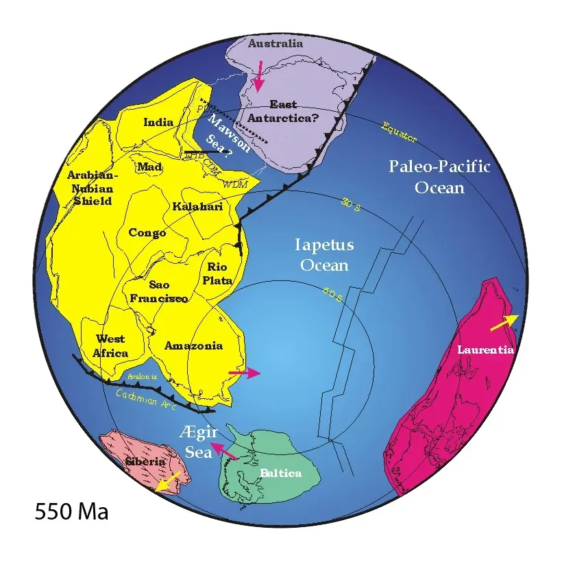
You may have heard of Pangaea, the great supercontinent that once held all of Earth’s landmasses together. But North America’s involvement with supercontinents goes back even further than that. The Grenville Orogeny was one of several Precambrian continental collisions that led to the assembly of the supercontinent Rodinia between about 1.4 billion and 900 million years ago. Rodinia was Pangaea’s much older ancestor, and North America sat right in the middle of it.
When Rodinia eventually broke apart, it set off a chain of geological consequences that would echo for hundreds of millions of years. Rodinia broke up about 750 million years ago. The geological evidence for this breakup includes large lava flows that are found where continental rifting took place. Seafloor spreading eventually started and created the oceans between the continents. Breakups, it turns out, are just as geologically transformative as collisions – whether you’re talking about supercontinents or otherwise.
The Western Interior Seaway and the Age of Dinosaurs
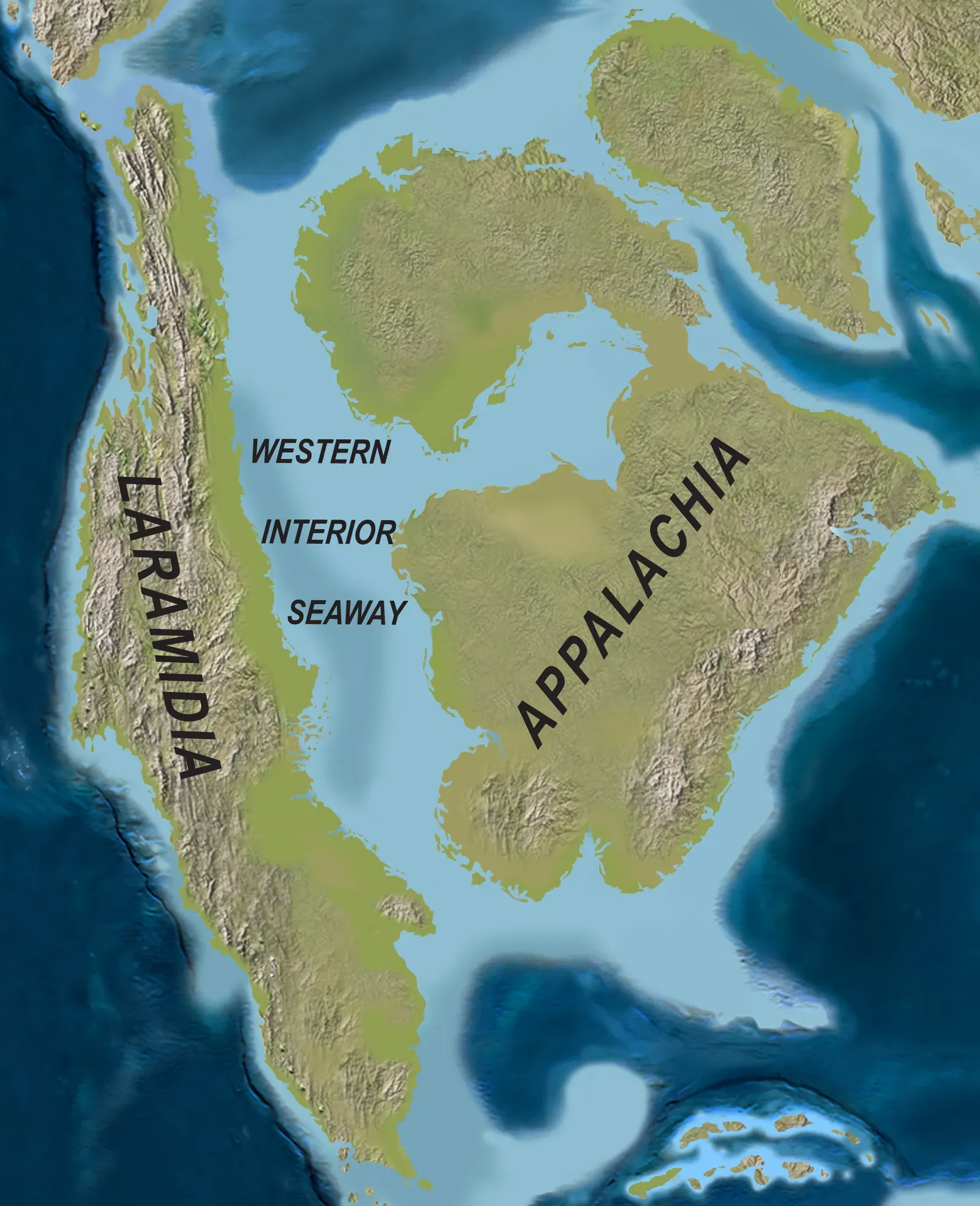
I know it sounds crazy, but roughly 100 million years ago, a shallow inland sea split North America in two. One hundred million years ago the entire state of Colorado and much of middle North America was submerged under the Western Interior Seaway. This was not a quiet pond – it was a warm, vast body of water teeming with marine life and bordered by jungles where some of the most famous dinosaurs ever discovered once roamed.
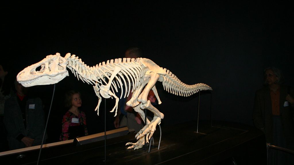
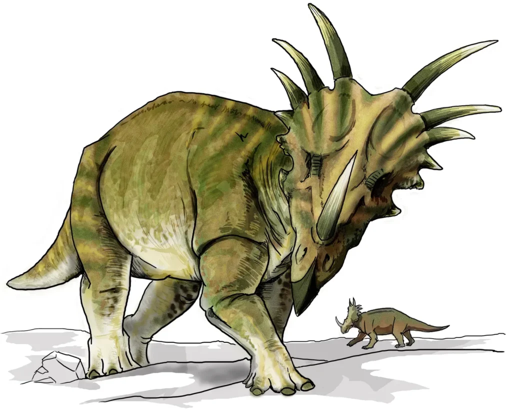
When the sea began to retreat, it triggered geological events that still define the American landscape. Powerful geologic forces began to fold and distort the rocks of Idaho, Utah, and Wyoming, beginning the processes that would form the Rocky Mountains. The dinosaurs living in the region during this transition – creatures like Triceratops and Tyrannosaurus – were witnessing the birth of mountain ranges that still tower above the plains today.
The Laramide Orogeny: How the Rockies Defied the Rules
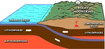
Let’s be real – the Rocky Mountains should not exist where they do. The modern-day Rocky Mountains are considered “weird” by geological standards. Most mountain ranges occur at tectonically active spots where tectonic plates collide, move away from each other, or slide past each other; the Rockies, however, are located in the middle of a large, mostly inactive continental interior away from a plate boundary. Geologists have spent decades puzzling over this.
The answer lies deep beneath the surface, in the strange behavior of an ancient ocean plate. Geologists attribute the Laramide Orogeny to the subduction of an oceanic plate, specifically the Farallon Plate, beneath the North American Plate. This subduction began roughly 160 million years ago, but the Laramide Orogeny only commenced around 80 to 70 million years ago. For some of its history, the Farallon Plate traveled more than 1,000 kilometers beneath North America at relatively shallow depths. That shallow angle is what pushed mountain-building so far inland. It is, honestly, one of the most fascinating geological puzzles on the planet.
The Ice Age Sculpts a Continent: Glaciers as Nature’s Bulldozers
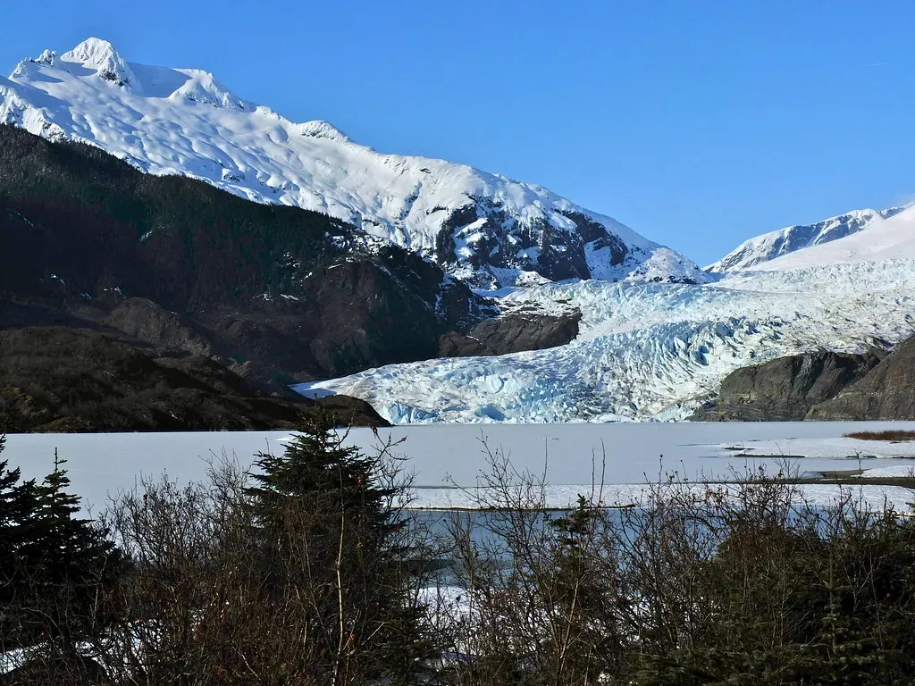
Even after all those billions of years of tectonic drama, one final act of geological transformation swept across North America – the Ice Age. The largest was the Laurentide Ice Sheet in North America, which at times stretched from the Canadian Rocky Mountains on the west to Nova Scotia and Newfoundland on the east and from southern Illinois on the south to the Canadian Arctic on the north. This was not a thin dusting of snow. It was a continent-crushing mass of ice that physically reshaped the land beneath it.
The legacy of those glaciers is still absolutely visible in the landscape you can explore today. The Laurentide Ice Sheet created much of the surface geology of southern Canada and the northern United States, leaving behind glacially scoured valleys, moraines, eskers and glacial till. It also caused many changes to the shape, size, and drainage of the Great Lakes. Every time you fish on a Great Lake or drive across the rolling plains of the American Midwest, you are traveling across terrain that a glacier carefully scraped, deposited, and molded.
Conclusion: A Continent Still in the Making

North America is not a finished product. It never was. Every eruption in Yellowstone, every tremor along the San Andreas Fault, and every millimeter of seafloor spreading in the Atlantic is proof that the geological engine beneath this continent never truly rests. The shape and position of North America has changed dramatically over the last billion years, and geologic processes continue these changes today. Compression from colliding plates, tension from plates pulling apart, the addition of land to North America, weathering, and erosion have all combined to slowly sculpt the form of the continent.
The ground you stand on right now is, in the grandest sense, temporary. Billions of years from now, it will look nothing like it does today. The rocks, though? They will still be telling the story – layer by layer, mineral by mineral. North America is not just a place you live. It is a living archive of Earth’s most dramatic chapters, and you are walking through its pages every single day. Does knowing that change the way you see the ground beneath your feet?