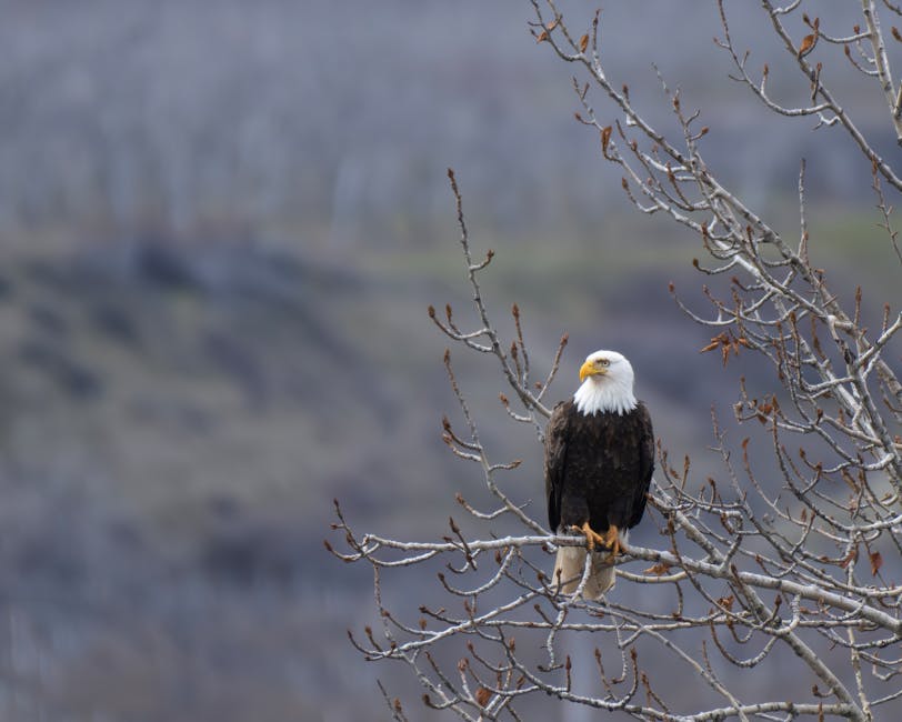
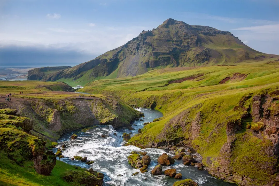
You might look at the Mississippi River, the Great Plains, or the Grand Canyon and take them more or less for granted. They’re just there, part of the backdrop of a familiar continent. What’s easy to miss is that none of it was inevitable. Every valley, every broad flood plain, and every dramatic canyon was negotiated over millions of years between flowing water and resistant rock.
The rivers you see today are, in many ways, just the latest draft. Long before them came enormous river systems that have since vanished, been buried by ice, or been rerouted so completely that their original courses are only visible through microscopic crystals, deep-sea sediment cores, and the careful detective work of geologists. Understanding those ancient waterways changes how you read the land itself.
The First Rivers: Water on a Primordial Continent
Long before anything resembling the modern North American landscape existed, rivers were already doing their work. More than a billion years ago, narrow strips of land collided and compressed to form the Precambrian beginnings of the North American continent, known as Laurentia. From this proto-North America, sediment was eroded and transported by rivers and streams across the ancient continental margins and into adjacent oceans.
Weathering and erosion have been constants throughout the history of time. Rocks are constantly worn down and broken apart into finer and finer grains by wind, rivers, wave action, freezing and thawing, and chemical breakdown. Over millions of years, weathering and erosion can reduce a mighty mountain range to low rolling hills. You can think of this as the planet’s own slow-motion recycling program, one that never fully stops.
Reading the Rock: How Geologists Decode Ancient River Courses
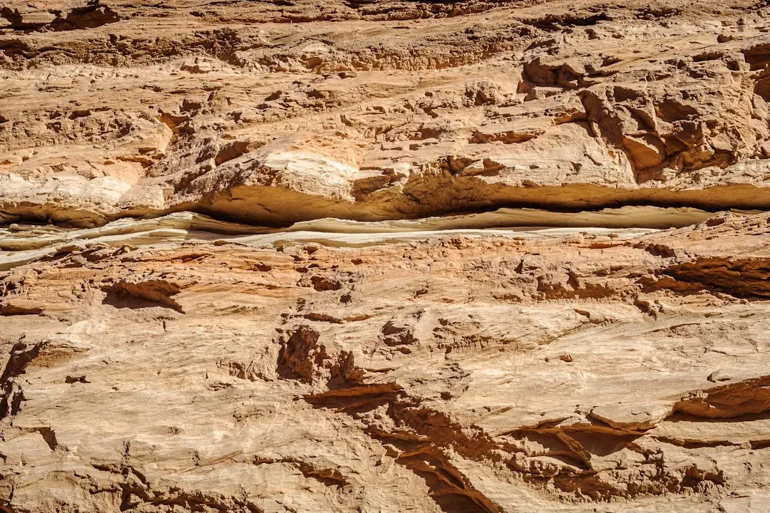
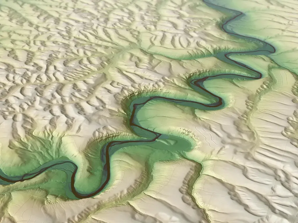
Geologists can reconstruct the courses of long-vanished rivers. The method by which they identify them should be familiar: if you take away a river, you are left with its sediments, which will eventually lithify. This leaves a set of rocks which look just like the lithified sediments of a river. In other words, the rivers are gone but they left a very detailed paper trail.
Both sorting and layering of sediments in river deposits are used to determine the location of ancient highlands and lowlands. To obtain a picture of ancient geography as it existed during a particular interval of geologic time, geologists plot the distribution of various kinds of rocks. Fossils, the size and sorting of grains, and the direction of cross-beds in rocks are among the most useful clues that geologists use to reconstruct paleogeography.
The Paleo-Bell River: North America’s Lost Amazon
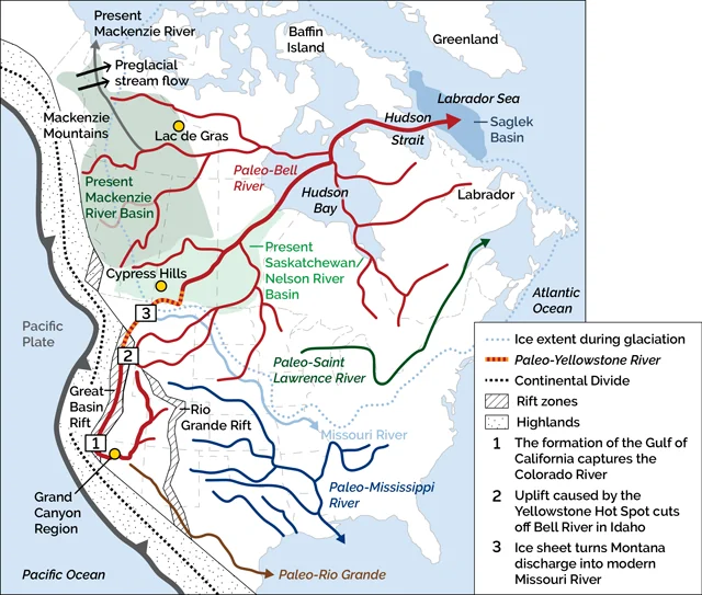
Earth scientists have long wondered why North America does not have a west-to-east-flowing river basin of similar scale to the Amazon, given the similar geologic histories of the two continents. In fact, North America did have such an extensive river system. From about 50 million to 3 million years ago, this system drained an area larger than today’s Amazon before it was supplanted by the continent’s modern river systems during the Pleistocene.
In recent years, as details of this former fluvial giant have emerged, it has become known as the Paleo-Bell River in honor of Canadian geologist Robert Bell, who first presented evidence of its existence. Researchers said they have found fresh evidence of the river’s existence by comparing sediment deposits about 1,800 miles apart and analyzing shells left by marine life of the time. The Saskatchewan and Nelson river systems, which drain much of Alberta, Saskatchewan and Manitoba, and part of North Dakota, are now considered the last remnants of the Paleo-Bell River system.
The Ice Age Rewrites Everything: Glacial Rerouting of Rivers
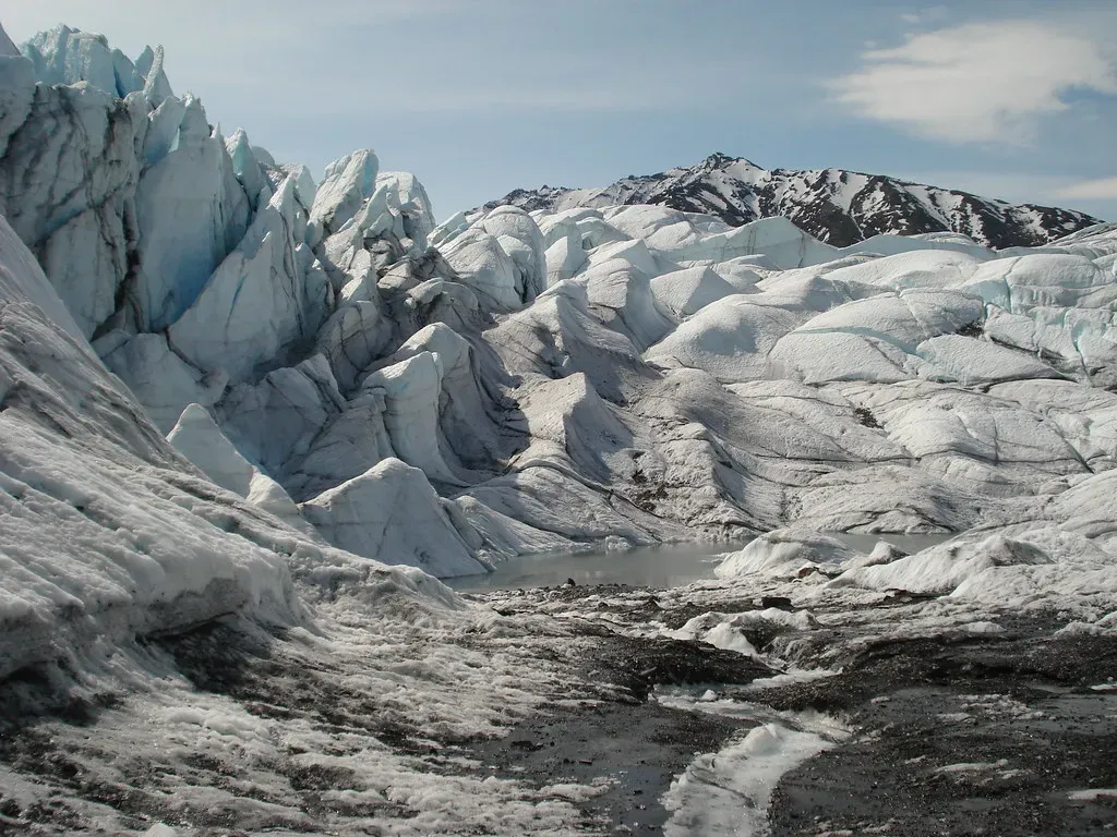
As the ice sheet advanced and retreated across the landscape, it intercepted, rerouted, and permanently modified river networks across the continent. Creeks and rivers in the Midwest have been following their current courses for only a few tens of thousands of years, at most. As glaciers scraped over the area, the ice sheets covered river valleys and filled them with sediment, effectively shoving rivers out ahead of them by forcing water to flow around their margins.
Until the ice sheets pushed down into North Dakota about two and a half million years ago, all the rivers in North Dakota flowed north and drained into Hudson Bay. For more than a century, it has been documented that the advance and retreat of Quaternary ice sheets in North America profoundly altered fluvial drainage patterns. The southwesterly path of the Missouri River, for instance, is the direct result of rerouting the river roughly parallel to the ancient ice margin.
The Mississippi System: An 80-Million-Year Story
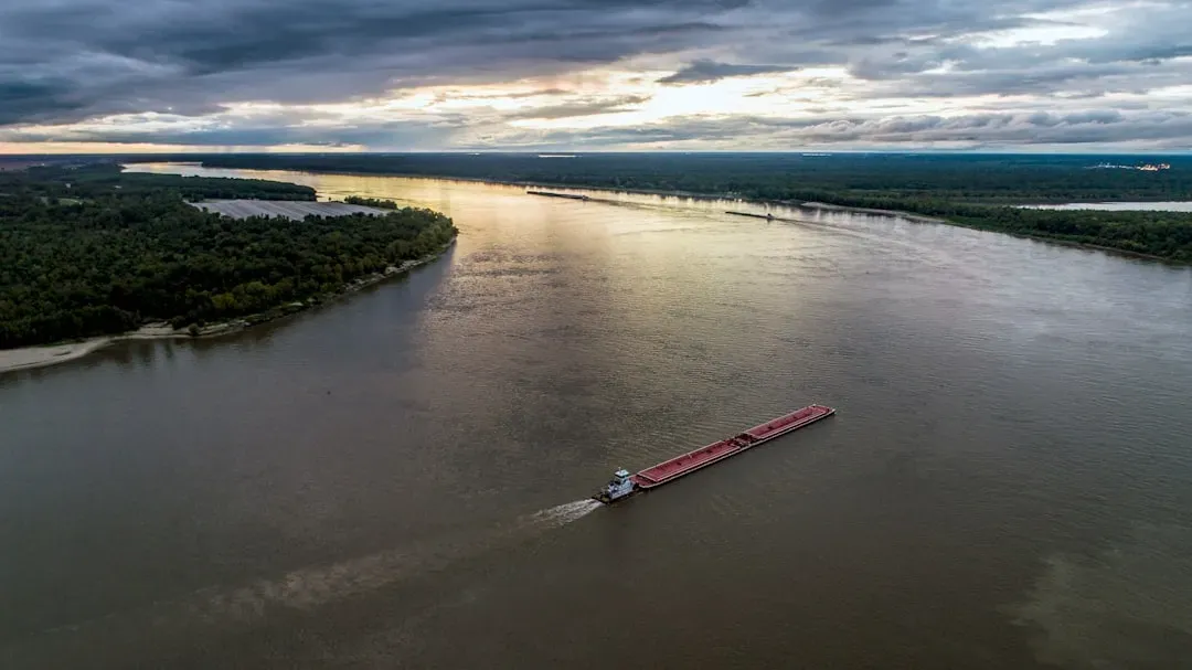
The Mississippi River has accumulated a fluvial sedimentary succession over 80 million years. Through the last 11,700 years of the Holocene Epoch, the wild river shaped the landscape in ways that have become classic in geological studies of ancient river strata. Clues to the river’s history and former ecosystems are in the composition and thickness of sediment layers, along with the animal bones, plant debris, chemical traces, and relics of human culture caught up among them.
Between the Last Glacial Maximum and the Younger Dryas cold event, it has been estimated that roughly nine out of every ten gallons of North American meltwater were discharged into the Gulf of Mexico via the Mississippi River drainage system. The huge volume of sediment deposited by the Mississippi River helped to build the greatest breadth of the Coastal Plain, which stretches approximately 800 kilometers from southeastern Missouri to the Mississippi Delta.
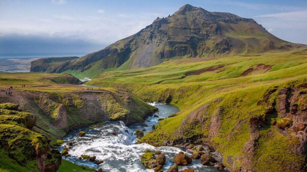
The Colorado River and the Grand Canyon: A Mile-Deep Record
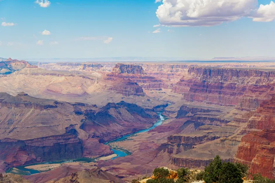
This incredible formation was carved over millions of years by the Colorado River. The canyon itself has formed much more recently than the deposition of rock layers, only about five million years ago, as opposed to the rocks, the youngest of which are a little less than 300 million years old. The major geologic exposures in the Grand Canyon range in age from the two-billion-year-old Vishnu Schist at the bottom of the Inner Gorge to the 270-million-year-old Kaibab Limestone on the Rim.
The uplift of the Colorado Plateau was another key factor in the canyon’s formation. This geological event steepened the river’s path, allowing it to cut deeper into the earth. The uplift enabled the river to carve the canyon to its current depth of more than a mile in some places. In the last two and a half million years, repeated cycles of glaciation in the Rockies caused huge Ice Age floods to roar down the river. As the river deepened its track in the Grand Canyon, the tributary streams kept pace as their load of more and bigger debris incised into the bedrock.
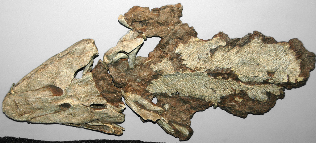
Ancient Appalachian Rivers: Some of the Oldest Waterways on Earth
The New River flows for 320 miles from the Blue Ridge Mountains of North Carolina northwest into Virginia and West Virginia, where it eventually connects with the Kanawha River. The river system is contained within basins in the Appalachian Mountains, and some scientists believe it is older than these mountains and that the water rose with them as they formed. The Susquehanna River is roughly the same age as the New River, somewhere between 260 and 325 million years old.
Antecedence and superimposition are geologic processes that explain how and why rivers can cut through mountain systems instead of going around them. Located in North Carolina, the French Broad River is known for being one of the oldest bodies of water on the continent. It could potentially be the oldest of all rivers in the United States, with some evidence suggesting it was created around 320 to 340 million years ago. When you trace a finger along these rivers on a map, you’re tracing corridors that predate the dinosaurs.
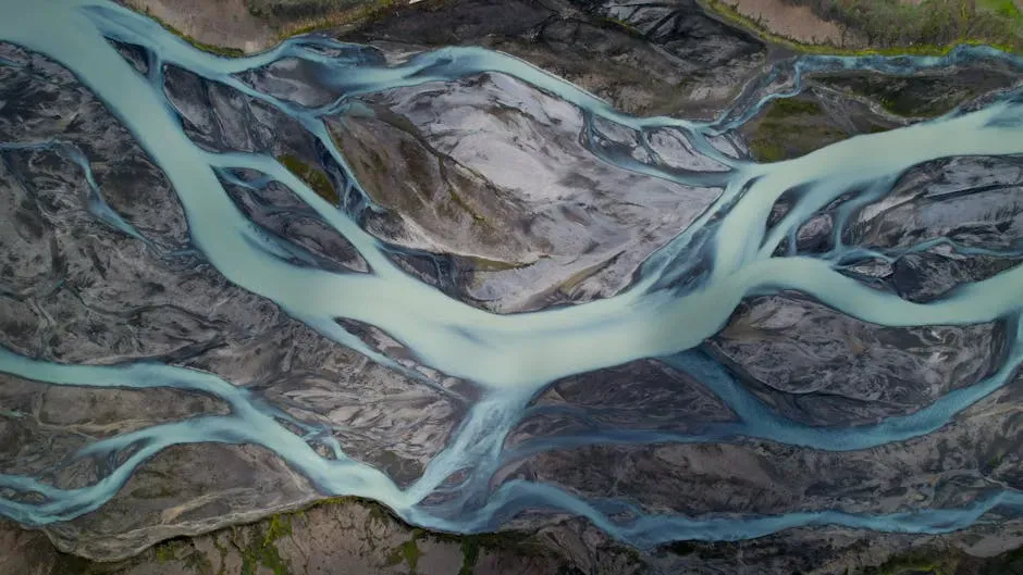
Submerged Channels: Prehistoric Rivers Now Beneath the Sea
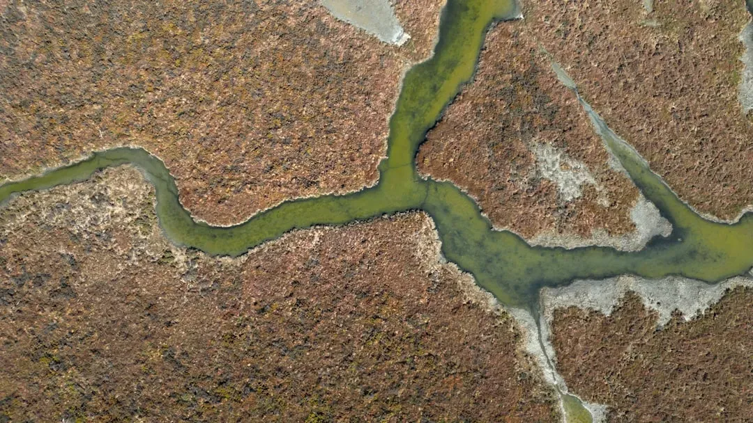
During a 2023 field season, NOAA scientists conducting mapping surveys of the seafloor off Wilmington, North Carolina, discovered what is believed to be well-preserved ancient remnants of a paleochannel system that could give a glimpse of what the North Carolina coastline looked like approximately 20,000 years ago. The location of these newly discovered paleochannels indicates that they may have once been part of North Carolina’s historic Cape Fear River and were likely above sea level during the Last Glacial Maximum.
These paleochannels now lie at the bottom of the ocean off the Wilmington coast, but they were once very active fluvial systems that may have supported many species, habitats, and potentially even humans. The last time this area was above sea level was during the Last Glacial Maximum approximately 20,000 years ago, when sea level was more than 400 feet lower than it is today. It’s a striking reminder that the coastline you see today is itself just a snapshot, one frame in a very long film.
What the Land Remembers: Sediment, Soil, and the Agricultural Legacy
Much of the soil throughout the Midwest is composed, in part, of sediment blown from the huge mudflats on the banks of the ancient Missouri River, which was a major channel for floods of glacial meltwater. The Peoria Loess, a layer of windblown rock flour dating to the Wisconsinan glacial interval, covers much of Illinois, Indiana, Iowa, and Wisconsin, as well as parts of Minnesota and Ohio.
Meltwater from the north was filled with sediment that accelerated erosion, carving most of the region’s modern river valleys into the landscape. As the flowing water approached the coast and slowed, it dumped its load of sediment, helping to build the Coastal Plain out into the Gulf of Mexico. Ancient glacial Lake Agassiz deposited sediments more than 100 feet thick on the bottom of its lake bed as it disappeared. Grass growing on that sediment-enriched soil transformed the Red River Valley into some of the most productive agricultural land in the world. The farms you see stretching across the northern plains owe their fertility not to anything recent, but to a vanished lake fed by vanished rivers.
The Climate Connection: How Prehistoric Rivers Still Shape Weather Patterns
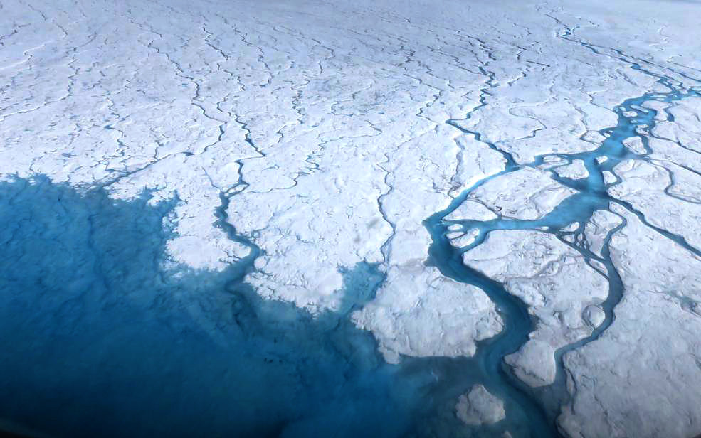
The Greenland Ice Sheet is currently melting freshwater into the sea in the same area where the Paleo-Bell River is believed to have emptied freshwater into the Labrador Sea. Scientists working separately have suggested that freshwater from the melting ice sheet is slowing Atlantic meridional overturning circulation, which could have major implications for global climate.
This flux has been linked to abrupt cooling events during the last deglaciation, as massive, temporary pulses of fresh meltwater off the North American continent disrupted North Atlantic thermohaline circulation. Often occurring over geologically short time scales, large-scale paleogeographic changes related to Pleistocene ice sheets significantly affected the evolution and migration patterns of flora and fauna, including early humans. In North America, the demise of the ice bridge connecting the Laurentide and Cordilleran ice sheets may have allowed southward passage by early humans, and the meltwater generated by the final collapse of this bridge roughly 14,500 years ago caused significant sea level rise and global climate change.
Conclusion: Reading a Continent Written in Water
Every time you cross a river valley, drive through a broad flat plain, or stand at the rim of a canyon, you’re standing inside evidence. The prehistoric rivers of North America didn’t just pass through the landscape. They built it, rerouted it, buried parts of it, and left nutrients in the soil that feed people today. They connected glaciers to oceans and shaped the paths that early humans followed across an entire continent.
What makes this story genuinely compelling isn’t just its scale. It’s the fact that none of it is truly finished. Rivers are still adjusting to the last ice age. Sea levels are still rising over drowned channels. Sediment is still moving from mountains to deltas. The continent beneath your feet is a work in progress, and the rivers, past and present, are still writing the next chapter.