
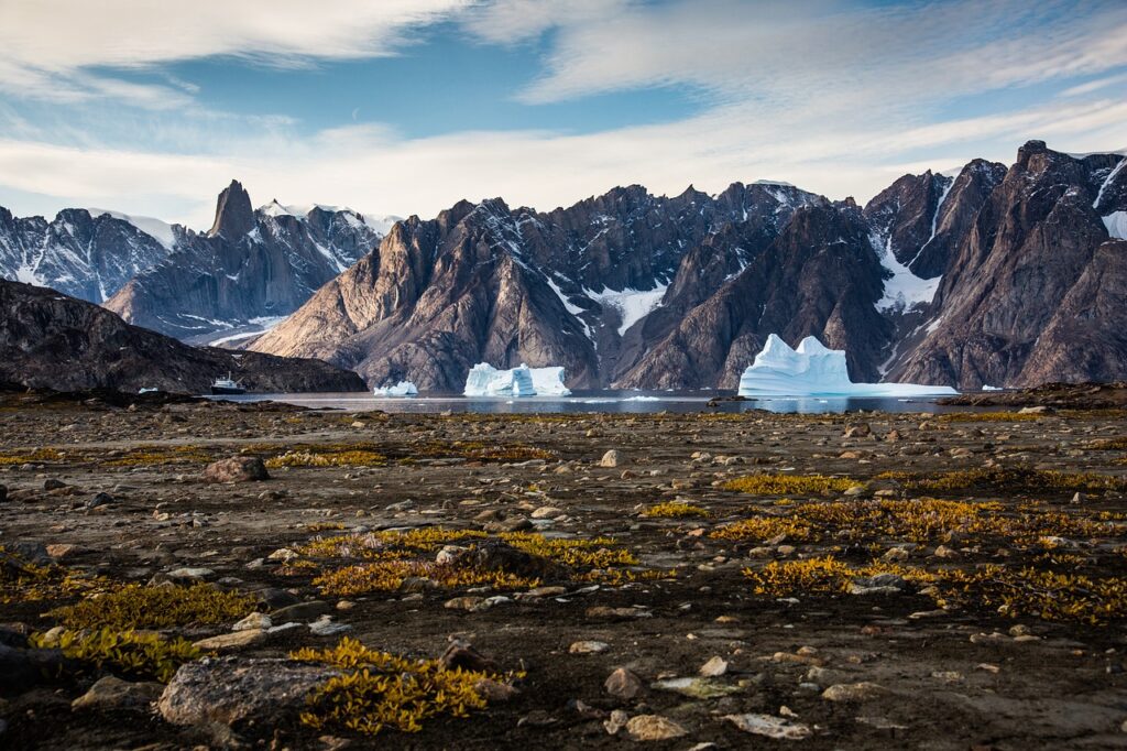
Across the United States, some of the most dramatic landscapes were carved, twisted, or drowned by forces that have gone quiet. Ancient ice sheets are gone, inland seas have drained away, volcanoes have fallen asleep, and rivers have shifted or died. Yet their fingerprints are everywhere, hiding in plain sight on road trips, national park postcards, and even satellite images.
Once you start seeing these ghost processes, the country looks different. A flat Midwest cornfield becomes the bottom of a vanished lake. A red rock canyon turns into a slow-motion echo of a river that no longer roars the way it used to. It is a bit like reading old diary entries the Earth wrote to itself, in stone and sediment instead of ink.
Let’s walk through twelve American landscapes whose shapes were formed by something that is not happening anymore – or at least, not in the same wild, overwhelming way. Think of it as time travel without needing a machine, just a decent map and a willingness to imagine.
#1 The Great Lakes: Ghosts of the Laurentide Ice Sheet
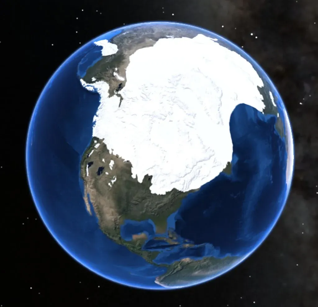
It is hard to imagine that the Great Lakes – holding roughly about one fifth of the world’s surface freshwater – owe their existence to a sheet of ice that no longer exists. During the last Ice Age, the Laurentide Ice Sheet smothered much of what is now the northern United States under ice that was in places more than a mile thick. That ice has been gone for thousands of years, but its legacy is the five inland seas that define the region today.
As the ice sheet advanced, it acted like an unimaginably heavy bulldozer, grinding bedrock and scooping out deep basins. When the climate warmed and the ice melted, those basins filled with water, leaving behind the outlines we now trace on maps as Superior, Michigan, Huron, Erie, and Ontario. The ice also dumped piles of debris, called moraines, that act like natural dams and shorelines. Without that long-vanished glacier, Chicago would not be a lakefront city and Buffalo’s famous snowbelts would not exist.
Today, the Great Lakes are shaped mainly by waves, currents, and human engineering rather than ice. Shorelines erode, dunes shift, and lake levels rise and fall with the seasons, but nothing is carving giant new basins anymore. The colossal process that created the overall form of the region – the advance and retreat of a continental ice sheet – has stopped. What we see now is the afterimage of glacial violence, softened by forests, cities, and sailboats.
- Formed by the vanished Laurentide Ice Sheet
- Basins carved by glacial grinding and later filled with meltwater
- Modern changes are small-scale compared to ancient ice-driven sculpting
#2 The Grand Canyon: A River That Does Not Cut Like It Used To
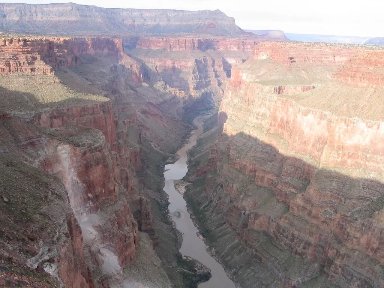
The Colorado River still flows through the Grand Canyon, but the mighty sculptor that carved its mile-deep gorge is not the same river that trickles, dam-controlled, through the canyon today. For millions of years, a wilder, sediment-laden Colorado chewed relentlessly through layers of rock, cutting down faster than the surrounding landscape could rise. What we hike now is mostly the frozen product of that more energetic, pre-dam river.
In the past, seasonal floods surged through the canyon, carrying enormous loads of sand and boulders. Those floods scoured the riverbed, undercut cliffs, and fed side canyons, constantly reshaping beaches and ledges. The modern river, throttled by upstream dams like Glen Canyon Dam, is much more regulated. Peak flows are tamer and more predictable, and vast amounts of sediment are trapped behind reservoirs instead of blasting through the canyon.
Geologically speaking, the canyon is never entirely “finished,” but the great phase of rapid excavation is largely over. Tectonic uplift of the Colorado Plateau has slowed, and human infrastructure has choked off the river’s most destructive moods. In that sense, the landscape we admire is the monument of a river that is not really allowed to be itself anymore. The process that carved the canyon – unrestrained, sediment-rich, high-energy flow over deep time – is a story from another era.
#3 The Channeled Scablands: Catastrophic Floods That Will Not Return
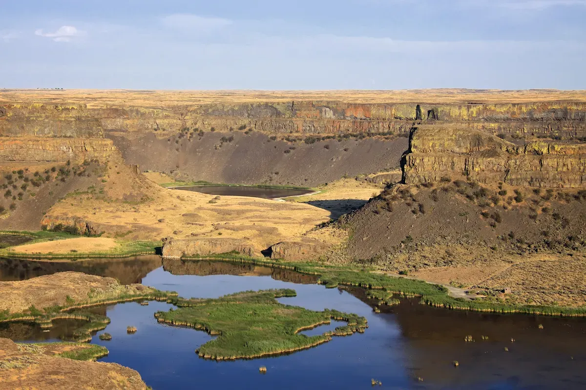
Eastern Washington’s Channeled Scablands look almost alien: dry coulees that resemble river valleys with no rivers, giant potholes, and cliff faces called “dry falls” with no water plunging over them. For a long time, geologists were baffled. Then came the idea that this landscape was carved not by a gentle river over millions of years, but by monstrous floods that are no longer happening.
During the last Ice Age, an ice dam repeatedly blocked what is now called Glacial Lake Missoula in Montana. When that dam failed, huge volumes of water – several times the flow of all the world’s current rivers combined – raced across eastern Washington in a matter of days. These jökulhlaup-style megafloods scoured bedrock, ripped away soil, and scooped out giant depressions. The now-dry Dry Falls, for example, once saw water thundering over it on a scale dwarfing today’s Niagara Falls.
Those ice-dam failures and catastrophic outburst floods ended as the climate warmed and the ice sheets vanished. Today, the Scablands are mostly dry farmland and sagebrush steppe, crossed by modest modern rivers that could never carve such features on their own. The landscape is a freeze-frame from a chapter of Earth history when sudden, violent floods rewrote topography in a geological instant – a chapter that has definitively ended.
- Carved by repeated Ice Age megafloods from Glacial Lake Missoula
- Modern rivers are too small to reproduce the existing landforms
- Ice-dam collapse process stopped when continental ice disappeared
#4 The Badlands: A Fossil-Rich Landscape of Slowing Erosion
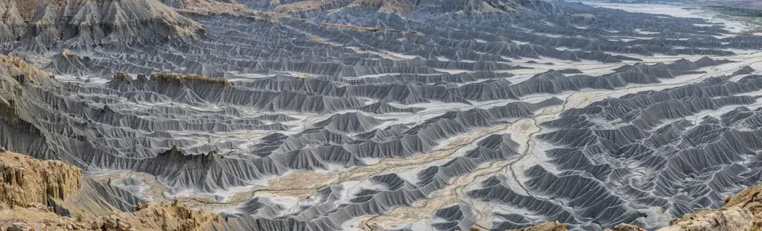
Places like Badlands National Park in South Dakota and Theodore Roosevelt National Park in North Dakota look like the surface of another planet – jagged pinnacles, striped sediments, and fragile spires rising from the prairie. These badlands were shaped by rapid erosion in a relatively brief geological window, especially after the last ice sheets retreated. Today, erosion still happens here, but the conditions that initially supercharged it have faded.
After the Ice Age, meltwater, sparse vegetation, and highly erodible clay-rich sediments worked together like a demolition crew. Occasional intense rainstorms cut gullies and canyons quickly, exposing ancient soils and fossil beds. With limited plant cover and strong seasonal temperature swings, the land broke down fast. In modern times, as the regional climate has shifted and vegetation patterns have stabilized somewhat, the pace of raw sculpting has slowed compared with those early postglacial centuries.
Scientists estimate that some of the most dramatic formations in the Badlands could erode away in only tens of thousands of years if conditions remained as they were. But we are already seeing changes: slightly more plant cover in some areas, human infrastructure altering drainage, and regional climate trends affecting rainfall patterns. The ultra-fast carving phase that gave the Badlands their striking relief is a chapter that peaked in the past; what we see now is a landscape gradually aging out of its wild youth.
#5 The Mississippi River Delta: A Sinking Landscape Once Built by a Freer River
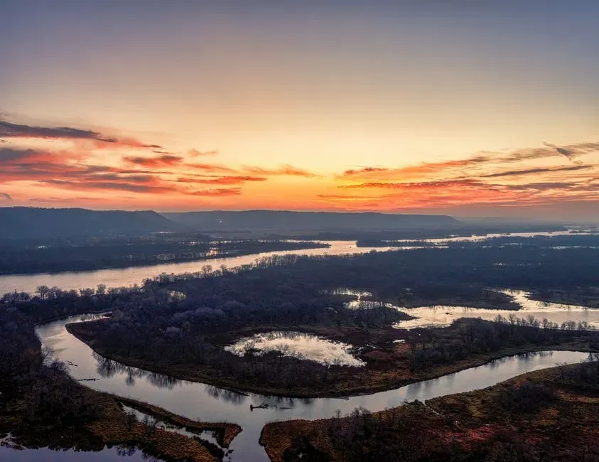
The Mississippi River Delta and the wetlands of coastal Louisiana were largely built by sediment that is no longer being delivered in the same way. For thousands of years, the river would naturally jump its channel from time to time, spreading new mud and sand across different parts of the Gulf Coast. Each course change built a new lobe of the delta, stacking land outward into the sea like a slow, muddy fan.
Modern levees and river-control structures now keep the Mississippi pinned in place, mostly to safeguard cities and shipping. Sediment that would otherwise nourish wetlands and build new land is funneled straight into deep water offshore. At the same time, the delta plain is subsiding as sediments compact, and sea level is rising. The result is a net loss of land, with wetlands turning into open water at a troubling pace.
- Historic delta growth relied on frequent channel shifts and overbank flooding
- Levees now prevent sediment from spreading across the delta plain
- Subsidence and rising seas accelerate land loss in a system no longer being built
Geologists can trace older, abandoned delta lobes like ghost fingerprints along the coast, each tied to a past course of the river. That style of delta-building, with the river allowed to meander and jump over centuries, is essentially shut down by human design. The grand land-making machine that constructed southern Louisiana is now operating in a constrained, diminished mode, even while the landscape it created literally sinks around it.
#6 The Colorado Plateau Arches: Relics of Long-Gone Rock Layers and Ancient Climates
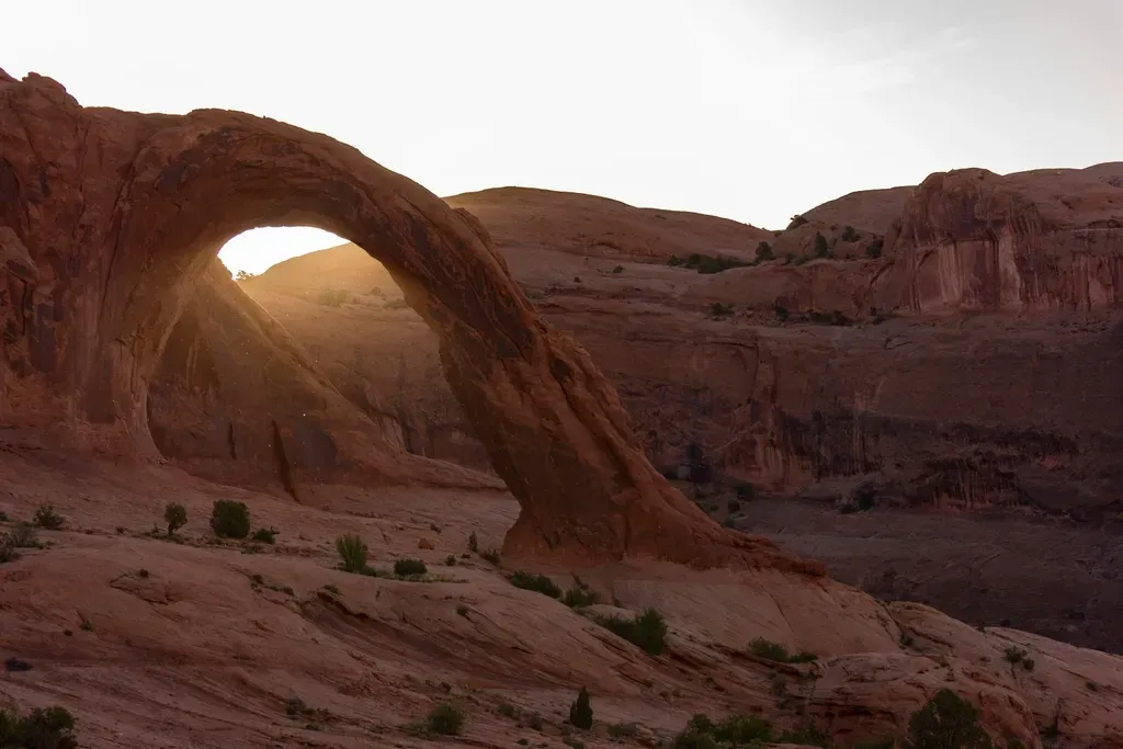
The red rock arches of Utah’s Arches and Canyonlands national parks look so perfectly shaped that they almost feel artificial. In reality, they are leftovers from rock layers and climatic conditions that have changed dramatically. The processes that set them up were far more intense and long-lasting than what we see today, and some of those key ingredients are no longer available at scale.
Most arches began as thick, horizontally layered sandstone deposited in ancient deserts and coastal environments. Over immense spans of time, tectonic uplift raised these rocks, and fractures formed. Groundwater and surface weathering widened some fractures into fins, while salt deposits deep below caused differential movement that helped bend and crack the overlying stone. Earlier, wetter climatic phases fostered freeze–thaw cycles and chemical weathering that attacked weaknesses in the rock more aggressively than today’s generally arid conditions.
Now, the landscape is in a kind of late stage of this process. The particular combination of salt tectonics, thick intact sandstone, and long-term climate swings that created ideal arch-forming conditions will not repeat here in any foreseeable future. Existing arches are still evolving – some collapse, others subtly enlarge – but they are essentially the delicate remnants of a more dynamic past. Once an arch falls, nothing like it will grow back in the same spot.
#7 The Black Hills and Devil’s Tower: Eroded Roots of Vanished Mountains and Magma
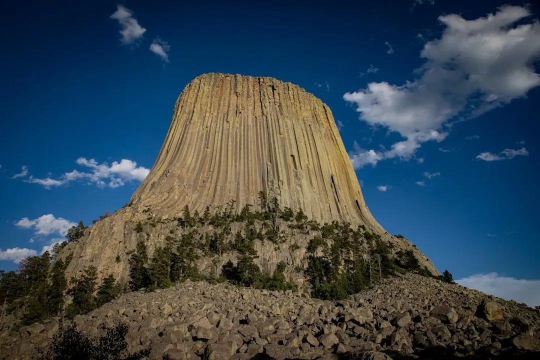
Drive through South Dakota’s Black Hills or stand beneath the looming column of Devil’s Tower in Wyoming, and you are seeing the ghosts of processes that finished long ago. The Black Hills are the deeply eroded core of an ancient uplift, and Devil’s Tower is a hardened plug of magma that never quite made it to the surface as a volcano. The mountains and possible volcano that once existed here are gone; only their internal anatomy remains.
Over tens of millions of years, tectonic forces slowly pushed up crustal blocks, forming a localized dome. Rivers and weather then stripped away the softer outer layers, leaving behind a rugged island of older, tougher rock surrounded by plains. Devil’s Tower, likely formed as magma intruded into surrounding sediments, was later exposed as those sediments eroded away. The columnar joints that make it look like a gigantic bundle of hexagonal pencils are a cooling pattern frozen in time.
The original uplift event and magmatic intrusion are over; there is no active mountain-building or volcanic system recharging here. What erosion is doing now is mostly light finishing work, nibbling at cliffs and slopes. The striking landforms that people photograph are, in a sense, the bones and scars of long-finished geological surgeries, not active operations.
- Black Hills are the eroded core of an ancient uplifted dome
- Devil’s Tower is an exposed, cooled magma body, not an active volcano
- Modern erosion reveals structures created by past tectonic and magmatic processes
#8 Ancient Lake Beds of the Great Basin: Shorelines With No Sea
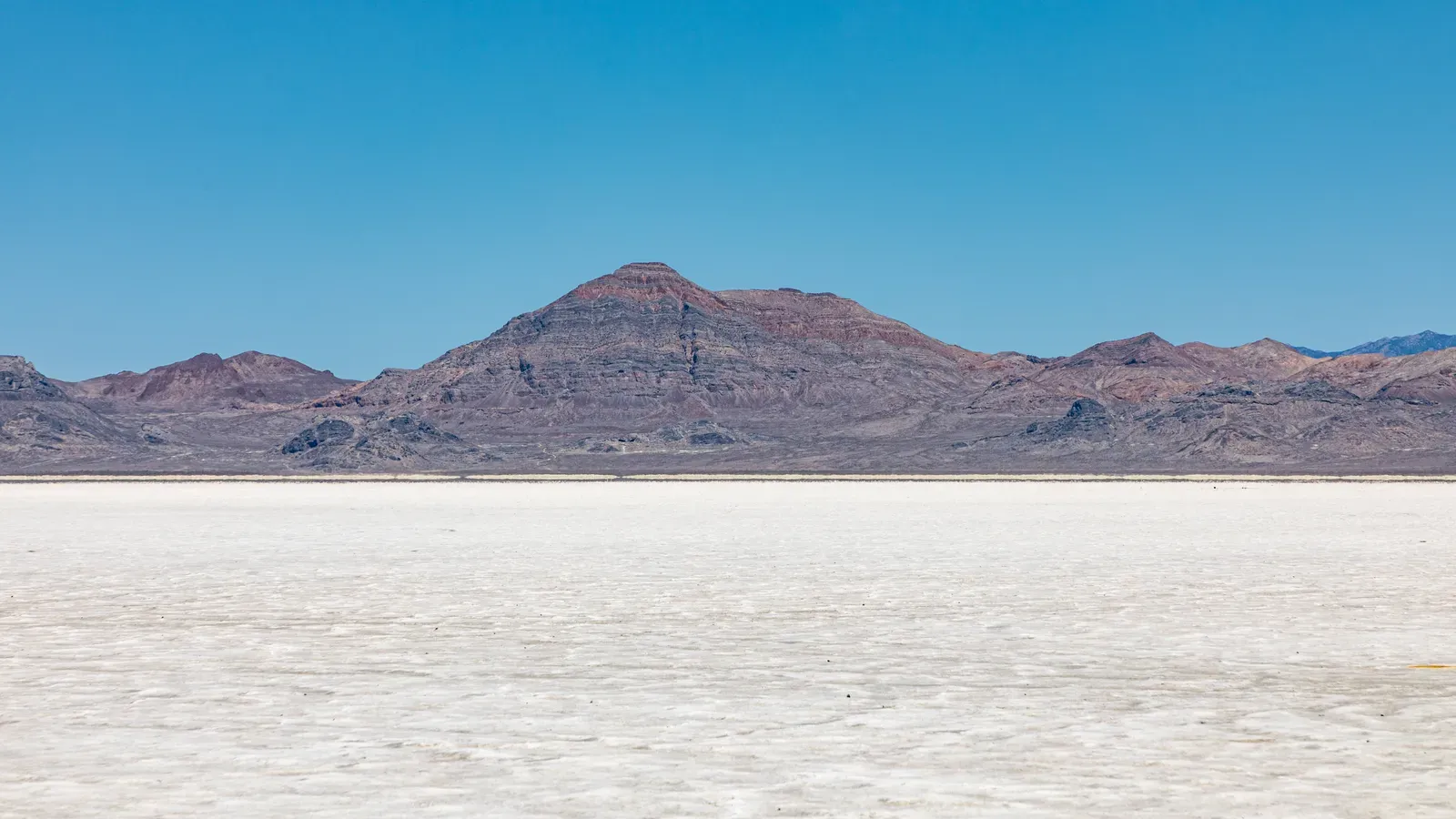
Much of Nevada, Utah, and neighboring states sits within the Great Basin, a region where water does not drain to the ocean. During the last Ice Age, many of these enclosed basins held enormous lakes fed by a cooler, wetter climate. Lake Bonneville, for example, once covered areas now occupied by the Great Salt Lake and much of the surrounding valley. Those great lakes are gone, but their shapes still control the landscape.
If you drive around the Great Salt Lake, you can actually see old shorelines etched into the hillsides – terraces that mark former water levels when Lake Bonneville was far deeper. Vast, uncanny flatlands known as playa or salt flats, like the Bonneville Salt Flats, are the dessicated bottoms of former lakes. The sediments left behind influence soil chemistry, plant communities, and even modern industry, from salt mining to testing high-speed vehicles on ultra-flat surfaces.
Today’s climate in the Great Basin is mostly too dry to sustain those past lake levels. Rivers that once fed full basins now end in smaller, saltier remnants, or disappear into groundwater and evaporation before building large lakes. The process that once smoothed entire valleys under water, carved wave-cut benches, and deposited thick lake sediments has largely ceased. The shorelines and lakebeds we see are the outlines of seas that will not return unless climate conditions change dramatically.
#9 The Appalachian Mountains: Soft Ridges from a Long-Finished Collision
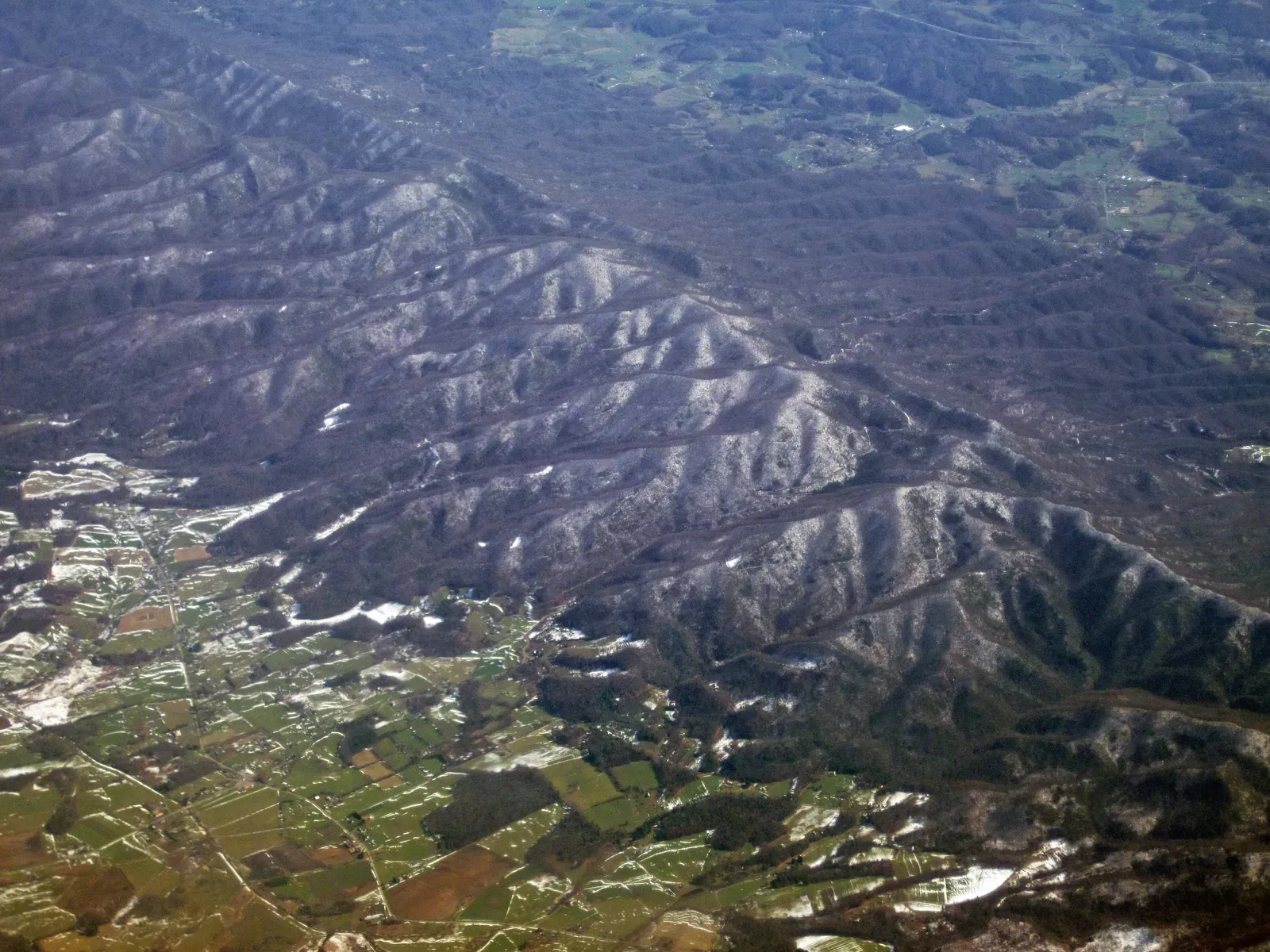
The Appalachians may not be as dramatic as the Rockies, but they have a deeper, more violent history. These worn-down ridges are the relics of ancient mountain chains that once rivaled the modern Himalaya in scale. Those ranges formed through tectonic collisions more than two hundred million years ago, when ancestral continents slammed into each other. The grand collisions and associated volcanic activity that built the original Appalachians are long over.
Over immense stretches of time, erosion has shaved these mountains down from jagged peaks to rounded ridges and rolling valleys. Rivers have carved water gaps – where streams slice right through ridge lines – and transported huge volumes of sediment to distant basins. What remains is more of a scar than an active wound: the internal framework of a mountain belt long after the forces that created it have relaxed.
- Formed by multiple ancient continental collisions
- Once much higher, comparable to major modern mountain ranges
- Now shaped mainly by slow erosion, not active tectonic building
There is still minor tectonic activity in the eastern United States, but it is subtle compared with the days when supercontinents were assembling. The big show – the collisions that scrunched up crust into towering peaks – ended before dinosaurs walked the Earth. When you hike a quiet Appalachian trail today, you are wandering over the softened remains of a mountain empire that fell long before humans ever arrived.
#10 The Columbia River Basalt and Palouse Hills: Lava Floods and Dust Storms That Have Stopped
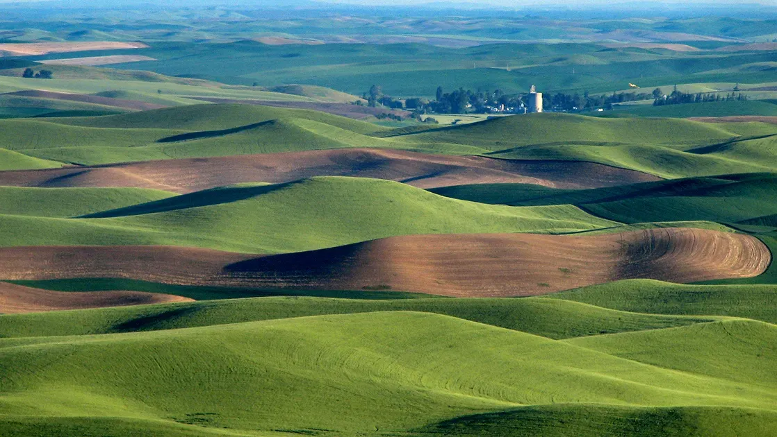
In the Pacific Northwest, two very different vanished processes created a surprisingly gentle-looking landscape. The dark bedrock beneath much of eastern Washington and parts of Oregon and Idaho is a stack of huge lava flows known as the Columbia River Basalt Group. These were not normal volcanoes but massive fissure eruptions that flooded the region with lava on and off tens of millions of years ago. That style of volcanism is no longer active there.
Later, during the Ice Age, strong winds picked up fine silt – loess – from outwash plains and deposited it in thick blankets over the basalt. Over time, that dust settled into rolling hills now known as the Palouse, which today are covered with wheat fields that look almost like a green-and-gold ocean. Modern winds still move dust, but the enormous supply from glacial grinding and bare ground is no longer there at the same scale.
The combination of giant lava floods and Ice Age dust storms was a one-two punch that set up the character of the region. Now, erosion and farming shape the surface, but they are working with materials and landforms produced by dramatic events that are not currently repeating. The peaceful Palouse hills you see from a highway overlook are literally built on rock poured out by extinct lava fountains and smoothed by dust from vanished ice.
#11 Dry Waterfalls and Hanging Valleys in Yosemite: Evidence of Former Glaciers
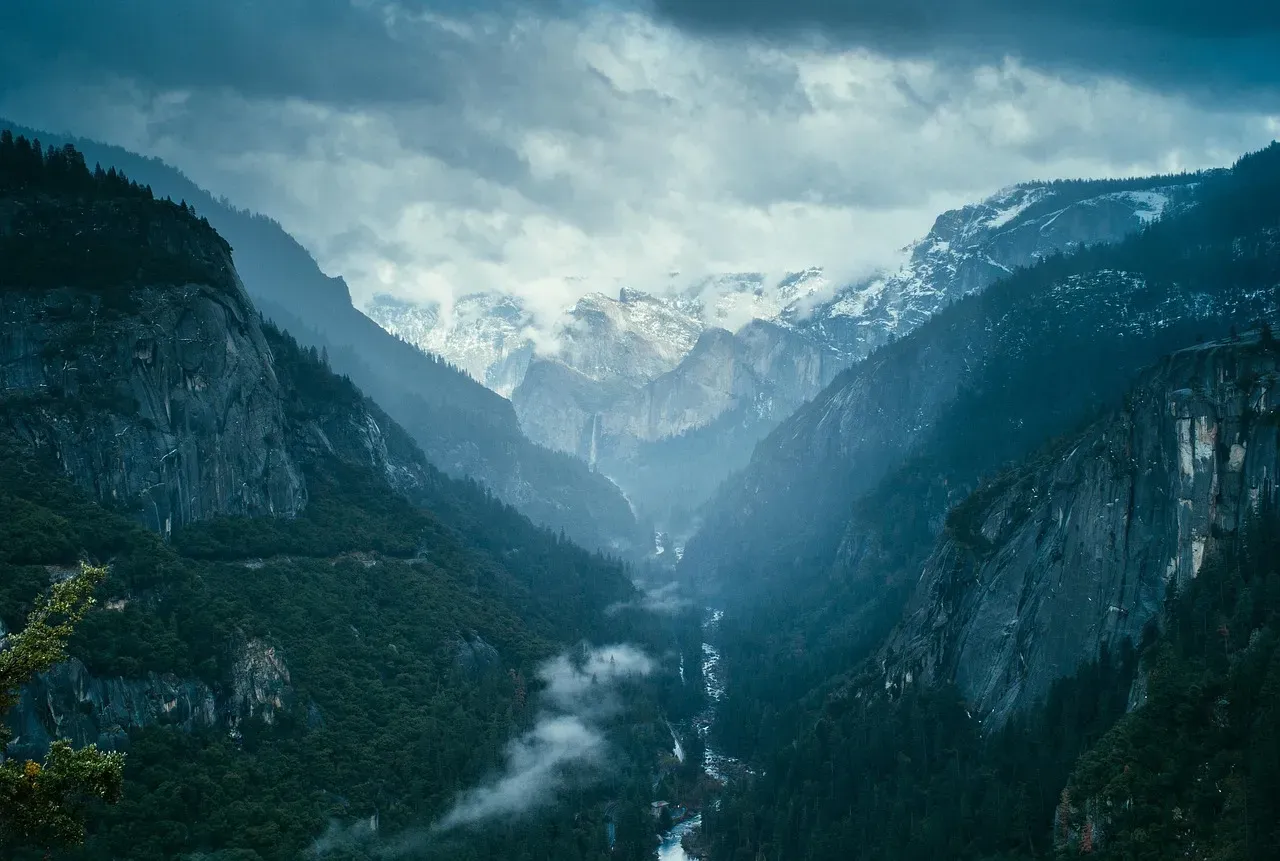
Yosemite Valley’s sheer granite walls and famous waterfalls owe almost everything to glaciers that have long since disappeared. During the last Ice Age, thick tongues of ice flowed down the valley, deepening and widening it into the iconic U-shape we see today. Smaller tributary glaciers carved side valleys that ended high above the main trunk glacier, creating what geologists call hanging valleys.
When the climate warmed and the ice retreated, rivers took over. Waterfalls like Yosemite Falls and Bridalveil Fall mark locations where streams drop from those hanging valleys into the main valley floor. Some side canyons, however, are now essentially dry waterfalls: steep, cliff-like valley mouths that clearly were once carved by ice or water but no longer host significant flows. The glaciers that did the heavy lifting are gone, and modern rivers are relatively minor remodelers by comparison.
- U-shaped valleys and hanging valleys are classic glacier-made features
- Current rivers are too small to have carved the main Yosemite Valley on their own
- Glaciation episodes have ended for now in the Sierra Nevada
As the Sierra Nevada warms, what little glacial ice remains in the range continues to shrink. There may be snowfields and seasonal meltwater, but the deep, grinding, valley-shaping glaciers that once dominated Yosemite are not coming back under current climate trends. The valley now is a snapshot from the end of a glacial chapter, with waterfalls and cliffs outlining forces that have fallen silent.
#12 The Florida Reef Tract and Fossil Coral Ridges: Built by a Different Sea
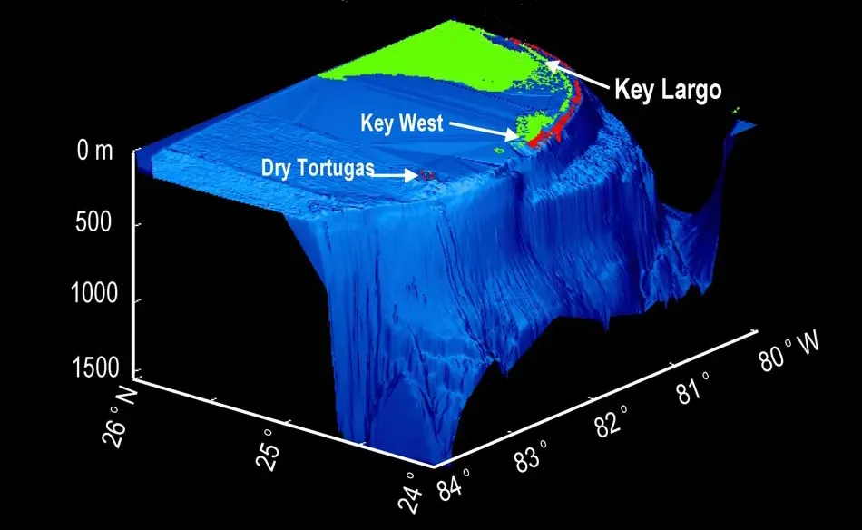
Florida’s Keys and parts of the peninsula itself are made of limestone that was once living coral reef, built under higher sea levels and warmer waters. Inland ridges, like the Atlantic Coastal Ridge near Miami, are actually ancient reef structures and marine deposits from times when the ocean shoreline sat much farther inland. The reefs that built those rocks existed under conditions that no longer prevail on land there today.
Modern reefs still grow along parts of the Florida Reef Tract offshore, but they are under severe stress from warming waters, disease, and pollution. Historic coral growth that turned into the solid limestone bedrock of the Keys required long periods of stable, clear, warm seas and slow relative sea-level changes. When sea level fell or conditions shifted, those reefs died and were left high and dry, later becoming the platform for roads, houses, and beaches.
Walking through parts of Miami or the Keys, you might literally be standing on fossil coral and shell fragments laid down when fish swam where cars now drive. The big pulses of natural reef building that sculpted much of south Florida’s bedrock are finished in those specific places because the sea has retreated. Present-day reef growth offshore is, in many areas, struggling just to stay alive, let alone build the kind of massive, enduring structures that shape entire coastlines.
Conclusion: A Country Shaped by Vanished Forces
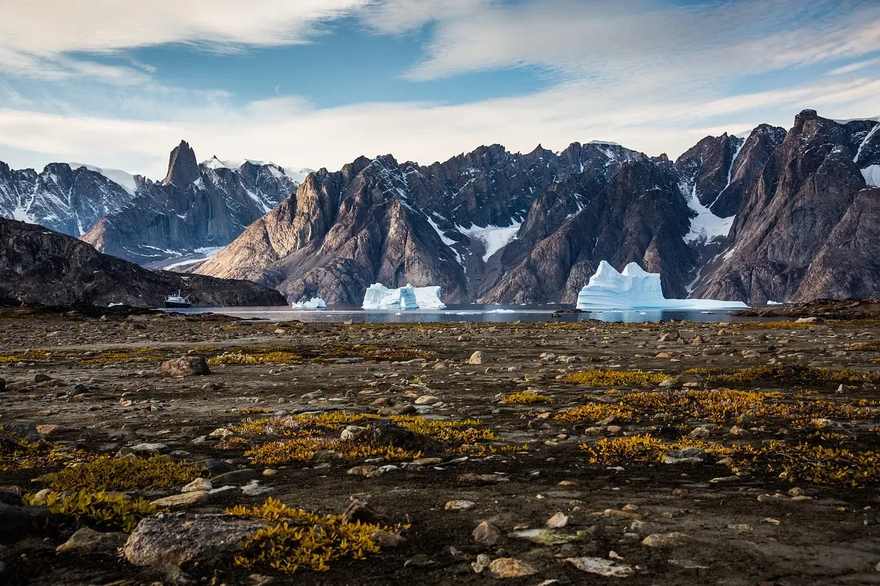
When you stitch these stories together, the United States starts to look less like a static map and more like a time-lapse movie paused in the middle. Gigantic ice sheets, wild untamed rivers, lava floods, catastrophic glacial lakes, Himalayan-scale mountains, and ancient coral seas all had their moments of dominance. Then they faded, leaving behind landscapes that feel permanent only because we are dropping in at one point in an incredibly long film.
Personally, I find this perspective both humbling and oddly comforting. The farm fields of the Midwest, the skyscrapers along Lake Michigan, the roads cutting through the Appalachians – all of them rest on the work of forces that could not care less about our timelines. At the same time, we are now doing something new: humans are becoming a noticeable geological force in places like the Mississippi Delta and the Florida coast, altering or even shutting down some of the natural land-shaping processes that built our home terrain.
That raises a real question of responsibility. If the landscapes we love were created by powerful processes that are now over, then damaging them can be a one-way street – there is no guarantee those same forces will come back to rebuild what we break. Protecting them is less about preserving a static postcard and more about honoring the incredibly rare, unrepeatable histories that made them. Next time you stand at the edge of a canyon, a salt flat, or a quiet Appalachian ridge, it might be worth asking yourself: if the story that made this place has already ended, what role do we want to play in the next chapter?