You might think continents change at a snail’s pace, like watching paint dry. Rivers carve valleys over millions of years, mountains rise an inch per century, and the land shifts so slowly we barely notice. At least that’s what we’ve been told.
Here’s the thing: during the last Ice Age, catastrophic events struck North America with shocking violence and speed. Glaciers advanced and retreated. Massive lakes burst through ice dams. The landscape got completely rewritten in mere days. These weren’t gentle processes. These were devastating catastrophes that forever altered the face of the continent, leaving scars you can still see today if you know where to look.
The Great Lake Missoula Floods Unleashed Unimaginable Power
Between 15,000 and 13,000 years ago, an ice dam containing Glacial Lake Missoula in Montana repeatedly failed as many as 100 separate times, with rising water either causing the ice dam to float or melting and widening cracks until the dam collapsed catastrophically. Imagine a lake the size of Lake Erie and Lake Ontario combined, held back by an ice wall towering over 2,000 feet high. Then picture it breaking loose.
Water burst through the base of the dam at a rate of ten times the combined flow of all the rivers in the world, with calculated flood speeds reaching almost 65 miles per hour. Roaring walls of water hundreds of feet high ripped through the Priest Rapids Valley at 80 miles per hour, and all human and animal life in the path of the raging waters died instantly. The entire lake drained in just days, sending torrents that scoured eastern Washington and carved the Channeled Scablands into existence. This wasn’t erosion over millennia. This was catastrophic violence on an unimaginable scale.
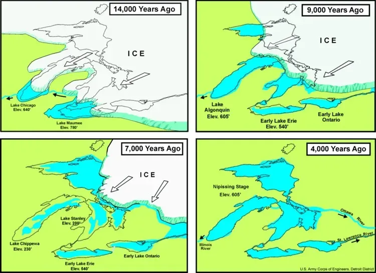
The Laurentide Ice Sheet Gouged Out the Great Lakes
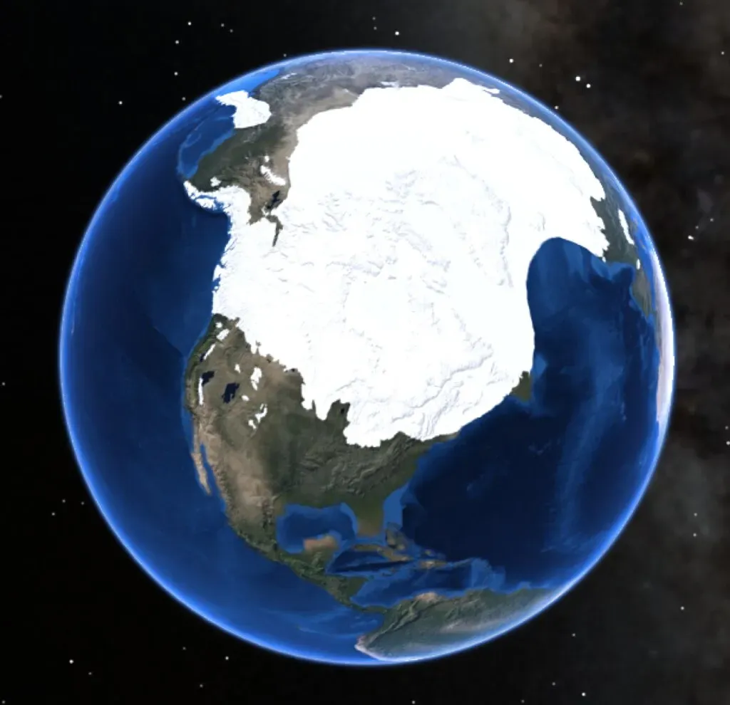
The Laurentide ice sheet covered millions of square miles, including most of Canada and a large portion of the Northern United States, and its last advance between 95,000 and 20,000 years ago gouged out the five Great Lakes. Think about that for a moment. These massive bodies of water weren’t always there. Ice sheets several miles thick pressed down on the land with such tremendous weight that they carved enormous basins into the bedrock.
The Great Lakes and the Finger Lakes were carved by ice deepening old valleys, and most of the lakes in Minnesota and Wisconsin were gouged out by glaciers and later filled with glacial meltwaters. The sheer force required to excavate these colossal depressions defies easy comprehension. When the ice finally melted, it left behind some of the largest freshwater lakes on the planet. The landscape had been fundamentally reshaped.
Glacial Isostatic Rebound Triggered Devastating Earthquakes
The weight of ice sheets kilometers thick didn’t just carve the surface. The redistribution of ice-water on Earth’s surface caused changes in the gravitational field, and the weight of the redistributed surface mass loaded the lithosphere, caused it to flex and also induced stress within Earth. The sheer pressure from that much ice pressing down literally deformed the planet’s crust.
The presence of glaciers generally suppressed the movement of faults below, but during deglaciation, the faults experienced accelerated slip triggering earthquakes, and these earthquakes triggered near the ice margin may in turn accelerate ice calving and may account for the Heinrich events. When the ice melted, the land sprang back like a compressed spring being released. In Scandinavia, the land is still rising at a rate of as much as 8 to 9 millimeters per year, or 1 meter in 100 years. Massive seismic activity rocked the deglaciated regions, reshaping drainage patterns and destabilizing remaining ice masses.
Lake Ojibway’s Catastrophic Drainage Flooded the Arctic
The last of the North American proglacial lakes, Glacial Lake Ojibway, reached its largest volume around 8,500 years ago when joined with Lake Agassiz, but its outlet was blocked by the great wall of the glaciers and it drained by tributaries into the Ottawa and St. Lawrence Rivers far to the south. This enormous body of water, stretching across much of central Canada, represented an almost incomprehensible volume of trapped freshwater.
About 8,300 to 7,700 years ago, the melting ice dam over Hudson Bay’s southernmost extension narrowed until pressure and buoyancy lifted it free and the ice dam failed catastrophically, with Lake Ojibway’s beach terraces showing it was 250 meters above sea level and its volume commonly estimated at about 163,000 cubic kilometers. That’s more than enough water to cover a flattened continent. The sudden release sent an unimaginable pulse of freshwater into the Arctic Ocean, dramatically affecting global ocean circulation and climate patterns.
The Younger Dryas Climate Collapse Froze a Warming World
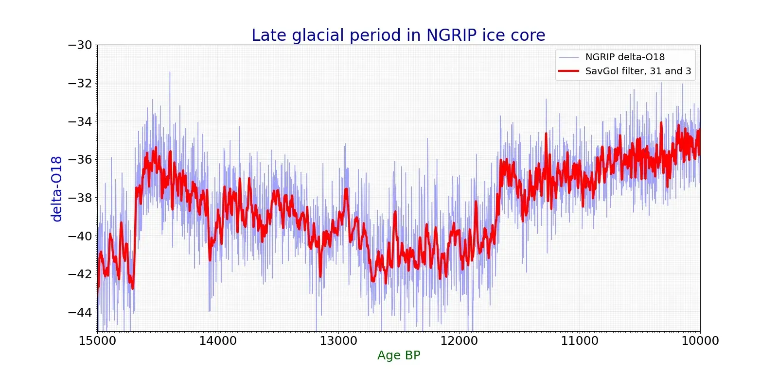
The last glacial recession was interrupted by a sharp advance between about 11,000 and 10,000 years ago called the Younger Dryas event, which coincided with an apparent temporary diversion of glacial meltwater from the Mississippi River to the St. Lawrence drainage system, and it has been postulated that this discharge of cold fresh water disrupted the Atlantic Ocean circulation system that warms the North Atlantic. Earth was warming nicely, emerging from the grip of the Ice Age. Then suddenly, temperatures plummeted.
As Earth was emerging out of the last glacial cycle, the warming trend was interrupted 12,800 years ago when temperatures dropped dramatically in only several decades, and a mere 1,300 years later, temperatures locally spiked as much as 20 degrees Fahrenheit within just several years. Imagine experiencing a return to Ice Age conditions within a single human lifetime. Though the cause remains debated, the effect was catastrophic for ecosystems across the Northern Hemisphere.
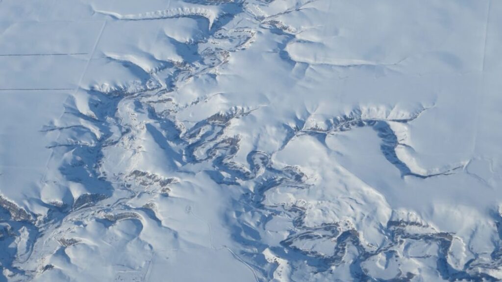
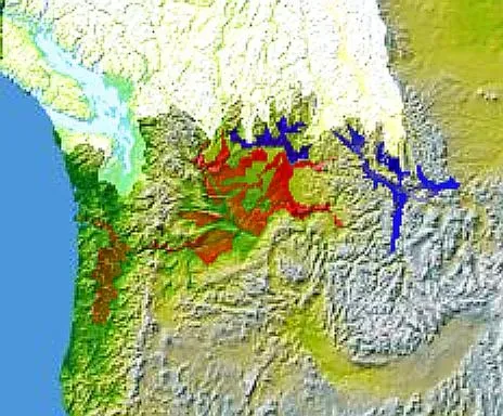
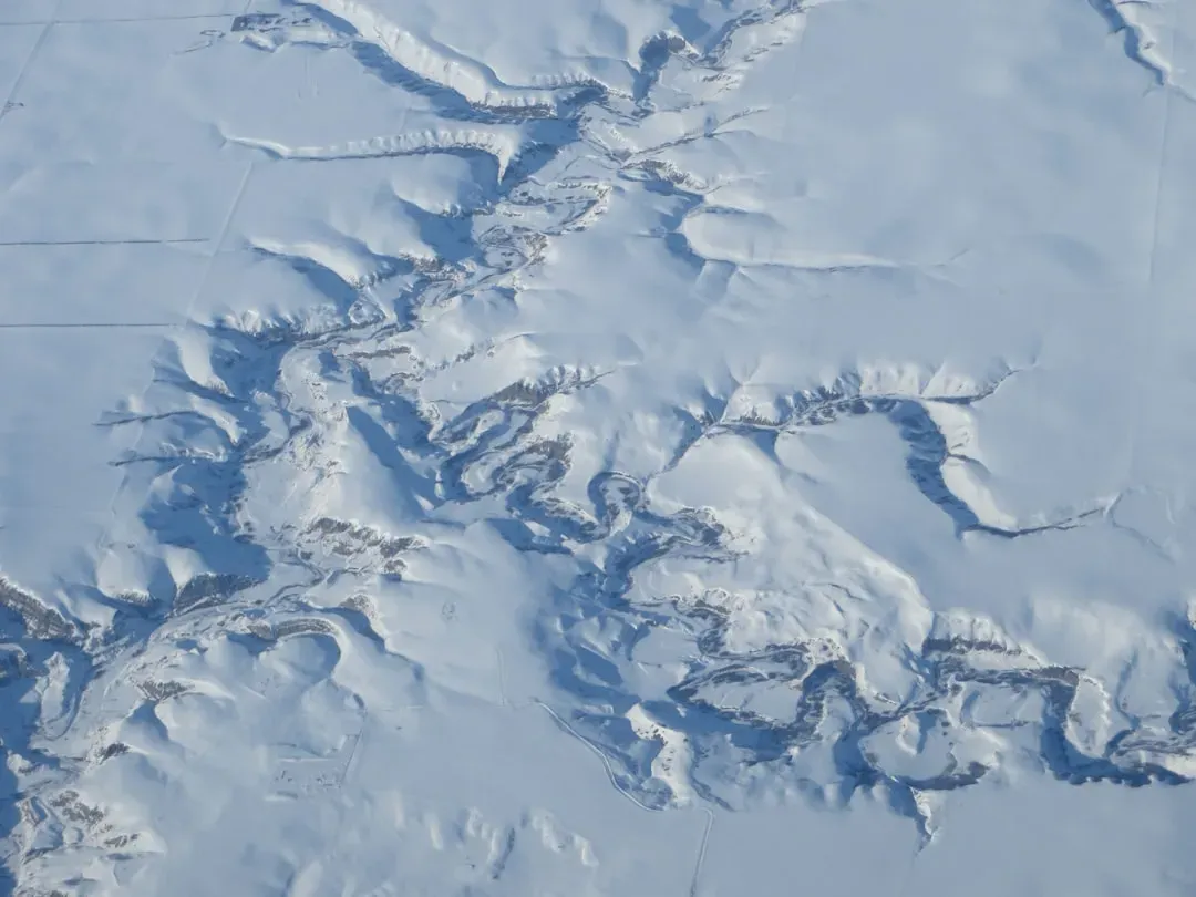
The Channeled Scablands Were Carved in Days Not Millennia
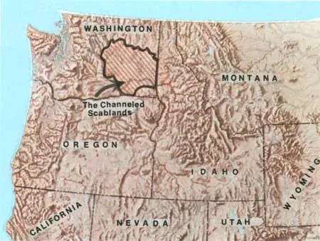
The Channeled Scablands of the Pacific Northwest, a landscape full of flat-topped plateaus that rise between steep-walled canyons, principally located in southeastern Washington state, bear the signs of an incredible Ice Age event. For decades, geologists refused to believe this bizarre landscape could have formed catastrophically. They insisted it must have taken millions of years of gradual erosion.
One stipulation of the older formulation of uniformitarianism was that the Earth is changing at a slow, gradual rate and that quick, catastrophic change was impossible, and Bretz’s idea for how the Scablands formed flew in the face of what many geologists accepted, as channels were thought to be carved over long periods of time by rivers, not by sudden floods. Eventually, by the 1970s, dismissive geologists changed their tune, and something catastrophic truly did transpire to create the Scablands. The evidence became overwhelming: these features formed during repeated megafloods, not slow processes.
The Bonneville Flood Reshaped the Snake River Plain
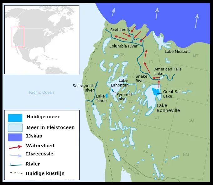
Seventeen thousand years ago, Lake Bonneville (the larger ancestor of the Great Salt Lake) in Utah smashed through its rocky bank, sending water as far north as Washington. This wasn’t one of the Missoula floods. This was a completely separate catastrophe from a different glacial lake system.
Lake Bonneville had been steadily rising until the water pressure finally overwhelmed the natural dam at Red Rock Pass in southern Idaho. The resulting flood was one of the largest known floods on Earth, with peak discharges that rival the Missoula floods. The torrent carved deep canyons, scattered massive boulders hundreds of miles downstream, and permanently reshaped the Snake River Plain. Within weeks, an entire lake nearly as large as present-day Lake Michigan had drained, leaving behind only the remnant we call the Great Salt Lake.
Mass Megafauna Extinctions Eliminated Iconic Species
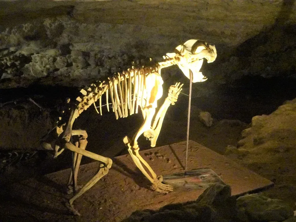
At the end of the Pleistocene in North America, 38 genera of mostly large mammals became extinct, and North America saw the extinction of about 70 percent of its megafauna guild, a catastrophic event, the cause of which is fiercely debated today. Mammoths, mastodons, giant ground sloths, saber-toothed cats, enormous short-faced bears, and dozens of other massive species simply vanished.
The timing of these extinctions roughly coincides with the end of the Ice Age and the arrival of humans in North America. In North and South America, about three-fourths of megafaunal mammal genera became extinct at or near the onset of the Younger Dryas, and over the decades, anthropologists have debated rival theories to explain the extinctions: slaughter of naive animals by newly arrived hunters, or the climatic change that marked the arrival of the Younger Dryas. Whether caused by climate change, human hunting, or some combination of catastrophic events, the result was the same: an entire ecosystem of giants disappeared forever, fundamentally altering the ecological structure of the continent.
Conclusion
The Ice Age didn’t reshape North America through gentle, gradual processes. Catastrophic floods draining in days carved canyons that should have taken millennia. Ice sheets miles thick gouged out the Great Lakes and triggered massive earthquakes when they melted. Entire ecosystems collapsed within human lifetimes. Climate whipsawed between warming and sudden refreezing.
These weren’t theoretical events buried in the distant past. The scars remain visible across the landscape today: giant ripple marks in Montana, scoured bedrock in Washington, the Great Lakes themselves. The continent we see today was violently sculpted by ice, water, and catastrophe on a scale almost beyond comprehension. What do you think would happen if similar catastrophes struck today? The thought alone is sobering.