If you could rewind Earth’s history like a movie, there’s a moment about 250 million years ago where the entire globe suddenly looks wrong. All the continents you know today snap together like a jigsaw puzzle, locking into one vast landmass: . Oceans shrink, coastlines vanish, and a single supercontinent dominates the planet like a stone giant sitting in the middle of a global sea.
What makes so addictive to think about is not just that it existed, but how deeply it reshaped climate, life, and even the world we live in right now. Your local mountains, your weather patterns, the fossils in a roadside cliff – so much of it is a leftover echo of that ancient mash‑up of continents. Once you realize how much still haunts the present, you’ll never look at a world map the same way again.
Pangaea Was Not the First Supercontinent (And Probably Not the Last)
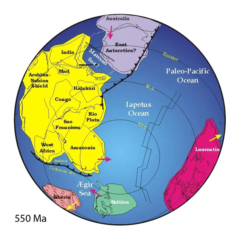
It’s tempting to think of Pangaea as a one‑time geological accident, but in reality it was part of a long-running planetary habit. Before Pangaea formed, earlier supercontinents like Rodinia and Pannotia had already come together and broken apart over hundreds of millions of years. Earth’s crust seems to breathe in and out on timescales far longer than human history, pulling landmasses together and then tearing them away again.
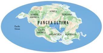
Geologists sometimes call this the supercontinent cycle, and it’s a bit like continents attending a very slow, very dramatic family reunion every few hundred million years. Based on how plates are moving today, some scientists expect a future supercontinent – often nicknamed “Pangaea Proxima” or similar – to form in the next couple hundred million years. You and I will never see it, but it means Pangaea wasn’t a one‑off miracle; it was one chapter in an ongoing saga.
All Today’s Continents Once Touched, But Not All in the Way You Think
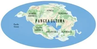
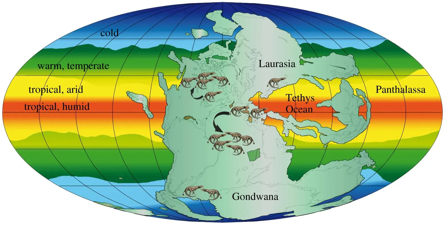
Schoolroom maps showing Africa snuggled perfectly into South America are surprisingly accurate, but the real picture of Pangaea is more chaotic and wild. North America was welded to northwestern Africa and parts of Europe, while Antarctica brushed shoulders with Australia, India, and southern Africa near the bottom of the world. What is now the Mediterranean region was a mash‑up zone squeezed between pieces of Africa and Eurasia in ways that look almost unrecognizable compared to today’s geography.
If you’ve ever tried to reassemble a torn-up cardboard map and realized some edges are bent or missing, that’s basically what geologists deal with. They use rock types, ancient mountain belts, and magnetic signatures locked into minerals to reconstruct who touched whom and when. The more you dive into those reconstructions, the more you realize that our familiar world map is just one temporary layout in a long series of wildly different Earths.
Pangaea’s Climate Was Extreme, With Scorching Interiors and Violent Seasons
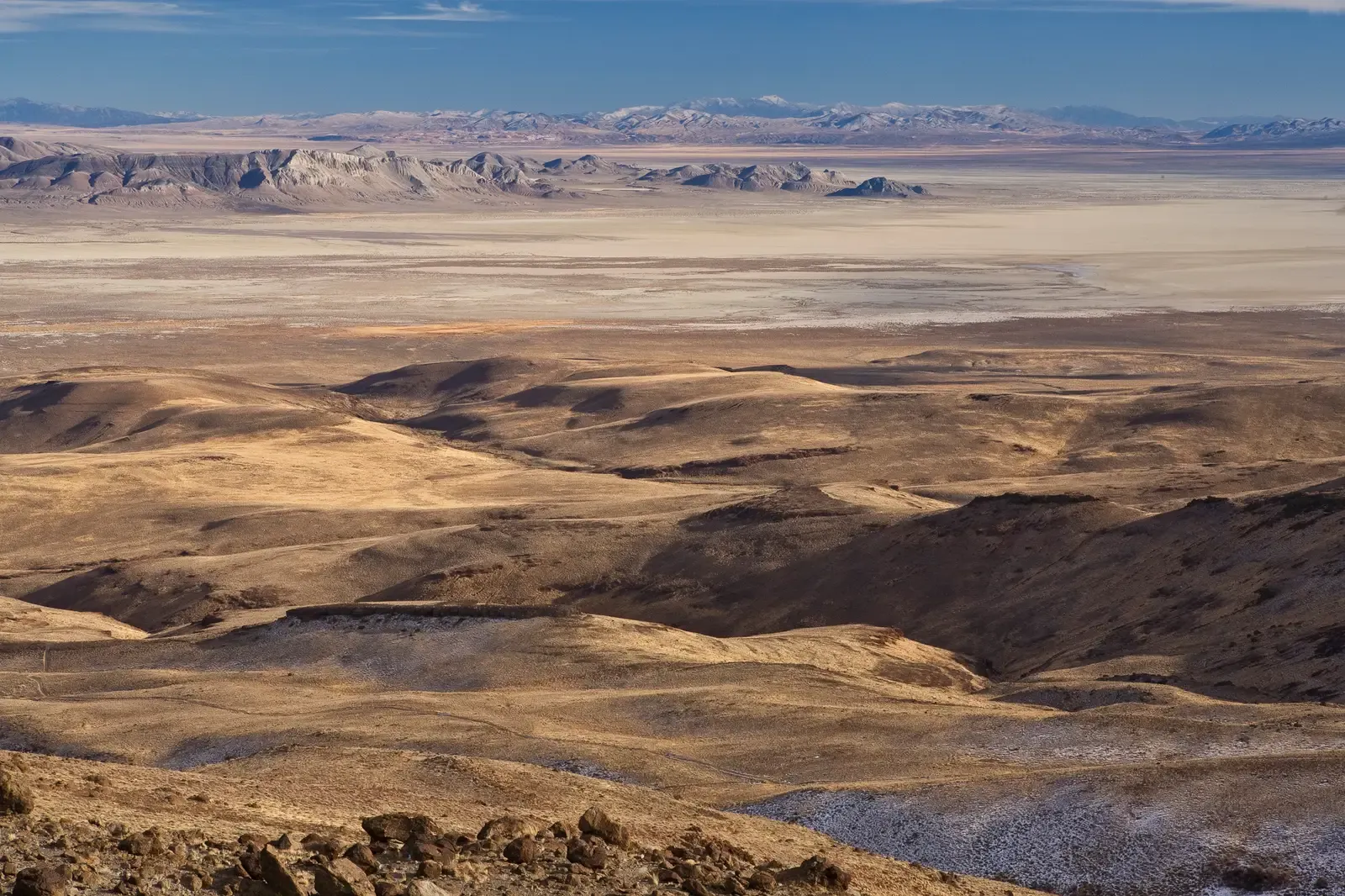
Having a single giant landmass sounds tidy, but it made Pangaea’s climate brutally uneven. The interior of the supercontinent was incredibly far from the ocean, which normally helps smooth out temperatures. Without that moderating influence, huge stretches of Pangaea were likely baking hot in summer, freezing cold in winter, and often bone-dry – picture something harsher than today’s largest deserts, stretched across continents.
At the same time, coastal regions and certain belts of Pangaea probably had intense monsoons, with seasonal rainfall driven by the way such a large landmass heated and cooled. Some climate models suggest that storms could have been massive and highly seasonal, reshaping landscapes in punchy bursts instead of gentle, year-round drizzle. When I first read about this, I remember thinking it sounded less like a calm prehistoric Earth and more like an alien world with mood swings.
Pangaea Helped Drive One of the Worst Mass Extinctions in Earth’s History
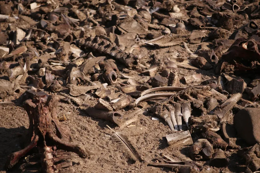
About 252 million years ago, near the end of the Permian period when Pangaea was still assembled, life on Earth hit a crisis point. A catastrophic mass extinction wiped out most marine species and a huge share of land animals and plants. Scientists link this disaster to massive volcanic eruptions, climate chaos, and ocean changes – but Pangaea’s configuration likely helped amplify the damage.
With so much land joined into one block, ecosystems were less isolated. Once environmental stress spread, it could sweep across enormous ranges instead of being contained in separate continental “islands.” On top of that, changes in ocean circulation around a single huge landmass may have reduced oxygen levels in the seas, turning large regions into deadly zones for marine life. Pangaea did not cause the extinction by itself, but it probably made a bad situation devastatingly worse.
Fossils on Opposite Sides of the World Only Make Sense Because of Pangaea
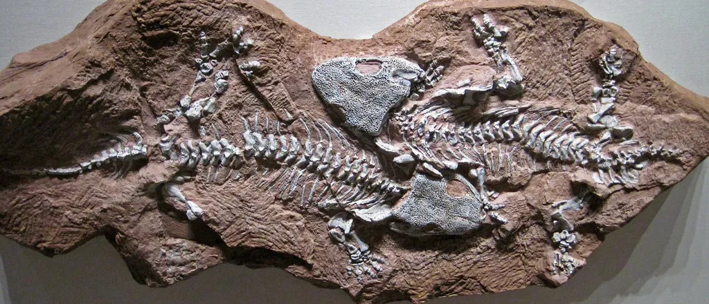
One of the most mind-bending things is how it neatly explains fossil mysteries that once baffled scientists. Identical or very similar fossils of land reptiles, plants, and early mammal relatives show up in places now separated by thousands of kilometers of ocean – like South America and Africa, or India and Antarctica. These creatures could not have swum across entire oceans, which was a huge clue that the continents were once joined.
Before plate tectonics was widely accepted, some researchers tried to explain this by invoking imaginary land bridges that have since disappeared. Once the Pangaea idea and continental drift took hold, those mental gymnastics were no longer needed; the continents themselves had done the traveling. I still find it weirdly touching that these ancient animals and plants left a breadcrumb trail across the planet, and it took us this long to read it properly.
Mountain Ranges You Know Today Are Scars from Pangaea’s Assembly
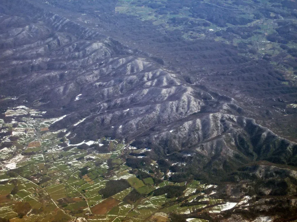
When continents crash into each other, they do not politely merge; they crunch, crumple, and stack up rock into towering mountains. During the assembly of Pangaea, collisions between what became North America, Europe, and Africa built huge mountain belts. Remnants of those ranges survive today in the Appalachians in North America and in parts of the mountains of western Europe and northwestern Africa.
If you hike in the Appalachians, you are literally walking on the battered seams of Pangaea’s formation, softened by hundreds of millions of years of erosion. Those hills were once more comparable to today’s Himalayas in raw height and ruggedness, raised when continents slammed together at speeds measured in centimeters per year. It’s a slow-motion car crash where the skid marks are entire mountain chains.
Pangaea Split Along Rifts That Became the Atlantic and Other Oceans
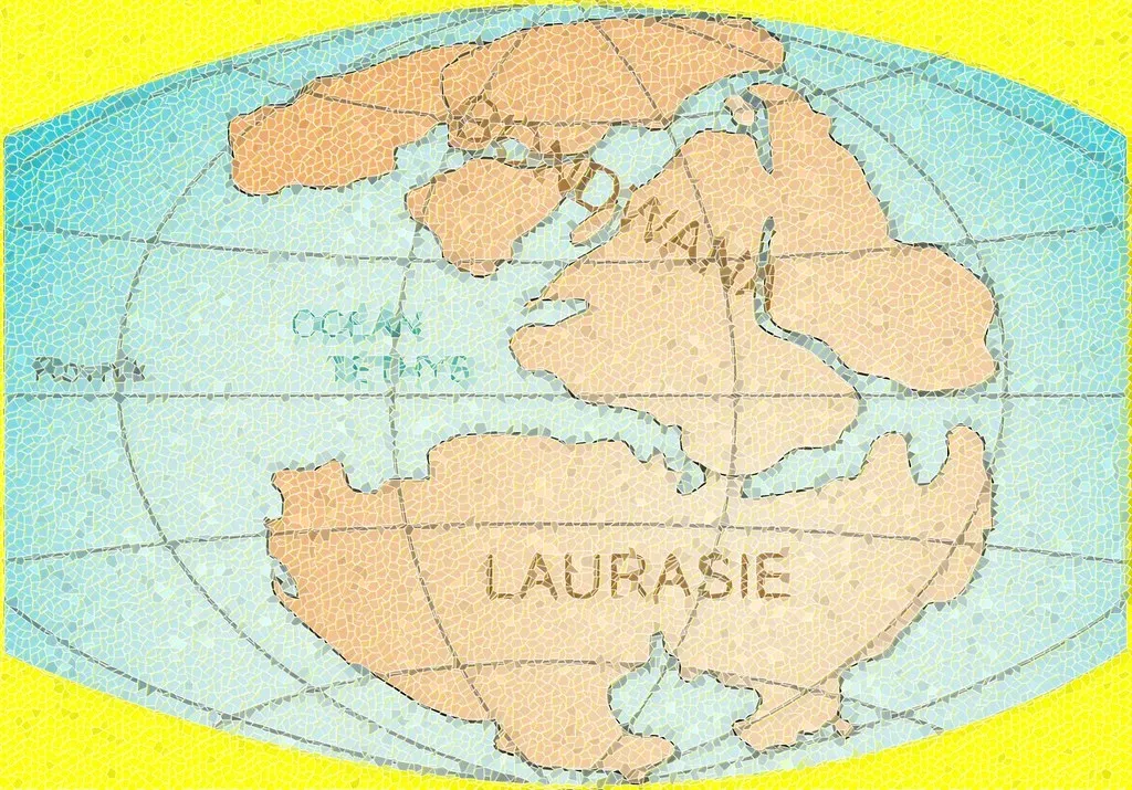
Just as Pangaea was assembled by plate collisions, it was eventually undone by stretching and tearing along deep rifts in the crust. These rifts allowed molten rock to rise, forming new ocean floor and pushing landmasses apart. The early splitting lines eventually widened into major oceans, including the Atlantic, which continues to open today as seafloor is created along its mid-ocean ridge.
On land, some of these ancient rift zones are still visible as dramatic valleys and basins, like the East African Rift that hints at future continental rearrangements. Lakes, volcanic fields, and long, linear valleys often betray where the crust once began to pull apart. It’s wild to realize that your favorite coastline might be the edge of a wound that first opened when Pangaea began to rip itself to pieces.
Pangaea Shaped the Evolution and Spread of Dinosaurs and Early Mammals
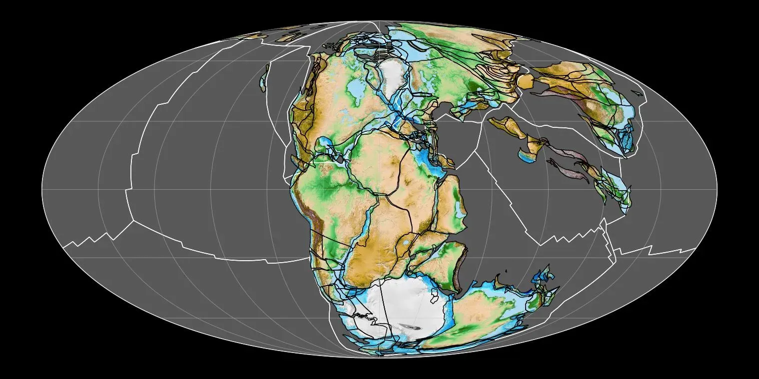
When the first dinosaurs evolved, Pangaea was still largely intact, which gave them a near‑continuous land highway across much of the world. Early dinosaur fossils are found across multiple modern continents, suggesting they were able to spread widely before the supercontinent fully fragmented. That early head start in a connected world probably helped them diversify and adapt into an impressive variety of forms.
As Pangaea continued to split, populations of dinosaurs and early mammal relatives became isolated on drifting landmasses. That isolation encouraged new evolutionary paths, leading to the different dinosaur communities we see in the fossil record on separate continents. I like to think of it as nature running parallel experiments in different labs, all set up by the slow breakup of a once-unified world.
We Can Recreate Pangaea at Home (And It Changes How You See the Globe)
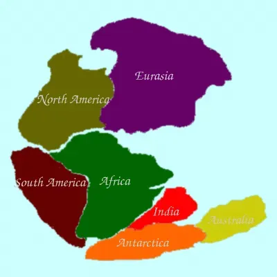
One surprisingly powerful way to grasp Pangaea is to literally cut up a world map and start sliding the continents around. If you line up the coast of Brazil with the bulge of western Africa, tuck North America against northwestern Africa and Europe, and swing Antarctica up beneath them, you get a rough sketch of how things once looked. It turns a flat, familiar picture into something dynamic and a little unsettling.
Digital tools go even further, letting you spin ancient Earths in 3D and watch continents drift over time like slow tectonic ballet. The more you play with those reconstructions, the harder it becomes to see today’s geography as fixed or permanent. I remember doing this the first time and suddenly feeling like the modern world map was just a paused frame in a much longer movie.
Conclusion: Pangaea Proves Our World Is Anything But Static
Pangaea is not just a prehistoric curiosity; it is a blunt reminder that our planet is restless, experimental, and sometimes ruthless. The same processes that created that supercontinent also raised mountains, steered evolution, and helped trigger catastrophe on a planetary scale. When I look at a globe now, I can’t help feeling a bit impatient, as if I’m staring at a still photo when the real story is a time‑lapse stretching over hundreds of millions of years.
In my view, the most incredible thing is not that it existed, but that we can piece it back together at all from scattered rocks, fossils, and the slow drift of plates. It makes human borders and even our biggest cities feel temporary, almost like doodles on a moving sidewalk. Next time you glance at a map, ask yourself: if this is just one frame in Earth’s long movie, what would the next scene look like?