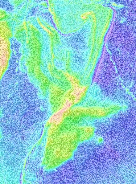
Imagine a continent approximately eighteen times the size of modern New Zealand sitting beneath the waves of the South Pacific, holding secrets that could revolutionize our understanding of how dinosaurs evolved and spread across Earth. This isn’t the plot of a science fiction movie. It’s Zealandia, the world’s eighth continent that remained hidden beneath nearly a mile of ocean water for millions of years, challenging everything scientists thought they knew about ancient life on Earth.
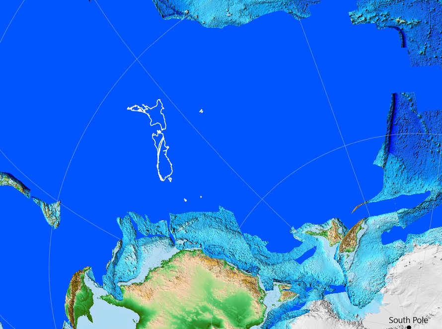
Millions of years ago, Earth was home to a supercontinent called Gondwana, which included present-day South America, Africa, Arabia, Madagascar, India, Australia, and Antarctica. Around 140 million years ago, tectonic plate movements caused South America and Africa to begin drifting apart. As magma from Earth’s mantle rose, it formed a new oceanic crust, gradually creating the Atlantic Ocean that now separates the two continents. However, the story of Zealandia tells a different tale entirely.
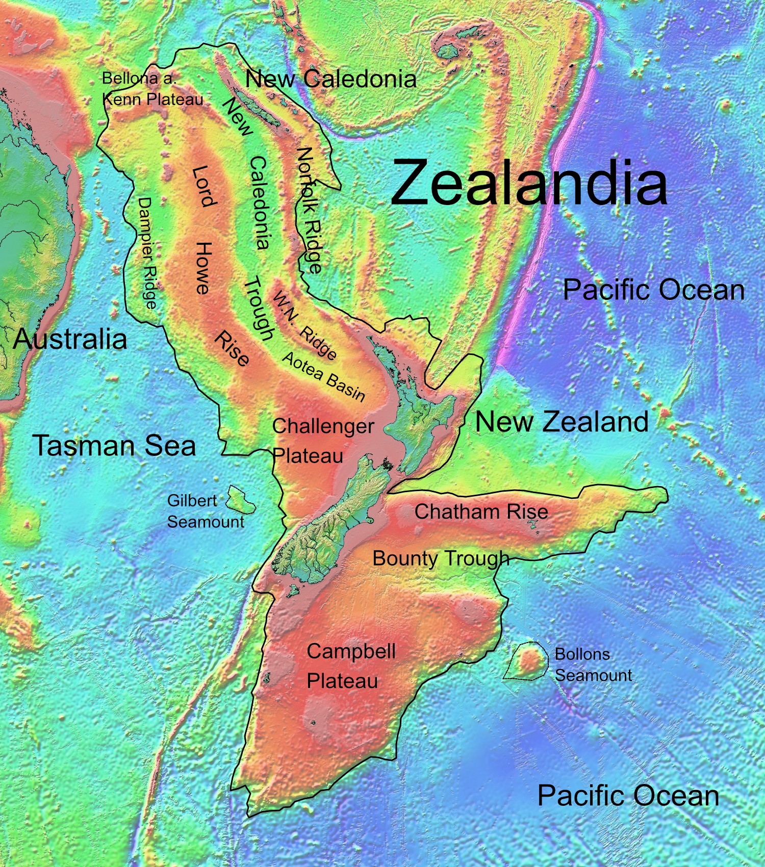
Zealandia is the world’s youngest, smallest, thinnest and most submerged continent. First, it was all land, but then it slowly sank as the Tasman Sea grew, and it continued to be stretched and thinned until about 25 million years ago, when it was mostly under the sea. Whether all of it fell below the surface has long been historically debated by scientists, but fossil evidence and living enigmas such as tuatara and kauri suggest that some small Zealandia islands survived the great drowning.
A Continent Lost to Time and Waves
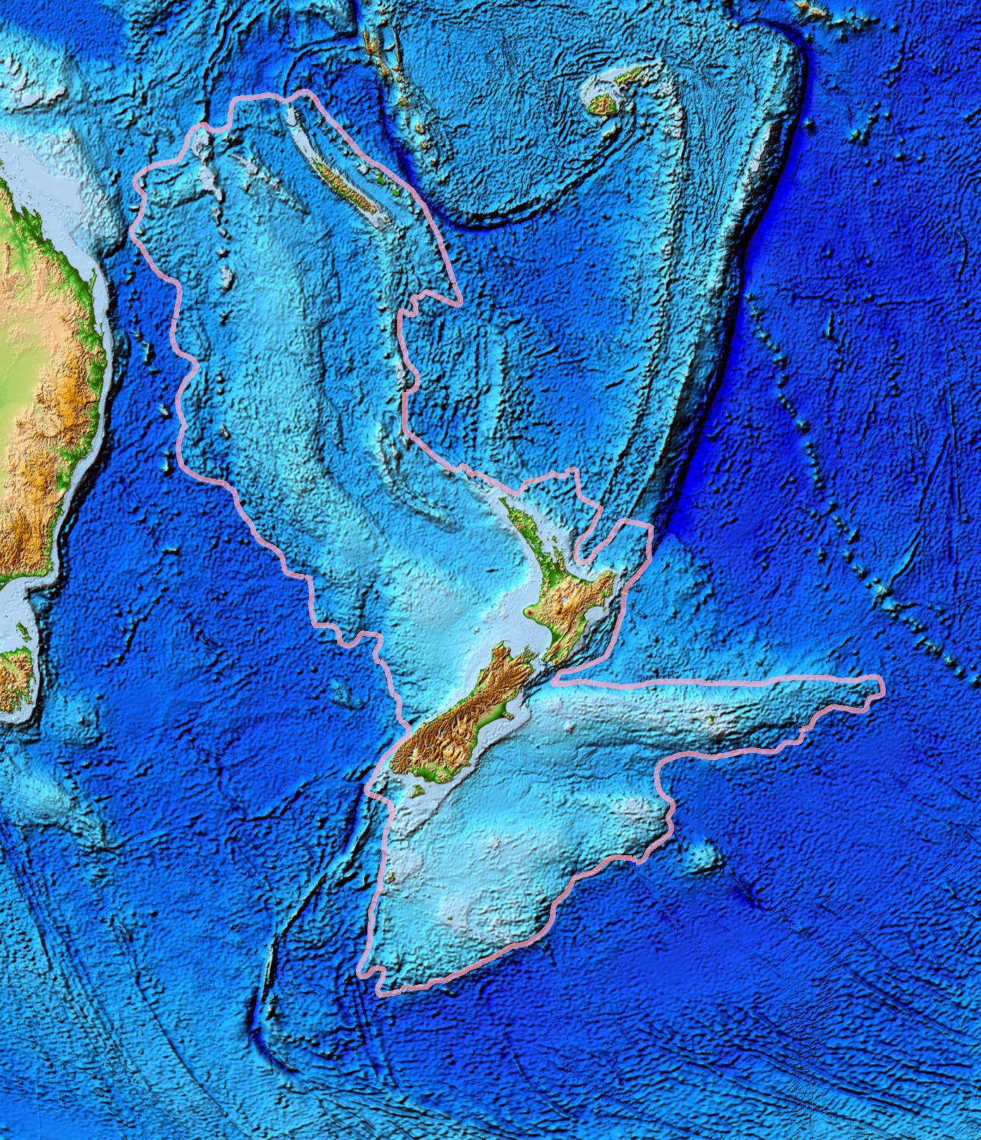
Ninety-four per cent of it now lies underwater. But if we drained the oceans, we could see it unfurling some 4.9 million sq km across the South Pacific. For decades, scientists suspected something was lurking beneath the waters around New Zealand, yet they hesitated to confirm what now seems obvious in hindsight.
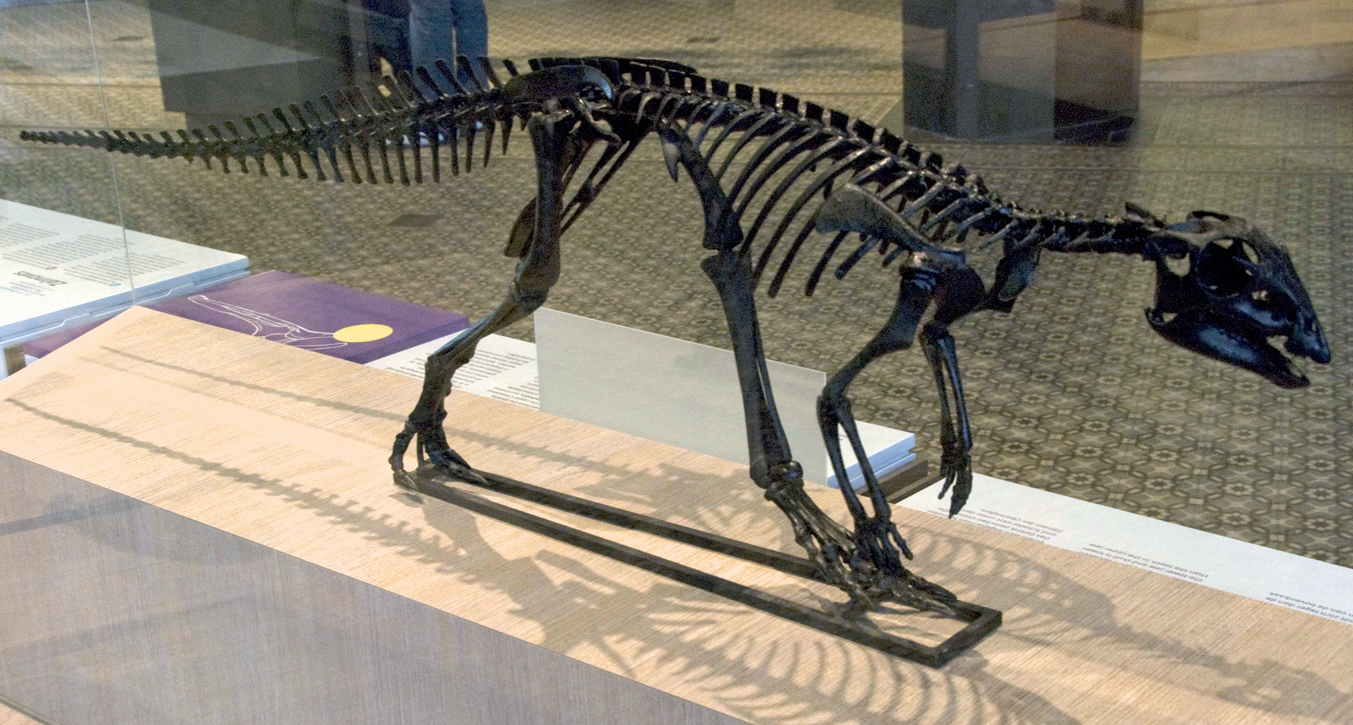
Scientists had known about it for decades, but were reluctant to state, unequivocally, that the lost continent physically existed. But it did: and for a relatively brief point in the Earth’s history its sprawling mass once stood above the waves, dispersing animals and plants from here to New Caledonia and the east of Australia. Most groups of dinosaurs, including the towering titanosaurs, roamed its rolling, mountainless, low-lying landscape. Think about that for a moment – massive long-necked dinosaurs walking across land that now sits more than a kilometer beneath the Pacific’s surface.
The Dinosaur Highway Beneath the Waves
Dinosaurs continued to live in New Zealand and had about 10–20 million years to evolve unique species after they separated from Gondwana. In the Cretaceous, New Zealand was much further south (c.80 degrees south) than it is today, however, it and much of Antarctica was covered in trees as the climate of 90 Ma was much warmer and wetter than today. This isolation wasn’t just geographic – it was evolutionary gold.
Then, about 85 million years ago, the New Zealand continent, Zealandia, broke away, carrying with it a cargo of plants and animals, including dinosaurs. Picture this ancient Noah’s Ark of sorts, drifting away from the supercontinent with its precious biological cargo intact. The animals that would have been on Zealandia when it began to split from Gondwana (starting around 80 million years ago) could well have included ancestors of tuatara, moa, weta, native frogs and fresh water animals. They would also have included dinosaurs and other animals that have since become extinct.
A single fossil locality (inland Hawke’s Bay) has yielded dinosaur, turtle, pterosaur and perhaps bird fossils from sedimentary rocks which formed in a shallow sea about 75 million years ago. Late Cretaceous dinosaur fossils are known from one other locality, on the Chatham Islands. Fragmentary theropod bones have been found in marine sedimentary rocks that are not older than 65 million years. These findings paint a picture of a continent that served as a unique evolutionary laboratory.
Revolutionary Dating Methods Reveal Ancient Secrets
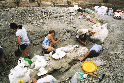
The cores plumbed 8,202 feet (2,500 m) below the surface, revealing 70 million years of the ancient continent’s history. The team found a treasure trove of fossils that reveal Zealandia wasn’t always under the ocean. More than 8,000 specimens were studied, and several hundred fossil species were identified. The discovery of microscopic shells of organisms that lived in warm shallow seas, and of spores and pollen from land plants, reveal that the geography and climate of Zealandia were dramatically different in the past.
The fossil evidence fundamentally changes how we understand dinosaur dispersal patterns. Big geographic changes across northern Zealandia, which is about the same size as India, have implications for understanding questions such as how plants and animals dispersed and evolved in the South Pacific. The discovery of past land and shallow seas now provides an explanation. There were pathways for animals and plants to move along. Previously, scientists couldn’t explain how certain dinosaur species appeared across different continents without clear migration routes.
The Pacific Ring of Fire Connection
The largely submerged Zealandia continent, which stretches across five million square kilometres beneath the southwest Pacific Ocean, was shaped by two tectonic events. First it was ripped away from Australia and Antarctica, and then it was carved by forces that started the Pacific Ring of Fire. This discovery links Zealandia’s fate directly to one of Earth’s most volatile geological features.
The results suggested tectonic forces stretched and thinned Zealandia’s crust until it was ripped from the ancient supercontinent Gondwana about 85 million years ago, during the time of dinosaurs. This created a deep ocean: the Tasman Sea. The timing couldn’t be more significant – this happened during the height of dinosaur diversity, meaning Zealandia’s separation created an isolated evolutionary environment just as dinosaurs were reaching their peak development.
Recent seafloor drilling has revealed that the ‘hidden continent’ of Zealandia — a region of continental crust twice the size of India submerged beneath the southwest Pacific Ocean — experienced dramatic elevation changes between about 50 million and 35 million years ago. New findings from this expedition, published today in Geology, propose this topographic upheaval may have been due to a widespread reactivation of ancient faults linked to formation of the western Pacific’s infamous Ring of Fire.
Fossil Evidence Rewrites Evolutionary Timelines
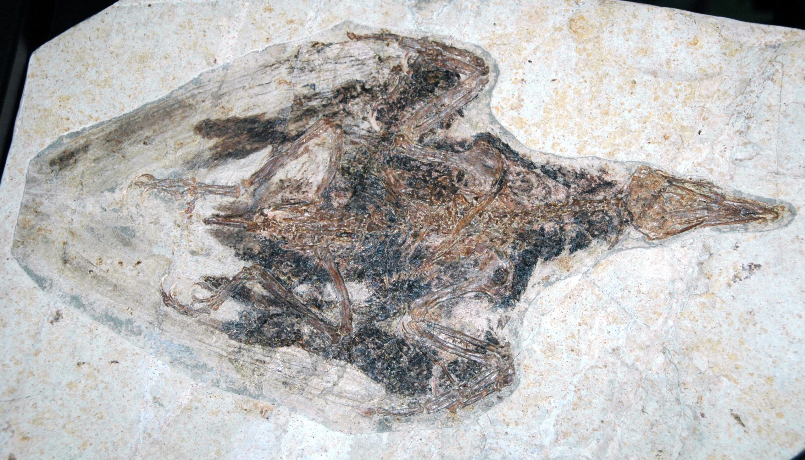
Although the evidence is rare, fossils reveal that there were Mesozoic reptiles, including dinosaurs in New Zealand. Possibly because it lacks the right conditions for fossilization, only fragmentary dinosaur remains have been found there. These fossils are often only a single bone or a piece of a bone, and thus the dinosaurs’ species cannot be identified. Yet what we do have tells an incredible story.
In 1995 Brendan Hayes, a fossil collector, was walking along the coast near the Waikato River mouth when he found a small bone encased in rock. The rock revealed its secrets when he extracted the bone and had it examined. He had found New Zealand’s first Jurassic dinosaur bone – a finger bone from a small theropod dinosaur that was about the size of a turkey. This single discovery opened a window into an entire lost world.
A co-author of the study, Diana P. Vineyard, revealed that most of the dinosaur fossils were created by ‘three-toed theropod dinosaurs,’ and a few were also likely made by sauropods or ornithischians. These footprints, according to the press release, were discovered in the Borborema region in the northeast part of Brazil and the Koum Basin in northern Cameroon. In addition to dinosaur tracks, the team also came across fossil pollen smudged in chalky sediment, which was aged to around 120 million years ago.
Hidden Continental Fragments Across the Globe
The break-up of continents is often associated with mantle plumes: These giant bubbles of hot rock rise from the deep mantle and soften the tectonic plates from below, until the plates break apart at the hotspots. This is how Eastern Gondwana broke apart about 170 million years ago. At first, one part was separated, which in turn fragmented into Madagascar, India, Australia and Antarctica, which then migrated to their present position. Zealandia wasn’t alone in this geological drama.
The Seychelles are a well-known example of such a continental fragment. The sand grains contain semi-precious zircons aged between 660 and 1970 million years, which is explained by the fact that the zircons were carried by the lava as it pushed through subjacent continental crust of this age. This dating method was supplemented by a recalculation of plate tectonics, which explains exactly how and where the fragments ended up in the Indian Ocean.
It also means that Iceland is now thought to be not just a volcanic island created by a hot mantle plume beneath, but that it also contains within it pieces of lost and submerged continental fragments buried beneath millions of years of volcanic lava flows. I like to think of this concept as the Earth Science equivalent of finding the Lost City of Atlantis; fragments of lost continent submerged beneath the sea and kilometres of lava flows. Scientists are discovering that our understanding of continental formation needs a complete overhaul.
Modern Technology Unveils Ancient Mysteries
They collected 2,500 meters (8,202 feet) of sediment cores from layers that record how the geography, volcanism and climate of Zealandia have changed over the last 70 million years. After a nine-week voyage to study the lost, submerged continent of Zealandia in the South Pacific, a team of 32 scientists from 12 countries has arrived in Hobart, Tasmania, aboard the research vessel JOIDES Resolution. Researchers affiliated with the International Ocean Discovery Program (IODP) mounted the expedition to explore Zealandia.
Meanwhile Dr Phethean, together with researcher Luke Longley from the University of Derby, were part of a team that recently discovered a new proto-microcontinent believed to have formed 60 million years ago. The proto-microcontinent is located between Canada and Greenland and is 250-miles long – about the same size as England. It currently sits below the Davis Strait, which connects the Labrador Sea in the south with Baffin Bay to the north. Its discovery was made using gravity data collected by space satellites and seismic reflection data – similar to a giant ultrasound scan of the Earth – which enabled the team to get an even better view of the proto-microcontinent. The technology allowing these discoveries would have been unimaginable just decades ago.
Geologists have reconstructed a massive and previously unknown tectonic plate that was once one-quarter the size of the Pacific Ocean. The team had predicted its existence over 10 years ago based on fragments of old tectonic plates found deep in the Earth’s mantle. To the lead researchers surprise, she found that oceanic remnants on northern Borneo must have belonged to the long-suspected plate, which scientists have named Pontus. Each new discovery reveals more pieces of Earth’s hidden geological puzzle.
Implications for Future Discoveries
They have found that when tectonic plates break apart, powerful waves are triggered deep within the Earth that can cause continental surfaces to rise by over a kilometre. Their findings help resolve a long-standing mystery about the dynamic forces that shape and connect some of the Earth’s most dramatic landforms — expansive topographic features called ‘escarpments’ and ‘plateaus’ that profoundly influence climate and biology. The new research, led by the University of Southampton, examined the effects of global tectonic forces on landscape evolution over hundreds of millions of years.
Understanding Zealandia’s story isn’t just about the past – it’s about predicting the future. Studies of the sediment cores obtained during the expedition will focus on understanding how Earth’s tectonic plates move and how the global climate system works. Records of Zealandia’s history, expedition scientists said, will provide a sensitive test for computer models used to predict future changes in climate. The same forces that shaped this lost continent continue to work beneath our feet today.
How many lost continents are out there undiscovered? If it’s on a cycle, when is Zealandia due to rise again? These aren’t idle questions. Their results help explain why parts of the continents previously thought of as ‘stable’ experience substantial uplift and erosion, and how such processes can migrate hundreds or even thousands of kilometers inland, forming sweeping elevated regions known as plateaus, like the Central Plateau of South Africa. They discovered that when continents split apart, the stretching of the continental crust causes stirring movements in Earth’s mantle (the voluminous layer between the crust and the core). This process can be compared to a sweeping motion that moves towards the continents and disturbs their deep foundations.
Conclusion
Zealandia’s discovery represents more than just finding another continent – it’s a fundamental shift in how we understand life’s evolutionary journey. The realization that dinosaurs lived, evolved, and developed unique characteristics on this now-submerged landmass forces us to reconsider migration patterns, evolutionary timelines, and the very mechanisms that drove ancient biodiversity.
From titanosaurs wandering across rolling landscapes that now rest beneath miles of ocean water to tiny theropods leaving their mark in sediments that would eventually become our only clues to their existence, Zealandia tells a story of isolation, adaptation, and ultimate submersion. The continent serves as a reminder that Earth’s surface has been far more dynamic than we ever imagined, with entire landmasses rising and falling like slow-motion waves across geological time.
What discoveries await us in the remaining unexplored depths of our oceans? If a continent the size of India could hide beneath the waves for so long, what other geological secrets might be reshaping our understanding of life’s grand evolutionary story?