Picture this: a volcanic system so massive that a single eruption could bury Texas under five feet of ash, create atmospheric changes visible from space, and fundamentally reshape an entire continent. This isn’t science fiction – it’s the extraordinary story of the Yellowstone volcanic system and its ancient predecessors that carved the American landscape we know today.
The Yellowstone Caldera spans parts of Wyoming, Idaho, and Montana, representing a Quaternary caldera complex whose volcanism began 2.1 million years ago and proceeded through three major volcanic cycles. Yet this famous supervolcano is merely the latest chapter in a much grander tale that stretches back over 17 million years across the American West.
The Birth of a Continental Hotspot
Long before Yellowstone became a household name, something extraordinary was stirring beneath the Pacific Northwest. In the middle Miocene, 17 to 15 Ma, the Columbia Plateau and the Oregon Basin and Range were flooded with lava flows attributed to a common source, the Yellowstone hotspot, with the most widely accepted idea being that a mantle plume or upwelling initiated widespread basaltic volcanism about 17 million years ago.
Hotspot volcanism commenced roughly 17 Ma in northeastern Nevada and continues to the present, with ignimbrites and tuff deposits marginal to the Snake River Plain recording the path of the North American Plate’s movement over the stationary hotspot at about 2.5 cm per year. This marked the beginning of one of Earth’s most dramatic geological transformations.
The Columbia River Basalt Catastrophe
During the middle to late Miocene epoch, the Columbia River flood basalts engulfed about 163,700 km² of the Pacific Northwest, forming a large igneous province with an estimated volume of 174,300 km³, with eruptions most vigorous 17–14 million years ago when over 99 percent of the basalt was released. To put this in perspective, imagine enough molten rock to bury the entire United States under 12 meters of lava.
The Columbia River Basalt Group is the youngest, smallest, and best-preserved continental flood basalt, erupting roughly 210,000 km³ of lava in the Pacific Northwest between approximately 17 and 5 million years ago. These weren’t ordinary volcanic eruptions – they were geological catastrophes that reshaped the continent’s climate and topography in ways we’re only beginning to understand.
The Snake River Plain: A Trail of Ancient Destruction
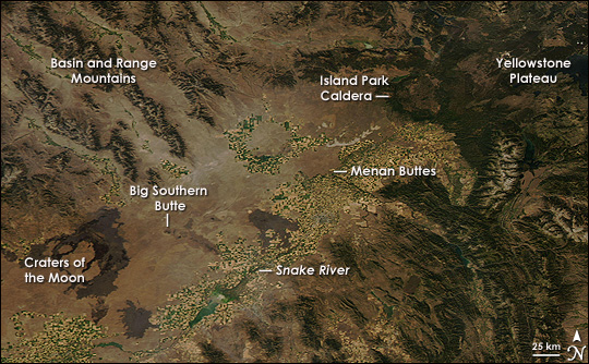
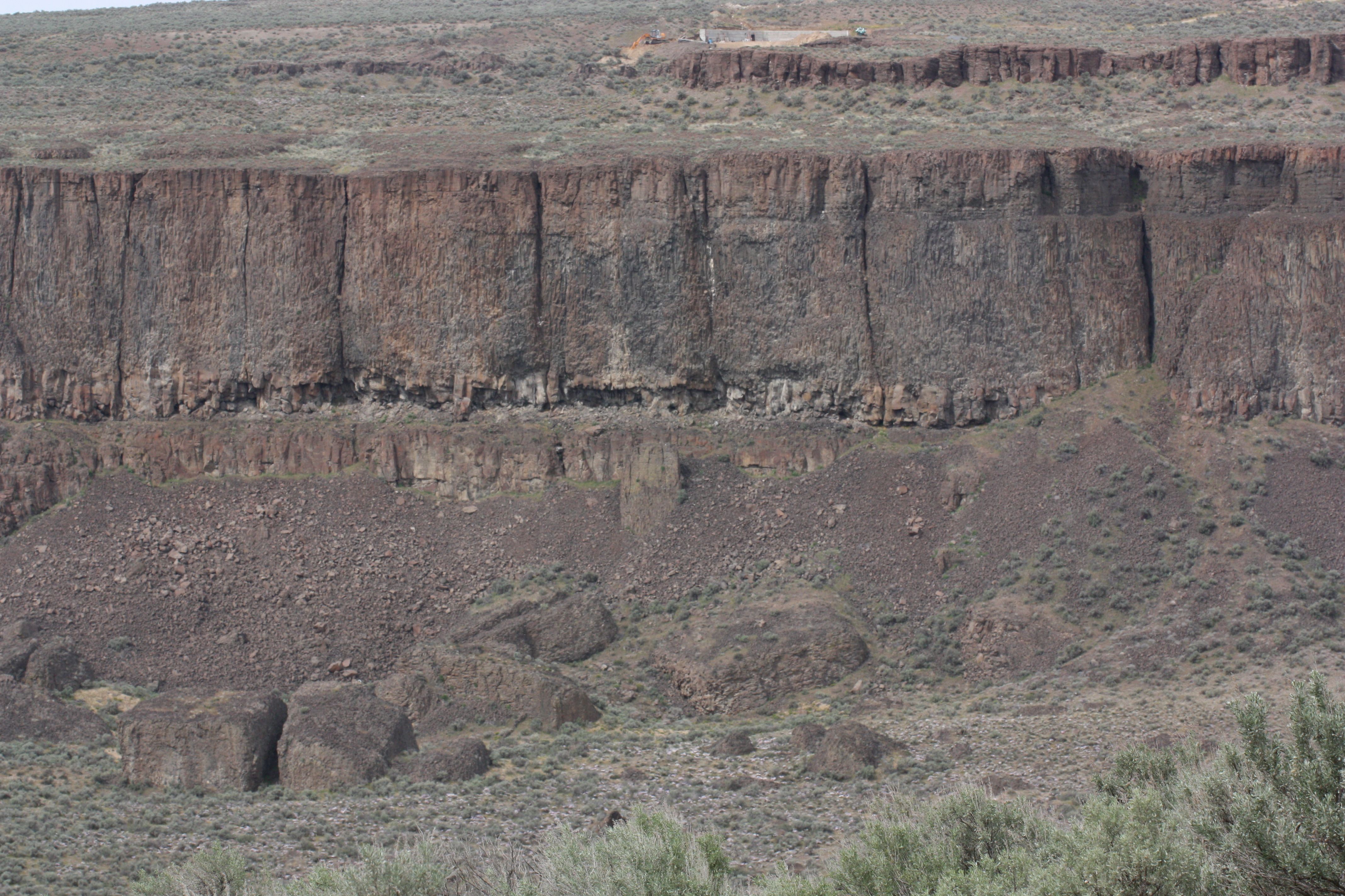
The Snake River Plain formed as the North American plate drifted southwest over a hot spot in Earth’s crust, with the hot spot that today fuels Yellowstone’s famous geysers providing evidence of its passage through lava flows, volcanic buttes, a caldera, and even the course of the Snake River. This 400-mile-long depression across southern Idaho tells a story of unimaginable volcanic violence.
Researchers have identified that one super-eruption from the Yellowstone hotspot track, the Castleford Crossing eruption, occurred about 8.1 million years ago with an estimated volume exceeding 1,900 km³, while the international research team suggests that 12 recorded giant eruptions were likely significantly larger than previously believed. Each of these ancient eruptions dwarfed anything in recorded human history.
Yellowstone’s Three Catastrophic Chapters
Volcanism at Yellowstone proceeded through three major volcanic cycles, with each cycle involving a large ignimbrite eruption, continental-scale ash-fall, and caldera collapse, and the first and largest cycle being the Huckleberry Ridge Tuff eruption about 2.1 million years ago, which formed the Island Park Caldera. These weren’t just local events – they were continental disasters.
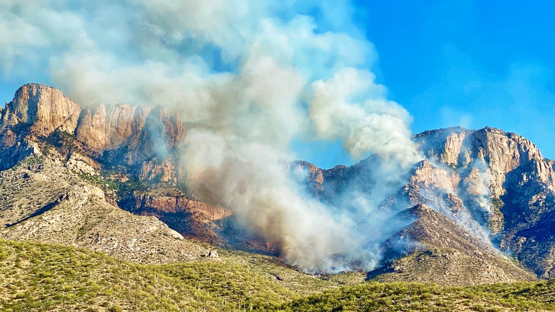
Evidence from the last big event, estimated to have occurred about 640,000 years ago, is sprawled throughout the park and across thousands of kilometers of surrounding landscape, with each previous eruption spewing enormous amounts of volcanic ash, gas, magma and debris that covered most of the continental U.S., with some material found as far away as Louisiana.
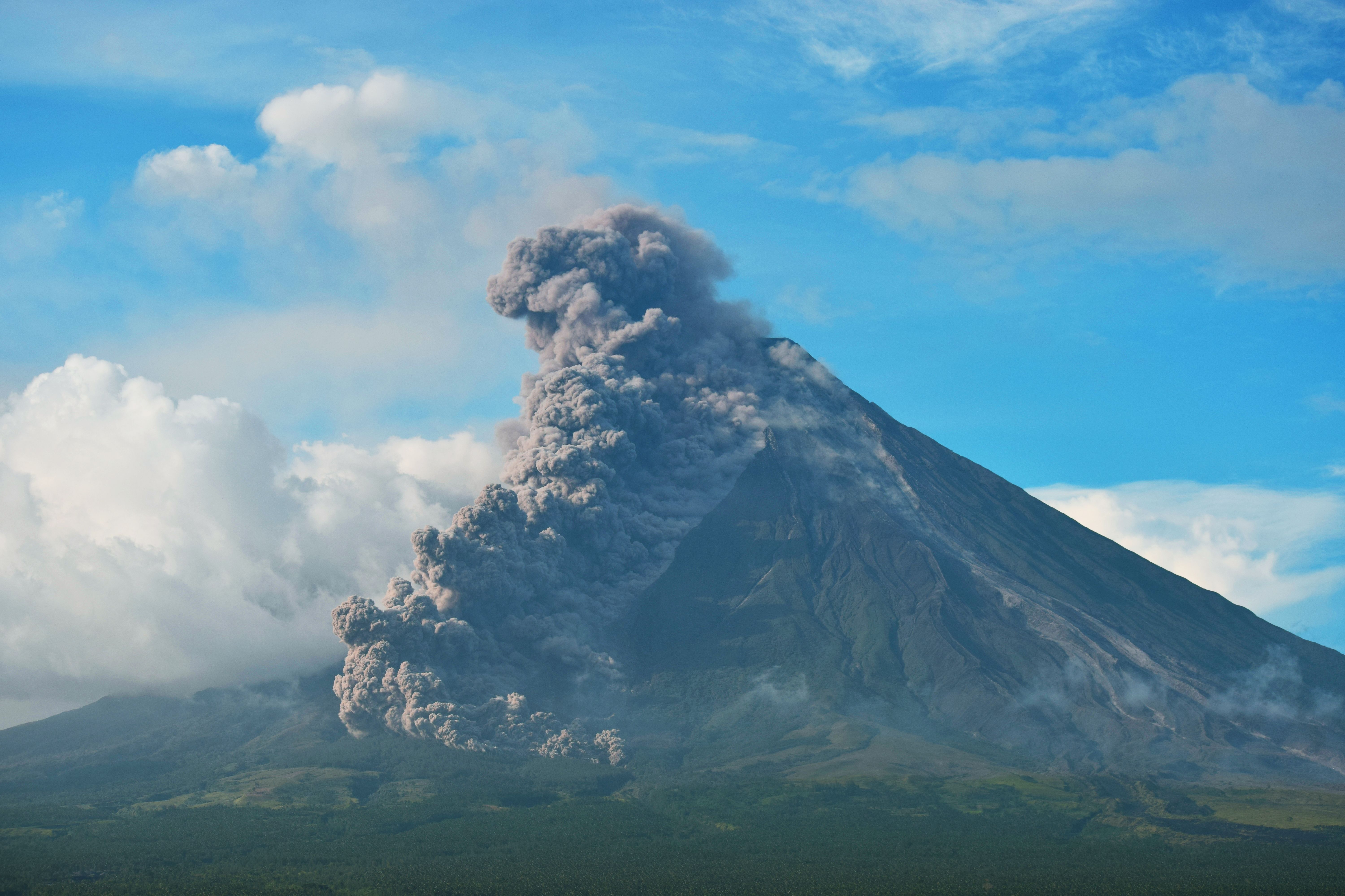
The scale of destruction was unprecedented. Scientists say the last Yellowstone eruption was 1,000 times greater than the notorious 1980 Mt. Saint Helens eruption, with the blast shooting a fatal plume of hot ash, molten rock, and lethal gases thousands of meters into the air.
How Ancient Eruptions Carved America’s Landscapes
Over time, the Yellowstone hotspot left a 70-mile wide channel through the Rocky Mountains, aligned with the gap between the Cascade Range and the Sierra Nevada, creating a moisture channel extending from the Pacific Ocean to Yellowstone. This geological bulldozing fundamentally altered North America’s climate patterns and water distribution.
The result is a chain of ancient volcanic fields that started over 16 million years ago near the Idaho/Nevada/Oregon border and gets progressively younger across southwestern Idaho and the eastern Snake River Plain, with at least seven volcanic fields identified: McDermitt (16.5 million years ago), Owyhee-Humboldt (15 million years ago), Bruneau-Jarbidge (12 million years ago), Twin Falls (10.5 million years ago), Picabo (10 million years ago), Heise (6.5 million years ago), and Yellowstone (2 million years ago).
Each volcanic field represents a chapter of destruction and creation that reshaped entire regions.
The Supervolcano’s Hidden Power
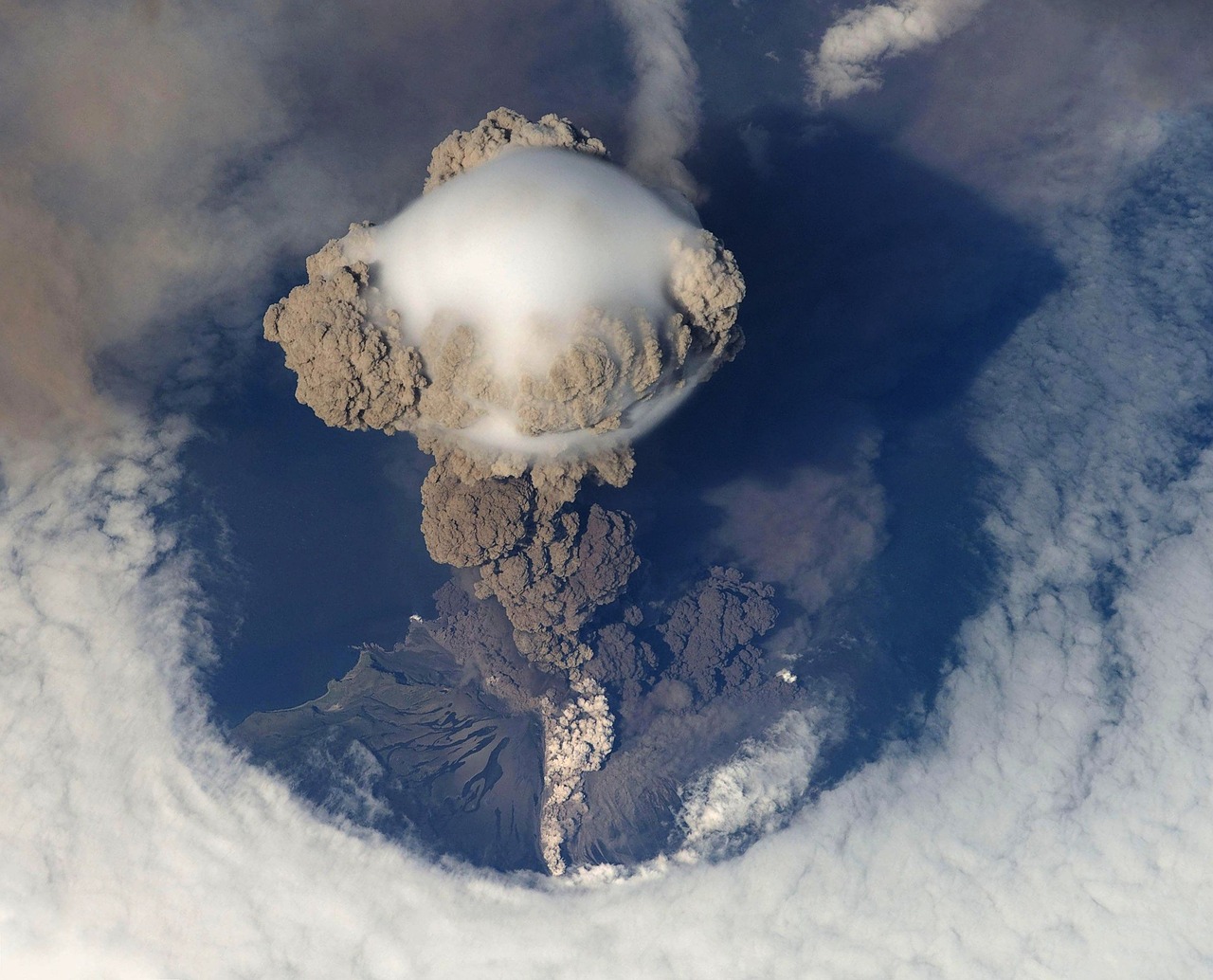
The first major eruption of the Yellowstone volcano, which occurred 2.1 million years ago, is among the largest volcanic eruptions known, covering over 5,790 square miles with ash, while the most recent major eruption, 640,000 years ago, caused the ground to collapse into the magma reservoir, leaving a giant caldera now measured at 43 x 28 miles. These dimensions barely hint at the system’s true power.
The Yellowstone volcanic system has experienced two supereruptions, or events resulting in accumulation of more than 250 cubic miles of debris – enough material to bury the state of Texas five feet deep. Yet recent research suggests the reality was even more dramatic than previously imagined.
Climate Consequences That Echoed Globally
During the three giant caldera-forming eruptions that occurred between 2.1 million and 631,000 years ago, volcanic ash covered much of the western half of North America, likely a third of a meter deep several hundred kilometers from Yellowstone, while wind carried sulfur aerosol and the lightest ash particles around the planet and likely caused a notable decrease in temperatures around the globe.
Eruption of the Columbia River Basalt Group has been linked to elevated atmospheric CO₂ and global warming during the mid-Miocene climate optimum roughly 16 million years ago. These ancient eruptions didn’t just reshape landscapes – they altered Earth’s entire climate system for millions of years.
The Modern Legacy of Ancient Fury
The passage of the Yellowstone hotspot affected earthquake activity in Idaho, Montana, Wyoming, and Utah, with geologists observing a unique “parabolic” pattern of seismicity around the hotspot track, sometimes described as a bow wave, including some of the most active faults in the region like the Lost River fault, Hebgen fault, Teton fault, and Wasatch fault.
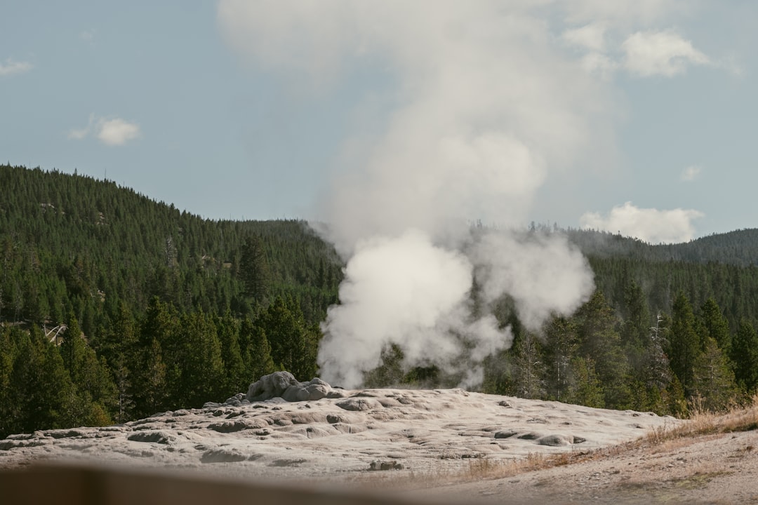
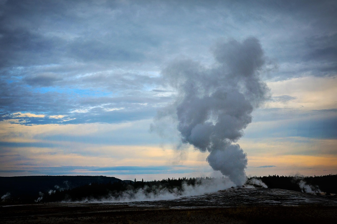
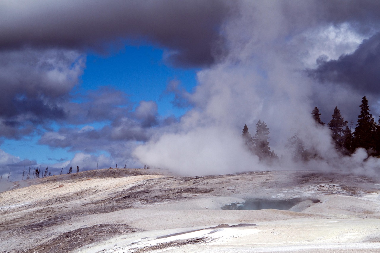
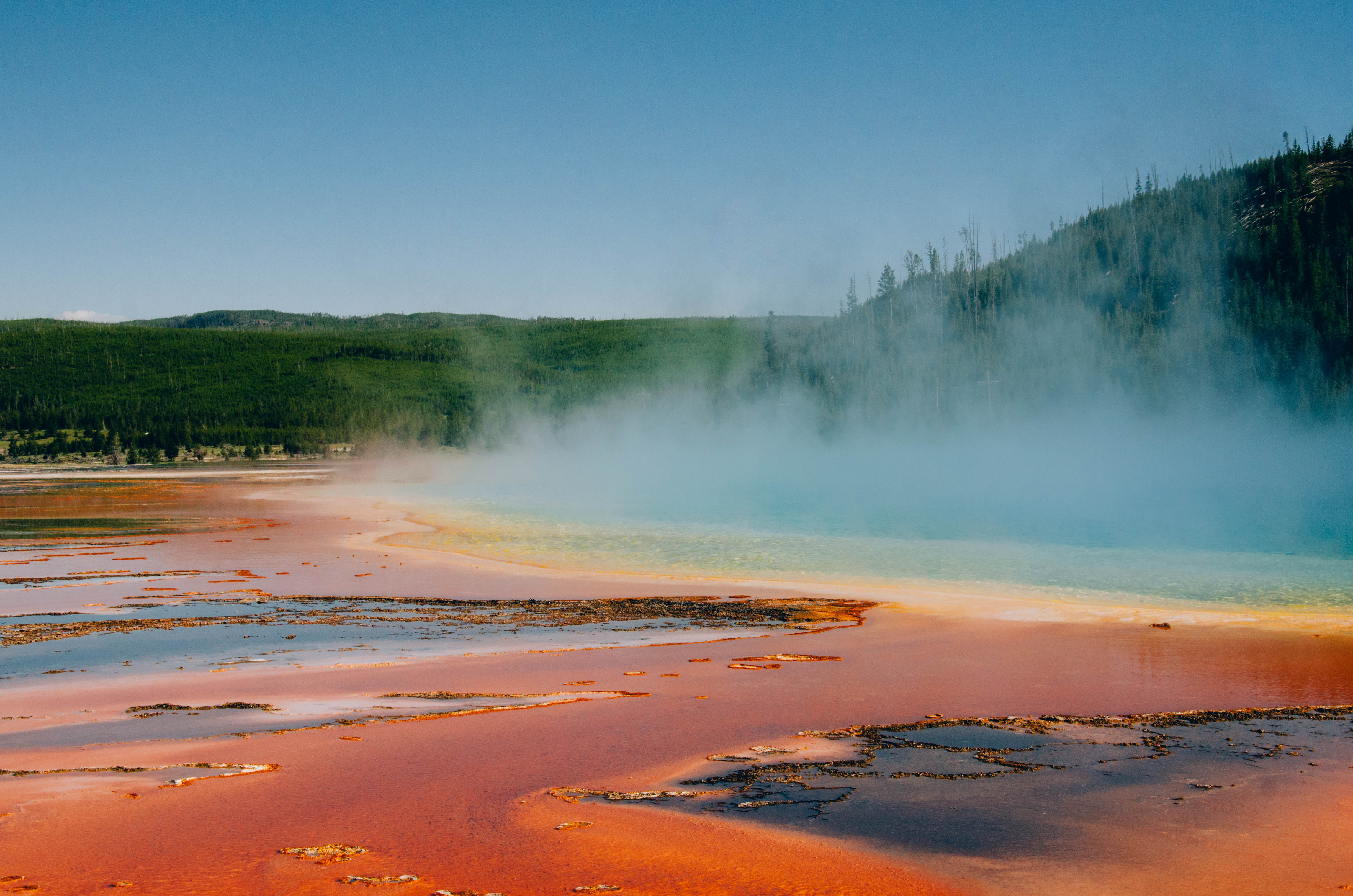
Today’s Yellowstone continues this legacy of geological influence. Yellowstone’s geysers and hot springs are a direct consequence of the volcanic system, existing because of the high heat discharge from molten rock found four to five miles beneath the surface, with heat conducted upward to the groundwater system.
Conclusion
The ancient volcanic system tells a story of unimaginable power and continental transformation. From the Columbia River flood basalts that buried the Pacific Northwest under miles of lava to Yellowstone’s catastrophic supereruptions that blanketed continents in ash, these geological forces carved the landscapes, climate patterns, and even the earthquake zones we live with today.
These weren’t just volcanic eruptions – they were Earth-changing events that literally moved mountains, carved river channels, and influenced weather patterns across an entire continent. The next time you see the Snake River winding through Idaho or feel the spray from Old Faithful, you’re witnessing the ongoing legacy of volcanic forces that have been reshaping America for over 17 million years.
What strikes me most about this story is how these ancient catastrophes became the foundation for some of our most beloved landscapes today. Did you expect that America’s most iconic natural features were born from such violent beginnings?