You’ve heard about the Great Lakes. Maybe you’ve marveled at the grandeur of Lake Superior, sprawled across more than thirty thousand square miles of water. Perhaps you’ve cruised along the Mississippi River, watching its muddy waters slide toward the Gulf of Mexico. These are massive features of our modern landscape, impressive in their own right.
What if I told you they’re mere puddles compared to what once existed? North America’s prehistoric waterways were so immense, so staggeringly vast, that they make our current lakes and rivers look like decorative garden ponds. We’re talking about bodies of water that could swallow entire states, rivers that made the Amazon look modest, and drainage systems so powerful they literally changed global climate patterns. The sheer magnitude of these ancient aquatic giants is almost impossible to grasp, even when you’re staring at the evidence carved into mountainsides and desert floors.
Lake Agassiz: The Colossus That Dwarfed All Modern Lakes
At its greatest extent, Lake Agassiz may have covered as much as 170,000 square miles, making it larger than any lake on Earth today. Think about that for a moment. At its peak, the lake’s area was larger than all of the modern Great Lakes combined. This wasn’t some fleeting geological hiccup either.
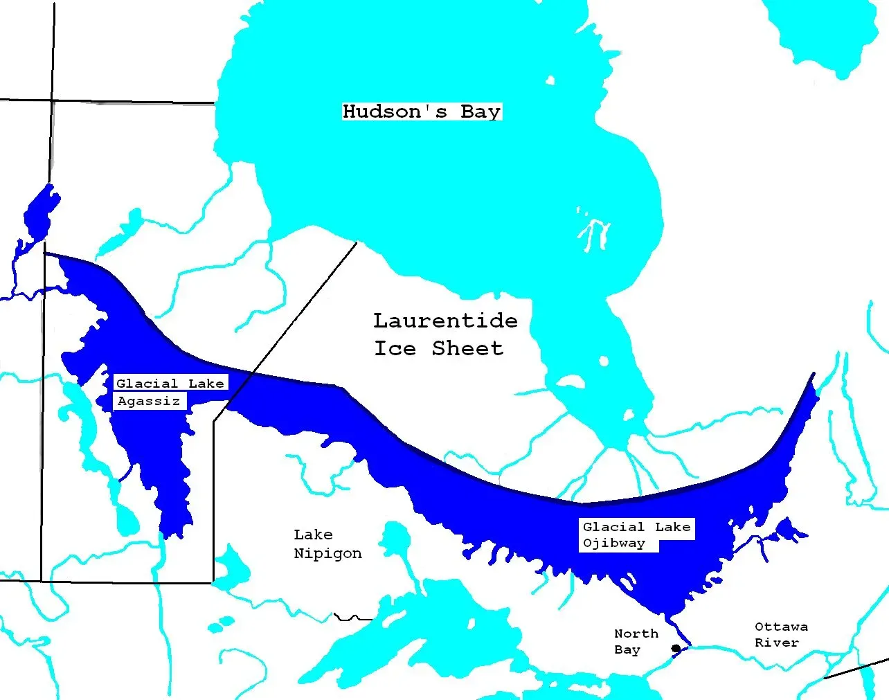
Lake Agassiz was a large proglacial lake that existed in central North America during the late Pleistocene, fed by meltwater from the retreating Laurentide Ice Sheet at the end of the last glacial period. At its largest, Lake Agassiz was about 1500 km long, over 1100 km wide and about 210 m deep. The city of Winnipeg, in modern Canada, would have been submerged under hundreds of meters of frigid freshwater.
The Dramatic Disappearance and Its Global Impact
This final drainage of Lake Agassiz has been associated with an estimated 0.8 to 2.8 m rise in global sea levels. Let that sink in. When this monster lake finally emptied around eight thousand years ago, it raised the world’s oceans by nearly ten feet. A flood of epic proportions drained at a rate of more than 800 Olympic swimming pools per second from a glacial lake that spanned the Prairie provinces more than 12,000 years ago.
The draining didn’t just affect sea levels. Lake Agassiz’s major drainage reorganization events were of such magnitudes that they significantly impacted climate, sea level, and possibly early human civilization. The lake’s enormous freshwater release into the Arctic Ocean has been postulated to have disrupted oceanic circulation and caused temporary cooling. Some scientists believe it triggered an ice age rebound called the Younger Dryas, plunging parts of the Northern Hemisphere back into near glacial conditions just when things were warming up.
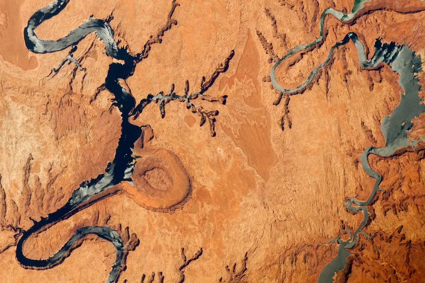
Lake Bonneville: Utah’s Vanished Inland Sea
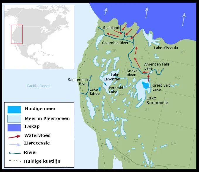
While Lake Agassiz dominated the northern plains, another prehistoric giant ruled the West. Lake Bonneville, prehistoric lake, formed about 30,000 years ago, covered an estimated 20,000 square miles, embracing much of what is now the western half of Utah and parts of Nevada and Idaho. Honestly, driving across Utah’s salt flats today, it’s hard to imagine this entire landscape submerged beneath nearly a thousand feet of water.
Lake Bonneville was about 325 miles long, 135 miles wide, and had a maximum depth of over 1,000 feet. At its maximum, when Lake Bonneville was more than 980 ft deep and almost 20,000 sq mi in surface area, it covered almost as much area as modern Lake Michigan. Salt Lake City would have been completely underwater, along with virtually every settlement along the Wasatch Front.
The Bonneville Flood: A Catastrophe Beyond Imagination
Approximately 14,500 years ago, a catastrophic flood took place at the natural dam structure known as Red Rock Pass. Increasing water levels and seepage at the dam resulted in structural collapse, producing a 410-foot wall of water spread throughout the Portneuf River Valley and into adjacent valleys along the path. Picture a wall of water taller than a forty story building racing across the landscape.
Many geological features found in the flood path are the result of this catastrophic event, believed to be the second largest in known geologic history. Other relics of Lake Bonneville are Utah Lake, Sevier Lake, and the Great Salt Lake Desert which contains the famous Bonneville Salt Flats. Today’s Great Salt Lake is a shallow, salty remnant of ancient Lake Bonneville. What remains is basically a puddle compared to what existed.
Lake Lahontan: Nevada’s Forgotten Leviathan
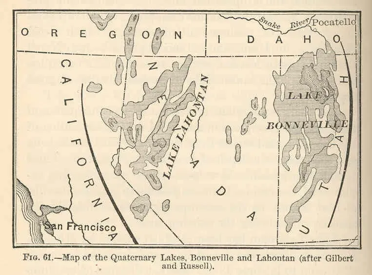
Not to be outdone, northwestern Nevada hosted its own aquatic monster. At its peak approximately 12,700 years ago, Lake Lahontan had a surface area of over 8,500 square miles. Lake Lahontan reached a maximum depth of over 500 feet and covered over 8,610 square miles. These days, you can drive for hours across bone dry playas where hundreds of feet of water once lapped against mountainsides.
The lakes were able to grow large, rivaling the Great Lakes, during the peak of the last Ice Age 21,000 years ago, because evaporation rates were significantly lower than today. It wasn’t necessarily that it rained more back then. The cooler temperatures meant less water evaporated, allowing these basins to fill to absolutely staggering levels. The only modern remnants existing as true lakes are Pyramid Lake and Walker Lake. Winnemucca Lake has been dry since the 1930s.
Ancient Rivers That Reshaped Continents
The prehistoric lakes are mind blowing, sure, yet the rivers that fed them were equally impressive. In North America, the New River, a Wild and Scenic River with 53 miles designated as the New River Gorge National Park and Preserve, is generally regarded as the most ancient, along with the Kanawha and French Broad Rivers. These waterways are so old they might actually predate the Appalachian Mountains themselves.
The Susquehanna River is one of the oldest rivers in the world, even older than the Appalachian mountains that surround it. There is evidence that the flow of the ancient Susquehanna was established early enough that it predated the formation of the Appalachian mountains over 300 million years ago. The Mississippi River system, which seems so permanent and ancient to us today, is actually a relative newcomer. Potter-McIntyre and her team concluded, based on the age of zircon fragments they excavated from sandstone in southern Illinois, that the river began flowing some 70 million years ago.
What the Evidence Tells Us About Our Future
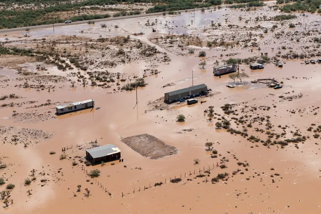
These remnants scattered across North America aren’t just fascinating historical curiosities. They’re warning signs. Ancient shorelines, ancient beaches, ancient dunes, and carved-out valleys where Lake Agassiz drained are still visible on the landscape today. Its waves created low cliffs and beach ridges, which are still visible on the landscape today. When you understand how dramatically water levels have shifted in the past, it makes you wonder what changes might be coming.
The prehistoric waterways of North America existed during climate conditions that weren’t radically different from what we might experience in the coming centuries. The enormous lakes that once dotted the western United States initially grew large during the peak of the Last Glacial Maximum due to reduced evaporation, but didn’t reach their maximum sizes until several thousand years later, when rain and snowfall increased. Small shifts in temperature and precipitation patterns created water bodies that would be unrecognizable to modern eyes.
What do you think would happen if similar conditions returned? Could you imagine Lake Superior expanding to cover Wisconsin and Minnesota? The evidence is literally carved into the mountains all around us.