Imagine standing at the edge of a vast, wind-swept landscape stretching hundreds of miles in every direction, with no ocean in sight, no GPS, and no map. You don’t know it yet, but you are standing on one of the most consequential pieces of land in all of human history. This is Beringia, the ancient land bridge that once connected Asia and North America, a place so significant that its very existence helped write the story of an entire hemisphere.
For centuries, scientists, historians, and Indigenous communities have grappled with a deceptively simple question: how did people first get to the Americas? The answer, it turns out, is both breathtaking in its scale and humbling in its complexity. So let’s dive in.
What Was the Bering Land Bridge, Exactly?
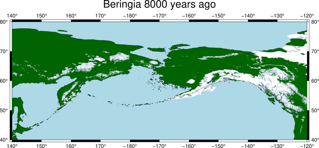
Let’s be real, the name “land bridge” makes it sound like a modest little pathway, like a cobblestone trail between two neighborhoods. The reality was something far more dramatic. At its greatest extent, the Bering Land Bridge was up to 1,000 kilometers wide and covered an area as large as British Columbia and Alberta combined, totaling about 1.6 million square kilometers, allowing biological dispersal to occur between Asia and North America.
Beringia refers to a prehistoric land bridge that once connected Asia and North America, specifically in the area now known as the Bering Strait. This land bridge was exposed during the Pleistocene epoch when global sea levels dropped significantly, allowing for a continuous land connection that measured over 600 miles at its maximum width. Think of it like draining a shallow bathtub and discovering a massive plain underneath. That is essentially what happened on a planetary scale.
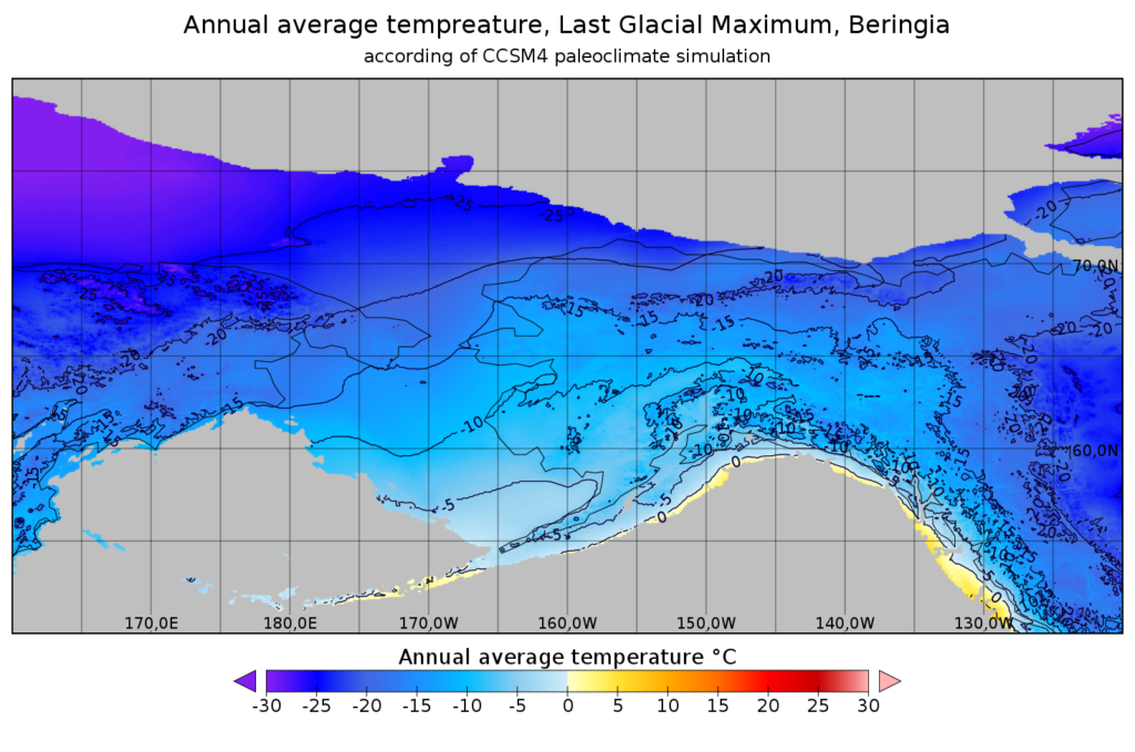
The Bering Land Bridge emerged as a result of dramatic climatic and geological changes during the Ice Age, particularly in the Pleistocene Epoch. During this time, glaciers trapped vast amounts of the Earth’s water, causing sea levels to drop by as much as 400 feet, which exposed the Bering Land Bridge. It was not a freak accident of geology. It was a slow, grinding process that unfolded over thousands of years.
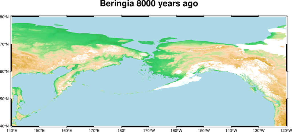
Data has constrained that the Bering Land Bridge existed between 36,000 and 11,000 years ago. Deglaciation commenced in the Northern Hemisphere approximately 19,000 years before present, and the bridge was finally inundated around 11,000 years ago. When the ice melted, the sea reclaimed its territory, and Beringia disappeared beneath the waves forever.
The Climate and Landscape of Ancient Beringia
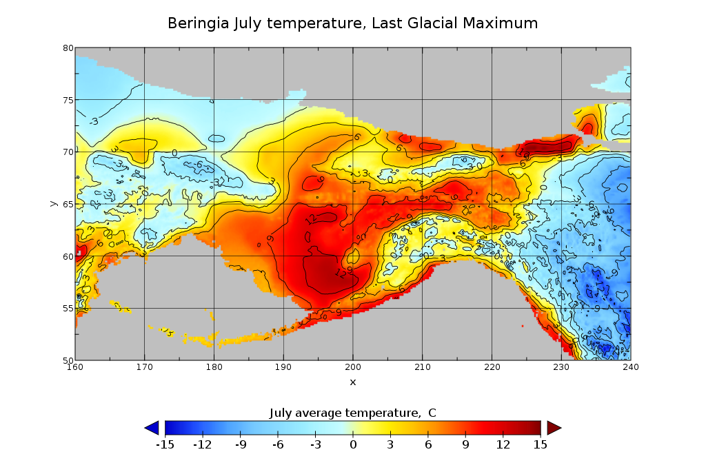
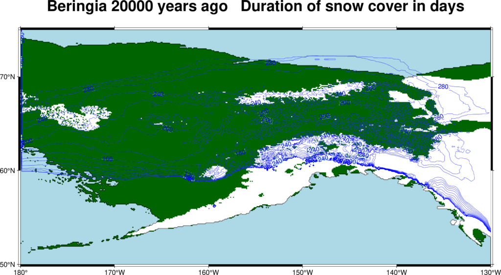
You might picture this ancient land as a frozen, desolate wasteland. Honestly, that assumption deserves a second look. Although glaciation throughout much of the Northern Hemisphere was extensive during the late Wisconsin period, with ice reaching thicknesses of as much as 2.5 miles in places, research has shown that much of Beringia had a dry climate and thus was not glaciated. This condition supported cold-hardy tundra vegetation that allowed land mammals to venture eastward into North America.
Sediments contain pollen, plant and insect fossils, suggesting the Bering land bridge wasn’t just barren, grassy tundra steppe but was dotted by refugia, or refuges, where there were brushy shrubs and even trees such as spruce, birch, willow, and alder. So when you picture those ancient people surviving on this land, imagine something closer to a cold but surprisingly livable shrubland rather than an endless sheet of ice. It was tough, no doubt, but it was survivable.
Beringia featured a tundra-like climate and supported a variety of migratory Pleistocene animals, such as mammoths and reindeer, which attracted nomadic peoples from northeast Asia. Where there were animals, there was food. Where there was food, people followed. Simple as that.
Animals Crossed First: The Great Biological Exchange
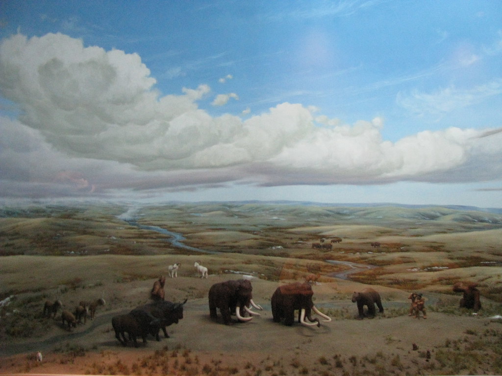
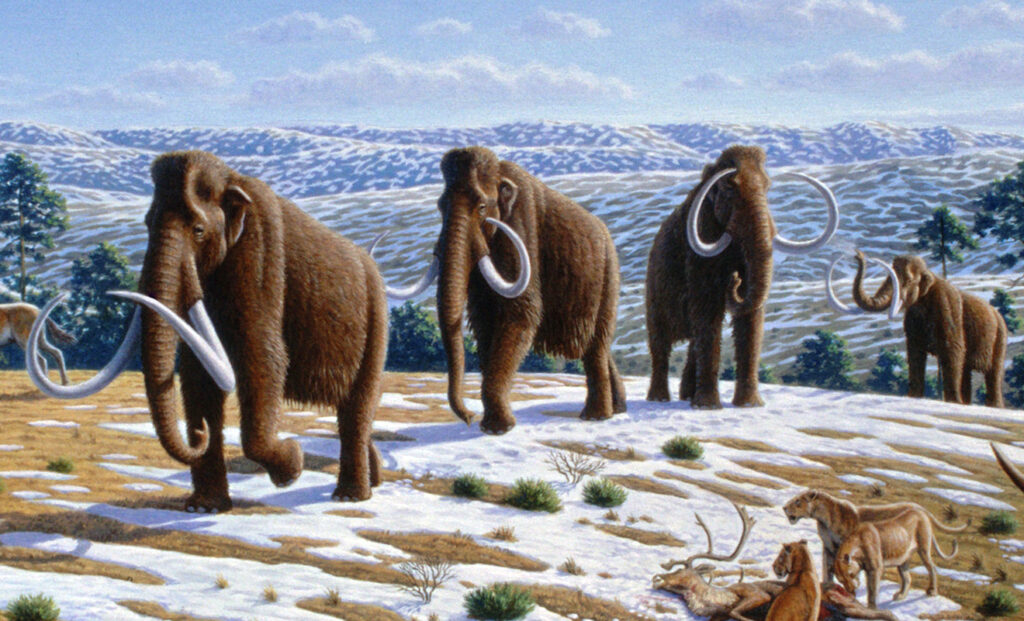
Here’s something that tends to surprise people: humans were not the first living things to use this land bridge. Not even close. Animals began migrating across the Bering Land Bridge before humans. People came later, following the animals they hunted such as woolly mammoth and steppe bison. In a very literal sense, the megafauna were the trailblazers, and humanity simply followed the trail they carved.
North American species such as horses and camels migrated into Asia, while Asian species like mammoths and saber-toothed tigers journeyed into North America. This bidirectional movement enriched biodiversity on both continents and played a pivotal role in shaping evolutionary pathways. It was a two-way highway, not a one-way street. The exchange of life was staggering in its variety and importance.
The pattern of bidirectional flow of biota has been asymmetric, with more plants, animals, and fungi generally migrating from Asia to North America than vice versa throughout the Cenozoic. Fossil evidence also indicates an exchange of primates and plants between North America and Asia around 55.8 million years ago. This means Beringia’s role as a biological connector goes back far deeper in time than even the human story suggests, making it one of the most important geographic features in the entire history of life on Earth.
The Human Story: Following Mammoths into a New World
It is believed that the peopling of the Americas began when Paleolithic hunter-gatherers, known as Paleo-Indians, entered North America from the North Asian Mammoth steppe via the Beringia land bridge, which had formed between northeastern Siberia and western Alaska due to the lowering of sea level during the Last Glacial Maximum, roughly 26,000 to 19,000 years ago. These were not explorers in any modern sense. They had no destination in mind.
This migration was not a directed, purposeful movement to a new continent. Think of it more like generations of families slowly expanding their hunting grounds, drifting eastward over centuries, never knowing they were crossing into an entirely different part of the world. It is, honestly, one of the most extraordinary unintentional journeys in the human story.
These populations expanded south of the Laurentide Ice Sheet, either by sea or land, and spread rapidly southward, occupying both North and South America no later than 14,000 years ago, and possibly before 20,000 years ago. It is believed that a small human population of at most a few thousand arrived in Beringia from eastern Siberia during the Last Glacial Maximum before expanding into the settlement of the Americas sometime before 23,000 and 21,000 years before present. A few thousand people. An entire hemisphere waiting to be discovered.
The Standstill Hypothesis: Thousands of Years Stranded on a Land Bridge
Now here is a chapter of the story that is genuinely mind-blowing. You might wonder why it took so long between humans arriving near Beringia and them actually spreading through the Americas. The answer, according to a compelling scientific theory, is that they were essentially stuck. One theory gaining popularity is the “Beringia standstill hypothesis.” This theory states that people moved onto the land bridge and lived there for a while. In fact, they were “trapped” as it were. They could not enter North America because it was blocked by ice sheets, yet they could not return to Siberia due to the glaciers in the Verkhoyansk mountain range.
Cumulative evidence indicates the ancestors of Native Americans lived on the Bering land bridge in the neighborhood of 10,000 years, from roughly 25,000 years ago until they began moving into the Americas about 15,000 years ago once glacial ice sheets melted and opened migration routes. Ten thousand years. That is longer than all of recorded human civilization as we know it. Entire generations were born, lived, and died on a piece of land that no longer exists.
Sometime between 18,000 and 15,000 years ago, the blockage to the east was broken. The ice sheets began to recede. This allowed humans to finally enter North America, following the animals they hunted and searching for other food sources. When that frozen door finally opened, it unleashed a migration that would populate two continents.
What Genetics and Archaeology Reveal Today
Modern science has transformed what we thought we knew about the Bering Land Bridge migrations, and the picture keeps getting more intricate. Advancements in archaeology and genetics have significantly altered our understanding of Bering Land Bridge Migration by providing new evidence about migration patterns, timelines, and population dynamics. Techniques such as DNA analysis have revealed connections between ancient populations and modern Native Americans, challenging earlier assumptions about a single wave of migration.
The Asian ancestry of Native Americans is supported by dental patterns, blood group markers, and other physical and genetic characteristics which indicate that American Indians are more similar to Asians than to any other human populations. The genetic fingerprint is unmistakable. It is written in the bones, the teeth, and the DNA of living people across two continents.
Perhaps the most surprising recent finding is that the land bridge was not just a one-way road. Groundbreaking research suggests that the Bering Strait land bridge was not a one-way road. The findings, published in Current Biology, summarize the genomic analysis of skeletal remains from ten individuals in three areas of North Asia: Siberia’s Altai Mountains, the Russian Far East, and the Kamchatka Peninsula. The team of international collaborators provides evidence of re-migration from America to Asia as recently as 1,500 years ago. Their work suggests that our early ancestors were far more interconnected than we knew. So not only did people cross into the Americas, some of their descendants actually went back. The migration story runs in both directions, and that should genuinely change the way you think about ancient human movement.
Conclusion: A Sunken Bridge That Still Shapes the World
The Bering Land Bridge is gone now, buried under roughly 160 feet of cold, dark seawater in the Bering Strait. Today, the only land visible from the central part of the Bering land bridge are the Diomede Islands, the Pribilof Islands of St. Paul and St. George, St. Lawrence Island, St. Matthew Island, and King Island. These tiny outposts are all that remain above water of what was once one of the most critical migration corridors in Earth’s history.
Yet the legacy of Beringia is anything but invisible. Genetic studies reveal that individuals across Canada, North America and South America share direct ancestral links with populations in present-day Eastern Russia, highlighting the impact of this ancient land bridge. Every time you learn about the rich diversity of Indigenous cultures across the Americas, you are looking at the long-term result of those first brave migrations across a frozen, windswept landscape.
It’s hard to say for sure exactly what those first crossings felt like on a human level. But it is safe to say that the story of the Bering Land Bridge is not just a chapter in a geology textbook. It is the opening act of the entire human drama in the Western Hemisphere. The bridge may be gone, but the people, the cultures, and the bloodlines it made possible are very much alive. What do you think about the idea that entire generations of your ancestors may have lived and died on a piece of land that no longer exists? Tell us in the comments.