Most people, when they think about ancient engineering marvels, picture the pyramids of Egypt or the temples of Rome. What they don’t often picture is Illinois, Ohio, or Louisiana. Yet right here in what you now call the United States, ancient civilizations built cities, roads, and earthworks on a scale that genuinely puzzles modern researchers.
The evidence is everywhere once you start looking. These weren’t small settlements. They were organized, ambitious, and structurally sophisticated – built by people who understood their landscape, their sky, and the limits of their materials in ways that continue to humble archaeologists working the sites today.
Cahokia, Illinois: The City That Shouldn’t Have Worked
If you could have stood in what’s now southwestern Illinois around the year 1100 CE, you’d have seen one of the largest cities in the world at that time. At its apex around that period, the city covered about six square miles, included about 120 earthworks in a wide range of sizes, shapes, and functions, and had a population of between 15,000 and 20,000 people. Covering more than 2,000 acres, Cahokia is the most sophisticated prehistoric native civilization north of Mexico.
The engineering centerpiece is Monks Mound, and it’s worth pausing on what that actually means in practical terms. Among the largest features at the site is an enormous central plaza encompassing nearly 40 acres, along with the pyramidal Monks Mound, built between 900 and 1200 CE, the largest prehistoric earthen structure in the Western Hemisphere, rising to 100 feet, covering more than 14 acres, and containing more than 25 million cubic feet of earth. Its core is a slab of clay about 900 feet long, 650 feet wide, and more than 20 feet tall – and from an engineering standpoint, clay should never be selected as the bearing material for a big earthen monument.
Clay readily absorbs water and expands as it does. The local clay, known as smectite clay, is especially prone to swelling – its volume can increase by a factor of eight. When it dries, it shrinks back to its original dimensions. The fact that Monks Mound still stands after more than a thousand years of freeze, thaw, and flooding is something structural engineers still scratch their heads over. The ancient people transported soil to the construction sites on their backs in baskets, and more than 50 million cubic feet of earth was moved for the construction of the mounds.
A circle of posts west of Monks Mound, dubbed “Woodhenge,” clearly marks solstices and equinoxes. It may have helped align the carefully built mounds at Cahokia, much like surveyors use specialized equipment in construction today, and it proves that the people of Cahokia had a strong understanding of how the sun moves across the sky – what we now call astronomy. You’re looking at a city that had urban planning, flood management infrastructure, long-distance trade networks, and a working solar calendar – all without a single written record or wheeled vehicle.
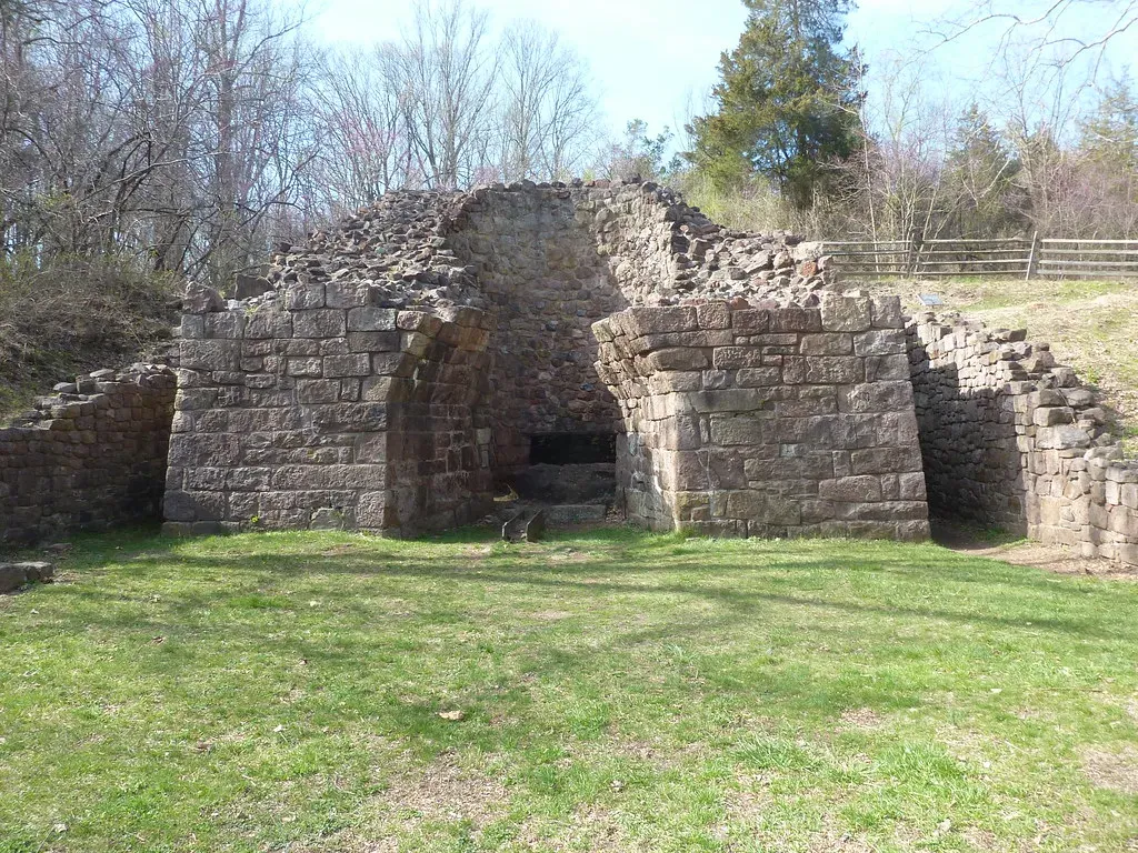
Chaco Canyon, New Mexico: Roads That Weren’t Built for Travel
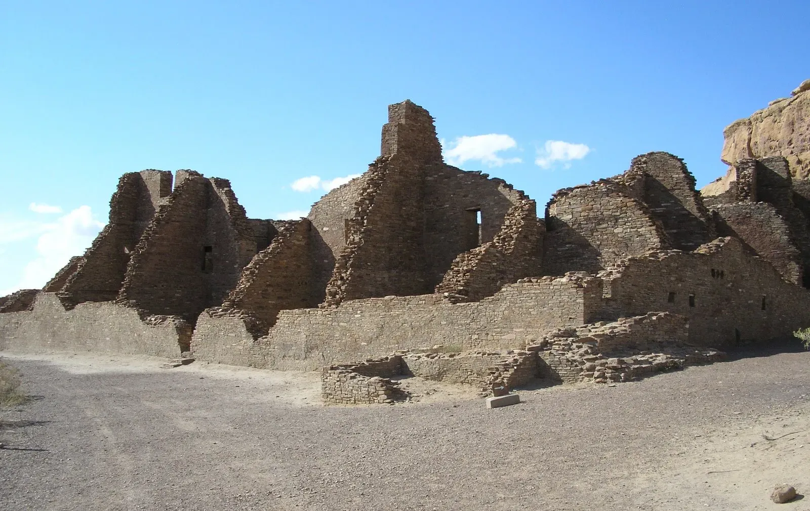
You might assume that ancient roads were built to move goods from one place to another. At Chaco Canyon in northwestern New Mexico, that assumption falls apart almost immediately. Between AD 900 and 1150, Chaco Canyon was a major cultural center for the Ancestral Puebloans, who quarried sandstone blocks and hauled timber from great distances, assembling fifteen major complexes that remained the largest buildings ever built in North America until the 19th century.
Thirty outlier sites spread across 65,000 square miles are connected to the central canyon by an enigmatic web of six Chacoan road systems, extending up to 60 miles in generally straight routes that appear to have been extensively surveyed and engineered. Their depressed and scraped beds reach 30 feet wide. Workers carved them into the sandstone bedrock, reaching those widths of up to 30 feet – an impractical size for a society that had no wheeled vehicles or pack animals.
Engineered roads stretch across dozens of miles in straight lines to significant landforms, but with little evidence of travel or trade. One such road, the Great North Road, connects the central canyon’s ceremonial buildings across 35 miles of desert to a steep badlands canyon to the north. Many of these ancient roads, and some surrounding structures, were intentionally aligned with solar and lunar events, demonstrating an advanced understanding of astronomy and a deep interest in the deeper meanings of celestial patterns.
Many Chacoan buildings may have been aligned to capture the solar and lunar cycles, requiring generations of astronomical observations and centuries of skillfully coordinated construction. At Fajada Butte, three massive sandstone slabs allowed noon sunlight on the summer solstice to precisely bisect a spiral petroglyph etched into a stone wall and to frame it precisely at winter solstice noon. These weren’t accidents. The precision involved implies sustained, organized observation passed down over many generations.
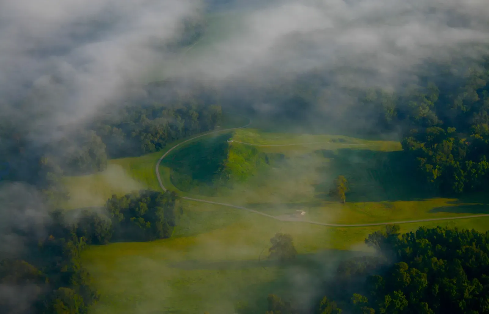
The Great Serpent Mound, Ohio: Astronomy Carved into the Earth
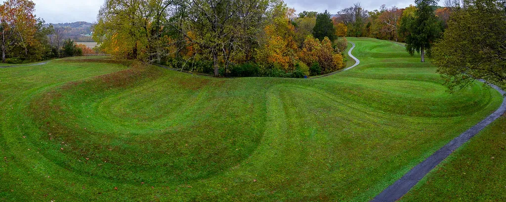
You’d need to look at Ohio’s Adams County from the air to fully grasp what’s there. The Great Serpent Mound is a 1,348-foot-long, four-foot-high prehistoric effigy mound located in Peebles, Ohio, built on a plateau running along Ohio Brush Creek. It is the largest serpent effigy in the world. The sheer scale of it is only readable from above – which raises its own uncomfortable questions about how and why it was built.
The leading theory is that the Fort Ancient Culture, active from 1000 to 1650 CE, is principally responsible for the mound, having erected it around 1070 CE. This mound-building society lived in the Ohio Valley and was influenced by the contemporary Mississippian culture, whose urban center was located at Cahokia in Illinois. The head of the serpent aligns with the summer solstice sunset, and the tail points to the winter solstice sunrise.
It has been suggested that the curves in the body of the snake parallel lunar phases, or alternatively align with the two solstices and two equinoxes. The unique geologic formations at the site suggest that a meteor struck the location approximately 250 to 300 million years ago, causing folded bedrock underneath the mound. Whether the builders chose this geologically unusual site on purpose remains an open question – though it’s difficult to believe they didn’t notice something unusual about the ground beneath them.
Determining exactly which culture designed and built the effigy mound, and when, is a matter of ongoing inquiry. A broad answer may lie in viewing the work as having been designed, built, or refurbished over an extended period of time by several indigenous groups. The complex mound is both architectural and sculptural, erected by settled peoples who cultivated maize, beans, and squash and who maintained a stratified society with an organized labor force, but left no written records. What you’re looking at is a massive astronomical instrument, a work of art, and a spiritual statement – all in one.
Mesa Verde, Colorado: Cliff Cities With Hidden Water Systems
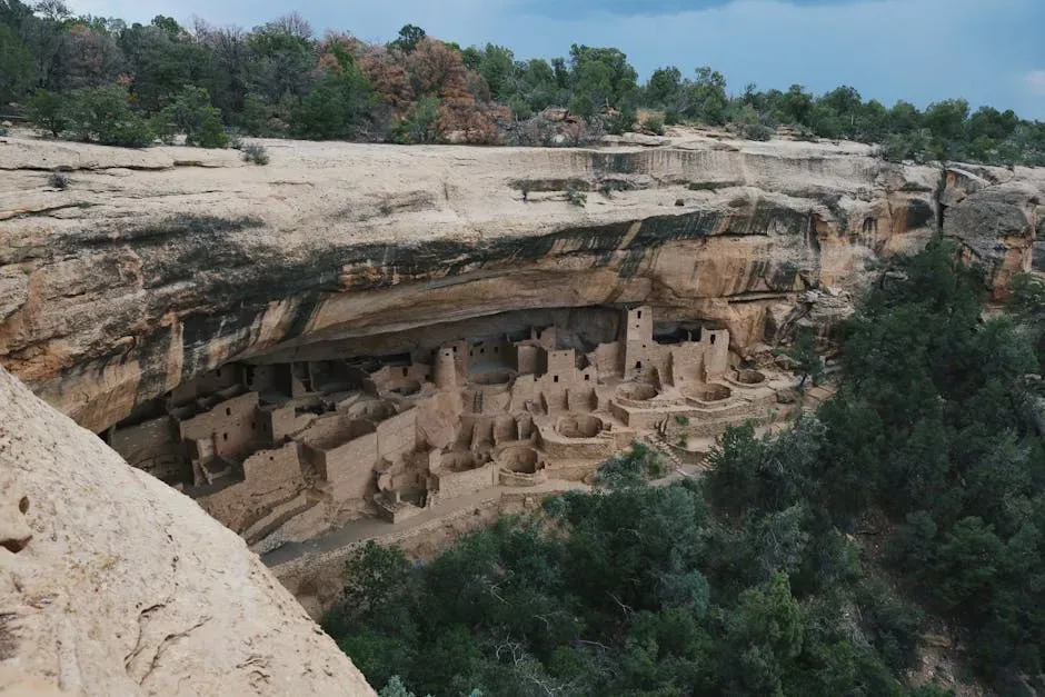
You’ve probably seen photographs of the Mesa Verde cliff dwellings. What you may not have considered is the engineering required to keep those cliff cities alive in one of the driest environments in North America. The cliff dwellings of Mesa Verde in Colorado offered a stunning display of what the Ancestral Puebloans could build. One of the most famous sites, Cliff Palace, features multi-room dwellings built into the cliffside, demonstrating an advanced understanding of architecture and resource management.
Because the Ancestral Pueblo people did not have a written language or use the wheel, historians tended to underestimate their technical acumen. Yet these ancient native people possessed what researchers describe as “rudimentary knowledge of hydrological phenomena, water transport and storage.” Scientists observed the presence of small walls throughout Mesa Verde called check dams, which could control the flow of water and silt and support terraced farming.
Researchers determined that the reservoir the Ancestral Pueblo people built at Morefield began as an excavated pond, with some of the water in the reservoir coming from high groundwater. Runoff water produced a lot of sediment, and they dredged out what they could. The reservoirs at Mesa Verde are occasions to respect the achievements of these Native Americans in work that required building skill, organization, and the ability across centuries to pass along knowledge and technology – capabilities that were later manifested in their beautiful and complex cliff houses.
The fact that an entire community survived for centuries in those alcoves, growing food in terraced fields and storing enough water to outlast dry seasons, tells you something important. The Chacoan people were superb engineers, builders, and sky watchers, but there’s no known written language, and the way of life in these settlements remains an archaeological mystery. The engineering at Mesa Verde wasn’t decorative. Every wall, dam, and reservoir had a precise purpose, and the system worked for hundreds of years.
Poverty Point, Louisiana: An Earthwork That Defies Its Era
Here is the most surprising entry on this list, and possibly the one that challenges assumptions the most. The Poverty Point site contains earthen ridges and mounds built by indigenous people between 1700 and 1100 BCE during the Late Archaic period in North America. That’s roughly contemporaneous with the height of ancient Egypt’s New Kingdom. The complex comprises five mounds, six concentric semi-elliptical ridges separated by shallow depressions, and a central plaza. It was created and used for residential and ceremonial purposes by a society of hunter-fisher-gatherers, and is a remarkable achievement in earthen construction in North America that was unsurpassed for at least 2,000 years.
New research finds that the people of the region raised the enormous earthworks in a matter of months, or even just weeks. One of the most remarkable things is that these earthworks have held together for more than 3,000 years with no failure or major erosion. Researchers have been unable to decipher the reasons behind the structure and design of Poverty Point, but estimates suggest that around 53 million cubic feet of soil were moved to create the ridges and mounds.
The people of Poverty Point created one of the most unusual cities of the ancient world: a densely populated, extensively developed settlement that lasted for five centuries without evidence of large-scale agriculture and with no evidence of an elite class. This was an egalitarian hunter-gatherer community with a long-distance trade network that collectively shaped the land where its inhabitants lived. More than 78 tons of rocks and minerals, materials essential for crafting tools, weapons, and ceremonial objects but none native to the area, were brought from as far as 800 miles away.
Mound A, the second-largest ancient architectural structure north of Mexico, was so large and appeared to be so thoroughly integrated into the contours of the land that as late as 1926, archaeologists believed it was a natural feature of the landscape. It is unusual that a society of hunter-gatherers could build the complex system of mounds at Poverty Point. That tension – between what we expect from hunter-gatherers and what these people actually built – is what makes Poverty Point so genuinely hard to explain.
Conclusion: The Ground Beneath Your Feet Has More History Than You Think
Each of these five sites challenges a comfortable assumption: that sophisticated engineering required writing, wheels, metal tools, or a farming economy to sustain it. These artifacts and structures represent far more than historical curiosities or mysterious anomalies – they demonstrate the sophisticated problem-solving capabilities, technical knowledge, and innovative thinking of ancient civilizations that challenge simplistic narratives about technological progress and human development.
One possible explanation for what remains mysterious is the loss of knowledge over time. Ancient technologies were often passed down through generations by skilled craftsmen, and if these traditions were disrupted through migration, conflict, or societal collapse, the knowledge could disappear. That’s not a comforting answer, but it’s an honest one. Entire bodies of practical engineering knowledge can vanish without a trace.
What unites these civilizations is not mystery for its own sake. It’s the unmistakable evidence of people who understood their environment, organized collective labor, observed the sky with extraordinary precision, and built structures meant to last. These achievements remind us that people in the past were not so different from us – they were thinkers, builders, and innovators. The next time you drive past a flat stretch of land in Illinois or a canyon in New Mexico, consider what might be underneath it – or still standing right in front of you, waiting to be properly understood.