You might not realize it when you look out at a valley, a rolling plain, or even a desert, but you are often staring at the frozen ghosts of ancient rivers. Long before modern cities, roads, and farms, immense river systems carved, filled, and rearranged the land in ways that still control how you live, build, and travel today. Even where the water has vanished, the imprint of those vanished flows quietly shapes everything from soil fertility to flood risk.
Once you start to see these patterns, today’s landscapes suddenly look less random and much more like the final frame of a very long movie. In this article, you will walk through how old rivers sculpted mountainsides, left behind rich farmland, hidden aquifers, and even shaped where your favorite cities now stand. By the end, you’ll be able to look at a map or a road cut and think, with a bit of awe: this used to be a river.
Paleochannels: Reading the Ghost Rivers Beneath Your Feet
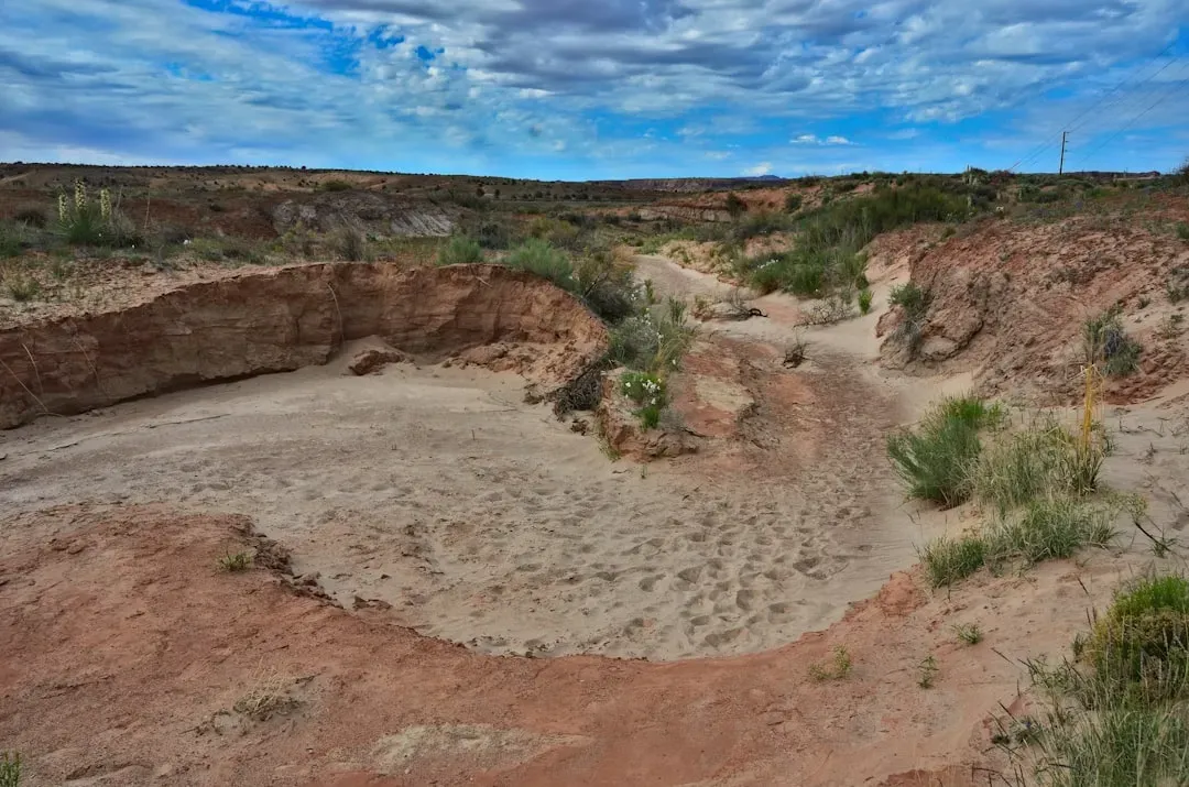
When you hear the term “paleochannel,” you can think of it as a buried fossil of a former river course. You may be walking or driving right over one without any clue, because over time these abandoned channels get filled with sediment, soil, or even human infrastructure. Yet the subtle clues remain: slightly different soil colors, unusual gravel layers in a road cut, or strange patterns in how plants grow.
Modern tools let you trace these ghost rivers in ways your grandparents could only guess at. With satellite images and radar that can see through thin layers of sand or vegetation, you can sometimes pick out faint meanders, old levees, and ancient floodplains preserved like fingerprints. Once you recognize that these paleochannels are all around you, it becomes obvious that today’s landscape is just one version of a riverscape that has been rearranged many times.
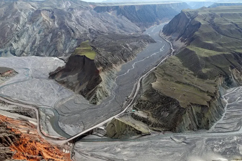
Valleys, Canyons, and Terraces: Carved by Water Over Deep Time

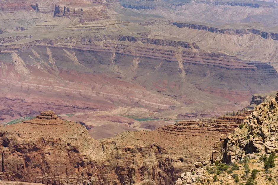
Whenever you stand at the edge of a steep-sided valley or canyon, you are really standing in the work of moving water stretched over unimaginable spans of time. Even in places where rainfall is now rare, a river in the distant past may have been powerful enough to cut down through rock, grain by grain, until you got the dramatic scenery you admire today. The depth and shape of those valleys depend on how much water flowed, how steep the land was, and how hard the underlying rock resisted erosion.
Terraces step along many valley sides like old staircases, and they tell you stories of older river levels. Each terrace marks a former floodplain that the river once occupied before it cut deeper, perhaps because the climate changed or the land slowly uplifted. When you look across a valley and see flat benches at different heights, you’re essentially reading a timeline of river positions, stacked up around you like pages of a book that the landscape never bothered to close.
Floodplains and Alluvial Fans: Quiet Powerhouses of Fertile Land
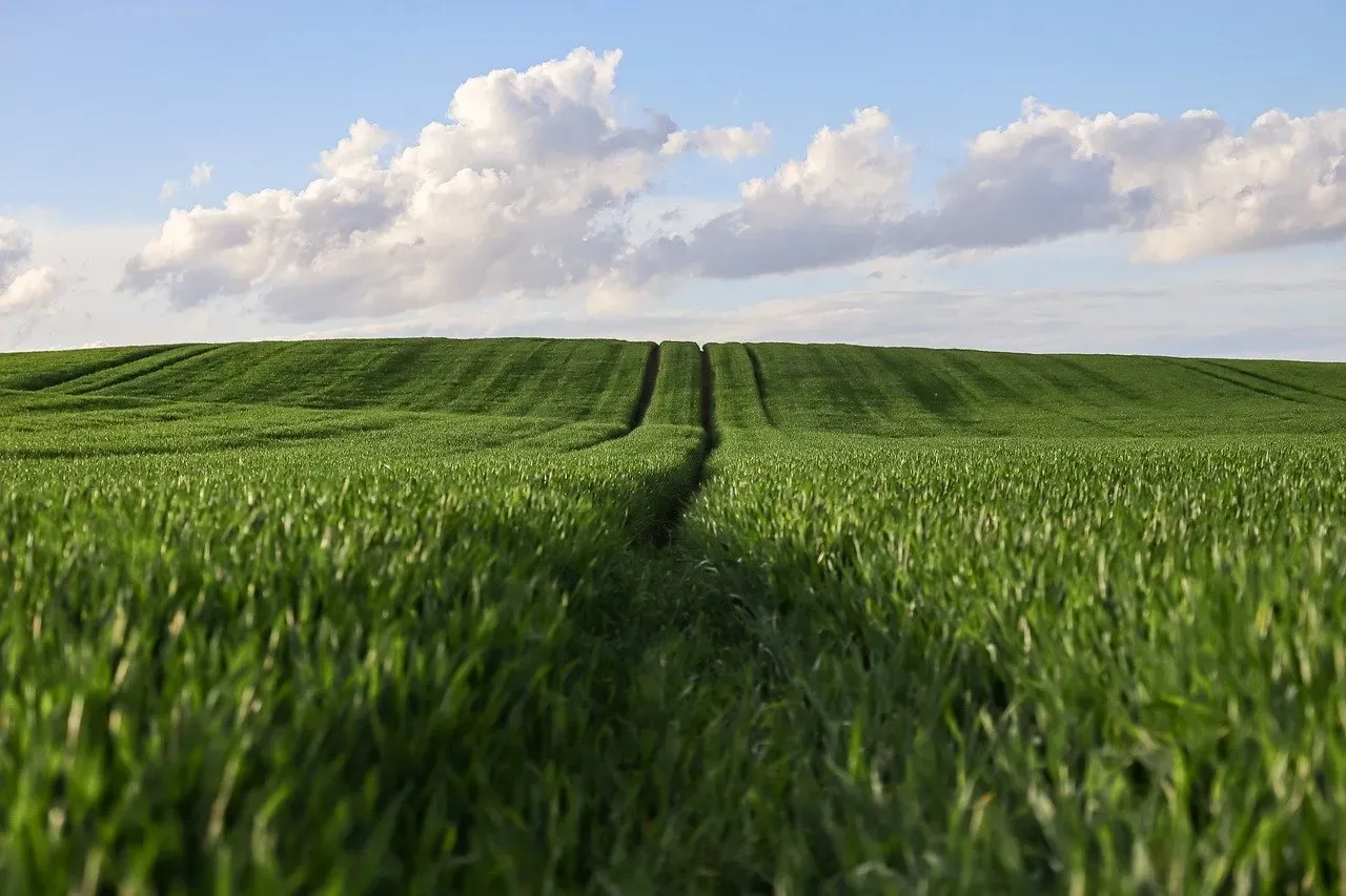
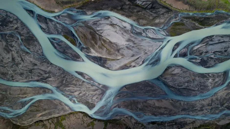
If you live on a broad, flat plain with rich soils, there is a good chance you are living on the legacy of an ancient or shifting river floodplain. Over repeated floods, rivers spread thin sheets of sediment across their banks, building up layers of silt, sand, and organic matter that can grow crops remarkably well. That is why some of the world’s most productive agricultural regions still hug river corridors or lie on their old floodplains, even if the main channel has drifted away.
At the foot of mountains or highlands, you might see alluvial fans: cone-shaped spreads of gravel, sand, and silt laid down where steep streams suddenly slow down. These fans can be deceptively flat and tempting for homes, roads, or warehouses, but they are also dynamic. Knowing that you are standing on an alluvial fan means understanding that rare but intense floods or debris flows can still reoccupy those surfaces, reminding you that the ancient patterns of deposition are not entirely over.
Ancient Rivers and Today’s Groundwater Stores
Even when the channel has dried up, old river paths can keep working for you underground. In many regions, the coarser sands and gravels that filled ancient channels now act as natural pipelines and reservoirs for groundwater. If you drill a well into one of these buried channels, you may tap into water that has been slowly stored and released through these sediments for a very long time.
This connection matters because your access to groundwater often depends on where those past rivers flowed, not just on today’s surface streams. Two wells a short distance apart can hit very different water supplies if only one intersects a former river deposit. By mapping these hidden sediment bodies, you gain a much more realistic picture of how resilient your water resources are, especially during droughts or as climate patterns shift.
Desert Landscapes Sculpted by Long-Gone Streams
It can feel counterintuitive, but some of the starkest deserts you see today owe much of their shape to wetter times with vigorous rivers. Dry valleys, wide plains of gravel, and winding, empty channels in the sand often trace routes where water once flowed regularly. When you see a sinuous depression cutting through a desert plateau, you may be looking at the remnant of a river that last ran strongly tens of thousands of years ago.
Wind and occasional flash floods now rework what those ancient rivers left behind, but they rarely erase the basic framework. Salty playas, dune fields anchored along old lake margins, and networks of dry washes all sit within the skeleton that those earlier rivers built. When you grasp that deserts are often reusing old river architecture, the landscape stops looking like a blank, lifeless expanse and starts to feel like an archive of older climates and vanished ecosystems.
Rivers as Blueprint: How Ancient Channels Guide Modern Cities and Roads
If you look at a map of many modern cities, you’ll notice that major roads, railways, and neighborhoods often line up along wide, flat corridors. Those handy corridors are frequently old floodplains or gently filled valleys carved by rivers long before any urban planner showed up. Even where a river has shifted or been straightened, the low-lying, easily graded land of its former path stays attractive for development, farming, and transportation.
This inheritance comes with trade-offs that you need to recognize. Building in old channels and floodplains means you benefit from gentle slopes and fertile soils, but you also inherit a higher risk of flooding or liquefaction during earthquakes. Understanding that many of your cities sit on former river deposits helps you make smarter choices about zoning, flood defenses, and where critical infrastructure should (and definitely should not) go.
Climate Clues Locked in Ancient River Deposits
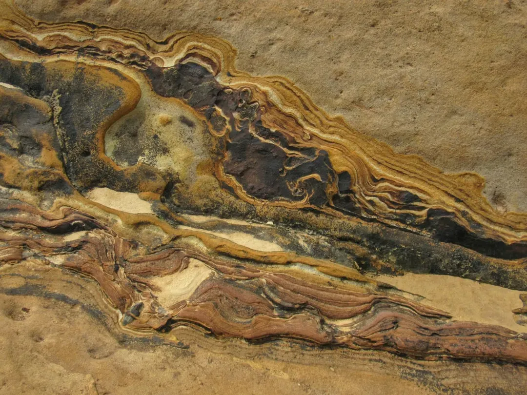
When you slice through the sediment left by an ancient river, you are not just looking at sand and gravel; you are looking at a climate log. The size of grains, the types of minerals, and even the fossils and organic matter within those layers can tell you whether the past environment was wetter, drier, colder, or warmer. As you move up through the layers, you can literally track shifts in river strength and style as past climates changed.
This matters for you today because those records help you understand how landscapes respond when rainfall patterns or temperatures swing. If you know that a river once expanded, braided, or abandoned its course during earlier warm or dry periods, you can better anticipate how it might behave as the climate changes again. Ancient deposits become like old field notes, reminding you that rivers are not fixed features but flexible systems that react to the larger climate story.
Living With the Legacy: How You Can Read and Respect Ancient Rivers
Once you start recognizing the fingerprints of old rivers, everyday scenes become richer and more informative. A sudden change in soil texture in your garden, a line of trees following a subtle depression, or a long, flat corridor cutting through hills can all hint at where water once flowed. You do not need to be a professional geologist to notice these patterns; you just need to slow down and ask what shaped the ground beneath you.
Paying attention to this hidden history is not just a fun mental exercise; it can genuinely help you live more safely and sustainably. If you know you are on a floodplain, you can take extra precautions; if you know a buried channel underlies your area, you can better understand your groundwater supply. In that sense, learning to read ancient river systems is like learning to read the user manual for the place you call home.
In the end, today’s landscapes are not random backdrops but the long-term handiwork of rivers that came and went before you were ever here. Ancient channels, floodplains, terraces, and buried gravels still decide where you can farm, build, and find water, even if the rivers themselves have shifted or disappeared. When you look around with that in mind, the world feels older, more layered, and strangely more personal, as if the ground itself is letting you in on a long-kept secret.
The next time you cross a valley or drive across a wide, flat plain, you might quietly wonder: if this land could remember every river that shaped it, what stories would it tell you?