Picture North America not as a solid continent, but as two long, lush landmasses separated by a warm, shallow sea swarming with giant reptiles and strange fish. For millions of years, that was reality: an ocean sliced straight through the heart of the continent, from the Arctic down to the Gulf region, flooding what is now the Great Plains. Yet most of the time, when you see dinosaurs in books or documentaries, they’re wandering around a dry, continuous land, as if this inland ocean barely existed.
That gap is not just a cute detail for geology nerds; it completely changes how we should imagine ancient ecosystems, climates, and the journey of life across the land that would become the United States and Canada. Once you realize a vast seaway used to sit where Kansas, Nebraska, and the Dakotas are today, a lot of things suddenly click: why there are marine fossils in the middle of the continent, how species moved and evolved, even why our modern landscapes look the way they do. Let’s walk straight into that missing ocean and see what the maps never really told us.
A Warm, Shallow Ocean Right Through the Middle of the Continent
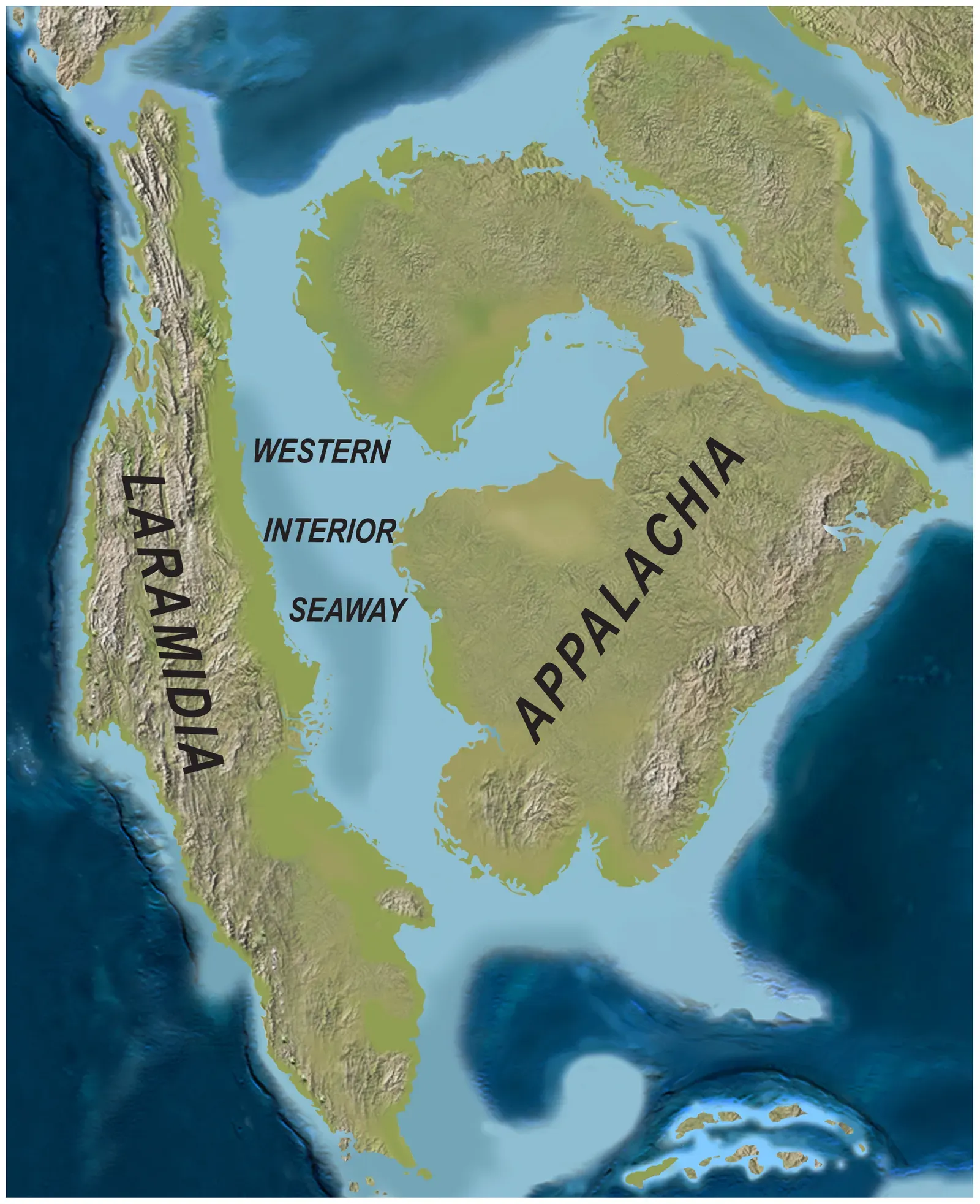
The Western Interior Seaway was not some small bay or oversized lake; it was a genuine ocean-scale seaway that stretched roughly from the Arctic region in the north down toward what is now the Gulf of Mexico in the south. It first formed in the Early to mid-Cretaceous period as global sea levels rose and the interior of North America sagged under tectonic forces, creating a long, low basin that seawater could invade. Imagine modern North America sliced into an eastern landmass and a western landmass, with an enormous, tropical to subtropical shallow sea between them.
This seaway covered much of what are now central Canada and the United States, drowning areas that today feel almost aggressively landlocked, like Kansas, Nebraska, Wyoming, and the Dakotas. The water was generally shallow compared to the open ocean, often only a few hundred feet deep, but it was wide, warm, and teeming with life. In many places, the shoreline shifted back and forth over millions of years like a very slow, planetary tide, constantly redrawing coastlines where future farmlands and prairies would eventually appear.
How Plate Tectonics and High Seas Tore the Continent in Two
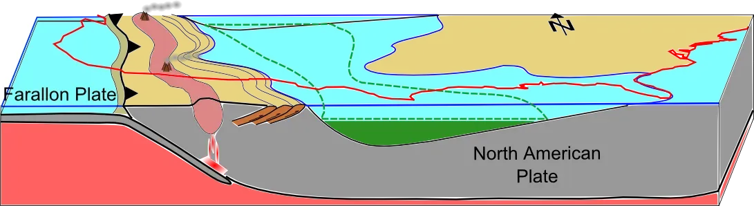
The story of why this ocean existed at all is basically the story of Earth’s restless crust and unusually high global sea levels during the Cretaceous. To the west, what would become the Rocky Mountains was starting to rise as an oceanic plate dove beneath the western edge of North America, pushing and flexing the continent like a giant, slow-motion car crash. That flexing caused the interior to sag in places, creating a long trough that naturally invited seawater in from both the north and the south.
At the same time, global sea levels were significantly higher than today, driven by a combination of warm climate and seafloor spreading that displaced ocean water upward. With higher seas and a convenient low spot in the middle of the continent, it did not take much to flood huge areas and connect northern and southern ocean basins. The end result was dramatic: for long stretches of the Late Cretaceous, the land that would become North America was not one big unified continent at all, but two major landmasses separated by this interior sea.
A Jurassic Park, But Make It Saltwater: Life Inside the Seaway
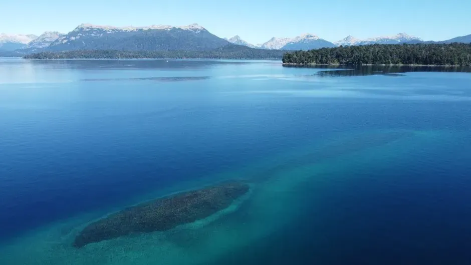
If you could dive into the Western Interior Seaway at its peak, it would feel more like snorkeling above a vast, shallow reef than plunging into a dark, featureless deep ocean. The water was full of plankton, ammonites, fish, and all sorts of marine invertebrates that built up thick layers of sediment on the seafloor. Those sediments would later turn into chalks, shales, and limestones that now form cliffs and outcrops across the central continent, quietly holding the story of this lost ocean in their layers.
The real showstoppers, though, were the marine reptiles and large predators that hunted these waters. Long-necked plesiosaurs cruised the shallows; massive mosasaurs ruled as apex predators, swallowing fish, turtles, and probably each other; and large fish with armor and odd jaws added to the chaos. Above the waves, flying reptiles soared along the coasts, while dinosaur-packed shorelines lined the edges of this inland sea. The seaway tied together ecosystems from polar regions to tropical zones, acting like a biological superhighway for marine life and coastal species.
Why Most Dinosaur Maps Quietly Erase This Massive Ocean
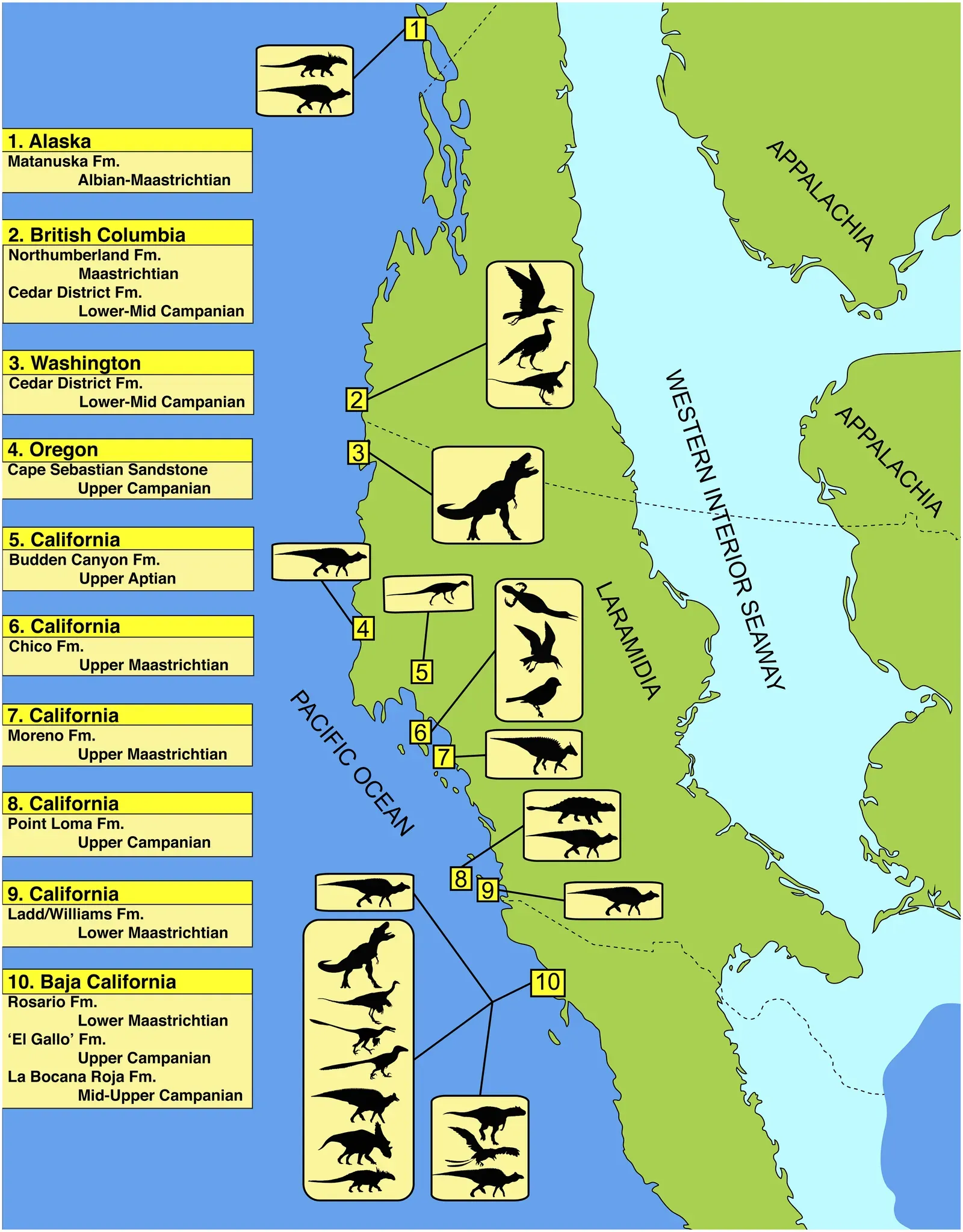
Here’s where it gets frustrating: if you flip through many children’s books, posters, or even some popular science illustrations of the Cretaceous, you’ll often see North America portrayed as one huge, continuous dinosaur playground. T. rex marches around what looks suspiciously like a modern outline of the United States, with barely a hint that a giant body of water sliced through the middle. The seaway might get one tiny inset picture or a short caption, almost like an afterthought.
Part of this is just visual convenience. It is easier and more familiar to show dinosaurs on a modern-looking continent, and squeezing in all the moving coastlines, shifting shorelines, and incomplete fossil data can feel messy. But the result is that the Western Interior Seaway, which was central to the entire geography of Late Cretaceous North America, gets mentally downgraded to “a neat bonus detail” instead of “the main stage.” That simplification quietly misleads people about how radically different Earth used to look.
Fossils in the Middle of Farmland: The Seaway’s Hidden Evidence
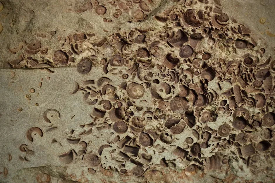
If you have ever wondered why there are marine fossils turning up in places that are hundreds of miles from the nearest ocean, the Western Interior Seaway is the answer. The famous chalk beds of Kansas, the marine shales of South Dakota, and the fossil-rich formations of places like Colorado and Wyoming are packed with remnants of this vanished sea. Giant mosasaur skulls, plesiosaur skeletons, ancient sharks, and delicate shells all testify that these flat, quiet regions were once coastal or fully submerged seafloor.
That can feel almost surreal when you stand on a modern Midwestern highway bordered by cornfields and ranchland, knowing you are parked on what used to be an ocean floor. Paleontologists have essentially been reconstructing this lost sea the way a detective reconstructs a crime scene, piecing together rock layers, fossil types, and sediment structures. Every time a new marine reptile is unearthed in the middle of the continent, it reinforces that we should picture not prairies, but waves and shorelines stretching to the horizon.
How a Lost Ocean Shaped Today’s Land, Climate, and Resources
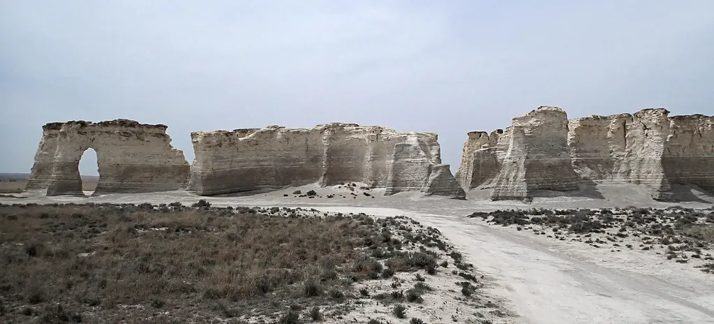
The Western Interior Seaway is not just a quirky ancient setting; it helped shape the land and resources we depend on today. The thick piles of sediments that settled onto its floor, layer by layer, would eventually compress into rock formations that hold important groundwater, hydrocarbons, and other resources. Large swamps, deltas, and coastal environments that fringed the seaway left behind organic-rich deposits that later turned into coal and other fuels, which modern societies have exploited heavily.
Its existence also played into long-term climate and ocean circulation patterns in the Cretaceous, affecting how heat and moisture moved across the continent. The seaway would have moderated temperatures in its region, influenced rainfall, and created unique coastal and marine climates along its shifting shores. So when we talk about the Western Interior Seaway, we are not just talking about a long-vanished map feature; we are talking about a system that still leaves fingerprints in our landscapes, our water supplies, and even our energy history.
The Rise of the Rockies and the Slow Death of the Seaway
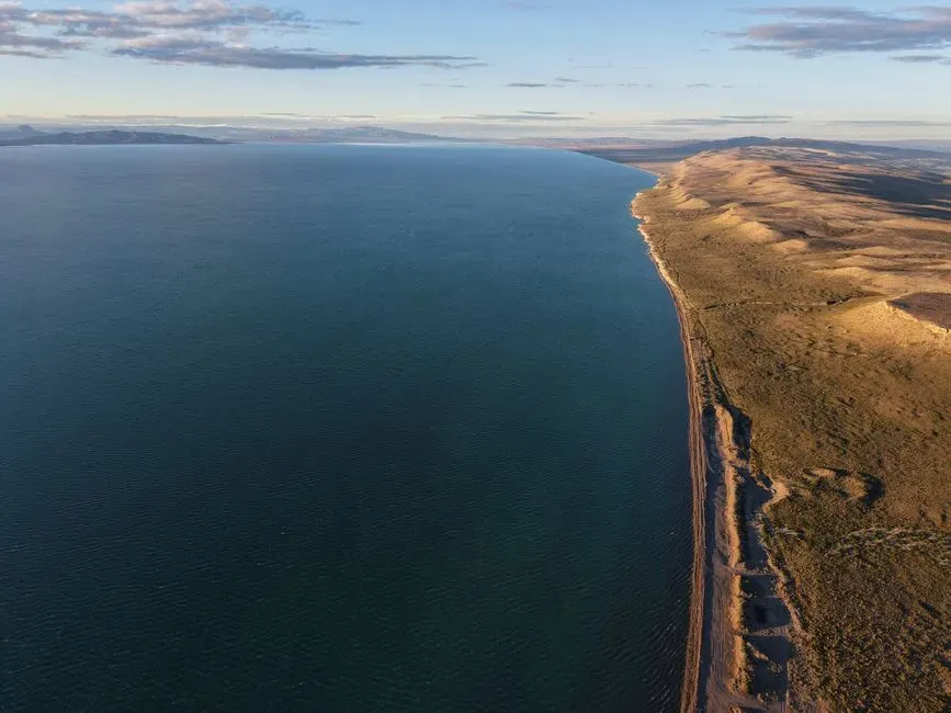
Like all good stories in geology, the tale of the Western Interior Seaway ends slowly, not with a sudden dramatic crash. As the Rocky Mountains continued to rise to the west and tectonic forces kept reshaping the region, the basin that held the seaway began to lift and deform. At the same time, global sea levels eventually dropped from their earlier high stands, and the pathways that had allowed seawater to flood the interior narrowed and shallowed.
Over millions of years, shorelines retreated, connections to the open ocean pinched off, and the vast interior sea broke up into smaller, isolated bodies of water before finally disappearing. What was once a continuous marine corridor from north to south turned back into dry land, river systems, and floodplains. By the time the age of dinosaurs closed with the end-Cretaceous extinction, the Western Interior Seaway was already on its way out, leaving behind sedimentary archives and fossil cemeteries as its only trace.
Rethinking Prehistoric Maps: Why This Ocean Deserves Center Stage
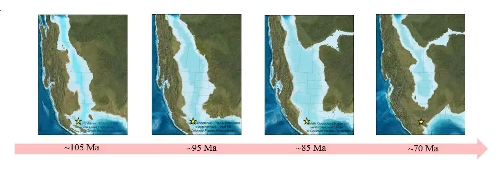
Here is the uncomfortable truth: if your mental picture of dinosaur-era North America is one solid landmass packed with giant animals wandering around from coast to coast, it is wrong in a pretty fundamental way. For a big chunk of Late Cretaceous time, the Western Interior Seaway split the continent into two major land areas, dramatically limiting where land animals could migrate and where different dinosaur communities could mix. It was not a background detail; it was a defining feature of the map.
That is why it feels fair to say that almost every simple map or mental image most of us grew up with is missing something huge at the center. The Western Interior Seaway should not be a footnote; it should be the headline image, with dinosaurs hugging shorelines instead of stomping straight across the middle. Personally, I think once you start picturing Kansas as beachfront property and Wyoming as shallow marine habitat, the prehistoric world becomes weirder, more beautiful, and a lot more honest. After all, if an entire inland ocean can vanish without most of us ever learning its name, what else might we be overlooking about Earth’s deep past?