
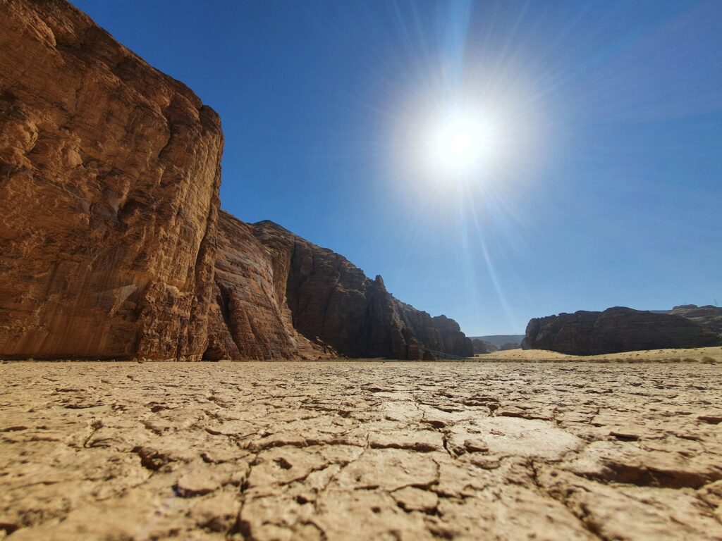
It sounds like a contradiction, right? The places we now picture as cracked earth, scorching heat, and endless sand were once shaped and carved by rushing rivers, roaring floods, and even vast lakes. But if you know where to look, the rocks are basically yelling their water-soaked history at you – they just need a translator.
That is the wild part: some of the best evidence for ancient, powerful waters is preserved in the very heart of our driest deserts. From sinuous dry channels that mimic frozen rivers to stranded shorelines halfway up barren mountains, these landforms are like crime-scene clues left behind after the water vanished. Let’s walk through eight of the most striking ones and what they quietly reveal about Earth’s not-so-dry past.
1. Dry River Channels (Wadis) That Trace the Ghosts of Ancient Streams
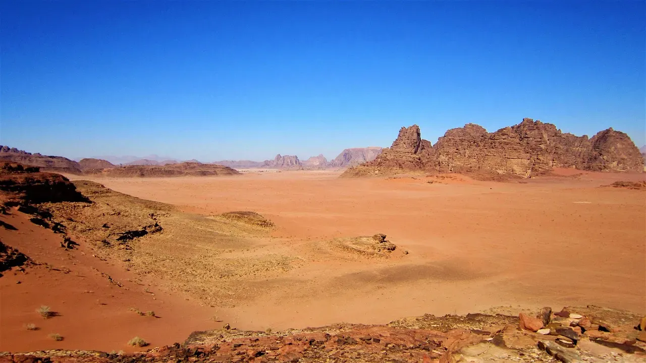
Imagine looking down at a desert from above and seeing a branching pattern that looks exactly like a river system – except there’s no water, just dust and stone. Those dry valleys, often called wadis, arroyos, or ephemeral channels, are some of the clearest hints that liquid water once flowed where now only hot air moves. Their meandering curves, tributaries, and floodplains are almost indistinguishable from modern rivers in wetter regions, which is a huge red flag that water did the carving.
Many of these dry channels still briefly come alive during rare storms, turning into sudden flash floods that reshape the bed and slam boulders downstream. That modern activity gives geologists a kind of living experiment in how the same processes would have worked when the climate was wetter and the flows more frequent. When you stand in the middle of a wide, empty wadi on a perfectly clear day, it feels weirdly like standing on an abandoned highway built for a traffic jam that never shows up anymore.
2. Slot Canyons Sculpted by Violent Floods, Not Gentle Breezes
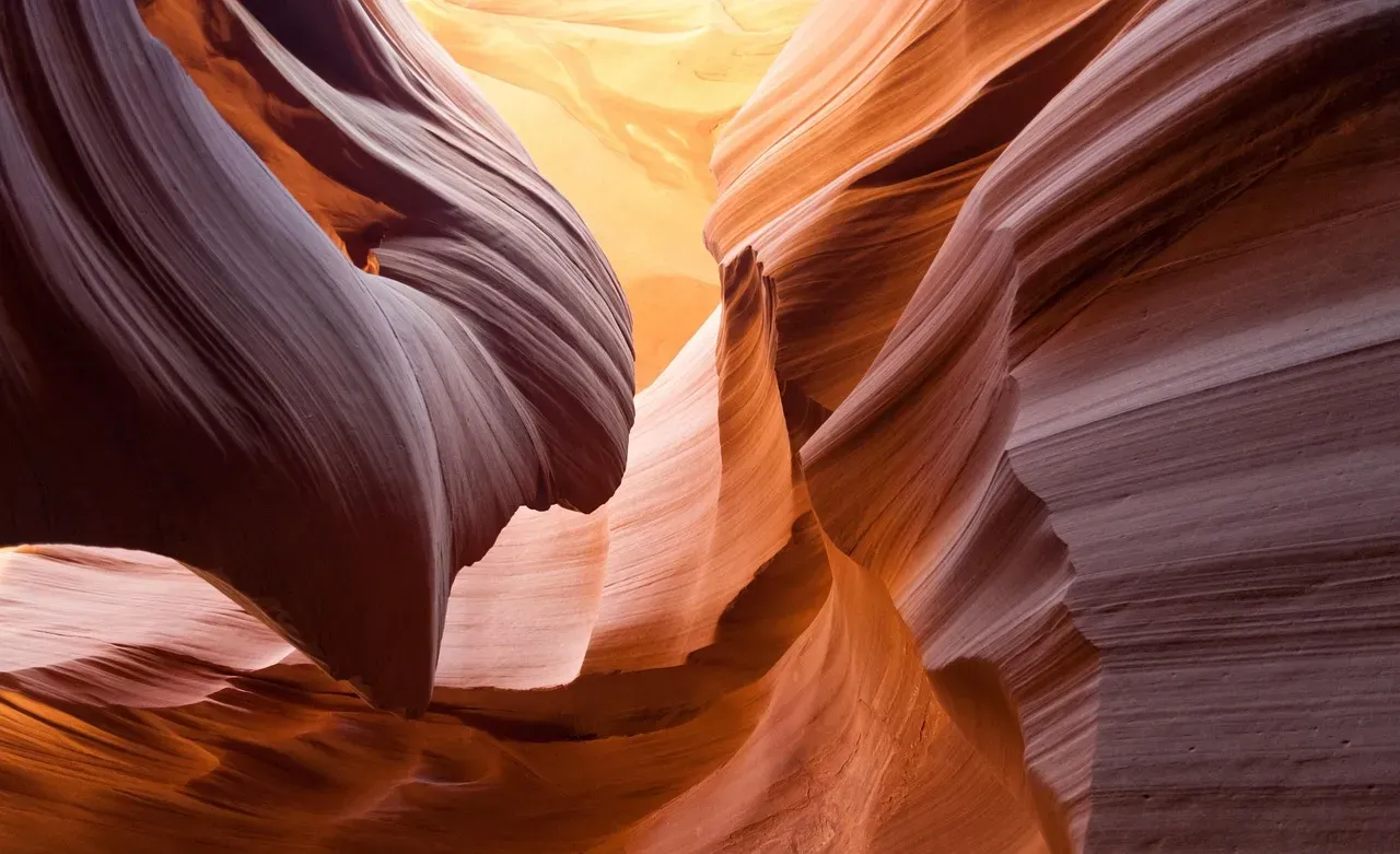
Desert slot canyons are some of the most dramatic landforms on the planet: narrow corridors of rock, sometimes barely wider than your shoulders, with walls polished smooth and carved into graceful curves. It is tempting to think wind did that, because we associate deserts with blowing sand. But those high, vertical walls and undercut shapes are a classic calling card of fast, abrasive water roaring through confined spaces. During intense flood events, water funnels into cracks and weaknesses in the rock, grinding them deeper and narrower over thousands to millions of years.
Inside many slot canyons, you can see flutes, potholes, and swirling patterns that tell a story of turbulent flow, like a mini whitewater course frozen in stone. Debris caught high on ledges and scoured logs wedged overhead in some active slots show that today’s rare storms can still send powerful flows through them, though usually far less frequently than in wetter eras. Walking through one, you get this eerie feeling that you are in a river channel paused mid-motion, as if someone hit a cosmic “freeze frame” button and then drained all the water away.
3. Alluvial Fans: Giant Stone Cones Built by Once-Raging Flows
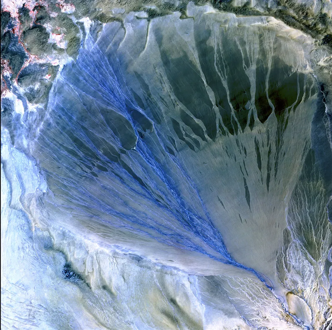
At the base of many desert mountains, you will see broad, fan-shaped spreads of gravel and sand gently sloping out into the basin. These alluvial fans form where steep, confined channels suddenly spill onto flatter ground, forcing water to slow down and drop the sediment it was carrying. In deserts today, flash floods still build and modify these fans, but their immense size and layered structure often indicate a long history of heavier, more sustained flows in the past.
If you dig into an alluvial fan or look at a cut made by a road or gully, you will often find stacked layers of different sizes of sediment – from boulders to fine sand – that record pulses of flooding over time. Some fans are so large they merge into broad aprons that wrap around entire mountain fronts, a sign that they were fed by networks of once-active streams and seasonal rivers. To me, alluvial fans feel like a slow-motion, geological scrapbook of every big storm that ever hit that mountain range.
4. Desert Playas and Salt Flats: The Ghost Beds of Vanished Lakes
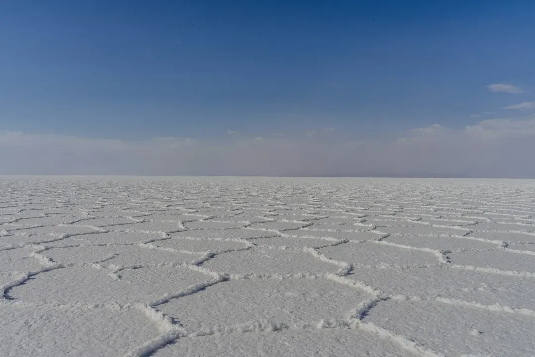
Flat, shimmering salt pans in deserts look almost alien, like someone poured a layer of white glass over the land. These playas are the dried-out floors of former lakes, basins where water once pooled, evaporated, and left behind layers of mud, clay, and salts. When you see a perfectly flat, bright expanse that crunches underfoot and sometimes develops polygon-shaped cracks, you are very likely standing in what used to be a body of water, sometimes a surprisingly large one.
Evidence from sediments, microfossils, and shorelines around many playas shows that some desert basins once held deep, long-lived lakes fed by rivers and wetter climates. Over time, as rainfall decreased and evaporation outpaced inflow, the lakes shrank, concentrating dissolved minerals that crystallized into the salt crusts we see today. It is a bit like finding the ring mark left on a wooden table after a glass of water has long since disappeared – except on the scale of whole valleys and ancient climate systems.
5. Ancient Shoreline Terraces Etched High Above Today’s Desert Floors
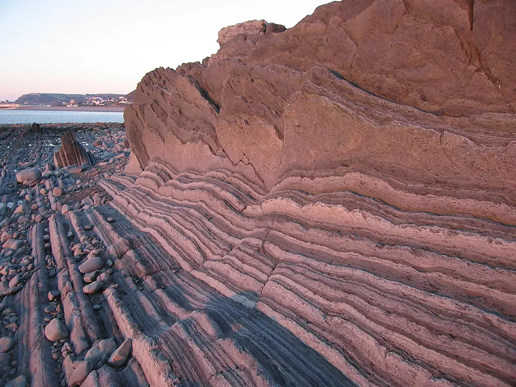
One of the most striking “you can’t ignore this” clues that water once dominated deserts is the presence of old shorelines carved into mountainsides and hills. These look like horizontal benches, beach ridges, or wave-cut notches that wrap around a basin at a consistent elevation, sometimes many tens or even hundreds of meters above the current valley floor. Waves and changing lake levels do this carving and piling, leaving behind terraces that are basically fossil beaches suspended in thin air.
In many dry basins, you can trace multiple shoreline levels stacked above one another, telling a story of lakes rising and falling with changing climate, glacial cycles, or shifting rivers. The sediments within these terraces – rounded pebbles, beach sands, even shells in some cases – are exactly what you would expect to find on modern lake and sea shores. Seeing a clear wave-cut bench slicing across a barren desert slope feels almost like catching Earth with its past life photos still hanging on the wall.
6. Yardangs and Streamlined Hills Shaped by Flowing Water Before Wind Took Over
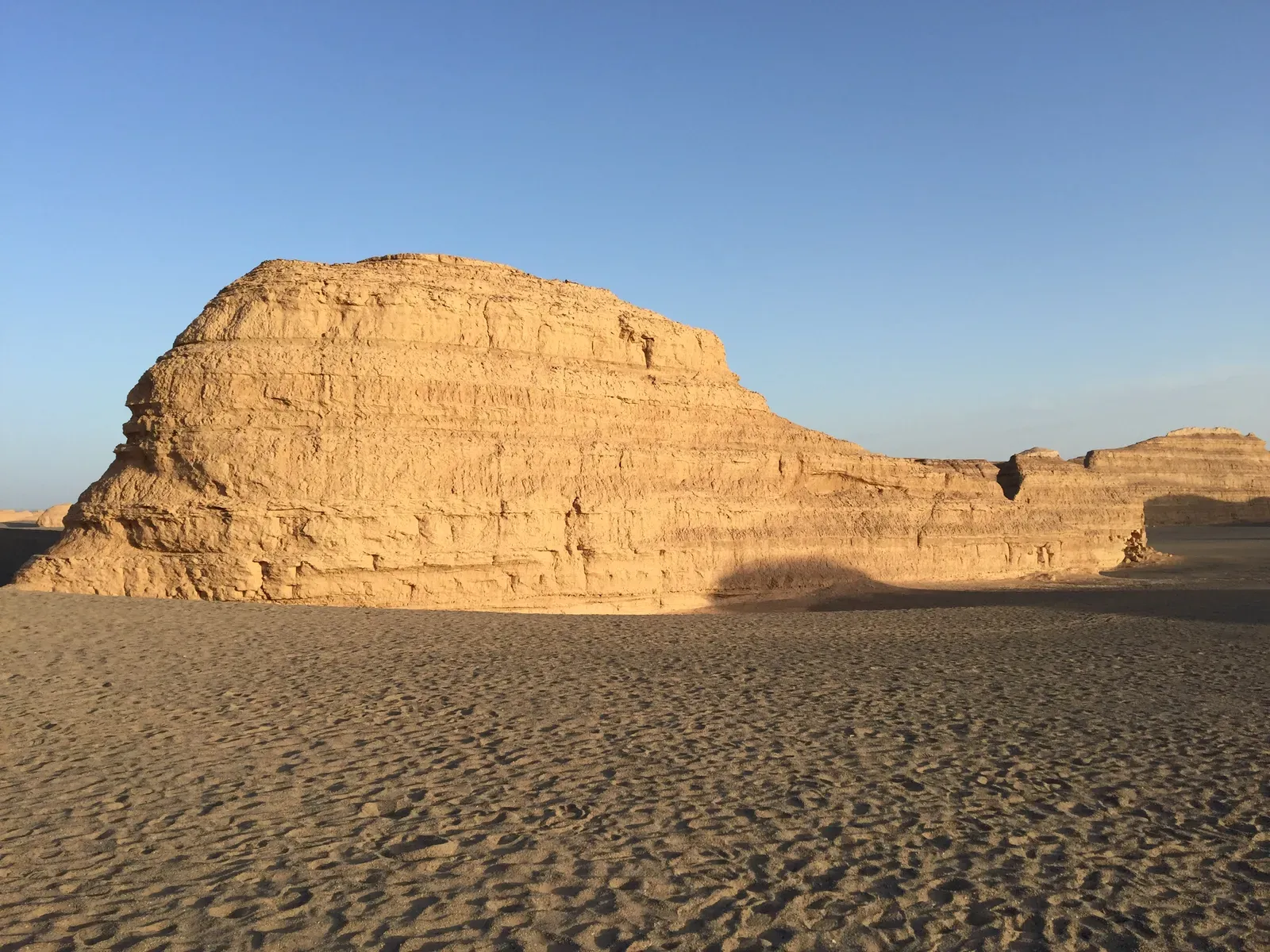
Yardangs are elongated ridges carved into bedrock or compacted sediment, aligned with the prevailing direction of erosion. They are famous as wind-sculpted landforms, which is often true for their final shaping, but many started out as features initiated or pre-structured by flowing water. Ancient channels, weaker rock zones, or water-laid layers can set up the basic shapes that later wind and sand refine, meaning the original template is fluvial even if the finishing touches are aeolian.
In some desert regions, you see entire landscapes of streamlined hills pointing in the same direction, like a fleet of stone ships frozen mid-sail. The geometry of these forms often reflects how water once flowed over or around obstacles, smoothing the upstream side and tapering the downstream part. Over time, as the climate dried and wind erosion gained the upper hand, those water-influenced shapes were sharpened and stripped, leaving a hybrid landform that quietly records both wet and dry phases of Earth’s story.
That mix of processes is something I personally find fascinating, because it reminds you that nature rarely works in neat categories. A single ridge can be part river memory, part wind sculpture – and that nuance is exactly what makes reading desert landscapes feel like decoding a layered, half-erased message.
7. Canyon Systems and Waterfalls Now Hanging High and Dry
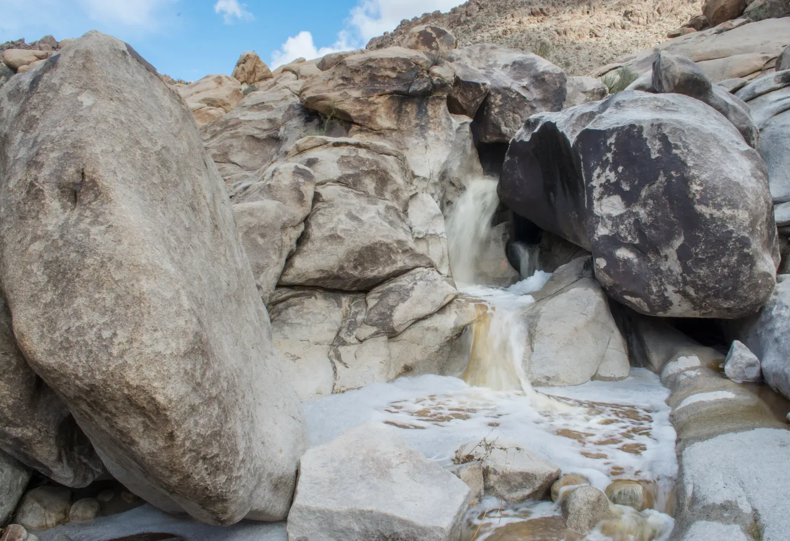
Large desert canyons with tributaries, benches, and plunge pools look almost overbuilt for the trickles of water (if any) they host today. Their sheer scale is often a clue that they formed under conditions with much stronger and more persistent runoff. In many places, you can even spot dry waterfalls – vertical steps or cliffs where water once cascaded, sometimes leaving behind rounded plunge basins at their base that are now filled with sand and rubble.
Some desert canyon networks connect to ancient lake basins or broad piedmonts, suggesting they once delivered significant sediment and water downstream. Their cross-sections, with V-shaped profiles and sometimes nested flood terraces, match what we see in actively eroding river systems elsewhere on the planet. Hiking through one of these canyons on a hot, silent afternoon is a surreal experience: the shapes all scream of roaring water, but your senses register only heat, stone, and the crunch of your boots.
8. Subtle Ripple Marks and Cross-Bedding That Freeze Past Currents in Stone
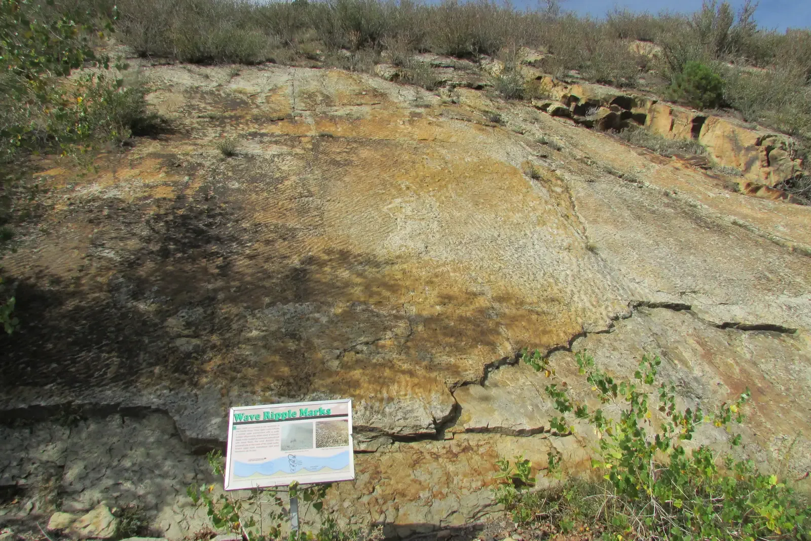
Not all proofs of past water are huge and dramatic; some are delicate textures preserved at your feet. In many desert rock outcrops, especially sandstones and siltstones, you can find fossil ripple marks that look just like the tiny waves on a shallow stream bed or the bottom of a lake. These ripples are created when moving water reshapes loose sediment into regular, wavy patterns, which are then buried and eventually turned into rock. Seeing them on a cliff in the middle of an arid plain is like catching a still image from a long-gone shoreline.
Cross-bedding – inclined layers within larger rock beds – is another powerful indicator of past currents, whether from rivers, deltas, or even shallow marine environments. The thickness, angle, and arrangement of these internal layers can tell geologists about flow directions and energy levels long after the actual water has vanished. I love this kind of subtle evidence because it feels like reading the fine print of Earth’s contract with time: the big landforms shout the general story, but the ripples and cross-beds whisper the details.
Conclusion: Deserts Remember More Water Than We Do
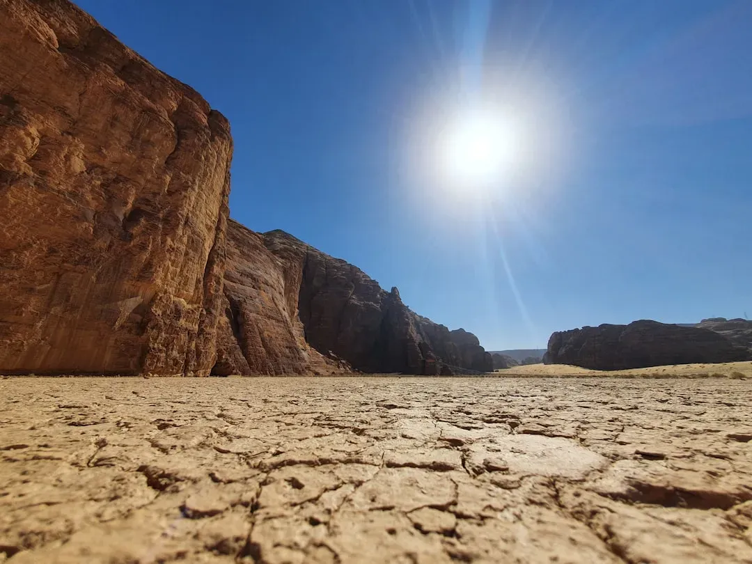
When you put all these landforms together – the dry river channels, stranded shorelines, abandoned waterfalls, and even the tiny ripple marks under your boots – a pretty clear message emerges: today’s deserts are not timeless wastelands. They are snapshots taken late in a very long movie, one that included raging floods, sprawling lakes, and sustained river systems. In my view, calling them “barren” sells them short; they are more like crowded archives where the ink just happens to be carved in stone instead of written on paper.
There is something humbling and a bit unsettling in realizing that some of the driest landscapes on Earth were once shaped by the very element they now seem to lack the most. It hints that climate, water, and habitability are far more changeable than we like to assume, not just on human timescales but on planetary ones. Next time you see a photo of a sun-baked canyon or a cracked salt flat, it is worth asking yourself: are you really looking at a land of dryness, or at the afterimage of enormous, vanished waters – and what does that say about the future of the places we think we know today?