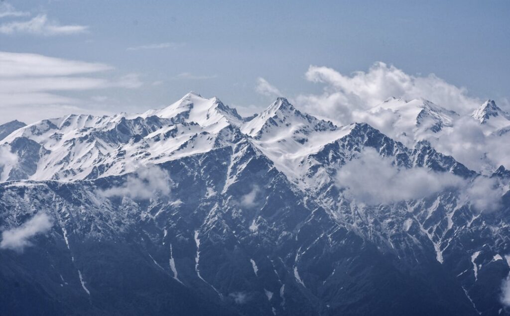
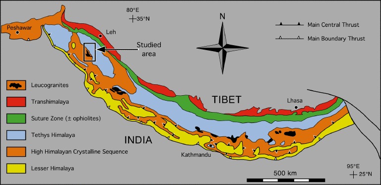
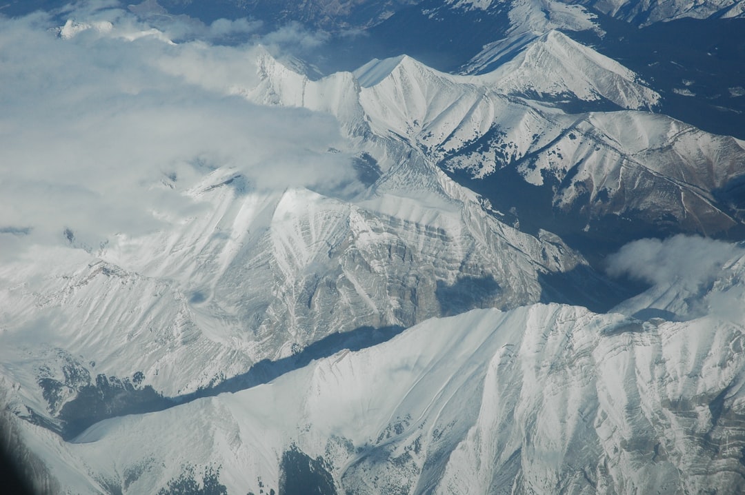
Picture this: the tallest mountains on Earth rising from ancient seabeds, their peaks formed not once but through multiple catastrophic collisions spanning tens of millions of years. The continental collision of the Indian and Eurasian tectonic plates has created the Himalayas, but the story is far more complex than a simple crash between two landmasses.
Recent scientific discoveries reveal that instead of India colliding directly with Eurasia to form the Himalayas, India first collided with a volcanic island chain (similar to the Mariana Islands today), and then with Eurasia up to 10 million years later than is generally accepted. This revolutionary understanding changes everything we thought we knew about how Earth’s mightiest mountain range came to be.
The Great Continental Journey North
This immense mountain range began to form between 40 and 50 million years ago, when two large landmasses, India and Eurasia, driven by plate movement, collided. However, the journey began much earlier than that momentous crash.
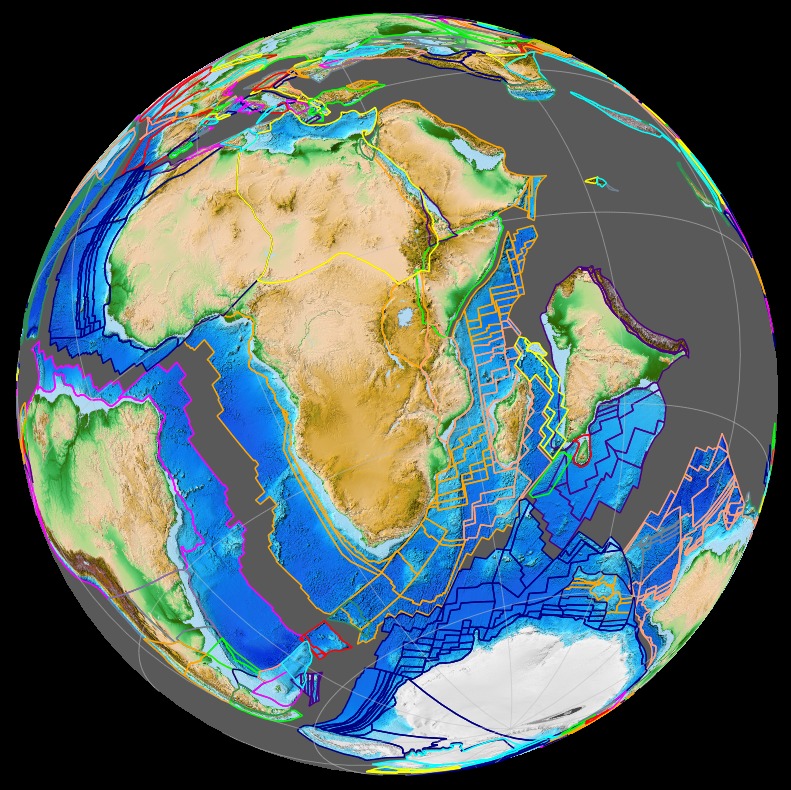
About 80 million years ago, India was located roughly 6,400 km south of the Asian continent, moving northward at a rate of about 9 m a century. The Indian plate zipped along at surprisingly fast speeds, geologically speaking, shifting nearly 30 feet or more each century. This wasn’t just any ordinary tectonic movement. At the time, the vast Tethys ocean filled the gap between India and Eurasia, but as India moved northward, the ocean began to close.
The First Hidden Collision
Here’s where the story gets fascinating. Scientists now believe the Himalayas weren’t born from a single dramatic impact but from two separate collisions. This finding is contrary to the long-held view that the India-Eurasia collision was a single-stage event that started at 55-60 million years ago.
Eighty million years ago, India and Eurasia were 4,000 miles apart, separated by an ancient body of water that geologists call the Neotethys Ocean, but Jagoutz believes there was more than just seawater between the two. Many geologists agree on the existence of an arc of volcanic islands that formed on the boundary of a smaller tectonic plate, similar to the Mariana Islands in the Pacific Ocean. This volcanic island chain would become the stage for the first collision that would eventually build the Himalayas.
This is because Kohistan-Ladakh arc and India collision slowed the India-Eurasia convergence rate, which kept decreasing until 45-40 million years ago when the final collision occurred. Picture tropical volcanic islands being sandwiched between massive continental plates and thrust skyward to become part of Earth’s roof.
Mountains Before the Mountains

Recent research has revealed something truly remarkable about the Himalayas’ formation. The tectonic plates that collided to form the peaks 45 million to 59 million years ago were already pushing against each other, causing the Himalayan mountains to rise to more than half their current elevation, before the big crash gave them a violent shunt upward. The Himalayas attained roughly 60% of their current elevation before the continental plates collided.
They found the makeup around 62 million years ago was consistent with an elevation of 11,480 feet (3,500 m). “That’s a lot higher than many thought,” Ibarra said in the statement. This means massive peaks already existed before the final continental collision that we typically associate with the Himalayas’ birth.
This initial uplift may have been caused by the oceanic part of the Indian tectonic plate, which at that time was pushing its way underneath the continental slabs at a low angle and forcing the overriding plate up. So, “the oceanic part of the India plate initiated convergence,” Ibarra told Live Science.
The Second Great Impact
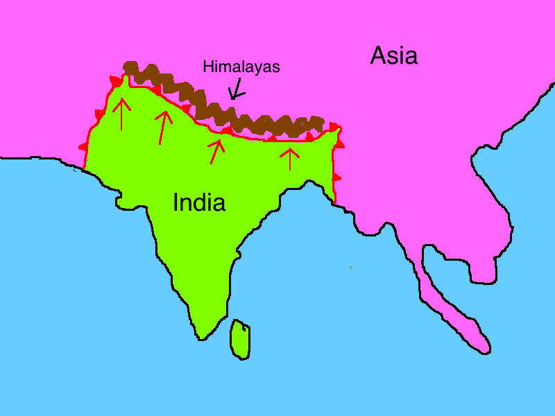
The second and more famous collision occurred when the continental portions of the Indian and Eurasian plates finally met. When India rammed into Asia about 40 to 50 million years ago, its northward advance slowed by about half. The collision and associated decrease in the rate of plate movement are interpreted to mark the beginning of the rapid uplift of the Himalayas.
A huge collision 45 million to 59 million years ago then forced the edges of the Indian and Eurasian tectonic plates up by an additional 0.6 miles (1 km), according to the study. This second collision was different from typical plate interactions because both these continental landmasses have about the same rock density, one plate could not be subducted under the other.
Unlike oceanic plates that can easily slide beneath continental ones, these continental slabs resisted sinking into the mantle, creating instead a massive crumpling effect that built the world’s highest mountains.
Modern Tectonic Drama Underground
The geological drama continues today, and recent discoveries suggest the story is becoming even more complex. New evidence suggests part of the Indian Plate may be splitting away and plunging into the mantle. Scientists studying earthquake waves beneath Tibet have found evidence of something extraordinary happening in the depths.
To get a clearer picture of what’s happening below Tibet, the researchers investigated earthquake waves traveling through the crust at the region where the two plates collide. They reconstructed images from these waves showing what appear to be tears in the slab of the Indian plate’s crust. In places, the bottom of the Indian plate is 124 miles (200 kilometers) deep, Science Magazine reported. In others, it is only 62 miles (100 km) to the bottom of the plate, suggesting some of it has peeled away.
The Earthquake Connection
These ongoing tectonic processes create one of the most seismically active regions on Earth. The continued convergence of the Indian plate with the Eurasian plate results in mega earthquakes. These seismic events can reach greater than MW 8 and result in intense damage to infrastructure.
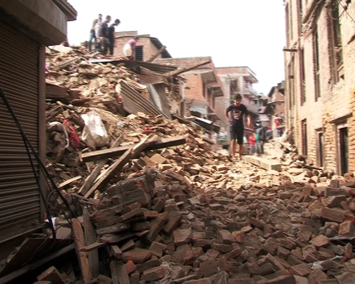
The devastating 2015 Nepal earthquake provided scientists with crucial insights into these processes. The initial shock, which registered a moment magnitude of 7.8, struck shortly before noon local time (about 06:11 am Greenwich Mean Time). Its epicentre was about 21 miles (34 km) east-southeast of Lamjung and 48 miles (77 km) northwest of Kathmandu, and its focus was 9.3 miles (about 15 km) underground.
The deaths of approximately 8,964 people (which included fatalities in nearby parts of India, China, and Bangladesh) were confirmed, with over 21,000 injured and some 2.8 million people displaced by the earthquake. One United Nations (UN) report mentioned that more than eight million people (more than one-fourth of Nepal’s population) were affected by the event and its aftermath.
Living on a Growing Mountain Range
What makes the Himalayas truly remarkable is that they’re still actively growing. Each year, the mountains rise by approximately 1-2 centimeters due to the ongoing collision between the Indian and Eurasian plates. This might not sound like much, but over centuries, it adds up, continually pushing the peaks higher.
The Himalayas continue to rise more than 1 cm a year – a growth rate of 10 km in a million years! Yet despite this constant uplift, as the rocks continue to rise toward the skies, erosion works against their upward progression. Wind and water scour away the surface, washing sediment into streams that race down the mountain’s flanks.
This creates a fascinating balance between construction and destruction, where the mountains grow even as they’re worn away by natural forces.
Ancient Oceans in the Sky
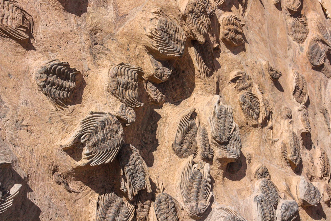
One of the most mind-bending aspects of Himalayan geology is what you can actually find on these towering peaks. Climbers who make it to the top of Mount Everest may not know it, but under the snowpack sits an expanse of mottled gray rocks that once lay on the ocean floor. The rocks arrived at this surprising spot, nearly 30,000 feet above sea level, due to the slow march of tectonic plates, slabs of solid rock that make up our planet’s fractured outer shell.
In some parts of the Himalayas, you can find marine fossils and evidence that this region was once at the bottom of a vast ocean called the Tethys Sea, which existed between India and Eurasia before their collision. These fossils, embedded in rocks at altitudes of over 5,000 meters, tell the story of the ocean that once separated the two continents. As the Indian Plate pushed northward, the sea floor was lifted high into the air, eventually forming the towering peaks we see today.
Imagine walking on what was once the ocean floor, now transformed into the roof of the world through millions of years of tectonic forces.
Future Earthquake Risks
Understanding the complex double collision history of the Himalayas isn’t just academic curiosity. It has real implications for earthquake prediction and public safety. Klemperer points out the newly proposed tear may also be influencing earthquake hazards in Tibet today. A deep fracture in the Tibetan Plateau known as the Cona-Sangri rift overlies the tear – a tantalizing hint that the tumult in the Indian Plate’s underbelly might somehow ripple to the surface.
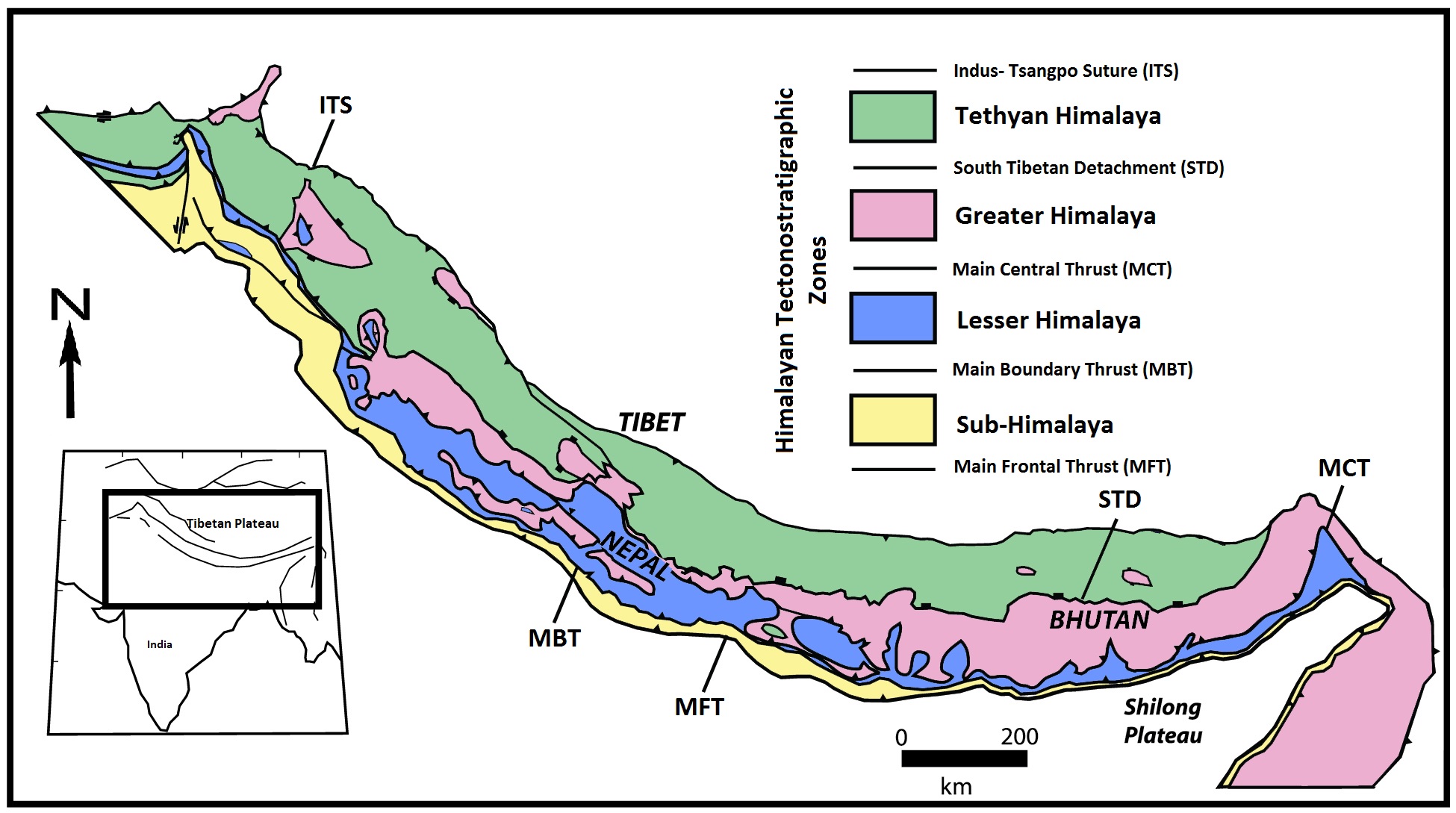
As the plate cleaves in two below ground, it could open up the region to earthquakes and other hazards, the scientists said. The Himalayan mountain range was formed by millions of years of earthquakes as the India and Eurasia tectonic plates have continued to push against one another at a relative rate of 40-50 mm/yr (1.6-2 in/yr). A large amount of that motion (18 mm/yr) is driving the uplift of the Himalayan Mountains. The boundary region between these two plates has a history of large and great earthquakes, making it one of the most seismically hazardous regions in the world.
Conclusion
The Himalayas stand as Earth’s most spectacular testament to the power of tectonic forces, but their creation story is far more complex than a simple continental collision. Through two distinct phases of mountain building – first through the collision with volcanic island chains, then through the final continental impact – these peaks represent tens of millions of years of geological drama.
Today, as the mountains continue their slow but relentless rise while deep underground forces threaten to tear the very plates apart that created them, the Himalayas remind us that our planet is anything but static. What do you think about this incredible geological journey? The next time you see images of Mount Everest, remember you’re looking at ancient ocean floors thrust skyward through one of the most complex tectonic stories on our planet.