Imagine trying to piece together a jigsaw puzzle with billions of years missing from the picture. That’s what scientists face when mapping ancient continents from long before dinosaurs walked the Earth. These lost worlds, concealed beneath billions of years of geological transformation, hold secrets about how our planet evolved and what conditions allowed life to eventually flourish.
You might wonder how anyone can possibly reconstruct landmasses from eras so distant that even rocks struggle to remember them. Yet through patient detective work combining magnetic clues frozen in ancient stones, chemical signatures in minerals, and patterns in mountain ranges separated by oceans, researchers have slowly unveiled a series of remarkable supercontinents. These vanished realms existed hundreds of millions of years before the first dinosaur ever hatched, shaping the very foundation upon which all later life would develop.
The Dawn of Precambrian Supercontinents
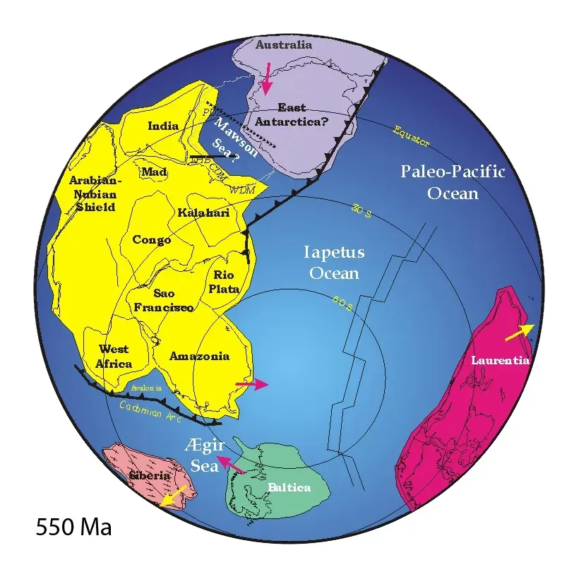
The Precambrian accounts for nearly ninety percent of Earth’s geologic time, spanning from our planet’s formation roughly four and a half billion years ago until about five hundred forty million years back. During this immense stretch, Earth looked nothing like the world you know today. The supercontinent Rodinia is thought to have formed about 1300-900 Ma, to have included most or all of Earth’s continents, creating a massive unified landmass in an alien world.
What makes this period fascinating is its sheer alienness. Life existed only as simple organisms, mostly microscopic. The atmosphere lacked sufficient oxygen for complex creatures. Unlike later supercontinents, Rodinia was entirely barren. It existed before complex life colonized on dry land.
Rodinia: The Motherland Supercontinent
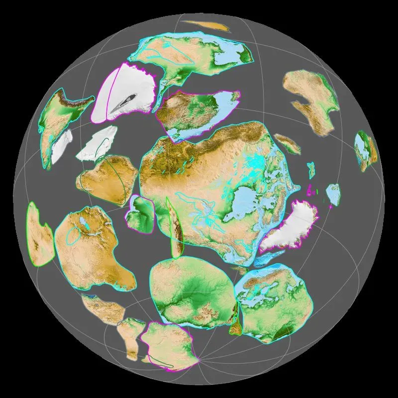
Rodinia was a Mesoproterozoic and Neoproterozoic supercontinent that assembled 1.26–0.90 billion years ago and broke up 750–633 million years ago. Its name comes from the Russian word for motherland or birthplace, fitting for one of Earth’s earliest known unified landmasses. Think of Rodinia as the great ancestor, predating even the most primitive animals.
Rodinia formed from the convergence of the fragments of a previous supercontinent called Columbia, which existed between 2.1 billion and 1.8 billion years ago. This reveals a pattern that would repeat throughout geological history: continents assembling, breaking apart, then reassembling in different configurations like an endless tectonic dance. Scientists debate the exact arrangement of Rodinia’s pieces, though most reconstructions place Laurentia at its core.
The breakup of this ancient giant had profound consequences. The results revealed the breakup of Rodinia occurred over the same geological time period as carbon dioxide declined and temperatures fell, pointing to Rodinia’s breakup as the cause of Snowball Earth.
The Snowball Earth Connection
Picture the entire planet locked in ice from pole to pole. The extreme cooling of the global climate around 717–635 Ma and the rapid evolution of primitive life during the subsequent Ediacaran and Cambrian periods are thought to have been triggered by the breaking up of Rodinia. This wasn’t just any cold snap. This was planetary deep freeze, with glaciers covering even equatorial regions.
The mechanism behind this dramatic cooling involves the exposure of fresh rock surfaces. When Rodinia shattered, volcanic rock rich in minerals that react with carbon dioxide became exposed to weathering. Rainwater, acidified by volcanic emissions, dissolved these rocks rapidly, trapping atmospheric carbon dioxide in the process. Less greenhouse gas meant plummeting global temperatures.
Globally, this period of glaciation lasted for about 60 million years (from ca 720 to 660 Ma) before the climate finally began to ameliorate. Honestly, sixty million years is hard to comprehend. That’s longer than the entire age of dinosaurs, spent in frozen desolation.
Pannotia: The Controversial Fleeting Giant
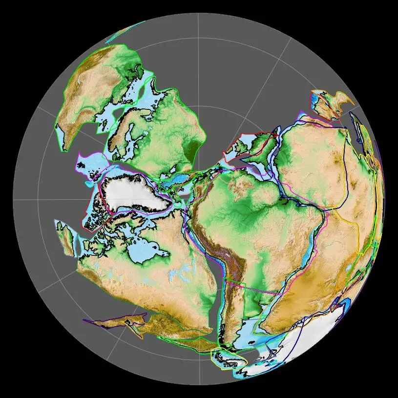
After Rodinia’s fragments drifted apart, they didn’t stay separated for long in geological terms. Pannotia formed at the end of the Precambrian during the Pan-African orogeny, during the Cryogenian period, and broke apart 560 Ma with the opening of the Iapetus Ocean. This makes Pannotia one of the shortest-lived supercontinents, existing for perhaps only fifty million years.
Here’s where things get controversial among geologists. The existence of the putative Ediacaran supercontinent Pannotia has come into question since the turn of the millenium, largely due to the geochronology of Ediacaran-Cambrian orogens, which suggests that the supposed landmass had begun to break up well before it was fully assembled. Some scientists argue it never achieved true supercontinent status.
Still, whether fully unified or partially connected, these continental masses played a crucial role. The break-up of Pannotia was accompanied by sea level rise, dramatic changes in climate and ocean water chemistry, and rapid metazoan diversification. The fragmentation created numerous shallow seas and continental margins, perfect environments for early complex life to experiment with new body plans.
Gondwana: The Southern Giant
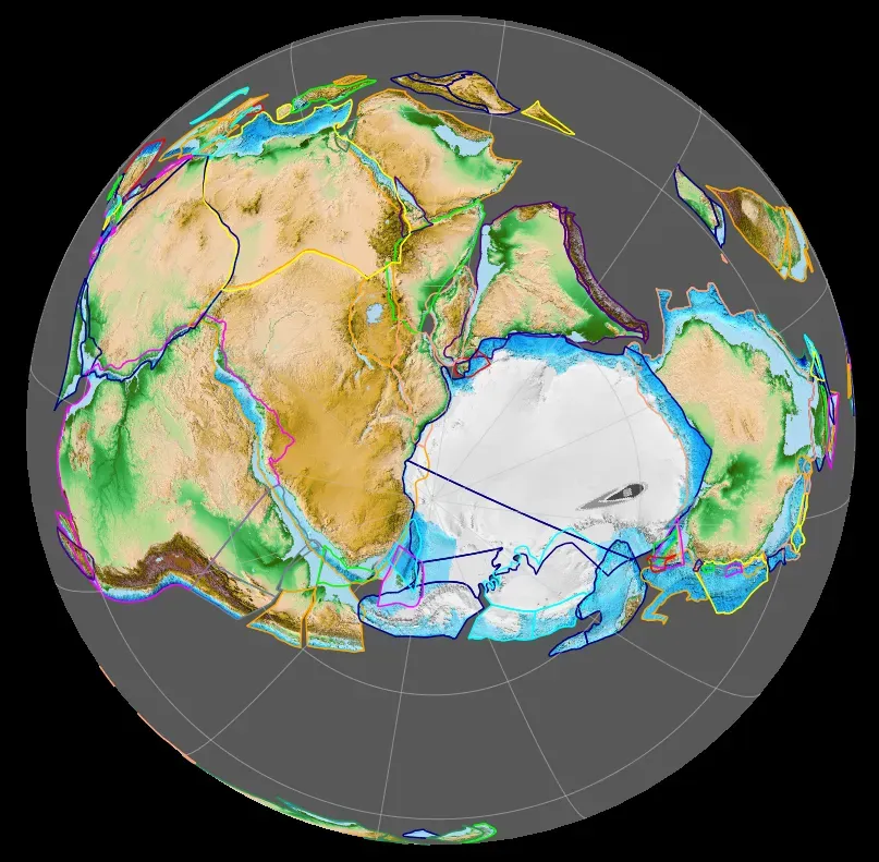
Gondwana was formed by the accretion of several cratons, beginning c. 800 to 650 Ma with the East African Orogeny, and culminating in c. 600 to 530 Ma. This massive southern hemisphere supercontinent would prove remarkably long-lived, persisting in various forms for hundreds of millions of years. Eventually, Gondwana became the largest piece of continental crust of the Paleozoic Era, covering an area of some 100,000,000 km2, about one-fifth of the Earth’s surface.
Gondwana encompassed what would eventually become South America, Africa, India, Australia, Antarctica, and Madagascar. During the Paleozoic Era, while early animals were just beginning to colonize land, Gondwana drifted across the South Pole. The majority of Cambrian landmasses were gathered together to form Gondwana, a supercontinent made up of the present-day continents of Africa, South America, Australia, and Antarctica and the Indian subcontinent.
Its position near the pole meant extensive glaciation during certain periods. These ice sheets left distinctive scratches on rocks that now lie scattered across multiple continents, providing some of the most convincing early evidence that these lands were once joined.
Paleomagnetic Detective Work: Reading Ancient Compasses
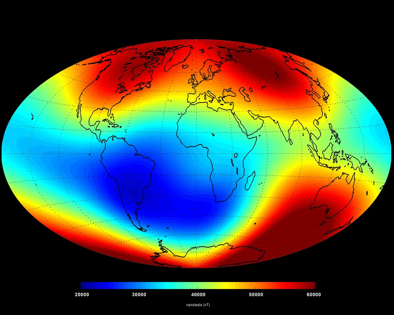
You might reasonably ask how scientists possibly determine where continents were positioned hundreds of millions of years ago. The answer lies in Earth’s magnetic field. Certain magnetic minerals in rocks can record the direction and intensity of Earth’s magnetic field at the time they formed. This record provides information on the past behavior of the geomagnetic field and the past location of tectonic plates.
When molten rock cools, magnetic minerals within it align like tiny compass needles, pointing toward the magnetic poles. Once the rock solidifies, these mineral orientations become locked in place, preserving a snapshot of where the rock was located relative to Earth’s magnetic field. Evidence from paleomagnetism led to the revival of the continental drift hypothesis. Apparent polar wander paths provided the first clear geophysical evidence for continental drift.
This technique isn’t without challenges. Rocks can be reheated, altered by chemical processes, or deformed by mountain-building events, potentially scrambling their magnetic records. That’s why paleomagnetic studies require careful selection of rock samples and rigorous testing to ensure the magnetic signatures are original rather than later overprints.
From Ancient Fragments to Familiar Continents
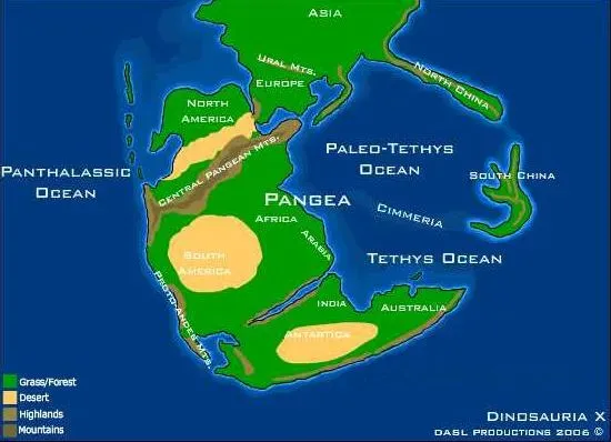
The beginning of the Paleozoic Era witnessed the breakup of the supercontinent of Pannotia and ended while the supercontinent Pangaea was assembling. This transition period saw continents scattered across the globe gradually migrating toward one another. About 200 million years ago Pangaea broke into two new continents Laurasia and Gondwanaland. Laurasia was made of the present day continents of North America, Europe, and Asia, while Gondwana comprised the southern landmasses.
The assembly of Pangaea roughly three hundred million years ago marked the most recent time all continents merged into a single landmass. From about 300-200 million years ago, the continent we now know as North America was contiguous with Africa, South America, and Europe. This was the world into which dinosaurs would eventually emerge during the Triassic Period.
Following Pangaea’s breakup, continents drifted toward their modern positions through processes still ongoing today. The Atlantic Ocean continues widening by a few centimeters annually, while the Pacific slowly shrinks. Eventually, millions of years from now, these wandering fragments may collide once again to form yet another supercontinent.
Looking back across this immense temporal landscape, what strikes you most is the dynamic restlessness of our planet. Continents are not fixed stages upon which life performs its drama. Rather, they’re active participants, constantly reshaping themselves, opening and closing oceans, building and eroding mountains. These ancient worlds before the dinosaurs remind us that Earth has always been a planet in flux, forever reinventing itself.
What mysteries still lie buried in rocks we haven’t yet examined? How many other ancient continental configurations remain to be discovered? The story of Earth’s lost worlds continues to unfold as new techniques reveal ever older chapters in our planet’s remarkable history.