You live on the aftershock of ice. Whether you stand on a rocky New England hill, a flat Midwestern cornfield, or a U-shaped valley in the Rockies, you’re standing in a landscape carved, scraped, and rearranged by glaciers that vanished thousands of years ago. Those ancient ice sheets were unimaginably large, as thick as skyscrapers and as wide as entire countries, and they dragged the surface of North America around like it was wet clay.
When you start to see the United States through the lens of ice ages, the whole map changes in your mind. Everyday things you might take for granted – fertile Midwestern soil, the Great Lakes, even why some rivers bend and others slice straight – suddenly make sense. You realize you’re not just looking at land; you’re looking at the frozen past, melted and revealed. And once you see those patterns, you can’t unsee them.
The Colossal Ice Sheets That Covered North America
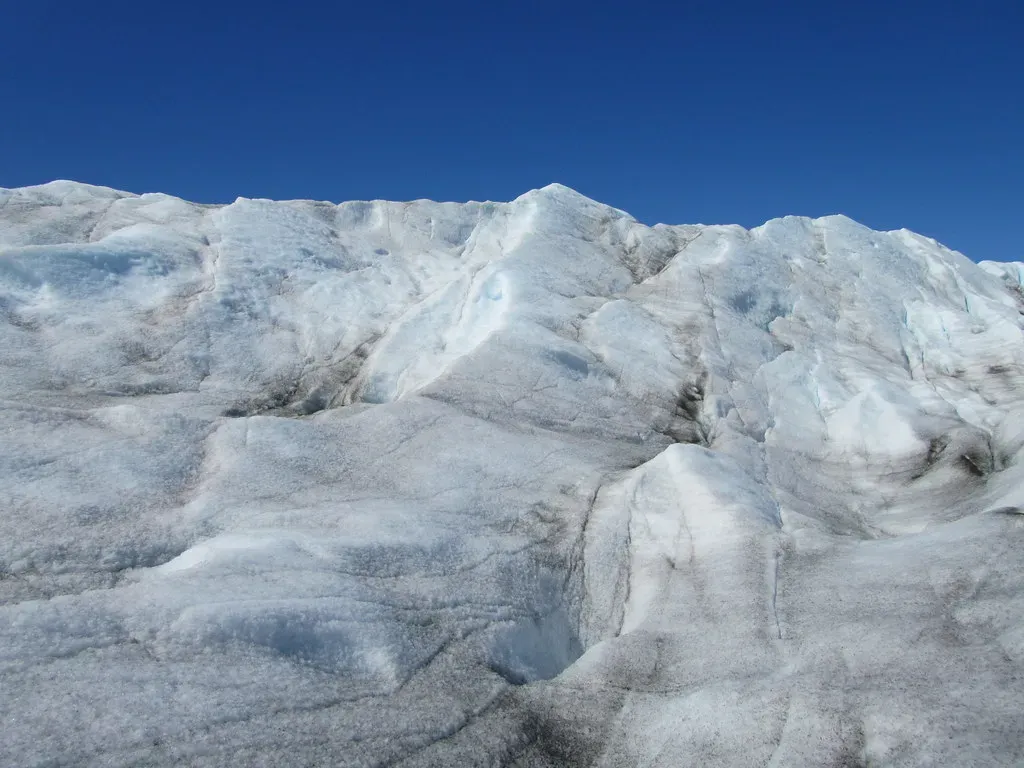
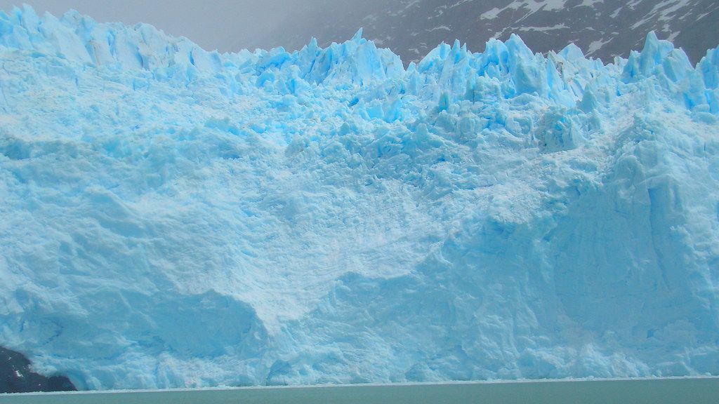
Imagine standing where you are now, but instead of open sky overhead, you’re under a moving mountain of ice up to a mile thick. During the peak of the last ice age, huge ice sheets spread over what is now Canada and pushed deep into the northern United States, burying places like Minnesota, Wisconsin, and New York under a slow-creeping glacier. You would have seen no trees, no cities, just a blinding white plain stretching beyond the horizon, reshaping everything as it crawled forward.
These were not local mountain glaciers like you see today in high ranges; they were continent-scale slabs of frozen water, anchored in the Arctic and pulsing southward over tens of thousands of years. As global climate cooled, snowfall exceeded melting year after year, and the ice thickened until gravity forced it to flow outward. From your perspective, it would have seemed motionless, but over centuries it bulldozed rock, soil, and entire hills, grinding them into powder and dragging the debris along. That relentless motion is what gave so much of the modern American landscape its basic form.
How Glaciers Carved Valleys, Lakes, and Rolling Hills
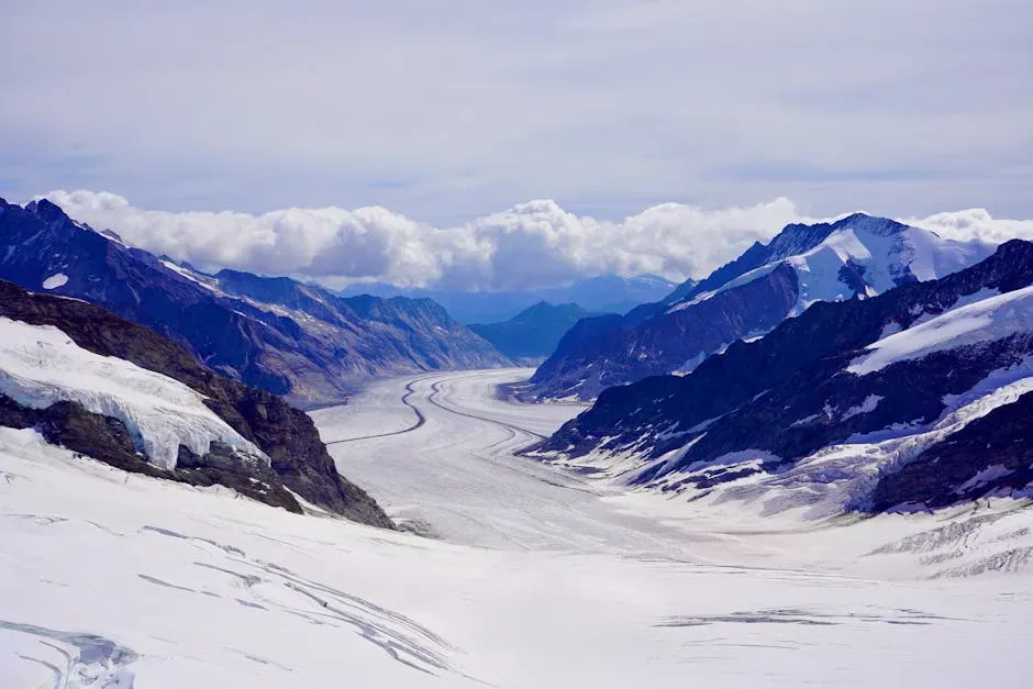
When you picture a valley in your mind, you might see a wide, broad-bottomed shape flanked by steep sides and a flat floor – almost like a giant U drawn into the earth. That’s a signature of glacial carving. As ice flowed through existing river valleys, it deepened and widened them, plucking boulders from the sides and dragging them along the base. If you hike in parts of the Rockies, the Sierra Nevada, or the Northeast and walk through a U-shaped valley, you’re literally walking inside the groove left by a glacier’s passing.
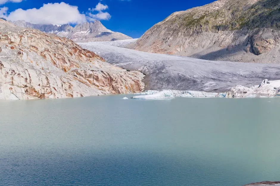
The ice did more than carve; it sculpted and then abandoned water-filled basins that later became lakes and ponds. When a glacier stopped advancing and began to melt, chunks of ice sometimes broke off and were buried in sediment; when those blocks melted, they left behind round depressions that filled with water, creating kettle lakes. In places where the ice gouged deeper hollows in softer rock, huge lakes could later form, like natural bathtubs in the bedrock. So every time you sit by a calm northern lake, you’re relaxing beside a scar left by ice.
How Ice Ages Built the Great Lakes You Know Today
If you look at a map of the Great Lakes, they almost seem too big and too neatly aligned to be accidental. Glaciers turned that region into one of the most dramatic showcases of ice-age engineering. As the ice sheets advanced, they scoured long troughs into the underlying rocks, especially in areas where older river valleys or weaker rock layers gave them an easy path. When the climate warmed and the ice melted back, those overdeepened troughs filled with meltwater, giving you the Great Lakes system that now holds a staggering amount of the world’s fresh surface water.
The shores you walk along today – sandy beaches, rocky bluffs, and low coastal plains – owe their existence to how the glaciers paused, retreated, and readvanced. The ice left behind a patchwork of ridges and lowlands that later guided water levels and shoreline positions. Even many of the smaller inland lakes scattered across states like Michigan, Wisconsin, and New York are leftovers from that same icy reshaping. When you drive across those regions and see water glittering around every bend, you’re looking at the melted imprint of a retreating ice edge.
Why the Midwest Is So Flat (and So Incredibly Fertile)
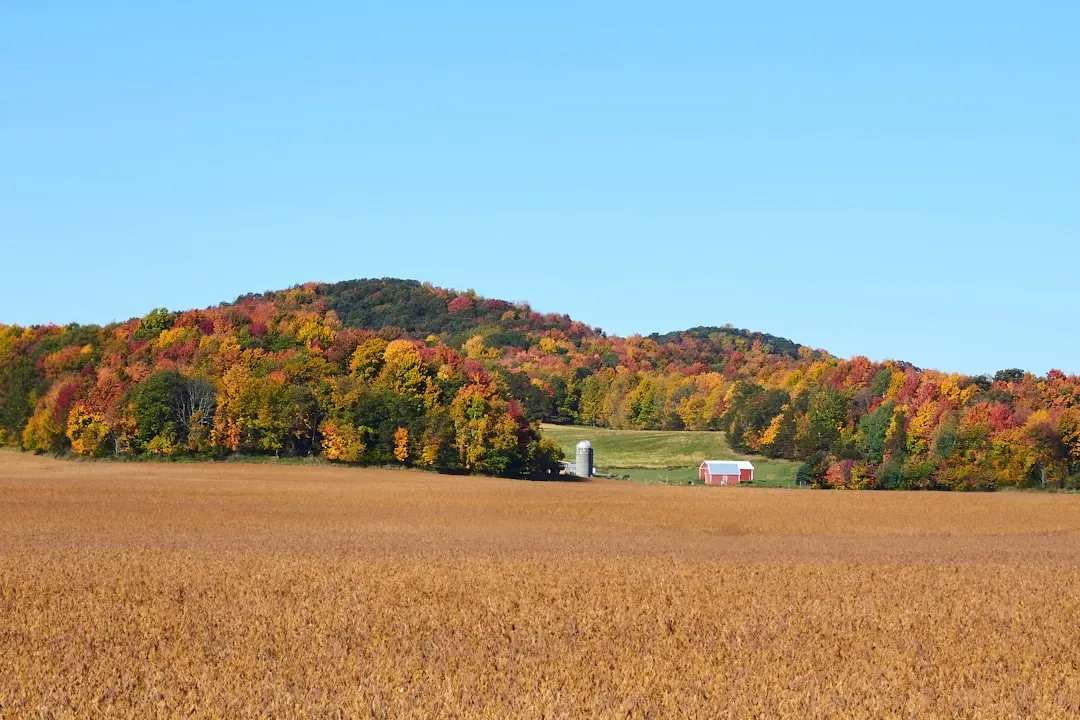
If you’ve ever driven across the Midwest and felt like the land might go on forever, almost perfectly level, you’ve experienced a classic glacial legacy. As the ice sheets melted, they dropped their load of finely ground rock, sand, and clay – what geologists call glacial till – across huge swaths of the interior. Instead of leaving behind jagged peaks, the glaciers smoothed and leveled the terrain, spreading out a blanket of sediment that later weathered into rich, deep soils. That’s a big reason why you see endless fields of corn, soybeans, and wheat today.
In some places, meltwater rivers flowing from the front of the ice sheets laid down layers of silt that the wind later picked up and carried farther south, piling it into thick deposits of loess. These windblown sediments created some of the most productive farming soils on Earth. So when you hold a handful of dark Midwestern topsoil, you’re literally holding the crushed remains of rocks that were scraped hundreds of miles by ice. Your food, your economy, and even the layout of small towns across the heartland all trace back to that frozen conveyor belt.
Glacial Erratics, Moraines, and Other Strange Landforms You Can Still See
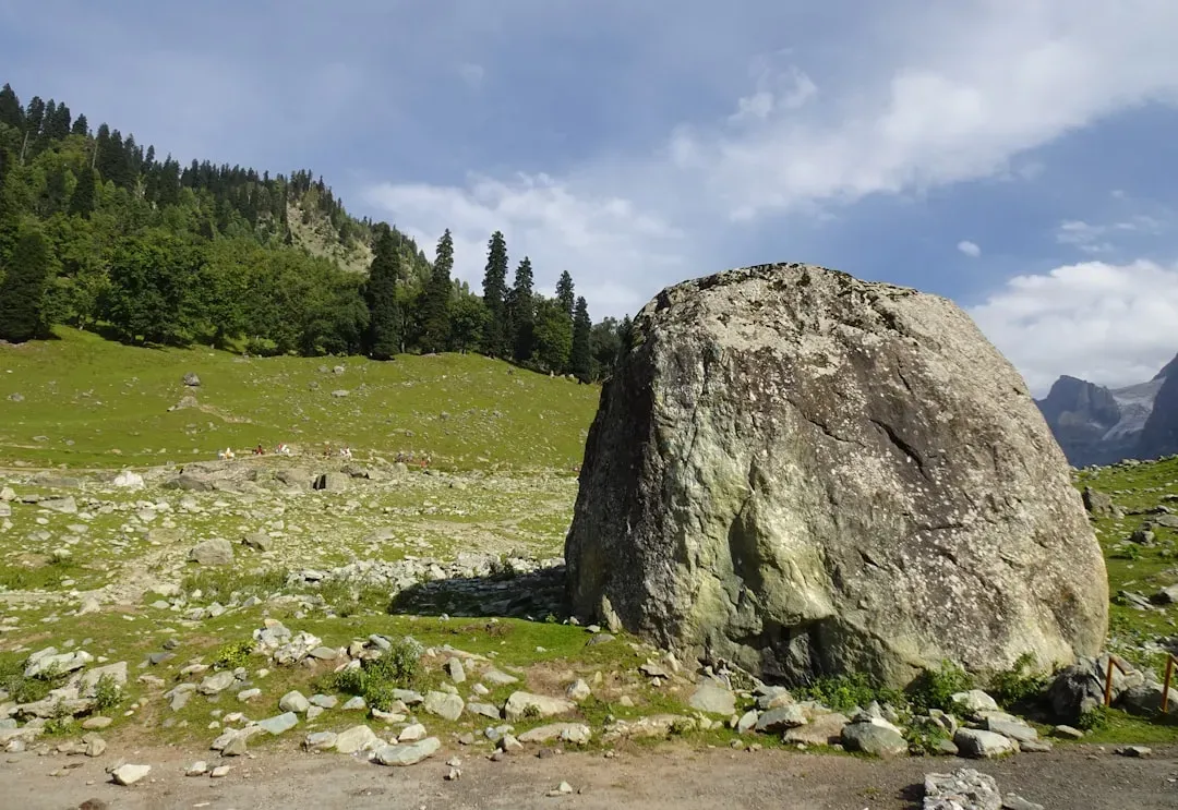
One of the most surprising things you can find in glaciated country is a huge boulder sitting alone in a field or perched on a small rise, looking wildly out of place. These are glacial erratics – rocks the glacier picked up in one region and dropped in another, sometimes hundreds of miles away from their original bedrock. If you pay attention to them, you can almost read the direction of the ice flow, like breadcrumbs left by a giant. Standing next to one, you’re literally touching proof that ice once had the strength to carry massive stones like pebbles.
You can also see where glaciers paused or halted by looking for moraines – long ridges of rock and debris dumped at the edges or front of the ice. Terminal moraines mark the furthest reach of the glacier, while lateral moraines line the sides of former ice lobes. Sometimes modern roads, property lines, or even neighborhoods follow these ridges without people realizing it. If you walk along one, you’re essentially walking the old boundary of an ice sheet, tracing the edge of a frozen world that ended right under your feet.
How Glacial Meltwater Shaped Rivers, Canyons, and Floodplains
As the glaciers melted, the water pouring off them was anything but gentle. Picture enormous, roaring outwash rivers carrying sand, gravel, and boulders, spreading across wide plains in braided channels that constantly shifted. These meltwater floods carved new pathways, deepened existing valleys, and left behind broad, flat floodplains where rivers later settled into more modest flows. Some river paths you see today were essentially chosen by those ancient torrents and have kept the same general course ever since.
In some regions, sudden releases of meltwater created catastrophic floods that tore through the landscape, scooping out basins and canyons in a geologic instant. You can stand on the edge of certain wide channels or scabland features and realize that modern rivers are far too small to have carved them on their own. That mismatch is your clue that something much bigger – glacial meltwater on a massive scale – did the original work. Every time you cross a broad valley with an undersized river at the bottom, you’re seeing the hanging remnant of a much wilder, wetter past.
How the Legacy of Ice Still Shapes Climate, Ecosystems, and Your Life
The glaciers may be gone, but their fingerprints are all over the climate patterns and ecosystems you live in today. Large lakes created by glacial carving help moderate local temperatures, keeping nearby areas cooler in summer and milder in winter. Wetlands, bogs, and marshes that formed in poorly drained glacial depressions now store carbon, filter water, and provide habitat for wildlife. So when you enjoy a lakeshore breeze or watch migrating birds gather over marshes, you’re experiencing climate and ecology that exist because of ancient ice.
The soils, landforms, and water bodies shaped by glaciers also guide where people build homes, plant crops, and place cities. Many major transportation routes follow low passes or gaps created or widened by ice-age processes, while fertile glacial plains support dense agricultural regions that feed millions. Even the recreational landscapes you love – ski hills built on glacial mounds, hiking trails along moraines, cabins on kettle lakes – are rooted in that frozen past. Without those ice ages, your daily map of life in America would look completely different.
What Studying Ancient Ice Teaches You About the Future
When you learn how glaciers once grew and then disappeared in response to natural climate shifts, you gain a powerful perspective on what rapid changes mean today. The ice-age record shows you that climate can flip between very different states, and when it does, landscapes, coastlines, and ecosystems transform. You can see that the Earth is not fixed; it is responsive, sometimes abruptly, to shifts in temperature and greenhouse gases. That knowledge makes today’s warming trend feel less abstract and more like the beginning of another chapter in a long, very real story.
By reading the rocks, landforms, and sediments left by prehistoric glaciers, scientists can reconstruct how fast ice sheets grew or shrank and how sea levels and weather patterns responded. When you pay attention to their findings, you start to recognize that the ground beneath your feet is a record book of past climate experiments. Understanding how ice once helps you imagine how modern changes – from retreating mountain glaciers to rising seas – might reshape your world. It turns distant science into something immediate, something that touches where you live and where future generations will stand.
In the end, prehistoric glaciers gave you more than scenic lakes and fertile fields; they handed you a living textbook written into hills, valleys, and shorelines. When you notice a lone boulder in a field, a perfectly flat stretch of farmland, or the sweeping curve of a U-shaped valley, you’re seeing the work of ice that vanished long before humans built cities. If you let that sink in, it changes how you look at every horizon you see. Next time you step outside, will you see just land, or will you see the ghost of the ice that shaped it?