
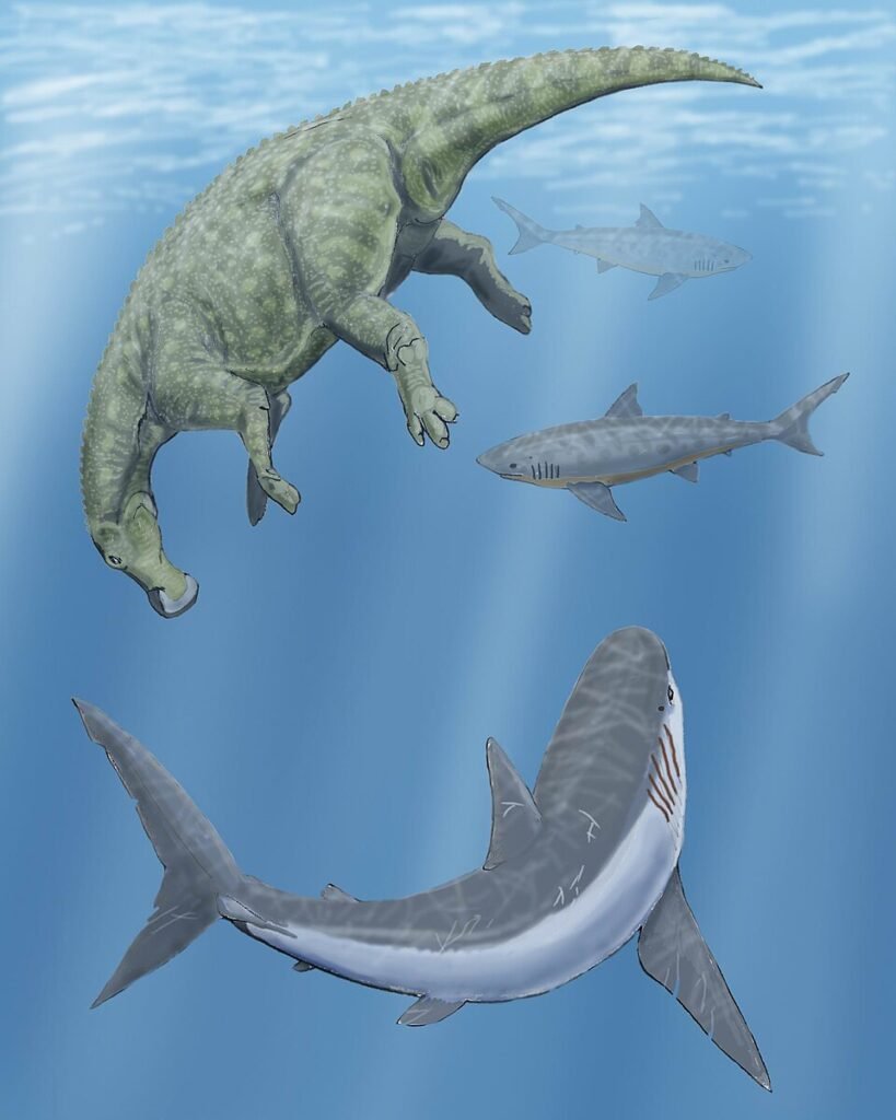
Imagine standing in the middle of Kansas and looking out, not at cornfields and cattle, but at a glittering blue ocean stretching from the Gulf of Mexico all the way to the Arctic. If you could rewind the clock roughly a hundred million years, that is exactly what you would have seen. Instead of tractors, you would have watched enormous marine reptiles cruising through deep water where today you might drive a pickup to town.
This is not science fiction or a wild exaggeration. You are living on the drained seafloor of what geologists call the Western Interior Seaway, a massive inland ocean that once sliced North America into two half-continents. When you walk across certain farm fields, hike badlands, or drive through rolling prairie, you are literally traveling across the ancient route of giant sea creatures that ruled a vanished world.
You Live on the Floor of an Ancient Ocean
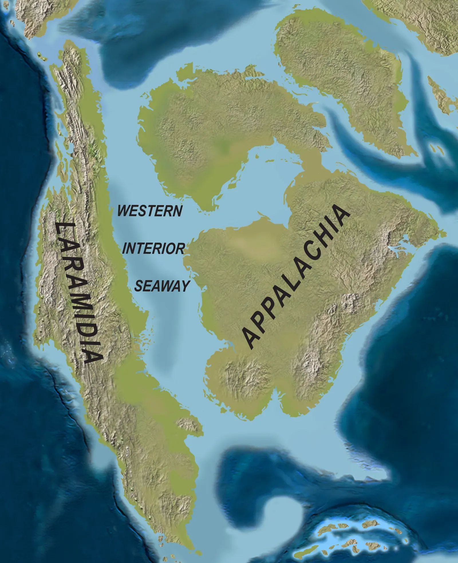
When you hear the word “ocean,” you probably think of coasts: California cliffs, Florida beaches, maybe rugged shores in New England. But during the mid to late Cretaceous Period, the ocean came far inland, pushing a warm, shallow sea right into the heart of the continent. If you could place yourself there, your feet would be hundreds of meters under water somewhere between two long chains of low islands and mountains to the east and west.
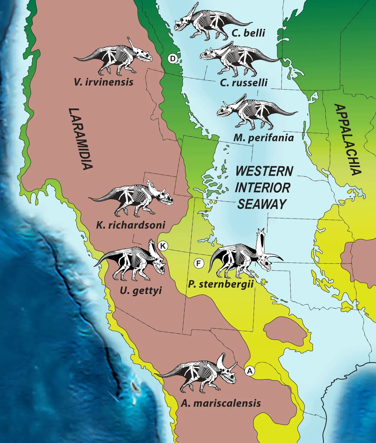
This inland sea, the Western Interior Seaway, stretched from what’s now the Gulf of Mexico up into the Arctic region, effectively cutting North America into a western landmass (often called Laramidia) and an eastern one (Appalachia). Today, many of the places you think of as “solidly landlocked” – Nebraska, Kansas, the Dakotas, parts of Colorado, Wyoming, and even southern Canada – were once underwater. You are surrounded by the quiet evidence of that ocean every time you see soft, layered rock in road cuts or fossil shells in dusty museum cases.
Giant Marine Reptiles Once Swam Across Today’s Farmland
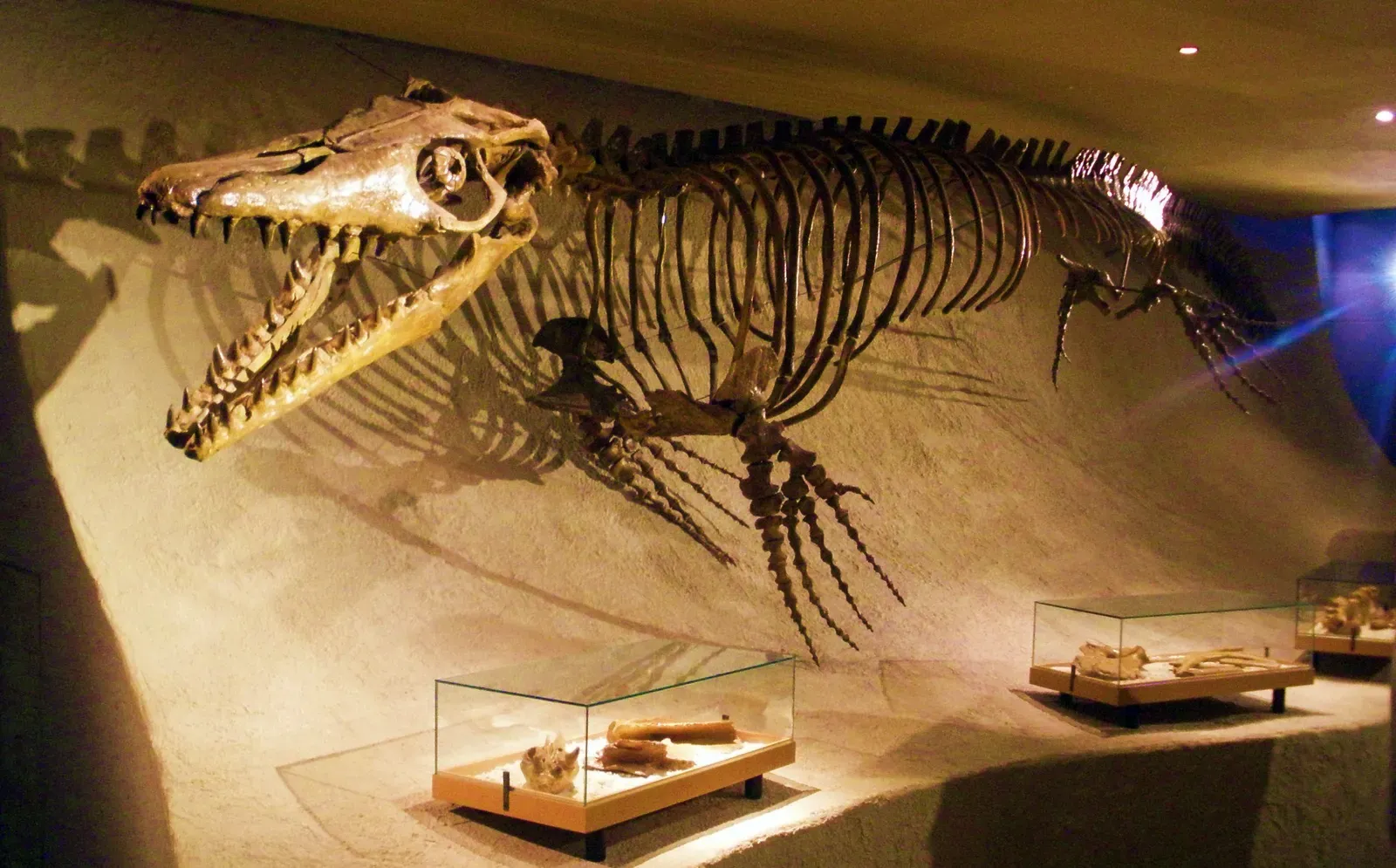
If you could dive into that vanished sea, you would not find whales or dolphins. Those had not evolved yet. Instead, you would meet marine reptiles that make a Hollywood monster look modest. Massive mosasaurs, some longer than a city bus, patrolled the deeper channels, with double-hinged jaws and sharp, conical teeth perfectly shaped for gripping slippery prey.
You would also see long-necked plesiosaurs gliding like underwater swans, using four powerful flippers to “fly” through the water, along with turtle species the size of dining room tables and huge predatory fish cruising the depths. Many of these animals crossed directly over places that now grow wheat, corn, and soybeans. Fossil skeletons of these creatures have turned up in quiet ranch land and on private farms, proving that your peaceful countryside was once a very crowded, very dangerous marine neighborhood.
The Western Interior Seaway Turned the Heartland Into a Tropical Coastline
It is strange to think of Wyoming or South Dakota as tropical, but that is the kind of climate you are dealing with when you step back into this part of Earth’s history. The planet was warmer, sea levels were higher, and there were no polar ice caps like today. As the global seas rose, water flooded low-lying areas of the continent, transforming what would become the Great Plains into shallow marine shelves and coastal lagoons.
For you, that means the underground geology beneath your feet is packed with fine sediments – muds, silts, and chalky layers that settled quietly onto the seafloor over millions of years. These deposits tell you that the water was often calm and relatively shallow, more like a broad inland gulf than a storm-tossed open ocean. On the ancient shorelines, you would have seen lush vegetation and dinosaurs wandering the coasts, while just offshore, marine reptiles and fish turned the water column into a vertical food web.
How You Know This Sea Was Real: Rocks, Fossils, and Ancient Mud
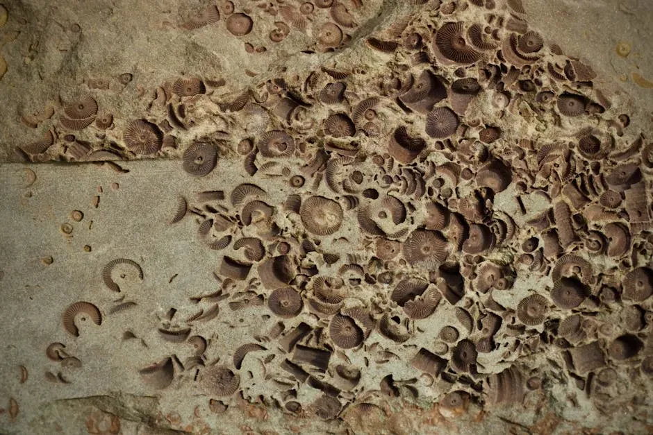
You do not have to take anyone’s word for this ancient ocean; the evidence is literally baked into the landscape. When you see soft, chalky white cliffs or light-colored, finely layered rock in the central parts of North America, you are often looking at old seafloor mud that has been compressed into stone. That chalky material is loaded with tiny remains of microscopic plankton that once drifted in vast numbers through the water above.
On top of that, you can find fossils of animals that had no business living on land: shells of marine clams and ammonites, teeth and bones of sharks, vertebrae and skulls of marine reptiles. If you walk the right stretches of badlands or visit local museums in the U.S. Midwest and Canadian Prairies, you will see creatures that clearly belonged to an ocean world. You are essentially reading pages of an ancient logbook written not with ink but with mud and bone.
The Seaway Shaped the Dinosaurs That Lived on Either Side
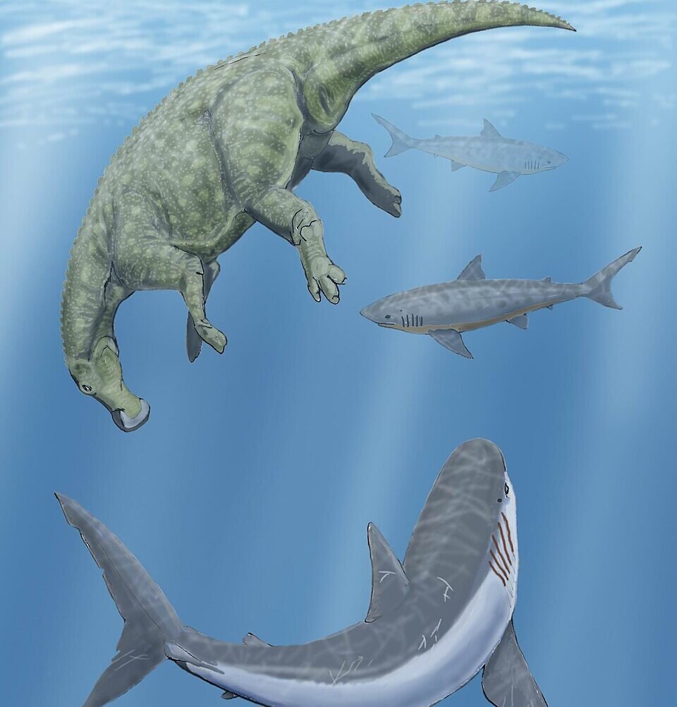
Because the Western Interior Seaway cut the continent in two, you did not just get a change in scenery; you got separate evolutionary laboratories on either side. Dinosaurs living on the western landmass had their own mix of species and body shapes, while those on the eastern side followed a different path. Over millions of years, that watery barrier encouraged new forms to appear, much like how islands isolated in the modern ocean promote unique wildlife.
For you, this means that many of the famous dinosaurs from western North America – especially from what is now Montana, Utah, or Alberta – developed under the influence of a nearby coastline and shifting sea levels. Their world was more like a chain of swampy coastal plains and floodplains than a uniformly dry inland desert. The seaway silently dictated where rivers flowed, where forests grew, and where different dinosaurs could actually live and thrive.
At the same time, the eastern side of the seaway, covering parts of what are now the central and eastern United States, hosted its own communities. Though fossils there are often harder for you to find because of younger sediments and vegetation cover, the overall story is the same: water divides, and life adapts. When you picture dinosaurs roaming across an open, continuous continent, you are missing a key twist – an ocean corridor right down the middle.
Why the Sea Disappeared and Left You With Prairies and Fields
The Western Interior Seaway did not vanish overnight. Over millions of years, the forces that created it – shifting tectonic plates, rising mountains to the west, and high global sea levels – began to reverse. As the Rocky Mountains rose higher and erosion poured more sediment into the basin, the sea gradually filled and shallowed. At the same time, global sea levels slowly fell, and the ocean retreated toward the coasts.
From your perspective today, the result looks like gentle prairie, rolling farmland, and scattered badlands. But that calm scene hides a dramatic history of uplift, erosion, and drainage. Rivers carved their way through the old seafloor, carrying away mud and sand and leaving behind the broad plains you know. When you see a flat landscape in the central part of the continent, you are often looking at the smoothed remains of that ancient seabed, sculpted by tens of millions of years of weather and time.
What This Ancient Sea Means for Your Water, Soil, and Future
Learning that you live on the floor of a vanished sea is not just a fun piece of trivia; it actually shapes your daily reality. The rich, dark soils that make the Great Plains such a productive farming region are built partly on those ancient sediment layers. Fine-grained marine deposits weather into fertile ground, allowing you to grow crops that feed millions. The rocks below you also influence where aquifers form and how groundwater flows, affecting the wells and rivers you rely on.
Beyond that, understanding this ancient seaway gives you perspective on how dramatically Earth’s climate and sea level can change over long periods. You are used to coastlines as fixed lines on a map, but the story of the Western Interior Seaway reveals how temporary that can be. When you hear scientists talk about rising seas in the future, this inland ocean from the past is a reminder that shorelines move, continents flood, and the planet is far more dynamic than you tend to think during a single lifetime.
You Can Still Walk the Edges of This Lost Ocean Today
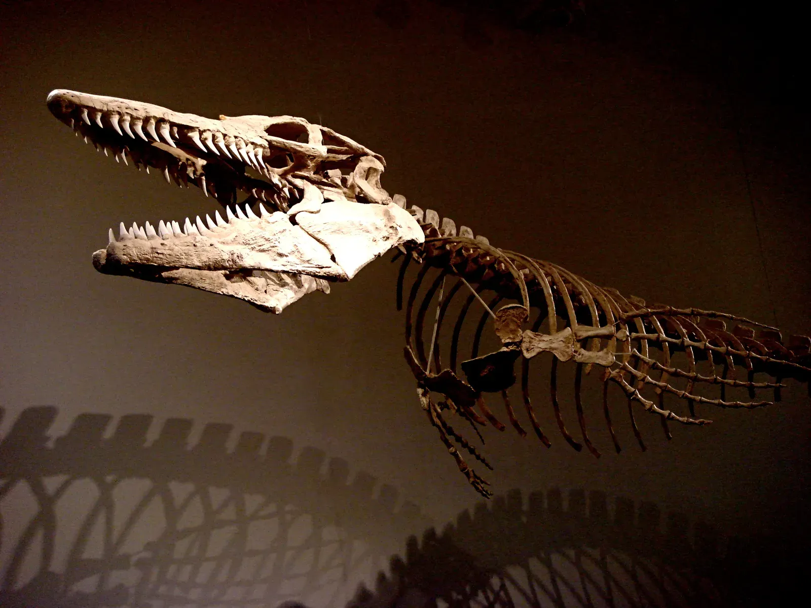
Even though the water is gone, you can still visit places where the seaway’s story is written in bold letters across the land. National parks and monuments in the central and western United States, as well as in parts of Canada, preserve cliffs of marine rock, fossil-rich badlands, and exhibit halls full of marine reptiles that were pulled from former seabeds. When you stand in front of a reconstructed mosasaur skeleton or trace your hand along a rock packed with fossil shells, you are literally touching the past shoreline of an inland sea.
If you travel through ranch country or farmland where these sediments outcrop, you might even unknowingly drive over the exact routes once taken by swimming reptiles. Some of the quietest, most unassuming landscapes you see from your car window are actually the stage of one of Earth’s strangest chapters: a time when giant reptiles cruised in deep water above what would one day become your neighbors’ fields and towns. Once you see it that way, a flat horizon starts to feel a lot more mysterious.
In the end, the idea that your continent was once sliced in half by an ocean changes how you look at a map. You are not just living on dry land; you are living on top of a buried seascape filled with the ghosts of tides, storms, and powerful predators that no longer exist. Next time you pass a cornfield, a cattle pasture, or a stretch of open prairie, you might quietly picture blue water rolling over that same ground, with the shadow of a huge reptile sliding just beneath the surface. When you imagine that, does the ordinary world around you feel a little less ordinary?