Imagine standing in the middle of Kansas and watching waves roll in like you were on a tropical beach. No highways, no cornfields, no cities – just warm, shallow seawater stretching from the Arctic to the Gulf of Mexico. It sounds like science fiction, but for tens of millions of years, that was reality: a gigantic inland sea that swallowed nearly half of what we now call North America.
This is the story of the Western Interior Seaway, the “forgotten ocean” that turned the heart of a continent into a marine world of mosasaurs, giant turtles, strange sharks, and floating forests of plankton. Once you see the continent through this lens, the flat plains, chalky cliffs, and fossil-rich badlands stop being random landscapes and start feeling like the ghostly shoreline of a vanished ocean.
A Continent Split in Two by a Shallow Sea
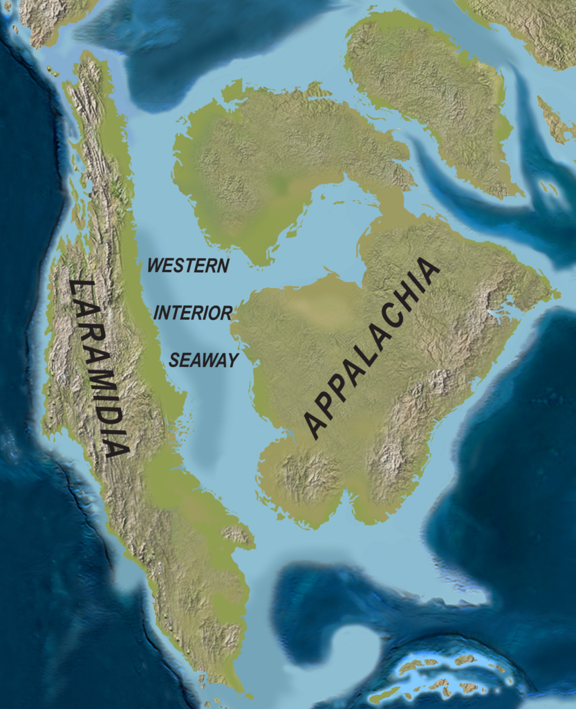
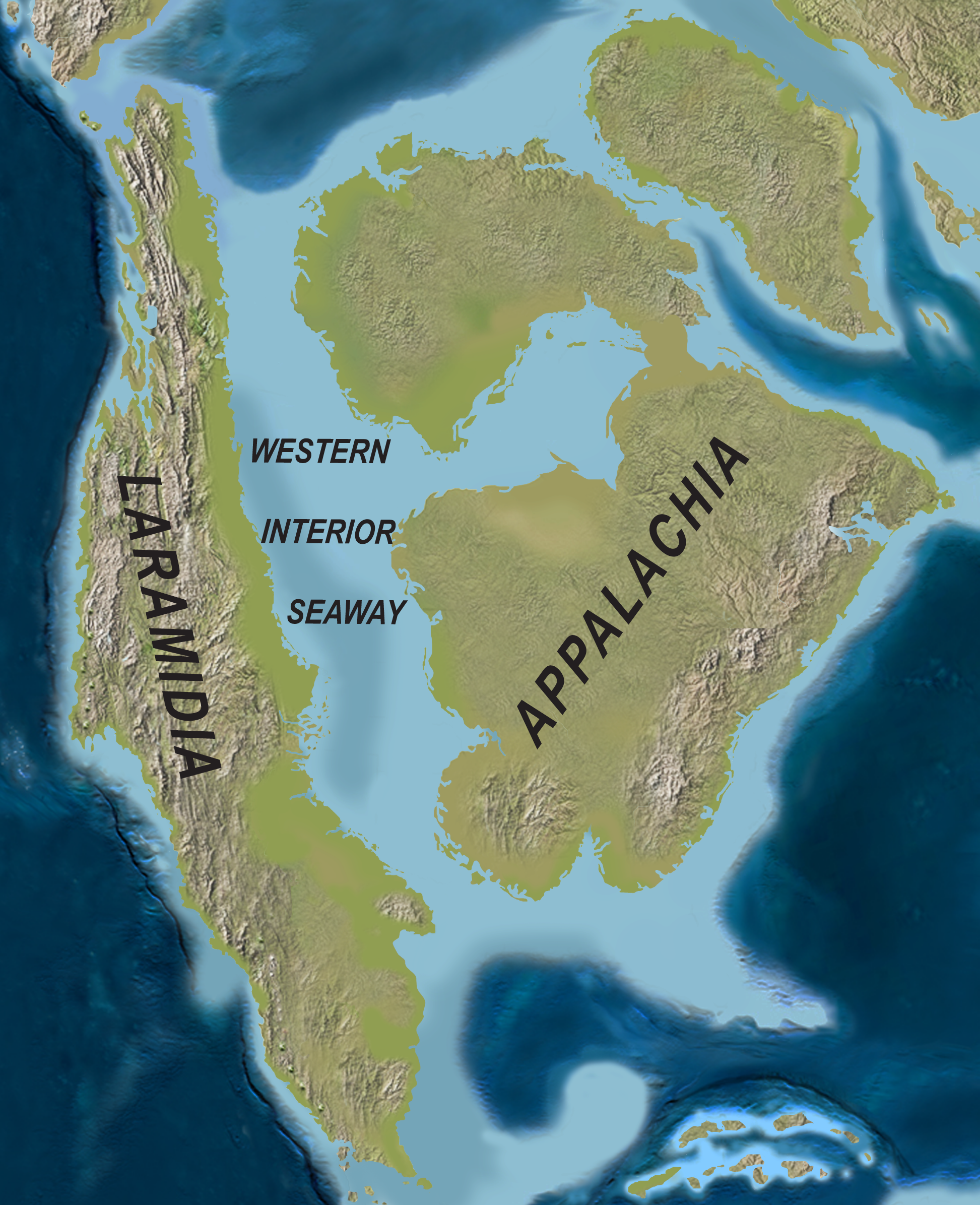
It is hard to overstate how shocking the ancient map of North America looks compared to today. During the Late Cretaceous period, rising sea levels and a subsiding interior created a long, shallow seaway that sliced the continent from the Arctic Ocean in the north down to the Gulf region in the south. Instead of one solid landmass, there were two: a western island continent and an eastern one, separated by a warm, inland ocean that could be hundreds of kilometers wide.
This ocean, called the Western Interior Seaway, was not some narrow river or bay – it covered much of what is now the Great Plains, parts of the Rockies’ foothills, and large chunks of central Canada and the United States. Picture Nebraska, Colorado’s eastern side, the Dakotas, Kansas, Wyoming, and Alberta all under water, with coastlines where today you might stop for gas along the interstate. When you drive through endless flat farmland, you are, in a very real sense, driving across an ancient seafloor.
Why Sea Levels Soared: Tectonics, Climate, and a Sinking Interior
So how does a continent end up with an ocean poured into its middle? The answer is a mix of slow-motion geology and global climate. During the Cretaceous, the planet was warmer, with no large polar ice sheets locking up water at the poles. Warmer oceans expand, and when you add a lack of major ice caps, global sea levels rise dramatically, flooding low-lying parts of continents that today sit safely above the shoreline.
On top of that, the western edge of North America was a geological construction zone. An active subduction zone along what is now the Pacific margin pushed up the early Rocky Mountains while also causing the crust in the continent’s interior to flex and sag downward. Think of it like pushing down on one end of a mattress and watching the middle dip slightly – that sag created a natural basin that rising seas could easily invade. The result was a long-lived, shallow, epicontinental sea right through the middle of the continent.
A Tropical Aquarium the Size of a Continent
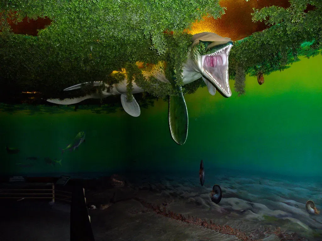
Calling this ocean “forgotten” does not mean it was boring. The Western Interior Seaway was a wildly alive, sometimes brutal, sometimes serene marine world. Its waters were often warm and relatively shallow, which is pretty much the ideal recipe for blooms of plankton, thriving reefs or reef-like communities, and a crowded food web stacked from microscopic algae all the way up to apex reptilian predators.
Imagine enormous mosasaurs cruising through the water like underwater Komodo dragons on steroids, long-necked plesiosaurs gliding beneath schools of fish, and giant sea turtles paddling slowly through murky depths. Above them, flying reptiles skimmed the waves, hunting fish and squid-like animals. The ocean floor hosted everything from clams and ammonites to burrowing worms, while clouds of tiny plankton in the water column quietly built the raw material that, millions of years later, would harden into chalk, limestone, and even help feed future oil and gas fields.
The Fossil Treasure Hidden in the Heartland
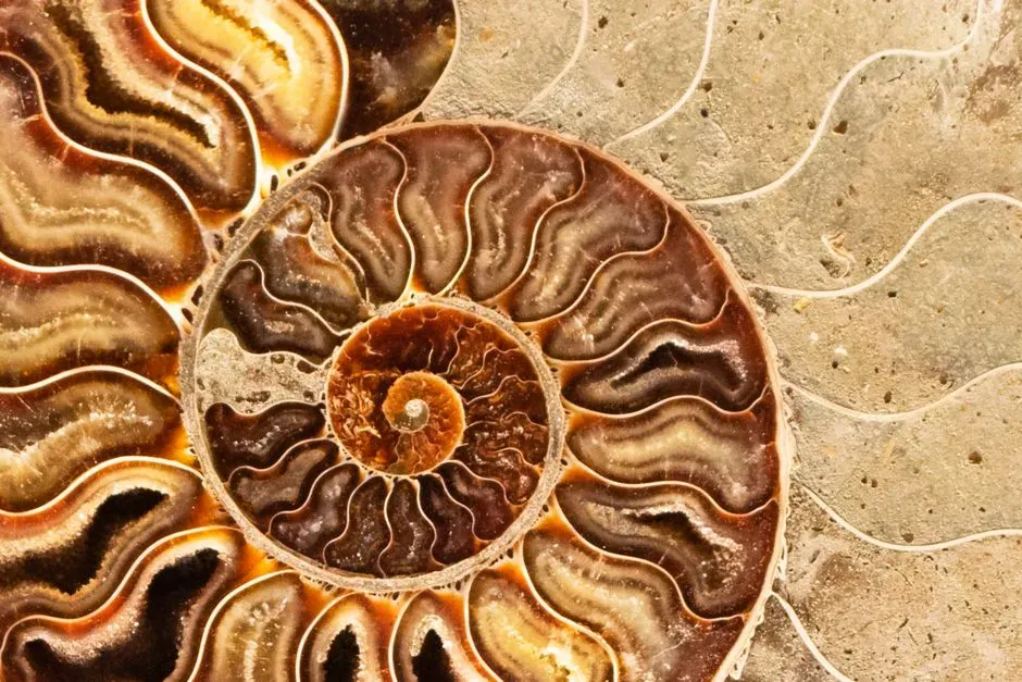
If this sounds like a fantasy setting, you only need to look at modern fossil sites to see how real it was. The flatlands and badlands of places like Kansas, South Dakota, Wyoming, and parts of Canada are loaded with marine fossils that feel completely out of place until you remember you are standing on top of a former sea. People have dug up complete mosasaur skeletons from what are now cow pastures, shark teeth from eroding cliffs, and delicate fish fossils preserved in fine marine sediments.
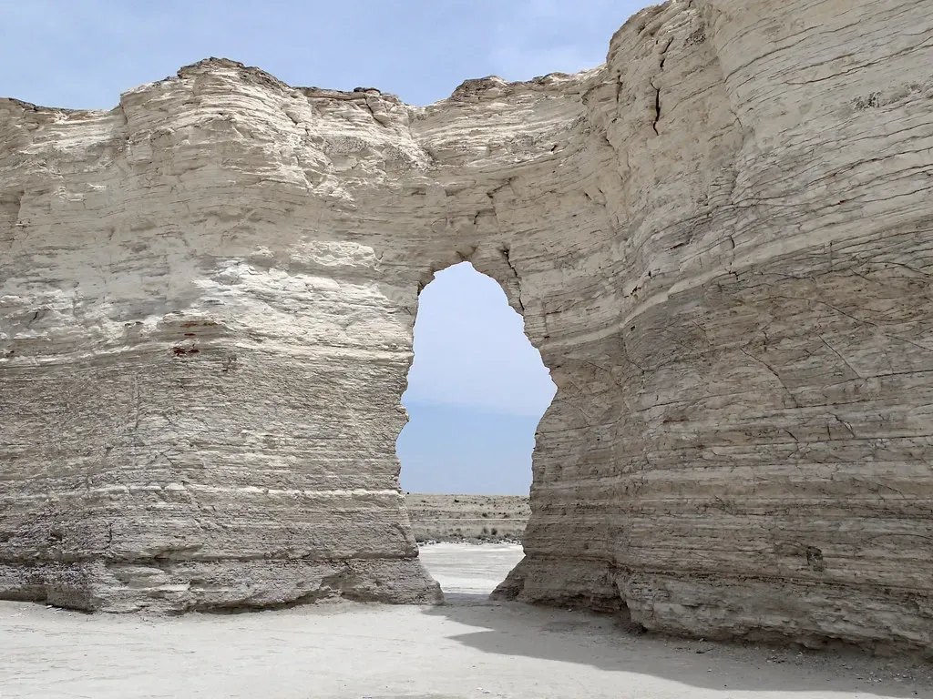
Some of the most striking rocks in the middle of the continent come directly from that ancient ocean. The bright white chalk of places like Kansas and parts of the Great Plains was built, grain by grain, from the microscopic shells of plankton that rained down on the seafloor. When you run your fingers across a chalk outcrop or see fossil-rich limestone used in old buildings, you are literally touching the compressed remains of that long-vanished sea and the tiny creatures that once drifted in its sunlit waters.
How a Giant Ocean Vanished Without a Trace
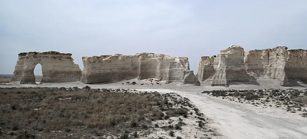
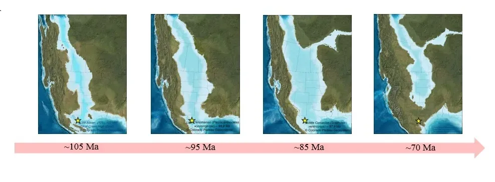
Geologically speaking, seas can appear and disappear the way lakes do in a drought, just on a much slower, grander scale. Over millions of years toward the end of the Cretaceous, global sea levels began to fall, and the tectonic forces that had pulled the interior downward shifted. The land started to rise relative to the oceans, and the once-deep basin of the Western Interior Seaway slowly shallowed and broke up into smaller, isolated bodies of water that finally drained or filled with sediment.
By the time the dinosaurs were wiped out around the end of the Cretaceous, much of the inland sea had already retreated, leaving behind broad coastal plains, rivers, and deltas where muddy seafloor had once been. Layer after layer of sand, silt, and mud buried the old marine sediments, locking away their fossils and reshaping the landscape into the high plains and rolling prairies we know today. The ocean did not vanish overnight with a dramatic crash; it faded away in slow motion, leaving only subtle clues and scattered fossils to tell its story.
This Ancient Ocean Still Shapes Our Climate, Resources, and Lives
Even though the water is long gone, the Western Interior Seaway quietly affects your life in ways you might not notice. Those thick stacks of marine sediments – rich in organic material and plankton remains – helped create some of the continent’s important oil and gas deposits. Groundwater aquifers, fertile agricultural soils, and certain mineral resources in the central interior all trace part of their origin back to that time when the region was a seabed instead of a breadbasket.
It also changes how we think about climate and sea level today. Knowing that half a continent once lay underwater under natural climate conditions reminds us that coastlines are not fixed or guaranteed. When scientists warn that rising seas can redraw maps, the Western Interior Seaway is proof that such redrawings are not theoretical – they have already happened in spectacular fashion. In a world now dealing with human-driven climate change, the story of this forgotten ocean is both a fascinating piece of deep history and a sobering preview of how fluid “land versus sea” can be.
Why This Forgotten Ocean Matters Now
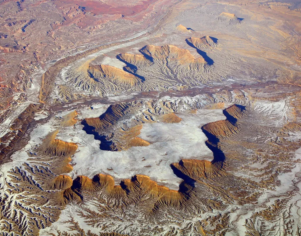
For me, the most unsettling and inspiring part of the Western Interior Seaway story is how it shrinks our sense of permanence. The idea that places I have driven through – flat Midwestern fields, quiet ranchland, dusty badlands – were once patrolled by marine reptiles and thick with plankton-filled waters forces a kind of humility. Our maps are just snapshots in time, not final drafts etched in stone.
In my view, we should talk about this ancient ocean more, not as a quirky trivia fact, but as a reminder that Earth has always been dynamic and will keep changing with or without our permission. It is comforting to imagine the world as stable, yet the Western Interior Seaway exposes that belief as wishful thinking and challenges us to plan for a future where coastlines move and climates shift. If half of North America could once disappear beneath the waves, what else about our world might be less permanent than we assume?