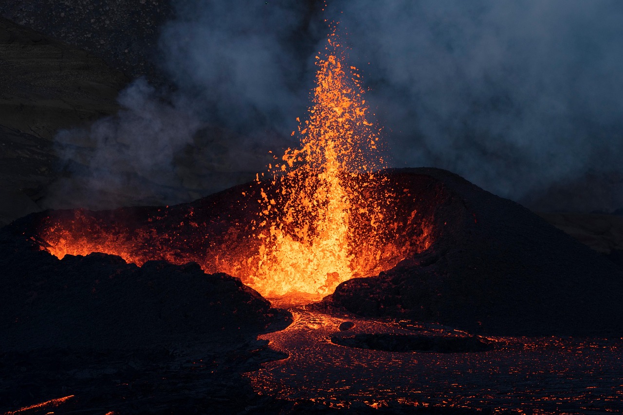
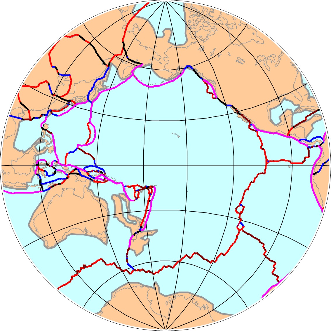
The Pacific Ocean covers nearly one-third of our planet’s surface, stretching endlessly from Asia to the Americas. Yet beneath these familiar blue waters lies a geological mystery that has captivated scientists for decades. You might think you know this ocean, but the truth is far stranger than fiction. Hidden beneath the waves are the ghostly remains of ancient worlds – massive tectonic plates and possibly entire continents that once dominated Earth’s surface millions of years ago.
Recent discoveries are rewriting what we thought we knew about our planet’s history. Using cutting-edge technology to peer deep into Earth’s interior, researchers have uncovered evidence of vanished landmasses and lost oceanic plates that tell an extraordinary story of our planet’s violent past. So let’s dive into this underwater world of geological detective work and uncover the secrets lurking beneath the Pacific.
The Ancient Ocean That Swallowed Continents
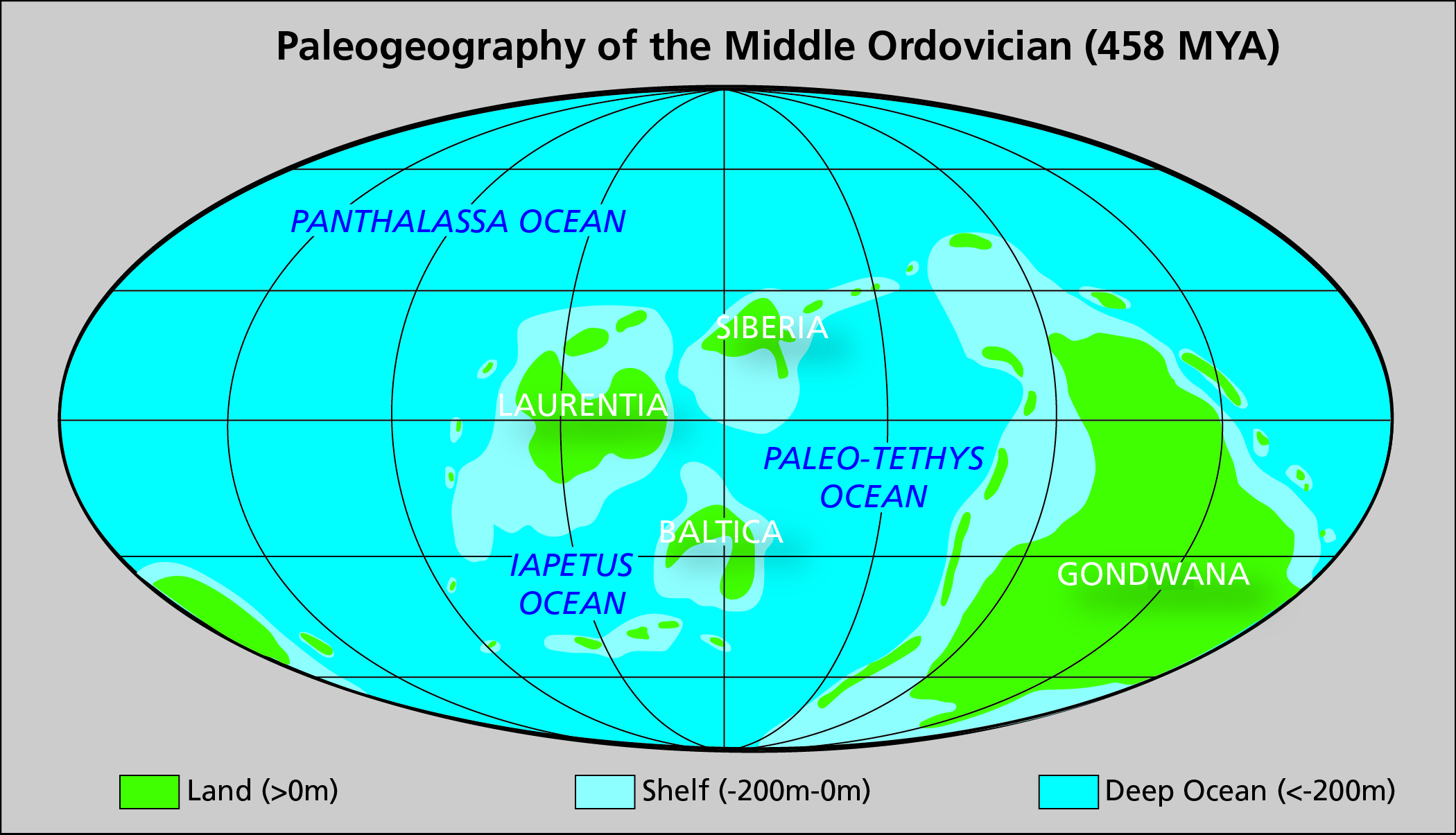
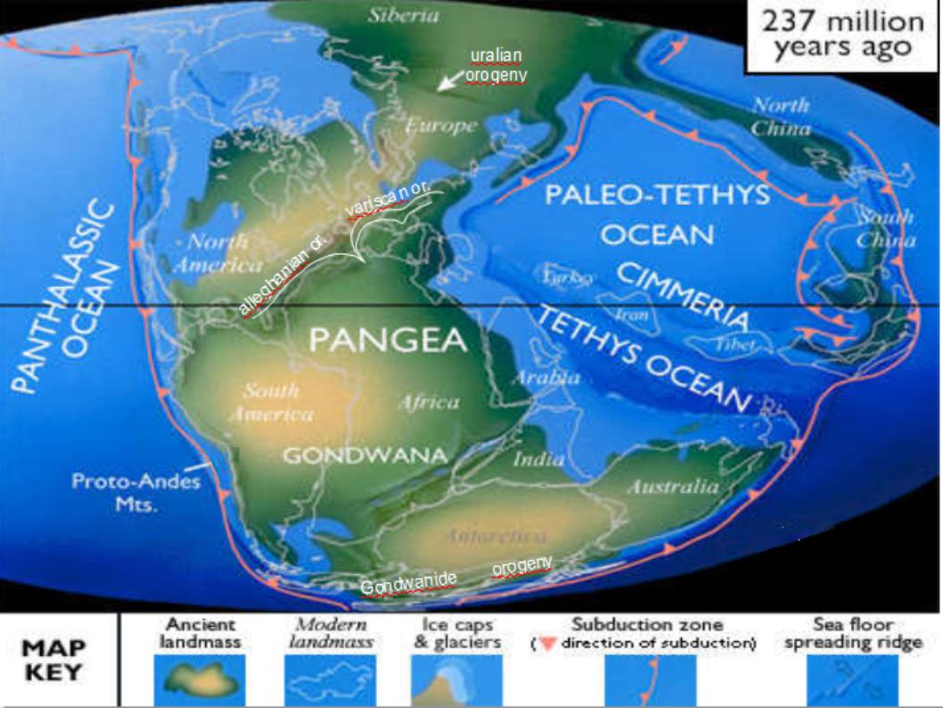
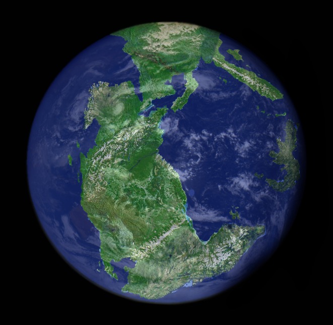
The Pacific Ocean as we know it today is actually the remnant of a much larger ancient ocean called Panthalassa, which surrounded the supercontinent Pangaea during Late Paleozoic and Early Mesozoic times. This vast water mass must have been underlain by multiple oceanic tectonic plates, comparable to the Pacific Ocean today. Think of Panthalassa as the Pacific’s enormous ancestor – an ocean so massive it covered nearly seventy percent of Earth’s surface around 250 million years ago.
Because the Panthalassa Ocean was completely surrounded by subduction zones, none of its plates was connected to a continent by an oceanic spreading record, and the majority of the plates have been lost to subduction. As a result, reconstructing Panthalassa’s plate tectonic evolution has proved to be a challenge. The ocean floor that once existed has vanished entirely, consumed by the relentless process of subduction where oceanic plates dive beneath continental margins and disappear into Earth’s interior.
Seismic Detective Work Reveals Hidden Slabs
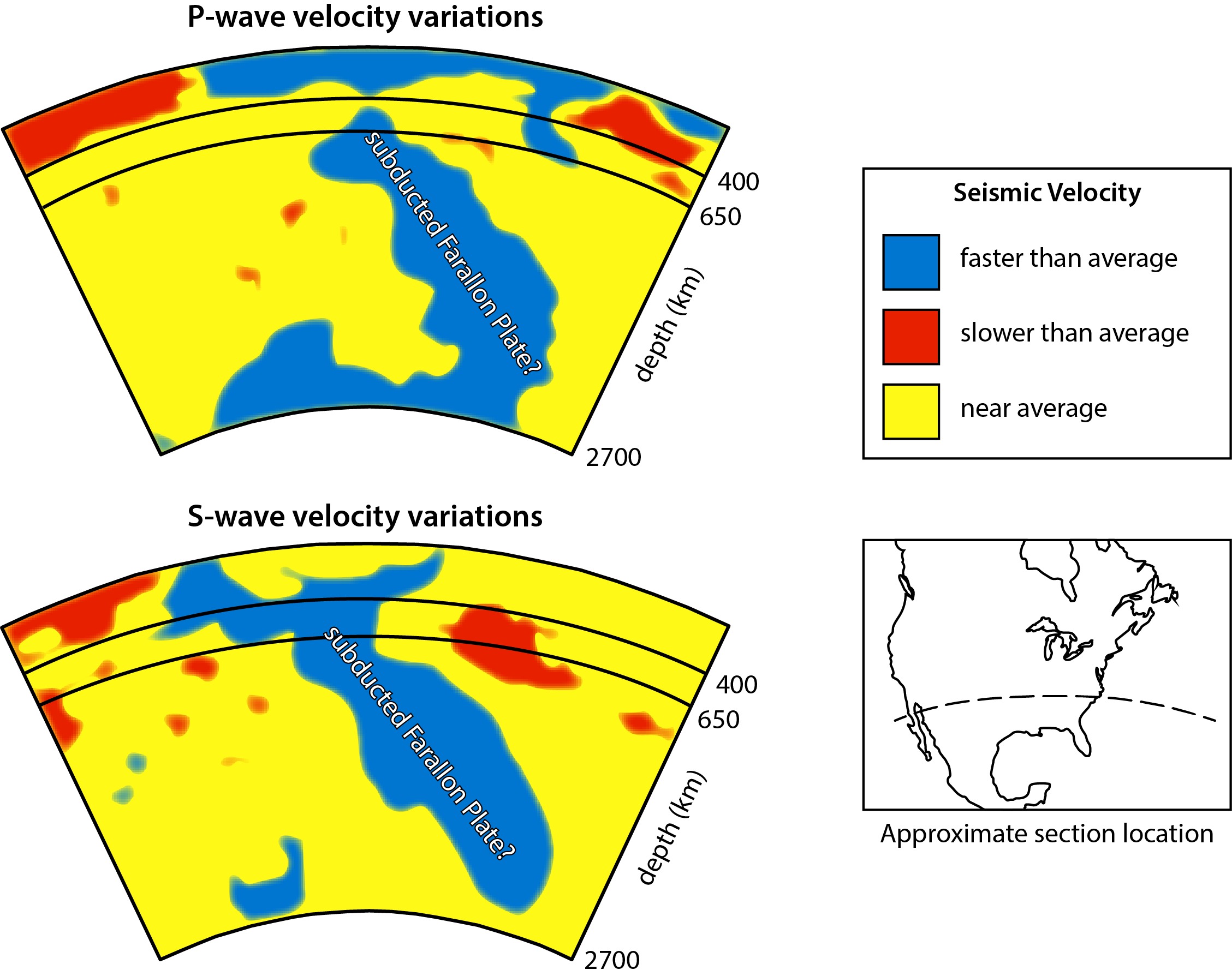
Modern scientists have become geological detectives, using seismic waves like X-rays to see deep inside our planet. Seismic tomography and seismic waveform analysis of deep mantle structure below the present Pacific Ocean show two major high-velocity anomaly zones that have been interpreted as remnants of slabs belonging to two large-scale intra-Panthalassa subduction systems that are oriented north-northwest–south-southeast. These “ghost slabs” are the preserved remains of ancient oceanic plates that once lay beneath Panthalassa.
A north–south trending belt of positive wave-speed anomalies under the central Pacific Ocean has been interpreted to represent a series of Triassic-Jurassic intra-oceanic subduction zones, called the Telkhinia subduction zones. These anomalies are detected in both the UUP07 model and S40RTS model in the lower mantle at depths greater than 1500 km. Three distinct intra-oceanic subduction zones were correlated to these anomalies. Scientists have named this ancient subduction system “Telkhinia,” after the Greek sea goddess, and it represents compelling evidence for vanished oceanic realms.
The Resurrection Plate Rises From the Dead
A new computer reconstruction of the tectonic plates of 60 million years ago reveals the existence of a lost plate called Resurrection. The plate, dubbed Resurrection, has long been controversial among geophysicists, as some believe it never existed. This aptly named tectonic plate represents one of the most dramatic recent discoveries in Pacific geology, literally brought back from the dead through advanced computer modeling.
Wu and his co-author used a computer model of Earth’s crust to “unfold” the movement of tectonic plates since the early Cenozoic, the geological era that began 66 million years ago. When ‘raised’ back to the Earth’s surface and reconstructed, the boundaries of this ancient Resurrection tectonic plate match well with the ancient volcanic belts in Washington State and Alaska. The evidence for Resurrection comes from matching ancient volcanic activity with reconstructed plate boundaries, creating a compelling case for this lost world beneath the Pacific.
Zealandia: The Submerged Eighth Continent
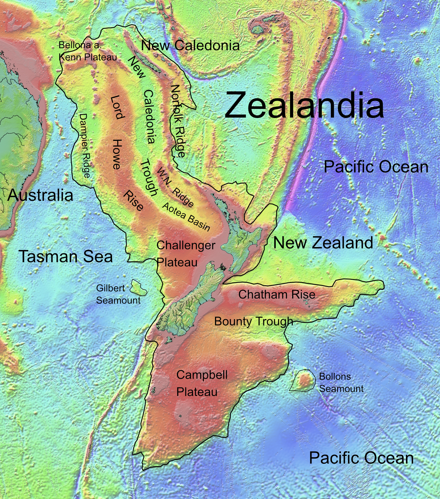
The evidence presented described 4.9 million square kilometres of the South West Pacific Ocean as underlain by a submerged continent, Zealandia. The paper also showed that Zealandia – like other continents – is large, relatively high, has thick crust, and contains rocks like granite and greywacke. Its continental crust thickness was measured as between 10km and 30km, and increasing to more than 40km under parts of the South Island. Zealandia challenges our very definition of what constitutes a continent.
In the case of this eighth continent, the thinning of the plate allowed the ocean to flood much of the territory, leaving only a few points visible, such as the islands that make up New Zealand. Initially, this land remained above sea level, but various tectonic changes caused its crust to thin and eventually sink underwater. Zealandia represents a fascinating example of how entire continents can become “lost” not through destruction, but simply by sinking below the waves.
The Pontus Mega-Plate Discovery
One of the most significant recent discoveries in plate tectonics is the confirmation of the Pontus plate, which once covered 15 million square miles – about a quarter of the Pacific Ocean. Scientists have discovered the long-lost Pontus tectonic plate, which once stretched across 15 million square miles. The Pontus plate represents perhaps the most massive of all the lost Pacific plates, covering an area larger than the entire North American continent.
The technique helped researchers confirm that Pontus was once part of a vast subduction system dividing the paleo-Pacific Ocean. This discovery came through seismic imaging techniques that can detect ancient plate fragments buried deep within Earth’s mantle, some dating back as far as 300 million years. The Pontus plate’s enormous size suggests that the ancient Pacific contained multiple continent-sized oceanic plates that have since vanished entirely.
Evidence From Volcanic Arcs and Fossil Trails
The former margins of the ocean contain allochthonous terranes with preserved Triassic–Jurassic intra-Panthalassic volcanic arcs, including Kolyma–Omolon (northeast Asia), Anadyr–Koryak (east Asia), Oku–Niikappu (Japan), and Wrangellia and Stikinia (western North America). Geological clues come from extinct intra-oceanic volcanic arcs that formed above ancient subduction zones, but have since been accreted to the North American and Asian continental margins. These volcanic remnants act like geological breadcrumbs, marking the former locations of vanished oceanic plates.
The Telkhinia slabs were correlated to exotic Triassic to Lower Cretaceous volcanic arcs now accreted in the far east Asian margin, currently incorporated in the Kolyma-Omolon and Andyr-Koryak arcs in Siberia, and the Oku-Niikappu arc in northern Japan. Scientists can trace these ancient volcanic chains like fossil footprints, revealing where long-lost oceanic plates once supported island arcs and underwater mountain ranges.
The Birth of the Modern Pacific
The geometry of the oldest marine magnetic anomalies of the Pacific Plate attests to a unique plate kinematic event that sparked the plate’s birth at virtually a point location, surrounded by the Izanagi, Farallon, and Phoenix Plates. The consequent plate boundary reorganization resulted in the formation of a stable triangular three-ridge system from which the nascent Pacific Plate expanded. We link the birth of the Pacific Plate to the regional termination of intra-Panthalassa subduction. The modern Pacific plate emerged from the death of its predecessors in a remarkable geological event.
This is a very unusual tectonic event because all other modern plates formed as a result of breakup of a predecessor by rifting and subsequent mid-ocean ridge formation within the continental or oceanic lithosphere. The Pacific plate’s birth represents something entirely unique in Earth’s geological history – a plate that originated virtually from a single point rather than from the splitting of existing landmasses.
Modern Technology Reveals Ancient Secrets
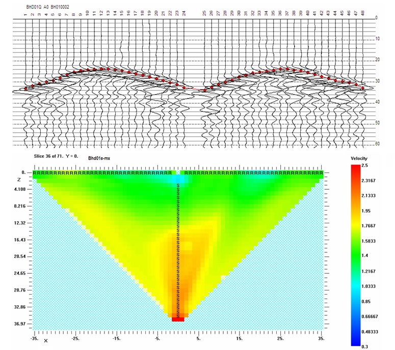
Tomographic images can track the subduction zones beneath Central America and Japan close to the core-mantle boundary, suggesting that a 670-km- deep transition between the upper and lower mantle is not an impenetrable barrier to mantle flow. These images also indicate that some subducted slabs have accumulated in slab graveyards. Modern seismic tomography allows scientists to peer nearly 3,000 kilometers into Earth’s interior, revealing ancient slabs preserved in the deepest layers of our planet.
The MTZ thickening beneath the Nazca Plate is unique because the proposed ancient subducted slab has been well preserved since the late Mesozoic and has direct interaction with the Pacific LLSVP in the lower mantle. The inferred Triassic-Jurassic SPS reconciles the observations of the anomalous MTZ thickening and seismic tomography. These preserved slabs continue to influence Earth’s interior dynamics hundreds of millions of years after their original subduction, creating a permanent geological record of vanished worlds.
Conclusion
The Pacific Ocean conceals one of Earth’s most extraordinary geological stories – a tale of vanished continents, lost mega-plates, and ancient oceanic realms that once dominated our planet’s surface. Through the power of modern seismic tomography and computer modeling, scientists have resurrected these lost worlds from the depths of Earth’s mantle, revealing that our familiar Pacific is merely the latest chapter in a much longer story.
From the massive Pontus plate that once covered a quarter of the ancient Pacific, to the submerged continent of Zealandia still lurking beneath New Zealand, these discoveries fundamentally challenge how we understand our planet’s history. The evidence suggests that Earth’s surface has been far more dynamic and changeable than previously imagined, with entire oceanic plates and possibly continents appearing and disappearing over geological time.
What fascinates you more – the idea that vast continents can simply sink beneath the waves, or that we’re only now discovering these lost worlds through technology that lets us see thousands of kilometers into Earth’s interior?