Our planet is, among other things, a masterful storyteller. Every cliff face, every canyon wall, every ancient stretch of eroded rock is a page in a story that started roughly 4.6 billion years ago. These stories don’t come with captions or narration. You have to read them in layers, in minerals, in fossilized creatures that lived and died long before anything resembling a human walked the Earth.
Some of these geological formations are so dramatic they take your breath away at first glance. Others look unassuming, almost ordinary, until you learn what’s actually locked inside their ancient stones. Either way, they all have something in common: they have preserved time itself. Let’s dive into eleven of the most iconic formations on Earth that give us a front-row seat to our planet’s deep and extraordinary past.
1. The Grand Canyon, USA: Earth’s Greatest Geological Textbook

Honestly, it’s hard to know where to begin with the Grand Canyon. You’ve probably seen the photos, maybe even visited it, but standing at that rim still doesn’t fully prepare you for what you’re actually looking at. The Grand Canyon exposed nearly two billion years of Earth’s history in a single spectacular view, making it one of the most studied geological formations on the planet. Think about that. Nearly two billion years, visible in one glance.
The Grand Canyon extends more than 400 kilometers, from Lake Powell to Lake Mead, and it cuts 2 kilometers into the crust, revealing 1.7 billion years of Earth’s geological history. The oldest of these rocks are nearly 2 billion years old, which means that in this one relatively small sliver of canyon, rocks representing roughly 40% of Earth’s history are exposed to human examination. That’s not a geological wonder. That’s a miracle.
The oldest rocks in the Grand Canyon, found at the bottom of the canyon, are primarily metamorphic, with igneous intrusions. The intrusive igneous rocks here are called Zoroaster granite. The name given to this rock set is Vishnu Basement Rocks. And here’s a wild detail worth knowing: the Colorado River started carving into the rocks of the Grand Canyon only 5 to 6 million years ago, which, in geological terms, is extraordinarily recent.
The theory that water erosion formed the Grand Canyon forced geologists and literate members of society into mind-bending speculations about the age of the Earth. A water-carved Grand Canyon would have required millions of years of slow, steady erosion. This intellectual revolution didn’t just change geology. It changed how humans understood time itself.
2. The Burgess Shale, Canada: A Snapshot of the Cambrian Explosion
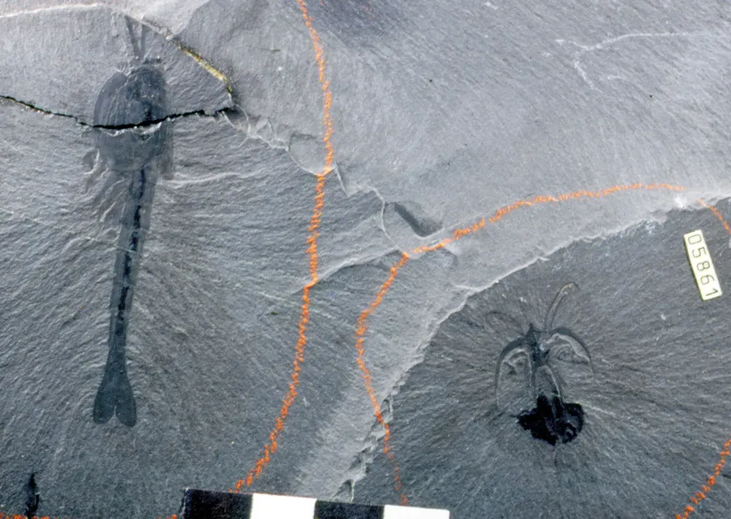
High in the Canadian Rockies of British Columbia lies a fossil site so important that geologists consider it one of the most significant discoveries in the history of paleontology. The Burgess Shale preserves soft-bodied organisms from 508 million years ago with extraordinary detail, including creatures that look like nothing alive today. Most fossil sites only preserve hard shells or bones. The Burgess Shale preserved everything, including the soft, squishy parts of ancient life that almost never survive.
About 500 million years ago was an evolutionary “big bang” called the Cambrian Explosion. Until that time globally there was pretty much only simple, unicellular life and some complex animals but without mineralized skeletal remains. Thus the Cambrian Explosion marks an important experimental evolution event in Earth’s history with the appearance of hard-shell creatures. During this time the Burgess Shale was underwater when a submarine cliff catastrophically failed and buried the creatures instantly, leading to their preservation we see today. It’s a grim fate for those creatures, but a remarkable gift for science.
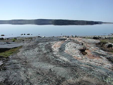
3. Acasta Gneiss, Canada: The Oldest Exposed Rock on Earth
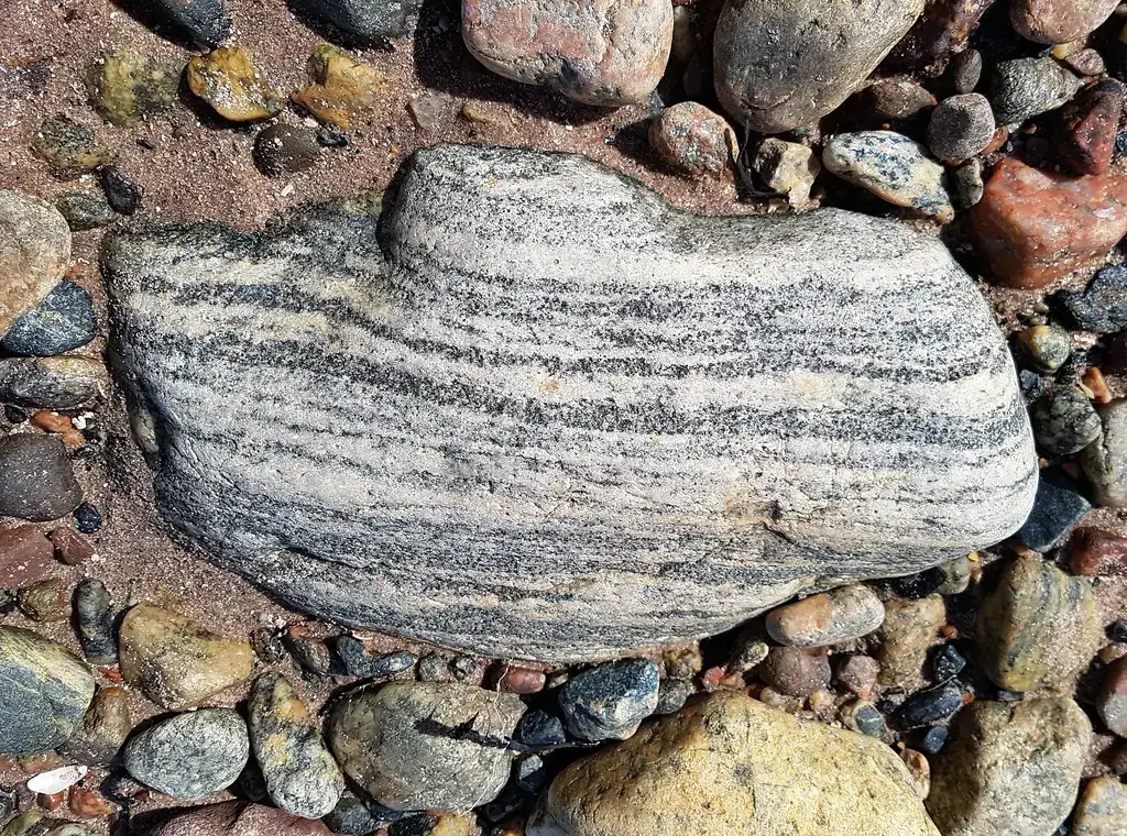
If you want to touch something almost as old as the planet itself, you’d need to travel to Canada’s Northwest Territories. The Acasta Gneiss, located in Canada’s Northwest Territories, formed during Earth’s earliest geological period, the Hadean eon. These ancient rocks originated as igneous formations that underwent intense metamorphic processes, transforming them into the banded gneiss we see today. What you’re looking at is not just old rock. It’s a relic of a planet that was still figuring itself out.
Scientists have dated these rocks using uranium-lead radiometric dating of zircon crystals found within the formation. Through this precise dating method, researchers determined that the Acasta Gneiss is approximately 4.03 billion years old, making it the oldest known exposed rock formation on Earth. The zircon crystals within these rocks have remained remarkably stable over billions of years, preserving crucial information about Earth’s early history. The formation’s composition suggests it originally formed as tonalite, a granite-like igneous rock, before being metamorphosed under extreme pressure and temperature conditions.
4. The Giant’s Causeway, Northern Ireland: Basalt Columns Born of Fire
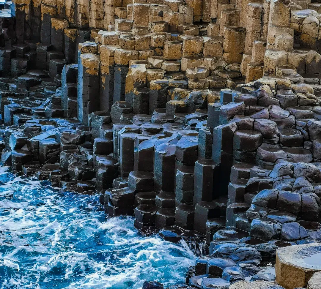
There’s a reason people travel from all over the world to walk across these strange, hexagonal stepping stones at the northeastern coast of Northern Ireland. Over 40,000 basalt hexagonal columns make up the Giant’s Causeway on the northeast coast of Northern Ireland. Their unique shapes make this one of the most interesting geological sites in Europe. The columns formed via hot, mafic volcanic rock cooling and contracting into hexagonal columns. It’s the kind of natural precision that makes you feel like someone planned it.
The Giant’s Causeway is a UNESCO World Heritage site renowned for its unique hexagonal basalt columns that form a series of stepping stones leading into the sea. The formation was created by volcanic activity over 50 million years ago and has since become one of the most iconic natural landmarks in Ireland. This formation helped geologists understand volcanic processes and provided early evidence for the theory of continental drift, as similar formations exist on the Scottish coast across the ancient rift valley. Let’s be real: few geological sites blend scientific importance with sheer visual drama quite like this one.
5. The Jurassic Coast, England: 185 Million Years in a Single Shoreline
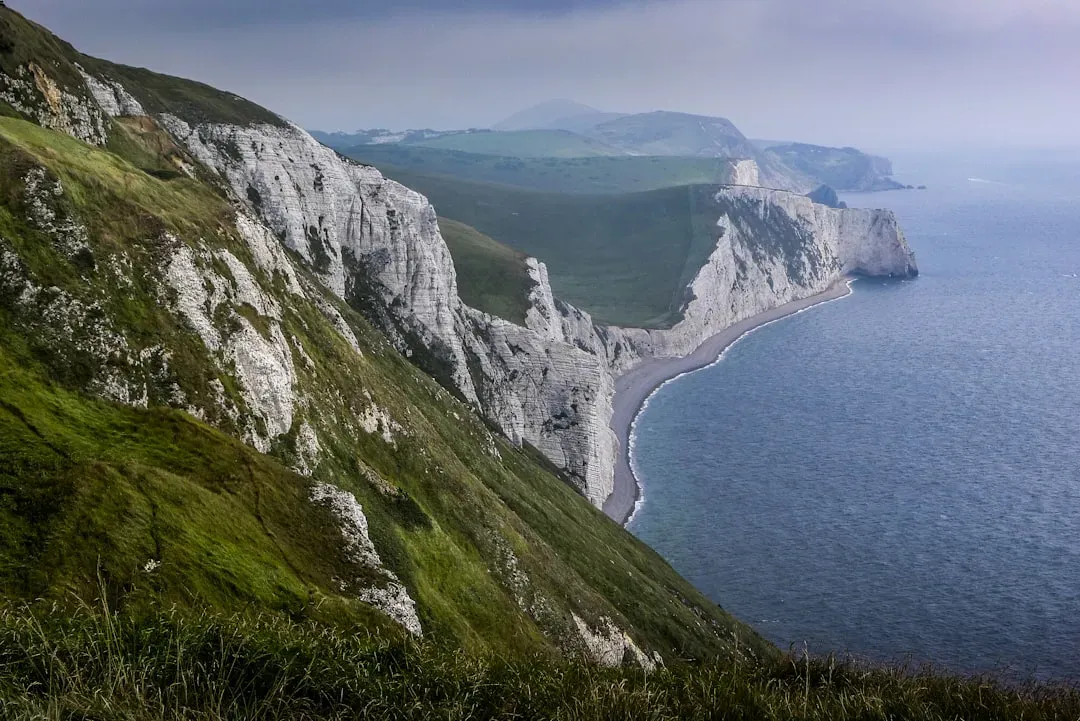
Stretching along the coastline of Dorset and East Devon in southern England, the Jurassic Coast is one of the most fascinating geological strips of land on the planet. The Jurassic Coast along southern UK’s Dorset and East Devon coastlines is named appropriately. This coastline is special because it is a continuous preservation of Earth’s history from 250 to 65 million years ago, known as the Triassic, Jurassic and Cretaceous periods. During this time the coast changed a lot, going from a desert, to a tropical sea, to a coastal forest and swamp, and to a shallow sea.
There are many fossils scattered along the coastline and in the cliffs. The most common type of fossil here is marine, including famous pyrite “fool’s gold” ammonites, belemnites, and even bones of large sea-dwelling marine reptiles like the Ichthyosaurs. These crumbling coastal cliffs have yielded some of the most important marine reptile fossils ever discovered, including the first scientifically described ichthyosaur and plesiosaur specimens. The Jurassic marine sediments preserve a complete ecosystem from 200 million years ago, showing how large marine reptiles dominated ancient oceans. It’s basically an open-air museum, except the exhibits have been sitting there for hundreds of millions of years.
6. Uluru, Australia: A Half-Billion-Year-Old Sentinel of the Outback
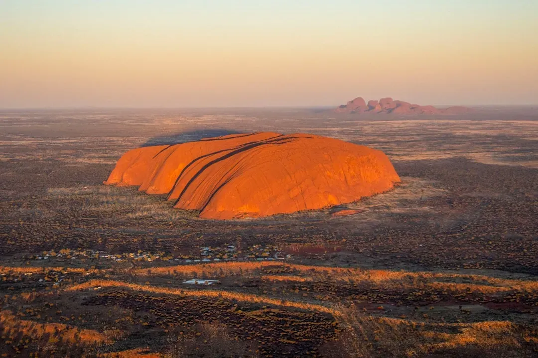
There is arguably no rock on Earth as recognized, as culturally profound, or as geologically fascinating as Uluru. Uluru is a roughly 550 million year old isolated rock of arkosic sandstone. It has actually been tilted on its side by 90° since its formation way back when. That detail alone is astonishing. What you’re looking at is essentially a massive vertical slab of sandstone whose original horizontal layers are now standing upright.
Uluru is really a huge rock that continues for possibly 5 to 6 km below the surface, sort of like an iceberg. You can see the sub-vertical layers and ribs that have been accentuated by years and years of erosion in the Aussie outback. The part you see above ground is just the tip. What lies beneath is a geological structure so immense it dwarfs what your eyes perceive, which is a wonderful metaphor for most of what geology teaches us.
7. The Vredefort Dome, South Africa: Earth’s Largest Known Impact Structure
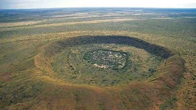
Here’s a formation that will genuinely stop you in your tracks if you think too hard about what created it. About two billion years ago, an impactor hurtled toward Earth, crashing into the planet in an area near present-day Johannesburg, South Africa. The impactor, most likely an asteroid, formed what is today the biggest crater on our planet. What remains today, after billions of years of erosion, is still staggeringly large.
The remaining structure, the “Vredefort Dome”, consists of a partial ring of hills 70 km in diameter, and is the remains of the central uplift created by the rebound of rock below the impact site after the collision. Estimates have placed the structure’s age to be 2.023 billion years old, which places it in the Orosirian Period of the Paleoproterozoic Era. Rocks spanning roughly 1.4 billion years of Earth history, from a granite-greenstone Archean Basement Complex to a near-continuous record of Neoarchean to Paleoproterozoic sedimentation and volcanism, provide an exceptional record of early crustal evolution. In 2005, the Vredefort Dome was added to the list of UNESCO World Heritage Sites for its geologic interest.
8. The Deccan Traps, India: Where Volcanoes May Have Helped End an Era
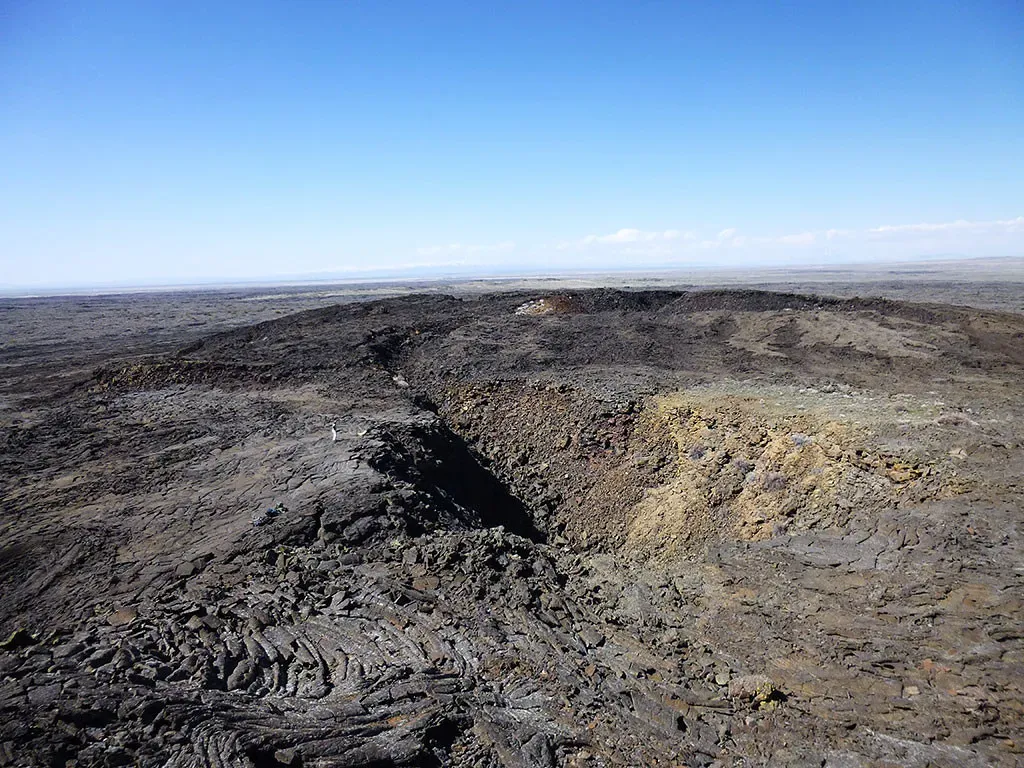
India holds one of the most geologically dramatic regions on Earth, and it’s not the Himalayas. It’s the Deccan Traps, a vast plateau of layered lava flows that covers much of west-central India. The Deccan Traps are one of the largest volcanic provinces in the world. They consist of a composite thickness of more than 6,500 feet of flat-lying basalt lava flows and cover an area of nearly 200,000 square miles. That’s roughly the size of a major European country, covered entirely in ancient lava.
The Deccan Traps began forming 66.25 million years ago, at the end of the Cretaceous period. The bulk of the volcanic eruption occurred at the Western Ghats between 66 and 65 million years ago when lava began to extrude in fissure eruptions. This timing places the Deccan Traps right at the boundary of the mass extinction event that wiped out the non-avian dinosaurs. The Deccan Traps is of great importance in volcanology, igneous petrology, geochemistry, geochronology, planetary geology, geophysics, and geodynamics. Geologists are still debating its exact role in that extinction, and I think that uncertainty makes this formation even more compelling.
9. The Chicxulub Crater, Mexico: Ground Zero for the Dinosaur Extinction
Buried beneath the Gulf of Mexico and the Yucatán Peninsula lies a scar from the most consequential single event in the last 100 million years of Earth’s history. It was formed slightly over 66 million years ago when an asteroid, about ten kilometers in diameter, struck Earth. The crater is estimated to be 200 kilometers in diameter and is buried to a depth of about 1 kilometer beneath younger sedimentary rocks. You can’t see it with the naked eye. You have to look at gravity maps and drill cores to appreciate what happened here.
This impact is thought to be responsible for the Cretaceous-Paleogene extinction event. It also caused a number of damaging effects globally and locally, such as greenhouse heating, widespread forest fires, acid rain, and destruction of the ozone layer. Fossil evidence for an instantaneous extinction of diverse animals was found in a soil layer only 10 centimeters thick in New Jersey, 2,500 kilometers away from the impact site, indicating that death and burial under debris occurred suddenly and quickly over wide distances on nearby land. The thinness of that layer is almost incomprehensible given what it represents.
10. Nuvvuagittuq Greenstone Belt, Quebec: A Window Into Earth’s Infancy
If the Acasta Gneiss gave you chills, wait until you hear about the Nuvvuagittuq Greenstone Belt in northern Quebec. The Nuvvuagittuq Greenstone Belt in Quebec harbors rocks potentially as old as 4.28 billion years, though their exact age remains debated among geologists. That places it potentially close to the very beginning of what we can call solid Earth. It’s hard to fully comprehend that kind of age.
The oldest known rocks, the faux amphibolites of the Nuvvuagittuq Greenstone Belt in Quebec, Canada, have an isotopic age of 4.28 billion years. There is in effect a stretch of approximately 300 million years for which no geologic record for rocks exists, and the evolution of this pregeologic period of time is the subject of much speculation. These ancient formations do more than mark time. They reveal the conditions present during Earth’s infancy, from the composition of early atmospheres to the emergence of the first continents. It’s hard to say for sure just how much more these rocks will reveal as dating techniques continue to improve, but the potential is extraordinary.
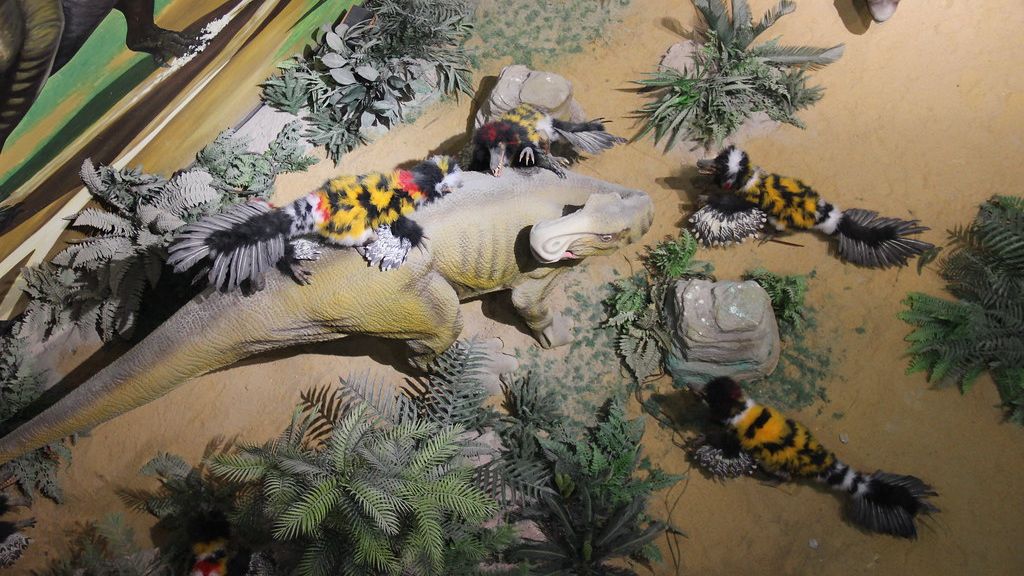
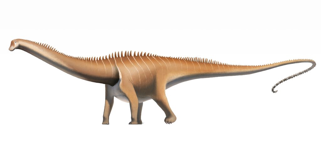
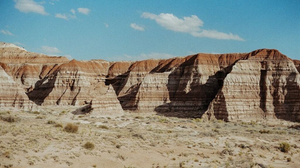
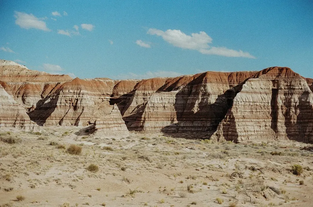
11. The Hell Creek Formation, USA: The Last Days of the Dinosaurs in Stone
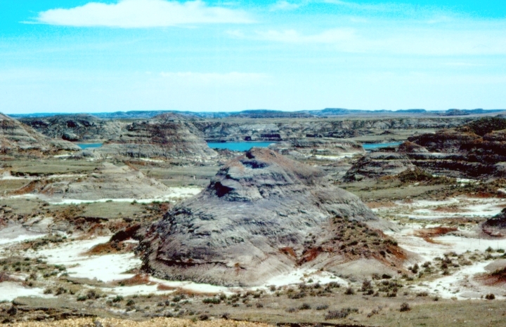
Stretching across parts of Montana, North Dakota, South Dakota, and Wyoming, the Hell Creek Formation is one of the most scientifically important rock sequences in North America. Famous formations from North America include the rich marine fossils of Kansas’s Smoky Hill Chalk Member and the terrestrial fauna of the late Cretaceous Hell Creek Formation. Within the Hell Creek’s sedimentary layers lies a record of the final chapter of the age of dinosaurs, preserved in remarkable detail.
Field research from the Hell Creek Formation in North Dakota published in 2019 shows the simultaneous mass extinction of myriad species, combined with geological and atmospheric features that are consistent with the impact event. The colorful sandstone layers preserve a detailed record of conditions during the Jurassic period, including some of the most important dinosaur trackways ever discovered. The cross-bedded sandstone formations reveal ancient sand dune patterns and wind directions from 200 million years ago. These cliffs also contain early mammal fossils that help scientists understand how small creatures survived alongside the dinosaurs. The Hell Creek Formation is essentially a timeline of life on Earth just before everything changed forever.
Conclusion: The Earth Never Stops Telling Its Story
Every single one of these formations is, in its own way, a time machine. You don’t need a laboratory or a physics degree to appreciate what they represent. You just need to stand in front of them, or even read about them, and let the scale of geological time sink in slowly.
From the ancient gneisses of Canada to the catastrophic crater buried beneath Mexico’s Yucatán, our planet has been recording its own history with stubborn precision for billions of years. Ultimately, geologists rely upon the preserved clues of ancient geologic processes to understand Earth’s history. Because younger environments retain more evidence than older environments, Earth’s recent history is better known than its ancient past. Although preserved geologic clues are indeed fragmented, geologists have become increasingly skilled at interpreting them and constructing ever more detailed pictures of Earth’s past.
There is something deeply humbling about standing near a rock that is older than multicellular life itself. It makes every human concern feel, if only for a moment, a little smaller than it seemed. What would it mean to you to look at a cliff face and realize you’re staring at time itself? Tell us in the comments.