You hear about the Grand Canyon, Yellowstone, and Yosemite all the time. They’re spectacular, no doubt, but they’re also crowded, photographed to death, and often feel more like outdoor theme parks than wild frontiers. If you’ve ever stood shoulder-to-shoulder at a scenic overlook and thought, there has to be more than this, you’re absolutely right. Across the United States, there are ancient landscapes so old they predate the Rockies, and wilderness so quiet you can hear your own heartbeat.
In this guide, you’re not chasing postcard views; you’re walking into deep time. You’ll step over rocks billions of years old, wander through badlands that were once subtropical swamps, and drift across dark waters where glaciers once carved the earth. Some of these places require effort and a bit of grit to reach, but that’s the point: they’ve stayed relatively untouched precisely because they are not easy. If you’ve been craving wildness that still feels raw, unpolished, and deeply rooted in Earth’s history, these twelve hidden wonders are where you start.
Bisti/De-Na-Zin Wilderness, New Mexico: Walking Through a Fossilized Dreamscape
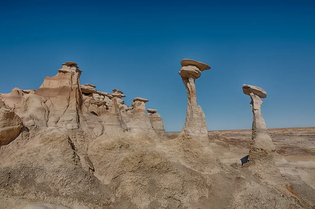
Imagine stepping into a landscape that looks like another planet, then realizing you’re actually walking across the remains of an ancient river delta at the edge of a vanished inland sea. In the Bisti/De-Na-Zin Wilderness of northwestern New Mexico, that’s exactly what you’re doing. Here, layered beds of sandstone, mudstone, shale, and coal were laid down roughly seventy million years ago, then slowly sculpted into hoodoos, spires, and strange stone mushrooms by wind and water over eons. When you wander here at dawn or dusk, the colors – soft grays, rust reds, pale yellows – glow as if the land itself remembers the sea that once covered it.
You don’t get boardwalks or marked trails in Bisti; you get open badlands and a map (and ideally, a GPS track) plus your sense of direction. That’s what keeps this place relatively wild and quiet despite its growing reputation. As you roam, you may stumble upon scattered petrified wood, eroded ridges that crumble underfoot, and silent basins where fossils of early Paleocene mammals have been discovered. You’re not just taking a hike; you’re threading your way through the transition from the age of dinosaurs to the age of mammals, with no crowds to break the spell – only wind, sky, and the crunch of ancient sediment beneath your boots.
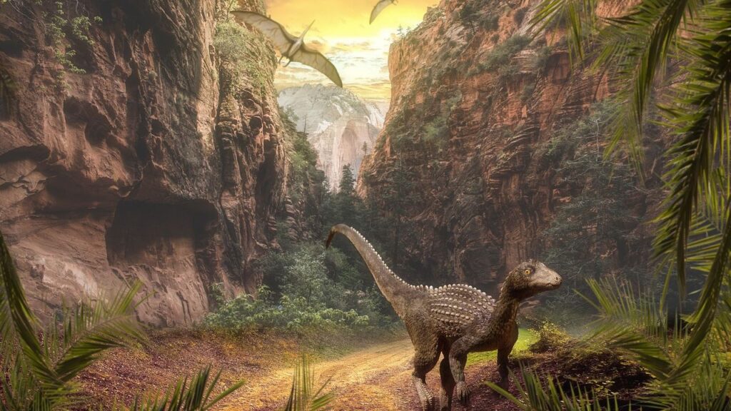
Petrified Forest National Park, Arizona: Forests Turned to Stone Under Open Sky
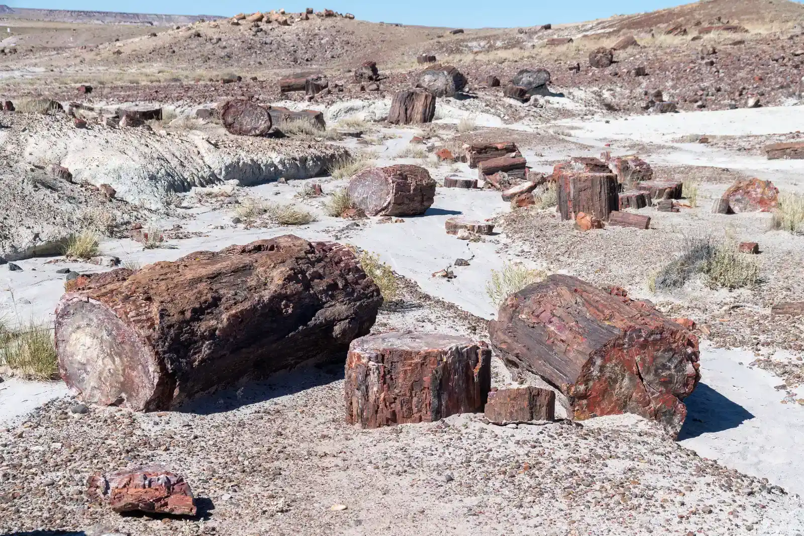
When you first hear the name “Petrified Forest,” you might picture a few rock-like logs behind a fence. The reality is much wilder and much older. In northeastern Arizona, Petrified Forest National Park preserves the remains of a vast Late Triassic ecosystem, more than two hundred million years in the making. Back then, this region was a humid lowland crossed by rivers and choked with giant conifers, ferns, and early reptiles. Over time, fallen trees were buried in sediment, infused with silica-rich water, and slowly transformed into quartz, preserving their structure in jeweled stone.
Today, you can wander among entire hillsides strewn with rainbow-colored logs, where shades of purple, red, orange, and blue glow under a big, empty sky. Beyond the famous petrified wood, the park protects expansive designated wilderness with some of the cleanest air in the country, rugged badlands of the Chinle Formation, and more than a thousand recorded Indigenous sites. When you leave the paved overlooks and head into the backcountry, you feel how remote this landscape really is: no trees to hide behind, no easy water, and no modern noise. It’s just you, the wind, and a stone forest quietly outlasting everything you know.
Bisti’s Cousin in Deep Time: Badlands Wilderness, South Dakota
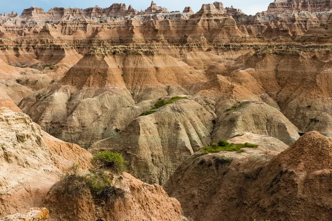
If you picture the Great Plains as flat and predictable, the Badlands Wilderness inside Badlands National Park will shock you. Here, ancient seafloor sediments and river deposits from tens of millions of years ago have been carved into jagged ridges, delicate pinnacles, and steep ravines. Layer upon layer of clay-rich rock tells a story of vanished seas, subtropical floodplains, and the early mammals that replaced the dinosaurs. You’re not just looking at scenery; you’re staring straight into one of Earth’s strangest geological scrapbooks.
The wilderness section of the park strips away the usual comforts: no handrails, no designated viewpoints – just open country where bison roam and storms roll in without warning. When you shoulder a pack and hike off-trail, you step into one of the most ecologically intact remnants of mixed-grass prairie left in the country, framed by those eroding formations. Fossils of ancient horses, rhinos, and other mammals have emerged from these soft layers, reminding you that deep time is still being uncovered here, bit by bit, every time rain cuts a fresh gully in the clay.
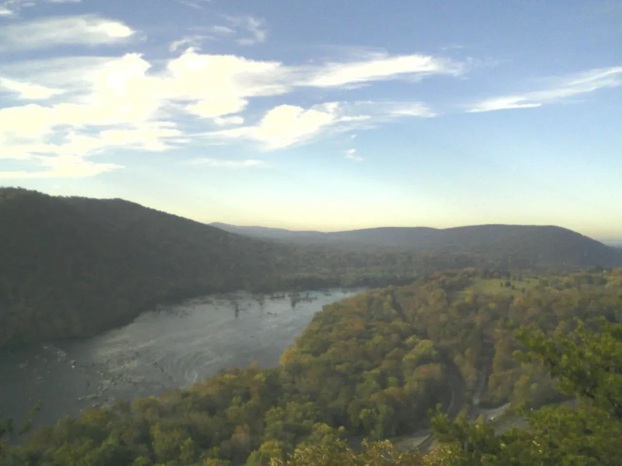
Voyageurs and the Ancient Shield, Minnesota: Canoeing on Billion-Year-Old Stone
In northern Minnesota’s lake country, you paddle across water so still it feels like glass, yet beneath you lies rock nearly as old as the planet itself. Voyageurs National Park sits on the southern edge of the Canadian Shield, where some of the oldest exposed rocks in North America, and even older rocks just south of the park, clock in at over three and a half billion years. When your canoe slips along a granite shoreline, you’re moving over crust that has survived continents colliding, mountains rising and eroding, and entire oceans opening and closing.
What makes this landscape feel untouched is not its drama but its quiet persistence. There are no soaring peaks here, just low, forested ridges and labyrinths of interconnected lakes and bays. Once you leave the main boat routes, you can tuck into hidden coves, camp on rocky points, and listen as loons call across water that once lay under miles of ice. With no roads cutting through the backcountry and access mostly by boat, you feel how the combination of age and remoteness has kept this place wild. You are, in a very real sense, drifting across the bones of an ancient Earth.
Birkhead Mountains Wilderness, North Carolina: Among Some of North America’s Oldest Hills
Central North Carolina is not where you’d expect to find some of the continent’s oldest mountains, yet that is exactly what you walk across in the Birkhead Mountains Wilderness. These low, forested ridges are part of the Uwharrie Mountains, a deeply eroded remnant of a once much higher range that formed hundreds of millions of years ago. Over unimaginable spans of time, weather and erosion planed those peaks down to the modest, rounded hills you see today. When you hike here, you are tracing the soft afterimage of mountains that rivaled the great ranges of their time.
The wilderness itself is small by Western standards, just a few thousand acres, but it feels surprisingly secluded. Trails twist through oak and pine forest, cross rocky streams, and occasionally give you glimpses of old stone outcrops that hint at the age beneath the soil. Long before European settlers arrived, Indigenous peoples hunted, traveled, and lived among these hills, leaving a legacy that rarely makes it onto trail signs. As you pick your way along narrow paths, you might be surprised by how wild it feels, given its location in the more densely populated East – proof that ancientness is not always about size, but about continuity.
Arbuckle Mountains, Oklahoma: Ancient Range Hiding in Plain Sight
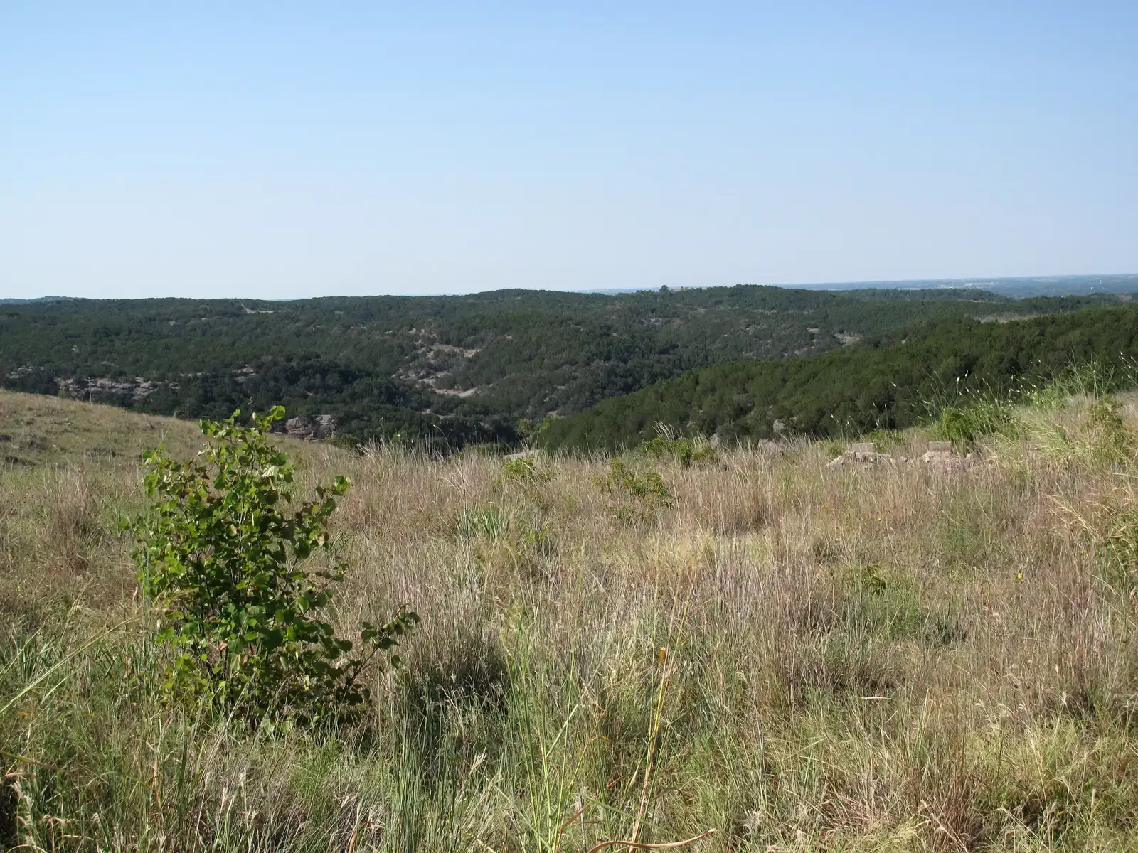
Driving along Interstate 35 in south-central Oklahoma, you might not even realize you are cutting straight through one of America’s most ancient mountain ranges. The Arbuckle Mountains, spread across roughly a thousand square miles, are among the oldest known formations between the Appalachians and the Rockies. Geologists trace their roots back hundreds of millions of years to intense tectonic upheaval, followed by relentless erosion that carved down the once-mighty peaks into today’s rugged hills and canyons.
When you leave the highway and step into the back roads, you start to see the age written in the rock: folded and tilted layers, massive limestone and dolomite cliffs, and springs that emerge from deep within ancient strata. You can explore short canyons, swim in clear, spring-fed streams, and climb to viewpoints that reveal the complex structure beneath the green. It’s not a designated wilderness in the federal sense, so you’ll find towns and development nearby, but many corners still feel remarkably raw. Here, you see how an ancient landscape can survive inside a modern corridor and still whisper its story if you’re paying attention.
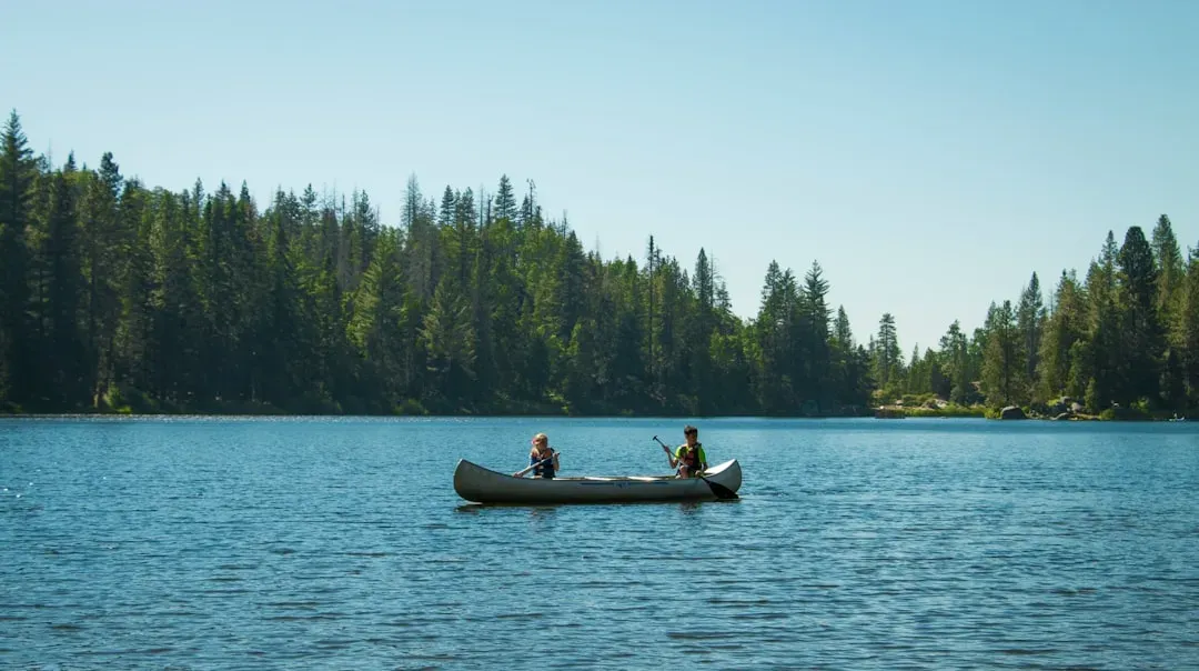
Boundary Waters and the Shield Country, Minnesota: Silence Over Glacially-Carved Wilds
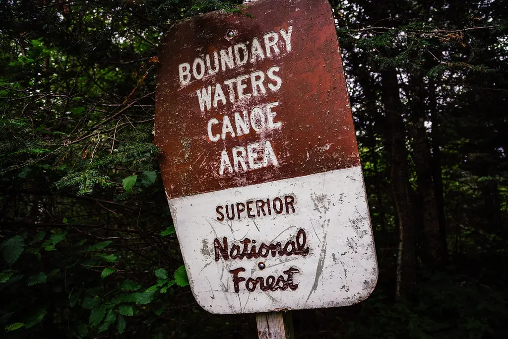
If you crave a place where roads, cell signals, and engines mostly disappear, the Boundary Waters Canoe Area Wilderness delivers in a way few places in the lower forty-eight can. Sprawling across northern Minnesota along the Canadian border, this protected wilderness preserves an astonishing mosaic of lakes, rivers, and boreal forest draped over very old rock of the Canadian Shield. You travel here by paddle and portage, tracing routes that Indigenous peoples used long before the modern borders were drawn.
The sense of untouched age comes from two timelines layered together: the billion-year-old bedrock and the more recent, but still ancient-feeling, imprints of the last Ice Age. Glaciers scoured this landscape, carving basins that filled with water and leaving behind smoothed ridges and erratic boulders. When you camp on a rocky point under tall pines and watch northern lights flicker over the water, it feels like very little has changed in thousands of years. You’re not just visiting a park; you’re sinking into a slow, patient rhythm that modern life rarely allows.
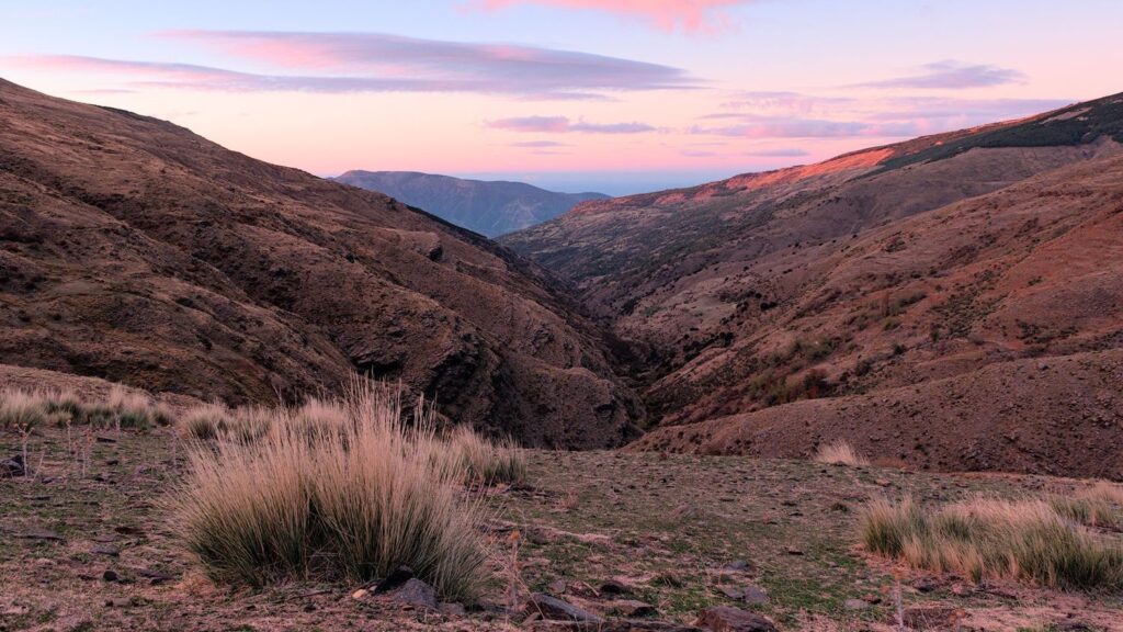
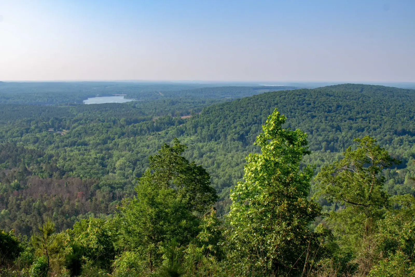
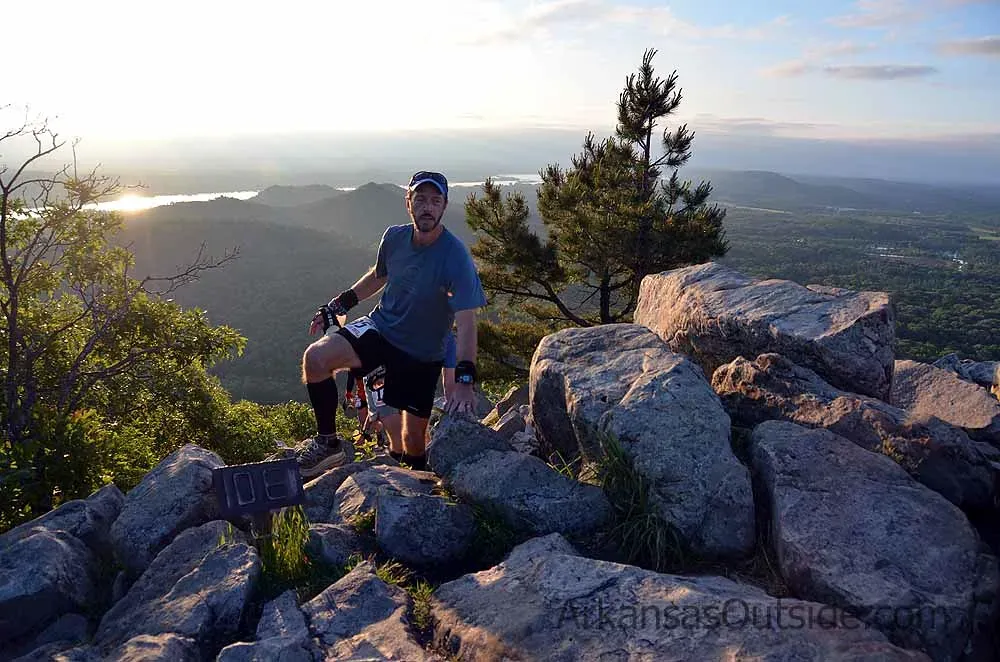
Ouachita Mountains and National Forest, Arkansas–Oklahoma: Old Ridges Running Against the Grain
Most American mountain ranges run north–south, but in western Arkansas and eastern Oklahoma, the ridges of the Ouachita Mountains defy the pattern and stretch east–west. That quirky orientation hints at a complex geologic history tied to ancient continental collisions. The Ouachita National Forest, the oldest national forest in the southern United States, protects large swaths of these folded and faulted rocks, some of which were once part of the floor of an ancient ocean.
When you hike or ride the ridgelines, you feel the terrain’s stubbornness: long, forested backs of mountains running like waves turned sideways, with valleys tucked in between. Within the forest, designated wilderness areas such as Black Fork Mountain and others shelter significant old-growth stands that give you a rare glimpse of what southern forests looked like before heavy logging. You can sit on a rocky outcrop at sunset, watch layers of blue ridges fade into the distance, and realize you’re standing on land that has been rising, sinking, and bending for hundreds of millions of years – and yet still offers quiet pockets where human impact feels distant.
Craters of the Moon and Ancient Lava Fields, Idaho: A Frozen Sea of Fire
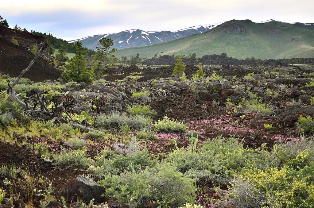
Parts of Idaho host some of the oldest and most evocative lava fields in the United States, and Craters of the Moon National Monument is where you feel that volcanic story under your feet. When you step onto the dark, rippled ground, it’s like walking across waves in a black ocean suddenly frozen in place. These flows, part of a much broader volcanic system, began forming millions of years ago, with newer eruptions layered over older ones to create a complex, time-rich landscape of cinder cones, lava tubes, and rugged basalt.
What makes this place feel deeply untouched is how harsh it can be. Vegetation clings only where it can, temperatures swing brutally, and the jagged rock punishes casual wandering. Yet if you push a bit beyond the main loops, you find pockets of stillness where it’s just you, wind, ravens, and the faint crunch of glassy lava under your boots. The realization hits you that you’re walking on a geologic story written by fire rather than water, and that in this hostile, beautiful terrain, you are a brief visitor on a surface that will likely outlast entire civilizations.
Bears Ears Region, Utah: A Cultural and Geological Time Capsule
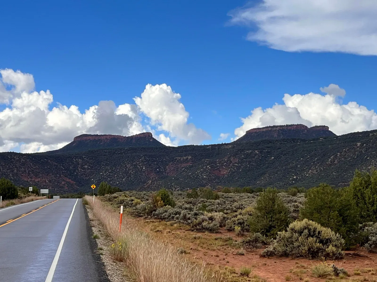
Southern Utah has no shortage of famous parks, but the Bears Ears region remains one of the most quietly powerful landscapes you can visit. Twin sandstone buttes watch over a vast terrain of mesas, canyons, and high plateaus that hold one of the most significant cultural landscapes in the United States. Long before the area became a focus of national debate, Indigenous nations lived, farmed, and traveled through this rugged country, leaving behind cliff dwellings, rock art, and ceremonial sites that tie human history directly to the stone.
From a geologic perspective, you walk across layers of sedimentary rock that record ancient rivers, deserts, and inland seas, sculpted into arches, alcoves, and sheer walls by relentless erosion. Some nearby sites even preserve evidence of very early human presence in the region. When you hike a remote canyon here, you’re not only tracing the path of water through stone, you’re moving through an intertwined story of earth and culture that reaches far back in time. This is not just untouched wilderness; it is living ancestral ground, and you feel that weight in every quiet bend of the trail.
Shenandoah Wilderness and the Old Blue Ridge, Virginia: Soft Mountains, Hard History
At first glance, the Blue Ridge Mountains in Virginia’s Shenandoah region look gentle – rounded summits, rolling ridges, and leafy hollows. But those soft outlines hide rocks that are incredibly old, part of the ancient roots of once-mighty ranges that towered long before the Atlantic Ocean opened. In the designated wilderness areas within and around Shenandoah National Park, you can hike for hours along narrow paths where the only sounds are wind in the oaks and the rush of distant streams.
The sense of age here is quieter than in the jagged West, but it’s no less powerful. Outcrops of greenstone, quartzite, and other Precambrian rocks tell you that this landscape has been through more cycles of uplift and erosion than you can easily imagine. When you stand on a rocky viewpoint at dusk, with valleys fading into haze and deer moving silently through the understory, you’re seeing a forest that has regrown over centuries on bones far older than your sense of time can comfortably handle. It’s a good reminder that ancient does not always mean dramatic; sometimes it means enduring.
Congaree Floodplain Wilderness, South Carolina: Primeval Forest on the Flatlands
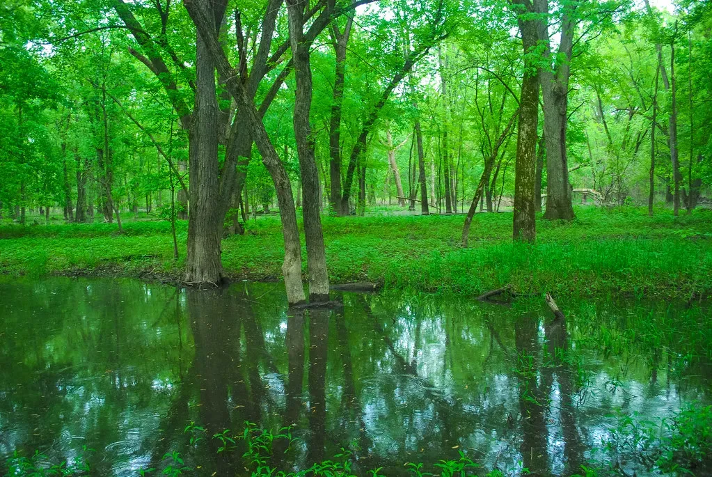
When you think of ancient, untouched landscapes, you probably picture mountains or deserts, not a flat, swampy floodplain. Yet Congaree National Park in South Carolina protects one of the last and largest remnants of old-growth bottomland hardwood forest in North America. In its designated wilderness, massive loblolly pines, cypress, and hardwoods tower over a maze of sloughs and oxbow lakes, creating a cathedral-like space where water, not rock, is the master architect.
What makes Congaree feel so timeless is the way natural river processes still run the show. Floods regularly spill across the forest floor, depositing fresh sediment, shifting channels, and creating a dynamic, living mosaic that has been repeating itself for millennia. You drift through it by canoe or walk the boardwalks and side trails, listening to barred owls call and woodpeckers hammer at ancient trunks. You realize that “untouched” can mean a place where the river, not the chainsaw, sets the rhythm – and where the age you feel is expressed in tree rings and deep, dark soil instead of towering peaks.
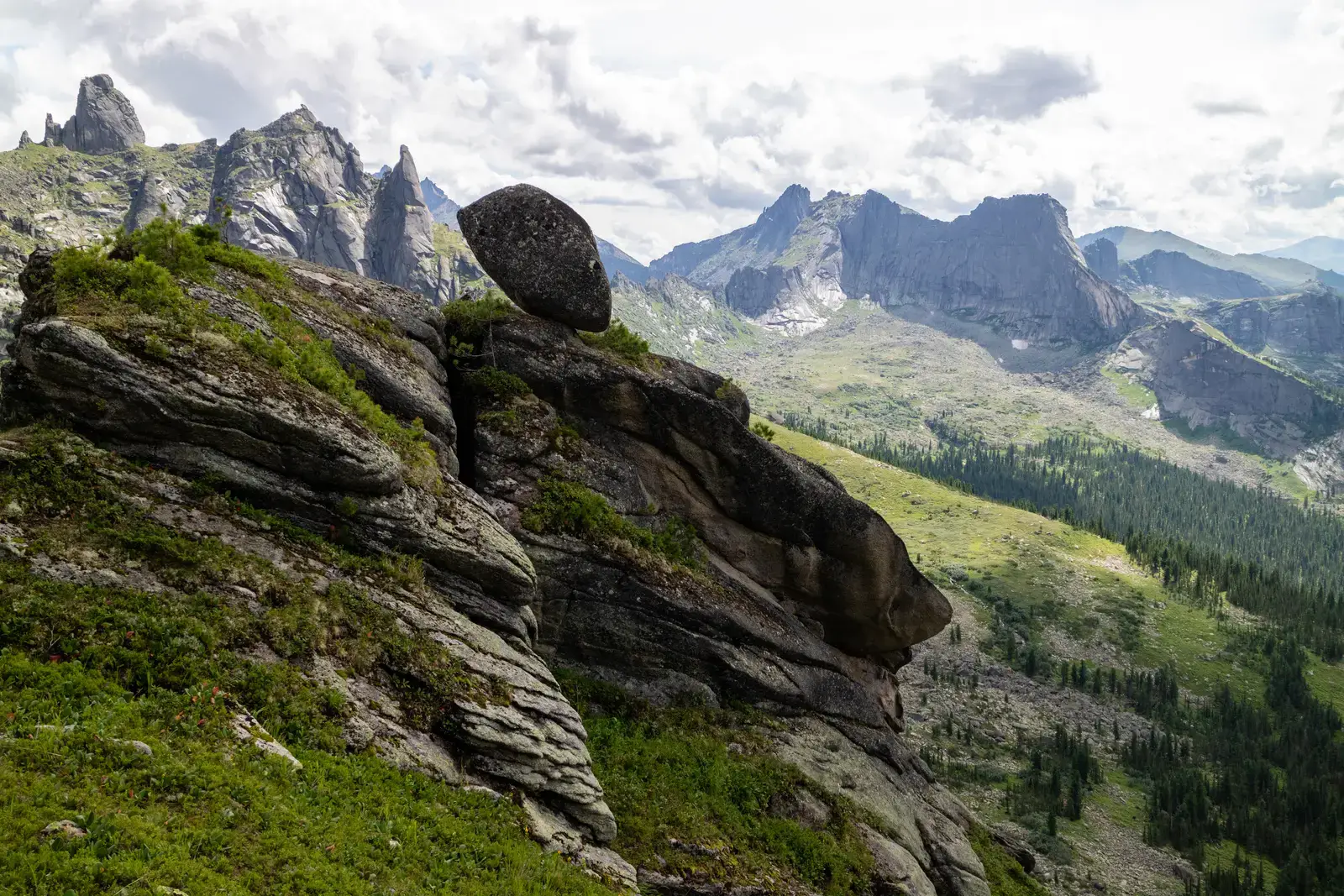
Ansel Adams–Style High Country: Glacially Carved Wilderness of the Sierra Nevada
In California’s Sierra Nevada, high-country wilderness areas such as those adjacent to famous parks offer some of the most pristine glacially carved landscapes you’ll ever set foot in. Deep U-shaped valleys, sharp granite peaks, and chains of alpine lakes tell the story of ice that once ground slowly across this backbone of the West. When you shoulder a pack and head several days from the nearest road, you leave behind crowds and step into a world that feels spare, clean, and overwhelmingly old.
You pick your way over talus, camp beside lakes still partially ringed with snow in early summer, and watch the light shift across polished slabs of granite that have been shaped by glaciers over many thousands of years. The rock itself is much older, born from long-cooled magma deep underground before being uplifted into the sky. Out here, you move at the pace of your own footsteps, and the only infrastructure you see might be a faint, cairned route. You feel how long this high country has stood, slowly eroding, quietly holding snowfields, and offering refuge to anyone willing to earn their way in.
Conclusion: Listening to the Quiet of Deep Time
When you start seeking out America’s hidden ancient landscapes, you realize how much of the story you’ve been missing. The country’s most famous parks are just the bright cover of a book whose best chapters are often tucked far from crowds: a badlands basin where early mammals left their bones, a lake-filled shield of billion-year-old rock, a floodplain forest that still submits to the river’s whims. You’re not just ticking places off a list; you’re learning to read land the way you might read a favorite novel – slowly, with attention to the details others skip.
Each of these places asks something different of you: navigation skills in trackless desert, patience on a long paddle route, respect in culturally sacred spaces, humility on high, glaciated stone. In return, you get more than pretty views; you get a sense of time so vast it makes your everyday worries feel strangely small. The next time you plan a trip, you might find yourself looking past the biggest names and reaching for a map full of quieter, older lines. After all, if you really want to understand America, why not start by listening to the landscapes that have been here the longest – what are they saying to you?