
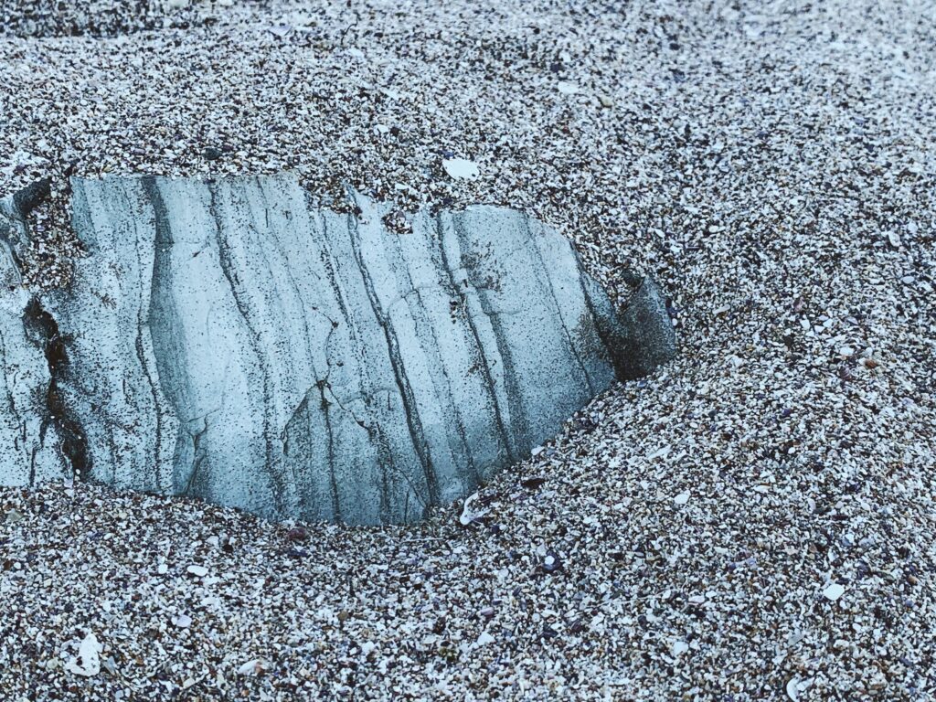
Stand on a quiet granite ledge in the mountains or a windswept headland by the sea and you might be looking at the scars of an ancient ice age without even knowing it. Long after the glaciers have melted and the ice sheets have vanished, the rocks remember. They carry scratches, grooves, ripples, and strange perched boulders that quietly shout: ice was here.
Once you know what to look for, landscapes you thought you understood suddenly flip into a different picture. A smooth hill becomes a bulldozed pile of rubble. A random boulder turns into a traveler from hundreds of kilometers away. A polished bedrock surface is no longer “just rock” but the underside of a frozen conveyor belt that ground its way across continents.
Let’s walk through twelve of the clearest, most fascinating marks that tell us exactly where ice once sat, slid, and reshaped the planet. Some are subtle, some are dramatic, and a few are so odd that, the first time you see them, you wonder if someone made them as a prank. But together they form a kind of forensic toolkit for reading the stone diary of the ice ages.
#1 Glacial Striations: The Ice Age Scratch Marks
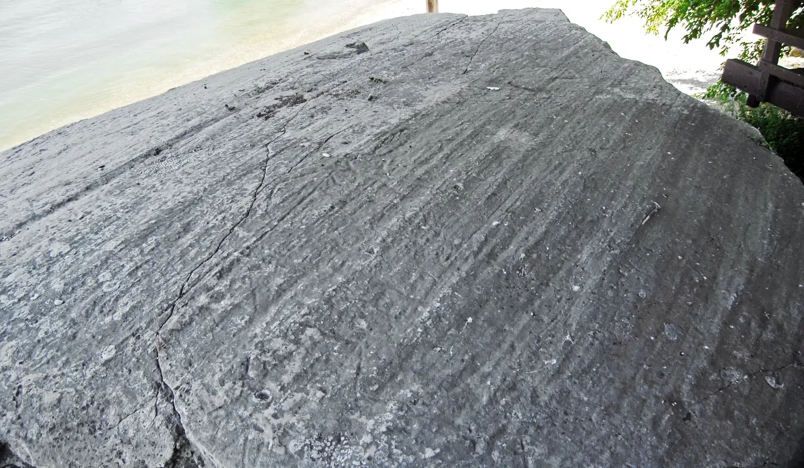
Imagine dragging a giant sheet of sandpaper loaded with rocks over a stone countertop for thousands of years. That is roughly what a moving glacier does, and the result is written in long, parallel scratches called glacial striations. These fine, straight grooves are carved when stones frozen into the base of the ice scrape across solid bedrock, leaving behind a pattern that almost looks machine-made.
Striations can be just a few millimeters wide or broad enough for your fingers to trace easily. What makes them so powerful is that they tell you the direction the ice once flowed, like arrows drawn into the rock itself. When scientists map hundreds or thousands of striation directions over a region, they can reconstruct the former shape and movement patterns of ice sheets that vanished tens of thousands of years ago.
On a sunny day, they can be tricky to see until the light hits them at an angle and the grooves suddenly pop into view. Hikers in glaciated regions often walk over them without ever noticing. Yet those subtle lines are one of the most direct, literal signatures that ice not only sat there, but dragged its frozen, rock-studded belly across that exact spot.
In a nutshell, glacial striations tell you:
- Ice moved right across that rock surface, not just nearby.
- Stones embedded in the ice acted like cutting tools.
- The direction of the grooves records the direction of ice flow.
#2 Glacial Grooves and Rock Pavements: When Ice Turns Bedrock into a Floor
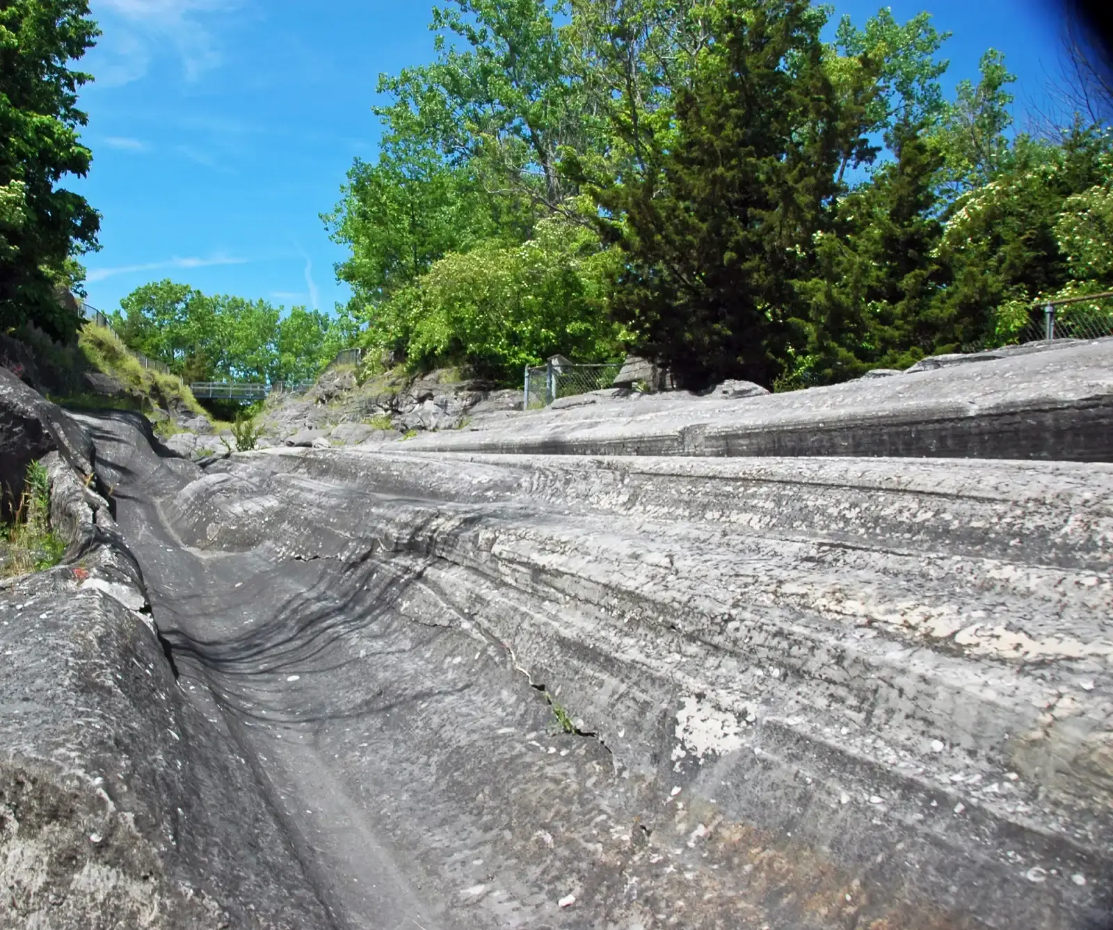
Striations are like fine scratches; glacial grooves are the heavy-duty version. Where glaciers carried large, hard boulders at their base, those stones could plow deep channels into the underlying bedrock, sometimes wide enough to stand in. These grooves can run for meters to tens of meters, forming striking corridors that look almost like ancient roadways etched into stone.
When many striations and grooves overlap and blend, they create a polished stone surface known as a glacially abraded rock pavement. These pavements often have a smooth, almost slippery feel underfoot, especially on tough rocks like granite or basalt. They are the literal “floor” over which the ice slid, smoothed by countless years of grinding and polishing.
These pavements can cover huge areas, from coastal headlands to upland plateaus. In cities built on glaciated bedrock, engineers sometimes uncover them during construction, finding a pristine ice-age surface that has been sealed under soil and pavement since the last glacial period. It is a bit like lifting carpet in an old house and discovering original hardwood floors underneath, except the “renovation” was done by a glacier.
- Deep grooves reflect especially powerful abrasion by large stones.
- Rock pavements mark places where ice slid repeatedly, not just briefly.
- They usually accompany other glacial features, confirming an icy past.
#3 Roche Moutonnée: The Classic Sheep-Back Hills
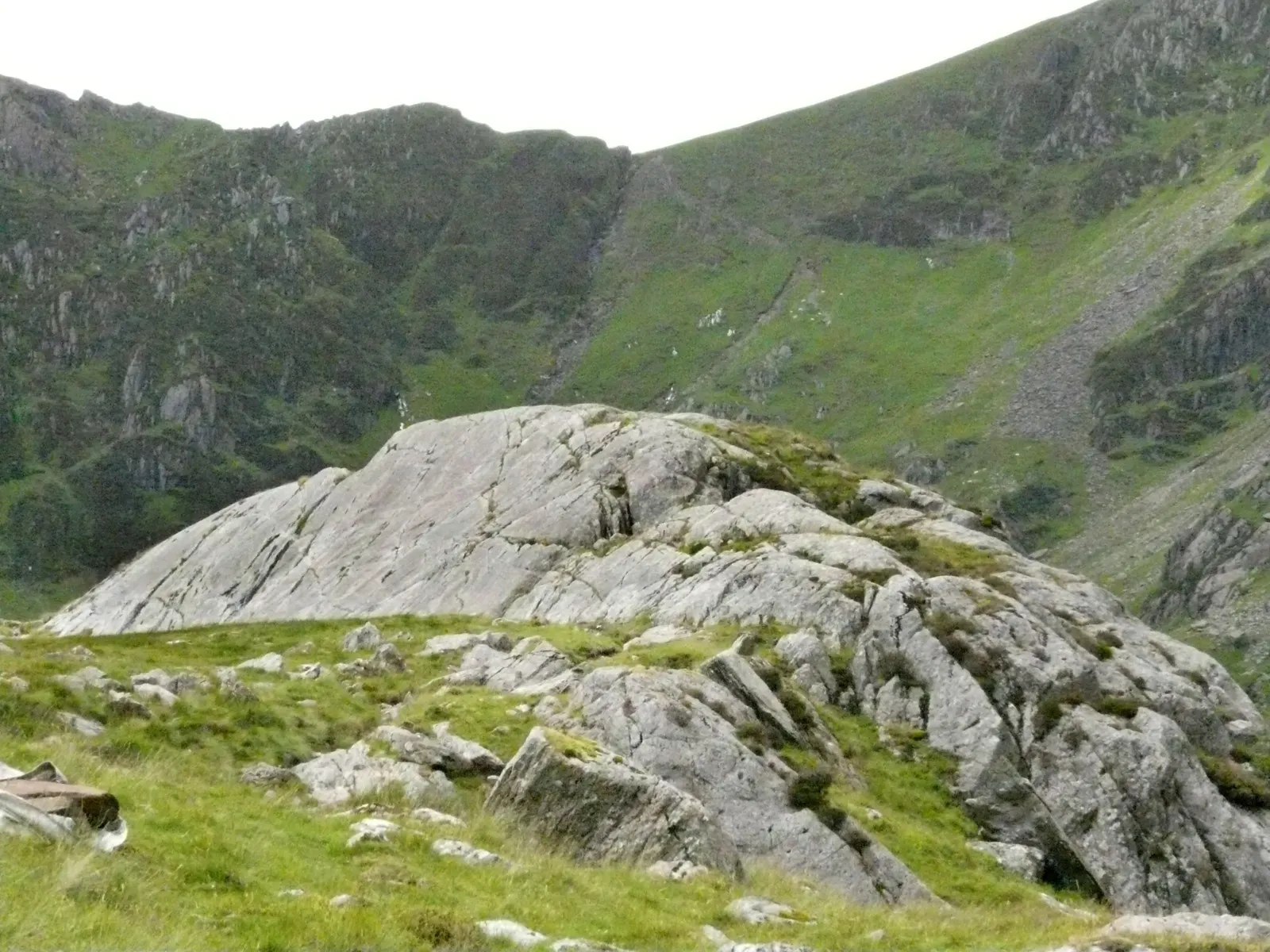
Roche moutonnée, a French term often translated as “sheep-back rock,” describes asymmetric rock hills sculpted by passing ice. On the side where the glacier approached, the rock is gently sloping and smoothly polished. On the downstream side, the rock face is steeper, rougher, and often broken. The contrast looks a bit like a wave frozen mid-crest or the back of a sleeping sheep.
This shape forms because ice grinds and smooths the up-glacier side as it presses against the rock, like sandpaper on wood. On the down-glacier side, pressure drops and water seeps into cracks. When that water refreezes, it can pry chunks of rock loose in a process called plucking. Over time, this combination carves a smooth “stoss” side facing the oncoming ice and a jagged “lee” side trailing behind.
Roche moutonnée hills are some of the clearest three-dimensional evidence of former glaciation. Once you see a landscape full of them, you realize the entire area was once under a thick, moving sheet of ice. They are also fantastic flow indicators: by noting which side is smooth and which is steep, you can tell exactly which way the glacier was traveling, often with far more certainty than you get from a single scratch or groove.
#4 Chatter Marks and Crescentic Gouges: The Stutter Step of Moving Ice
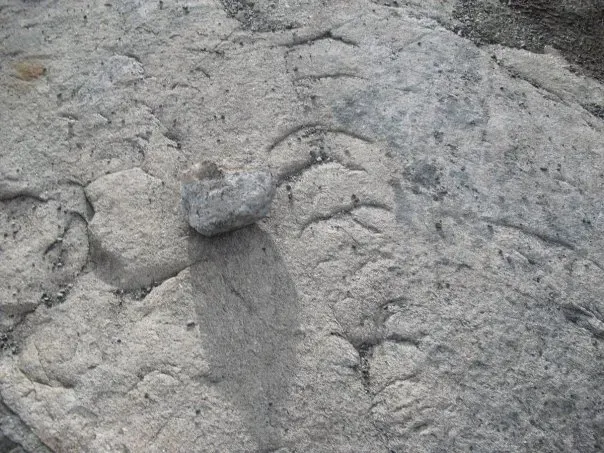
Not all glacier marks are smooth and continuous. Sometimes the stones frozen into the ice base skip and jump, leaving a series of crescent-shaped chips called chatter marks or crescentic gouges. They can look a bit like someone took a rock hammer and tested it repeatedly along the same line, leaving a chain of bite marks in the bedrock.
These crescents tend to face in a consistent direction, and that direction again points to ice movement. The shape and orientation are controlled by how pressure is applied as the stone jerks forward under the weight of the ice. In some locations, you see multiple rows of these crescents cut into otherwise polished rock, like punctuation scattered between longer grooves and striations.
Geologists like chatter marks because they confirm that the rock surface was not just eroded gently but subjected to intermittent, high-pressure impacts. In other words, you are seeing the stutter in the glacier’s step. They are also a reminder that ice movement is not a smooth, slow-motion slide; at the base, things can be jerky, noisy, and violent, even if we experience glaciers as serene from a distance.
- Crescent shapes open in the direction of ice flow.
- They signal intermittent, high-pressure contact from embedded stones.
- They often appear alongside smoother abrasion features, telling a fuller story.
#5 U‑Shaped Valleys: Carved by Ice, Not by Rivers
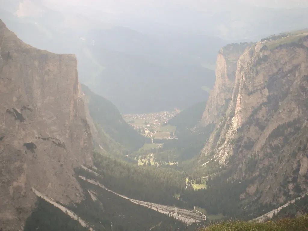
Perhaps the most iconic glacial landscape feature is the classic U‑shaped valley. Before glaciation, many mountain valleys are narrow V shapes carved by rivers cutting down through rock. When a glacier fills that valley, it does not just erode downward; it scours the sides as well, broadening and deepening the whole cross-section into a wide U shape with steep walls and a flat or gently rounded floor.
Once the ice melts, what remains is a broad valley that feels oversized for the streams that occupy it. You might walk beside a modest river winding across a flat, grassy floor while towering cliffs rise on either side. That mismatch is the giveaway: a small river could not possibly have carved such a huge trough in the time available. Only a thick, grinding glacier could do that, working more like a bulldozer than a knife.
On the valley walls, you often see other marks that confirm the story: polished rock benches, hanging side valleys that drop abruptly into the main one, and occasional perched boulders. All these details add up to a simple conclusion: where you see a colossal U‑shaped cross-section, you are walking through a place where ice once sat so thick it filled the entire valley from wall to wall.
#6 Hanging Valleys and Truncated Spurs: Glacial Surgery on Mountain Walls
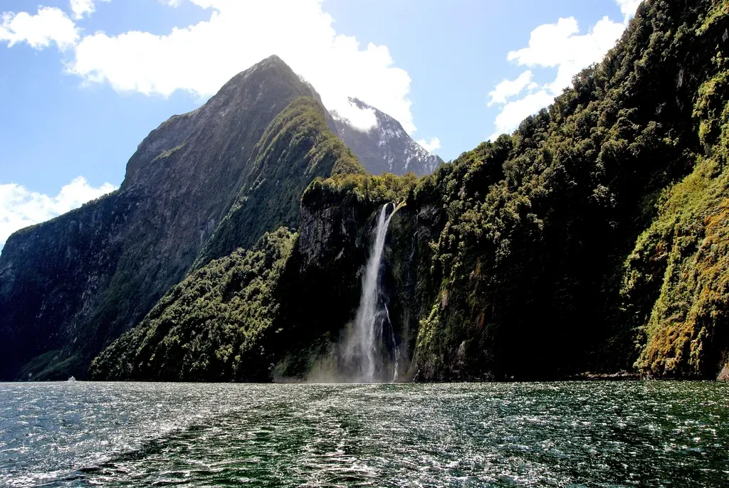
If U‑shaped valleys are the main stage, hanging valleys are the dramatic side balconies. A hanging valley is a smaller valley that joins a big glacial trough high up on its wall, often ending in waterfalls where streams plunge down to the main valley floor. Before glaciation, these tributary valleys flowed directly into the main river. After a large glacier deepens the main valley far more than the side ones, the tributaries end up stranded high above.
Truncated spurs tell a related story. River valleys often have pointed ridges, or spurs, that jut into them as the river weaves around. But when a glacier later occupies that valley, it does not bother to curve around these ridges. Instead, it simply cuts them off, leaving steep, flat faces where the points once were. The result looks like someone sliced the valley walls with a gigantic knife, leaving clean cross-sections of ridges facing across the main valley.
Both hanging valleys and truncated spurs mark the power imbalance between main trunk glaciers and their smaller tributary glaciers. The big glacier does most of the heavy excavation, deepening and widening the central trough, while side glaciers only partially reshape their own branches. That uneven work leaves behind the dramatic elevation differences and chopped-off ridges that shout, very clearly, that the valley’s main sculptor was ice, not water alone.
- Hanging valleys often feature waterfalls dropping into a larger glacial valley.
- Truncated spurs appear as abruptly cut-off ridges along valley walls.
- Together they show how glaciers reshape, simplify, and over-deepen landscapes.
#7 Moraines: The Ridges Where Ice Dropped Its Load
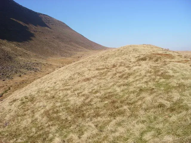
Think of a glacier as a slow-moving conveyor belt that picks up debris at its upper end and dumps it wherever the ice melts. Moraines are the ridges and mounds of rock, gravel, and dirt that pile up at the edges and ends of glaciers. Unlike the clean, polished look of abraded rock, moraines are messy heaps, but their positions are incredibly revealing.
Terminal moraines form at the furthest reach of a glacier’s snout, marking the line where the ice once stopped advancing. Lateral moraines form along the sides of the glacier, squeezed between ice and valley walls. When the ice disappears, these ridges of unsorted debris remain, perfectly tracing where the glacier once sat and how thick it was. In some landscapes, you can see multiple nested terminal moraines, each marking a separate pause or re-advance of shrinking ice.
Moraines are powerful time markers. A well-preserved ridge across a valley may show the maximum reach of the last major glaciation in that area. On top of that, the rocks within moraines often come from far up the valley, providing a mineral map of where the ice gathered its cargo. They are less elegant than striations or roche moutonnée, but as direct evidence of ice margins, moraines are hard to beat.
#8 Erratics: Giant Boulders Dropped in the Wrong Place
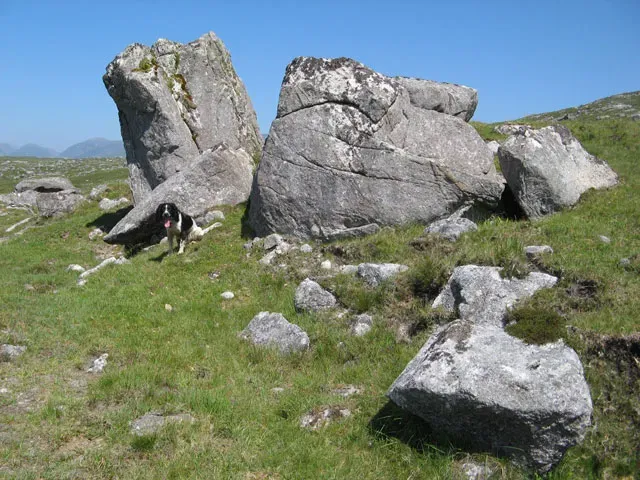
Few glacial features are as oddly charming as erratics: large rocks or boulders that clearly do not match the bedrock beneath them. Picture a lonely granite boulder sitting on a plain of sandstone, or a smooth, rounded block perched on a hill made of completely different rock. It looks random, almost comedic, as if some giant had absentmindedly set it down and walked away. In reality, glaciers did the heavy lifting.
Erratics are carried within or on top of ice for long distances, sometimes tens or even hundreds of kilometers from their source. When the ice melts, the boulders are left stranded wherever the ice happened to be at that moment. Because they are often large and resistant to weathering, they can sit there for thousands of years, acting as quiet messengers from distant mountain ranges or bedrock outcrops.
They are especially persuasive evidence of glaciation in places where other features are subtle or eroded. If you find a block of rock that geologists can match precisely to a distant source area, and there is no river or landslide path that could reasonably have brought it there, ice becomes the only realistic explanation. It is like finding a suitcase from another continent on your doorstep with no flight records; somehow, it made an improbable journey.
- Erratics usually rest on different rock than they are made of.
- They can travel surprisingly long distances inside or atop the ice.
- Their presence helps map the former extent and direction of glaciers.
#9 Till and Drumlins: The Chaotic Debris and the Streamlined Hills
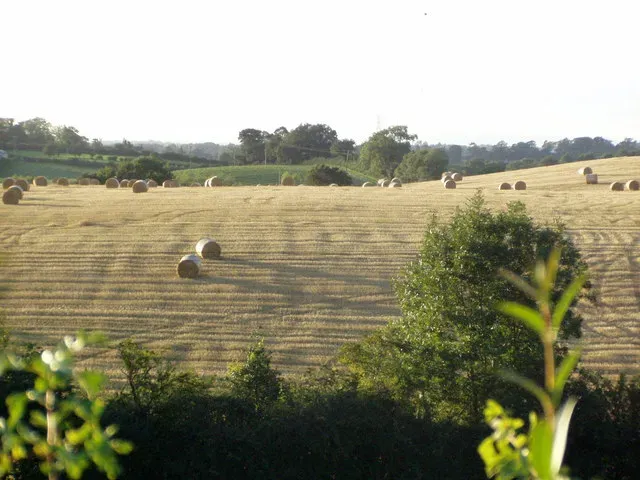
Glacial till is the raw rubble that glaciers leave behind: a chaotic mixture of clay, sand, gravel, and boulders all jumbled together. Unlike river deposits, which tend to be sorted by size as currents separate fine and coarse material, till is unsorted. You can pick up a handful and find tiny grains next to fist-sized stones. It is the direct dump of what ice carried, ground, and then abandoned when it melted.
From this till, glaciers sometimes build smooth, elongated hills called drumlins. Drumlins typically have a blunt up-ice end and a tapered down-ice tail, giving them a streamlined, teardrop shape. They often occur in swarms that sweep across the landscape like a frozen school of fish all pointing in the same direction. The exact formation process is still debated, but most researchers agree they form beneath actively moving ice where till is reshaped by pressure and flow.
Drumlin fields are some of the clearest landscape-scale indicators of ice flow. If you stand on one and look across a whole region of aligned hills, you are essentially reading the grain of the last glacial movement in that area. Combined with striations, moraines, and erratics, drumlins help draw a three-dimensional, dynamic picture of how ice covered and then retreated from a region.
- Till is unsorted, angular debris, a direct product of melting ice.
- Drumlins are streamlined hills aligned with the direction of ice movement.
- Together they show both what glaciers carried and how they reshaped it.
#10 Kettle Holes and Outwash Plains: Where Meltwater Finishes the Job
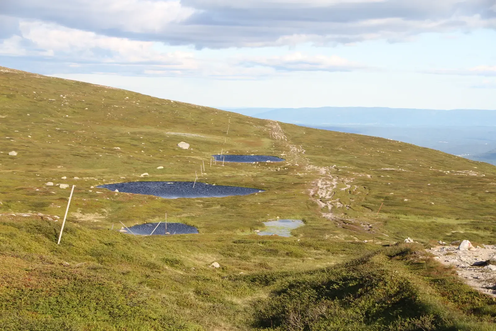
Not every glacial mark is cut directly into bedrock. Some of the most revealing features form in the sediments that glaciers leave behind. Outwash plains stretch away from former ice fronts, built from sand and gravel carried by braided meltwater streams. They are generally better sorted than till, showing clear layering and channels as running water does its usual work of separating particles by size.
Within or around these outwash and till deposits, you often find kettle holes: depressions that formed where isolated blocks of buried ice slowly melted. As the ice blocks vanished, the overlying sediment collapsed, leaving behind pits that can fill with water to become ponds or small lakes. Seen from above, a formerly glaciated lowland can look like a Swiss cheese of kettles dotting the broader outwash surface.
Although kettles and outwash are technically meltwater features, they are inseparable from the story of where ice once sat. You cannot get a field of kettles without stranded ice blocks, and you do not get large, flat outwash plains without a retreating glacial margin feeding huge volumes of sediment-laden water. Together, they mark the lively, messy phase at the end of a glacier’s life, when solid ice gives way to torrents of water that rearrange the debris one last time.
#11 Polished Whalebacks and P‑Forms: The Flowing Sculptures of Subglacial Water and Ice
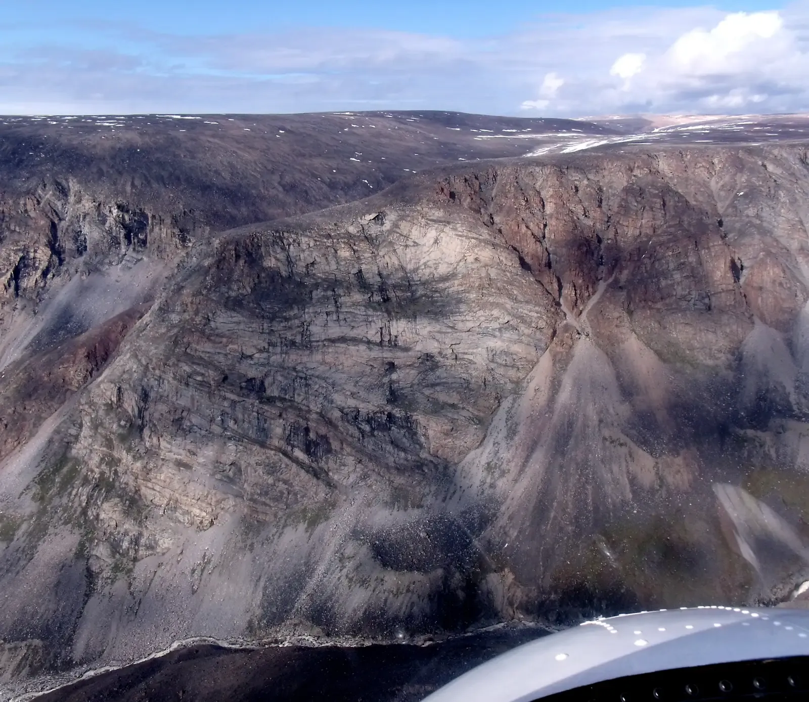
Some glacially shaped rocks are so smooth and flowing that they look like sculptures designed by an abstract artist. Whalebacks are low, elongated rock knobs with gently rounded surfaces that resemble the backs of surfacing whales. They are polished and streamlined by ice moving steadily over them, often in the same direction as striations and grooves found nearby.
Then there are P‑forms (short for plastically molded forms), which are even more enigmatic. These are curving, molded depressions and ridges carved into bedrock, likely by pressurized water flowing beneath the glacier, possibly aided by stones and ice. They can look like scooped-out hollows, elongated flutes, or swirling channels, sometimes nested within each other. Their forms suggest a complex dance between solid ice and liquid water under tremendous pressure.
These features matter because they hint at what was happening beneath the ice, not just at its edges. Subglacial water systems are crucial for how glaciers slide, speed up, or slow down. When you see whalebacks and P‑forms, you are essentially reading a trace of that hidden plumbing system stamped into the rock. They show that glaciers are not just frozen bulldozers; they are leaky, dynamic bodies with watery underbellies that leave surprisingly elegant marks behind.
- Whalebacks are low, smoothed rock knobs aligned with ice flow.
- P‑forms are molded bedrock shapes likely carved by subglacial water.
- Both highlight the importance of what happens under, not just inside, the ice.
#12 Patterned Ground and Frost‑Shattered Rock: The Permafrost Echo of Former Ice
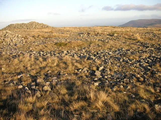
Even after the main glaciers have retreated, their legacy lingers in cold-climate processes that continue to work on the landscape. One of the more subtle, but telling, signs is patterned ground: networks of stone circles, polygons, and stripes formed by the repeated freezing and thawing of soil. As the ground freezes, ice lenses grow and push stones upward; as it thaws, gravity and water help the stones settle and sort themselves into distinct patterns.
On bedrock, persistent freeze-thaw cycles can shatter even tough stone into angular blocks, creating broken, blocky surfaces or fields of jagged fragments called felsenmeer in very cold uplands. While these features are not carved by glaciers directly, they are strongly associated with periglacial environments – cold regions around ice sheets and mountain glaciers. When you see widespread patterned ground or frost-shattered rock on high plateaus or polar areas, you are looking at the echo of glacial climates, even if the ice itself has moved on.
These marks remind us that ice influence is not an on-off switch. Once a region has been pushed into a glacial climate, the residual cold and seasonal freezing can keep sculpting rocks and soils long after the big ice masses have gone. They are like the aftershocks of an earthquake: quieter, more subtle, but still very much part of the same story.
Conclusion: Reading the Stone Diary of the Ice Ages
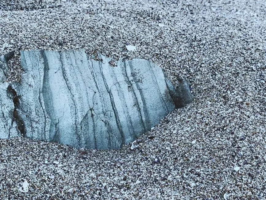
I still remember the moment a geologist friend pointed at what I had always thought was just a smooth lakeside rock and casually mentioned that ice once slid over it thousands of years ago. Suddenly the faint scratches and glossy sheen clicked into place, and the whole landscape around me felt different. Once you learn to read these marks – striations, roche moutonnée, U‑shaped valleys, moraines, erratics, and all the rest – the world becomes a kind of time machine, and bare rock turns into evidence.
What strikes me most is how patient and honest these stone records are. They do not care about our timelines or our opinions; they simply preserve what happened, grain by grain and groove by groove. In an era when ice is shrinking rapidly in many parts of the world, being able to see where it once sat is more than just a geological curiosity. It is a reminder that Earth’s climate has swung wildly in the past, and that the landscapes we take for granted are snapshots in a much longer, more dramatic film.
There is also a humbling twist: many of the most beautiful outdoor places people love today – broad valleys, dramatic waterfalls from hanging valleys, smooth lake basins carved into rock – are direct products of the same ice that once made those regions harsh and nearly uninhabitable. The scars of glaciers have become backdrops for our hikes, photos, and quiet moments by the water. Next time you run your hand across a polished rock or spot a lonely boulder far from any cliff, it might be worth asking yourself: what story of ancient ice is sitting right under my fingertips, waiting to be noticed?