Try to imagine a world where mountains taller than the Himalaya shattered and sank, where inland seas stretched across continents, and where lush, tropical forests thrived in what is now frozen polar night. That world was real, and in geological terms, it was not even that long ago. The landscapes that shaped the early history of life on Earth looked nothing like the map we know today.
Many of those places have vanished so completely that you would never guess they were once there, even if you stood right on top of them. They have been ground down, drowned, buried, or ripped apart by the slow violence of plate tectonics and climate change. Let’s walk through seven as they once did – and see how scientists have slowly pieced them back together from clues carved into stone.
The Tethys Sea: The Ocean Between Lost Worlds
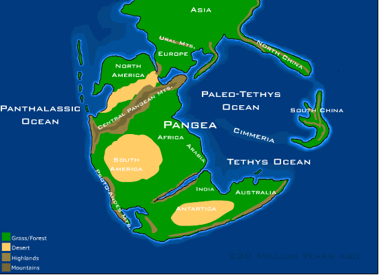
Hidden beneath the Mediterranean, the Alps, and the Himalaya lies the ghost of a vanished ocean: the Tethys Sea. For hundreds of millions of years, this warm, shallow ocean separated two huge landmasses, the northern Laurasia and the southern Gondwana. Imagine something like today’s Caribbean, but stretched from Spain all the way toward Southeast Asia, glittering with coral reefs and teeming with marine reptiles and early whales.
As the African, Indian, and Eurasian plates slowly collided, the Tethys was squeezed shut like a rug wrinkling under moving furniture. Its seafloor was thrust upward into great mountain belts, which is why you find seashell fossils on the high slopes of the Himalaya and the Alps. The Tethys as a distinct ocean is gone, but its scattered fragments live on in landlocked seas, mountain limestone, and the complex geology beneath parts of Europe, the Middle East, and Asia.
Sundaland: The Drowned Tropical Continent of Southeast Asia
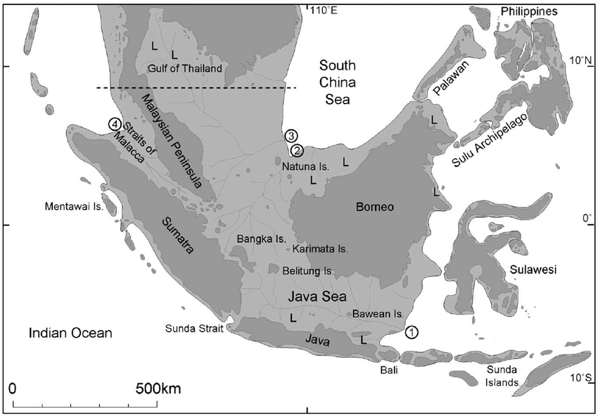
When sea levels were far lower during the last ice ages, a vast landmass called Sundaland connected what are now the islands of Borneo, Sumatra, Java, Bali, and the Malay Peninsula. Instead of a maze of islands, there was one sprawling tropical subcontinent with wide river valleys, dense rainforests, and giant river systems draining into broad coastal plains. You could have theoretically walked from present-day Thailand all the way to Borneo without ever boarding a boat.
As the ice sheets melted at the end of the last glacial period, global sea levels rose by more than a hundred meters over several thousand years. Low-lying basins and river valleys in Sundaland were slowly flooded, fragmenting the once-continuous landscape into the island chains we know today. Scientists use seafloor maps, sediment cores, and genetic clues from plants and animals to reconstruct this drowned world, and it has huge implications for understanding ancient human migrations through Southeast Asia.
The Western Interior Seaway: An Ocean Through North America
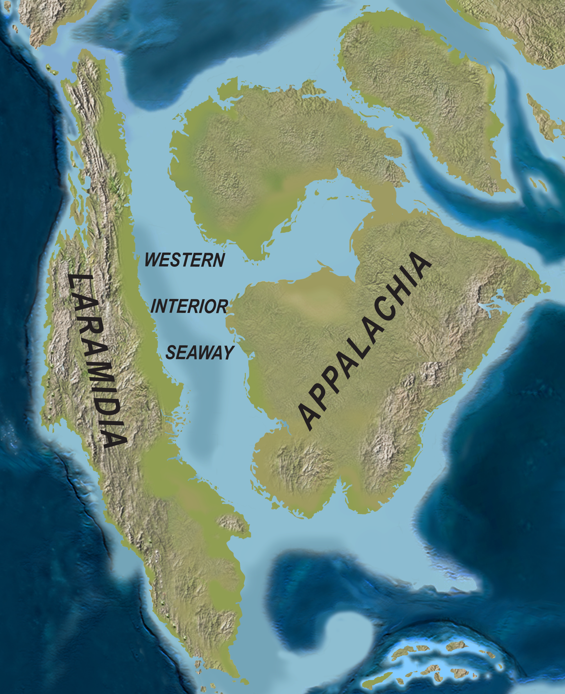
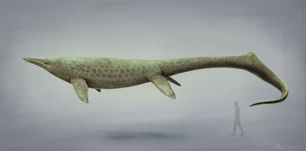
Picture standing in what is now Kansas and watching waves roll in from a vast, shallow, tropical sea stretching from the Gulf of Mexico to the Arctic. During the Late Cretaceous period, a huge inland ocean known as the Western Interior Seaway split North America into two landmasses. Instead of the Great Plains, there were chalky seafloors, swarms of ammonites, mosasaurs cruising the depths, and giant toothed birds gliding above the waves.
This seaway existed because global sea levels were higher and the center of North America had sagged downward under the weight of growing mountain belts to the west. Over millions of years, as mountain building slowed and seas retreated, the seaway gradually drained away and filled in with sediments. Today, the soft chalk and shale left behind form the basis of famous fossil sites in places like Kansas and South Dakota, but the ocean itself is gone, replaced by cornfields, ranches, and highways.
Pangaea’s Interior Desert: A Supercontinent’s Harsh Heart
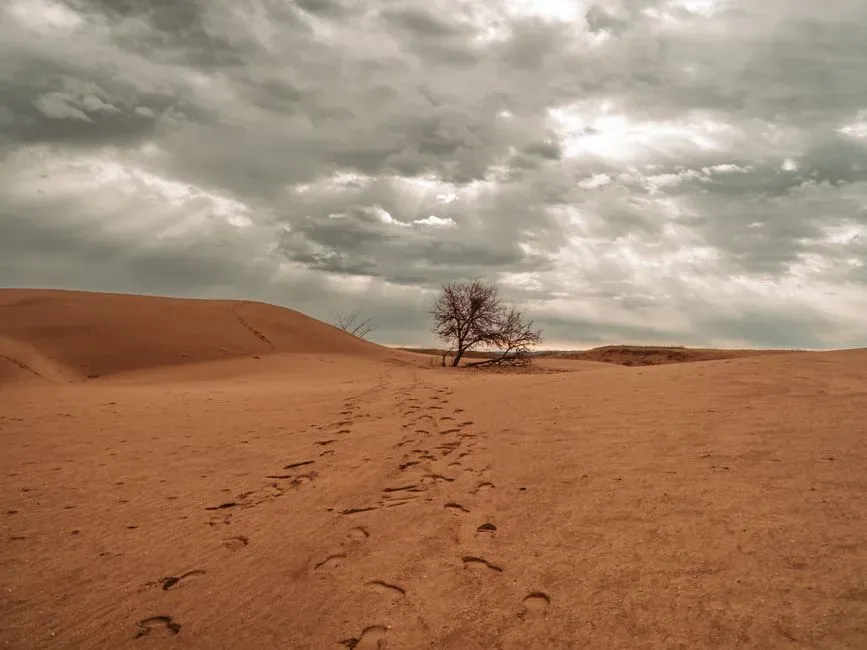
Everyone has heard of Pangaea, the supercontinent that once bundled almost all Earth’s land into one enormous mass. What we talk about less is the ruthless interior climate of that supercontinent. Far from any ocean, huge swaths of Pangaea’s central regions were dominated by bone-dry deserts, marked by immense sand dunes, seasonal flash floods, and temperature extremes that make modern deserts look tame.
Geologists find the fingerprints of this vanished desert in massive layers of sandstone, with wind-blown crossbeds preserved like fossilized waves of sand. These ancient desert rocks are now scattered across different continents, from parts of the United States to North Africa and Europe, thanks to the later breakup of Pangaea. The land is still there, but the coherent, continuous desert landscape at the heart of a single mega-continent s in any recognizable form.
The Permafrost-Free Arctic Forests
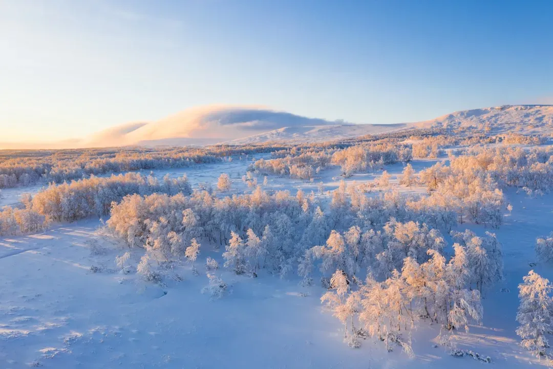
It is hard to imagine the Arctic without ice, but for long stretches of Earth’s history, there were no permanent ice caps at the poles. During warm periods such as the early Eocene, the Arctic was covered not by bare rock and glaciers, but by lush, swampy forests of cypress, dawn redwood, and broadleaf trees. Fossil wood, leaves, and even preserved soils show that these forests supported a surprisingly rich ecosystem of plants, insects, and vertebrates.
Because the poles still experienced months of darkness in winter, life there had to adapt to extreme seasonal light, not extreme cold. The permafrost, sea ice, and polar desert we now associate with the high north are relatively young conditions in geological terms. As climates cooled and polar ice sheets grew, that ancient forested Arctic world disappeared, leaving behind only scattered fossils and hints in the chemistry of old sediments to tell its story.
The Sahara’s Green Phase: Lakes, Rivers, and Grasslands
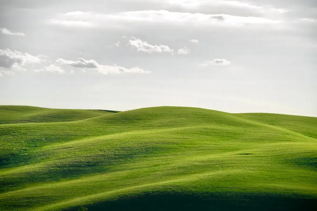
The Sahara Desert feels timeless, but it has flipped back and forth between dry and green many times over the past few hundred thousand years. During so-called African Humid Periods, the landscape that is now a sea of sand supported large lakes, permanent rivers, wetlands, and sprawling grasslands. Rock art and fossils suggest that hippos, crocodiles, giraffes, and early human groups thrived where today only dunes and barren rock remain.
These green phases were driven by subtle shifts in Earth’s orbit that altered the strength and position of monsoon rains. When the monsoon pushed farther north, rainfall transformed the Sahara into a mosaic of savanna and lake systems; when the pattern shifted back, the region dried out and the desert returned. The most recent major humid phase ended several thousand years ago, and while small bits of that greener world linger in underground aquifers and buried lake beds, the connected, vibrant landscape is gone.
Zelandia Above the Waves: The Mostly Sunken Continent
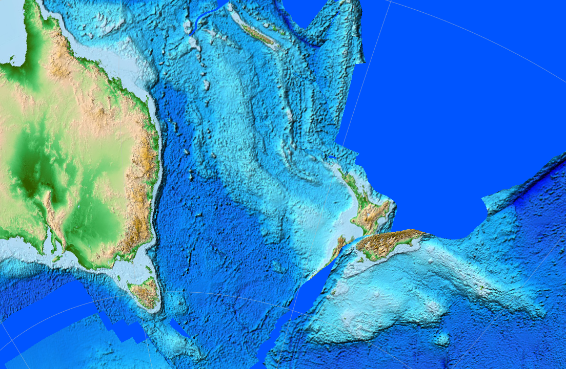
Southwest of the Pacific’s usual tourist maps lies one of Earth’s strangest geological stories: Zealandia, a largely submerged continent roughly the size of India. Today, only the higher parts poke above the water as New Zealand and a few scattered islands. But geological evidence suggests that much more of Zealandia once stood near or above sea level, supporting forests, rivers, and diverse ecosystems across broad plateaus instead of scattered peaks.
Over tens of millions of years, as the surrounding oceanic crust cooled and subsided and tectonic forces stretched and thinned Zealandia’s crust, much of this land slowly sank beneath the sea. What was once a coherent continental landscape is now a drowned highland, accessible only through deep-sea drilling and careful geophysical mapping. Standing on a New Zealand hillside today, it is strangely humbling to realize you are walking on the surviving ridge of an almost entirely sunken continent.
Conclusion: The Earth We Stand On Is Temporary
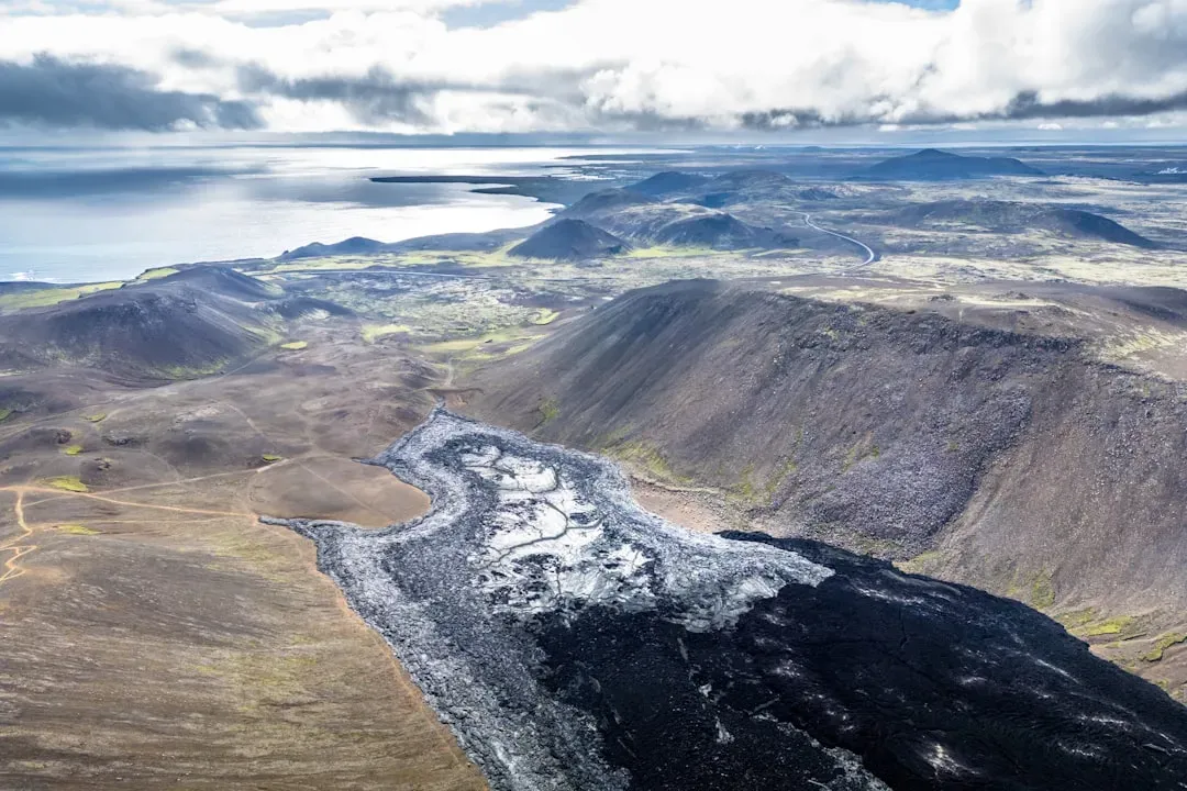
When you zoom out to geological timescales, one unsettling truth jumps out: no landscape is permanent. Oceans close, continents tear apart, deserts flip to grassland and back again, entire inland seas appear and vanish. From the Tethys Sea to Sundaland’s drowned plains and the Western Interior Seaway, each of these lost worlds felt as solid and enduring to the life that inhabited them as our current map feels to us today.
To me, that is both sobering and oddly comforting. It means our mountains, coasts, and cities are just one temporary chapter in a much longer story, not the final picture. In a few tens of millions of years, some future geologist – human or not – may puzzle over the eroded leftovers of our own familiar landscapes. If Earth has rewritten itself so many times before, what makes us think the version we know now is the one that will last?