You probably picture a narrow strip of land when you hear “land bridge,” but the Bering Land Bridge was more like an entire lost subcontinent. During the last ice age, sea levels fell so dramatically that Asia and North America were welded together by a vast grassland plain called Beringia. For thousands of years, that drowned world quietly shaped the fate of humans, animals, and ecosystems on both sides of the Pacific.
When you trace your mental map of how people first reached the Americas, you almost always end up standing in the cold wind of this vanished landscape. Yet the story is far richer than a simple “people walked across, end of story.” You’re looking at a puzzle still being reassembled: shifting sea levels, giant ice sheets, mammoths and bison on the move, and small groups of humans making life-or-death decisions in one of the harshest environments on Earth.
A Continent That Disappeared Beneath Your Feet
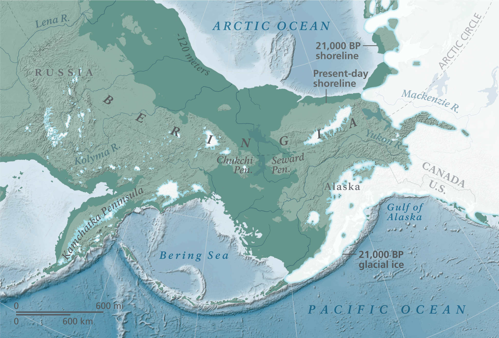
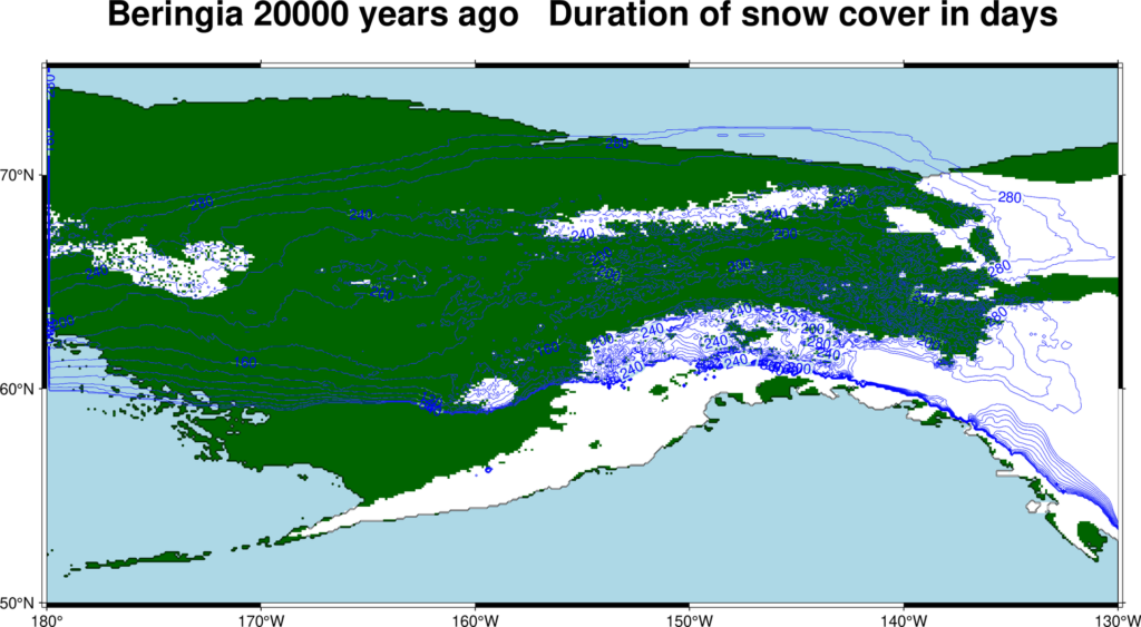
Imagine standing today on the shore of western Alaska or eastern Siberia and looking across the Bering Strait. Now, erase the water in your mind and drop sea level by more than a hundred meters. What you’d see instead is a broad, low-lying expanse of land roughly a thousand miles across at its widest point, connecting two continents in a sweeping arc of tundra and steppe. That was Beringia, a place so large that you could have walked for weeks without ever reaching the open ocean.
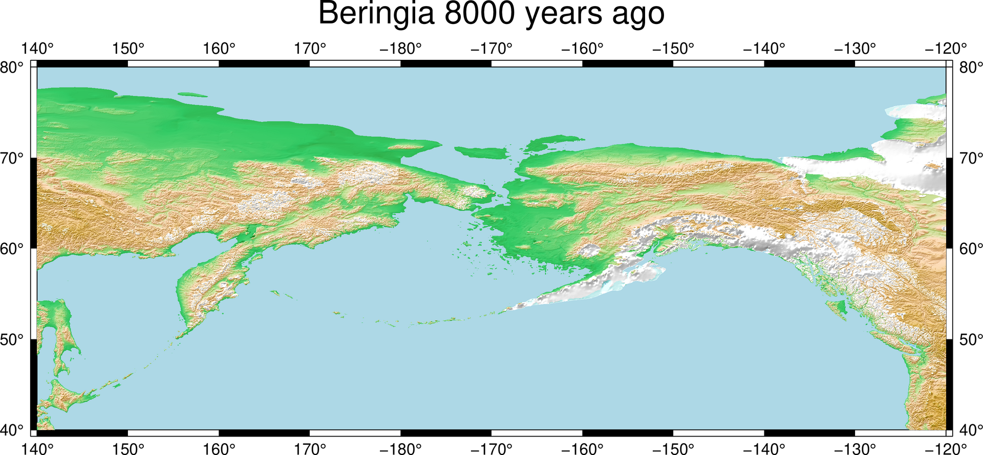
This land existed because so much water was locked up in continental ice sheets during the Pleistocene, the long ice age cycle that lasted until about eleven and a half thousand years ago. When ice grew, seas fell, and old seafloor emerged as dry land; when ice melted, seas rose, and those same plains drowned again. The Bering Land Bridge came and went multiple times over hundreds of thousands of years, but the episode you care most about is the last one, which opened sometime around the late stages of the last ice age and finally flooded as the modern Bering Strait just before the Holocene began.
Life on the Mammoth Steppe: Your Mental Picture of Beringia

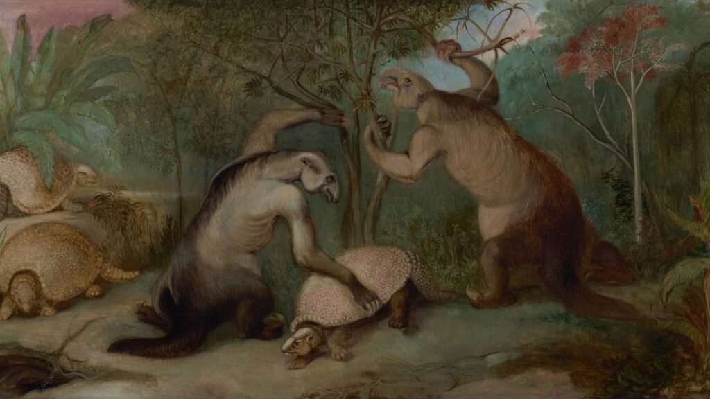
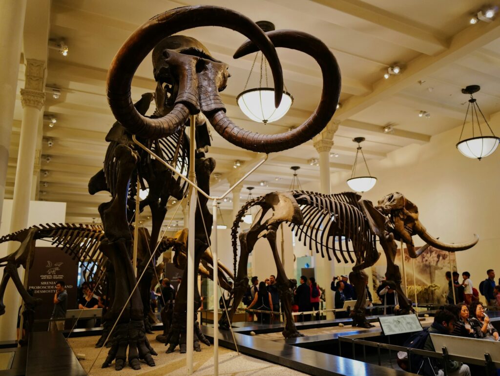
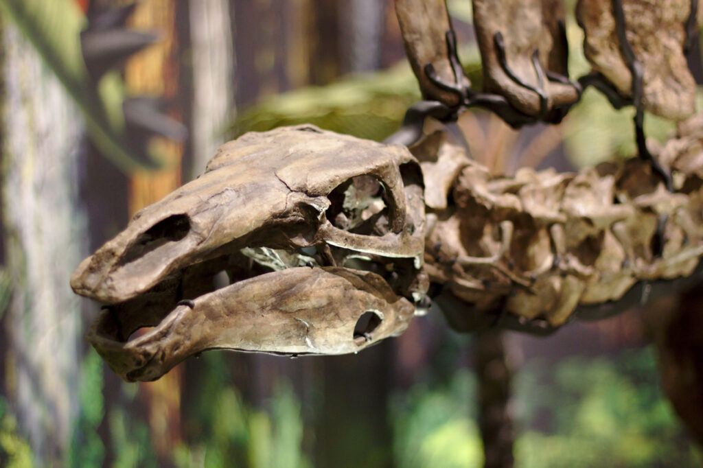
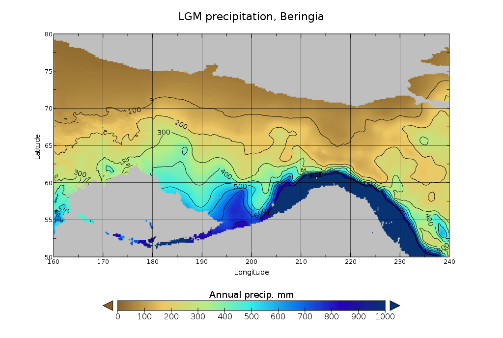
If you could step back into Beringia at its peak, you wouldn’t find a frozen wasteland of endless ice. Instead, you would walk into what scientists call the “mammoth steppe,” a cold but surprisingly productive grassland stretching from Siberia through Alaska and Yukon. Think of it as an ancient version of the African savanna, but with woolly coats: mammoths, steppe bison, wild horses, muskoxen, caribou, and predators like wolves and big cats roaming in search of grazing herds.
For you as a human hunter-gatherer, this landscape would be harsh but full of opportunity. The short summers would explode with grasses and sedges, feeding vast herds that in turn could feed your band if you knew how to track and cooperate. Winters would be brutal, windy, and dark, demanding warm clothing, shelter, and deep knowledge of animal movements. You would not think of Beringia as a “bridge” at all; to you it would simply be home, a broad region where rivers, hills, and coastlines shaped your seasonal rounds.
When You Step Onto the Bridge: Timing and Sea-Level Drama
The timing of when you could have actually walked across Beringia is more complicated than many textbooks suggest. For a long time, you might have heard the story that the land bridge simply appeared around seventy thousand years ago and sat there waiting, but newer research shows a much narrower window. By reconstructing ancient sea levels, scientists now argue that the land bridge did not fully emerge until roughly thirty-six thousand years ago, and it stayed open until rising seas flooded it again around eleven thousand years ago.
Within that window, your opportunity to move south into the rest of the Americas depended on more than just dry land. Enormous ice sheets smothered much of northern North America, sometimes blocking interior routes like a wall of frozen rock. That is why many researchers now think your ancestors may have lingered in Beringia for thousands of years, adapting to the local environment, before pushing south along ice-free coastal corridors or through openings in the ice when conditions finally allowed. In other words, the “bridge” behaved less like a highway and more like a complex crossroads where climate, ice, and sea level constantly negotiated your options.
How You (Probably) Reached the Americas

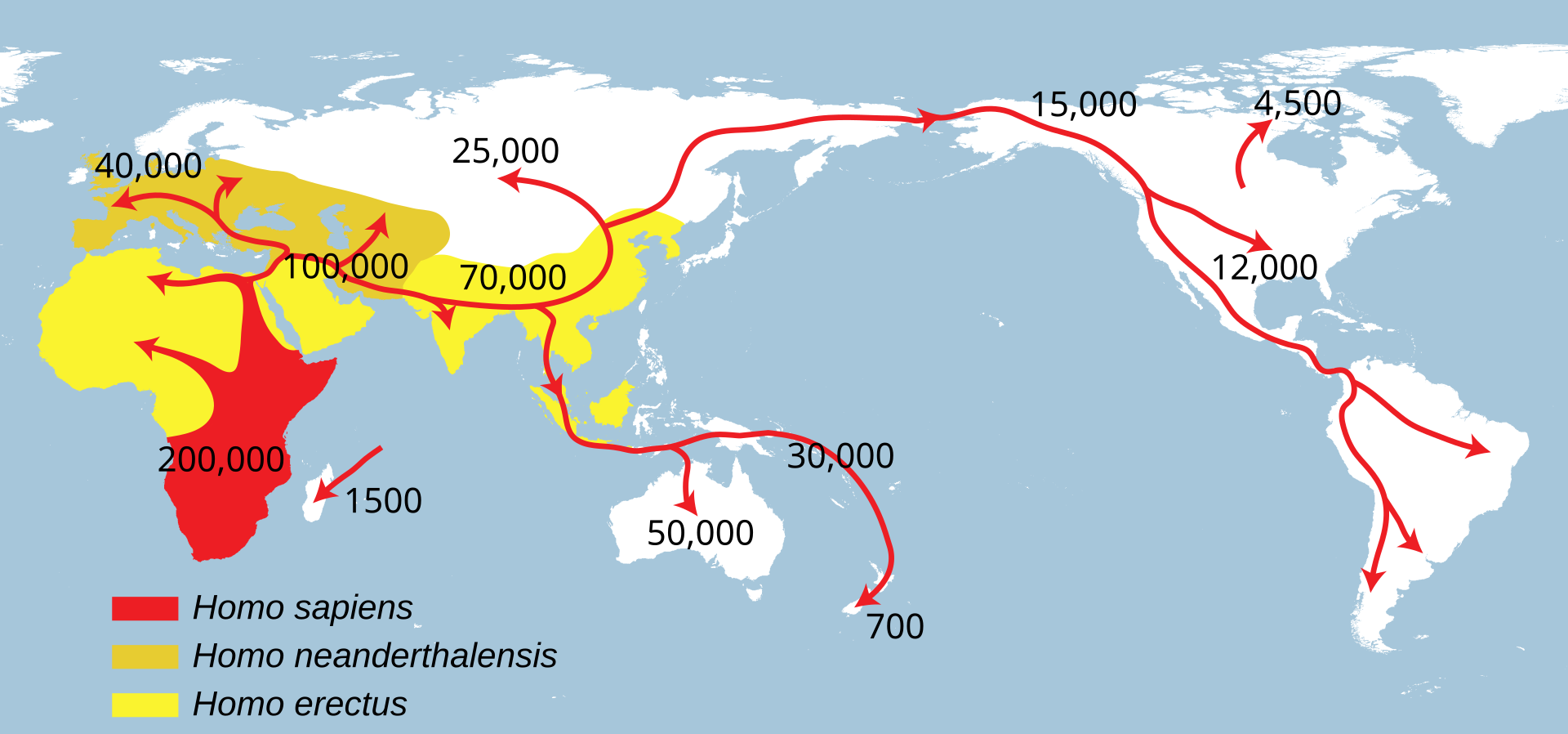
When you follow the strongest lines of evidence today – genetics, archaeology, and climate records – you’re led toward a story with a single broad Asian source population moving into Beringia and then diversifying as people spread into the Americas. Genetic studies suggest that the ancestors of Indigenous peoples of the Americas branched off from northeast Asian populations and spent a significant period isolated in or near Beringia before expanding southward. You can picture a relatively small number of people, perhaps only a few thousand at most, living in scattered bands across this region, gradually adapting to colder climates and new prey.
Exactly when you and your relatives first reached the lower latitudes of the Americas is still being argued. For much of the twentieth century, the dominant view placed the first widespread human presence around thirteen and a half thousand years ago, linked to a tool tradition known as Clovis. But discoveries at sites in North and South America that are older than that, sometimes by several thousand years, now tell you that people were already here well before Clovis appeared. That pushes your mental clock of migration earlier, and it fits better with the idea that you had time to move from Beringia along the Pacific coast and into the interior as ice retreated.
Beyond a Single Road: Theories You Should Know

If you grew up with the simplest version of the story, you probably picture just one route: people sprinting through an “ice-free corridor” between massive glaciers after crossing the land bridge. Today, you’re looking at a much more layered picture. Many researchers think that a coastal route along the Pacific Rim may have been crucial, where your ancestors could have followed beaches, islands, and rich marine ecosystems instead of waiting for interior ice corridors to fully open. In this view, Beringia still matters deeply, but you are just as likely to imagine boats, shoreline camps, and kelp forests as you are to imagine long inland marches.
At the same time, you’ll hear about alternative or additional ideas, from multiple migration pulses over thousands of years to more speculative proposals involving Atlantic crossings. The weight of the evidence still circles you back to Beringia as the main staging area, but you are reminded to keep some intellectual humility. So much of the relevant coastline and land bridge is now underwater that many of the earliest camp sites, kill sites, and shorelines are hidden from you beneath the modern ocean, waiting for marine archaeology and new technologies to pull more of the story into view.
How You Can Still Visit a Fragment of Beringia
Even though the original land bridge is gone, you can still stand on pieces of ancient Beringia today. In northwest Alaska, on the Seward Peninsula and surrounding areas, Bering Land Bridge National Preserve protects a remnant of that Pleistocene world. When you hike across its rolling tundra, soak in its hot springs, or watch migratory birds swarm the sky, you are literally walking on high ground that once formed part of the great corridor between continents. The same is true for parts of eastern Siberia on the other side of the present Bering Strait.
If you visit, you get a rare chance to feel the scale of this story with your own senses instead of just reading about it. You can imagine herds of bison grazing where modern shrubs now grow, or picture bands of hunters scanning distant ridges for movement. You also see how climate and sea level continue to reshape coastlines, reminding you that what feels permanent under your boots is really just a moment in a much longer geological drama. In that way, Beringia becomes not just a chapter in ancient history but a lens you can use to think about ongoing environmental change today.
Why the Bering Land Bridge Still Matters to You
When you boil it down, the Bering Land Bridge is not just a quirky bit of ice-age trivia; it is a key to understanding where many of the peoples of the Americas ultimately came from. If you have ancestry from these continents, you are very likely tied in some way to decisions made by a relatively small number of people navigating the windswept plains and coasts of Beringia tens of thousands of years ago. That connection can shift how you think about migration, belonging, and the deep time roots of culture and identity.
The story also shows you how dramatically Earth’s surface can change when climate and ice respond to shifts in temperature. A huge landmass appeared and vanished purely because water moved between ice sheets and the sea, rewriting the map and opening or closing pathways for life. When you look at modern sea-level rise and rapid Arctic warming, you can use Beringia as a kind of ancient case study in how geography, climate, and human movement are braided together. It reminds you that your world has never been static, and that flexibility and curiosity have always been among your best survival tools.
In the end, when you picture the Bering Land Bridge, you are not just seeing a strip of land in a textbook map. You are watching your species take a huge experimental leap into new continents, guided by changing ice, shifting seas, and the pull of opportunity over the horizon. The gateway itself is gone, but its legacy is written into the landscapes and peoples of the Americas – and into the questions you still ask about where you came from and how you got here. If you could stand on that ancient grassland for just one evening, watching mammoths in the distance and hearing human voices on the wind, what would you imagine doing next?