If you could rewind Earth’s history like a movie, you’d barely recognize the planet you live on. Continents would slide across the screen, oceans would open and close, and mountain ranges would appear and vanish like shifting stage props. Plate tectonics is the engine driving this slow-motion chaos, and it is the quiet force that decided where you live, what climate you experience, and even what resources your society depends on.
When you understand how plates move and collide, the world map suddenly stops looking random. Coastlines start to make sense, mountain ranges tell stories, and even the shapes of continents become clues to ancient supercontinents. By the time you finish this article, you’ll be able to “read” the planet in a new way – almost like learning a new language written in rock and time.
How Earth Became a Planet with Moving Pieces
You live on a planet that behaves more like a conveyor belt than a solid rock. Deep beneath your feet, the mantle is not a rigid block but a hot, slowly flowing layer of rock that creeps over millions of years. This creeping motion drags giant slabs of the outer shell – tectonic plates – around the globe, carrying continents and oceans with them. Without this restless interior, Earth would likely be a dead, stagnant world with no shifting continents, no tall mountains, and maybe even no life as you know it.
To see why plates move at all, you can picture a pot of thick soup simmering on a stove. As the bottom heats up, the soup rises, spreads out, cools, and sinks again, creating churning loops. Inside Earth, heat from the core and radioactive elements does something similar to the mantle. Those slow, looping currents tug on the plates above, pulling them apart at some places and shoving them together at others. You walk around every day on the hardened skin of a giant, heat-driven experiment that has been running for billions of years.
Supercontinents: When the World’s Landmass Piled Together
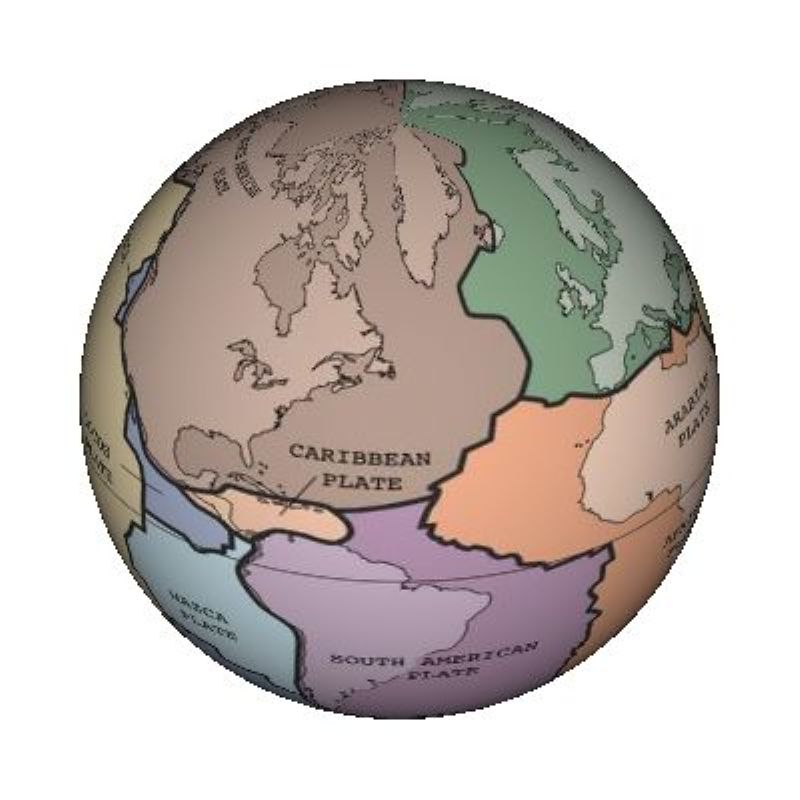
When you look at a world map, it’s easy to assume continents have always been where they are now, but that’s an illusion. Over hundreds of millions of years, Earth’s landmasses have repeatedly smashed together into giant supercontinents and then broken apart again. One of the most famous of these was Pangaea, a vast landmass that existed a few hundred million years ago and gathered most of today’s continents into one connected block. If you had been alive then, you could have walked from what is now North America to Africa without ever seeing an ocean.
This supercontinent cycle has probably repeated many times, with earlier giants before Pangaea and likely more in the far future. Each time continents weld together, mountain belts rise along their sutures, climates shift dramatically, and ocean currents are rearranged. Then, as heat builds up beneath the thick, combined crust, the supercontinent eventually rips open like a loaf of bread tearing along a weak seam. You are catching Earth in one chapter of a long-running story, not at the beginning or the end.
Breaking Apart: How Rifts and Oceans Are Born
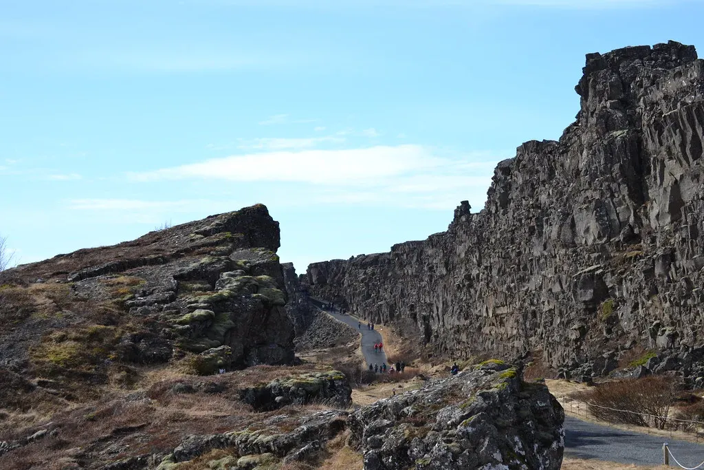
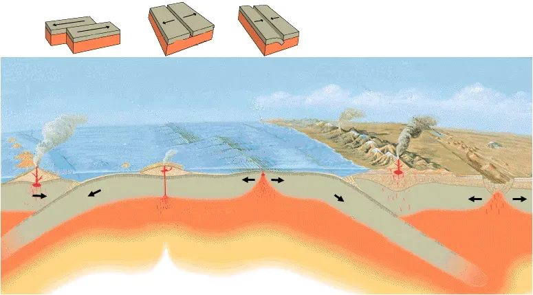
Right now, you live in an era when many continents are moving apart from each other, creating new ocean basins in the process. When a continent begins to stretch, it can crack open along long, linear rift zones, where the crust thins and sinks. Magma from below may rise to fill the gaps, forming volcanic activity and young crust. If the rift keeps widening over millions of years, it can flood with seawater and evolve into a full-fledged ocean, with a mid-ocean ridge pumping out brand-new seafloor.
You can see an early-stage example of this process if you imagine standing in East Africa, where a major rift system is actively splitting the continent. The ground there is pulling apart, creating deep valleys, volcanoes, and chains of lakes that trace the line of the rift. Given enough time, such a rift can become a new ocean separating two landmasses. What looks to you like a patch of rugged landscape today may be the birthplace of a future sea on some far-future version of the world map.
Colliding Plates: Building Mountains and Shaping Continents
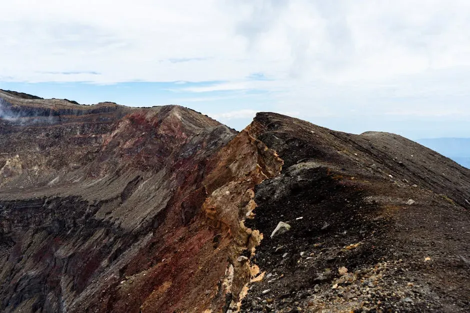
Where plates collide instead of separate, you get some of the most dramatic reshaping of Earth’s surface. If two continents on different plates are pushed together, the crust between them crumples and thickens, stacking layers of rock into towering mountain ranges. This is how some of the world’s greatest ranges formed, including examples in Asia and elsewhere, as continents slammed together like slow-motion car crashes. You are literally looking at frozen waves of rock when you see those jagged peaks.
When an oceanic plate meets a continental plate, the denser oceanic crust usually dives beneath in a process called subduction. As it sinks, it helps generate magma that can rise and feed volcanic arcs on the overriding plate. This not only reshapes coastlines but also helps recycle old seafloor back into the mantle. Wherever you see chains of volcanoes parallel to deep ocean trenches, you are watching the destructive side of the plate puzzle, where old crust is consumed so that new crust can form elsewhere.
Hidden Clues in the Shapes and Rocks of Continents
You do not have to be a geologist to notice that some continents look like they once fit together. If you slide the coastlines of western Africa and eastern South America together in your imagination, you see how neatly they match. These jigsaw-like fits were some of the earliest hints that continents had moved across the globe. But the real proof comes from rocks and fossils that match up across oceans, like pages from the same book that got torn apart and scattered.
When you compare ancient rock layers on different continents, you often find that their ages, compositions, and even old mountain belts line up surprisingly well. Fossils of land animals and plants that could not have crossed wide oceans turn up on widely separated continents that must once have been connected. Even glacial scratches carved into ancient rocks tell you where ice sheets once spread over joined landmasses. If you know what to look for, every cliff, canyon, and coastline becomes a piece of evidence for a world that never stood still.
How Plate Tectonics Controls Climate and Life’s Opportunities
The movement of continents does not just redraw coastlines; it quietly steers climate and life as well, including your own. As continents drift toward or away from the poles, they drag ecosystems with them, shifting where deserts, forests, and ice sheets can exist. Mountain ranges raised by collisions can block moist air, creating wet zones on one side and dry rain shadows on the other. Over millions of years, these changes open and close migration paths, isolate species, and set the stage for bursts of evolution or waves of extinction.
Even the arrangement of continents around the equator or the poles can change how ocean currents flow, and those currents act like a global thermostat. When landmasses cluster in certain ways, they can promote ice ages or warmer greenhouse phases by altering how heat moves through the oceans and atmosphere. The continents you see today helped shape the climates your ancestors adapted to, which in turn influenced where agriculture could start, where civilizations could grow, and how human history unfolded. The ground under your feet has been quietly scripting your story for far longer than you have been around.
What Plate Tectonics Means for Your Future World
![What Plate Tectonics Means for Your Future World ([4], Public domain)](https://nvmwebsites-budwg5g9avh3epea.z03.azurefd.net/dws/09e504e2585e930e24e3c14b1ae7fd05.webp)
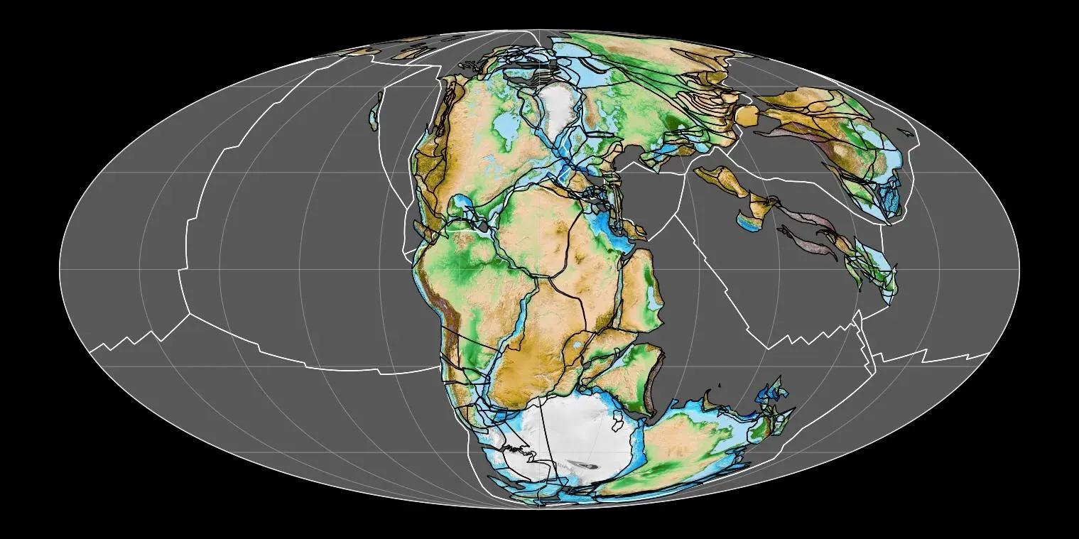
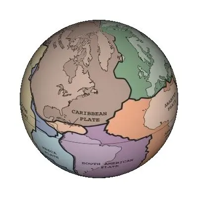
It is tempting to think the map you grew up with is permanent, but from a geologic perspective, it is just a snapshot. If you could fast-forward tens of millions of years, you might see familiar continents drift into new positions, oceans shrink or widen, and new mountains rise where flat plains once stretched. Some scientists expect that another supercontinent will eventually form, though the exact layout is still a matter of different scenarios and models. In any case, the basic rule remains the same: nothing on the surface of this planet stays in the same place forever.
For you, this long-term movement matters in subtle but real ways. The stresses along plate boundaries influence where major earthquakes and volcanic eruptions happen, shaping which regions face the greatest natural hazards. Over even longer timescales, shifting continents will keep altering climate patterns, coastlines, and habitats. While you will not see continents collide in your lifetime, you are still living on a planet in motion, and understanding that motion helps you make sense of both the risks you face now and the deep future of the world your descendants will inherit.
Conclusion: Reading the Moving Map Beneath Your Feet
Once you see plate tectonics as the driving force behind the rise of the modern continents, the world map stops being a static picture and becomes a living story. You realize that the mountains you hike, the coastlines you love, and even the climate you rely on are all products of a restless planet. Continents have wandered, collided, and broken apart again and again, and the arrangement you know today is only the latest act in a very long play.
When you step outside now, you are not just standing on solid ground – you are standing on a slow-moving raft riding a deep, convecting engine that has shaped oceans, guided life, and set the stage for human history. If you learn to read the clues in rocks, fossils, and landforms, you can trace that history for yourself and glimpse where the story might be heading next. So the next time you look at a globe, you might ask yourself: how different will this map look if someone spins it again a hundred million years from now?