You live on a continent that has been sculpted, cracked, drowned, and lifted over billions of years – and the traces of that violent past are still all around you. Long before written history, ancient landscapes were already steering where people could live, what they could eat, and even what they believed about the world.
When you start to look at America through its rocks, you realize you are walking through an old epic. Mountain chains become the remains of vanished oceans, red-rock deserts preserve entire ecosystems that vanished before the dinosaurs, and strange stone towers hint at how ancient peoples made sense of sky and earth. Let’s walk through nine of the most powerful geological forces and places that quietly shaped ancient life in the Americas – and still shape the way you experience the land today.
1. The Appalachian Mountains: Ghosts of Lost Oceans
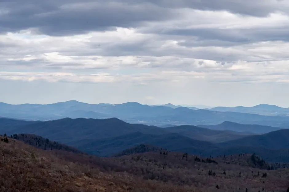
If you hike along the Appalachians today, you might think of them as gentle, almost modest mountains – but you are actually walking on the eroded stumps of what were once global giants. Hundreds of millions of years ago, when early life was still experimenting with complex forms, huge tectonic collisions crushed continents together and raised a Himalayan-scale range where the Appalachians now stand. You would have seen active volcanoes, earthquakes, and towering peaks feeding endless rivers of sediment toward nearby seas.
By the time ancient peoples arrived, those raw peaks had already been worn down into a long, forested backbone stretching from Alabama to Canada. For you, that means the Appalachians became less of a deadly barrier and more of a corridor: they guided migration routes, channeled rivers, and provided rich soils formed from deeply weathered rock. If you imagine trying to survive in a premodern world, a place like this – with reliable water, varied plants and animals, and defensible ridges – would have felt like a natural home base.
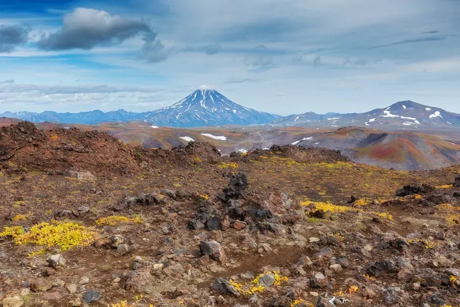
2. The Colorado Plateau: A Stone Textbook of Deep Time
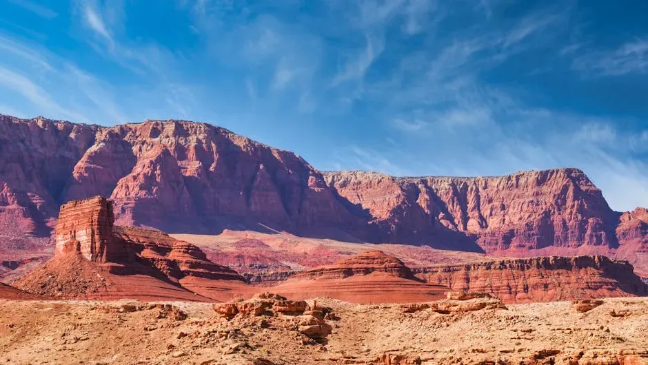
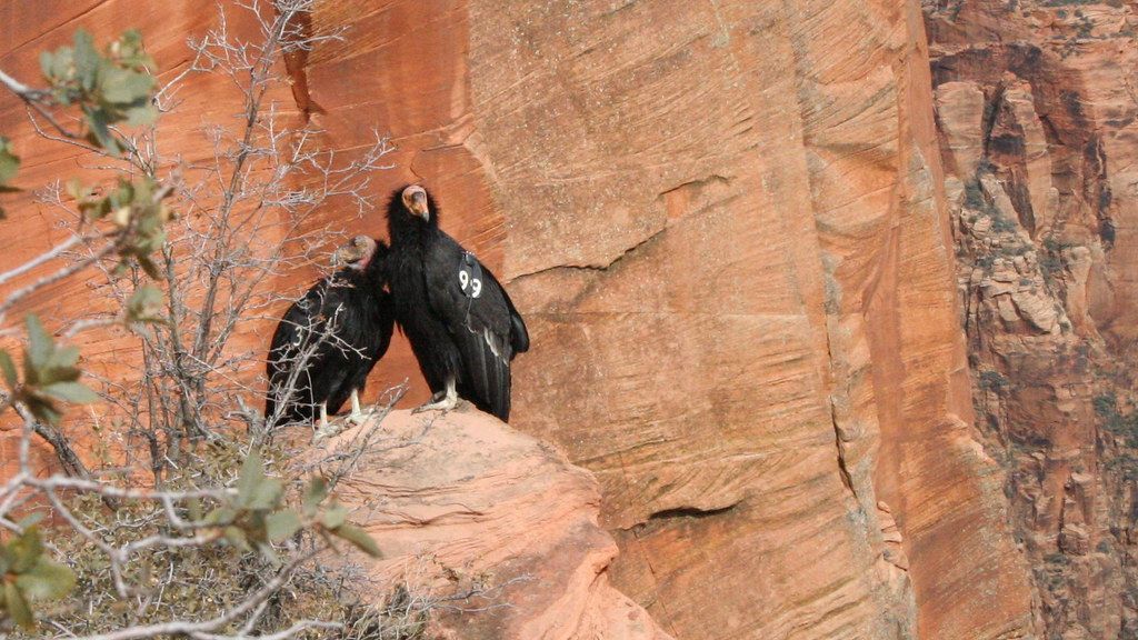
When you stand at the edge of the Grand Canyon or wander the mesas of Utah and Arizona, you are looking at the Colorado Plateau: a block of crust that stayed stubbornly intact while the land around it stretched, broke, and sank. Over hundreds of millions of years, seas advanced and retreated here, deserts came and went, and rivers crisscrossed the land, laying down layer after layer of mud, sand, and lime. Later, the whole region rose like a slow elevator, and rivers carved down through those stacked layers, revealing a cross section of deep time as neat as pages in a book.
For ancient communities, this stone staircase gave you more than pretty views. The tilted strata created natural terraces for dwellings, defensive positions, and fields. Canyon walls sheltered you from wind and concentrated precious water in an otherwise dry landscape. When you look at cliff dwellings tucked into alcoves, you’re seeing people taking advantage of weaknesses in sandstone, natural ledges, and the way water hollows out soft layers – a direct response to the geology under their feet.
Imagine trying to cross North America during the last Ice Age and suddenly hitting an invisible wall of frozen air. That is what the Laurentide Ice Sheet was: a slab of ice up to several thousand feet thick that smothered much of what is now Canada and the northern United States. It scraped away soil, carved deep basins that later filled as lakes, and pushed hills of debris ahead of it like a bulldozer. When it finally melted back in pulses, it left behind a jumbled landscape of moraines, kettle lakes, and newly exposed ground.
If you were living just south of that wall of ice, your migrations, hunting grounds, and settlements would have been shaped by its edge. Meltwater carved out huge river systems such as those feeding the Mississippi Basin, giving you rich floodplains perfect for early agriculture. As the ice retreated, new routes opened for you to move northward, while cold, nutrient-rich waters in the Atlantic helped sustain rich coastal ecosystems. The ice itself never wrote history, but it decided where early people could walk and what kind of world they found when they got there.
4. The Mississippi River System: A Continental Conveyor Belt of Life
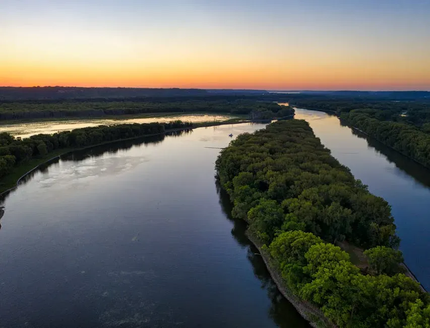
When you picture ancient America, it helps to think of the Mississippi and its tributaries as a vast conveyor belt running from the Rockies and Appalachians down to the Gulf of Mexico. For millions of years, these rivers have been grinding rock into fine sediment and delivering it south, spreading it into some of the richest soils on the continent. Every flood laid down new layers of silt, building natural levees and creating backswamps, oxbow lakes, and fertile bottomlands.
If you were an early farmer, this river system was almost irresistible. The broad floodplain gave you predictable water, easily worked soil, and natural transport routes. You could move goods, stories, and ideas by canoe much more easily than by crossing dense forests or rugged hills. Over time, this stable, productive landscape helped support complex mound-building cultures and dense populations long before European contact, all made possible because the geology funneled water and sediment through this corridor.
5. The Andean Range’s Northern Reach: Tectonic Forces and Ancient Highways
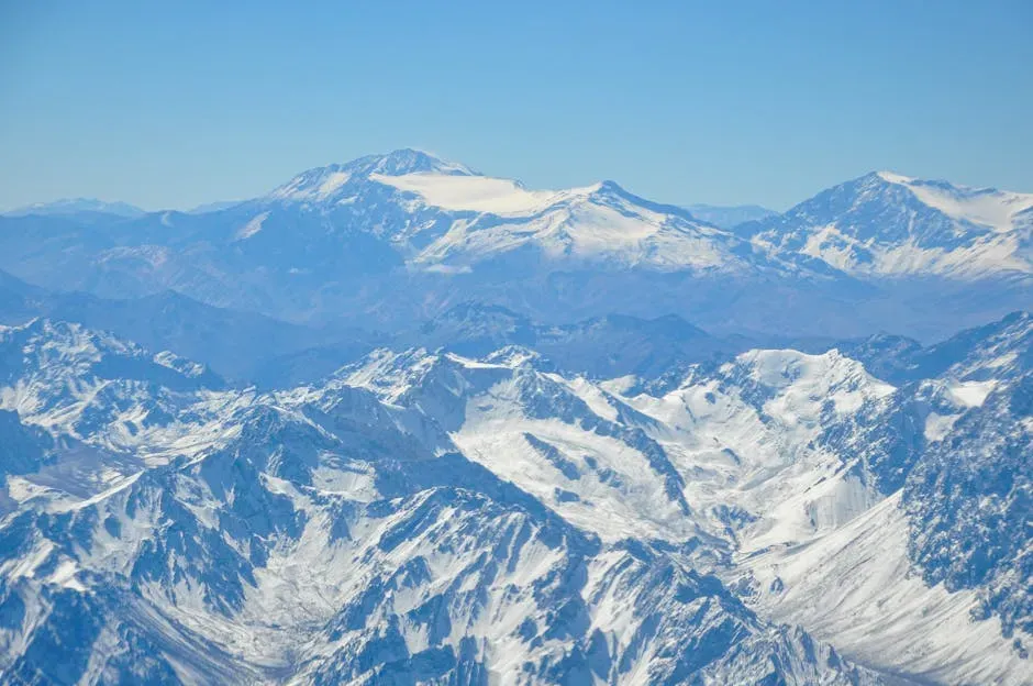
Although you might think of the Andes as a South American story, the northern reaches of this mountain chain connect deeply with the geology of Central and even southern North America through the same plate interactions. Along the Pacific margin, the oceanic plates have been sinking beneath the continental crust for tens of millions of years, driving up long, narrow ranges and feeding volcanic arcs. What you see today as steep valleys, active volcanoes, and uplifted plateaus is the surface expression of that slow, relentless collision.
For ancient people moving up from Central into North America or trading across these zones, this tectonic scaffolding shaped everything from travel routes to climate. High elevations caught moisture and created pockets of fertile ground, while passes became natural gateways between regions. You can think of these mountains as both barriers and bridges: hard to cross but rich in minerals, varied climates, and strategic vantage points that influenced where early communities clustered and how they interacted.
6. Coastal Plains and Ancient Shorelines: The Breathing Edge of the Continent
If you could roll time backward along the Atlantic and Gulf coasts, you would watch the shoreline inhale and exhale as sea level rose and fell. During colder ice ages, so much water was locked in ice sheets that the ocean retreated, exposing broad coastal plains. During warmer periods, seas advanced inland, laying down layers of sand, shells, and clay, and sometimes drowning river valleys to create estuaries and bays. These repeated transgressions and retreats left a staircase of ancient shorelines buried beneath your feet.
For ancient peoples, this shifting edge meant opportunity and risk. Newly exposed land offered you fresh hunting grounds and plant communities, while drowned coasts forced you to move or adapt your ways of life. Rich estuaries and marshes became some of the most productive ecosystems you could exploit, full of fish, shellfish, and bird life. Even today, when you see low, flat country along the coast, you are looking at the quiet legacy of those ancient sea-level swings that guided where early settlements could safely grow.
7. The Basin and Range Province: A Land Stretched Until It Broke
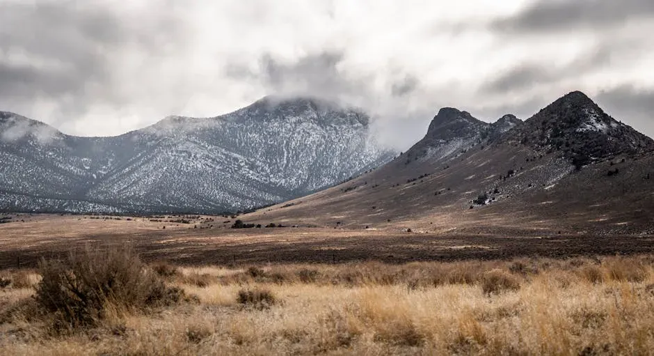
When you drive across Nevada or parts of Utah and Arizona, the repeating pattern of narrow mountains and broad, flat valleys might seem almost hypnotic. That rhythm exists because the land here has been pulled apart over millions of years, like slow taffy, creating a series of tilted fault blocks. Each range is a piece of crust that has been lifted and tilted, while each basin is a down-dropped block where sediments and, in wetter times, lakes accumulated.
For you in an ancient context, this broken terrain meant water and resources were scattered in predictable but challenging ways. Valleys often held playas, springs, or long-vanished lakebeds with concentrated salts and minerals, while ranges hid timber, game, and rock resources. If you were moving through this region, you would learn to navigate from range to range, always aiming for the passes and the rare, dependable water sources – your survival strategy etched directly into the architecture of the crust.
8. Volcanic Fields and Lava Plateaus: Fire Beneath Your Feet
From the Columbia River Plateau in the Pacific Northwest to the volcanic fields of the American Southwest, much of the landscape you see was shaped by eruptions that poured out enormous volumes of lava. Sometimes the lava welled up through fissures, spreading in thin layers that eventually stacked into thick plateaus. In other places, isolated volcanoes built cones, craters, and ash fields, leaving behind dramatic features like cinder cones, lava tubes, and calderas.
If you were living near these volcanic zones in ancient times, the risk and reward would have felt very real. Fresh lava flows are deadly and destructive, but over time, volcanic ash and weathered basalt can create extremely fertile soils. You might have taken advantage of warm springs and mineral-rich waters, or used distinctive volcanic rocks for tools and trade items. Even without modern geology, you would have felt that the earth here was alive and unpredictable, and you would shape your stories and settlements around that uneasy energy.
9. Karst Landscapes and Cave Systems: Hidden Worlds Below the Forest
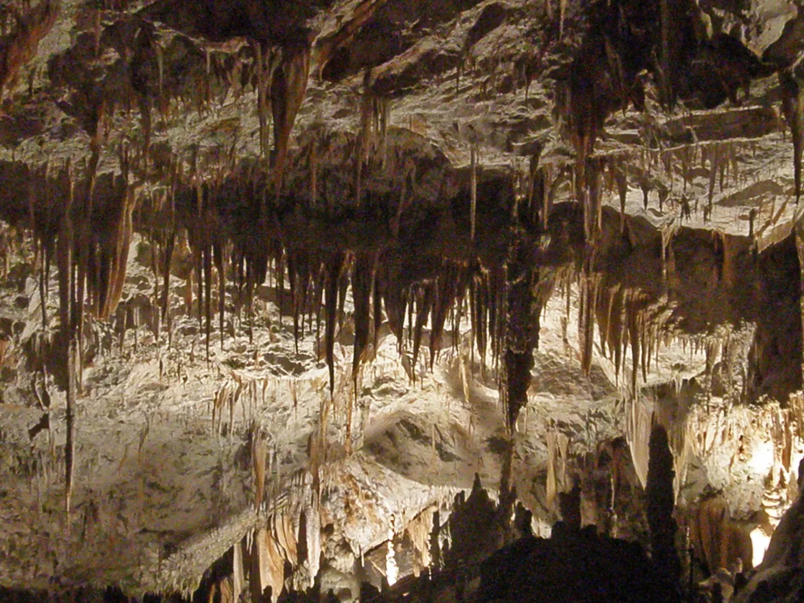
In parts of the eastern and central United States, thick layers of limestone have been quietly dissolving away beneath you for millions of years. Rainwater, slightly acidic from the atmosphere and soil, seeps into the ground and slowly eats tunnels, shafts, and vast caverns into the rock. At the surface, this process gives you sinkholes, disappearing streams, and strange, lumpy terrain known as karst. Underground, it builds pillars, curtains, and pools that feel almost otherworldly.
For ancient communities, these hidden spaces offered both practical shelter and powerful symbolism. Caves could serve as temporary homes, cool storage, or safe refuges, but they also felt like gates into a deeper, mysterious realm of the earth. Springs emerging from karst systems provided reliable water, while sinkholes and dolines shaped where you could farm or build safely. When you look at maps of ancient routes and sacred sites, you often find they line up with these geological quirks, quietly revealing how rock and water guided human choices.
As you step back from these nine formations, you start to see that ancient America was never just a backdrop for human stories – it was an active partner. Mountains channeled your migrations, rivers fed your crops, volcanoes both threatened and nourished you, and caves invited you to imagine worlds beyond the visible. The choices early peoples made about where to live, what to worship, and how to move were all, in one way or another, answers to the land itself.
Next time you cross a mountain pass, follow a winding river, or stand at the edge of a canyon, you can ask yourself: if you had arrived here thousands of years ago with no maps and no machines, how differently would you see the rocks beneath your feet – and what kind of ancient story would you start to tell?